Ai cov trac
•Download as PPTX, PDF•
0 likes•30 views
For proposal
Report
Share
Report
Share

Recommended
Recommended
The study aimed to investigate into the impact of a National COVID-19 Health contact tracing and monitoring system for Namibia. The study used qualitative methods as a research strategy. Qualitative data was collected
through zoom meeting and a Google form link was distributed to the participants. The findings of the study revealed
that a total of 18 participants responded to the semi-structured questions of which 38.9% represents male while
female 61.1%. The age group between 18–25 response rate were 22.2%, age group between 26–35 response rate were
55.6%, age group between 36–45 response rate were 16.7% and the age group between 46 and above response rate
was 10% represented in green colour to represent participants who fall in the age group between 46 and aboveAn Investigation Into the Impacts of ICT in the Compacting of COVID-19: A Nam...
An Investigation Into the Impacts of ICT in the Compacting of COVID-19: A Nam...BOHR International Journal of Smart Computing and Information Technology
This is beneficial in organizing and ensuring a systematic way of posting information about their travel policies and requirements that can be processed online. The system can also help the Philippine National Police (PNP) guide residents going to other LGUs in applying for travel documents when needed and with the help of the LGUs in monitoring travellers in their territories and verify the authenticity of travel documents presented. Also, Monitoring Agencies can easily monitor the travellers and generate a report at the municipal, provincial, levels for monitoring and planning purposes. The study explored the challenges encountered by Police Officer in the implementing of cross-border requirements. The study used interviewed guide question and interview guide as the main instrument to gather the data needed for the study. Part I. Respondents Profile which are formulated by the researchers that deals with the profile of the respondents such as Age, Civil Status, Gender and Length of Service. Also consisting Part II. Core Questions and Part III. Terminating Questions as an interview guide. The study consists of a total of 10 participants who are PNP personnel in Liloan Border and Ozamis Port. The researchers purposive choose five participants every border at Misamis Occidental. The participants were interviewed under the following criteria: 1) experience with implementing the border entrance requirements, 2) Difficulties encountered in performing the duties, 3) Common excuse upon entering the border. Non-compliance to Border Entry, Encountered travellers bringing forged document requirements, Professionalism in Handling Arrogant travellers, adhering to Border and protocol requirements in travelling. There were several problems or issues encountered by the PNP in the border majority is having no requirements as the same time against by their religion or having a Doctor’s advices as reasons against vaccination. As the researcher conduct this study they seen the efforts of the PNP in enforcing the law by maintaining their patience towards from the passengers who have arrogant attitude. But in the other hand they already know that every passenger entering the border line they have vaccination cards in order for them to pass through. The IATF is no longer strict about the protocol and they also know lots of the travelers are already vaccinated. The study in the non-compliance in border many have not yet getting vaccinated but the IATF issue in the border to have free vaccination in the area, some of the travellers will not proceed in the province if they have no requirements needed in border.Implementation of Cross-Border Requirements: Challenges Encountered by the Po...
Implementation of Cross-Border Requirements: Challenges Encountered by the Po...Associate Professor in VSB Coimbatore
More Related Content
Similar to Ai cov trac
The study aimed to investigate into the impact of a National COVID-19 Health contact tracing and monitoring system for Namibia. The study used qualitative methods as a research strategy. Qualitative data was collected
through zoom meeting and a Google form link was distributed to the participants. The findings of the study revealed
that a total of 18 participants responded to the semi-structured questions of which 38.9% represents male while
female 61.1%. The age group between 18–25 response rate were 22.2%, age group between 26–35 response rate were
55.6%, age group between 36–45 response rate were 16.7% and the age group between 46 and above response rate
was 10% represented in green colour to represent participants who fall in the age group between 46 and aboveAn Investigation Into the Impacts of ICT in the Compacting of COVID-19: A Nam...
An Investigation Into the Impacts of ICT in the Compacting of COVID-19: A Nam...BOHR International Journal of Smart Computing and Information Technology
This is beneficial in organizing and ensuring a systematic way of posting information about their travel policies and requirements that can be processed online. The system can also help the Philippine National Police (PNP) guide residents going to other LGUs in applying for travel documents when needed and with the help of the LGUs in monitoring travellers in their territories and verify the authenticity of travel documents presented. Also, Monitoring Agencies can easily monitor the travellers and generate a report at the municipal, provincial, levels for monitoring and planning purposes. The study explored the challenges encountered by Police Officer in the implementing of cross-border requirements. The study used interviewed guide question and interview guide as the main instrument to gather the data needed for the study. Part I. Respondents Profile which are formulated by the researchers that deals with the profile of the respondents such as Age, Civil Status, Gender and Length of Service. Also consisting Part II. Core Questions and Part III. Terminating Questions as an interview guide. The study consists of a total of 10 participants who are PNP personnel in Liloan Border and Ozamis Port. The researchers purposive choose five participants every border at Misamis Occidental. The participants were interviewed under the following criteria: 1) experience with implementing the border entrance requirements, 2) Difficulties encountered in performing the duties, 3) Common excuse upon entering the border. Non-compliance to Border Entry, Encountered travellers bringing forged document requirements, Professionalism in Handling Arrogant travellers, adhering to Border and protocol requirements in travelling. There were several problems or issues encountered by the PNP in the border majority is having no requirements as the same time against by their religion or having a Doctor’s advices as reasons against vaccination. As the researcher conduct this study they seen the efforts of the PNP in enforcing the law by maintaining their patience towards from the passengers who have arrogant attitude. But in the other hand they already know that every passenger entering the border line they have vaccination cards in order for them to pass through. The IATF is no longer strict about the protocol and they also know lots of the travelers are already vaccinated. The study in the non-compliance in border many have not yet getting vaccinated but the IATF issue in the border to have free vaccination in the area, some of the travellers will not proceed in the province if they have no requirements needed in border.Implementation of Cross-Border Requirements: Challenges Encountered by the Po...
Implementation of Cross-Border Requirements: Challenges Encountered by the Po...Associate Professor in VSB Coimbatore
Similar to Ai cov trac (20)
Digital technology and COVID-19 . Daniel Shu Wei Ting & others
Digital technology and COVID-19 . Daniel Shu Wei Ting & others
An Investigation Into the Impacts of ICT in the Compacting of COVID-19: A Nam...
An Investigation Into the Impacts of ICT in the Compacting of COVID-19: A Nam...
Implementation of Cross-Border Requirements: Challenges Encountered by the Po...
Implementation of Cross-Border Requirements: Challenges Encountered by the Po...
TRACKID – A LOCATION TRACKING APPLICATION FOR CHILDREN ON SCHOOL TRANSPORT
TRACKID – A LOCATION TRACKING APPLICATION FOR CHILDREN ON SCHOOL TRANSPORT
DIGITAL TRANSFORMATION OF THE HEALTH SECTOR DURING THE COVID-19 PANDEMIC IN S...
DIGITAL TRANSFORMATION OF THE HEALTH SECTOR DURING THE COVID-19 PANDEMIC IN S...
An open toolbox for generating map of actively confirmed SARS-CoV-2 or COVID-...
An open toolbox for generating map of actively confirmed SARS-CoV-2 or COVID-...
PANDEMIC INFORMATION DISSEMINATION WEB APPLICATION: A MANUAL DESIGN FOR EVERYONE
PANDEMIC INFORMATION DISSEMINATION WEB APPLICATION: A MANUAL DESIGN FOR EVERYONE
Cloud Based Spatial Analysis for the Health Sector: a Case Study of Egypt
Cloud Based Spatial Analysis for the Health Sector: a Case Study of Egypt
Using Geographic Information Systems (GIS) to Model the Clustering Effect of ...
Using Geographic Information Systems (GIS) to Model the Clustering Effect of ...
Mobile Mapping Market to reach USD 127.3 Billion by 2031 at 18.2% CAGR by AMR
Mobile Mapping Market to reach USD 127.3 Billion by 2031 at 18.2% CAGR by AMR
The International Journal of Computational Science, Information Technology an...
The International Journal of Computational Science, Information Technology an...
Impact of Telecommunication tools in Covid-19 spreading - Conference Part 4 -...
Impact of Telecommunication tools in Covid-19 spreading - Conference Part 4 -...
Ai cov trac
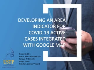
- 1. Presented by: Roxas, Mary Antonette O. Saraus, Al Zoren C. Gabe, Juven Cubillan, Leoner Vincent
- 2. BACKGROUND OF THE STUDY The pandemic has vastly affect the economy and people have been given some travel advisories to avoid the spread of the pandemic. The purpose of this study is to locate Covid-19 active cases base on the records that has been given to the public with the use of Google map. The proposed study will be integrated with Google map that will indicate the location of the area where Covid-19 positive patients location. The study aim to help users to be more aware of the pandemic and to be alerted if they are near at the place where Covid-19 positive are isolated. The application has also a feature where users can fill up forms and can be use as information's where it can be scanned using a QR code so that it can help users a less time to fill-up forms in some establishments that ask for there information, in these way it may prevent the virus to spread because it will help them not to touch any of the equipment that will be used in filling up an information.
- 3. Statement of the Problem • Unaware if the place has Covid-19 active cases • Affected travels • Arduous process of filling up personal information
- 4. Comparison of Related Studies TITLE FEATURE QR Code Based Smart Attendance System The proposed system is a couple of two applications, one for generating the QR Code by entering the student details and second application for taking the attendance and generating the attendance in CSV or XLS format A Google Map Based Social Network (GMBSN) for Exploring Information about a Specific Territory users can choose their desired city of interest from the list. The selected city will be highlighted on Google map. After choosing any city from the map, the user will be able to select any category from the list and start finding and sharing information about the desired city of any country.
- 7. GUI OF THE APP