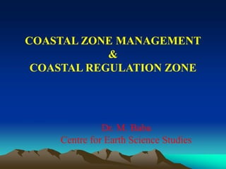
13. District Coastal Management Plan
Ashtamudi Estuary, Kollam, India
Proposed tourism and marine park zoning map
Produced by: M. Muralikrishna
Project Directors: Prof. Kerry Black and Dr. M. Baba
Project leaders:ASR Ltd., Marine and Freshwater Consultants,
New Zealand
Counterpart: Centre for Earth Science Studies (CESS), India
Sponsor: Asia Development Assistance Facility (ADAF),
Ministry of Foreign Affairs and Trade, New Zealand
WEST KALLADA
EAST KALLADA
THRIKKARUVA
MUNDROTHURUTHU
PERAYAM
PERINAD
ASH TAMU D I KA YAL
CEN TR AL KAYAL
KUNDRA
BOAT BERTHING
AND NATURE PARK
MARINE RESERVE
(FISHING NO T ALLOWED)
TOURISM CENTRE
HOUSEBOAT MOORING
MARINE RESERVE
RESEARCH CENTRE
TOURISM AREA
ÊÚ
KANJIRAKOTTU KAYAL
FISHING ZONE
FISHING ZONE
Î
KUMBALATTU KAYAL
FISHING ZO NE
KAL LA DA R
N
PROPOSED TOURISM AND MARINE PARK ZONES - ASHTAMUDI ESTUARY
Km s1 0 1
14. WEST KALLADA
EAST KALLADA
THRIKKARUVA
MUNDROTHURUTHU
PERAYAM
PERINAD
ASHTAMUDI KAYAL
CENTRAL KAYAL
KUNDRA
BOAT BERTHING
AND NATURE PARK
MARINE RESERVE
(FISHING NOT ALLOWED)
TOURISM CENTRE
HOUSEBOAT MOORING
MARINE RESERVE
RESEARCH CENTRE
TOURISM AREA
ÊÚ
KANJIRAKOTTU KAYAL
FISHING ZONE
FISHING ZONE
Î
KUMBALATTU KAYAL
FISHING ZONE
KAL LA DA
R
N
PROPOSED TOURISM AND MARINE PARK ZONES - ASHTAMUDI ESTUARY
Kms1 0 1
15. Coastal Zone boundaries for different countries
COUNTRY INLAND BOUNDARY OCEAN BOUNDARY
Brazil
China
Costa Rica
India
Israel
Philippines
Queensland
South Australia
Spain
Sri Lanka
Sweden
United Kingdom
U.S.A
2 km from MHW
10 km from MHW
200 m from MHW
500 m from HTL
1 – 2 km variable
Flexible
400 m from MHW
100 m from MHW
500 m from highest
storm or tide line
300 m from MHW
100 – 300 m
Flexible
Flexible
12 km from MHW
15 m isobath (depth)
MLW
LTL
500 MLW
Continental Shelf
3 NM from the CB
3 NM from the CB
12 NM (limit of territorial
sea)
2 km from MLW
2 NM
12 NM
12 NM
16. Areas included by different countries in the
Coastal Management Zone
• All coastal lands that are subject to storms and flooding by the sea
• All intertidal areas of mangrove, marsh, deltas, salt flats, tidal flats
and beaches
• All permanent shallow coastal water areas such as bays, lagoons,
estuaries, deltaic waterways, and nearshore than include seagrass
meadows, coral reefs, shellfish beds or submerged bars
• All small coastal islands and other important nearshore features
17. Economic/Development
Pressure
Societal/Environmental
Pressure
I C Z M
Environmental
Conservation
Equitable Benefit Sharing Conflict Resolution
SUSTAINABLE COASTAL
RESOURCE UTILISATION
EQUITABLE SOCEITAL & ECONOMIC DEVELOPMENT
Legislative intervention - CRZ
Action Plans
Coastal Resources
Incorporation into Local body Plans
Spatial planning
18. NATIONAL COASTAL ZONE MANAGEMENT
POLICY
• Issues due to resource overuse,
• Degradation of ecosystems,
• Conflicts among stakeholders
• Coastal hazards
• Livelihood security
• Sustainable development
19. Why regulated development of the
coast?
• Protection of fishery
• Protection of coastal ecosystems
• Protection of life and property
• Maintain the scenic beauty of coast
• Encourage sustainable tourism
• Ensure public access to beach
20. Coastal Regulation Zone
• Intertidal zone- area
between HTL & LTL
• Defined regulation zone
landward of the HTL on
sea coast and on the
banks of estuaries creeks
and backwaters
• 500 m along sea &
estuary coast
• 100 0r 150 m on banks of
backwater, river
21. CRZ Notification - Genesis
1981 – Prime Minister Indira Gandhi’s letter: Keep 500 m from the
HTL free from development activities
1982- Working Group on beach development guidelines
1983- Guidelines for the development of beaches
(Tourism, Industrial development, Urban and rural development
Special areas – mangroves, scenic areas, corals, oceanic islands)
1986 – Environmental Protection Act
1989 – Draft CRZ Notification
1991 – CRZ Notification
1994 – Supreme Court direction asking for strict implementation of
CRZ
1996 – Approval to State CZMPs
1997 – Constitution of Aquaculture Authority
1998 – National and State Coastal Zone Management Authorities
22. How it progressed……
• Vohra Committee
• Saldhana Committee
• Balakrishnan Nair Committee
• Saldhana Committee
• Babu Paul Committee
• Swaminathan Committee
23. Benefits of CRZ
• Awareness on coast
• Traditional rights
• Industries controlled
• Natural hazard
protection
• Livelihood security
• Fragile systems
• Aesthetics
24. Failures of CRZ
• Arbitrary zone
• Mainly violated
• No participation
• Too restrictive
• Goals undefined
• No incentives
• No enforcement
25. Terms of Reference of Swaminathan Committee
1. Review reports of various Committees & international
practices
2. Suggest scientific principles for an ICZM best suited for the
country
3. Define and enlist various coastal and marine resources
4. Recommend the methodology for their identification
5. Recommend the extent of safeguards required for
conservation and protection
6. Revisit CRZ, Notification, 1991 in the light of above
7. Recommend necessary amendments to make the regulatory
framework consistent with recommendations
26. COASTAL ISSUES
• Social and economic development of the
country
• Bring together a unique collection of natural
resources
• Coast an economic base and physical
location
• Fast developing area in the country
• Environmental degradation, resource
reduction and user conflicts
• Large scale destruction of life, property and
natural resources due to natural hazards
27. MSS Committee
GUIDING PRINCIPLES OF CZM
• Ecological and cultural security, livelihood security
and national security
• Territorial sea and the landward administrative
biological limits
• Regulation, education and social mobilization
• conformity with international laws
• Regulation based on sound, scientific and ecological
principles
• Precautionary approach where there are potential
threats or irreversible damage to ecologically fragile
systems
• Significant biological, cultural and natural assets
should be considered incomparable
28. MSS Committee
GUIDING PRINCIPLES OF CZM
• Coastal policy and regulations should be guided by the
principles of gender and social equity as well as intra-
generational and inter-generational equity
• ‘Polluter-pays’ principle(s) and ‘public trust’ doctrine
• Concurrent attention to conservation, sustainable use
and equitable sharing of benefits
• National coastal bio-shield movement
• Short term commercial interests not be allowed to
undermine the ecological security of our coastal areas
• Cohesive, multi-disciplinary approaches
29. MSS Committee
A NATIONAL COASTAL ZONE MANAGEMENT
ACTION PLAN
• To protect with peoples participation the
livelihood security of the coastal fishers
and others
• To protect life and property
• To protect the ecosystems which sustain
productivity of the coastal areas
• Promote sustainable development that
contribute to nation’s economy and
prosperity.
Objectives
30. DEFINITION
The coastal zone is defined as an area from the
territorial waters limit (12 nautical miles) including its
sea bed upto the landward boundary of the local self
government abutting the sea coast.
Coastal zone also includes inland water bodies
influenced by tidal action including its bed and the
adjacent land area upto the landward boundary of the
local self-government abutting such water bodies.
In case of ecologically sensitive areas, the entire
notified area/biological boundary of the area will be
included.
MSS Committee
31. ECOLOGICALLY SENSITIVE AREAS (ESA)
• Mangroves
• Coral reefs
• Sand beaches and sand dunes
• Inland tidal water bodies, i.e. estuaries, lakes,
lagoons, creeks
• Mudflats
• Marine wildlife protected areas under the Wildlife
(Conservation) Act.
• Coastal fresh water lakes
• Salt marshes
• Turtle nesting grounds
• Horse shoe crabs habitats
• Seagrass beds
• Seaweed beds
• Nesting grounds of migratory birds
32. AREAS OF PARTICULAR CONCERN
• Coastal municipalities / corporations (the entire notified
area)
• Coastal panchayats with population density more than
400 persons per sq.km. (the entire notified area)
• Ports and harbours
• Notified tourism areas
• Mining sites
• Notified industrial estates
• Special Economic Zones
• Haritage areas
• Notified archaeological sites under the Protected
Monuments Act
• Defence areas / installations
• Power plants
33. FACILITIES / ACTIVITIES REQUIRING ACCESS
TO THE SHORELINES
• Port and harbours, including refueling facilities, and dredging and
reclamation
• Fish landing sides
• Public toilets
• Lighthouses and light-towers
• Beach tourism and water sports facilities
• Salt pans
• Mining of minerals other than beach sand, rocks, gravel, and sea-
shells
• Ship building and repair facilities
• Coastal protection structures
• Hydrocarbon exploration and production
• Defence installations
• Discharge pipelines for treated effluent and sewage
• Approach roads, railways, pipelines, power transmissions and
distribution lines to service the above
34. A comparison of the CRZ &
MSS recommendations
Item CRZ MSS Report
Approach Regulatory
(top down)
Participatory management
(bottom up)
Area Covered Only coastal land Land and water
Boundaries Shoreline (LTL) to
500m
Entire panchayat / municipality &
territorial sea & coastal waters
Coastal peculiarities Not fully accounted Fully accounted
Development
setbacks
HTL, 200m, 500m Based on vulnerability to hazards
Livelihood security Partial coverage Wider coverage
Traditional rights Partially covered Fully covered
Responsibility for
implementation
Central Govt. Local Self Governments
Funding Nil Central funds available