Hawaii -Kilauea - Eruptions - Seismic Activity - The Earth's Core
CB-Impactite Talk_LPL revised
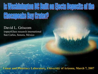
1. David L. Griscom
impactGlass research international
San Carlos, Sonora, México
Lunar and Planetary Laboratory, University of Arizona, March 7, 2007
2. However, during the past eight years the speaker has been
formulating the hypothesis that these “upland deposits” are
ejecta from the Chesapeake Bay crater.
Prologue
The 35.5-million-year-old, 90-km-diameter crater buried beneath
the lower Chesapeake Bay was discovered and characterized in
considerable detail in the mid 1990’s by C. Wylie Poag and his
colleagues at the U.S. Geological Survey. Its existence and
radiometric age are now universally accepted.
The origin of ~5,000 km2 of sand, silt and gravel blanketing parts
of Washington, DC, southern Maryland, and eastern Virginia had
been controversial for well over a century when Schlee (1957)
seemed to have settled the matter in favor of a fluvial model.
3. Parts of This Lecture Are Taken From:
Fossil Natural Glasses Composed of Ferric Oxyhydroxides:
Impactites of the 35.5-Million-Year-Old Chesapeake Bay Crater
by
David L. Griscom,
Ayao Akiyoshi,1 Tomotaka Homae,1 Ken-ichi Kondo,1 Chihiro Yamanaka,2 Takehiro
Ueno,2 Motoji Ikeya,2 Mario Affatigato,3 and Allison Schue3
Presented at « Natural Glasses-4 », Lyon, France 29-31 August 2002
Additional contributions by the following individuals are gratefully acknowledged:
4Guillaume Morin, 5Gabriele Giuli, 5Eleonora Paris, and 6Giovanni Pratesi
1Tokyo Institute of Technology 2Osaka University 3Coe College
4Université de Paris 6 5Università di Camarino 6Università di Firenze
Published in Journal of Non-Crystalline Solids 323 (2003) 7-26.
5. Quartzite pebbles with adhering hard red-brown iron
oxide found in the gardens of our former home in
Northern Virginia (located about 10 km south of
Washington, DC).
1
I also found a few pebbles showing
Devonian-age (~360-400 Ma) brachiopod fossils.
6. 500 μm
3 cm →
External flange
Red-brown material penetrates sandstone
to uniform depth
Thin section viewed under crossed polars
reveals fractured quartz grains “floating” in
hard red-brown matrix – without relative
rotations of the fragments!
7. Chesapeake Bay Structure
Piedmont Metamorphic Rocks
250 km
Limit of Atlantic Coastal Plain
Geology of the Eastern United States
Appalachian Mountain Anticlines
8. Geology of the State of Virginia
●
Silurian and Devonian
Sandstones
The Chesapeake Bay Structure
This and other similar maps taken from K. Frye, Roadside Geology of Virginia (Missoula Press, 1986)
Piedmont Coastal Plain
Fall Line
9. Geology of U.S. Mid-Atlantic Coastal Plain
Sandstones:
Silurian
Washington, DC
Upper Chesapeake Bay
Silurian and Devonian
Sandstones
Hypothetical Anticlines ~200 Million Years Ago, Now Eroded
Sand, Gravel
and Clay (Soft)
Ancient
Metamorphic
Rocks (Hard)
A Syncline
, Devonian
“Upland Deposits”
10. Examples of Upland Gravels from the Speaker’s
Neighborhood (Alexandria, VA)
0 1 2 3
0
20
40
60
Cobble Size (mm)
NumberCount
Un-Fractured
Single Fracture
Two or More
Fractures
32 64 128 256
Silica-based optical fibers without
surface flaws require application
of ~5 GPa tension to fracture.
When they do fail, a characteristic
“mirror-mist-hackle” pattern is
observed.
11. The “Upland Deposits” of Southern Maryland:
A 1957 Field Study/Review Article by John Schlee
BULLETIN OF THE GEOLOGIAL SOCIETY OF AMERICA
VOL. 68, PP. 1371-1410, 21 FIGS. OCTOBER 1957
UPLAND GRAVELS OF SOUTHERN MARYLAND
By John Schlee
First sentence in the Introduction:
First sentences of sixth paragraph:
The origin of the southern Maryland upland deposits is controversial.
First geologic studies of the region date back to the early 1800’s, but the most
definitive work was done in the last 75 years. (WJ McGee, 1888; 1891; Darton,
1891; 1893; 1894; 1939; 1951; Cooke, 1930; 1932; 1941; Cooke et al., 1952;
Stephenson et al., 1932; Dryden and Overbeck, 1948; Carr, 1950, Hack, 1955).
60 years!
It is my impression that the model due to Hack (1955) became
universally accepted shortly after its reluctant adoption by
Schlee (1957) … who carefully noted a host of contradictions.
40 pages! 50 years ago!
12. The “Upland Deposits” of Southern Maryland:
A 1957 Field Study/Review Article by John Schlee
According to Schlee (Bull. Geological Society of America 68, 1371, 1957):
Geology:
A “sheetlike deposit” ~9 m deep dipping southeastward from
Washington, DC, covering ~1,600 km2 of southern Maryland
● A Petrological Oddity within the “Upland Gravels”:
“Secondarily introduced iron oxide locally cements the sand and
gravel along definite zones and in large irregular masses up to 3 feet
across”
• Lithology:
(1) an upper “loam member” (~90% quartz silt) ~8 m thick
(2) a lower “gravel member” (mostly sandstone) ~1 m thick
Loam
90% Quartz
~1 cm
9 m
~1 m
“Upland Gravels”
“Peanut Brittle-Like”
13. Soft coastal plane sediments
“Upland Deposits” of Southern Maryland
Currently Accepted Emplacement Mechanism (Hack, 1955; Schlee, 1957)
Silurian &
Devonian
Sandstone
Outcrops
Blue Ridge
Water Gap
Fall Line Mouth of
Potomac
River
Erosion
~65 km
~120 km
~65 km 128 mm Cobbles
• Geologists presently believe this process to have taken place within the past 10 million
years
• This scheme models the 1-m deep “gravel member” only.
— 37 years before the discovery of the crater!
Shenandoah R.
Potomac River
“Ancestral” Potomac River
Transport Without Deposition Deposition Without Erosion
…and that the 75-year controversy regarding origins had been resolved in 1957
14. Devonian
Sandstone
Outcrops
~85 km
Tysons Corners, VA District of
Columbia
~100 km
Schlee (1957): “Modern Potomac River gravel …is quite different
in composition from that of most of the upland gravels.”
100 m
125 m
Vein Quartz Modern Potomac River
Sea Level
Piedmont
Metamorphic
Rocks
(Hard)
“Upland Deposits” of Southern Maryland
As They Appear Today (Schlee, 1957)
SENW
Coastal-Plain
Sediments
(Soft) ~1 m
~8 m
15. “Upland Deposits” of Southern Maryland
A Contemporary Schematic Cross Section
N.B. “Upland deposits” are not present here in this section.
However, they do occur at these elevations ~25 km west
(at Tysons Corners).
after USGS (2000)
Eocene
Paleocene
Miocene
The base of “upland deposits” dips at ~1 m/km for ~100 km
My hypothesis: Base was sculpted by “jetting” phase of the impact.
NW SE
Crater 120 km
Miocene (?)Potomac River
Meters
150 –
100 –
50 –
0 –0 –
-50 –
-100 –
…and it exhibits no hint of ancient shorelines!!!
16. Interpretation adverse to the present
hypothesis:
“Upland Deposits”
Current Mapping in Maryland
This Map Published 2000 by:
U.S. Department of the Interior
U.S. Geological Survey
District of
Columbia
The “Upland gravels” are
mapped by geologists as overlying
formations (e.g., the Calvert Formation)
that are regarded as younger than the
Chesapeake Bay crater.
There is no way to duck the
stratigraphic superposition principle.
I will tell you shortly how I deal with it.
●
“Upland Deposits”
of Southern
Maryland
But first, more from John Schlee…
17. The “Upland Deposits”
Data, Analyses, and Quotes from John Schlee (1957)
Schlee gives four distinct reasons
why the “upland deposits” could not
have formed in their present locations
as an alluvial fan!
Schlee’s cumulative frequency
distribution of sorting coefficients of
the upland gravels is “suggestive of
an alluvial fan deposit.”
Log2(Size in mm)
“The loam member was not
investigated, but structures and
textures of the gravels were studied
at 98 localities.”
“Most of the coarser fractions of the
gravels are ‘vein’ quartz, quartzite,
and chert” (α-quartz forms of SiO2).
4 8 16 32 64 128 256 mm
Note the cut-off for streams!
“Anomalous”
boulders up to
~4 m3 are also
found among the
upland deposits!
So by process of
elimination, he returned to a fluvial
model, ignorant of the existence of the crater!
18. The “Upland Deposits”
Gravel-Size Data and Analyses of John Schlee (1957)
-6.0 -5.5
-4.5
-4.0
-5.0
-3.5
-3.0
-2.5
-2.0
Washington, DC
N.B. Schlee’s gravel-size contours
are labeled by the negative log to
the base 2 of the observed modal
sizes (so-called “phi units”).
Noting that the contours were
more or less equally spaced in phi
units, Schlee (1957) perceived a
possible exponential progression.
To test this notion, he took four
additional sets of gravel-size data
along four approximately-linear
paths running generally
southeasterly of the U.S. Capitol.
19. 128 mm
The “Upland Deposits”
Gravel-Size Data and Analyses of John Schlee (1957)
Direction of the Center
of the Chesapeake Bay Crater
Mean Direction of
Apparent Dip of the
Gravel Exposures
Washington, DC
0 10 20 30 40 50 60
2
3
4
5
6
Ancient Potomac River (?)
Cobble Size Reduction Rates
Rhine River
Mur River
ModalGravelSize(PhiUnits)
Distance (km)
32 mm
16 mm
8 mm
4 mm
My Interpretation:
Atmospheric size
sorting of ejecta
in flight.*
-6.0 -5.5
-4.5
-4.0
-5.0
-3.5
-3.0
-2.5
-2.0
-
-
-
-
-
Extrapolates to 128-mm cobbles at ~15 km
northwest of Washington, DC – where
most rocks this size are petrologically
different from the upland gravels!
*Schultz, Gault
(1979)
64 mm
+
20. The “Upland Deposits” of Southern Maryland
Model of Hack (1955) and Schlee (1957):
Deposition by the Potomac River ~10 to ~3 Million Years Ago
Problem: Schlee’s cobble-size
gradient extrapolates to a source region
~15 km NW of Washington, DC ( ), but
no major outcrops of quartzite are found
there! The nearest potential source of
the Devonian quartzites in the “upland
deposits” is ~135 km to the west!
Problem: The “upland deposits” are
far larger than the region studied by
Schlee.
Problem: The cobble-size gradients
are much too large for a river unable to
cut a deep channel in the “soft easily
eroded Coastal Plain sediments” that
underlie the “upland deposits”.
25 km
They extend far southward…
Laterally migrating channel
growing ~1 m deeper per
kilometer of sideways displacement
Ancient
Potomac
River
Courses
21. “Upland deposits”
of southern Maryland
(studied by Schlee (1957))
Richmond, VA
Washington, DC
Gravity map showing negative
gravity anomaly coinciding with
the inner basin of the Chesapeake
Bay structure. The position of the
outer rim is shown as
the dashed curve.
(After Koeberl et al.,
1996).
“Upland deposits”
of eastern Virginia
(Frye, 1986)
22. The Chesapeake Bay Impact Structure
(Cross section from Koeberl et al., 1996 and Poag, 1997)
Koeberl et al. and Poag: The Lower-Cretaceous target rocks are
poorly-lithified, non-marine, mainly siliciclastic sediments ~500 m thick.
Griscom: It seems possible that these target rocks included alluvial
deposits rich in Devonian quartzite gravels – exactly matching the
description of the “upland deposits”.
400-360 Ma (Devonian): Quartzite sandstones deposited
Time
250 Ma: Appalachian Mountains folded, uplifting anticlines of Devonian quartzites
140-100 Ma (Lower Cretaceous): Alluvial fans crept seaward from the Appalachians
35.5 Ma: Impact!!!
My View:
25. The “jetting” stage is
well known in cratering
physics …but this may
represent the first ever
appeal to jetting in an
attempt to explain an
actual geological feature
on the face of the Earth.
15-cm Ball of Marine Chalk
Found in an Upland Depression
(Sliced Cross Section)
Note “toasted” exterior and
shattered (brecciated) interior.
My Model for the
Jetting-Phase:
The Ocean – and the
Soft Coastal Deposits –
Are Chamfered at an
Angle of ~0.06o
Present day
slope of the base
of the “upland deposits”
-200 -100 0 100 200
-300
-200
-100
0
100
200
300
400
500
600
700
Elevation(m)
Distance (km)
26. “Upland
Deposits”
R-3
4,300 km3
(Poag, 1997)
Crater Diameter: 87 km
Energy: 18 TeraTons of TNT
Projectile Diameter: 6 km
Projectile Density: 1500 kg/m3
Impact Velocity: 30 km/s
Impact Angle: 45°
It is known from
explosion experiments
that the thicknesses of
ejecta blankets follow
the -3rd power of the
radius R from the
crater center. The
normalization factor is
determined from the
total volume of ejecta,
which in turn can be
scaled from the known
diameter of the crater.
About Ten Minutes after Impact Trial Parameters Entered into a
Crater-Size Calculation:
0.06°
-200 -100 0 100 200
-200
-100
0
100
200
300
400
500
600
700
Elevation(m)
Distance (km)
27. H.J. Melosh, Impact Cratering – A Geologic Process
(Oxford University Press, New York, 1989)
J.N. Head, H.J. Melosh, B.A. Ivanov
Science 298 (2002) 1752
The fastest interference-zone
ejecta can leave with ~0.5
times the speed vi of the
impacting object!
~2.0 Impactor Diameters
Interference-Zone
Ejecta
But let us drop back to the
first few tenths of a second…
~0.02vi
28. But let us drop back to the
first few tenths of a second…
GRANITE
Vertical
Exaggeration
X 50
Distance (km)
Chesapeake Bay Crater
10 min
“Effective”
Interference Zone
(v 0.02vi)
Frye (1986) found this granite “dropstone”
in a mudstone bed 800 km due west of
the crater center.
27-kg granite object found among the
“upland gravels” 200 km northwest of the
crater center (speaker’s front yard).
-40 -20 0 20 40
-3
-2
-1
0
1
Elevation(km)
D
Lower Limit of Interference Zone
USGS
29. “Effective”
Interference Zone
~212 km3
Vertical Exaggeration X330I propose that the “upland gravels” are interference-zone ejecta comprising
pre-formed alluvial, mostly-quartzite gravels >2 mm that were
subject to size sorting by atmospheric drag
during ballistic flight.
Tysons
Washington
-200 -100 0 100 200
-700
-600
-500
-400
-300
-200
-100
0
100
200
300
Elevation(m)
Distance (km)
30. “The Day After”About 10,000 Years LaterAbout Two Million Years Later
Calvert I & II contain mostly the same microfossils, but there are
differences.
35.5 Ma
Chickahominy Fm.
CALVERT II
“Exmore Breccia”
Glass
???
???
But if so many of these species survived the impact,
why are is the Chickahominy cohort almost totally different?
I argue that the microfossils in Calverts I and II are shallow-
water species, whereas those in Chickahominy represent
“disaster blooms” that lived here when the ocean was deeper.
<35.5 Ma
It’s about sea levels!
-200 -100 0 100 200
-700
-600
-500
-400
-300
-200
-100
0
100
200
300
Elevation(m)
Distance (km)
31. Eustatic Sea Level through Geological “Deep Time”
(Plot Taken from a Review by Hallam, 1984)
65 33 5
Chesapeake Bay
& Popigai, Russia,
both ~90 km
Chicxulub, México,
~200 km Diameter
(Dinosaurs Extinct)
Bedout High, Australia
(Greatest Mass
Extinction in Earth History)
Some Impact Craters of
Major Significance to
Earth History:
Ice Caps Form“Snowball Earth”
Silurian
Devonian
Permian
Triassic
Jurassic
Cretaceous
Eocene
Miocene
Pre-Appalachian
Sandstones
Deposited
Appalachian
Mountains
Uplifted
Appalachian
Mountains
Eroded
Atlantic Ocean Opens
Most sea-level changes during this interval are presumed due to changes in sea-floor geometry.
32. Can an Impact Cause an Ice Age?
…Provided the Impact Can Create a Ring Around the Earth!
The Answer Is a Definite “Maybe”
Recent Photographs from the NASA Cassini-Huygens
Space Probe at Saturn
Note Ring Shadows Falling on the Winter Hemisphere!
33. Climatic Effects of an Impact-Induced Equatorial Debris Ring
(P.J. Fawcett, M.B.E. Boslough, J. Geophys. Res. 107, No. D15, 2002)
Oblique impacts between 10° and 20° can insert debris into earth orbit (Schultz & Gault, 1990)
Fawcett and Boslough (2002) calculated effects of a ring-forming impact on Earth’s climate,
which included severe cooling, sea ice, and polar ice-cap formation. These authors suggest
that the Chesapeake Bay (or Popigai) impact may have been a ring-forming one.
34. “The Heartbeat of the Oligocene Climate System”
H. Pälike et al., Science 314, 22 December 2006, 1894-1898.
36.3 Ma
35.2 Ma
The authors measured a 13-million-year continuous record of Oligocene
climate from a Pacific Ocean Drill core.
“Ages and step functions on right side illustrate the changes in silicate weathering
applied to each model in order to simulate the onset of the Oligocene icehouse.”
Maybe the end-Eocene comet shower DID restore Earth’s ice caps!!!
Mi-1 Oi-1
35. Response of Eustatic Sea Level Due to Polar-Ice-Cap Formation:
A Major Constraint on Coastal-Plane Deposition Rates
Chesapeake Bay Impact (35.5 Ma)
Triassic
Jurassic
Cretaceous
Eocene
Miocene
Recent
155 m
65 m
0 m
-140 m
Oligocene
250 65 24 5
Time (Millions of Years)
Arctic Ice Sheets
Antarctic Ice Sheets
Global deep-sea drill-core 18O studies
by Zachos et al., Science 292, 686 (2001)
SeaLevel
(metersabovepresent)
The highest point of the
Calvert Formation in
southern Maryland is
about 70 m above
present sea level.
Thus, a sea-level high
stand >70 m would have
been required to deposit
Calvert I.
33.7
CALVERT I
It’s about sea levels!
It follows that
Calvert I was more likely
deposited earlier than
~34 Ma.
-
-
-
-
-
-
- (Hallam, 1984)
~2 My
00
36. Aquifers presumably containing
precipitated iron oxides
Stratigraphy
of U.S. Mid-Atlantic
Coastal Plain
(Figure from Poag, 1997)
TABB FM
SHIRLEY FM.
BACONS CASTLE FM
“UPLAND DEPOSITS”
The accepted stratigraphy of
the U.S. Mid-Atlantic Coastal
Plain was determined before the
discovery of the Chesapeake
Bay crater
On the basis of several lines of
evidence I have argued that the
“upland deposits” have been
chronologically misplaced in the
this scheme and are in fact crater
ejecta.
I have just argued that there
are two (diachronous) Calvert
Formations, not just one.
CALVERT I
CALVERTCALVERT II
Now –
-
10 Ma –
-
20 Ma –
-
30 Ma –
-
40 Ma –
-
50 Ma –
-
60 Ma –
-
70 Ma –
Geologic Time
35.5 Ma
Hiatuses
and has changed very
little since.
140 Ma
11-28 My
Hiatuses!
Other units must change
too…
37. The “Upland Deposits” of Southern Maryland:
A 1957 Field Study/Review Article by John Schlee
According to Schlee (Bull. Geological Society of America 68, 1371, 1957):
Geology:
A “sheetlike deposit” ~9 m deep dipping southeastward from
Washington, DC, covering ~1,600 km2 of southern Maryland
• Lithology:
(1) an upper “loam member” (~90% quartz silt) ~8 m thick
(2) a lower “gravel member” (mostly sandstone) ~1 m thick
Loam
90% Quartz
~1 cm
9 m
~1 m
“Upland Gravels”
● A Petrological Oddity within the “Upland Gravels”:
“Secondarily introduced iron oxide locally cements the sand and gravel
along definite zones and in large irregular masses up to 3 feet across”
N.B. These things are the same size as the “spall plates” predicted to be launched
at high speeds as coherent clods of interference-zone ejecta (Melosh, 1987, 1989).
~1 m
38. Red-Brown Materials: Energy Dispersive Analysis
EDX scan was recorded for a quartz-free spot in the red-brown matrix.
Quartz
The
Matrix
Is Nearly
Pure Iron
Oxide!
Fe
Fe
P
SiAlOC
(Data compliments of J. Quick, USGS)
SEM
Fe
keVQuartz grains are “floating” in an iron-oxide matrix!
39. Red-Brown Materials: X-Ray Diffraction
(Guillaume Morin, Université de Paris 6)
Orange curve is a simulation based on (1) catalog parameters for α quartz and
(2) fitted parameters for goethite (α FeOOH) in particle sizes ~100x150 Å.
These results, together with Mössbauer data, suggest the possible co-presence
of an amorphous-ferric-oxyhydroxide component.
20 40 60 80 100 120
10
3
10
4
Co K
041
131
140
021
231
002
151
160
221
130
110
020
Counts
Angle 2 (Degrees)
40. No Stone Left Unturned
Schlee (1957) reported these things to be common, but…
It took me many months to amass this collection by digging in our yard
in Alexandria, VA.
I found a few other unspectacular examples 50 km south in Aquia, VA…
41. No Stone Left Unturned
Then one day…
I noticed a couple piles of rocks in a vacant lot in the next subdivision.
They’d been trucked in from an excavation in Springfield, VA, 8 km west.
cm
42. Now I began to cut these rocks with diamond saws.
Missing
Spall
Internal Fractures
with No External
Expression
Dark Stains
Contiguous
with the Flanges
Penetrate
Solid Rock!!
External Flanges Join Rocks Together
No Stone Left Unturned
Jackpot!
I will show that all of these features can have been made by shock waves
– and probably in no other way.
New!
New!
43. Staining of Quartzite Clasts by Fe Oxyhydroxides
Empty
Fractures
Mild Staining
Unstained
The reason for internal “staining” is
that the iron oxide has intruded the
rock by expanding the spaces between
individual quartz grains.
Iron oxide fills the internal fracture in
the magnified area, but the rest of the
fracture is empty! This effect cannot be
due to in-diffusion of aqueous solutions! Next Slide
Slide After
Next
44. Now let’s now compare the above cobble
from Springfield, VA, with the pebble from
my backyard (8 km to the east).
Geologists currently interpret these ferric
oxyhydroxides as “bog iron”.
Quartz Grains “Floating” in an
Iron-Oxide Matrix!!!
Among the problems with attributing the present
ferric oxyhydroxides to bog iron are the absolute
absence of organic material – and the necessity to
“levitate” the quartz grains during precipitation.
500 μm
500 μm
But if the iron oxide were originally a viscous melt,
it could have been quenched into its present solid
form replete with inclusions that appear to “float.”
“Melt-matrix breccias” are well known results of
impacts, although similar things also occur in
volcanic lavas. However, there are no known
volcanic lavas that consist of pure iron oxide.
Conclusion: These things can have been made
only by impact!
Bog iron is a well known phenomenon on the U.S.
mid-Atlantic Coastal Plane, and is due to oxidation
of Fe2+ in spring-water-fed bogs.
Such things are called “melt-matrix breccias.”
(with bog iron present in the target?)
45. Quartz Grains Interior to the Same Pebble:
Comparison to Sandstone Ejecta from Meteor Crater, Arizona
Same
“uplands
deposits”
stone as
illustrated
in the two
previous
slides
(crossed
polarizers)
800 m 200 m
Coconino
Sandstones
from Meteor
Crater, AZ.
Source:
B.M. French,
Traces of
Catastrophe
(Lunar and
Planetary
Institute,
Houston,
1988) “moderately shocked” “highly shocked”
46. Energy Dispersive Analysis
(M. Affatigato and A Schue, Coe College, USA)
Bulk analyses by energy-dispersive x-ray fluorescence
Data are modeled here as “Fe2O3” diluted by quartz
1
3
2
1 2
3
Weight Percent Fe2O3
WeightPercent
Impurity contents in “Fe2O3” are extrapolated: ~1% each Si, Al, P, K
47. Scanning Electron Spin Resonance Imaging
(Motoji Ikeya et al., Osaka University)
Measured paramagnetic species was radiation-induced E´ centers in quartz.
Factor of 2
I had anticipated the possibility that the E´ centers might have annealed out in
the stained regions 35.5 My ago (time of impact) but that a full 400-My-worth
of (Devonian age) centers could have survived in the white part. I was wrong.
I am instead compelled to ascribe the observed intensity variations to
shock-induced introduction and/or redistribution of radionuclides, most likely
40K (τ1/2 = 1.3109 yr)., correlated with the presence of the iron oxide.
48. Experimental Shocking
(Ken-ichi Kondo et al., Tokyo Institute of Technology)
(a)
(b)
(c)
(d)
(a) Amorphous ferric
oxyhydroxides and/or
nanocrystalline
goethite in a thin
section of “upland
deposits” rock.
quartz+goethite sample
(b-d) Laboratory shocked
α-FeOOH-quartz-
powder bi-layers.
200 m
50 m
49. Experimentally Shocked Samples Should Be Subjected to
Further Studies
The following model is proposed for the effect of shock on Goethite:
2FeOOH(normal crystals) + shock 2FeO2 (silica-like Fe4+ glass) + H2
In the event the above mechanism should be correct, then the present upland
materials might have resulted from the following diagenetic reaction:
36FeO2 (glass) + 12H2O 24FeOOH (xtalites ~10 nm) + 6Fe2O3 + 9O2
The mineral Goethite has hardness 5-5.5 and perfect cleavage along one plane.
The Hard Ferric Oxyhydroxides of the “Upland Deposits”
Should Be Also Subjected to Further Studies
By contrast, the ferric oxyhydroxides of the “upland deposits” universally exhibit
conchoidal fracture and appear from scratch tests to be harder than quartz (>7)!
In fact, the majority of the hard ferric oxyhydroxides endemic to the “upland
deposits” appear to have suffered conchoidal fracturing prior to their
emplacement!
50. 2v
U
UR
Internal Fracture
Shock Pressure Wave
Infinite
Planar
Surface
Pressure ≈0 in interference zone
UR
UR
U
U
Spall
An Example from the “Upland Gravels”
Pressure
(N.B. This geometry is more
complicated than an
infinite plane.)
— but forward-moving particle velocities are doubled!
Missing
Spall
Shock Effects
H.J. Melosh (1989): Impact Cratering
A Geologic Process
2V
Elastic
Solid
Reflected Rarefaction
(Tensional) Wave
2V
51. Model for Iron-Oxide Melt Sheets Shock-Induced in Water
Containing Precipitate Ferric Oxyhydroxides
Distance
(a) Profile of a shock pulse (Melosh, 1989) (c) Water vaporizes, consuming pulse tail
Suspended ferric oxyhydroxides melt, and melt sheet may overtake pressure pulse.
Water
Steam
Vacuum Water
Steam
U+ε
(b) Water cavitates in wake of shock wave
(d) The evaporating surface is accelerated
forward, concentrating suspended particles.
52. Model for Shock-Induced Iron-Oxide Melt Sheets Penetrating
Sandstone Cobbles
Transmitted
Pulse
First Reflection
Vacuum
Distance
I
II
III
IV Second Reflection
Unstained Rock
Spall
Probable fossil
record of multiple
reverberations
Water (not shown elsewhere)
Shock Front
(Pressure Pulse)
Iron oxide melt sheet overtakes rock
Reflected Pulse
(Rarefaction)
Pressure Pulse Pushes Fe-Oxide
Melt into Inter-Granular Spaces
Opened by the Rarefaction Pulse
53. Conclusions
The “upland deposits” of the U.S. Mid-Atlantic Coastal Plain…
were created 35.5 million years ago by shock waves passing through
wet siliciclastic sediments (including Devonian quartzite gravels) present
in the target area of the Chesapeake Bay impactor (Koeberl et al., 1996).
The gravel member of the “upland deposits” is here imputed to
interference-zone ejecta (Melosh, 1989) from the Chesapeake Bay crater .
The extreme cobble-size gradient reported by Schlee (1957) is thus
reasonably ascribed to atmospheric size sorting (Shultz and Gault, 1979).
Schlee’s (1957) alluvial-fan statistics for the “upland gravels” plausibly
indicate that the lower-Cretaceous target rocks included alluvial sediments.
Iron oxyhydroxides precipitated in aquifers of the target area were
concentrated and melted by impact shock waves. These ~1-cm-thick melts
penetrated, entrained, and finally welded target gravels into irregular
masses 1 m (Schlee, 1957), interpretable as “spall plates” (Melosh, 1989).
54. What Does the Future Hold?
If and when a reproducible 40Ar-39Ar date
is obtained for the ferric oxyhydroxides of
the “upland deposits”, I will finally be
proved right
If I am right, it will be a bonanza for impact
geology, since the “upland deposits” would
then become the best preserved, most
extensive, and most accessible ejecta of
any major crater on the surface of the
earth.
Among the possible scientific treasures
one could hope to extract from these
deposits might be rocky fragments of a
cometary nucleus!
…or wrong.