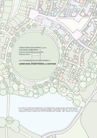
1. STONEYTHORPE DEVELOPMENT Co. and
THE DARLING FAMILY TRUST
Present promotional Document No2
(February 2014)
For a SUSTAINABLE VILLAGE DEVELOPMENT at
LOWER FARM, STONEYTHORPE, nr SOUTHAM
2. Introduction
The emerging spatial strategy faces the
challenge of delivering more homes and
greater employment opportunities whilst
protecting the historic areas of the District.
The evidence indicates a need to provide
many more homes than originally planned
for in order to meet the requirements of
an economically active population. With
such a historically important urban centre
and the predominately rural character of
the District, the challenge to address the
shortage of market and affordable homes
requires innovative thinking and bold
decision-taking.
The proposed settlement at Lower Farm,
Stoneythorpe is located next to a significant
employment site, and is well connected by
the local and strategic highway network.
Delivering a sustainable community here
offers the District an opportunity to
meet a significant portion of its housing
requirement. In doing so, the inherent
pressure of expanding the historic centre
of Stratford is minimised. The burden of
growth on outlying historic and sustainable
rural settlements will be reduced whilst still
accommodating growth to meet local need
and to sustain businesses, schools and local
services.
Both the emerging spatial strategy and the
core planning principles of the National
Planning Policy Framework have been
considered in bringing the site forward for
your consideration. The site is aligned with
both local and national planning policy
objectives and is considered a viable and
developable development fit for inclusion
within the Council’s emerging plans.
These abstract images are taken from local villages and
show the intimacy and density of the settlement and
the resultant grain.
These sample images attempt to show the variation
of typologies that may be applied through an agreed
design code.
3. PROPOSAL FOR NEW ECO-FRIENDLY SUSTAINABLE VILLAGE DEVELOPMENT AT STONEYTHORPE
Our goal is to invest in the creation of a sustainable, extremely energy efficient, environmentally friendly village community of the
future. Blending truly innovative use of the latest technologies and materials with traditional community values for people of all ages,
cultures and aspirations. Following the direction of other estates such as the Duchy of Cornwall, Calthorpe Estate, Bourneville Village
Trust and on a smaller scale and local, the Overbury Estate. The essence of a vibrant community is one of “live, work and play” ones
where the public realm and community facilities are as important as the home itself.
A Blueprint Village of the future.
Jim Darling, David Darling CBE
The proposed settlement will sit between the existing slopes framed by the swales and trees. Sustained by
the products of the elements within the site and the adjoining environs it will be planned to accommodate
a diverse community and encourage similar diversity for the ecological habitat that becomes it’s base.
4. Creating a walkable neighbourhood is a
Key objective in this proposal.
All key services and facilities such as the
school, shops and leisure will be within a
5 minute walk of all homes.. This will help
to generate a pattern that will reinforce
community through personal contact and
discourage car use. It will encourage a
modal shift from the private car to more
sustainable means of transport.
The quality of the routes is a major factor,
the roads and lanes will satisfy functional
criteria although there will be an underlying
emphaisis towards the pedestrian,
dog-walker, jogger and cyclist etc.
The beneficial experience of these and
similar groups and the connection with the
diverse environment that will surround the
settlement typifies the aspirations for this
proposal.
Aspirations for Innovation, Sustainability and Vision
5. The use of materials indigenous to the site is a
priority and design will be informed by the use
of materials that are sourced as locally as possible.
If materials rising from the site are limited in
availability then they will be used in central and
communal areas, in a framework of structural
and enclosing elements for walls and retaining
structures. This approach will distribute the
indigenous materials across the site for the benefit
of everyone who can experience the public realm
in Stoneythorpe and will create a locally distinctive
character.
Using ‘Lanes’ as informal routes will be a key
element in the Design Code that will be
developed with the Local Authority.
A hierarchy of streets with an emphasis on
creating shared surfaces of indeterminate width
(varying but having a minimum dimension) and
not necessarily having a pavement for all of its
length. It will create one zone for people, cars,
bikes to meet and integrate. The design detail will
discourage the intrusion of the large lorries. The
Estate Management Company will have the facility
to accept deliveries and distribute around the site.
Houses facing the village
green are part of the central
settlement area nd therefore densely
organised and having an intimate
relationship with the street/ lane/
footpath. The front elevation is close
up to the back of pavement or
separated by a shallow garden area
with railings
On the outer lying
areas of the development the
densities are generally reduced and
the plot ratios are larger. This gives the
opportunity for larger plots altough
there will be greater density and
lower values in the ‘Mews’ style courts
withinh these blocks or parcels.
6. Context, Connections and Linkages
The network of existing routes across
the site includes paths/ lanes suitable
for cycling that will link to the new
cycle paths that will be laid out over
the adjacent landfill site. As well as
connecting the sporting use to the
settlement the routes will be extended
to the existing public rights of way that
can link to Southam, Ufton and the Grand
Union Canal Walk along the towpath
near Bascote. This is a network that
connects to Leamington Spa and to the
Centenary Way.
The routes over the settlement will
connect with the areas surrounding
woodland.
The bridle path that surrounds the site
will be capable of giving access to visitors
and emergency vehicles across the site.
B4552 TOWARDS HARBURY, THE M43
AND BANBURY
7. OLYMPIC LEGACY
One of the first initiatives driving this proposal was to integrate
a sporting legacy from the recent London Olympics.
By making maximum use of the adjacent Biffa landfill site
which is currently being remediated the Trust believes that a
mixed woodland that will provide renewable fuel for all of the
dwellings and commercial and community accommodation.
In addition a cycle trail can be designed to create a rugged
competition course that can be varied to suit different ages and
abilities. The tracks will be integrated into the settlement and
extended to tie into the established public footpath network.
In line with the Governments aspirations to promote recovering
energy from waste, there is scope for the masterplan
development to incorporate energy from waste.
The proposed development is adjacent to Biffa waste
management site in it’s final stages and therefore the integration
of a “Energy from waste” facility to provide either heating and/or
electricity (via “Biogas” driven Combined heat and power plant)
will be explored.
This will be a key element of an overall sustainable development
by not only reducing the development’s reliance on valuable
fossil fuels, but also a better environmental solution by reducing
the amount of waste to landfill.
Geoff Neal, Director,
THE ENGINEERING PRACTICE
Environmental Service Engineers
The development will involve remodeling of the existing ground
to provide community and recreation areas. These excavations
together with those associated with construction will result in
a significant quantity of material. It is intended to optimize the
reuse of these arisings on the site.
The geology of the site is in the Blue Lias formation and is
characterized by alternate band of argillaceous limestone and
calcareous clays or shales below the top soils.
The limestone bands are thin and easily excavated. The separated
components can be used for:
• Stone for walling in the landscape.
• Crushed to provide road base and stone for SUDS drainage.
• Filling for gabions and crib wall for retaining walls.
• Mass fill to form banks and landscaped areas.
• Top soil for landscaping etc.
The masterplan will incorporate the concept of all arising
excavated material being retained on site with the most efficient
use of the various components.
This will minimize the import of material thereby reducing
transport impact and quarrying impacts elsewhere.
Richard Fenton, Director;
FENTON HOLLOWAY,
Civil Engineers, Structural Engineers and Innovators
A452 TOWARDS SOUTHAM
BIFFA LANDFILL SITE
8. Transport
The development would be accessible by a range on
non-car travel modes, there being existing or planned
pedestrian and cycle links providing connectivity to
Southam and other local settlements. The site is already
located on a bus route which would be brought into the
heart of the development, providing excellent access to
surrounding centres. The scale of the proposal considered
as a whole will comfortably support improved bus
provision. Access to the rail network would be provided
by the frequent bus connections to Leamington, with the
development improving the viability of a new station to
serve the local area near Deppers Bridge.
A mixture of on-site facilities, augmented by existing local
and other accessible provision located further afield,
means that the development proposals would be highly
sustainable in respect of access by non-car travel modes to
a wide range of employment, education, retail and leisure
opportunities and healthcare services.
Following discussions with Warwickshire County Council
(WCC), vehicular access to the site will be provided via a
single primary access from the A425 via a new roundabout
to the east of Codemasters, with a second emergency
access, As well as providing appropriate capacity, the
proposed junction arrangement has been designed to
ensure access to the site can be maintained at times of
emergency.
The primary access crosses the planned alignment of
HS2 where it lies within a green tunnel. HS2 Ltd has
advised that the construction of the tunnel will be able to
accommodate the access above.
The primary access and roundabout junction can be
constructed whilst the A425 is temporarily diverted as part
of the HS2 works, minimising disruption.
MAYER BROWN ; ENVIRONMENT & TRANSPORT
Within the site, alternative vehicular links through and
around the development will be provided, connecting
close to the primary access. As well as dispersing traffic
and providing for emergency and refuse access, this will
also facilitate the provision of a circular route through the
site for bus services.
Whilst subject to the undertaking of a detailed Transport
Assessment, preliminary studies and discussions with
WCC indicate that development traffic generations
can be accommodated an the surrounding highway
network without the need for any major infrastructure
improvements.
Noise & Air Quality
The noise environment within the site will be primarily
influenced by the A425 and HS2. The most sensitive
portion of the site in respect of noise and vibration
from HS2 is that 100 – 300m into the site where the
line enters the cutting. Assessment of traffic data for the
A425 indicates that noise levels are not a constraint to
development subject to refined mitigation, design and
layout.
Assessment undertaken to assess the likely effect of traffic
pollutants associated with the A425 demonstrates that air
quality will not be a significaant constraint to development.
Renewables / Technologies
The whole of the development will be subject to high
design and construction standards exceeding current
and planned regulations, providing for high standards of
energy and water efficiency. It is planned to build to code
level 5 of the Code for Sustainable Homes.
The ethos and scale of the development provide for range
of options in respect of energy generation on a variety of
scales. These range from individual building technologies
such as heat pumps, PV, and solar thermal to community
heating with CHP, biomass and/or energy from waste. The
proposed water attenuation within the site could provide
for hydro-electric generation and/or thermal storage, whilst
9. the adjacent Biffa site and limited views from the south
lend themselves photo-voltaic (PV) farms.
Rain-water harvesting and the re-use of grey water will be
considerations within both the micro and macro design
of the development. In addition to a local community
recycling centre, it is proposed that technologies such as
centralised vacuum waste disposal also be explored.
Ecology
Habitats within the site comprise grassland, trees and
hedgerow, water courses (including River Itchen) and
seasonally wet areas (reed beds present).
Based on the identified habitats, potential species within
the site include bats, birds, harvest mice, barn owl,
hedgehog, badger, fox, amphibians and reptiles.
The ecological significance of the site will be examined
further as part of an Extended Phase 1 habitat survey,
which will also determine the number and extent of
detailed ecological surveys.
Ecological considerations have been taken into account
during the development of the masterplan. Furthermore,
measures to protect and enhance the ecology of the site
and surrounding land will be incorporated within the
detailed design stages.
Arboriculture
There are areas of dense hedgerow, trees and woodland
within the site. These have been incorporated into
the masterplan and will be a key consideration in the
formulation of a detailed design.
An Arboricultural Assessment will be undertaken for the
site to ascertain the value and condition of the hedgerows,
trees and woodland. The outcome of the assessment will
feed into the development of the masterplan and detailed
design.
An objective of the scheme will be to significantly
enhance the tree and low level vegetation growth and to
use this and the ecology as an integral part of the unique
development setting.
Archaeology
The proposed development site does not contain any
designated heritage assets such as Scheduled Monuments,
Listed Buildings, Battlefields, Parks and Gardens or World
Heritage sites.
A formal Desk-Based Assessment and Historic Buildings’
Assessment will be prepared to support any future
planning application. However, in consideration of the
information currently available there are no heritage
assets within the site that need to be considered in the
formulation of the masterplan.
Landscape and Visual Impact
Due to local topography and vegetation cover, the site is
visually contained within the surrounding landscape.
From the north and north-east, the site is generally visually
screened by the hedgerow and semi-mature trees that
align the A425 and those associated with the copses and
parkland around the polo grounds and Stoneythorpe Hall.
From the south and south-west, there are limited views into
the site. This is due to the existing woodland around the
landfill site and the rising land that is the landfill site.
From the east, the site is visually contained by the local
rolling topography and the semi-mature hedgerows and
mature trees within the hedges.
From the west, the site is visually screened by boundary
hedgerow vegetation and the existing trees and vegetation
associated with Lower Farm.
Flood Risk and Drainage
The majority of the development site is located within
what the Environment Agency identifies as being Flood
Zone 1, which presents very little risk of flooding. The
River Itchen runs through the eastern extents of the site
and thus the design has incorporated the river and its
flood plains.
A flood risk assessment (FRA) will be undertaken in respect
of the development proposals to ascertain the risk which
may be presented to the development and which the
development may pose in respect of increasing any risk of
flooding.
A sustainable drainage strategy (SuDS) will be formulated
whereby innovative engineering is incorporated such
that the risk of flooding is minimised. This provides the
opportunity through the creation of attenuation and
swales to enhance the ecological value of the site.
Ground Conditions
No detrimental risk of any naturally occurring or man-made
potential sources of contamination has been identified
within initial site investigation works that have been
undertaken. Potential sources of contamination accounted
for include ground gases generated from natural strata
beneath the site, naturally elevated metal concentrations
and reduced quality waste material and leachate from the
landfill and recycling centre.
Further site investigation will be undertaken as
necessary to determine any specific measures needed
to be incorporated within the detailed design of
the development in consideration of any potential
contaminants.
HS2
The HS2 rail line crosses the north eastern extents of the
site. The current proposals indicate that the line will tunnel
beneath the A425 Leamington Road and into the site.
Access can be positioned to ensure the alignment of the
HS2 has no impact on the development sighting
The alignment of the HS2 line has formed a key
consideration in the derivation of our plans.
Potential mitigation measures will also need to be
identified in respect of the impact the rail line may have
on potential residents of the development in respect
of noise and vibration, again best practice will ensure a
development of this nature can be accommodated in
proximity to the HS2.
10. The River Itchen runs through the site and is fed by two
minor streams/ ditches that do run dry. There is a flood
plain or water meadow area identified and this area will
be retained as an area to encourage biodiversity and as
a re-location area for any flora and fauna that will need
protection.
The new road will be built on a retaining structure that
will hold back the water to form a fish pond. Subject to
more detail analysis the available levels should produce a
difference in water level capable of driving a water wheel
that might be used for producing energy via a
hydro-turbine.
The Estate Management Company needs to work together
with the local authority and utilities companies to enable
the adoption of roads and services to a standard of
maintenance of repair that is acceptable to the EMC. The
desired solution will be more in keeping with the rural
vernacular of the location and a more pleasant experience
for the user.
A New Village Settlement: Densities and Grain
At the centre of the village the grain or texture is a close
weave. This becomes more open as one moves towards
the perimeter. The properties are closely grouped with
front walls close to the pavement and the narrowness of
the streets emphasised by the solid edge of the block
form. This is slowly eroded and broken down as the
development distances from the market place. Design
devices breakdown the solid continuous street elevations
to give a transition to a more open grain as the settlement
unfolds. The outer lyoing houses will have the larger plots.
The boundary of the settlement will be surrounded by
managed woodland and coppicing that will provide
renewable energy for the dwellings.
DEVELOPMENT OF DENSITY IDEASUSE THE INDIGENOUS LANDSCAPE
The
water meadow and the
swales frame the area
identified for the central
open space for the
settlement.
Settting the
pattern of densities
around the open
space and water
meadow.
The Market
Square has narrow
fronted shops facing
the open space and the
central area free for a
variety of activities.
The 1/1.5
Form Entry (FE) village school will house
a nursery and share the open space for
sports and activities. Located at the very
heart of the settlement the intention is
for the school to be a key component in
the new community with a strong tie to
the countryside. It is envisaged children
will have good access to learn about rural
issues and their surrounding
environment.
11. The perimeter houses face outwards to avoid a ‘back-fence’
situation and encourage engagement in use, supervision
and maintenance. Although visitors and service vehicles
can access via the perimeter lane the owners can use an
inner courtyard arrangement that includes some higher
density dwelling blocks to develop a secondary pattern
of accommodation that will frame a different macro
environment.
DEVELOP BUILT-FORM CONCEPTSINTRODUCE OPEN SPACESOpen spaces are
developed from the
village green and
give legibility to the
circulation routes.
The built-form extends
the density concept and
distributes the variety of
housing product over
the settlement.
The
parcels of development
towards the boundary of the
settlement will have a reduced
density but will have a Mews
style of inner courtyards that
can offer smaller, lower value
products.
12. Variety, Grain and Public Open Spaces
The River Itchen runs through the site, within which it is
fed by two minor streams. There is an area of flood plain
alongside the river and it is proposed to utilse this area for
multiple purposes, providing a key element of the drainage
strategy for the site, providing a biodiverse ecological
habitat and providing a focal point for the development.
A retaining structure will be formed across the flood plain
to create a large attenuation pond to accommodate run-off
water from the development and control downstream flow.
Where drainage conditions permit, water may be collected
from the pond and pumped to a cistern at high level, from
where it can be fed by gravity back down the levels to
provide irrigation to public areas of planting and green
space. At the point of discharge the retained water may be
capable of generating power, whilst the retaining structure
itself could provide a crossing point to permit circulation
around the site.
13. employment opportunities within the settlement.
Shops will sit alongside cafes bars and restaurants to
serve the inhabitants of the village, employees from the
offices and visitors. The intention is to provide support for
start-up businesses through the EMC to encourage young
entrepreneurs. Support that will endorse strongly the use
of environmentally sustainable practices and of sources as
local as possible.
The Retail model that is proposed for the Village centre
is multi faceted. It will provide an active frontage that will
bind the centre of the settlement, bring life interest and
employment to the heart of the village.
The EMC will encourage new ‘start-up’ businesses with the
financial and mentoring assistance that is the legacy from
the establishment of Codemasters in 1986 by the Darlings.
The shop front however could only be part of the facility
with supporting space and resources in the centre of
the block being able to accommodate a parallel internet
based business from the same location. Indeed for young
entrepreneurs the residential accommodation above the
shop could be their first home.
The aspiration here is to create a situation where specialist
retailers can develop national or international markets
utilising the internet, but with a street presence that will
attract visitors to this village high street. Potential internet
activities will be greatly enhanced with high speed
broadband connections and expertise available to all
village residents/businesses.
The following is a Case Study example;
A shop in Les jardins d’eini, Autoire, Midi Pyrennes, The
Lot, France imports and stocks exotic dried mushrooms
from around the world.
This facility that would be prohibitively expensive in
Paris but with the supporting resources and space the
business can have a public presence as well as a national
distribution network thanks to the internet.
One of the objectives of the Estate Management
Company is to manage the adjacent woodland sites and
to plant the landfill site with new woodland to produce
a new facility of diverse species. This will provide a wide
ranging environment for flora and fauna as well as product
for coppicing for logs, wood chippings and material for
charcoal.
The Woodland Trust have agreed to help develop this
thinking and Biffa have indicated that our proposals will not
prejudice the planned remediation strategy and that tree
planting can be accommodated on site in line with our
aspirations.
Cycling UK have also committed to encouraging the
development of a cycling facility that could include
woodland tracks and slopes.
There would be a particular interest in developing
technologies that help cyclists with disabilities. This could
be very appropriate with the technological pedigree of
the location and building a new facility from effectively a
new site.
Other employment opportunities will be created in the
procurement and the delivery of the construction of the
built form.
In using local materials compounds and yards will be
established on site to train young craftsmen in the use
of these materials both in a traditional way and to suit
contemporary applications. The vision is for this demand
to provide a programme of construction projects and new
business ventures that can be nutured from Stoneythorpe.
Connections to the local skills market should encorage new
jobs and new training opportunities in crafts and skills.
These light industrial uses will be sited to the north of the
site against the A425 or the edge of HS2 if / when it is
confirmed.
The village centre will be a mix of modest shops with the
flexibility to trade off site, a philosophy matched by other
14. The site is in the single ownership of the Darling family who
are committed to delivering a high quality development.
The family will establish a Trust and will invest substantial
funds in developing infrastructure. Working in partnership
with long term development partners, the project would
be delivered in accordance with Design Codes agreed in
partnership with local stakeholders.
There are several examples of this approach, the Duchy
of Cornwall, Bourneville Village Trust, the Calthorpe
Estate and Port Marine Bristol are some that have been
highlighted.
In the context of the National Planning Policy Framework,
it is considered that the site is available now and is suitable
for development in that it offers another option to
merely enlarging Stratford and outlying settlements and it
comprises land adjacent to a source of employment and a
potential source of renewable energy. It is also considered
to be achievable within the plan period and is not
adversely affected should HS2 be built.
Southam - Lower Farm Deliverability
15. Assessment
The reason for the delay is that the Core Strategy has
to meet the objectively assessed housing needs. The
latest evidence which underpins this is the Coventry
and Warwickshire Strategic Housing Market Assessment
(CWSHMA) which considered the wider housing market
area.
This document recommended that the objectively assessed
housing need for Stratford District over the period 2011-
2031 should lie at 570 dwellings per annum (11,400 over a
20-year period).
A further report prepared on behalf of the Council was
undertaken by Environmental Resource Management
(ERM). This report considered the objectively assessed
housing need lay between 10,500 and 10,800.
The Council’s own Strategic Housing Market Assessment
(SHMA) (Update) ( Jan 2013) objectively assessed the
needs for market and affordable housing in the district.
The SHMA indicates a housing requirement of 14,500 new
dwellings over the plan period (up to 2028). It notes that
this figure is based on continuing high levels of in-migration
to the district which the Council wishes to limit moving
forwards.
The Housing Provisions Options Study 2012 Update ( Jan
2013) is a further piece of evidence which informs housing
needs.
It states that an objective assessment of development
needs for housing up to 2028 would fall between 12,000
and 13,000.
There is therefore a strong body of evidence that indicates
that the Council will need to find additional sites for
housing in order to accommodate their objectively
assessed housing need; whichever housing requirement
figure is used.
The aspirations of the Council to limit in-migration is
acknowledged, however, the Council must meet its housing
needs and must ensure that its strategy for growth does
not impede economic growth within both the district
and neighbouring authorities. It is recognised that finding
locations for the additional homes required will be
challenging.
The current strategy of limiting growth at Stratford and
distributing housing to the outlying service villages and
main rural centres aims to safeguard the historic integrity of
Stratford. Distributing housing to the outlying settlements
has significant merit on sustainability grounds; however
these settlements will only be able to accommodate a level
of growth commensurate with the infrastructure in place.
The latest round of consultation is encouraging and it is
evident that the Council is meeting the challenge head on.
The new freestanding, sustainable, community-focused
settlement outlined in this document offers the Council an
opportunity to meet its identified housing needs whilst
delivering on its objective of minimising development at
Stratford and at the other rural centres.
Due to the scale and nature of the proposal, the spatial
strategy and strategic objectives of the emerging Core
Strategy have been considered, along with the associated
evidence base on housing and the policies and objectives
of the National Planning Policy Framework (NPPF).
In January 2014, Cabinet resolved to extend the plan
period so that it will now run from 2011 to 2031. The
emerging Stratford-upon-Avon Core Strategy will set out
the Council’s spatial strategy for the district. Emerging
policies of the Core Strategy will carry greater weight
further along the adoption process.
Given that additional consultation has since taken place on
new proposals and that the Council is currently carrying
out a focused consultation on the 2011-2031 housing
requirement and strategic site options (Feb/March 2014),
the Council have acknowledged that the date for adoption
has slipped considerably.
16. In order to assist the local planning authority in considering alternative options for growth it is considered that the 12 Core Planning Principals contained within the NPPF provide an
excellent framework to initially appraise the site.
Be Genuinely Plan Led
The proposed development should be
Considered in the context of the Council’s emerging
spatial strategy and the need to provide significantly more
housing than originally planned for. The Council’s spatial
strategy of limiting growth within Stratford and distributing
housing to its main Service Centres and local service
villages is not comprised by this development. Indeed, the
development compliments the spatial strategy and can
assist in limiting future growth within Stratford and some of
the more sensitive rural settlements.
It is anticipated that significant involvement from the
community and from local stakeholders including Parish
and Ward Councillors would help shape the proposals and
to ensure that local issues are addressed from the outset.
It is considered therefore that the development does not
prejudice the wider strategy for growth within Stratford
District and can assist the Council’s need for economic and
housing growth.
Planning should be a creative exercise in finding ways to
enhance and improve in which places people live their
lives
The site is located next to the locally significant employer,
Codemasters. The firm has recently been granted planning
permission for extensions which would see employment on
site increase from 500 to up to 1,000 jobs.
The site also lies next to a former waste disposal site which
is currently in the process of being remediated.
A recycling centre is located on this site and has the
potential for significant growth to assist the Council
in achieving its aim to reduce landfill and meeting the
challenge of a changing climate.
Locating housing adjacent to a significant local employer
and alongside the former waste disposal site offers
imaginative solutions to both sustainable energy generation
and local employment.
The development would tie in with the existing business
and provide opportunities for IT, financial services and
professional and research companies to locate to a pleasant
setting, close to regional centres and strategic transport
routes. The establishment of a new community would
require a democratic framework to be created so to ensure
that a community is supported by the necessary social
infrastructure.
This could be a Trust which would maintain a level of
control and ‘sponsorship’ of village centre uses, and
provides the bedrock for committee’s tasked to manage
sports and social clubs, allotments and other local
community enterprises.
Pro-actively drive and support sustainable economic
development through objectively assessing the housing
business and other development needs of an area.
There is now a significant body of evidence that indicates
the District’s objectively assessed housing need lies
between 10,500 and 14,500 homes. Under-providing is
not an option and would result in a decline in the number
of residents in the district in employment.
It is therefore the case that in order to meet the Council’s
objectively assessed economic and housing needs
additional homes are needed. A new freestanding
settlement under single ownership represents an
exceptional opportunity for an innovative and exciting
response to the challenge.
Always seek to secure high quality design.
The document sets out the very high quality design
intent that would be delivered on this site. A range of
innovative technologies are proposed to link in with
surrounding sustainable/renewable energy opportunities.
The development would be focused on a village centre
with the range of traditional shops, services and amenities
planned in an organic and diverse manner. It is anticipated
that the proposal would include a Primary School and has
the potential to provide for new health and community
facilities. Design codes would be supported to ensure
the vision for the new community would be retained
throughout the development of the site. It is expected that
the Local Planning Authority and other local stakeholders,
including the Parish Council, would be involved in the
preparation of the detailed design codes.
Assessment
The proposed settlement will assist significantly in achieving
this by providing the additional housing in a manner
that protects and safeguards the historic character of
Stratford and ensures that growth in outlying rural centres
remains proportionate to their existing size. It also places
housing very close to an existing and expanding source
of employment and is an opportunity to create a high
quality, innovative, sustainable development with a strong
community focus.
17. Take account of the different roles and character of
different areas
The development would still allow for a proportionate
and appropriate amount of development to be directed
towards urban areas and existing settlements to ensure that
there remains an urban focus and that villages and other
rural centres remain sustainable in the future.
Development would retain existing hedgerows and
mature trees and would supplement these with significant
new planting. Any proposal would work with the existing
topography to ensure that development assimilates
successfully into the landscape. Whilst development would
represent a change, the landscape is not subject to any
specific landscape designation and is not Green Belt.
The delivery of homes on this site would safeguard
Stratford from excessive growth and would ensure the main
rural centres and the local service villages are not
over-burdened with housing and the infrastructure and
social pressures this can entail.
Support the transition to the low carbon future in a
changing climate
The scale of the development and its location next to a
former waste disposal centre provides an opportunity to
utilise a range of renewable energy technologies.
The mix of uses also allows for energy that has been
generated on site to be used throughout the day.
There is also the opportunity to quarry building materials
from the site as there is a known source of aggregate
beneath the ground.
This locally sourced material is sustainable and whilst it is
unlikely to be used for building homes, its use on walls
and within public open space will give a strong sense of
character and place. The document sets out the range of
technologies that are feasible for use on this scheme.
Contribute to conserving and enhancing the natural
environment
The vision is to create a sustainable place with a working
community. Primary Schools, shops, services and facilities
would be provided on site and would enable residents to
remain car free for much of their day to day needs.
The proposed mix of uses also enables local employment
thus reducing the necessity for out-commuting.
Habitat creation and woodland management would be a
key priority under the proposals.
The number of homes that are needed within the District
is such that the development of greenfield land will be
necessary. The construction of a significant portion of the
housing requirement in one single location will minimise
the impact of the alternative which would see a wider and
more dispersed development of greenfield sites.
Encourage the effective use of land by re-using land that
has been previously developed
In order to meet the objectively assessed housing and
economic needs for the district the authority will have
to release greenfield sites. In order to safeguard the
historic integrity of Stratford this site represents a good
opportunity to strike a balance between housing growth
and the protection of heritage assets.
More pertinent perhaps is that there is simply not enough
brownfield sites within the District to meet the objectively
assessed housing needs.
Promote mixed use developments
The proposal would deliver a range of housing to meet
local market and affordable needs, Primary School and
Nursery provision, local shops, services and facilities
including retail, take-away/restaurant and pub uses.
It would also provide for employment uses (B1/B2 Use) as
well as Medical/Health facilities such as a local GP surgery
or dental practice..
Conserve heritage assets in a manner appropriate to
their significance
The character and setting of the nearby heritage assets
will be maintained through the provision of appropriate
landscape buffers. The development would enable the
Council to limit housing growth at its more sensitive historic
centres such as Stratford and Southam.
Manage patterns of growth to make fullest possible use
of public transport, walking and cycling
The site is located alongside the A425 (Leamington Road)
which provides convenient links to the Southam, Warwick,
Leamington and the M40. Public transport, cycle and
walking routes would be incorporated throughout and
to the edges of the development so that no part would
be further than 800m from any other part. This walkable
neighbourhood will be complimented by access to
public transport which will connect to local service and
employment centres.
Take account and support local strategies to improve
health, social and cultural well-being
The development would be of a size that could
accommodate health facilities. Outdoor recreational
activities will be a strong feature of the development and
will encourage residents to walk and cycle within, around
and out of the site into the surrounding countryside.
The social, health and well-being will be strengthened by
the creation of a connected community.
This will include a strong village centre and sport and
recreational ground and importantly a democratic
framework which would ensure that opportunities for
public participation are facilitated.
18. Southam - Lower Farm policy references
NPPF Core Planning Principle Stratford Upon Avon Local Plan Review (saved policies)
(LPR)
Stratford Upon Avon Core Strategy (CS)
Be Genuinely Plan Led STR1, STR3 Strategic objections 1-8, CS1, CS16
A creative exercise in finding ways to enhance and
improve the places in which people live
STR1, STR3, PR6, EF7, EF9, EF10, DEV1, DEV8, COM3,
COM5, COM7, COM9
CS1, CS2, CS11, CS15, CS16, CS20, CS25, CS27,
CS28, CS29
Drive and support sustainable economic development STR1 CS1, CS16
Secure high quality design DEV1, DEV2, DEV9, DEV11, IMP2, IMP3 CS1, CS10, CS13, CS15, CS17, CS19, CS20, CS22,
CS25, CS27
Consider the different roles and character of different
areas
DEV1, DEV2, DEV11, IMP2, IMP3, EF7, EF9 CS1, CS10, CS11, CS15, CS25
Support a low carbon future PR5, PR6, IMP2, DEV8 CS1, CS2
Conserve and enhance the natural
environment
EF7, EF9, EF10, DEV2 CS1, CS10, CS11, CS13, CS15, CS25
Encourage the effective use of land STR1 CS1, CS16
Promote mixed use developments DEV1, COM3, COM13, COM14, COM17, COM18,
COM19, STR3
CS1, CS15, CS17, CS20, CS22, CS23, CS24, CS25,
CS27, CS28, CS29
Conserve heritage assets EF11, EF13 CS15
Maximise the use of public transport, walking and
cycling
STR1, STR2, DEV1, DEV9, COM7, COM9, COM17,
COM18, SUA.D, IMP4, IMP5, IMP6, IMP7
CS1, CS16M CS28, CS29
Support and improve strategies on health, social and
cultural well-being
DEV6, COM4, COM5, COM9, SUA.D, STY10, IMP4,
IMP5
CS13, CS15, CS27, CS28, CS29
19. This document has been prepared to support the District
Council’s evidence base which indicates a need to provide
many more homes than originally planned for.
The proposal site would assist in safeguarding Stratford
from unsympathetic levels of housing growth and ensures
the District provides enough homes for its economically
active population. The document sets out the core
planning principles of the NPPF and details how the
proposal site accords to their over arching aims.
Policies of the saved Local Plan and the emerging Core
Strategy have been considered and it is concluded that
the proposal site is aligned to the main policies and in
particular does not prejudice the Council’s spatial vision for
the District.
The proposal site is deliverable and is available and can
proceed should HS2 be constructed. It can assist the
Council with a sound strategy and can deliver a significant
number of market and affordable homes, employment, also
health and social infrastructure and will limit the need for
excessive growth in more sensitive parts of the District.
The alternative may be to direct substantial housing and
employment provision within and to the edge of the urban
area of Stratford.
This will impact on the historic core and the town’s wider
setting.
In summary, the proposals have been positively prepared,
are justified against alternative options, will be effective and
are consistent with national policy.
Southam - Lower Farm Conclusion
20. Document prepared by David C Higgens RIBA in collaboration with Cerda Planning Ltd, other consultants;
Mayer Brown, Environment and Transport, Philip King and Co. Property Consultants, EC Harris Built asset consultancy, Fenton Holloway, Civil
and Structural Engineering, The Engineering Practice, Services Engineers
c David C Higgens RIBA; June, 2013