JHydro - an implementation of the digital watershed
ngis-value-chain
1. Water Resources Information
National Groundwater Information Systems
(NGIS) Portfolio
CHART
Description
CHART is a software solution, developed for DWA users exclusively.
CHART is an integrated, hydrochemical analysis and reporting application that
aims to assist hydrogeologists and hydrogeochemists in decision making
during analysis and assessment of data.
CHART supports the analysis and assessment of the complete hydrogeological
cycle and hydrochemical trends in an integrated fashion with collaboration
between groundwater, surface water, and meteorological data in a single
snapshot or dashboard.
CHART also fulfills an integral management role that aims to assist
geohydrologists with implementation and management of monitoring
programmes and networks.
In the future CHART will be accessible via the Internet.
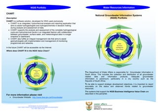
Where does CHART fit in the NGIS Value Chain?
For more information please visit
Groundwater Website : http://www.dwa.gov.za/Groundwater
NGIS Portfolio
DEPARTMENT OF WATER AFFAIRS
CHIEF DIRECTORATE: WATER RESOURCES INFORMATION MANAGEMENT
TOLL FREE: 0800 200 200
The Department of Water Affairs is responsible for Groundwater Information in
South Africa. This includes the collection and distribution of all groundwater
related data and information products. Adequate groundwater
information is paramount, particularly in a dry country such as the
Republic of South Africa.
To be able to support strategic development objectives, it is important to report
accurately on the status and observed trends related to groundwater
resources.
The systems that support the NGIS Business Intelligence Value Chain are
described in this pamphlet.
NGIS
Business
Intelligence
Value Chain
Maps
Graphs
Reports
Data
CHART in the
NGIS
Business
Intelligence
Value Chain
Maps
Graphs
Reports
Data
2. NGIS Portfolio NGIS Portfolio
National Groundwater Archive (NGA)
Description
The NGA is a web enabled database system that allows capturing, viewing,
modifying and extraction of groundwater related data by registered users.
Currently the main focus of NGA is on point data known as Geosites (Borehole,
Drain, Dug Well, Lateral/Radial Arm Collector, Mine, Seepage Pond, Sinkhole,
Spring, Tunnel, Well Point). Line and polygon data will be made available in future.
There are already in excess of 250 000 Geosite records on the NGA.
NGA includes an ensemble of tools including but not limited to a Geosite
Identification Management Tool. For the purpose of managing the acquisition
of all newly generated data the Geosite Identification Tool can be used by all
duly registered users. This will allow the DWA to keep track of all groundwater
exploration and development projects and thus ensures that all newly generated
data is captured.
To register go to: http://www3.dwa.gov.za/nganet
Enquiries: ngaadm@dwa.gov.za
Where does the NGA fit in the NGIS Business Intelligence Value Chain?
Geohydrological Reports System
Description
The Geohydrological Reports System is a database that contains groundwater
related technical reports.
Approximately 2600 technical reports are available in the library at National Office.
These reports reflect the hydrogeological investigations done by DWA officials or
consultants.
A web enabled system allows one to inquire about the availability of specific doc-
uments and are made available in PDF format.
To search the database go to http://www.dwa.gov.za/ghreport.
Where does the Geohydrological Reports System fit in the NGIS Value Chain?
NGA in the NGIS
Business
Intelligence
Value Chain
Maps
Graphs
Reports
Data
Geohydrological
Reports in the
NGIS
Business
Intelligence
Value Chain
Maps
Graphs
Reports
Data