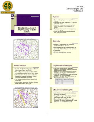
3. Carl Holt
Advance Digital GIS
Final Project
I. Purpose
The purpose of this project was to evaluate the location of street light in
and around the campus of North Alabama. The two parties involved in this study
are The University of North Alabama and City of Florence Electricity Department.
North Alabama (UNA) Maintenance Department owns and maintains all the
street light found on campus on the exterior of buildings. The Florence Electricity
Department (FED) maintains all the street lights on public right-of-ways and
roads. The interior of campus is very well lit with an assortment of street lights.
The streets in a one block radius of campus fails in properly lighting the streets
for safety to pedestrians and drivers.
Provide the University of North Alabama and the City of Florence
Electricity Department with information to maximize the efficiency of the current
street lights. This will aid in providing the proper illumination for the safety of
residents and students. The neighborhoods surrounding campus are some of
the highest land values in the city, yet they lack the proper illumination. Also
many students live close to campus and walk to class instead of driving. Maybe
with the proper placement of street lights more students would be encouraged to
walk instead of adding to the parking problem on campus.
II. Methods
The first task was to find out what the wattage of the street lights on
campus are. UNA Maintenance Department provided extensive details on which
lights have what wattage. Next, the same had to be done for the street lights
owned by FED. An electrical engineer from the Electricity Department was
recruited to drive around and report the wattage of street lights. From there the
Electricity Department furnished a manual that expressed the illumines and
radius the light extends from the fixture.
Next using a Tremble Juno ST, GPS points are taken at every street light
on campus because the geographic locations are not known and an attribute
table has not been compiled. The GPS points can then be uploaded onto
ArcMap using a base map provided by the Electricity Department that displayed
the geographic position of poles, lights, streets, edge-of-pavement, buildings, and
electrical lines. The height was recorded using a digital hypsometer, provided by
the UNA Geography Department. The height, wattage, and illumines of each
light pole was placed into an attribute file.
The GPS points were downloaded with Pathfinder Office and exported as
a shapefile to ArcMap. The shapefile was then projected to overlay the
basemap. Next, a buffer was created to show the extent of illumination from the
fixture. Different sized buffers were used to show the different amount of light
output that each sized bulb and fixture produce.
III. Analysis
The areas that UNA controls have amble light and there are few areas that
lack the proper illumination. The streets and surrounding neighborhoods lack
street lights. It is a policy of FED to place street lights 400 feet apart and at
intersections, (Chip Rasch, Electrical Engineer). The areas that needed more
street lights are only found in the neighborhoods surrounding UNA.
3
4. Carl Holt
Advance Digital GIS
Final Project
IV. Conclusion
In conclusion, the campus of North Alabama has proper light from the
quad to every dormitory parking lot. The City of Florence, however, is lacking
and needs to upgrade the street light infrastructure around the campus. The four
areas that need attention are: an alley connecting Parking Lot Z to Wood Ave,
Irvine Ave and Court Street, Willingham Street and Hawthorne Street, and Irvine
Ave and Wood Ave. The alley needs the most attention because two large
dormitories containing 148 students, mostly females, and a large commuter
parking lot. The alley cuts between two houses and that cuts off a large amount
of light that would shine from the lights on the parking lot and Wood Ave. This
alley is heavily traveled by students. Next, the intersection of Court Street and
Irvine Ave is a heavily traveled intersection and a very confusing of drivers. The
addition of more street lights would lower the amount of accidents that happen at
the intersection. Third, the area around the intersection of Willingham Street and
Hawthorne Street is located behind four dormitories and is major route to the
campus and parking garage. There are many students living near this
intersection and many accidents are preventable by installing more street lights.
Fourth, the intersection of Wood Ave and Irvine Ave has a traffic light, but no
street light. It is important that this intersection by properly lit because the main
entrance is located one block west of the intersection and three apartment
buildings are within 100 yards of this heavily traveled intersection.
The improvement of street lights can only help the campus and
surrounding neighborhoods. The land values will increase because of the
placement of new street lights. Students would be more willing to walk to class
and not drive onto campus looking for a parking space. The addition of street
lights is a win-win situation for the students, citizens, and university.
Special thanks goes out to the University of North Alabama, Geography
Department for furnishing the GPS and hypsometer. The City of Florence Electricity
Department for providing the base map, layers, street light information, and the
assistants of electrical engineer Allen Caddell. The assistance of David Austin in using
the hypsometer.
4