SlideShare a Scribd company logo
1 of 109
Download to read offline
University 
Avenue 
& Royal 
Hoover 
Street 
W. Jefferson 
Boulevard 
UNIVERSITY PARK AND JEFFERSON 
BOULEVARD STREET PLAN 2014 
Prepared by the Fall 2014 USC PPD 531L Complete Streets and Bicycle Planning Studio
PLAN AUTHORS 
Fall 2014 PPD 531L Complete Streets and Bike Planning Students: 
Nick Armour, Christine Blackman, Karl Fielding, Lynnette Hartenian, 
Haijing Lin, Clare Kelley, Patrick Martinez, Bryan Moller, 
Lavandra Raghuraman, Shrota Sharma, Peter Soderberg, 
Kurt Taillin, Lawrence Young, Samuel Zneimer 
Direction and edits by Professor Alison Kendall, LEED AP BD+C, AICP 
ACKNOWLEDGEMENTS 
The following members of the Trojan Community and various governmental agencies and cy-cling 
and pedestrian safety advocates assisted in the preparation of this documen: 
USC Administration 
Student Affairs 
Ainsley Carry, VP-Student Affairs 
Facilities/Construction/Auxilliary Services 
Brian League 
Administrative Services 
Brian Gross, Special Projects 
Department of Public Safety 
Chief John Thomas 
Faculty/External Relations 
David Galaviz, Exec. Director, Local Govt 
Relations 
Transportation 
David Donovan, Assistant Director 
Sol Price School of Public Policy, USC 
Students of the Spring 2012 Bike Planning Studio 
Students of the Spring 2014 Bike Planning Studio 
USC Undergraduate Student Government 
Jordan Fowler 
Kody Kessler 
USC Graduate Student Government 
Christine Wozniak, Director of Campus Affairs 
City of Los Angeles 
Dave Somers, City Planning, Policy 
Rubina Ghazarian, LA DOT, Bicycle Coordinator 
USC Bicycle Coalition 
Cathy Ji, President 
Alex Leavitt, Graduate School Representative 
Jake Peters, Staff Representative 
LA Metro 
Tham Nguyen 
TRUST South LA 
Malcolm Harris, Director of Programs & 
Organizing 
TABLE OF CONTENTS 
I) Introduction 
Chapter 1: Executive Summary .................................................................. 01 
Chapter 2: Issues and Opportunities ............................................................ 07 
II) Proposed Street Improvements and Programs 
Chapter 3: University Avenue and Royal Street Improvements ................. 21 
3.1 Issues & Opportunities............................................................ 22 
3.2 Proposed Improvements....................................................... 23 
3.3 Implementation Plan.............................................................. 35 
Chapter 4: Hoover Avenue and McClintock Improvements ........................ 43 
4.1 Issues & Opportunities.......................................................... 44 
4.2 Proposed Improvements....................................................... 50 
4.3 Implementation Plan............................................................... 56 
Chapter 5: Jefferson Boulevard-Vermont to Normandie............................. 63 
5.1 Issues & Opportunities........................................................... 64 
5.2 Proposed Improvements........................................................ 71 
5.3 Implementation Plan.............................................................. 81 
III) Next Steps & Other Resources 
Chapter 6: Implementation: Evaluation and 
Campus Community Collaboration............................................ 86 
6.1 Recommendation on Implementation ................................. 86 
6.2 Implementation by Area .......................................................... 87 
6.3 Education................................................................................ 90 
6.4USC Coordination with City and County Agencies....................91 
Appendix ........................................................................................................ 99 
Bicycle and Pedestrian Counts..................................................... 99 
Funding Opportunities............................................................... 103 
References.................................................................................. 106
1 Executive Summary 2 3 4 5 6 A 
1 
Chapter 1: 
Executive Summary 
Purpose of the University 
Park and Jefferson Boulevard 
Streets Plan 
The University Park and Jefferson 
Boulevard Streets Plan was prepared 
by the Fall 2014 Complete Streets 
and Bicycle Planning Studio at the 
Sol Price School of Public Policy as an 
exploration of the potential for street 
redesign and collaborative USC/City 
of LA/Community planning to en-hance 
the livability and mobility of 
this unique neighborhood in LA. 
The University Park neighborhood 
directly north of the main USC cam-pus 
contains a large number of USC 
undergraduate and graduate stu-dents, 
as well as a large number of 
university related institutions. Two 
streets examined in this study, Uni-versity 
Avenue and Hoover Avenue, 
link the campus to the area and carry 
extremely high volumes of bicycles 
and pedestrians throughout the day 
and evening. Currently the USC Vil-lage 
project is under construction just 
north of the main campus, and offers 
a chance to substantially improve the 
safety, convenience and character of 
University Park streets over the lon-ger 
term, while currently impacting 
them during construction. 
Given the flat terrain and dispersed 
facilities, bicycling is an increasingly 
popular choice for USC students, fac-ulty 
and staff commuting and trav-eling 
between University facilities. 
However the campus area has not 
adapted to this cycling increase by 
providing a clear bicycle circulation 
network, supported by bike safety ed-ucation, 
enforcement and adequate 
bicycle parking and services. 
The goal of the University 
Park and Jefferson Boulevard 
Street Plan is to propose street 
improvements to improve 
the safety and convenience of 
bicycling and walking in the area 
immediately north and west of the 
University Park Campus. Cycling 
should be supported as a healthy 
and sustainable transportation 
option for students, faculty, staff, 
and community members. 
USC and the University Park area have one of the highest cycling rates in California. This 
Street Plan proposes street improvements for consideration by the City of LA, USC, and the 
local community. the safety and convenience of bicycling and walking. programning and 
infrastructure, it can also become one of the most bicycle friendly Universities in the country.
2 
Proposed long-term improvements along Hoover Cooridor 
Photo simulation of street trees, pedestrian scale lighting, 
bicycle parking and lanes near the corner of Jefferson Boulevard 
and Budlong Avenue. Some of these improvements can be 
implemented at low cost yet could dramatically change the 
corridor. 
Policies of the North University 
Park and Jefferson Blvd Streets 
Plan 
The Plan identifies specific actions 
and strategies to: 
1. Propose and encourage imple-mentation 
of bicycle and pedestrian 
safety improvements for key path-ways 
and streets north and west 
of the USC main campus. A clear 
bicycle circulation network reduces 
potential conflicts between pedestri-ans 
and cyclists. 
2. Improve bicycle and pedestrian 
safety at campus gateways and key 
intersections, and promote coopera-tion 
between USC, the community, 
and the the City of LA to coordinate 
bikeway improvements in the Uni-versity 
Park and Jefferson Boulevard 
area. 
3. Identify key partners and 
stakeholders who can participate in 
improving bicycle and pedestrian 
safety and convenience through safe 
cycling education, encouragement 
for bicycle commuters, and consis-tent 
enforcement of safety regula-tions 
Seek recognition of the Univer-sity 
Park and Jefferson Boulevard 
area as a Bicycle Friendly Commu-nity 
and USC as a Bicycle Friendly 
University to recognize and celebrate 
bicycle improvements and program 
achievements. 
Organization of the Plan 
I) Introduction 
1. Executive Summary 
2. Issues and Opportunities 
II) Policies and Programs 
3. University Avenue 
4. Hoover Avenue 
5. Jefferson Boulevard 
III) Next Steps & Other 
Resources 
6. Implementation & Evaluation and 
Campus-Community Collaboration 
7. Appendices & Resources
1 Executive Summary 2 3 4 5 6 A 
The 2014 Bike Planning Studio Class - 
Bike Safety and Training Day 
3 
Policy Context 
Planning Process 
Preparation of the North Univer-sity 
Park and jefferson Boulevard 
Streets Plan nvolved members of the 
Trojan Community, residents and 
merchants in surrounding neigh-borhoods 
and public agencies. This 
planning document builds upon USC 
policies developed in a broader pub-lic 
process in the 2012 University of 
Southern California Bicycle Master 
Plan. 
Other relevant Planning Documents 
which affect the Project Areas in-clude: 
2010 City of LA Bike Plan, My 
Figueroa Streetscape Plan, USC Vil-lage 
Development Agreement and 
Jefferson Streetscape Design Guide-lines. 
(provide full names, web ad-dress) 
USC graduate students from the 2014 
Bike Planning Studio Class collected 
valuable bicycle and pedestrian count 
data and analyzed bicycle and pedes-trian 
collision data to identify safety 
issues and develop recommendations 
for potential bicycle improvements 
and programs in the area north and 
west of the USC campus. 
This input was integrated, along with 
planning concepts from the previ-ous 
2012 Bike Planning Studio Class, 
into Draft Plan Proposals discussed 
with USC, public agencies and com-munity 
representatives on October 
30, 2014 and December 4, 2014, and 
in numerous Stakeholder meetings 
held with University Park and Jef-ferson 
Boulevard area stakeholders. 
This Draft Streets Plan has been pre-pared 
for the use of key stakehold-ers 
in the University Park, Jefferson 
Boulevard, and USC Community and 
by City of LA transportation plan-ners 
and advocates. Comments from 
guest reviewers will be integrated
into the Final North University Park 
Streets Plan. 
Next Steps and Implementation 
Chapter 6 of the Plan describes the 
recommended Implementation 
Strategy, including integration with 
the USC Bicycle Education Program 
and Bicycle Master Plan implementa-tion. 
Implementation of the street im-provements 
3, 4, and 5 can be phased and coor-dinated 
4 
Photo simulation of long-term improve-ments 
at Hoover and Jefferson intersection 
mentioned in Chapters 
with related campus plan-ning 
projects. City and County of 
Photo simulation of raised crosswalk at intersection of Univer-sity 
Avenue and 30th Street 
Los Angeles projects will also present 
opportunities for implementing the 
plan and coordinating USC and pub-lic 
agency efforts. 
TIMS data showing the high collision 
injury rate on Hoover Street and at 
30th and 32 Streets should be used 
in making the case for the City of Los 
Angeles and USC to participate in 
implementing the raised crosswalks, 
extended curb cuts and possibly oth-er 
additional improvements such as 
flashing beacons.
1 Executive Summary 2 3 4 5 6 A 
5 
USC Bicycle Master Plan: Circulation Network
6 
THIS PAGE HAS BEEN 
INTENTIONALLY LEFT BLANK
1 2 Issues & Opportunities 3 4 5 6 A 
7 
Chapter 2: 
Issues and Opportunities: 
Volume Counts and Safety Issues This chapter is intended to highlight 
and summarize the data collection 
process and the subsequent findings 
from bicycle and pedestrian counts 
conducted at major intersections 
north of the USC campus with heavy 
bicycle and pedestrian volumes. These 
include Figueroa Street, University 
Avenue and Hoover Avenue, and 
Vermont Avenue at Jefferson 
Boulevard in Los Angeles, California. 
These counts will be used in part as 
baseline data, prior to the My Figueroa 
complete streets project, to inform 
future political and infrastructure 
decisions regarding pedestrians, 
bicycles, and complete streets 
projects in Los Angeles and beyond. 
Counts conducted after the 
completion of the My Figueroa 
project will be used in comparison 
to these baseline counts to provide 
empirical evidence of the impact of 
complete streets facilities on volumes 
of bicycles and pedestrians, perceived 
safety of the bicycling environment, 
and changes in bicyclist behavior 
i.e. Sidewalk riding, wrong-way 
riding, use of helmets, etc. The 
This chapter also discusses safety 
following sections will document 
concerns in the area and highlights 
the data collection process, site 
areas of special concern. The North 
characteristics, and findings 
University Park and West Adams 
resulting from the completed counts. 
neighborhoods experience high 
Bicycle and Pedestrian Collisions 2008-2012 Data Source: SafeTrec’s Transportation Injury Mapping System 
volumes of cyclists and pedestrians. 
Due to behavioral and road design 
issues there are also high volumes 
of collisions involving cyclists 
and pedestrians in this area.
8 
2.1 Figueroa Street and Jefferson Boulevard: 
Volume Counts and Safety Issues 
Site Characteristics 
The intersection of Jefferson Blvd. 
and South Figueroa St. currently 
favors vehicle transportation over 
bicycles. Both Jefferson and Figueroa 
have a total of six lanes of traffic and 
an additional lane of parking near the 
intersection, as well as posted speed 
limits of 35 MPH, respectively. The 
two streets are devoid of on-street 
bicycle facilities; there are no bike 
lanes or sharrows present. Figueroa 
is designated as a Bike Route and one 
sign located east of the intersection 
on Jefferson, heading west, indicates 
this, yet this area contains only the very 
most southern tip of this designation 
because it ends at Exposition Blvd. 
The intersection does, however, have 
a fairly strong pedestrian orientation. 
There are ADA accessible pedestrian 
curb cutouts at each corner. The 
intersection borders the main 
campus of USC to the southwest, 
the Galen Center to the southeast, a 
mixed-use development comprised 
of retail and student housing to 
the northwest, and an automobile 
dealership to the northeast. The 
sidewalk width is between 10 and 20 
feet alongside all of these properties, 
except the auto dealership, in which 
case it decreases to approximately 
8 feet. There is a strong pedestrian 
orientation due to the presence of the 
University and the close proximity 
to the Metro Exposition light rail 
line (Expo), located one block 
east of the study intersection, on 
Jefferson Blvd. and South Flower St. 
There is a limited amount of bicycle 
parking along the north leg of 
Figueroa in front of the mixed-use 
development, likely to serve 
the occupants of the apartment 
building and the customers of the 
retail locations. However, there is no 
bicycle parking along the other legs of 
the intersection. Much of the bicycle 
parking for this area is located on 
USC’s campus, with the expectation 
that cyclists will then walk to their 
destinations. Hence, there is a 
lack of adequate bicycle parking 
facilities for non-USC affiliated 
cyclists and users of the Expo line. 
Findings 
Depending on the location of 
screenline counters, some bicyclists 
and pedestrians can appear to be 
“lost” in the intersection, that is, 
there are differences in the number 
of people approaching and departing 
a given intersection. This commonly 
occurs when the individual’s trip 
destination or origin is located 
between the screenlines; thus, they 
will pass only one screenline instead 
of two. This is likely to occur at this 
particular location because a large 
apartment complex and entrances to 
the University of Southern California, 
two significant trip generators, are 
located at the intersection. For this 
reason, we will focus on the approach 
numbers in order to show trends in 
bicyclist and pedestrian volumes. 
Our data shows that the volume of both 
bicyclists and pedestrians appears 
to generally increase throughout 
the day, likely in surges during 
peak periods. During the morning, 
midday, and evening peak periods, 
a total of 192, 391, and 525 bicyclists 
approached the intersection, 
respectively. Similarly, 632, 1176, 
and 2152 pedestrians approached 
7 a.m. to 9 a.m.
1 2 Issues & Opportunities 3 4 5 6 A 
9 
the intersection during the same 
respective time periods. It is feasible 
that the University of Southern 
California is among the largest 
generators of bicycle and pedestrian 
traffic since in all cases, except for 
midday bicyclists, between 52% and 
62% of approach traffic is heading 
in the direction of the University 
(located at the south-east corner of 
the intersection) during any given 
peak period. While it is impossible to 
determine the ultimate destination of 
these travelers without widespread 
surveying and turning movement 
counts, the approach numbers 
can still be loosely extrapolated 
to show direction of travel. 
In a similar fashion, pedestrians and 
cyclists coming to and from the Expo 
line can also be roughly estimated 
based on the westbound approach 
(coming from the Expo station) and 
the eastbound departure (going to 
the Expo station) count numbers. 
These numbers are particularly 
revealing for pedestrians, with 23% 
of morning peak period pedestrians 
coming from the direction of the 
Expo line and 22% of evening peak 
period pedestrians going in the 
direction of the Expo line. Again, 
while we cannot say for sure if these 
trips are due to the Expo line without 
a proper trip generation and transit 
11 a.m. to 1 p.m. 4 p.m. to 6 p.m. 
ridership analysis, an extrapolation 
can be made to suggest that these 
people may be walking between 
the transit line and the University. 
Both of these points may be used 
in discussions to provide enhanced 
infrastructure and programs related 
to the active transportation users 
seeking access to the University of 
Southern California and first mile-last 
mile connections with the Metro 
Expo Line.
10 
2.2 University Avenue: 
Volume Counts and Safety Issues 
Site Characteristics 
University Avenue is a critical 
transportation corridor, providing 
a direct connection between off-campus 
student housing and the 
University of Southern California, as 
well as an intermediate connection 
to 30th Street and 32nd Street that 
in turn connect to Hoover Street 
and Figueroa Street. The southern 
terminus at the Jefferson/Hoover/ 
University intersection adds 
complexity to the movement of all 
modes of transportation. This avenue 
is not open for vehicular traffic except 
for the occasional USC facilities truck. 
This thoroughfare offers a park-like 
setting for other modes of transport 
including pedestrian, bicycle, and 
skateboard, locomotion. Signs are 
posted to disallow skateboard use. 
There is a large median within the 
length of the avenue that is planted 
with grass and trees, and provides 
some seating in the form of foot-wide 
cement walls (that act as benches). 
The median divides the avenue 
into uneven paths on either side. 
This design carries through both 
blocks of University with only slight 
variation between the two blocks. It 
is important to note that the median 
is of variable width that adds to the 
park-like setting, but inhibits to some 
degree the efficient movement of large 
volumes of pedestrians and bicyclists. 
Royal Street is another pedestrian 
path that is used sometimes by 
vehicular traffic to access the parking 
lot to the west, for instance during 
Shrine Auditorium shows. There is 
a gate that is normally locked at the 
north end of Royal Street, at 32nd 
Street, and cement barriers at the 
south end, at Jefferson Boulevard, 
to prevent vehicle access. There are 
also more cement barriers about 
halfway between Jefferson and 
32nd. The design of this street is 
more open, without greenery, and 
the only inhibition to pedestrian and 
bicycle movement are the gates and 
the cement barriers. There are no 
posted signs along this passageway. 
Findings 
The screenline method provided 
counts at a particular location north 
of the intersections. Each screenline 
location was approximately 120 
feet north, and allowed the counter 
to count both northbound and 
southbound pedestrians and 
bicyclists crossing the screenline, 
and either approaching or departing 
Bicycle and Pedestrian Collisions 2008-2012 Data Source: SafeTrec’s Transportation Injury Mapping System 
the respective intersection. 
Our data shows that the volume 
of both bicyclists and pedestrians 
appears to generally increase 
throughout the day, likely in surges 
or class changes during peak periods. 
On University, during the morning, 
midday, and evening peak periods, a
1 2 Issues & Opportunities 3 4 5 6 A 
11 
total of 340, 477, and 292 bicyclists 
approached the intersection, 
respectively. A total of 45, 373, 
and 513 bicyclists traveled north, 
departing the intersection area during 
the same peak periods. The largest 
volume coincides with the typical 
end to day class times. Similarly, 
355, 498, and 292 pedestrians 
approached the intersection during 
the same respective time periods, 
and 60, 470, and 691 pedestrians 
departed. It is likely that the 
University of Southern California 
is among the largest generators of 
this bicycle and pedestrian traffic 
during any given peak period, 
considering the location. While it is 
impossible to determine the ultimate 
destination or departure point of 
these travelers without widespread 
surveying and turning movement 
counts, the approach numbers 
can still be loosely tied to USC. 
Royal Street overall experiences less 
foot and bicycle traffic. During the 
midday peak period, a total of 396 
pedestrians, and 105 bicyclists, moved 
both north and south fairly evenly 
split between the two directions. The 
volumes for both locations increase 
typically in the fifteen-minute 
periods prior to an hour, for instance 
11:45 am – 12:00 pm. Additionally, 
on University, the midday and 
evening peaks experience the highest 
volumes between 800 to 1,000 
each for pedestrians and bicyclists! 
These high volumes and high collision 
reports may be used in discussions 
to provide enhanced infrastructure 
and programs related to the active 
transportation users seeking access to 
the University of Southern California. 
Royal Street 11 a.m. to 1 p.m.
12 
7 a.m. to 9 a.m. 
Cyclist and Pedestrian Volume Counts: 
University Avenue 
These figures show the northbound and southbound volumes on 
University Avenue for bicyclists and pedestrians north of the Jefferson/ 
Hoover/University intersection during the three peak periods. At right 
is Royal Street for north of the Jefferson/Gate 4 intersection during one 
peak period. Generally, Royal experiences much lower volumes than 
University, so the count emphasis was placed at University Avenue. 
11 a.m. to 1 p.m. 4 p.m. to 6 p.m.
1 2 Issues & Opportunities 3 4 5 6 A 
13 
2.3 Hoover Street: Volume 
Counts and Safety Issues 
The bicycle counts conducted on 
the Hoover Avenue corridor showed 
massive volumes of cyclists, which 
are detailed in the Hoover Avenue 
corridor analysis chapter. The data 
indicates that a large number of 
bicyclists use the Hoover/Jefferson/ 
University intersection to enter 
campus. While bike counts were 
not performed at the McClintock/ 
Jefferson intersection observations 
were made about the intersection. 
The Hoover Avenue and McClintock 
Avenue corridors face similar safety 
concerns; the mixing of different 
modes at intersections, the temporary 
elimination of bicycle facilities do to 
USC Village construction, and high 
volumes with insufficient capacity. 
The intersections are of particular 
concern as they involve bicycle 
and pedestrian movements at the 
same time, and when construction 
is finished at the Hoover Jefferson 
intersection, both are scrabble 
configuration intersections. The 
conflicting movement and speed of 
the cyclist and pedestrians can result 
in collisions. In the short-term there 
are limited solutions but adding 
capacity for bicyclist by changing 
curb-cuts or temporary markings 
can help with the separation. In 
the long-term more comprehensive 
recommendations should be used. For 
the streets outside of the intersection 
there is currently bike lanes for both; 
while better than nothing upgrading 
the corridors to cycle tracks will 
increase the safety and comfort 
of bicyclist separating them from 
vehicular traffic and possible dooring. 
The other safety issue is inexperienced 
users utilizing the corridors. In USC 
Bicycle Master Plan states that the 
surveys of the student population 
confirm that they lack experience 
and frequently engage in dangerous 
behavior. The data illustrates how 
this manifests a high number of 
users riding without a helmet, on 
the sidewalk and the wrong-way 
within the roadway. While current 
construction contributes to the illegal 
and unsafe riding it was also observed 
that cyclist would ride one-handed 
either holding coffee or a cellphone. 
Site Characteristics 
The intersection of Jefferson Blvd. 
and South Figueroa St. currently 
favors vehicle transportation over 
bicycles. Both Jefferson and Figueroa 
have a total of six lanes of traffic and 
an additional lane of parking near the 
intersection, as well as posted speed 
USC 
Bicycle and Pedestrian Collisions 2008-2012 Data Source: SafeTrec’s Transportation Injury Mapping System
limits of 35 MPH, respectively. The 
two streets are devoid of on-street 
bicycle facilities; there are no bike 
lanes or sharrows present. Figueroa 
is designated as a Bike Route and one 
sign located east of the intersection 
on Jefferson, heading west, indicates 
this, yet this area contains only 
the very most southern tip of this 
designation because it ends at 
Exposition Blvd. 
The intersection does, however, have 
a fairly strong pedestrian orientation. 
There are ADA accessible pedestrian 
curb cutouts at each corner. The 
intersection borders the main 
campus of USC to the southwest, 
the Galen Center to the southeast, a 
mixed-use development comprised 
of retail and student housing to 
the northwest, and an automobile 
dealership to the northeast. The 
sidewalk width is between 10 and 20 
feet alongside all of these properties, 
except the auto dealership, in which 
case it decreases to approximately 
8 feet. There is a strong pedestrian 
orientation due to the presence of the 
University and the close proximity to 
the Metro Exposition light rail line 
(Expo), located one block east of the 
study intersection, on Jefferson Blvd. 
and South Flower St. 
14 
There is a limited amount of bicycle 
parking along the north leg of 
Figueroa in front of the mixed-use 
development, likely to serve 
the occupants of the apartment 
building and the customers of the 
retail locations. However, there is no 
bicycle parking along the other legs of 
the intersection. Much of the bicycle 
parking for this area is located on 
USC’s campus, with the expectation 
that cyclists will then walk to their 
destinations. Hence, there is a lack of 
adequate bicycle parking facilities for 
non-USC affiliated cyclists and users 
of the Expo line. 
Findings 
Depending on the location of 
screenline counters, some bicyclists 
and pedestrians can appear to be 
“lost” in the intersection, that is, 
there are differences in the number 
of people approaching and departing 
a given intersection. This commonly 
occurs when the individual’s trip 
destination or origin is located 
between the screenlines; thus, they 
will pass only one screenline instead 
of two. This is likely to occur at this 
particular location because a large 
apartment complex and entrances to 
the University of Southern California, 
two significant trip generators, are 
located at the intersection. For this 
reason, we will focus on the approach 
numbers in order to show trends in 
bicyclist and pedestrian volumes. 
Our data shows that the volume of both 
bicyclists and pedestrians appears 
to generally increase throughout 
the day, likely in surges during 
peak periods. During the morning, 
midday, and evening peak periods, 
a total of 192, 391, and 525 bicyclists 
approached the intersection, 
respectively. Similarly, 632, 1176, 
and 2152 pedestrians approached 
the intersection during the same 
respective time periods. It is feasible 
that the University of Southern 
California is among the largest 
generators of bicycle and pedestrian 
traffic since in all cases, except for 
midday bicyclists, between 52% and 
62% of approach traffic is heading 
in the direction of the University 
(located at the south-east corner of 
the intersection) during any given 
peak period. While it is impossible to 
determine the ultimate destination of 
these travelers without widespread 
surveying and turning movement 
counts, the approach numbers can 
still be loosely extrapolated to show 
direction of travel. 
In a similar fashion, pedestrians and 
cyclists coming to and from the Expo 
line can also be roughly estimated 
based on the westbound approach 
(coming from the Expo station) and 
the eastbound departure (going to 
the Expo station) count numbers. 
These numbers are particularly 
revealing for pedestrians, with 23% 
of morning peak period pedestrians 
coming from the direction of the 
Expo line and 22% of evening peak 
period pedestrians going in the 
direction of the Expo line. Again, 
while we cannot say for sure if these 
trips are due to the Expo line without 
a proper trip generation and transit 
ridership analysis, an extrapolation 
can be made to suggest that these 
people may be walking between the 
transit line and the University. 
Both of these points may be used 
in discussions to provide enhanced 
infrastructure and programs related 
to the active transportation users 
seeking access to the University of 
Southern California and first mile-last 
mile connections with the Metro 
Expo Line.
1 2 Issues & Opportunities 3 4 5 6 A 
15 
7 a.m. to 9 a.m. 
Cyclist and Pedestrian Volume Counts: 
Hoover Avenue and Jefferson Boulevard 
Volume counts conducted at the intersection of Hoover Avenue and 
Jefferson Boulevard demonstrate the large flows of cyclists and 
pedestrians to and from the USC campus during three peak periods. Full 
volume count data is included in the Appendix of this report. 
11 a.m. to 1 p.m. 4 p.m. to 6 p.m.
2.4 Vermont Avenue and Jefferson 
Boulevard: Volume Counts and Safety 
Issues Count Data 
Cyclist and pedestrian counts were 
conducted over a three week period 
from October 9, 2014 to October 23, 
2014 at three two-hour intervals. The 
counts were done during morning 
peak hours of 7 AM to 9 AM, midday 
peak hours between 11 AM - 1 PM 
and evening peak hours between 4 
PM - 6PM. The location of counts 
were north, east, south and west 
of the intersection at Jefferson 
Boulevard and Vermont Avenue. 
The count data displayed high 
volumes of cyclists and pedestrians. 
About 245 pedestrians used the 
sidewalks near the intersection of 
Jefferson Boulevard and Vermont 
Avenue in any given direction for 
all peak hour intervals. Similarly, a 
large number of bicyclists traveled 
through the intersection--an average 
of 121 bicyclists. The volumes of 
pedestrians and bicyclists were 
higher in the eastbound direction 
towards campus, with the exception 
of evening peak hours, in which 
westbound volumes are much 
higher. Northbound and southbound 
volumes have no discernible pattern 
over the peak hour intervals. 
16 
Safety Problems 
Counters at Jefferson Blvd. and 
Vermont Ave. noted clearly visible 
problems between motor vehicles, 
cyclists, and pedestrians. Motorists 
often fail to yield to pedestrians when 
making right turns on red lights. A 
high percentage of observed cyclists 
where sidewalk riders, demonstrating 
that many riders do not feel that 
the street is a safe place to ride. 
Collision data shows a concentration 
of collisions involving cyclists or 
pedestrians at the intersection of 
Jefferson Boulevard and Vermont 
Avenue. Collisions are also 
clustered along Vermont Avenue 
south of Jefferson Boulevard. 
Bicycle and Pedestrian Collisions 2008-2012 Data Source: SafeTrec’s Transportation Injury Mapping System 
USC
1 2 Issues & Opportunities 3 4 5 6 A 
17 
7 a.m. to 9 a.m. 
Cyclist and Pedestrian Volume Counts: 
Vermont Avenue and Jefferson Boulevard 
Volumes are consistently high during the three peak hour intervals. Both 
pedestrians and bicyclists use the Jefferson Boulevard corridor, west 
of Vermont Avenue, regularly. These numbers validate that there is a 
comparable number of users that would value the addition of bicycle 
infrastructure and pedestrian-friendly streets. 
11 a.m. to 1 p.m. 4 p.m. to 6 p.m.
18 
2.5 Jefferson Boulevard: 
Vermont Avenue to Normandie Avenue: 
Safety Issues 
Safety data collected in the 
Transportation Injury Mapping 
System, provided by SafeTrec, reveals 
that nearly one hundred collisions 
involving cyclists or pedestrians 
occurred in the project study area 
from 2008 to 2012. Collisions are 
clustered along Jefferson Boulevard 
at intersections. The intersections 
of Jefferson Boulevard and Vermont 
Avenue and Jefferson Boulevard and 
Normandie Avenue are particular 
hot spots. 
Most collisions involved cyclists who 
must contend with a lack of bicycle 
facilities along Jefferson Boulevard 
from Vermont Avenue to Normandie 
Avenue The primary collision factor 
in the majority of these collisions 
was driver behavior. Driver behavior 
includes illegal maneuvers as well as 
falling asleep at the wheel and other 
improper driving. 
Nearly thirty percent of these 
collisions were classified as hit 
and runs, indicating a lack of 
accountability for cyclist and 
pedestrian safety. Additionally, the 
majority of cyclist collisions resulted 
in visible injuries. Both cyclists and 
pedestrians were severely injured 
during this time period in collisions. 
Most collisions took place during the 
daytime, which should be safer than 
periods in darkness. Over half of 
the collisions involving pedestrians 
occurred in intersections without 
control devices demonstrating 
the need for enhanced pedestrian 
infrastructure. 
Infrastructure deficits, discussed 
in the Chapter 5, likely contributed 
to these collisions. There are 
opportunities to provide enhanced 
facilities for cyclists and pedestrians 
along the corridor, improving safety 
for all. 
Pedestrian Collisions 2008-2012 
Pedestrian Collisions 2008-2012
1 2 Issues & Opportunities 3 4 5 6 A 
19 
USC 
Bicycle and Pedestrian Collisions 2008-2012 Data Source: SafeTrec’s Transportation Injury Mapping System
2200 
THIS PAGE HAS BEEN 
INTENTIONALLY LEFT BLANK
1 2 3 University Avenue 4 5 6 A 
21 
Chapter 3: 
University Avenue 
University Avenue is a critical trans-portation 
corridor, providing a direct 
connection between off-campus stu-dent 
housing and the University of 
Southern California, as well as an in-termediate 
connection to 30th Street 
and 32nd Street which in turn con-nect 
to Hoover Street and Figueroa 
Street. A number of transportation 
efficiency and safety related issues 
have been identified in regards to 
University Avenue; most notably, 
there are safety concerns due to col-lisions, 
congestion, user conflict, and 
inadequate crossing facilities at in-tersections 
which will be discussed 
in depth in the appendix. This report 
will discuss some of these issues, pro-pose 
a number of improvements to 
the existing facilities, detail these im-provements 
through concept designs 
and graphics, and finally, justify the 
importance of investing in these in-frastructure 
and plan improvements. 
Project Study Area
2222 
3.1 Issues and 
Opportunities 
The neighborhood north of the USC 
campus is busy with movement from 
all modes of transportation. As 
shown by the counts taken, pedes-trian 
and bicycle volumes within this 
area are extremely high and often 
there are severe conflicts that pro-duce 
critical safety hazards for these 
particular modes. University Avenue 
is a pedestrian pathway (used by bi-cyclists 
as well) that is intersected by 
32nd Street. It is an important link-age 
between student housing and 
the university, and experiences high 
volumes with chaotic and inefficient 
flows. Risk of collisions between bi-cyclists 
and pedestrians is high, as 
well as collisions with vehicles at the 
crossings of Jefferson Boulevard, and 
32nd and 30th Streets. 
Royal Street presents fewer safety 
concerns within its corridor; howev-er, 
pedestrians and bicyclists face the 
similar hazards crossing Jefferson 
Boulevard as those from University 
Avenue. The pedestrians and bicy-cles 
crossing Jefferson to enter Gate 
4 experience serious conflict with 
vehicles using this University access. 
In addition, the existing single pedes-trian 
crosswalk is inadequate. 
These challenges are, in fact, oppor-tunities 
for improvement. Los Ange-les 
is looking forward to an increase 
in complete streetscape design that 
includes good mobility for all users. 
The upcoming MyFig and Jefferson 
Boulevard Streetscape projects are 
evidence of that trend. The Univer-sity 
community has an opportunity 
to increase the benefits of those im-provements 
by moving forward with 
design ideas from this planning stu-dio, 
as well as past efforts that pro-duced 
the USC Bicycle Master Plan, 
and providing support with the nec-essary 
collaborations that will be re-quired 
with other agencies such as 
LADOT. In particular, this section’s 
focus on University Avenue and Roy-al 
Street, and their relevant cross-ings, 
provides opportunity in the 
short term to make smaller improve-ments 
that will have a significant and 
positive impact for pedestrians and 
bicyclists. Longer term improve-ments 
will need a more coordinated 
effort but the effort will be rewarded 
with lifting the University area into a 
bike and pedestrian friendly status, 
which aligns well with the historical 
and significant use of walking and cy-cling 
for residents in this area. This 
is another opportunity for USC to ex-tend 
its good neighbor effort into the 
north and west of the Academic core. 
University Avenue - Current Conditions
1 2 3 University Avenue 4 5 6 A 
23 
3.2 Proposed Improvements 
1. Protected Cycle Track 
One of the primary concerns re-garding 
University Avenue is safety 
for both bicyclists and pedestrians 
throughout the length of the heavily 
used corridor. In order to reduce col-lisions 
and increase efficient flow of 
traffic, it is imperative to physically 
separate the pedestrians from the 
faster moving bicycles. Observations 
show limited compliance with the 
painted bicycle lanes on Trousdale 
Parkway. Therefore, a greater degree 
of separation is desired to ensure 
appropriate and adequate use. This 
separation can be achieved through 
a cycle track featuring a painted lane 
with pylon buffers creating a physical 
barrier between the cyclists and the 
pedestrians. In doing so, user con-flict 
and congestion will be reduced, 
travel times will likely become faster 
and there is potential for reduced in-cidence 
of collision. In addition, pre-senting 
cycle tracks to the on cam-pus 
student population may have 
spillover benefits resulting in greater 
ridership for the nearby My Figueroa 
complete streets project which makes 
use of similar cycle tracks. 
Further complicating travel down 
University Avenue is the presence 
of a large median containing green 
space and pedestrian seating ar-eas. 
The median provides valuable 
green space and supports a number 
of mature trees. It is very feasible to 
reduce the median width and this is 
recommended for the following im-provements. 
The median is also not 
centered directly in the middle of the 
path, creating a narrow side on the 
east and a wider side on the west. In 
addressing this issue, two alterna-tives 
involving physically separated 
cycle tracks were studied for how best 
to conduct this separation, discussed 
below. 
Proposed cycle track along University Avenue with con-nections 
to surrounding bicycle infrastructure
2244 
Two-way cycle track on west 
side of University 
Contrary to the traditional one-way 
cycle tracks which feature one direc-tional 
traffic of bicycles on the right 
side of a street, two-way cycle tracks 
instead place each directional lane 
right next to each other, allowing the 
track to be on one side of the street 
instead of both sides. Two-way cycle 
tracks are commonly featured as rec-reational 
bike paths, and more re-cently, 
in urban settings in both Eu-ropean 
and North American cities. At 
its most narrow point, the east side 
is a mere 12 feet wide, too narrow to 
accommodate both a two-way cycle 
track with an appropriate width of 
6.5 feet per lane and pedestrians. 
This cycle track could be placed on 
the west side, abutting the median. 
This provides space for pedestrians 
on both sides of the median and al-lows 
pedestrian access into the me-dian. 
Photo simulation showing proposed two-way cycle track along 
the west side of median along University Avenue
1 2 3 University Avenue 4 5 6 A 
25 
One-way cycle tracks on both 
sides of the median 
One cycle track concept was a one-directional 
separated cycle track on 
both the east and west sides of the 
median. These cycle tracks would be 
6.5 feet wide and will allow adequate 
space for pedestrians to utilize both 
sides of the median. Sections along 
the cycle tracks will be marked with 
striped paint and feature gaps in the 
physical separation in order to indi-cate 
pedestrian crossing zones. This 
signage performs three important 
functions. First, it alerts both cyclists 
and pedestrians to each others’ pres-ence 
and shows that pedestrians are 
permitted to cross the path in these 
locations thus, reducing poten-tial 
for user conflict and collisions. 
Second, it provides convenient en-trances 
and exits for cyclists using 
the cycle tracks, and third, they al-low 
pedestrians to access the pub-lic 
green space in the median. This 
treatment is the less preferred op-tion 
due to the creation of conflict 
areas and reduced access to the 
green space present in the medi-an. 
The two-way cycle track would 
maintain adequate access to the 
median while avoiding conflict 
zones. 
Class II Bike Lane 
Alternative idea for separated cycle track along University
2. Crossings at 32nd and 30th 
- Raised Crosswalk 
According to traffic injury data col-lected 
2266 
from TIMS, there are bicycle 
and pedestrian collision hotspots at 
the intersections of University and 
30th as well as University and 32nd. 
These locations likely yield a high 
number of collisions due to poor sig-nage, 
large volumes of bikes and pe-destrians, 
and inadequate crossing 
facilities for all users. In order to ease 
the flow of traffic, increase the visibil-ity 
of pedestrians, and enhance the 
integration of the bicycle network, 
we suggest adding a raised cross-walk. 
There’s a school nearby (Thirty 
Second School Street) which is an-other 
challenge for all users because 
students are picked up and dropped 
off on 32nd street near USC at peak 
hours. The raised crosswalk would 
calm down traffic and force cars to 
slow down. This is great for pedes-trians 
because the users can feel safe 
when crossing the path from curb to 
curb and cars know to slow down be-cause 
of the raised crosswalk along 
with increasing signage in the area. 
Aerial view showing proposed cycle track 
connection to existing bike lanes north of 
30th Street 
Photo simulation of raised crosswalk at intersection of Univer-sity 
Avenue and 30th Street
1 2 3 University Avenue 4 5 6 A 
27 
3. Crossing at Jefferson Blvd. 
- Dedicated Bike Crossing Phase 
Another area with significant conges-tion 
and user conflict is the intersec-tion 
where Hoover St, Jefferson Blvd, 
and University Ave meet. The exist-ing 
intersection dynamic is very cha-otic, 
allowing bicycles and pedestri-ans 
to cross the intersection vertical-ly, 
horizontally, and diagonally lead-ing 
directly into a bottleneck on the 
campus side caused by a fence and a 
utility box. To reduce congestion and 
improve safety at this crossing, it is 
important to first remove this bottle-neck 
by relocating the utility box and 
expanding the existing curb cut to 
provide greater access to the Univer-sity 
property. 
Next, it is important to again sepa-rate 
the bicyclists from the pedestri-ans 
in order to reduce user conflict. 
This will be done by painting bicycle 
boxes at either side of the intersec-tion 
to physically bring bicycles in 
front of pedestrians at the intersec-tion. 
Then the signal phasing will 
be altered to provide a 4 second bi-cycle 
only crossing phase. These 4 
seconds will be allocated by taking 2 
seconds from the southbound green 
phase and the eastbound/westbound 
through phase. This altered signal 
phasing will allow bikes to cross the 
intersection before pedestrians begin 
crossing, reducing user conflict and 
congestion. It is important to main-tain 
the full time allocated for pedes-trian 
crossing phases due to the high 
volumes of pedestrians. 
In order to move forward with an im-provement 
for this intersection, it is 
important to coordinate it with and 
include the Jefferson Blvd streetscape 
improvements as well as to take in 
account of the future opening of the 
USC Village project at the northwest 
corner of this intersection, a mixed 
use retail and housing development 
which will bring an additional 2,700 
students to the area. However, USC 
Village will be providing a dedicated 
pedestrian crossing at Jefferson Blvd 
and Watt Way to the west of this in-tersection, 
reducing much of the con-gestion 
that would otherwise spill 
over from the project. 
Aerial view showing proposed cycle track 
connection to intersection of Hoover Street 
and Jefferson Boulevard
4. “Road Diet” on 32nd between 
Hoover and Figueroa 
To enhance bike and pedestrian safe-ty, 
as well as encourage safer driving 
habits along 32nd street, a standard 
“road diet” is recommended. This 
road diet will consist of reducing the 
number of travel lanes in each direc-tion 
from two lanes to one lane, add-ing 
a 2-way left turn lane in the me-dian 
and adding 5 feet class II bike 
lanes on both sides of the street. This 
type of road treatment will maintain 
the existing street parking on 32nd 
but provide much safer travel condi-tions 
2288 
for all modes of transportation 
5. Removal of parking and ad-dition 
of bike lanes on 30th be-tween 
Royal and Figueroa 
Currently, there are class II bike lanes 
on 30th between Hoover and Royal, 
but these bike lanes then transition 
into sharrows. To address the safety 
concerns in this neighborhood, it is 
important to update this infrastruc-ture 
and provide 5 feet class II bike 
lanes. However, there is insufficient 
space to add this treatment with the 
existing lane configuration. In order 
to add this improvement, the remov-al 
of street parking along 30th from 
Royal to Figueroa will be necessary. 
Bike parking along University Avenue causes additional conflict 
zones that must be navegated by pedestrians and bicyclists.
1 2 3 University Avenue 4 5 6 A 
29 
3.2.6 Royal and Jefferson 
Intersection at USC Gate 4 
The crossing here does not work well 
for bicyclists nor for the automobiles 
exiting the gate. It is also difficult for 
vehicle traffic to move in and out of 
Gate 4 which is on the south side of 
the intersection. The Gate itself was 
not designed for either pedestrians 
or bicyclists to enter or exit, yet many 
people do use this Gate on foot and 
bicycle due to its location near the 
Shrine parking garage and the Gate-way 
housing complex. 
In order to improve the pedestrian 
and bicycle crossing facilities, it is 
recommended that an additional 
crosswalk on the west side of the in-tersection 
be striped. This crosswalk 
should also lead into a newly build 
bicycle and pedestrian oriented gate 
on the west side of the existing auto-mobile 
gate. Additional signage and 
pedestrian striping should continue 
through the gate, leading bicyclists 
and pedestrians into the existing 
campus transportation network. 
To further reduce the user conflict 
at this intersection, it is also recom-mended 
that the signal phasing be al-tered 
to provide a 4 second head start 
phase for bicycles and pedestrians 
crossing the intersection. University 
Avenue experiences much higher vol-umes 
of pedestrian and bicycle traf-fic 
so making improvements for that 
multi-use pathway should be the pri-ority. 
However, the USC community 
will continue to utilize this intersec-tion, 
it is important to address the 
existing inadequacies. In addition, 
a proposed USC parking garage on 
the current Shrine parking lot will 
increase pedestrian use and may 
provide an opportunity to reduce the 
barricades to through bicycle access 
on Royal Street. 
Proposed crossing and 
entrance to campus for 
pedestrians and bicyclists 
at Royal Street 
Proposed intallation of bike and pedestrian path 
at Royal Street entrance to campus
3300 
3.2.7 Recommendations 
Justification 
The majority of recommendations 
made in this report are infrastructure 
improvements, supplemented with 
an educational program to improve 
knowledge and awareness. Of these 
improvements, the most important 
for improving the safety throughout 
the entire University Avenue corri-dor 
are the cycle track and the raised 
crosswalks along University Avenue. 
The primary concern for the corridor 
is protecting student safety by reduc-ing 
collisions, congestion, and user 
conflict. All three of these aspects 
can be improved by providing a cycle 
track which separates the bicycles and 
pedestrians effectively eliminating 
user conflict and bicycle-pedestrian 
collisions. Congestion along the cor-ridor 
is likely to improve as bicycles 
are free to move faster, since they will 
not be impeded by pedestrians, and 
pedestrians do not have be constantly 
on alert for approaching bicycles. Ad-ditionally, 
the raised crosswalk will 
create more visibility for bicyclists 
and pedestrians while simultaneous-ly 
slowing down motor vehicles, two 
features crucial for alleviating the 
collision hotspots observed at these 
intersections (see Appendix). 
Due to the difficult existing condi-tions 
on Royal Street, University Av-enue 
will be made into the primary 
connection to campus. University 
currently has higher bicycle and pe-destrian 
volumes than Royal (see 
Fig.5 in Appendix) thus, the focus 
will be placed on improving condi-tions 
at University to diverting bicy-cle 
and pedestrian traffic to this cor-ridor. 
However, the improvements 
at the intersection of Royal and Jef-ferson 
are still critical for ensuring a 
safe and convenient route for bicycles 
and pedestrians.
1 2 3 University Avenue 4 5 6 A 
31 
3.2.8 Issue Identification 
University Avenue is a multi-use 
transportation pathway, providing 
a vital connection between the Uni-versity 
of Southern California and 
a large supply of off-campus stu-dent 
housing located just North of 
Campus. University Avenue also in-tersects 
with 30th Street and 32nd 
Street, two east-west running streets 
which connect to Hoover Street and 
Figueroa Street. These are two im-portant 
connections for facilitating 
travel throughout this neighborhood. 
The path provides automobile free 
access for bicycles and pedestrians, 
which include skateboards, scooters, 
and rollerbladers. Due to the direct 
connection between USC and student 
housing, as well as the diverse trans-portation 
modes permitted to use the 
path, there are high volumes of users 
along University Avenue and signifi-cant 
conflict between various modes 
(see figure 1). 
The pathway appears generally cha-otic, 
with a median consisting of 
green space and pedestrian oriented 
seating bordered by two strips of un-even 
pavement. With no designated 
space for pedestrian and bicycle ac-cess, 
nor a separation for direction of 
travel, the entire corridor becomes a 
hodge podge of traffic moving in dif-ferent 
directions, at different speeds. 
This creates a serious 
Bicycle and Pedestrian volumes on University Ave
safety concern for students trav-eling 
3322 
along University Avenue. 
1. Traffic Injury Mapping System 
(TIMS) data was analyzed to quan-tify 
this safety concern (see figure 2), 
however, this data does not accurate-ly 
reflect bicycle-bicycle and bicycle-pedestrian 
collisions due to a lack of 
incident reporting and poor commu-nication 
between the University De-partment 
of Public Safety and the Los 
Angeles Police Department, the latter 
of whom reports the statewide stan-dardized 
collision data used in TIMS. 
In moving forward with improving 
the safety of this area, it is important 
to establish a protocol for bicycle and 
pedestrian collision reporting, with 
the University Department of Pub-lic 
Safety, so that baseline data can 
be established and future changes in 
collisions and injuries can be prop-erly 
recorded, scrutinized, and ad-dressed 
through policies, programs, 
and improvements. 
2. The data does however indicate 
hotspots of collisions along Universi-ty 
Avenue at Jefferson Blvd, 32nd St, 
and 30th St. These intersections are 
likely made more dangerous because 
of the large volumes of bike and pe-destrian 
traffic, inadequate crossing 
facilities, and poor signalization for 
automobiles. 
3. Additionally, the high volumes of 
bicycles and pedestrians crossing 
Jefferson where University Ave and 
Hoover St converge creates a number 
of other issues. The existing signaliza-tion 
provides an all pedestrian cross-ing 
phase in which both pedestrians 
and bicycles cross in any and every 
direction possible. This intersection 
reflects the same user conflict issues 
present along University Avenue and 
should be addressed by creating sep-aration 
of bicycles and pedestrians 
during the crossing to both ensure 
safety and reliable crossing access. 
1/2-mile radius around Hoover Street and Jef-ferson 
Boulevard intersection showing bicycle 
and pedestrian crashes (2008-2012)
1 2 3 University Avenue 4 5 6 A 
33 
Royal Street and Gate to Campus 
A good portion of the bicycle and pe-destrian 
traffic chooses to cross at 
the intersection of Jefferson Blvd and 
Royal St, one block to the East. This 
intersection however, was not de-signed 
to handle the large amount of 
non-motorized vehicle crossings and 
presents significant safety and traf-fic 
congestion issues. This rerouted 
traffic reflects the existing deficien-cies 
along University Ave. If travel 
down University is made more safe, 
reliable, and efficient traffic will be 
far more likely to continue using Uni-versity 
instead of shifting to Royal. 
Creating this incentive to use Univer-sity 
Avenue instead of Royal Street is 
imperative to ensuring student safe-ty, 
alleviating vehicle traffic conges-tion 
along Jefferson Boulevard, and 
reducing conflicts with The Shrine 
located at the corner of Royal and 
Jefferson. However, USC plans to 
construct a parking garage opposite 
of the Shrine which will increase the 
need to accommodate more pedes-trian 
and bike crossings here. 
Bicycle and Pedestrian volumes on Royal Street.
3344 
Suggested Improvements for Royal 
and Jefferson Blvd. Intersection 
The issues along University Avenue 
regarding safety are as follows: 
1. Separating bicycles and pedestri-ans 
on University Avenue in order 
to reduce congestion, collisions, and 
user conflict 
2. Increase reporting of bicycle-bicy-cle 
and bicycle-pedestrian collisions 
in order to generate more accurate 
safety data and quantifiable needs 
and benefits derived from existing 
and future safety programs and poli-cies 
3. Provide safe and timely crossing 
mechanisms along University Av-enue 
at the intersections of Jefferson 
Boulevard, 32nd Street, and 30th 
Street 
4. Creating incentives to maintain 
ridership along University Avenue 
instead of diverting traffic to Royal 
Street 
1. Add pedestrian gate east of Gate 
4 so pedestrians are not in the gate 
driveway. 
2. Include pedestrian striping and 
crosswalk within Gate drive, just 
west of parking kiosk. Continue pe-destrian 
striping along northwestern 
curb for MRF building until it meets 
up with sidewalk just west of MFR. 
Add ADA compliant curb-cut ramp at 
sidewalk for uninterrupted access. 
3. Remove driveway for Gate 4,and 
replace it a few feet to the south (and 
just north of the brick pedestal) so 
the sidewalk pedestrians walking 
along Jefferson are aware of entry 
into a major conflict zone. 
4. Bike lane striping across Jefferson, 
from Gate 4 to Royal; two ways and 
split on east and west side of intersec-tion. 
5. Add painted bike boxes on north 
and south side of intersection at the 
appropriate waiting zone. 
6. Implement signal change for 
pedestrians and bicycles to move 
through the intersection ahead of 
vehicles entering and exiting Gate 4. 
Install signal change for vehicles exit-ing 
Gate 4 to a standard red, yellow, 
green, traffic light. 
7. Remove west end of median on 
Jefferson that currently intrudes into 
crosswalk. 
8. Add ADA compliant curb-cut 
ramps for pedestrians at either end 
of the crosswalk.
1 2 3 University Avenue 4 5 6 A 
35 
3.3 Implementation Plan for 
University Avenue 
Recommendation by Priority Cost & Level of 
Coordination Implementation Recommendation (Description) 
Phase I: 0-3 Years Short Term and Intermediate Improvements 
Education and Collision Reporting Low 
Orientation programs, signage and notices, bicycle safety 
training courses; LAPD & DPS coordination 
Crossing at Jefferson Blvd. Low/Medium Curb smoothing, consolidation and relocation of signal 
poles 
Cycle Tracks on University Avenue Medium Median reduction, lane striping and pylon installation 
Crossing at Jefferson Blvd. High 
Expand curb cuts, relocate utility box, paint bike boxes, 
add lead signal for bicyclists 
Raised Speed Tables at 32nd St. and 30th St. Medium Raised table installation, striping, signage 
Crossing at Royal and Jefferson High 
Install curb cuts, add signal changes, crossing striping, 
pedestrian gate, and striping within gate area 
Phase II: 3-5 Years Long Term Improvements 
The recommendations that are of-fered 
here are critical to improve the 
safety of pedestrians and bicyclists in 
the area north of the USC University 
Park Campus. There are significant 
safety concerns that are evidenced 
by the high number of reported col-lisions. 
However, the recommenda-tions 
have different levels of funding 
requirements and coordination with 
other jurisdictions. Therefore, each 
improvement and program has been 
prioritized. 
Recommendations that require less 
investment appear earlier in the im-plementation 
strategy because early 
action provides forward momentum 
for the plan. In addition, smaller 
funding amounts are more easily 
found. Other recommendations ap-pear 
later in the implementation 
timeline due to the complex coordi-nation 
needed with other agencies 
and higher funding required. Table 
1 lists each recommendation in or-der 
of priority. Additionally, we have 
created a two-phase implementation 
program in which to organize these 
improvements based on the difficulty 
and complexity of implementation. 
Please note that the Phase I improve-ments 
to the Jefferson/Hoover inter-section 
(Crossing at Jefferson, Table 
1) can be easily integrated into the 
Jefferson Streetscape which is al-ready 
planned in conjunction with 
the University Village project. These 
minor changes can be implemented 
soon with low to no additional cost 
because of the timing of our recom-mendations. 
See Section 4.2.1 for 
more details.
3366 
3.3.1 Implementation Timeline 
Phase I consists of the simpler, eas-ier 
to implement programs and im-provements. 
These include educa-tional 
outreach programs, improved 
collision reporting, and policy en-forcement. 
These programs are easy 
and comparatively inexpensive to 
implement. They will also allow for 
a smoother implementation process 
for future improvements. It is expect-ed 
that all elements of Phase I can be 
implemented within one year of final 
approval. 
• Education and Collision Re-porting 
The USC Bicycle Master Plan (2012) 
reported on collision data and made 
recommendations for ongoing edu-cation 
programs for improved bicy-cling 
behavior. Many of the issues 
found at that time are still occurring 
on a regular basis. Accurate collision 
reporting informs both the bicyclists 
and pedestrians, and the community, 
including the University, and has the 
added value of providing motivation 
to develop educational programs 
that serve to improve safety. Signage, 
brochures and maps, are some edu-cational 
components that can be im-plemented 
as early as Spring of 2015. 
The provision of orientation materi-als 
and information, as well as mak-ing 
available bicycle safety training 
classes, should be implemented by 
September 2015. 
Educational campaigns, particularly 
those aimed at incoming students 
through orientation programs, are 
paramount to the success of the bi-cycle 
network and fully realizing the 
potential of other infrastructure im-provements 
to be implemented in the 
future. Educational programs are low 
cost, in comparison to physical infra-structure 
development, and can be 
used to not only encourage safe be-havior, 
but to increase awareness of 
forthcoming improvements to bicycle 
facilities. While infrastructure im-provements 
make up the bulk of this 
report, their efficacy can be greatly 
enhanced by simple and cost effective 
educational programs.
1 2 3 University Avenue 4 5 6 A 
37 
Phase I - Intermediate Improve-ments 
Phase I intermediate improvements 
contain physical infrastructure devel-opments, 
beginning with those that 
are most critical to our project area 
and least complicated to implement. 
These improvements consist of the 
least complex projects and take into 
account the permitting process for the 
Jefferson streetscape improvements. 
Since the permit has not been final-ized 
some minor changes are possible 
especially for needed improvements 
to safety, and for conformance to the 
Jefferson Streetscape guidelines. 
• Cycle Tracks on University 
Ave. 
Due to the higher costs associated 
with physical infrastructure projects, 
installation of the cycle track will 
be conducted after educational out-reach 
programs have begun. Since 
this project will be entirely within 
an area maintained by the Univer-sity, 
there will be far fewer barriers 
to implementation than some of the 
other recommended improvements. 
In light of these findings, it is recom-mended 
that these cycle tracks are 
the first infrastructure improvement 
to be made, since they can func-tion 
as independent bicycle facilities 
with or without the more costly and 
complicated infrastructure improve-ments 
that require cooperation with 
LADOT. 
• Intermediate - Crossing at 
Jefferson Boulevard 
This intersection presents many 
safety challenges critical to our 
study area, and some mitigation 
efforts can be implemented in the 
short-term, while more extensive 
design changes may follow later. 
Due to the ongoing construction 
at USC Village, this is an impor-tant 
area to implement the recom-mended 
safety strategies without 
delay, even while recognizing a 
larger funding need and increased 
cooperation with LADOT in or-der 
to implement any changes 
to the existing street infrastruc-ture. 
However, since the permit-ting 
process for USC Village has 
already been completed and any 
significant changes to the devel-opment 
plan are unlikely, we have 
created an intermediate improve-ments 
plan for the intersection 
that can be further bolstered with 
a long-term improvement project 
in the future. In the short term, 
basic capacity and access issues 
will be addressed with low im-pact 
improvements included curb 
smoothing on the north and south 
sides of the crosswalk, consolida-tion 
of signal poles on the north 
side, and relocating the signal 
pole on the south side to remove a 
bottleneck. These improvements 
are shown in Section 3.2, Number 
3. Please also see Section 4.2.1. 
Short-term 0-3 years (2015-2018)
The long-term improvements are 
comprised of the most complicated 
and expensive projects that will ide-ally 
3388 
be constructed to finish improv-ing 
and connecting the bicycle net-work. 
These more complex projects 
will require more funding and be 
subject to a greater level of scrutiny, 
thus they will likely require a longer 
implementation period. 
• Long Term - Crossing at Jeffer-son 
Boulevard 
More intensive long term improve-ments 
include expansion of curb 
cuts, relocation of the utility box to 
the south of the crosswalk, painted 
bicycle boxes, and new bicycle signals 
which will provide a 4 second “head 
start” crossing period for bicycles be-fore 
the pedestrian crossing phase. 
The overall cycle length will remain 
the same, this 4 second all-bicycle 
period will be derived by reallocating 
2 seconds from the southbound traf-fic 
phase and 2 seconds from the east 
and westbound through phase. 
This improvement has been pushed 
behind the other projects due to the 
slow and bureaucratic nature of multi-jurisdictional 
projects such as this 
in which the University and LADOT 
both have a stake and oversight over 
Long-term 0-3 years (2015-2018) 
various portions of the project. Since 
the Jefferson streetscape improve-ments 
are already in the permitting 
process, these more intensive im-provements 
are unlikely to be short-term 
implementations, thus, they 
have been designated as long-term 
improvements. While this intersec-tion 
is among the primary concerns 
for our study area, the timeline in 
which the improvement is likely to be 
completed forces us to prioritize oth-er, 
more easily attainable goals, first. 
• Raised Crossings (Speed Ta-ble) 
at 32nd St. and 30th St. 
Raised speed tables installed at the 
32nd Street and 30th Street crossings 
at University Avenue will provide im-proved 
safety and efficiency for all 
modes of transport. A temporary so-lution 
may inform us further regard-ing 
the exact design and the configu-ration 
of the street lanes just before 
the intersections. Some early work 
to gain more insight into a preferred 
final solution is recommended. An 
education campaign for all users of 
these intersections will be beneficial. 
Early work can be implemented with-in 
4 years, with a transition to the full 
implementation occurring within 6 
years. 
Since these intersections have similar 
jurisdictional issues as the Jefferson 
intersection, they too are pushed fur-ther 
back in the improvements pri-oritization 
plan. Additionally, since 
they create less of a bottleneck and 
critical juncture compared with the 
Jefferson intersection, they have 
been pushed further back still. While 
their timely implementation is still 
critical for a fully functioning, effi-cient 
bicycle and pedestrian network, 
the feasibility timeline and cost func-tion 
of the project makes it the least 
important in terms of chronologi-cal 
prioritization. Painted crossings 
as an interim solution may serve to 
improve safety while waiting for full 
implementation. 
• Crossing at Royal St. and Jef-ferson 
Blvd. 
Planning at this intersection is insuf-ficient 
for the volumes of bicycle and 
pedestrian traffic currently utiliz-ing 
the intersection. The USC Gate 4 
entrance is not designed well for pe-destrian 
and bicycle access. The 2012 
USC Bicycle Master Plan pointed this 
out. These improvements include 
ADA compliant curb cuts on all four 
corners, pedestrian and bicycle only 
signal (ahead of vehicle traffic), bike 
lane striping and painted bicycle box-
1 2 3 University Avenue 4 5 6 A 
39 
es, as well as the addition of a pedes-trian 
crossing on the west side of the 
intersection. Gate entrance design 
improvements can be implemented at 
a later time because within that area, 
improved efficiency is the main goal. 
Again, since the Jefferson streetscape 
improvements are moving through 
the city process, some changes may 
be able to be implemented sooner. 
Again, this intersection faces simi-lar 
jurisdictional issues mentioned 
above stemming from the neces-sary 
collaboration between USC and 
LADOT. Despite the fact that the in-tersection 
is performing very poorly, 
it is outside of our primary focus, the 
corridor of University Avenue. The 
greatest priority is to address the 
University Avenue connection issues 
and provide direct connections to 
the existing bicycle network through 
this route. Royal Street remains an 
important intersection in need of im-provements, 
but its separation from 
University Avenue makes it less of an 
immediate implementation concern.
4400 
3.3.2 Benchmarking and 
Evaluation Strategies 
Benchmarking and evaluation fall 
into several categories. A designated 
Bicycle and Pedestrian Coordinator, 
as recommended in the 2012 USC 
Bicycle Master Plan, will be best for 
monitoring implementation of im-provements, 
as well as monitoring 
bicycle ridership, and following prog-ress 
through the Bicycle Friendly Uni-versity 
designation. DPS is the best 
candidate for monitoring collision 
and injury data, as well as coordinat-ing 
with LAPD, and reporting data to 
the state-wide database. As recom-mended 
in the Bicycle Master Plan, 
establishing a Bicycle and Pedestrian 
Advisory Committee will also con-tribute 
to assuring that benchmarks 
are reached, and needs are assessed 
accurately. 
Completion of Recommended 
Improvements 
The simplest way to evaluate the suc-cess 
of a plan is through measuring 
the tangible developments produced 
from it. Comparing the rate in which 
projects are actually completed to the 
improvements timeline released with 
this plan will show whether they were 
constructed ahead of schedule, on 
time, delayed, or not at all. Keeping 
track of when various improvements 
are completed will play a role in how 
other benchmarking strategies are 
conducted. For instance, baseline 
measurements on collisions and rid-ership 
must be conducted before and 
after each improvement. Not only 
will this metric clearly show if the 
plan is actually being implemented, 
but it will also provide insight in how 
to best perform future benchmarking 
procedures based on the completion 
of infrastructure improvements. 
Monitoring Collision and Injury 
Rates 
In order to continuously monitor bi-cycle- 
bicycle and bicycle-pedestrian 
collisions and injuries, it is necessary 
for the Department of Public Safety 
to first engage in a stricter reporting 
protocol to ensure that this data is as 
accurate as possible. Injuries from 
collisions involving pedestrians and 
bicyclist need to be reported to the 
state-wide SWITRS database used by 
the Transportation Injury Mapping 
System so hot spots and trends can be 
identified. After this reporting proto-col 
has been established, collision and 
injury reports will be generated on a 
yearly basis in order to show trends 
in collisions and injuries. These will 
be particularly illuminating during 
pre and post improvement condi-tions. 
This will show us how well the 
infrastructure is working to actually 
prevent collisions and achieve our 
goal of creating a safer, more reliable 
transportation network. 
Monitoring Bicycle Ridership 
This strategy is intended to evalu-ate 
the impacts that infrastructure 
improvements will have on encour-aging 
more students to ride bicycles 
to campus and to ride them in a 
safe way. We have already conduct-ed 
baseline bicycle and pedestrian 
counts in which cyclist behavior was 
also observed. These counts should 
be repeated after each phase of in-frastructure 
improvements in order 
to see if there is a discernable effect 
on ridership from providing these bi-cycle 
facilities. Safety is often cited as 
a common barrier preventing people 
from riding bicycles in an urban en-vironment, 
so if these infrastructure 
improvements are successful in im-proving 
the perceived safety of cy-cling 
to campus, we would expect an 
increase in bicycle ridership as well 
as a decrease in injuries from colli-sions. 
Benchmarking against other Univer-sities: 
Bike Friendly University Status 
It is important to continue updat-ing 
the bicycle plan and strive to 
provide cutting edge infrastructure 
improvements and programs in or-der 
to promote student safety and 
maintain the University’s innovative 
approach to student affairs and cam-pus 
life. The first step is to become a 
Bicycle Friendly University through 
the League of American Bicyclists. 
This will better position the Univer-sity 
to meet with other schools and 
compare best practices in bicycle de-velopments, 
policies, and programs. 
Engaging in discussions and com-parisons 
of best practices will en-sure 
that USC does not become com-placent 
and will continue to pursue 
more improvements for the benefits 
of students and the greater Univer-sity 
community.
1 2 3 University Avenue 4 5 6 A 
41 
3.3.3 Estimated Costs 
Short-term Impovement Cost Estimates Long-term Impovement Cost Estimates 
RTraiesaetdm Ceronstswalk at University Avenue and Cost of Project 
3R0atishe Sdt Crereotsswalk at University Avenue and $ 100,000.00 
32nd Street $ 100,000.00 
Dedicated Pedestrian Gate at Jefferson 
$ 2,087.00 
Boulevard and Royal Street 
Additional pavement leading through 
Pedestrian Gate at Jefferson Boulevard and 
Royal Street 
$ 37,500.00 
Striping along pavement through Pedestrian 
Gate $ 9 00.00 
Estimated 20% cost for construction $ 48,097.40 
Subtotal for Short Term Improvements $ 2 88,584.40 
Total for Short Term and Long Term 
Improvments $ 5 00,470.80 
Treatment Cost of Project 
Two-way Cycle Track on University Avenue $ 164,036.00 
Class II Bicycle Lanes on 32nd from Hoover 
Street to Figueroa Street $ 6,680.00 
Class II Bicycle Lanes on 30th from Royal 
$ 5,240.00 
Street to Figueroa Street 
Additional Crosswalk on the west side of the 
intersection of Jefferson Boulevard and Royal 
Street 
$ 616.00 
Estimated 20% cost for Construction $ 35,314.40 
Subtotal for Short Term Improvements $ 2 11,886.40
4422 
THIS PAGE HAS BEEN 
INTENTIONALLY LEFT BLANK
1 2 3 4 Hoover Corridor 5 6 A 
43 
Chapter 4: Hoover Street 
& Jefferson Boulevard 
The Hoover and Jefferson entrance 
to the University of Southern Cali-fornia 
is one of the most heavily used 
gateways onto campus. With the vast 
amount of student housing, this cor-ridor 
provides an easy access route 
for students coming from Greek Row 
and other neighborhoods to the north. 
Dealing with the large volume of both 
pedestrians and bicyclists coming 
south to campus and leaving cam-pus 
to the north on their way home 
has led to traffic changes such as di-agonal 
crossings and pedestrian-only 
signals, providing additional safety 
by freezing automobile traffic with a 
pedestrian phase. Bicycles crossing 
between campus and Hoover tend to 
use the pedestrian phase and cross-walks. 
While this is illegal under Los 
Angeles law, it is rarely enforced at 
this intersection. Conflicts between 
bikes/pedestrians and cars are com-mon, 
though less so than in other 
North University Park areas due to 
high volume and slower speeds. Re-cent 
construction along Hoover has 
Hoover and Jefferson on a typical day. This intersection contains 
diagonal crossings and a pedestrian phase scramble. While Los 
Angeles law treats bicycles as vehicles, most bicyclists at USC 
coss during the pedestrian phase using the crosswalks. 
low for improved amenities and safer 
access for the large population of the 
student population who choose an 
alternative mode of transportation 
than the automobile. 
led to many safety issues that have 
not been properly addressed during 
USC Village construction, from 2014- 
2017. 
By assessing volume counts and ex-ploring 
potential design options, 
there are several improvements that 
could be made in both the short-and 
long-term . These changes would al-
Map showing screen-line locations of bike and pedestrian counts 
44 
4.1 Issues and Opportunities 
4.1.1 Bike and Pedestrian Counts 
The methodology for collecting data 
for the Jefferson/Hoover/Univer-sity/ 
Trousdale intersection required 
multiple manual counters, four 
screen lines, recorded at three differ-ent 
times of day. The time periods 
for data collect were 7:00 – 9:00 am, 
11:00 am – 1:00 pm, and 4:00 – 6:00 
pm; the morning period and evening 
period are traditional peak travel for 
work purposes. The 11:00 am – 1:00 
pm period is a better represents the 
college students’ travel into and out 
of campus. The data collection pro-cess 
utilized 13 counters; multiple 
days to collect the data and groups to 
analyze data. 
Existing intersection conditions at Hoover and Jefferson
1 2 3 4 Hoover Corridor 5 6 A 
45 
stand that the high-volume of users 
forces solutions to be more creative 
and different than traditional in-tersection 
or corridor treatments to 
facilitate safe movement. 
During the 4:00 – 6:00 pm time 
period was the highest recorded bi-cycle 
and pedestrian counts. More 
of the bicyclist and pedestrians are 
traveling north away from the cam-pus, 
with most classes ending before 
6:00 pm this makes sense. As was 
mentioned before with the 11:00 am 
– 1:00 pm time period, the massive 
volume forces creative solutions. 
4.1.2 Existing Conditions 
A. Summary of Data Collection 
Time Periods 
During the 7:00 – 9:00 am time 
period the majority of bicyclists and 
pedestrians are traveling south onto 
campus; this would be expected 
for faculty, workers and students. 
The bicycle and pedestrian counts 
were their lowest at the beginning 
of count period with higher counts 
at the of h count period which coin-cides 
with the beginning of classes at 
9:00 am. 
During the 11:00 am – 1:00 pm time 
period the north/south movements 
were relatively equal and both bike 
and pedestrian movements were 
extremely high. A comparison with 
UCLA, a comparable campus exam-ple, 
which only has 88 cyclists and 
1500 pedestrians during its peak pe-riod, 
further demonstrates the high 
volumes at USC (LACBC, 2011). The 
number of users, both pedestrians 
and bicyclists, at this intersection 
and corridor are much higher than 
most locations through Los Angeles. 
As such, it is important to under- 
Aerial showing bike and pedestrian volume - 
7:00am-9:00am
46 
• Bicycle and Pedestrian Path on 
University 
University has a water feature that 
creates a chokepoint restricting 
movements and forces further con-flicts 
by limiting capacity. There 
is no delineation of space for dif-ferent 
modes, so there is a con-stant 
conflict of user and speed 
due to the nature of the corridor. 
• Campus Entry Hoover to 
Trousdale 
Jefferson has lower bicycle and pe-destrian 
counts which is not sur-prising 
and the majority of users 
will utilize egress/ingress on-cam-pus 
that facilitates their north/ 
south movement without the neces-sity 
of going east/west on Jefferson. 
B. Summary of Conditions of 
Intersection and Corridor 
• The construction at the intersection 
and immediate corridor has the big-gest 
effect on the current conditions 
of the area. The construction has 
removed both the sidewalk and the 
bike lane on the west side of Hoover. 
This also resulted in the partial clo-sure 
of the intersection and remov-ing 
the scramble intersection design, 
further exacerbating the pedestrian 
and bicycle conflicts. The east side 
of Hoover has a sidewalk and north-bound 
bike lane with existing park-ing. 
One of the issues with the park-ing 
is that food trucks parking there 
which obstruct sight lines and can 
cause congestion on the sidewalk. 
Aerial showing bike and pedestrian volume - 
11:00am-1:00pm 
Aerial showing bike and pedestrian volume - 
4:00pm-6:00pm
1 2 3 4 Hoover Corridor 5 6 A 
47 
A walk audit and review of the USC 
Bicycle Master Plan revealed bicy-cle 
parking was only existent on the 
University corridor. The lack of bike 
parking along Hoover is an issue as 
there is currently with destinations 
along the corridor. Bicycle parking 
should be provided at entry points 
to buildings and existing activity 
centers. Once completion of Phase 
1 of the USC Village is completed 
bicycle parking should be readily 
available on the Hoover/Jefferson 
entrance as well as ample bicycle 
parking within the development. 
When reviewing the TIMS data, one 
notices that there have been a num-ber 
of collisions within the Hoover/ 
University corridors an unsurpris-ingly 
it is at the intersection of 32nd 
street for both corridors. National 
statics reveal that the majority of ac-cidents 
occur at intersections. This 
data might be further skewed as this is 
TIMS data and it is reported by LAPD 
or LA Sheriff’s department, which are 
not likely the first responders to col-lisions 
involving student at USC. DPS 
would likely have more statics about 
the collisions occur in this study area. 
TIMS 10-year heat map for collisions
C. Risky Behavior by Cyclists 
While large volume and limited ca-pacity 
48 
is the infrastructure issue that 
needs to be addressed, dangerous 
behavior by users contribute to the 
safety issues at this intersection and 
along the corridor. One of the main 
issues is distracted users; both cyclist 
and pedestrians are guilty of this. Us-ers 
are not looking at what is ahead of 
them rather they are looking down at 
their phones, unaware of the danger 
of oncoming traffic or traffic trying 
to pass them. This can be worsened 
by the use of head phones, again, 
both bicyclist and pedestrian utilize 
head phone while traveling. For cy-clist 
it’s illegal, but most either don’t 
know or don’t practice safe behav-ior. 
Specifically for bicyclists, hold-ing 
objects like coffee or a cell phone 
minimizes the control of the bicycle 
and can contribute to collisions. 
• Current Construction Effects 
USC Village construction, expect-ed 
to 2014-2017, has removed the 
southbound bicycle lane. Eliminat-ing 
a major cyclist route has result-ed 
in more riding on the sidewalk 
and wrong way riding in the north-bound 
bike lane. This risky behav-ior 
creates a dangerous potential 
for bike on bike collisions, or worse 
bike on car collisions, if a motorist is 
not expecting a wrong-way rider in 
the bike lane or in the intersection. 
Cell phone use by bikers is a common practice around USC
1 2 3 4 Hoover Corridor 5 6 A 
49 
Current USC Village construction has led to a closure of the 
sidewalk on the NW corner of Hoover and Jefferson 
The main concern for the corridor is 
safety. The infrastructure is not suf-ficient 
for the high volume of users 
at the intersection and the corridor 
in general. At the intersection, there 
is a small curb-cut that bicyclists and 
pedestrians utilize and the current 
crosswalks have deficient allocation 
of space to accommodate the users. 
This results in near collisions on a 
regular biases and actual collisions at 
times, the separation of modes at the 
intersection would help mitigate that 
issue. Also within the University cor-ridor 
there is no delineation of space 
for modes, so the speed differentials 
cause modal conflicts that can lead to 
collisions and injury for both cyclists 
and pedestrians. 
Current construction has intensified 
the problem by reducing intersection 
space and curb-cuts as well as side-walks 
and bike lanes on the west side 
of Hoover. By not providing a sepa- 
~6’ 
Image Courtesy of Google Street View 
do not want to ride in a general pur-pose 
lane take to sidewalk riding and 
riding the wrong-way in the existing 
northbound bike lane. These practic-es 
are very dangerous and will con-tribute 
to the high rate of collisions. 
Food trucks parking on the east side 
of Hoover has created two major safe-ty 
hazards; first it worsens sight lines 
for users as food trucks are big than 
normal cars, two it creates pedestrian 
traffic on Hoover and with sidewalk 
riding and the large amounts of users 
along that street it increase conges-tion. 
While these issues persist, there are a 
multitude of opportunities to capital-ize 
on. The high numbers of cyclists 
and pedestrians within this corridor 
provides for great reasons to design 
great streetscapes with less parking 
and more “place.” While construc-tion 
may bring temporary issues, the 
USC Village investment could feature 
robust bicycle improvements that 
provide equitable and safe transpor-tation 
facilities for all users. As part 
of the development Jefferson will be 
undergoing improvements that can 
incorporate improvements to the Jef-ferson/ 
Hoover intersection. 
4.1.3 Summary of Issues and 
Opportunities 
rated bicycle lane or even temporary 
bicycle facilities during construction 
it further mixes cars and bicycles. 
With many of the cyclists being in-experienced, 
this can lead to unsafe 
practices while riding in a mixed-use 
lane. Additionally, those cyclists who 
Current curb cut and obstacles that form a bottleneck for pedes-trians 
and bikes
50 
4.2 Proposed Street 
Recommendations 
4.2.1 Short Term Recommendations Photo-simulation showing installation of new extended curb cut 
A. Hoover/Jefferson Intersec-tion 
Improvements 
The Hoover/Jefferson intersection 
deals with the highest volumes of 
bikes and pedestrians in the entire 
City of Los Angeles. Much of this traf-fic 
is generated by University Avenue, 
so improving the design of this inter-section 
will work to aid flows on both 
University and Hoover. Additionally, the street clutter at the 
intersection in terms of signs, poles, 
and the large central fountain fur-ther 
reduce the capacity of the con-nection 
between University Avenue 
and Hoover to Jefferson. This leads 
to even more bottlenecks which spill 
out to affect the entire intersection. 
To improve this, the curb cuts must 
be widened on both sides of Jefferson 
and much of the clutter at the Univer-sity/ 
Jefferson intersection must be 
removed. This will allow individuals 
attempting to move northbound on 
Hoover from campus to do so more 
smoothly. 
• Separate Bikes and Pedestri-ans 
Also, within the University corridor 
there is no delineation of space for 
pedestrians and bicyclists. Because 
of the speed differential between the 
two, conflicts arise which can lead to 
collisions and injury for both cyclists 
and pedestrians. To solve this, Uni-versity 
Avenue should separate these 
uses. Just like with the curb cuts, this 
action will also improve the ability of 
those seeking to go northbound on 
Hoover avoid the congestion of bikes 
and pedestrians attempting to get 
onto University Avenue. 
• Improve Signage, road mark-ings 
Finally, bicyclists riding southbound 
on Hoover need to have better sig-nage 
and wayfinding tools available 
to properly navigate this complicated 
• Widen Curb Cuts, Eliminate 
Bottleneck 
First and foremost, the curb cuts at 
the intersection must be extended. 
The volume of bikes and pedestrians 
is simply too high for standard curb 
cuts utilized by intersections with 
much lower bike volumes to suffice 
here. Because of the narrow entry-ways, 
the throughput of the intersec-tion 
is significantly reduced, forming 
bottlenecks behind the curb cuts. 
and relocation of signal pole to avoid conflict zone. 
Photo simulation of North-east side of Jefferson intersection 
with extended curb cut and consolidation of signal poles.
1 2 3 4 Hoover Corridor 5 6 A 
51 
means cars come around this cor-ner 
relatively fast, leaving the drivers 
little time to see a southbound cyclist 
waiting in the northbound Hoover 
lanes. 
With construction lasting for ap-proximately 
three years, it is impera-tive 
that there is a short term solution 
to this. One option is to replace one 
of the car lanes with a buffered bike 
lane. While this would be the best 
option, it would significantly reduce 
capacity for cars on southbound 
Hoover and may not be the most 
feasible solution. However, a much 
more implementable strategy would 
be to paint sharrows on southbound 
Hoover. This would give cyclists a 
greater sense of safety that they have 
a right to use the southbound lanes, 
intersection. Southbound Hoover 
consists of two lanes. The far left lane 
is for left turns on eastbound Jeffer-son 
only, while the right lane permits 
both left and right turns onto Jeffer-son. 
The right lane is also where all 
cyclists queue up at the light. How-ever, 
most southbound cyclists on 
Hoover are not trying to navigate 
onto either eastbound or westbound 
Jefferson. Instead, most of them 
make a left turn from the right lane 
and then to head up the curb cut that 
permits access into campus. This 
tricky maneuver obviously cannot be 
replicated by cars, so there is abso-lutely 
no signage in the intersection 
to guide cyclists in making this move. 
In addition, the crowds that can form 
near the curb cuts place the cyclist in 
a difficult position to exit Jefferson 
Blvd and enter campus. The cyclist is 
forced to slow down, and sometimes 
walk their bike within the intersec-tion, 
while fast moving cars behind 
them whip past to move eastbound 
on Jefferson, placing the cyclist in a 
dangerous position. Obviously, es-tablishing 
signage and markings on 
the roadway to lead cyclists through 
the intersection and to alert motor-ists 
that they will likely be making 
this move becomes very important. 
Establishing a bike box for south-from 
the pre-construction volumes. 
Cyclists are now turning to alterna-tive 
routes such as McClintock, Royal 
and University. Unfortunately, they 
have also turned to using the north-bound 
bike lanes of Hoover to move 
south. This is a dangerous practice 
that puts these southbound cyclists 
in conflict with northbound cars and 
cyclists. It also puts them into direct 
conflict with cars turning right from 
the east/west intersections along 
the corridor as they are not looking 
for bicycles coming from their right. 
And, when these southbound cyclists 
reach the Hoover/Jefferson intersec-tion 
lights, they stop in the right hand 
turn lane, which is especially danger-ous 
because the right green arrow on 
westbound Jefferson that is present 
when Hoover has the green lights 
bound turning cyclists would allow 
these individuals to know where to 
stop at the light, stagger them for-ward 
when the light turns green, and 
alert motorists to their presence. 
• Ban Food Trucks on Hoover 
Food trucks currently create two ma-jor 
issues. First, they worsen sight-lines 
for cyclists as food trucks are 
larger than normal cars. And second, 
they create standing pedestrian traf-fic 
that blocks the narrow Hoover 
sidewalk. By banning these food 
trucks on Hoover, both of these is-sues 
could be alleviated. 
B. Southbound Hoover Im-provements 
Outside of the intersection at Hoover 
and Jefferson, cyclists face significant 
constraints in navigating southbound 
on the roadway. This is because the 
current construction of the USC Vil-lage 
has eliminated both the south-bound 
bike lane and sidewalk that 
used to exist, forcing cyclists to mix 
in with fast moving southbound traf-fic 
in a narrow lane. Because of the 
perceived danger many cyclists have 
about riding southbound on Hoover, 
the volume of bikes on this stretch of 
roadway has significantly declined 
Photo simulation showing short-term addition of sharrows on 
South-bound Hoover Street
reducing the chances that they would 
instead ride in the northbound bike 
lane. The sharrows would also alert 
drivers that the roadway is utilized 
by cyclists. Additionally, more “Share 
the Road” signs could be placed along 
the corridor adjacent to construction. 
This awareness would lead motorists 
to slow down and give cyclists greater 
clearance when passing, increasing 
both actual and perceived safety lev-els. 
52 
D. McClintock/Jefferson Im-provements 
Because of the USC Village construc-tion, 
much of the southbound traf-fic 
on Hoover has diverted to south-bound 
McClintock. McClintock’s bike 
lane dumps cyclists into the intersec-tion 
at Jefferson that has many of the 
same problems as Hoover and Jeffer-son. 
Pedestrian and bicycle volumes 
are extremely heavy here as well. 
While the access point at McClintock 
into campus is much wider than at 
Hoover, there is a very large speed 
bump after the gates posing a major 
obstacle to cyclists. If the cyclist does 
not want to be jarred by riding over 
the speed bump, they have to cycle 
in the opposite lane, shoot a narrow 
gap between the end of the speed 
bump and the curb, or ride on the 
sidewalk. All three of these scenarios 
are extremely dangerous for the cy-clist, 
and, because the sidewalks are 
extremely narrow at the McClintock 
entrances, the presence of a bicycle 
on the sidewalk also puts pedestrians 
in danger as well. Thus, one of our 
major short term recommendations 
is to either remove that speed bump 
outright, or to at least take out sec-tions 
of it which allow cyclists to ride 
through while still being wide enough 
C. Northbound Hoover Im-provements 
at 28th, 30th, and 
32nd 
Unlike the southbound lanes im-pacted 
by construction, the east side 
of Hoover has both a bike lane and a 
sidewalk. Although this arrangement 
works in the short term, there are 
several persistant problems that re-ally 
can only be solved with long term 
strategies, as will be shown later on. 
However, in the short term, north-bound 
Hoover can be improved by 
providing better pavement marking 
for some of the quick jogs that have 
to be made across the roadway from 
feeder east west streets that termi-nate 
at Hoover. For example, cyclists 
riding east on 28th St west of Hoover 
have to make an unsignalized right 
turn onto Hoover and then quickly 
cut across two lanes of fast moving 
traffic in order to make a left to con-tinue 
eastbound on 28th St. Several 
of these scenarios exist up and down 
the corridor, impeding the non-arte-rial 
east/west flow of cyclists. In order 
to improve these conditions, placing 
pavement markings that both show 
cyclists how to navigate the intersec-tions 
and alert motorists as to cyclist 
presence would greatly improve safe-ty 
on these difficult maneuvers. 
to pose as an obstacle to vehicles. 
Furthermore, the median that exists 
on Jefferson west of McClintock forc-es 
cyclists living west of the intersec-tion 
into wrong way riding eastbound 
towards McClintock. This places 
them in a position to be easily hit by 
westbound cars and bicycles on Jef-ferson, 
as well as cars turning right 
from McClintock onto Jefferson. This 
further exacerbates the issues that al-ready 
exist at the intersection. 
Finally, the USC Village construction 
has meant that the northbound bike 
lanes on McClintock have been re-moved. 
This puts cyclists into a nar-row 
car lane with bad sightlines due 
to the high fencing and curvature of 
the road. Poor lighting at night makes 
the sightlines even worse. Thus, this 
stretch of a roadway must become a 
definite priority to avoid a potentially 
fatal collision. At the very least, shar-rows 
and dashed bike markers must 
be installed on McClintock north-bound 
and in the Jefferson intersec-tion 
to remind cyclists they can ride 
there and alert motorists of cyclists. 
When the USC Village construction is 
done, McClintock could revert back 
to its prior two bike lane format and 
the parking could be reinstated.
1 2 3 4 Hoover Corridor 5 6 A 
53 
4.2.2 Long Term Recommendations 
While the strategies mentioned 
above can be implemented relatively 
soon, the following long term recom-mendations 
call for improvements 
that will primarily come after the new 
University Village has been complet-ed 
and the temporary issues associ-ated 
with its construction will have 
been solved. This project will signifi-cantly 
alter the conditions along the 
corridor necessitating new solutions 
to improve the flow of all traffic. 
• Protected Bike Lanes on 
Hoover 
First and foremost, our long term 
plan calls for swapping the parking 
and the bike lane on Hoover, creat-ing 
northbound and southbound pro-tected 
bike lanes. As the current bike 
lane is within the door zone, this swap 
would not only protect cyclists from 
driver side doors swinging open with 
a wider buffer zone, but it would also 
protect them from the fast moving 
Hoover traffic. We also recommend 
removing the southbound parking 
lane to allow for better bike lane and 
car travel lane widths. With an added 
sense of safety, bicycle traffic may use 
Hoover instead of University to move 
to and from campus, which would re-duce 
congestion on University. Using 
Photo simulation of long-term improvements at Hoover and 
Jefferson intersection
54 
for other uses along Hoover. How-ever, 
in the long term, there must 
be ample parking on the west side of 
Hoover to serve the University Vil-lage 
destinations. 
• University & City Coordination 
No matter the final implemented so-lution, 
any pedestrian and bicycling 
facilities along Hoover will have to be 
integrated within the overall frame-work 
of the USC Village. The pres-ence 
of so much housing, retail, and 
parking to buffer bike lanes has been 
successful in many US cities and 
would be a feasible solution here as 
well. Protected bike lanes should also 
be installed northbound and south-bound 
on McClintock; there is ample 
right-of-way in the street to accomo-date 
existing automobile uses as well 
as the expanded bike facilities. 
• Tie in to University Avenue Cy-cle 
Track 
As a long-term recommendation, the 
University Avenue cycle tracks would 
tie into the improvements at the 
Hoover and Jefferson intersection. In 
order to accomodate the high volume 
of bikes, the eastern crosswalk will 
be split in half, with the eastern half 
accomodating bikes and the western 
half remaining for pedestrians. Bike 
boxes will be placed at both ends of 
the bike crossing to accomodate bik-ers 
waiting at the light. Additionally, 
bike-jogs will be used to allow bikers 
travelling south on Hoover to join the 
bike path, as well as those travelling 
north to join the north-bound pro-tected 
bicycle lane on Hoover. 
• Bike Parking 
Currently, bike parking is not an is-sue 
along Hoover as there are not 
many major destinations, as well as 
dining destinations will significantly 
alter the flows of automobiles, bi-cycles, 
and pedestrians. Thus, long 
term recommendations must be sure 
to take into account these volumes 
and the nature of the entry and exit 
points for this development. Finally, 
the proponents of these long term 
Hoover solutions will have to be sure 
to work with the University and the 
City of Los Angeles in order to secure 
implementation commitments and 
to develop a design that fits in with 
the rest of the city’s and schools in-frastructure. 
Photo-simulation showing installment of new extended curb cut, 
removal of obstacles and new bike box and lane onto campus
1 2 3 4 Hoover Corridor 5 6 A 
55 
Proposed Hoover Street Section 
Proposed McClintock Avenue Section
University Park and Jefferson Boulevard Streets Plan Proposes Bicycle and Pedestrian Improvements

More Related Content

Similar to University Park and Jefferson Boulevard Streets Plan Proposes Bicycle and Pedestrian Improvements

ASU bicycle-proposal
ASU bicycle-proposalASU bicycle-proposal
ASU bicycle-proposalShawn Monk
 
Practicum Final (1)
Practicum Final  (1)Practicum Final  (1)
Practicum Final (1)Allan Karim
 
Comprehensive Plan and Unified Development Ordinance Review
Comprehensive Plan and Unified Development Ordinance ReviewComprehensive Plan and Unified Development Ordinance Review
Comprehensive Plan and Unified Development Ordinance ReviewCity of College Station
 
CE 527 - Sustainable Mobility - Group 2 - Johnson Park Final Report
CE 527 - Sustainable Mobility - Group 2 - Johnson Park Final ReportCE 527 - Sustainable Mobility - Group 2 - Johnson Park Final Report
CE 527 - Sustainable Mobility - Group 2 - Johnson Park Final ReportDoug Moody
 
Trehan_Asirifi_RU_TDM_Nov2016
Trehan_Asirifi_RU_TDM_Nov2016Trehan_Asirifi_RU_TDM_Nov2016
Trehan_Asirifi_RU_TDM_Nov2016Aman Trehan
 
Bicycle Infrastructure Improvement Study and Implementation Plan
Bicycle Infrastructure Improvement Study and Implementation PlanBicycle Infrastructure Improvement Study and Implementation Plan
Bicycle Infrastructure Improvement Study and Implementation PlanZack Lofton, AICP, CNU-A
 
TRANSPORTATION as a CAREER - Roger Bazeley - USA
TRANSPORTATION as a CAREER - Roger Bazeley - USATRANSPORTATION as a CAREER - Roger Bazeley - USA
TRANSPORTATION as a CAREER - Roger Bazeley - USARoger Bazeley, USA
 
Brea ATP Draft_October-2019
Brea ATP Draft_October-2019Brea ATP Draft_October-2019
Brea ATP Draft_October-2019Darin Dinsmore
 
Burlington Bike Path Improvement Public Forum
Burlington Bike Path Improvement Public ForumBurlington Bike Path Improvement Public Forum
Burlington Bike Path Improvement Public Forumchapinspencer
 
Urban Planning and Transportation Report
Urban Planning and Transportation ReportUrban Planning and Transportation Report
Urban Planning and Transportation ReportLucas Van Dyke
 
Fall Bicycle Planning Report
Fall Bicycle Planning ReportFall Bicycle Planning Report
Fall Bicycle Planning ReportCarson Quam
 
Audit of place(uc south sector) jade
Audit of place(uc south sector)  jadeAudit of place(uc south sector)  jade
Audit of place(uc south sector) jadeJadlineMurithi
 
North East Maryland Transit Oriented Development Plan
North East Maryland Transit Oriented Development PlanNorth East Maryland Transit Oriented Development Plan
North East Maryland Transit Oriented Development PlanPaul Vernon
 
Bikes Belong
Bikes BelongBikes Belong
Bikes Belongheexkyung
 

Similar to University Park and Jefferson Boulevard Streets Plan Proposes Bicycle and Pedestrian Improvements (20)

USP 187 poster 01
USP 187 poster 01USP 187 poster 01
USP 187 poster 01
 
FINAL Project
FINAL ProjectFINAL Project
FINAL Project
 
ASU bicycle-proposal
ASU bicycle-proposalASU bicycle-proposal
ASU bicycle-proposal
 
Practicum Final (1)
Practicum Final  (1)Practicum Final  (1)
Practicum Final (1)
 
Comprehensive Plan and Unified Development Ordinance Review
Comprehensive Plan and Unified Development Ordinance ReviewComprehensive Plan and Unified Development Ordinance Review
Comprehensive Plan and Unified Development Ordinance Review
 
CE 527 - Sustainable Mobility - Group 2 - Johnson Park Final Report
CE 527 - Sustainable Mobility - Group 2 - Johnson Park Final ReportCE 527 - Sustainable Mobility - Group 2 - Johnson Park Final Report
CE 527 - Sustainable Mobility - Group 2 - Johnson Park Final Report
 
Trehan_Asirifi_RU_TDM_Nov2016
Trehan_Asirifi_RU_TDM_Nov2016Trehan_Asirifi_RU_TDM_Nov2016
Trehan_Asirifi_RU_TDM_Nov2016
 
Become a community
Become a communityBecome a community
Become a community
 
Become a Road Respect community
Become a Road Respect communityBecome a Road Respect community
Become a Road Respect community
 
Bicycle Infrastructure Improvement Study and Implementation Plan
Bicycle Infrastructure Improvement Study and Implementation PlanBicycle Infrastructure Improvement Study and Implementation Plan
Bicycle Infrastructure Improvement Study and Implementation Plan
 
Big Impact Small Communities
Big Impact Small CommunitiesBig Impact Small Communities
Big Impact Small Communities
 
TRANSPORTATION as a CAREER - Roger Bazeley - USA
TRANSPORTATION as a CAREER - Roger Bazeley - USATRANSPORTATION as a CAREER - Roger Bazeley - USA
TRANSPORTATION as a CAREER - Roger Bazeley - USA
 
Brea ATP Draft_October-2019
Brea ATP Draft_October-2019Brea ATP Draft_October-2019
Brea ATP Draft_October-2019
 
Burlington Bike Path Improvement Public Forum
Burlington Bike Path Improvement Public ForumBurlington Bike Path Improvement Public Forum
Burlington Bike Path Improvement Public Forum
 
Urban Planning and Transportation Report
Urban Planning and Transportation ReportUrban Planning and Transportation Report
Urban Planning and Transportation Report
 
Fall Bicycle Planning Report
Fall Bicycle Planning ReportFall Bicycle Planning Report
Fall Bicycle Planning Report
 
Audit of place(uc south sector) jade
Audit of place(uc south sector)  jadeAudit of place(uc south sector)  jade
Audit of place(uc south sector) jade
 
North East Maryland Transit Oriented Development Plan
North East Maryland Transit Oriented Development PlanNorth East Maryland Transit Oriented Development Plan
North East Maryland Transit Oriented Development Plan
 
Bikes Belong
Bikes BelongBikes Belong
Bikes Belong
 
lower sproul report
lower sproul reportlower sproul report
lower sproul report
 

University Park and Jefferson Boulevard Streets Plan Proposes Bicycle and Pedestrian Improvements

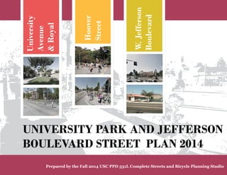
  • 1. University Avenue & Royal Hoover Street W. Jefferson Boulevard UNIVERSITY PARK AND JEFFERSON BOULEVARD STREET PLAN 2014 Prepared by the Fall 2014 USC PPD 531L Complete Streets and Bicycle Planning Studio
  • 2. PLAN AUTHORS Fall 2014 PPD 531L Complete Streets and Bike Planning Students: Nick Armour, Christine Blackman, Karl Fielding, Lynnette Hartenian, Haijing Lin, Clare Kelley, Patrick Martinez, Bryan Moller, Lavandra Raghuraman, Shrota Sharma, Peter Soderberg, Kurt Taillin, Lawrence Young, Samuel Zneimer Direction and edits by Professor Alison Kendall, LEED AP BD+C, AICP ACKNOWLEDGEMENTS The following members of the Trojan Community and various governmental agencies and cy-cling and pedestrian safety advocates assisted in the preparation of this documen: USC Administration Student Affairs Ainsley Carry, VP-Student Affairs Facilities/Construction/Auxilliary Services Brian League Administrative Services Brian Gross, Special Projects Department of Public Safety Chief John Thomas Faculty/External Relations David Galaviz, Exec. Director, Local Govt Relations Transportation David Donovan, Assistant Director Sol Price School of Public Policy, USC Students of the Spring 2012 Bike Planning Studio Students of the Spring 2014 Bike Planning Studio USC Undergraduate Student Government Jordan Fowler Kody Kessler USC Graduate Student Government Christine Wozniak, Director of Campus Affairs City of Los Angeles Dave Somers, City Planning, Policy Rubina Ghazarian, LA DOT, Bicycle Coordinator USC Bicycle Coalition Cathy Ji, President Alex Leavitt, Graduate School Representative Jake Peters, Staff Representative LA Metro Tham Nguyen TRUST South LA Malcolm Harris, Director of Programs & Organizing TABLE OF CONTENTS I) Introduction Chapter 1: Executive Summary .................................................................. 01 Chapter 2: Issues and Opportunities ............................................................ 07 II) Proposed Street Improvements and Programs Chapter 3: University Avenue and Royal Street Improvements ................. 21 3.1 Issues & Opportunities............................................................ 22 3.2 Proposed Improvements....................................................... 23 3.3 Implementation Plan.............................................................. 35 Chapter 4: Hoover Avenue and McClintock Improvements ........................ 43 4.1 Issues & Opportunities.......................................................... 44 4.2 Proposed Improvements....................................................... 50 4.3 Implementation Plan............................................................... 56 Chapter 5: Jefferson Boulevard-Vermont to Normandie............................. 63 5.1 Issues & Opportunities........................................................... 64 5.2 Proposed Improvements........................................................ 71 5.3 Implementation Plan.............................................................. 81 III) Next Steps & Other Resources Chapter 6: Implementation: Evaluation and Campus Community Collaboration............................................ 86 6.1 Recommendation on Implementation ................................. 86 6.2 Implementation by Area .......................................................... 87 6.3 Education................................................................................ 90 6.4USC Coordination with City and County Agencies....................91 Appendix ........................................................................................................ 99 Bicycle and Pedestrian Counts..................................................... 99 Funding Opportunities............................................................... 103 References.................................................................................. 106
  • 3. 1 Executive Summary 2 3 4 5 6 A 1 Chapter 1: Executive Summary Purpose of the University Park and Jefferson Boulevard Streets Plan The University Park and Jefferson Boulevard Streets Plan was prepared by the Fall 2014 Complete Streets and Bicycle Planning Studio at the Sol Price School of Public Policy as an exploration of the potential for street redesign and collaborative USC/City of LA/Community planning to en-hance the livability and mobility of this unique neighborhood in LA. The University Park neighborhood directly north of the main USC cam-pus contains a large number of USC undergraduate and graduate stu-dents, as well as a large number of university related institutions. Two streets examined in this study, Uni-versity Avenue and Hoover Avenue, link the campus to the area and carry extremely high volumes of bicycles and pedestrians throughout the day and evening. Currently the USC Vil-lage project is under construction just north of the main campus, and offers a chance to substantially improve the safety, convenience and character of University Park streets over the lon-ger term, while currently impacting them during construction. Given the flat terrain and dispersed facilities, bicycling is an increasingly popular choice for USC students, fac-ulty and staff commuting and trav-eling between University facilities. However the campus area has not adapted to this cycling increase by providing a clear bicycle circulation network, supported by bike safety ed-ucation, enforcement and adequate bicycle parking and services. The goal of the University Park and Jefferson Boulevard Street Plan is to propose street improvements to improve the safety and convenience of bicycling and walking in the area immediately north and west of the University Park Campus. Cycling should be supported as a healthy and sustainable transportation option for students, faculty, staff, and community members. USC and the University Park area have one of the highest cycling rates in California. This Street Plan proposes street improvements for consideration by the City of LA, USC, and the local community. the safety and convenience of bicycling and walking. programning and infrastructure, it can also become one of the most bicycle friendly Universities in the country.
  • 4. 2 Proposed long-term improvements along Hoover Cooridor Photo simulation of street trees, pedestrian scale lighting, bicycle parking and lanes near the corner of Jefferson Boulevard and Budlong Avenue. Some of these improvements can be implemented at low cost yet could dramatically change the corridor. Policies of the North University Park and Jefferson Blvd Streets Plan The Plan identifies specific actions and strategies to: 1. Propose and encourage imple-mentation of bicycle and pedestrian safety improvements for key path-ways and streets north and west of the USC main campus. A clear bicycle circulation network reduces potential conflicts between pedestri-ans and cyclists. 2. Improve bicycle and pedestrian safety at campus gateways and key intersections, and promote coopera-tion between USC, the community, and the the City of LA to coordinate bikeway improvements in the Uni-versity Park and Jefferson Boulevard area. 3. Identify key partners and stakeholders who can participate in improving bicycle and pedestrian safety and convenience through safe cycling education, encouragement for bicycle commuters, and consis-tent enforcement of safety regula-tions Seek recognition of the Univer-sity Park and Jefferson Boulevard area as a Bicycle Friendly Commu-nity and USC as a Bicycle Friendly University to recognize and celebrate bicycle improvements and program achievements. Organization of the Plan I) Introduction 1. Executive Summary 2. Issues and Opportunities II) Policies and Programs 3. University Avenue 4. Hoover Avenue 5. Jefferson Boulevard III) Next Steps & Other Resources 6. Implementation & Evaluation and Campus-Community Collaboration 7. Appendices & Resources
  • 5. 1 Executive Summary 2 3 4 5 6 A The 2014 Bike Planning Studio Class - Bike Safety and Training Day 3 Policy Context Planning Process Preparation of the North Univer-sity Park and jefferson Boulevard Streets Plan nvolved members of the Trojan Community, residents and merchants in surrounding neigh-borhoods and public agencies. This planning document builds upon USC policies developed in a broader pub-lic process in the 2012 University of Southern California Bicycle Master Plan. Other relevant Planning Documents which affect the Project Areas in-clude: 2010 City of LA Bike Plan, My Figueroa Streetscape Plan, USC Vil-lage Development Agreement and Jefferson Streetscape Design Guide-lines. (provide full names, web ad-dress) USC graduate students from the 2014 Bike Planning Studio Class collected valuable bicycle and pedestrian count data and analyzed bicycle and pedes-trian collision data to identify safety issues and develop recommendations for potential bicycle improvements and programs in the area north and west of the USC campus. This input was integrated, along with planning concepts from the previ-ous 2012 Bike Planning Studio Class, into Draft Plan Proposals discussed with USC, public agencies and com-munity representatives on October 30, 2014 and December 4, 2014, and in numerous Stakeholder meetings held with University Park and Jef-ferson Boulevard area stakeholders. This Draft Streets Plan has been pre-pared for the use of key stakehold-ers in the University Park, Jefferson Boulevard, and USC Community and by City of LA transportation plan-ners and advocates. Comments from guest reviewers will be integrated
  • 6. into the Final North University Park Streets Plan. Next Steps and Implementation Chapter 6 of the Plan describes the recommended Implementation Strategy, including integration with the USC Bicycle Education Program and Bicycle Master Plan implementa-tion. Implementation of the street im-provements 3, 4, and 5 can be phased and coor-dinated 4 Photo simulation of long-term improve-ments at Hoover and Jefferson intersection mentioned in Chapters with related campus plan-ning projects. City and County of Photo simulation of raised crosswalk at intersection of Univer-sity Avenue and 30th Street Los Angeles projects will also present opportunities for implementing the plan and coordinating USC and pub-lic agency efforts. TIMS data showing the high collision injury rate on Hoover Street and at 30th and 32 Streets should be used in making the case for the City of Los Angeles and USC to participate in implementing the raised crosswalks, extended curb cuts and possibly oth-er additional improvements such as flashing beacons.
  • 7. 1 Executive Summary 2 3 4 5 6 A 5 USC Bicycle Master Plan: Circulation Network
  • 8. 6 THIS PAGE HAS BEEN INTENTIONALLY LEFT BLANK
  • 9. 1 2 Issues & Opportunities 3 4 5 6 A 7 Chapter 2: Issues and Opportunities: Volume Counts and Safety Issues This chapter is intended to highlight and summarize the data collection process and the subsequent findings from bicycle and pedestrian counts conducted at major intersections north of the USC campus with heavy bicycle and pedestrian volumes. These include Figueroa Street, University Avenue and Hoover Avenue, and Vermont Avenue at Jefferson Boulevard in Los Angeles, California. These counts will be used in part as baseline data, prior to the My Figueroa complete streets project, to inform future political and infrastructure decisions regarding pedestrians, bicycles, and complete streets projects in Los Angeles and beyond. Counts conducted after the completion of the My Figueroa project will be used in comparison to these baseline counts to provide empirical evidence of the impact of complete streets facilities on volumes of bicycles and pedestrians, perceived safety of the bicycling environment, and changes in bicyclist behavior i.e. Sidewalk riding, wrong-way riding, use of helmets, etc. The This chapter also discusses safety following sections will document concerns in the area and highlights the data collection process, site areas of special concern. The North characteristics, and findings University Park and West Adams resulting from the completed counts. neighborhoods experience high Bicycle and Pedestrian Collisions 2008-2012 Data Source: SafeTrec’s Transportation Injury Mapping System volumes of cyclists and pedestrians. Due to behavioral and road design issues there are also high volumes of collisions involving cyclists and pedestrians in this area.
  • 10. 8 2.1 Figueroa Street and Jefferson Boulevard: Volume Counts and Safety Issues Site Characteristics The intersection of Jefferson Blvd. and South Figueroa St. currently favors vehicle transportation over bicycles. Both Jefferson and Figueroa have a total of six lanes of traffic and an additional lane of parking near the intersection, as well as posted speed limits of 35 MPH, respectively. The two streets are devoid of on-street bicycle facilities; there are no bike lanes or sharrows present. Figueroa is designated as a Bike Route and one sign located east of the intersection on Jefferson, heading west, indicates this, yet this area contains only the very most southern tip of this designation because it ends at Exposition Blvd. The intersection does, however, have a fairly strong pedestrian orientation. There are ADA accessible pedestrian curb cutouts at each corner. The intersection borders the main campus of USC to the southwest, the Galen Center to the southeast, a mixed-use development comprised of retail and student housing to the northwest, and an automobile dealership to the northeast. The sidewalk width is between 10 and 20 feet alongside all of these properties, except the auto dealership, in which case it decreases to approximately 8 feet. There is a strong pedestrian orientation due to the presence of the University and the close proximity to the Metro Exposition light rail line (Expo), located one block east of the study intersection, on Jefferson Blvd. and South Flower St. There is a limited amount of bicycle parking along the north leg of Figueroa in front of the mixed-use development, likely to serve the occupants of the apartment building and the customers of the retail locations. However, there is no bicycle parking along the other legs of the intersection. Much of the bicycle parking for this area is located on USC’s campus, with the expectation that cyclists will then walk to their destinations. Hence, there is a lack of adequate bicycle parking facilities for non-USC affiliated cyclists and users of the Expo line. Findings Depending on the location of screenline counters, some bicyclists and pedestrians can appear to be “lost” in the intersection, that is, there are differences in the number of people approaching and departing a given intersection. This commonly occurs when the individual’s trip destination or origin is located between the screenlines; thus, they will pass only one screenline instead of two. This is likely to occur at this particular location because a large apartment complex and entrances to the University of Southern California, two significant trip generators, are located at the intersection. For this reason, we will focus on the approach numbers in order to show trends in bicyclist and pedestrian volumes. Our data shows that the volume of both bicyclists and pedestrians appears to generally increase throughout the day, likely in surges during peak periods. During the morning, midday, and evening peak periods, a total of 192, 391, and 525 bicyclists approached the intersection, respectively. Similarly, 632, 1176, and 2152 pedestrians approached 7 a.m. to 9 a.m.
  • 11. 1 2 Issues & Opportunities 3 4 5 6 A 9 the intersection during the same respective time periods. It is feasible that the University of Southern California is among the largest generators of bicycle and pedestrian traffic since in all cases, except for midday bicyclists, between 52% and 62% of approach traffic is heading in the direction of the University (located at the south-east corner of the intersection) during any given peak period. While it is impossible to determine the ultimate destination of these travelers without widespread surveying and turning movement counts, the approach numbers can still be loosely extrapolated to show direction of travel. In a similar fashion, pedestrians and cyclists coming to and from the Expo line can also be roughly estimated based on the westbound approach (coming from the Expo station) and the eastbound departure (going to the Expo station) count numbers. These numbers are particularly revealing for pedestrians, with 23% of morning peak period pedestrians coming from the direction of the Expo line and 22% of evening peak period pedestrians going in the direction of the Expo line. Again, while we cannot say for sure if these trips are due to the Expo line without a proper trip generation and transit 11 a.m. to 1 p.m. 4 p.m. to 6 p.m. ridership analysis, an extrapolation can be made to suggest that these people may be walking between the transit line and the University. Both of these points may be used in discussions to provide enhanced infrastructure and programs related to the active transportation users seeking access to the University of Southern California and first mile-last mile connections with the Metro Expo Line.
  • 12. 10 2.2 University Avenue: Volume Counts and Safety Issues Site Characteristics University Avenue is a critical transportation corridor, providing a direct connection between off-campus student housing and the University of Southern California, as well as an intermediate connection to 30th Street and 32nd Street that in turn connect to Hoover Street and Figueroa Street. The southern terminus at the Jefferson/Hoover/ University intersection adds complexity to the movement of all modes of transportation. This avenue is not open for vehicular traffic except for the occasional USC facilities truck. This thoroughfare offers a park-like setting for other modes of transport including pedestrian, bicycle, and skateboard, locomotion. Signs are posted to disallow skateboard use. There is a large median within the length of the avenue that is planted with grass and trees, and provides some seating in the form of foot-wide cement walls (that act as benches). The median divides the avenue into uneven paths on either side. This design carries through both blocks of University with only slight variation between the two blocks. It is important to note that the median is of variable width that adds to the park-like setting, but inhibits to some degree the efficient movement of large volumes of pedestrians and bicyclists. Royal Street is another pedestrian path that is used sometimes by vehicular traffic to access the parking lot to the west, for instance during Shrine Auditorium shows. There is a gate that is normally locked at the north end of Royal Street, at 32nd Street, and cement barriers at the south end, at Jefferson Boulevard, to prevent vehicle access. There are also more cement barriers about halfway between Jefferson and 32nd. The design of this street is more open, without greenery, and the only inhibition to pedestrian and bicycle movement are the gates and the cement barriers. There are no posted signs along this passageway. Findings The screenline method provided counts at a particular location north of the intersections. Each screenline location was approximately 120 feet north, and allowed the counter to count both northbound and southbound pedestrians and bicyclists crossing the screenline, and either approaching or departing Bicycle and Pedestrian Collisions 2008-2012 Data Source: SafeTrec’s Transportation Injury Mapping System the respective intersection. Our data shows that the volume of both bicyclists and pedestrians appears to generally increase throughout the day, likely in surges or class changes during peak periods. On University, during the morning, midday, and evening peak periods, a
  • 13. 1 2 Issues & Opportunities 3 4 5 6 A 11 total of 340, 477, and 292 bicyclists approached the intersection, respectively. A total of 45, 373, and 513 bicyclists traveled north, departing the intersection area during the same peak periods. The largest volume coincides with the typical end to day class times. Similarly, 355, 498, and 292 pedestrians approached the intersection during the same respective time periods, and 60, 470, and 691 pedestrians departed. It is likely that the University of Southern California is among the largest generators of this bicycle and pedestrian traffic during any given peak period, considering the location. While it is impossible to determine the ultimate destination or departure point of these travelers without widespread surveying and turning movement counts, the approach numbers can still be loosely tied to USC. Royal Street overall experiences less foot and bicycle traffic. During the midday peak period, a total of 396 pedestrians, and 105 bicyclists, moved both north and south fairly evenly split between the two directions. The volumes for both locations increase typically in the fifteen-minute periods prior to an hour, for instance 11:45 am – 12:00 pm. Additionally, on University, the midday and evening peaks experience the highest volumes between 800 to 1,000 each for pedestrians and bicyclists! These high volumes and high collision reports may be used in discussions to provide enhanced infrastructure and programs related to the active transportation users seeking access to the University of Southern California. Royal Street 11 a.m. to 1 p.m.
  • 14. 12 7 a.m. to 9 a.m. Cyclist and Pedestrian Volume Counts: University Avenue These figures show the northbound and southbound volumes on University Avenue for bicyclists and pedestrians north of the Jefferson/ Hoover/University intersection during the three peak periods. At right is Royal Street for north of the Jefferson/Gate 4 intersection during one peak period. Generally, Royal experiences much lower volumes than University, so the count emphasis was placed at University Avenue. 11 a.m. to 1 p.m. 4 p.m. to 6 p.m.
  • 15. 1 2 Issues & Opportunities 3 4 5 6 A 13 2.3 Hoover Street: Volume Counts and Safety Issues The bicycle counts conducted on the Hoover Avenue corridor showed massive volumes of cyclists, which are detailed in the Hoover Avenue corridor analysis chapter. The data indicates that a large number of bicyclists use the Hoover/Jefferson/ University intersection to enter campus. While bike counts were not performed at the McClintock/ Jefferson intersection observations were made about the intersection. The Hoover Avenue and McClintock Avenue corridors face similar safety concerns; the mixing of different modes at intersections, the temporary elimination of bicycle facilities do to USC Village construction, and high volumes with insufficient capacity. The intersections are of particular concern as they involve bicycle and pedestrian movements at the same time, and when construction is finished at the Hoover Jefferson intersection, both are scrabble configuration intersections. The conflicting movement and speed of the cyclist and pedestrians can result in collisions. In the short-term there are limited solutions but adding capacity for bicyclist by changing curb-cuts or temporary markings can help with the separation. In the long-term more comprehensive recommendations should be used. For the streets outside of the intersection there is currently bike lanes for both; while better than nothing upgrading the corridors to cycle tracks will increase the safety and comfort of bicyclist separating them from vehicular traffic and possible dooring. The other safety issue is inexperienced users utilizing the corridors. In USC Bicycle Master Plan states that the surveys of the student population confirm that they lack experience and frequently engage in dangerous behavior. The data illustrates how this manifests a high number of users riding without a helmet, on the sidewalk and the wrong-way within the roadway. While current construction contributes to the illegal and unsafe riding it was also observed that cyclist would ride one-handed either holding coffee or a cellphone. Site Characteristics The intersection of Jefferson Blvd. and South Figueroa St. currently favors vehicle transportation over bicycles. Both Jefferson and Figueroa have a total of six lanes of traffic and an additional lane of parking near the intersection, as well as posted speed USC Bicycle and Pedestrian Collisions 2008-2012 Data Source: SafeTrec’s Transportation Injury Mapping System
  • 16. limits of 35 MPH, respectively. The two streets are devoid of on-street bicycle facilities; there are no bike lanes or sharrows present. Figueroa is designated as a Bike Route and one sign located east of the intersection on Jefferson, heading west, indicates this, yet this area contains only the very most southern tip of this designation because it ends at Exposition Blvd. The intersection does, however, have a fairly strong pedestrian orientation. There are ADA accessible pedestrian curb cutouts at each corner. The intersection borders the main campus of USC to the southwest, the Galen Center to the southeast, a mixed-use development comprised of retail and student housing to the northwest, and an automobile dealership to the northeast. The sidewalk width is between 10 and 20 feet alongside all of these properties, except the auto dealership, in which case it decreases to approximately 8 feet. There is a strong pedestrian orientation due to the presence of the University and the close proximity to the Metro Exposition light rail line (Expo), located one block east of the study intersection, on Jefferson Blvd. and South Flower St. 14 There is a limited amount of bicycle parking along the north leg of Figueroa in front of the mixed-use development, likely to serve the occupants of the apartment building and the customers of the retail locations. However, there is no bicycle parking along the other legs of the intersection. Much of the bicycle parking for this area is located on USC’s campus, with the expectation that cyclists will then walk to their destinations. Hence, there is a lack of adequate bicycle parking facilities for non-USC affiliated cyclists and users of the Expo line. Findings Depending on the location of screenline counters, some bicyclists and pedestrians can appear to be “lost” in the intersection, that is, there are differences in the number of people approaching and departing a given intersection. This commonly occurs when the individual’s trip destination or origin is located between the screenlines; thus, they will pass only one screenline instead of two. This is likely to occur at this particular location because a large apartment complex and entrances to the University of Southern California, two significant trip generators, are located at the intersection. For this reason, we will focus on the approach numbers in order to show trends in bicyclist and pedestrian volumes. Our data shows that the volume of both bicyclists and pedestrians appears to generally increase throughout the day, likely in surges during peak periods. During the morning, midday, and evening peak periods, a total of 192, 391, and 525 bicyclists approached the intersection, respectively. Similarly, 632, 1176, and 2152 pedestrians approached the intersection during the same respective time periods. It is feasible that the University of Southern California is among the largest generators of bicycle and pedestrian traffic since in all cases, except for midday bicyclists, between 52% and 62% of approach traffic is heading in the direction of the University (located at the south-east corner of the intersection) during any given peak period. While it is impossible to determine the ultimate destination of these travelers without widespread surveying and turning movement counts, the approach numbers can still be loosely extrapolated to show direction of travel. In a similar fashion, pedestrians and cyclists coming to and from the Expo line can also be roughly estimated based on the westbound approach (coming from the Expo station) and the eastbound departure (going to the Expo station) count numbers. These numbers are particularly revealing for pedestrians, with 23% of morning peak period pedestrians coming from the direction of the Expo line and 22% of evening peak period pedestrians going in the direction of the Expo line. Again, while we cannot say for sure if these trips are due to the Expo line without a proper trip generation and transit ridership analysis, an extrapolation can be made to suggest that these people may be walking between the transit line and the University. Both of these points may be used in discussions to provide enhanced infrastructure and programs related to the active transportation users seeking access to the University of Southern California and first mile-last mile connections with the Metro Expo Line.
  • 17. 1 2 Issues & Opportunities 3 4 5 6 A 15 7 a.m. to 9 a.m. Cyclist and Pedestrian Volume Counts: Hoover Avenue and Jefferson Boulevard Volume counts conducted at the intersection of Hoover Avenue and Jefferson Boulevard demonstrate the large flows of cyclists and pedestrians to and from the USC campus during three peak periods. Full volume count data is included in the Appendix of this report. 11 a.m. to 1 p.m. 4 p.m. to 6 p.m.
  • 18. 2.4 Vermont Avenue and Jefferson Boulevard: Volume Counts and Safety Issues Count Data Cyclist and pedestrian counts were conducted over a three week period from October 9, 2014 to October 23, 2014 at three two-hour intervals. The counts were done during morning peak hours of 7 AM to 9 AM, midday peak hours between 11 AM - 1 PM and evening peak hours between 4 PM - 6PM. The location of counts were north, east, south and west of the intersection at Jefferson Boulevard and Vermont Avenue. The count data displayed high volumes of cyclists and pedestrians. About 245 pedestrians used the sidewalks near the intersection of Jefferson Boulevard and Vermont Avenue in any given direction for all peak hour intervals. Similarly, a large number of bicyclists traveled through the intersection--an average of 121 bicyclists. The volumes of pedestrians and bicyclists were higher in the eastbound direction towards campus, with the exception of evening peak hours, in which westbound volumes are much higher. Northbound and southbound volumes have no discernible pattern over the peak hour intervals. 16 Safety Problems Counters at Jefferson Blvd. and Vermont Ave. noted clearly visible problems between motor vehicles, cyclists, and pedestrians. Motorists often fail to yield to pedestrians when making right turns on red lights. A high percentage of observed cyclists where sidewalk riders, demonstrating that many riders do not feel that the street is a safe place to ride. Collision data shows a concentration of collisions involving cyclists or pedestrians at the intersection of Jefferson Boulevard and Vermont Avenue. Collisions are also clustered along Vermont Avenue south of Jefferson Boulevard. Bicycle and Pedestrian Collisions 2008-2012 Data Source: SafeTrec’s Transportation Injury Mapping System USC
  • 19. 1 2 Issues & Opportunities 3 4 5 6 A 17 7 a.m. to 9 a.m. Cyclist and Pedestrian Volume Counts: Vermont Avenue and Jefferson Boulevard Volumes are consistently high during the three peak hour intervals. Both pedestrians and bicyclists use the Jefferson Boulevard corridor, west of Vermont Avenue, regularly. These numbers validate that there is a comparable number of users that would value the addition of bicycle infrastructure and pedestrian-friendly streets. 11 a.m. to 1 p.m. 4 p.m. to 6 p.m.
  • 20. 18 2.5 Jefferson Boulevard: Vermont Avenue to Normandie Avenue: Safety Issues Safety data collected in the Transportation Injury Mapping System, provided by SafeTrec, reveals that nearly one hundred collisions involving cyclists or pedestrians occurred in the project study area from 2008 to 2012. Collisions are clustered along Jefferson Boulevard at intersections. The intersections of Jefferson Boulevard and Vermont Avenue and Jefferson Boulevard and Normandie Avenue are particular hot spots. Most collisions involved cyclists who must contend with a lack of bicycle facilities along Jefferson Boulevard from Vermont Avenue to Normandie Avenue The primary collision factor in the majority of these collisions was driver behavior. Driver behavior includes illegal maneuvers as well as falling asleep at the wheel and other improper driving. Nearly thirty percent of these collisions were classified as hit and runs, indicating a lack of accountability for cyclist and pedestrian safety. Additionally, the majority of cyclist collisions resulted in visible injuries. Both cyclists and pedestrians were severely injured during this time period in collisions. Most collisions took place during the daytime, which should be safer than periods in darkness. Over half of the collisions involving pedestrians occurred in intersections without control devices demonstrating the need for enhanced pedestrian infrastructure. Infrastructure deficits, discussed in the Chapter 5, likely contributed to these collisions. There are opportunities to provide enhanced facilities for cyclists and pedestrians along the corridor, improving safety for all. Pedestrian Collisions 2008-2012 Pedestrian Collisions 2008-2012
  • 21. 1 2 Issues & Opportunities 3 4 5 6 A 19 USC Bicycle and Pedestrian Collisions 2008-2012 Data Source: SafeTrec’s Transportation Injury Mapping System
  • 22. 2200 THIS PAGE HAS BEEN INTENTIONALLY LEFT BLANK
  • 23. 1 2 3 University Avenue 4 5 6 A 21 Chapter 3: University Avenue University Avenue is a critical trans-portation corridor, providing a direct connection between off-campus stu-dent housing and the University of Southern California, as well as an in-termediate connection to 30th Street and 32nd Street which in turn con-nect to Hoover Street and Figueroa Street. A number of transportation efficiency and safety related issues have been identified in regards to University Avenue; most notably, there are safety concerns due to col-lisions, congestion, user conflict, and inadequate crossing facilities at in-tersections which will be discussed in depth in the appendix. This report will discuss some of these issues, pro-pose a number of improvements to the existing facilities, detail these im-provements through concept designs and graphics, and finally, justify the importance of investing in these in-frastructure and plan improvements. Project Study Area
  • 24. 2222 3.1 Issues and Opportunities The neighborhood north of the USC campus is busy with movement from all modes of transportation. As shown by the counts taken, pedes-trian and bicycle volumes within this area are extremely high and often there are severe conflicts that pro-duce critical safety hazards for these particular modes. University Avenue is a pedestrian pathway (used by bi-cyclists as well) that is intersected by 32nd Street. It is an important link-age between student housing and the university, and experiences high volumes with chaotic and inefficient flows. Risk of collisions between bi-cyclists and pedestrians is high, as well as collisions with vehicles at the crossings of Jefferson Boulevard, and 32nd and 30th Streets. Royal Street presents fewer safety concerns within its corridor; howev-er, pedestrians and bicyclists face the similar hazards crossing Jefferson Boulevard as those from University Avenue. The pedestrians and bicy-cles crossing Jefferson to enter Gate 4 experience serious conflict with vehicles using this University access. In addition, the existing single pedes-trian crosswalk is inadequate. These challenges are, in fact, oppor-tunities for improvement. Los Ange-les is looking forward to an increase in complete streetscape design that includes good mobility for all users. The upcoming MyFig and Jefferson Boulevard Streetscape projects are evidence of that trend. The Univer-sity community has an opportunity to increase the benefits of those im-provements by moving forward with design ideas from this planning stu-dio, as well as past efforts that pro-duced the USC Bicycle Master Plan, and providing support with the nec-essary collaborations that will be re-quired with other agencies such as LADOT. In particular, this section’s focus on University Avenue and Roy-al Street, and their relevant cross-ings, provides opportunity in the short term to make smaller improve-ments that will have a significant and positive impact for pedestrians and bicyclists. Longer term improve-ments will need a more coordinated effort but the effort will be rewarded with lifting the University area into a bike and pedestrian friendly status, which aligns well with the historical and significant use of walking and cy-cling for residents in this area. This is another opportunity for USC to ex-tend its good neighbor effort into the north and west of the Academic core. University Avenue - Current Conditions
  • 25. 1 2 3 University Avenue 4 5 6 A 23 3.2 Proposed Improvements 1. Protected Cycle Track One of the primary concerns re-garding University Avenue is safety for both bicyclists and pedestrians throughout the length of the heavily used corridor. In order to reduce col-lisions and increase efficient flow of traffic, it is imperative to physically separate the pedestrians from the faster moving bicycles. Observations show limited compliance with the painted bicycle lanes on Trousdale Parkway. Therefore, a greater degree of separation is desired to ensure appropriate and adequate use. This separation can be achieved through a cycle track featuring a painted lane with pylon buffers creating a physical barrier between the cyclists and the pedestrians. In doing so, user con-flict and congestion will be reduced, travel times will likely become faster and there is potential for reduced in-cidence of collision. In addition, pre-senting cycle tracks to the on cam-pus student population may have spillover benefits resulting in greater ridership for the nearby My Figueroa complete streets project which makes use of similar cycle tracks. Further complicating travel down University Avenue is the presence of a large median containing green space and pedestrian seating ar-eas. The median provides valuable green space and supports a number of mature trees. It is very feasible to reduce the median width and this is recommended for the following im-provements. The median is also not centered directly in the middle of the path, creating a narrow side on the east and a wider side on the west. In addressing this issue, two alterna-tives involving physically separated cycle tracks were studied for how best to conduct this separation, discussed below. Proposed cycle track along University Avenue with con-nections to surrounding bicycle infrastructure
  • 26. 2244 Two-way cycle track on west side of University Contrary to the traditional one-way cycle tracks which feature one direc-tional traffic of bicycles on the right side of a street, two-way cycle tracks instead place each directional lane right next to each other, allowing the track to be on one side of the street instead of both sides. Two-way cycle tracks are commonly featured as rec-reational bike paths, and more re-cently, in urban settings in both Eu-ropean and North American cities. At its most narrow point, the east side is a mere 12 feet wide, too narrow to accommodate both a two-way cycle track with an appropriate width of 6.5 feet per lane and pedestrians. This cycle track could be placed on the west side, abutting the median. This provides space for pedestrians on both sides of the median and al-lows pedestrian access into the me-dian. Photo simulation showing proposed two-way cycle track along the west side of median along University Avenue
  • 27. 1 2 3 University Avenue 4 5 6 A 25 One-way cycle tracks on both sides of the median One cycle track concept was a one-directional separated cycle track on both the east and west sides of the median. These cycle tracks would be 6.5 feet wide and will allow adequate space for pedestrians to utilize both sides of the median. Sections along the cycle tracks will be marked with striped paint and feature gaps in the physical separation in order to indi-cate pedestrian crossing zones. This signage performs three important functions. First, it alerts both cyclists and pedestrians to each others’ pres-ence and shows that pedestrians are permitted to cross the path in these locations thus, reducing poten-tial for user conflict and collisions. Second, it provides convenient en-trances and exits for cyclists using the cycle tracks, and third, they al-low pedestrians to access the pub-lic green space in the median. This treatment is the less preferred op-tion due to the creation of conflict areas and reduced access to the green space present in the medi-an. The two-way cycle track would maintain adequate access to the median while avoiding conflict zones. Class II Bike Lane Alternative idea for separated cycle track along University
  • 28. 2. Crossings at 32nd and 30th - Raised Crosswalk According to traffic injury data col-lected 2266 from TIMS, there are bicycle and pedestrian collision hotspots at the intersections of University and 30th as well as University and 32nd. These locations likely yield a high number of collisions due to poor sig-nage, large volumes of bikes and pe-destrians, and inadequate crossing facilities for all users. In order to ease the flow of traffic, increase the visibil-ity of pedestrians, and enhance the integration of the bicycle network, we suggest adding a raised cross-walk. There’s a school nearby (Thirty Second School Street) which is an-other challenge for all users because students are picked up and dropped off on 32nd street near USC at peak hours. The raised crosswalk would calm down traffic and force cars to slow down. This is great for pedes-trians because the users can feel safe when crossing the path from curb to curb and cars know to slow down be-cause of the raised crosswalk along with increasing signage in the area. Aerial view showing proposed cycle track connection to existing bike lanes north of 30th Street Photo simulation of raised crosswalk at intersection of Univer-sity Avenue and 30th Street
  • 29. 1 2 3 University Avenue 4 5 6 A 27 3. Crossing at Jefferson Blvd. - Dedicated Bike Crossing Phase Another area with significant conges-tion and user conflict is the intersec-tion where Hoover St, Jefferson Blvd, and University Ave meet. The exist-ing intersection dynamic is very cha-otic, allowing bicycles and pedestri-ans to cross the intersection vertical-ly, horizontally, and diagonally lead-ing directly into a bottleneck on the campus side caused by a fence and a utility box. To reduce congestion and improve safety at this crossing, it is important to first remove this bottle-neck by relocating the utility box and expanding the existing curb cut to provide greater access to the Univer-sity property. Next, it is important to again sepa-rate the bicyclists from the pedestri-ans in order to reduce user conflict. This will be done by painting bicycle boxes at either side of the intersec-tion to physically bring bicycles in front of pedestrians at the intersec-tion. Then the signal phasing will be altered to provide a 4 second bi-cycle only crossing phase. These 4 seconds will be allocated by taking 2 seconds from the southbound green phase and the eastbound/westbound through phase. This altered signal phasing will allow bikes to cross the intersection before pedestrians begin crossing, reducing user conflict and congestion. It is important to main-tain the full time allocated for pedes-trian crossing phases due to the high volumes of pedestrians. In order to move forward with an im-provement for this intersection, it is important to coordinate it with and include the Jefferson Blvd streetscape improvements as well as to take in account of the future opening of the USC Village project at the northwest corner of this intersection, a mixed use retail and housing development which will bring an additional 2,700 students to the area. However, USC Village will be providing a dedicated pedestrian crossing at Jefferson Blvd and Watt Way to the west of this in-tersection, reducing much of the con-gestion that would otherwise spill over from the project. Aerial view showing proposed cycle track connection to intersection of Hoover Street and Jefferson Boulevard
  • 30. 4. “Road Diet” on 32nd between Hoover and Figueroa To enhance bike and pedestrian safe-ty, as well as encourage safer driving habits along 32nd street, a standard “road diet” is recommended. This road diet will consist of reducing the number of travel lanes in each direc-tion from two lanes to one lane, add-ing a 2-way left turn lane in the me-dian and adding 5 feet class II bike lanes on both sides of the street. This type of road treatment will maintain the existing street parking on 32nd but provide much safer travel condi-tions 2288 for all modes of transportation 5. Removal of parking and ad-dition of bike lanes on 30th be-tween Royal and Figueroa Currently, there are class II bike lanes on 30th between Hoover and Royal, but these bike lanes then transition into sharrows. To address the safety concerns in this neighborhood, it is important to update this infrastruc-ture and provide 5 feet class II bike lanes. However, there is insufficient space to add this treatment with the existing lane configuration. In order to add this improvement, the remov-al of street parking along 30th from Royal to Figueroa will be necessary. Bike parking along University Avenue causes additional conflict zones that must be navegated by pedestrians and bicyclists.
  • 31. 1 2 3 University Avenue 4 5 6 A 29 3.2.6 Royal and Jefferson Intersection at USC Gate 4 The crossing here does not work well for bicyclists nor for the automobiles exiting the gate. It is also difficult for vehicle traffic to move in and out of Gate 4 which is on the south side of the intersection. The Gate itself was not designed for either pedestrians or bicyclists to enter or exit, yet many people do use this Gate on foot and bicycle due to its location near the Shrine parking garage and the Gate-way housing complex. In order to improve the pedestrian and bicycle crossing facilities, it is recommended that an additional crosswalk on the west side of the in-tersection be striped. This crosswalk should also lead into a newly build bicycle and pedestrian oriented gate on the west side of the existing auto-mobile gate. Additional signage and pedestrian striping should continue through the gate, leading bicyclists and pedestrians into the existing campus transportation network. To further reduce the user conflict at this intersection, it is also recom-mended that the signal phasing be al-tered to provide a 4 second head start phase for bicycles and pedestrians crossing the intersection. University Avenue experiences much higher vol-umes of pedestrian and bicycle traf-fic so making improvements for that multi-use pathway should be the pri-ority. However, the USC community will continue to utilize this intersec-tion, it is important to address the existing inadequacies. In addition, a proposed USC parking garage on the current Shrine parking lot will increase pedestrian use and may provide an opportunity to reduce the barricades to through bicycle access on Royal Street. Proposed crossing and entrance to campus for pedestrians and bicyclists at Royal Street Proposed intallation of bike and pedestrian path at Royal Street entrance to campus
  • 32. 3300 3.2.7 Recommendations Justification The majority of recommendations made in this report are infrastructure improvements, supplemented with an educational program to improve knowledge and awareness. Of these improvements, the most important for improving the safety throughout the entire University Avenue corri-dor are the cycle track and the raised crosswalks along University Avenue. The primary concern for the corridor is protecting student safety by reduc-ing collisions, congestion, and user conflict. All three of these aspects can be improved by providing a cycle track which separates the bicycles and pedestrians effectively eliminating user conflict and bicycle-pedestrian collisions. Congestion along the cor-ridor is likely to improve as bicycles are free to move faster, since they will not be impeded by pedestrians, and pedestrians do not have be constantly on alert for approaching bicycles. Ad-ditionally, the raised crosswalk will create more visibility for bicyclists and pedestrians while simultaneous-ly slowing down motor vehicles, two features crucial for alleviating the collision hotspots observed at these intersections (see Appendix). Due to the difficult existing condi-tions on Royal Street, University Av-enue will be made into the primary connection to campus. University currently has higher bicycle and pe-destrian volumes than Royal (see Fig.5 in Appendix) thus, the focus will be placed on improving condi-tions at University to diverting bicy-cle and pedestrian traffic to this cor-ridor. However, the improvements at the intersection of Royal and Jef-ferson are still critical for ensuring a safe and convenient route for bicycles and pedestrians.
  • 33. 1 2 3 University Avenue 4 5 6 A 31 3.2.8 Issue Identification University Avenue is a multi-use transportation pathway, providing a vital connection between the Uni-versity of Southern California and a large supply of off-campus stu-dent housing located just North of Campus. University Avenue also in-tersects with 30th Street and 32nd Street, two east-west running streets which connect to Hoover Street and Figueroa Street. These are two im-portant connections for facilitating travel throughout this neighborhood. The path provides automobile free access for bicycles and pedestrians, which include skateboards, scooters, and rollerbladers. Due to the direct connection between USC and student housing, as well as the diverse trans-portation modes permitted to use the path, there are high volumes of users along University Avenue and signifi-cant conflict between various modes (see figure 1). The pathway appears generally cha-otic, with a median consisting of green space and pedestrian oriented seating bordered by two strips of un-even pavement. With no designated space for pedestrian and bicycle ac-cess, nor a separation for direction of travel, the entire corridor becomes a hodge podge of traffic moving in dif-ferent directions, at different speeds. This creates a serious Bicycle and Pedestrian volumes on University Ave
  • 34. safety concern for students trav-eling 3322 along University Avenue. 1. Traffic Injury Mapping System (TIMS) data was analyzed to quan-tify this safety concern (see figure 2), however, this data does not accurate-ly reflect bicycle-bicycle and bicycle-pedestrian collisions due to a lack of incident reporting and poor commu-nication between the University De-partment of Public Safety and the Los Angeles Police Department, the latter of whom reports the statewide stan-dardized collision data used in TIMS. In moving forward with improving the safety of this area, it is important to establish a protocol for bicycle and pedestrian collision reporting, with the University Department of Pub-lic Safety, so that baseline data can be established and future changes in collisions and injuries can be prop-erly recorded, scrutinized, and ad-dressed through policies, programs, and improvements. 2. The data does however indicate hotspots of collisions along Universi-ty Avenue at Jefferson Blvd, 32nd St, and 30th St. These intersections are likely made more dangerous because of the large volumes of bike and pe-destrian traffic, inadequate crossing facilities, and poor signalization for automobiles. 3. Additionally, the high volumes of bicycles and pedestrians crossing Jefferson where University Ave and Hoover St converge creates a number of other issues. The existing signaliza-tion provides an all pedestrian cross-ing phase in which both pedestrians and bicycles cross in any and every direction possible. This intersection reflects the same user conflict issues present along University Avenue and should be addressed by creating sep-aration of bicycles and pedestrians during the crossing to both ensure safety and reliable crossing access. 1/2-mile radius around Hoover Street and Jef-ferson Boulevard intersection showing bicycle and pedestrian crashes (2008-2012)
  • 35. 1 2 3 University Avenue 4 5 6 A 33 Royal Street and Gate to Campus A good portion of the bicycle and pe-destrian traffic chooses to cross at the intersection of Jefferson Blvd and Royal St, one block to the East. This intersection however, was not de-signed to handle the large amount of non-motorized vehicle crossings and presents significant safety and traf-fic congestion issues. This rerouted traffic reflects the existing deficien-cies along University Ave. If travel down University is made more safe, reliable, and efficient traffic will be far more likely to continue using Uni-versity instead of shifting to Royal. Creating this incentive to use Univer-sity Avenue instead of Royal Street is imperative to ensuring student safe-ty, alleviating vehicle traffic conges-tion along Jefferson Boulevard, and reducing conflicts with The Shrine located at the corner of Royal and Jefferson. However, USC plans to construct a parking garage opposite of the Shrine which will increase the need to accommodate more pedes-trian and bike crossings here. Bicycle and Pedestrian volumes on Royal Street.
  • 36. 3344 Suggested Improvements for Royal and Jefferson Blvd. Intersection The issues along University Avenue regarding safety are as follows: 1. Separating bicycles and pedestri-ans on University Avenue in order to reduce congestion, collisions, and user conflict 2. Increase reporting of bicycle-bicy-cle and bicycle-pedestrian collisions in order to generate more accurate safety data and quantifiable needs and benefits derived from existing and future safety programs and poli-cies 3. Provide safe and timely crossing mechanisms along University Av-enue at the intersections of Jefferson Boulevard, 32nd Street, and 30th Street 4. Creating incentives to maintain ridership along University Avenue instead of diverting traffic to Royal Street 1. Add pedestrian gate east of Gate 4 so pedestrians are not in the gate driveway. 2. Include pedestrian striping and crosswalk within Gate drive, just west of parking kiosk. Continue pe-destrian striping along northwestern curb for MRF building until it meets up with sidewalk just west of MFR. Add ADA compliant curb-cut ramp at sidewalk for uninterrupted access. 3. Remove driveway for Gate 4,and replace it a few feet to the south (and just north of the brick pedestal) so the sidewalk pedestrians walking along Jefferson are aware of entry into a major conflict zone. 4. Bike lane striping across Jefferson, from Gate 4 to Royal; two ways and split on east and west side of intersec-tion. 5. Add painted bike boxes on north and south side of intersection at the appropriate waiting zone. 6. Implement signal change for pedestrians and bicycles to move through the intersection ahead of vehicles entering and exiting Gate 4. Install signal change for vehicles exit-ing Gate 4 to a standard red, yellow, green, traffic light. 7. Remove west end of median on Jefferson that currently intrudes into crosswalk. 8. Add ADA compliant curb-cut ramps for pedestrians at either end of the crosswalk.
  • 37. 1 2 3 University Avenue 4 5 6 A 35 3.3 Implementation Plan for University Avenue Recommendation by Priority Cost & Level of Coordination Implementation Recommendation (Description) Phase I: 0-3 Years Short Term and Intermediate Improvements Education and Collision Reporting Low Orientation programs, signage and notices, bicycle safety training courses; LAPD & DPS coordination Crossing at Jefferson Blvd. Low/Medium Curb smoothing, consolidation and relocation of signal poles Cycle Tracks on University Avenue Medium Median reduction, lane striping and pylon installation Crossing at Jefferson Blvd. High Expand curb cuts, relocate utility box, paint bike boxes, add lead signal for bicyclists Raised Speed Tables at 32nd St. and 30th St. Medium Raised table installation, striping, signage Crossing at Royal and Jefferson High Install curb cuts, add signal changes, crossing striping, pedestrian gate, and striping within gate area Phase II: 3-5 Years Long Term Improvements The recommendations that are of-fered here are critical to improve the safety of pedestrians and bicyclists in the area north of the USC University Park Campus. There are significant safety concerns that are evidenced by the high number of reported col-lisions. However, the recommenda-tions have different levels of funding requirements and coordination with other jurisdictions. Therefore, each improvement and program has been prioritized. Recommendations that require less investment appear earlier in the im-plementation strategy because early action provides forward momentum for the plan. In addition, smaller funding amounts are more easily found. Other recommendations ap-pear later in the implementation timeline due to the complex coordi-nation needed with other agencies and higher funding required. Table 1 lists each recommendation in or-der of priority. Additionally, we have created a two-phase implementation program in which to organize these improvements based on the difficulty and complexity of implementation. Please note that the Phase I improve-ments to the Jefferson/Hoover inter-section (Crossing at Jefferson, Table 1) can be easily integrated into the Jefferson Streetscape which is al-ready planned in conjunction with the University Village project. These minor changes can be implemented soon with low to no additional cost because of the timing of our recom-mendations. See Section 4.2.1 for more details.
  • 38. 3366 3.3.1 Implementation Timeline Phase I consists of the simpler, eas-ier to implement programs and im-provements. These include educa-tional outreach programs, improved collision reporting, and policy en-forcement. These programs are easy and comparatively inexpensive to implement. They will also allow for a smoother implementation process for future improvements. It is expect-ed that all elements of Phase I can be implemented within one year of final approval. • Education and Collision Re-porting The USC Bicycle Master Plan (2012) reported on collision data and made recommendations for ongoing edu-cation programs for improved bicy-cling behavior. Many of the issues found at that time are still occurring on a regular basis. Accurate collision reporting informs both the bicyclists and pedestrians, and the community, including the University, and has the added value of providing motivation to develop educational programs that serve to improve safety. Signage, brochures and maps, are some edu-cational components that can be im-plemented as early as Spring of 2015. The provision of orientation materi-als and information, as well as mak-ing available bicycle safety training classes, should be implemented by September 2015. Educational campaigns, particularly those aimed at incoming students through orientation programs, are paramount to the success of the bi-cycle network and fully realizing the potential of other infrastructure im-provements to be implemented in the future. Educational programs are low cost, in comparison to physical infra-structure development, and can be used to not only encourage safe be-havior, but to increase awareness of forthcoming improvements to bicycle facilities. While infrastructure im-provements make up the bulk of this report, their efficacy can be greatly enhanced by simple and cost effective educational programs.
  • 39. 1 2 3 University Avenue 4 5 6 A 37 Phase I - Intermediate Improve-ments Phase I intermediate improvements contain physical infrastructure devel-opments, beginning with those that are most critical to our project area and least complicated to implement. These improvements consist of the least complex projects and take into account the permitting process for the Jefferson streetscape improvements. Since the permit has not been final-ized some minor changes are possible especially for needed improvements to safety, and for conformance to the Jefferson Streetscape guidelines. • Cycle Tracks on University Ave. Due to the higher costs associated with physical infrastructure projects, installation of the cycle track will be conducted after educational out-reach programs have begun. Since this project will be entirely within an area maintained by the Univer-sity, there will be far fewer barriers to implementation than some of the other recommended improvements. In light of these findings, it is recom-mended that these cycle tracks are the first infrastructure improvement to be made, since they can func-tion as independent bicycle facilities with or without the more costly and complicated infrastructure improve-ments that require cooperation with LADOT. • Intermediate - Crossing at Jefferson Boulevard This intersection presents many safety challenges critical to our study area, and some mitigation efforts can be implemented in the short-term, while more extensive design changes may follow later. Due to the ongoing construction at USC Village, this is an impor-tant area to implement the recom-mended safety strategies without delay, even while recognizing a larger funding need and increased cooperation with LADOT in or-der to implement any changes to the existing street infrastruc-ture. However, since the permit-ting process for USC Village has already been completed and any significant changes to the devel-opment plan are unlikely, we have created an intermediate improve-ments plan for the intersection that can be further bolstered with a long-term improvement project in the future. In the short term, basic capacity and access issues will be addressed with low im-pact improvements included curb smoothing on the north and south sides of the crosswalk, consolida-tion of signal poles on the north side, and relocating the signal pole on the south side to remove a bottleneck. These improvements are shown in Section 3.2, Number 3. Please also see Section 4.2.1. Short-term 0-3 years (2015-2018)
  • 40. The long-term improvements are comprised of the most complicated and expensive projects that will ide-ally 3388 be constructed to finish improv-ing and connecting the bicycle net-work. These more complex projects will require more funding and be subject to a greater level of scrutiny, thus they will likely require a longer implementation period. • Long Term - Crossing at Jeffer-son Boulevard More intensive long term improve-ments include expansion of curb cuts, relocation of the utility box to the south of the crosswalk, painted bicycle boxes, and new bicycle signals which will provide a 4 second “head start” crossing period for bicycles be-fore the pedestrian crossing phase. The overall cycle length will remain the same, this 4 second all-bicycle period will be derived by reallocating 2 seconds from the southbound traf-fic phase and 2 seconds from the east and westbound through phase. This improvement has been pushed behind the other projects due to the slow and bureaucratic nature of multi-jurisdictional projects such as this in which the University and LADOT both have a stake and oversight over Long-term 0-3 years (2015-2018) various portions of the project. Since the Jefferson streetscape improve-ments are already in the permitting process, these more intensive im-provements are unlikely to be short-term implementations, thus, they have been designated as long-term improvements. While this intersec-tion is among the primary concerns for our study area, the timeline in which the improvement is likely to be completed forces us to prioritize oth-er, more easily attainable goals, first. • Raised Crossings (Speed Ta-ble) at 32nd St. and 30th St. Raised speed tables installed at the 32nd Street and 30th Street crossings at University Avenue will provide im-proved safety and efficiency for all modes of transport. A temporary so-lution may inform us further regard-ing the exact design and the configu-ration of the street lanes just before the intersections. Some early work to gain more insight into a preferred final solution is recommended. An education campaign for all users of these intersections will be beneficial. Early work can be implemented with-in 4 years, with a transition to the full implementation occurring within 6 years. Since these intersections have similar jurisdictional issues as the Jefferson intersection, they too are pushed fur-ther back in the improvements pri-oritization plan. Additionally, since they create less of a bottleneck and critical juncture compared with the Jefferson intersection, they have been pushed further back still. While their timely implementation is still critical for a fully functioning, effi-cient bicycle and pedestrian network, the feasibility timeline and cost func-tion of the project makes it the least important in terms of chronologi-cal prioritization. Painted crossings as an interim solution may serve to improve safety while waiting for full implementation. • Crossing at Royal St. and Jef-ferson Blvd. Planning at this intersection is insuf-ficient for the volumes of bicycle and pedestrian traffic currently utiliz-ing the intersection. The USC Gate 4 entrance is not designed well for pe-destrian and bicycle access. The 2012 USC Bicycle Master Plan pointed this out. These improvements include ADA compliant curb cuts on all four corners, pedestrian and bicycle only signal (ahead of vehicle traffic), bike lane striping and painted bicycle box-
  • 41. 1 2 3 University Avenue 4 5 6 A 39 es, as well as the addition of a pedes-trian crossing on the west side of the intersection. Gate entrance design improvements can be implemented at a later time because within that area, improved efficiency is the main goal. Again, since the Jefferson streetscape improvements are moving through the city process, some changes may be able to be implemented sooner. Again, this intersection faces simi-lar jurisdictional issues mentioned above stemming from the neces-sary collaboration between USC and LADOT. Despite the fact that the in-tersection is performing very poorly, it is outside of our primary focus, the corridor of University Avenue. The greatest priority is to address the University Avenue connection issues and provide direct connections to the existing bicycle network through this route. Royal Street remains an important intersection in need of im-provements, but its separation from University Avenue makes it less of an immediate implementation concern.
  • 42. 4400 3.3.2 Benchmarking and Evaluation Strategies Benchmarking and evaluation fall into several categories. A designated Bicycle and Pedestrian Coordinator, as recommended in the 2012 USC Bicycle Master Plan, will be best for monitoring implementation of im-provements, as well as monitoring bicycle ridership, and following prog-ress through the Bicycle Friendly Uni-versity designation. DPS is the best candidate for monitoring collision and injury data, as well as coordinat-ing with LAPD, and reporting data to the state-wide database. As recom-mended in the Bicycle Master Plan, establishing a Bicycle and Pedestrian Advisory Committee will also con-tribute to assuring that benchmarks are reached, and needs are assessed accurately. Completion of Recommended Improvements The simplest way to evaluate the suc-cess of a plan is through measuring the tangible developments produced from it. Comparing the rate in which projects are actually completed to the improvements timeline released with this plan will show whether they were constructed ahead of schedule, on time, delayed, or not at all. Keeping track of when various improvements are completed will play a role in how other benchmarking strategies are conducted. For instance, baseline measurements on collisions and rid-ership must be conducted before and after each improvement. Not only will this metric clearly show if the plan is actually being implemented, but it will also provide insight in how to best perform future benchmarking procedures based on the completion of infrastructure improvements. Monitoring Collision and Injury Rates In order to continuously monitor bi-cycle- bicycle and bicycle-pedestrian collisions and injuries, it is necessary for the Department of Public Safety to first engage in a stricter reporting protocol to ensure that this data is as accurate as possible. Injuries from collisions involving pedestrians and bicyclist need to be reported to the state-wide SWITRS database used by the Transportation Injury Mapping System so hot spots and trends can be identified. After this reporting proto-col has been established, collision and injury reports will be generated on a yearly basis in order to show trends in collisions and injuries. These will be particularly illuminating during pre and post improvement condi-tions. This will show us how well the infrastructure is working to actually prevent collisions and achieve our goal of creating a safer, more reliable transportation network. Monitoring Bicycle Ridership This strategy is intended to evalu-ate the impacts that infrastructure improvements will have on encour-aging more students to ride bicycles to campus and to ride them in a safe way. We have already conduct-ed baseline bicycle and pedestrian counts in which cyclist behavior was also observed. These counts should be repeated after each phase of in-frastructure improvements in order to see if there is a discernable effect on ridership from providing these bi-cycle facilities. Safety is often cited as a common barrier preventing people from riding bicycles in an urban en-vironment, so if these infrastructure improvements are successful in im-proving the perceived safety of cy-cling to campus, we would expect an increase in bicycle ridership as well as a decrease in injuries from colli-sions. Benchmarking against other Univer-sities: Bike Friendly University Status It is important to continue updat-ing the bicycle plan and strive to provide cutting edge infrastructure improvements and programs in or-der to promote student safety and maintain the University’s innovative approach to student affairs and cam-pus life. The first step is to become a Bicycle Friendly University through the League of American Bicyclists. This will better position the Univer-sity to meet with other schools and compare best practices in bicycle de-velopments, policies, and programs. Engaging in discussions and com-parisons of best practices will en-sure that USC does not become com-placent and will continue to pursue more improvements for the benefits of students and the greater Univer-sity community.
  • 43. 1 2 3 University Avenue 4 5 6 A 41 3.3.3 Estimated Costs Short-term Impovement Cost Estimates Long-term Impovement Cost Estimates RTraiesaetdm Ceronstswalk at University Avenue and Cost of Project 3R0atishe Sdt Crereotsswalk at University Avenue and $ 100,000.00 32nd Street $ 100,000.00 Dedicated Pedestrian Gate at Jefferson $ 2,087.00 Boulevard and Royal Street Additional pavement leading through Pedestrian Gate at Jefferson Boulevard and Royal Street $ 37,500.00 Striping along pavement through Pedestrian Gate $ 9 00.00 Estimated 20% cost for construction $ 48,097.40 Subtotal for Short Term Improvements $ 2 88,584.40 Total for Short Term and Long Term Improvments $ 5 00,470.80 Treatment Cost of Project Two-way Cycle Track on University Avenue $ 164,036.00 Class II Bicycle Lanes on 32nd from Hoover Street to Figueroa Street $ 6,680.00 Class II Bicycle Lanes on 30th from Royal $ 5,240.00 Street to Figueroa Street Additional Crosswalk on the west side of the intersection of Jefferson Boulevard and Royal Street $ 616.00 Estimated 20% cost for Construction $ 35,314.40 Subtotal for Short Term Improvements $ 2 11,886.40
  • 44. 4422 THIS PAGE HAS BEEN INTENTIONALLY LEFT BLANK
  • 45. 1 2 3 4 Hoover Corridor 5 6 A 43 Chapter 4: Hoover Street & Jefferson Boulevard The Hoover and Jefferson entrance to the University of Southern Cali-fornia is one of the most heavily used gateways onto campus. With the vast amount of student housing, this cor-ridor provides an easy access route for students coming from Greek Row and other neighborhoods to the north. Dealing with the large volume of both pedestrians and bicyclists coming south to campus and leaving cam-pus to the north on their way home has led to traffic changes such as di-agonal crossings and pedestrian-only signals, providing additional safety by freezing automobile traffic with a pedestrian phase. Bicycles crossing between campus and Hoover tend to use the pedestrian phase and cross-walks. While this is illegal under Los Angeles law, it is rarely enforced at this intersection. Conflicts between bikes/pedestrians and cars are com-mon, though less so than in other North University Park areas due to high volume and slower speeds. Re-cent construction along Hoover has Hoover and Jefferson on a typical day. This intersection contains diagonal crossings and a pedestrian phase scramble. While Los Angeles law treats bicycles as vehicles, most bicyclists at USC coss during the pedestrian phase using the crosswalks. low for improved amenities and safer access for the large population of the student population who choose an alternative mode of transportation than the automobile. led to many safety issues that have not been properly addressed during USC Village construction, from 2014- 2017. By assessing volume counts and ex-ploring potential design options, there are several improvements that could be made in both the short-and long-term . These changes would al-
  • 46. Map showing screen-line locations of bike and pedestrian counts 44 4.1 Issues and Opportunities 4.1.1 Bike and Pedestrian Counts The methodology for collecting data for the Jefferson/Hoover/Univer-sity/ Trousdale intersection required multiple manual counters, four screen lines, recorded at three differ-ent times of day. The time periods for data collect were 7:00 – 9:00 am, 11:00 am – 1:00 pm, and 4:00 – 6:00 pm; the morning period and evening period are traditional peak travel for work purposes. The 11:00 am – 1:00 pm period is a better represents the college students’ travel into and out of campus. The data collection pro-cess utilized 13 counters; multiple days to collect the data and groups to analyze data. Existing intersection conditions at Hoover and Jefferson
  • 47. 1 2 3 4 Hoover Corridor 5 6 A 45 stand that the high-volume of users forces solutions to be more creative and different than traditional in-tersection or corridor treatments to facilitate safe movement. During the 4:00 – 6:00 pm time period was the highest recorded bi-cycle and pedestrian counts. More of the bicyclist and pedestrians are traveling north away from the cam-pus, with most classes ending before 6:00 pm this makes sense. As was mentioned before with the 11:00 am – 1:00 pm time period, the massive volume forces creative solutions. 4.1.2 Existing Conditions A. Summary of Data Collection Time Periods During the 7:00 – 9:00 am time period the majority of bicyclists and pedestrians are traveling south onto campus; this would be expected for faculty, workers and students. The bicycle and pedestrian counts were their lowest at the beginning of count period with higher counts at the of h count period which coin-cides with the beginning of classes at 9:00 am. During the 11:00 am – 1:00 pm time period the north/south movements were relatively equal and both bike and pedestrian movements were extremely high. A comparison with UCLA, a comparable campus exam-ple, which only has 88 cyclists and 1500 pedestrians during its peak pe-riod, further demonstrates the high volumes at USC (LACBC, 2011). The number of users, both pedestrians and bicyclists, at this intersection and corridor are much higher than most locations through Los Angeles. As such, it is important to under- Aerial showing bike and pedestrian volume - 7:00am-9:00am
  • 48. 46 • Bicycle and Pedestrian Path on University University has a water feature that creates a chokepoint restricting movements and forces further con-flicts by limiting capacity. There is no delineation of space for dif-ferent modes, so there is a con-stant conflict of user and speed due to the nature of the corridor. • Campus Entry Hoover to Trousdale Jefferson has lower bicycle and pe-destrian counts which is not sur-prising and the majority of users will utilize egress/ingress on-cam-pus that facilitates their north/ south movement without the neces-sity of going east/west on Jefferson. B. Summary of Conditions of Intersection and Corridor • The construction at the intersection and immediate corridor has the big-gest effect on the current conditions of the area. The construction has removed both the sidewalk and the bike lane on the west side of Hoover. This also resulted in the partial clo-sure of the intersection and remov-ing the scramble intersection design, further exacerbating the pedestrian and bicycle conflicts. The east side of Hoover has a sidewalk and north-bound bike lane with existing park-ing. One of the issues with the park-ing is that food trucks parking there which obstruct sight lines and can cause congestion on the sidewalk. Aerial showing bike and pedestrian volume - 11:00am-1:00pm Aerial showing bike and pedestrian volume - 4:00pm-6:00pm
  • 49. 1 2 3 4 Hoover Corridor 5 6 A 47 A walk audit and review of the USC Bicycle Master Plan revealed bicy-cle parking was only existent on the University corridor. The lack of bike parking along Hoover is an issue as there is currently with destinations along the corridor. Bicycle parking should be provided at entry points to buildings and existing activity centers. Once completion of Phase 1 of the USC Village is completed bicycle parking should be readily available on the Hoover/Jefferson entrance as well as ample bicycle parking within the development. When reviewing the TIMS data, one notices that there have been a num-ber of collisions within the Hoover/ University corridors an unsurpris-ingly it is at the intersection of 32nd street for both corridors. National statics reveal that the majority of ac-cidents occur at intersections. This data might be further skewed as this is TIMS data and it is reported by LAPD or LA Sheriff’s department, which are not likely the first responders to col-lisions involving student at USC. DPS would likely have more statics about the collisions occur in this study area. TIMS 10-year heat map for collisions
  • 50. C. Risky Behavior by Cyclists While large volume and limited ca-pacity 48 is the infrastructure issue that needs to be addressed, dangerous behavior by users contribute to the safety issues at this intersection and along the corridor. One of the main issues is distracted users; both cyclist and pedestrians are guilty of this. Us-ers are not looking at what is ahead of them rather they are looking down at their phones, unaware of the danger of oncoming traffic or traffic trying to pass them. This can be worsened by the use of head phones, again, both bicyclist and pedestrian utilize head phone while traveling. For cy-clist it’s illegal, but most either don’t know or don’t practice safe behav-ior. Specifically for bicyclists, hold-ing objects like coffee or a cell phone minimizes the control of the bicycle and can contribute to collisions. • Current Construction Effects USC Village construction, expect-ed to 2014-2017, has removed the southbound bicycle lane. Eliminat-ing a major cyclist route has result-ed in more riding on the sidewalk and wrong way riding in the north-bound bike lane. This risky behav-ior creates a dangerous potential for bike on bike collisions, or worse bike on car collisions, if a motorist is not expecting a wrong-way rider in the bike lane or in the intersection. Cell phone use by bikers is a common practice around USC
  • 51. 1 2 3 4 Hoover Corridor 5 6 A 49 Current USC Village construction has led to a closure of the sidewalk on the NW corner of Hoover and Jefferson The main concern for the corridor is safety. The infrastructure is not suf-ficient for the high volume of users at the intersection and the corridor in general. At the intersection, there is a small curb-cut that bicyclists and pedestrians utilize and the current crosswalks have deficient allocation of space to accommodate the users. This results in near collisions on a regular biases and actual collisions at times, the separation of modes at the intersection would help mitigate that issue. Also within the University cor-ridor there is no delineation of space for modes, so the speed differentials cause modal conflicts that can lead to collisions and injury for both cyclists and pedestrians. Current construction has intensified the problem by reducing intersection space and curb-cuts as well as side-walks and bike lanes on the west side of Hoover. By not providing a sepa- ~6’ Image Courtesy of Google Street View do not want to ride in a general pur-pose lane take to sidewalk riding and riding the wrong-way in the existing northbound bike lane. These practic-es are very dangerous and will con-tribute to the high rate of collisions. Food trucks parking on the east side of Hoover has created two major safe-ty hazards; first it worsens sight lines for users as food trucks are big than normal cars, two it creates pedestrian traffic on Hoover and with sidewalk riding and the large amounts of users along that street it increase conges-tion. While these issues persist, there are a multitude of opportunities to capital-ize on. The high numbers of cyclists and pedestrians within this corridor provides for great reasons to design great streetscapes with less parking and more “place.” While construc-tion may bring temporary issues, the USC Village investment could feature robust bicycle improvements that provide equitable and safe transpor-tation facilities for all users. As part of the development Jefferson will be undergoing improvements that can incorporate improvements to the Jef-ferson/ Hoover intersection. 4.1.3 Summary of Issues and Opportunities rated bicycle lane or even temporary bicycle facilities during construction it further mixes cars and bicycles. With many of the cyclists being in-experienced, this can lead to unsafe practices while riding in a mixed-use lane. Additionally, those cyclists who Current curb cut and obstacles that form a bottleneck for pedes-trians and bikes
  • 52. 50 4.2 Proposed Street Recommendations 4.2.1 Short Term Recommendations Photo-simulation showing installation of new extended curb cut A. Hoover/Jefferson Intersec-tion Improvements The Hoover/Jefferson intersection deals with the highest volumes of bikes and pedestrians in the entire City of Los Angeles. Much of this traf-fic is generated by University Avenue, so improving the design of this inter-section will work to aid flows on both University and Hoover. Additionally, the street clutter at the intersection in terms of signs, poles, and the large central fountain fur-ther reduce the capacity of the con-nection between University Avenue and Hoover to Jefferson. This leads to even more bottlenecks which spill out to affect the entire intersection. To improve this, the curb cuts must be widened on both sides of Jefferson and much of the clutter at the Univer-sity/ Jefferson intersection must be removed. This will allow individuals attempting to move northbound on Hoover from campus to do so more smoothly. • Separate Bikes and Pedestri-ans Also, within the University corridor there is no delineation of space for pedestrians and bicyclists. Because of the speed differential between the two, conflicts arise which can lead to collisions and injury for both cyclists and pedestrians. To solve this, Uni-versity Avenue should separate these uses. Just like with the curb cuts, this action will also improve the ability of those seeking to go northbound on Hoover avoid the congestion of bikes and pedestrians attempting to get onto University Avenue. • Improve Signage, road mark-ings Finally, bicyclists riding southbound on Hoover need to have better sig-nage and wayfinding tools available to properly navigate this complicated • Widen Curb Cuts, Eliminate Bottleneck First and foremost, the curb cuts at the intersection must be extended. The volume of bikes and pedestrians is simply too high for standard curb cuts utilized by intersections with much lower bike volumes to suffice here. Because of the narrow entry-ways, the throughput of the intersec-tion is significantly reduced, forming bottlenecks behind the curb cuts. and relocation of signal pole to avoid conflict zone. Photo simulation of North-east side of Jefferson intersection with extended curb cut and consolidation of signal poles.
  • 53. 1 2 3 4 Hoover Corridor 5 6 A 51 means cars come around this cor-ner relatively fast, leaving the drivers little time to see a southbound cyclist waiting in the northbound Hoover lanes. With construction lasting for ap-proximately three years, it is impera-tive that there is a short term solution to this. One option is to replace one of the car lanes with a buffered bike lane. While this would be the best option, it would significantly reduce capacity for cars on southbound Hoover and may not be the most feasible solution. However, a much more implementable strategy would be to paint sharrows on southbound Hoover. This would give cyclists a greater sense of safety that they have a right to use the southbound lanes, intersection. Southbound Hoover consists of two lanes. The far left lane is for left turns on eastbound Jeffer-son only, while the right lane permits both left and right turns onto Jeffer-son. The right lane is also where all cyclists queue up at the light. How-ever, most southbound cyclists on Hoover are not trying to navigate onto either eastbound or westbound Jefferson. Instead, most of them make a left turn from the right lane and then to head up the curb cut that permits access into campus. This tricky maneuver obviously cannot be replicated by cars, so there is abso-lutely no signage in the intersection to guide cyclists in making this move. In addition, the crowds that can form near the curb cuts place the cyclist in a difficult position to exit Jefferson Blvd and enter campus. The cyclist is forced to slow down, and sometimes walk their bike within the intersec-tion, while fast moving cars behind them whip past to move eastbound on Jefferson, placing the cyclist in a dangerous position. Obviously, es-tablishing signage and markings on the roadway to lead cyclists through the intersection and to alert motor-ists that they will likely be making this move becomes very important. Establishing a bike box for south-from the pre-construction volumes. Cyclists are now turning to alterna-tive routes such as McClintock, Royal and University. Unfortunately, they have also turned to using the north-bound bike lanes of Hoover to move south. This is a dangerous practice that puts these southbound cyclists in conflict with northbound cars and cyclists. It also puts them into direct conflict with cars turning right from the east/west intersections along the corridor as they are not looking for bicycles coming from their right. And, when these southbound cyclists reach the Hoover/Jefferson intersec-tion lights, they stop in the right hand turn lane, which is especially danger-ous because the right green arrow on westbound Jefferson that is present when Hoover has the green lights bound turning cyclists would allow these individuals to know where to stop at the light, stagger them for-ward when the light turns green, and alert motorists to their presence. • Ban Food Trucks on Hoover Food trucks currently create two ma-jor issues. First, they worsen sight-lines for cyclists as food trucks are larger than normal cars. And second, they create standing pedestrian traf-fic that blocks the narrow Hoover sidewalk. By banning these food trucks on Hoover, both of these is-sues could be alleviated. B. Southbound Hoover Im-provements Outside of the intersection at Hoover and Jefferson, cyclists face significant constraints in navigating southbound on the roadway. This is because the current construction of the USC Vil-lage has eliminated both the south-bound bike lane and sidewalk that used to exist, forcing cyclists to mix in with fast moving southbound traf-fic in a narrow lane. Because of the perceived danger many cyclists have about riding southbound on Hoover, the volume of bikes on this stretch of roadway has significantly declined Photo simulation showing short-term addition of sharrows on South-bound Hoover Street
  • 54. reducing the chances that they would instead ride in the northbound bike lane. The sharrows would also alert drivers that the roadway is utilized by cyclists. Additionally, more “Share the Road” signs could be placed along the corridor adjacent to construction. This awareness would lead motorists to slow down and give cyclists greater clearance when passing, increasing both actual and perceived safety lev-els. 52 D. McClintock/Jefferson Im-provements Because of the USC Village construc-tion, much of the southbound traf-fic on Hoover has diverted to south-bound McClintock. McClintock’s bike lane dumps cyclists into the intersec-tion at Jefferson that has many of the same problems as Hoover and Jeffer-son. Pedestrian and bicycle volumes are extremely heavy here as well. While the access point at McClintock into campus is much wider than at Hoover, there is a very large speed bump after the gates posing a major obstacle to cyclists. If the cyclist does not want to be jarred by riding over the speed bump, they have to cycle in the opposite lane, shoot a narrow gap between the end of the speed bump and the curb, or ride on the sidewalk. All three of these scenarios are extremely dangerous for the cy-clist, and, because the sidewalks are extremely narrow at the McClintock entrances, the presence of a bicycle on the sidewalk also puts pedestrians in danger as well. Thus, one of our major short term recommendations is to either remove that speed bump outright, or to at least take out sec-tions of it which allow cyclists to ride through while still being wide enough C. Northbound Hoover Im-provements at 28th, 30th, and 32nd Unlike the southbound lanes im-pacted by construction, the east side of Hoover has both a bike lane and a sidewalk. Although this arrangement works in the short term, there are several persistant problems that re-ally can only be solved with long term strategies, as will be shown later on. However, in the short term, north-bound Hoover can be improved by providing better pavement marking for some of the quick jogs that have to be made across the roadway from feeder east west streets that termi-nate at Hoover. For example, cyclists riding east on 28th St west of Hoover have to make an unsignalized right turn onto Hoover and then quickly cut across two lanes of fast moving traffic in order to make a left to con-tinue eastbound on 28th St. Several of these scenarios exist up and down the corridor, impeding the non-arte-rial east/west flow of cyclists. In order to improve these conditions, placing pavement markings that both show cyclists how to navigate the intersec-tions and alert motorists as to cyclist presence would greatly improve safe-ty on these difficult maneuvers. to pose as an obstacle to vehicles. Furthermore, the median that exists on Jefferson west of McClintock forc-es cyclists living west of the intersec-tion into wrong way riding eastbound towards McClintock. This places them in a position to be easily hit by westbound cars and bicycles on Jef-ferson, as well as cars turning right from McClintock onto Jefferson. This further exacerbates the issues that al-ready exist at the intersection. Finally, the USC Village construction has meant that the northbound bike lanes on McClintock have been re-moved. This puts cyclists into a nar-row car lane with bad sightlines due to the high fencing and curvature of the road. Poor lighting at night makes the sightlines even worse. Thus, this stretch of a roadway must become a definite priority to avoid a potentially fatal collision. At the very least, shar-rows and dashed bike markers must be installed on McClintock north-bound and in the Jefferson intersec-tion to remind cyclists they can ride there and alert motorists of cyclists. When the USC Village construction is done, McClintock could revert back to its prior two bike lane format and the parking could be reinstated.
  • 55. 1 2 3 4 Hoover Corridor 5 6 A 53 4.2.2 Long Term Recommendations While the strategies mentioned above can be implemented relatively soon, the following long term recom-mendations call for improvements that will primarily come after the new University Village has been complet-ed and the temporary issues associ-ated with its construction will have been solved. This project will signifi-cantly alter the conditions along the corridor necessitating new solutions to improve the flow of all traffic. • Protected Bike Lanes on Hoover First and foremost, our long term plan calls for swapping the parking and the bike lane on Hoover, creat-ing northbound and southbound pro-tected bike lanes. As the current bike lane is within the door zone, this swap would not only protect cyclists from driver side doors swinging open with a wider buffer zone, but it would also protect them from the fast moving Hoover traffic. We also recommend removing the southbound parking lane to allow for better bike lane and car travel lane widths. With an added sense of safety, bicycle traffic may use Hoover instead of University to move to and from campus, which would re-duce congestion on University. Using Photo simulation of long-term improvements at Hoover and Jefferson intersection
  • 56. 54 for other uses along Hoover. How-ever, in the long term, there must be ample parking on the west side of Hoover to serve the University Vil-lage destinations. • University & City Coordination No matter the final implemented so-lution, any pedestrian and bicycling facilities along Hoover will have to be integrated within the overall frame-work of the USC Village. The pres-ence of so much housing, retail, and parking to buffer bike lanes has been successful in many US cities and would be a feasible solution here as well. Protected bike lanes should also be installed northbound and south-bound on McClintock; there is ample right-of-way in the street to accomo-date existing automobile uses as well as the expanded bike facilities. • Tie in to University Avenue Cy-cle Track As a long-term recommendation, the University Avenue cycle tracks would tie into the improvements at the Hoover and Jefferson intersection. In order to accomodate the high volume of bikes, the eastern crosswalk will be split in half, with the eastern half accomodating bikes and the western half remaining for pedestrians. Bike boxes will be placed at both ends of the bike crossing to accomodate bik-ers waiting at the light. Additionally, bike-jogs will be used to allow bikers travelling south on Hoover to join the bike path, as well as those travelling north to join the north-bound pro-tected bicycle lane on Hoover. • Bike Parking Currently, bike parking is not an is-sue along Hoover as there are not many major destinations, as well as dining destinations will significantly alter the flows of automobiles, bi-cycles, and pedestrians. Thus, long term recommendations must be sure to take into account these volumes and the nature of the entry and exit points for this development. Finally, the proponents of these long term Hoover solutions will have to be sure to work with the University and the City of Los Angeles in order to secure implementation commitments and to develop a design that fits in with the rest of the city’s and schools in-frastructure. Photo-simulation showing installment of new extended curb cut, removal of obstacles and new bike box and lane onto campus
  • 57. 1 2 3 4 Hoover Corridor 5 6 A 55 Proposed Hoover Street Section Proposed McClintock Avenue Section