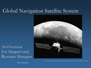
1. Global Navigation Satellite System
An Overview
For Mappers and
Resource Managers
Source: Peter H. Dana, Department of Geography, The University of Colorado at Boulder.
-Bob Champoux
3. Why is GNSSS Important
to Mappers and Resource Managers?
Mapping
Locate Features That Can be Incorporated into a GIS.
Navigation
Allows User to Visit the Same Location Again.
4. Objectives
A Quick Overview.
How A GNSS Receiver Determines Its Position.
How Accurate is GNSS?
Factors Affecting Accuracy.
How GNSS relates to GIS.
5. An Overview
GPS developed by the US Dept. of Defense (1978).
24 Satellites. Each orbits every 12 hours.
Worldwide Coverage
24 hours a day, 7days a week.
Independent of Weather…
Source: GPSCO
9. How Does A GNSS Receiver
Determine Its Position?
By measuring distances from satellites.
Each satellite transmits a unique radio signal.
Receiver listens to radio signals.
Receiver measures distance from each satellite.
With three distances, receiver can determine its
position via trilateration.
Source: Understanding the GPS,
Gregory French
10. What’s Trilateration?
If you know distances from three known points, you
can determine your position.
You are Here…
11. How Do Receivers Measure Distances?
Distances are determined by signal travel time:
Signal Travels at Speed of Light.
Since satellites are 11,500± miles away,
travel time is 0.06± seconds.
Accurate timing is very important.
(Thus, satellites have atomic clocks.)
Source: Understanding the GPS,
Gregory French
12. So, Only Three Satellites are Needed?
Actually, a minimum of 4 satellites are needed.
The fourth satellite is required to help minimize
errors caused by inaccurate clock in the receiver.
Source: Peter H. Dana, Department of Geography,
The University of Colorado at Boulder.
13. What’s the Accuracy?
A receiver will display a position, but:
This position has error.
The displayed coordinates may not even be close!
Many users think the position is absolute.
The accuracy in the position of the receiver is
10 - 20 meters (95% of the time).
The accuracy varies because of error…
14.
15. Errors and Factors Affecting Accuracy
We Can Control:
Geometry of the satellites.
Multipath.
Atmospheric Delay.
16. Geometry of the Satellites
PDOP (Position Dilution of Precision).
17. Geometry of the Satellites
Poor PDOP (Satellites are closely spaced).
18. Geometry of the Satellites
Source: Understanding the GPS,
Gregory French
19. Geometry of the Satellites
PDOP (Position Dilution of Precision).
Less than 4 = Good Geometry (Very Good Position)
4 – 6 = Good Position
Greater than 6 = Poor Geometry (Poor Position)
Receiver will indicate PDOP.
PDOP can be determined prior to fieldwork.
21. Multipath
Satellite signal is reflected before reaching receiver.
Not always obvious that this is occurring. Source: Understanding the GPS,
Gregory French
24. Minimizing the Errors
and Improving the Accuracy
Or: What do I really need to know to use a GNSS receiver
in the field?
4 Satellites
Solid objects and power lines block satellite signals.
Good Satellite Geometry
Collect data when the PDOP is 6 or less.
(Low PDOP indicates good satellite geometry)
Eliminate Multipath
Avoid positioning near buildings, cars, ledges, etc.
Minimize Atmospheric Delay
Set the receiver mask angle = 15º
25. More Ways to Improve Accuracy
Collect numerous positions for each point.
When in the woods:
GNSS works under open tree canopies.
Problematic with softwoods, dense canopies and
canopies with numerous branches.
Move slightly to improve signal reception and accuracy.
Wet leaves can interfere with signal reception.
Differential Corrections…
27. Differential Corrections
Corrections are made while in the field (Real Time)
or afterwards (Post Processing).
Government agencies broadcast real time
corrections.
Can download corrections from agencies,
via the Internet, for post processing.
28. How Do Differential Corrections Help?
Eliminates or reduces numerous errors.
Plus, corrections improve accuracy of position:
Without Differential Corrections: 10-20 meters.
Using Real Time Corrections: 1-5 meters.
Using Post Processed Corrections: 1-3 meters.
Advanced mapping receivers: 0.1 meters.
(But only 95% of the time…)
29. The GNSS/GIS Link
GNSS receivers can locate point, line and polygon
features and collect attribute data.
Software easily converts GNSS points and attributes
into GIS geodatabases or shapefiles and tables
to be incorporated in a map.
Need to confirm that the coordinate system
and projection matches the those of the map.
Source: ARCView,
ESRI
30. Summary
GNSS is used to locate feature positions or navigate.
Works by measuring distances from satellites.
Several factors affect accuracy:
PDOP (The lower the number, the better).
Avoid proximity to solid objects (Can cause multipath).
Set mask angle to 15º (to limit atmospheric delay).
Differential Correction
Second receiver used.
Further improves accuracy.
GNSS can be used to collect point, line and polygon
features for inclusion in a GIS map.
32. Resources
These serve as great introductions to GNSS:
Hurn, Jeff (1989). GPS A Guide to the Next Utility, Sunnyvale,
California: Trimble Navigation.
NOAA Coastal Services Center (2001). Introduction to Global Positioning
Systems.
Quickplan is free software used for GNSS planning. Graphics show
projected number of satellites available, locations and PDOP.
(www.trimble.com/support/files/qp.htm)
33. References
French, Gregory T. (1996). Understanding the GPS. An Introduction to the
Global Positioning System. What it is and How it Works. Bethesda,
Maryland: GeoResearch Inc.
Hurn, Jeff (1989). GPS A Guide to the Next Utility. Sunnyvale,
California: Trimble Navigation.
McElroy, Simon ( 1992). Getting Started with GPS Surveying. Bathurst,
New South Wales, Australia: Global Positioning System Consortium
(GPSCO).
Editor's Notes
Who has used GNSS?
How does it work? What the basic premise?
Those that have used it, what did you use it for?
ANIMATION! (Need to click once to get all info on slide to appear)
How does it relate to GIS? What’s the connection?
1978 was the launch date of the first satellite.
Orbital Plane: 55 degrees to the equatorial plane
Planes are spaced 60 degrees apart.
24 satellites operational, 4 are backup.
Original satellites cost $40 million each. Launch vehicles cost $100 million each.
Cost: $12 billion to get 24 satellites in orbit.
GNSS system a/k/a NAVSTAR, was built under cost, completed ahead of schedule and more accurate than originally expected: Originally thought that system would be accurate to 100 meters.
Civilian access to GNSS, without charge, was given by President Reagan after the downing of Korean Flight KAL-007.
Usable by anyone; it’s a free service.
GNSS is rapidly changing as it’s a new technology.
Navigation, surveying and mapping are three fields benefiting from these advancements.
Several signals are sent from each satellite.
Mapping Grade receivers listen to Coarse Acquisition (C/A) Code (1.023MHz).
Signal is very weak.
Position would be a unique location on earth.
Position can be Lat., Long., UTM or State Plane Coords., for examples.
ANIMATION! (Need to click twice to get all info on slide to appear)
ANIMATION (.mpg file. Runs automatically)
Use analogy of counting time before hearing thunder after seeing lightning.
On chalkboard, walk thru how far off receiver is if time is off 1 second, 1/10 sec., 1/100 sec…..1/1,000,0000sec.
Atomic clocks lose only 1 second every three million years. Each cost $200,000.
Satellites orbit very predictably.
Write these on chalkboard.
Blank our screen and discuss pulling ties when anchor points are 90 degrees to one another versus those with a shallow angle between them.
Here’s what we just discussed but with satellites.
Determining good PDOP times ahead of time is known as Mission Planning.
Free software is available to do this. See Resource Slide at end of slides.
The signal takes longer to get to the receiver thus, distance calculations are off.
Receivers can sometimes recognize when this occurs and account for it.
Metallic and glass surfaces and chain link fences promote multipath.
Can sometimes tell if multipath is occurring because the coordinate values are fluctuating more than usual.
Models of the atmosphere are used by the receiver to eliminate some of the error.
Trade off of not acquiring degraded signals but may eliminate a satellite that offers good PDOP.
ANIMATION! (Need to click 4 times to all information to appear on slide)
High tension lines are the problem not power lines along roadways.
When collecting point data, receiver stays motionless while receiver takes 2-5 measurements deriving 2-5 positions. Receiver will automatically average these yielding one position.
Sources of Error and under optimum conditions:
Ionosphere: 4.0 meters
Clock: 2.1 meters
Projected location of satellites: 2.1 meters
Multipath: 1.0 meters
Troposphere: 0.7 meters
Internal errors within receiver: 0.5 meters
These add up to 10 meters
ANIMATION! (Need to click 4 times to get all information to appear on slide)
For highest accuracy, collect however many positions for each point that the manufacturer recommends.
Describe this by reiterating what is on the next slide.
Point it out to students so they don’t have to take go nuts taking notes.
Print out this slide for student’s notes but don’t have in slide show.
Corrections made in the field are done so by having the second receiver (base) broadcast, via its own radio, the corrections. The first receiver out in the field (rover) would have another antenna to pick up this signal and apply the corrections. This is known as real time corrections.
To do so afterwards is known as post processing. Done by downloading the date into specific software made for this. Can use bases set up by gov’t agencies and access correction info via the Internet.
ANIMATION! (Need to click 2 times for all data to appear on slide)
Differential Correction eliminates or minimizes these errors:
Ionosphere, Clock, Projected location of satellites, Troposphere and Internal errors within receiver.
Differential Correction won’t improve multipath errors.
Accuracy in Real Time using Coast Guard beacons: 1-3 meters
Accuracy in Real Time using WAAS (Wide Area Augmentation System) FAA: 1-5 meters
WAAS sends corrections from ground station to geo-stationary satellites that then broadcast signal to GNSS receivers.
Another way to obtain Differential Corrections is thru the commercial service OMNIStar. It’s a privately-owned satellite that does the same thing as WAAS. Costs $800/yr. Being superceded by WAAS.
Another system by the FAA LAAS (Local Area Augmentation System). Will be established at airports to aid in landing. 1 meter accuracy. Won’t be useful to mappers. Good only in proximity to the airport.
If 2-5 positions are collected for a point, it will be more accurate than a line.