Submit Search
Upload
Continental Divide Trail GPS Mapping Project
•
1 like
•
721 views
K
kshakarjian
Follow
Basic outline of implementation of the CDNST GPS Mapping Project
Read less
Read more
Report
Share
Report
Share
1 of 22
Recommended
This presentation outlines an GPS data collection method for rapid GIS map production - for multiple users under emergency/disaster conditions. Database available upon request
GPS to GIS Emergency Mapping
rmikol
Data_Sources
Data_Sources
Lyndy Worsham, GISP
http://www.fao.org/globalsoilpartnership This Presentation was made during the Digital Soil Mapping training that took place in Amman - Jordan from 29 November - 7 December 2015, and it presents how to install DSM softeware © FAO: http://www.fao.org
Install Digital Soil Mapping Software
FAO
http://www.fao.org/globalsoilpartnership This Presentation was made during the Digital Soil Mapping training that took place in Amman - Jordan from 29 November - 7 December 2015, and it presents the Digital Soil Mapping steps © FAO: http://www.fao.org
Digital Soil Mapping steps
FAO
DATABASE
215 spatial db
215 spatial db
surekamurali
Intro to ArcGIS
Lecture 1b introduction to arc gis
Abir Mohammad
http://www.fao.org/globalsoilpartnership This Presentation was made during the Digital Soil Mapping training that took place in Amman - Jordan from 29 November - 7 December 2015, and it presents a review of Digital Soil Mapping steps © FAO: http://www.fao.org
Review of Digital Soil Mapping steps
FAO
Introduction to InfoGrafix
Info Grafix
Info Grafix
mdcamp021
http://www.fao.org/globalsoilpartnership This Presentation was made during the Digital Soil Mapping training that took place in Amman - Jordan from 29 November - 7 December 2015. This presentation was made by Mahmoud Alferihat and it presents an introduction to the Soil Survey and Land Management © FAO: http://www.fao.org
Introduction to the Soil Survey and Land Management
FAO
Different types of GIS Data
Types of GIS Data
Types of GIS Data
Preeti Prajapati
Presented by: Katherine Anaya
Advanced Technologies
Society of Women Engineers
CLASES DE PREGRADO
Día 3
Día 3
RonaldoAlberto1
adbms contents for undergraduate level.
Spatial databases
Spatial databases
Dabbal Singh Mahara
A presentation I made for a college GIS course. Just the basics of who GIS is and how it is applied.
Applications of Arc GIS
ExtraPDFs
Essential for the primary learners of Geographical Information System (GIS)
Introduction to gis
Introduction to gis
Habibur Rahman
Conference presentation
Józsa e.
Józsa e.
mirijovsky
Database Structures – Relational, Object Oriented – ER diagram - spatial data models – Raster Data Structures – Raster Data Compression - Vector Data Structures - Raster vs Vector Models TIN and GRID data models - OGC standards - Data Quality.
Spatial Data Models
Spatial Data Models
RajalakshmiS34
Emmanuel Blondel's presentation at 9th RDA PLenary Meeting, 6 April 2017 www.bluebridge-vres.eu
Geo-referencing concepts for fisheries data interoperability
Blue BRIDGE
ds
Mapping toolbox
Mapping toolbox
xsenonjackal
Gis Application
Gis Application
Gis Application
Rishabh Gupta
Portfolio_Gis_others
Mohammed Bhatia
Presentation on Esri European User Conference 2011 by Ignacio Vázquez and Elisa Gómez
Arc gis desktop_and_geoprocessing
Esri
http://www.fao.org/globalsoilpartnership This Presentation was made during the Digital Soil Mapping training that took place in Amman - Jordan from 29 November - 7 December 2015, and it presents course plan of the course © FAO: http://www.fao.org
Digital Soil Mapping–Capacity Building Course- Lecture1
FAO
An analytical advantage - using data to reduce lap times
David Carson
Geographical information system(GIS) in transportation planning
Geographical information system in transportation planning
shayiqRashid
Gis
Gis
Centre for Research, Development & Consultancy.
Fiver Rivers Waterwatch supported by Intergraph Global Education Program.
Five Rivers Waterwatch, Tasmania
Adrian O'Connor
Database gis fundamentals
Sumant Diwakar
Trail Building Volunteer hometown locations in relation to the Continental Divide National Scenic Trail volunteer project locations
Long Distance Volunteering
kshakarjian
Flowchart2 1228834831706753-9
Beauty concepts pvt ltd
More Related Content
What's hot
http://www.fao.org/globalsoilpartnership This Presentation was made during the Digital Soil Mapping training that took place in Amman - Jordan from 29 November - 7 December 2015. This presentation was made by Mahmoud Alferihat and it presents an introduction to the Soil Survey and Land Management © FAO: http://www.fao.org
Introduction to the Soil Survey and Land Management
FAO
Different types of GIS Data
Types of GIS Data
Types of GIS Data
Preeti Prajapati
Presented by: Katherine Anaya
Advanced Technologies
Society of Women Engineers
CLASES DE PREGRADO
Día 3
Día 3
RonaldoAlberto1
adbms contents for undergraduate level.
Spatial databases
Spatial databases
Dabbal Singh Mahara
A presentation I made for a college GIS course. Just the basics of who GIS is and how it is applied.
Applications of Arc GIS
ExtraPDFs
Essential for the primary learners of Geographical Information System (GIS)
Introduction to gis
Introduction to gis
Habibur Rahman
Conference presentation
Józsa e.
Józsa e.
mirijovsky
Database Structures – Relational, Object Oriented – ER diagram - spatial data models – Raster Data Structures – Raster Data Compression - Vector Data Structures - Raster vs Vector Models TIN and GRID data models - OGC standards - Data Quality.
Spatial Data Models
Spatial Data Models
RajalakshmiS34
Emmanuel Blondel's presentation at 9th RDA PLenary Meeting, 6 April 2017 www.bluebridge-vres.eu
Geo-referencing concepts for fisheries data interoperability
Blue BRIDGE
ds
Mapping toolbox
Mapping toolbox
xsenonjackal
Gis Application
Gis Application
Gis Application
Rishabh Gupta
Portfolio_Gis_others
Mohammed Bhatia
Presentation on Esri European User Conference 2011 by Ignacio Vázquez and Elisa Gómez
Arc gis desktop_and_geoprocessing
Esri
http://www.fao.org/globalsoilpartnership This Presentation was made during the Digital Soil Mapping training that took place in Amman - Jordan from 29 November - 7 December 2015, and it presents course plan of the course © FAO: http://www.fao.org
Digital Soil Mapping–Capacity Building Course- Lecture1
FAO
An analytical advantage - using data to reduce lap times
David Carson
Geographical information system(GIS) in transportation planning
Geographical information system in transportation planning
shayiqRashid
Gis
Gis
Centre for Research, Development & Consultancy.
Fiver Rivers Waterwatch supported by Intergraph Global Education Program.
Five Rivers Waterwatch, Tasmania
Adrian O'Connor
Database gis fundamentals
Sumant Diwakar
What's hot
(20)
Introduction to the Soil Survey and Land Management
Types of GIS Data
Types of GIS Data
Advanced Technologies
Día 3
Día 3
Spatial databases
Spatial databases
Applications of Arc GIS
Introduction to gis
Introduction to gis
Józsa e.
Józsa e.
Spatial Data Models
Spatial Data Models
Geo-referencing concepts for fisheries data interoperability
Mapping toolbox
Mapping toolbox
Gis Application
Gis Application
Portfolio_Gis_others
Arc gis desktop_and_geoprocessing
Digital Soil Mapping–Capacity Building Course- Lecture1
An analytical advantage - using data to reduce lap times
Geographical information system in transportation planning
Gis
Gis
Five Rivers Waterwatch, Tasmania
Database gis fundamentals
Viewers also liked
Trail Building Volunteer hometown locations in relation to the Continental Divide National Scenic Trail volunteer project locations
Long Distance Volunteering
kshakarjian
Flowchart2 1228834831706753-9
Beauty concepts pvt ltd
One of many Continental transportation design projects.
Continental Mapping Projects - Trans Design
Continental Mapping Consultants
Curbing profit shifting in international transaction un oecd model _ Jena
Chidananda Jena
Tax governance challenges and potential _ Jena
Chidananda Jena
Direct Tax Code India _ Jena
Chidananda Jena
The Art Scraps – video podcast about creating interior objects in industrial style, made from old manufactured things.
The Art Scraps Eng
The Art Scraps Eng
Evgeny Zdorov
71911-asinado (1)
71911-asinado (1)
Ramón Castro
Presentation by Arulalan.T given at #PythonMonth at IIC (South Campus) DU.
Python an-intro-python-month-2013
Konark modi
SWIFT entry message interface
IntellectLink
IntellectLink
Marisa Saimur
Выгодный способ подключения к SWIFT
Alliance Lite and IntellectLink
Marisa Saimur
Curs sobre l'energia a Andratx
L'energia conceptes clars
Josep Rigo
The Art Scraps – видеоподкаст об изготовлении предметов для интерьера из вещей промышленного назначения в индустриальном стиле
The Art Scraps Ru
The Art Scraps Ru
Evgeny Zdorov
Presentatie van Simon van de Denkfiguren bij de Leraren met Lef manifestatie 2013. In de presentatie worden fundamentele veranderingen middels sociale innovatie vertaald naar het ideaal-type van de netwerkdocent.
Leraren met Lef: Denkfiguren
Simonverwer
This is a presentation on MLA history and use..
Mla 2011 montessori
Mla 2011 montessori
hipengprof
Our wishes to you all...
Christmas message 2011
debmc333
party
Bnvitation
Bnvitation
batong canlas
מודלים לפיתוח למידה מתוקשבת מבלי להמציא את הגלגל, עבודה תבניתית, מושכלת ואפקטיבית לארגון! תהנו...
למידה מתוקשבת - מודלים, תבניות, רעיונות
Sharona Segal
Excercise to practise vowels
Delince Samuel
This is an attempt to study the Value Added Tax (VAT) policy, organization, functions, functionaries, Governance and E-governance measures, citizens charter, E-services, processes, business intelligence (BI), performance indicators of Commercial Taxes Department of a small federal state/ UT in India, benchmark against progressive states and recommend reforms in policy, organization, people, functions, processes and other areas as mentioned above.
Tax Governance Reforms in small federal states India _ Jena
Chidananda Jena
Viewers also liked
(20)
Long Distance Volunteering
Flowchart2 1228834831706753-9
Continental Mapping Projects - Trans Design
Curbing profit shifting in international transaction un oecd model _ Jena
Tax governance challenges and potential _ Jena
Direct Tax Code India _ Jena
The Art Scraps Eng
The Art Scraps Eng
71911-asinado (1)
71911-asinado (1)
Python an-intro-python-month-2013
IntellectLink
IntellectLink
Alliance Lite and IntellectLink
L'energia conceptes clars
The Art Scraps Ru
The Art Scraps Ru
Leraren met Lef: Denkfiguren
Mla 2011 montessori
Mla 2011 montessori
Christmas message 2011
Bnvitation
Bnvitation
למידה מתוקשבת - מודלים, תבניות, רעיונות
Excercise to practise vowels
Tax Governance Reforms in small federal states India _ Jena
Similar to Continental Divide Trail GPS Mapping Project
Mobile Mapping
Spar 2010 Presetation
cformeller
Presentation to State of the Map US, focusing on routing using OSM data.
SoTM US Routing
SoTM US Routing
MapQuest
Gis capabilities on Big Data Systems
Ahmad Jawwad
Abrief about GIS and an introduction to arc gis
Introduction to arc gis
Mohamed Hamed
Aldridge asset and infrastrcuture mobile mapping
GeCo in the Rockies
NAPSG 2010 Fire/EMS Conference - Data Sharing Basics
pdituri
HDF and HDF-EOS Workshop XVIII (2015) Christine White
ArcGIS and Multi-D: Tools & Roadmap
The HDF-EOS Tools and Information Center
GPS Receiver design using kalman filter in presence of ionospheric scintillation
Gps general-training-and-software-applications-kuala lumpur-nov-2018
Harshali Mane
Utah is expanding the functional capability of its major geographic information repositories by creating web services available to the public.
Utah Reorganizes its GIS Around Web Services
State of Utah, Salt Lake City
Reorganizing Around Web Services
GIS in Utah
GIS in Utah
National States Geographic Information Council
Remote sensing and GIS
Unit 4 Data Input and Analysis.pptx
e20ag004
An overview of simple techniques for bringing non-spatial business data into ArcGIS Server applications.
Strategies for Integrating Utility System Operational Data into ArcGIS Server...
True North Geographic Technologies
Data Management and Processing Systems Hardware and Software Trends Geographic Information Systems: GIS Software, GIS Architecture and functionality, Spatial Data Infrastructure (SDI) Stages of Spatial Data handling: Spatial data handling and preparation, Spatial Data Storage and maintenance, Spatial Query and Analysis, Spatial Data Presentation. Database management Systems: Reasons for using a DBMS, Alternatives for data management, The relational data model, Querying the relational database. GIS and Spatial Databases: Linking GIS and DBMS, Spatial database functionality.
TYBSC IT PGIS Unit II Chapter I Data Management and Processing Systems
Arti Parab Academics
2004-11-13 Supersite Relational Database Project: (Data Portal?)
Rudolf Husar
http://capitawiki.wustl.edu/index.php/20041113_Supersite_Relational_Database_Project:_%28Data_Portal%3F%29
Srds Pres011120
Srds Pres011120
Rudolf Husar
Data Entry and Preparation Spatial Data Input: Direct spatial data capture, Indirect spatial data captiure, Obtaining spatial data elsewhere Data Quality: Accuracy and Positioning, Positional accuracy, Attribute accuracy, Temporal accuracy, Lineage, Completeness, Logical consistency Data Preparation: Data checks and repairs, Combining data from multiple sources Point Data Transformation: Interpolating discrete data, Interpolating continuous data
TYBSC IT PGIS Unit III Chapter II Data Entry and Preparation
Arti Parab Academics
materi pebelajaran kelas sig untuk mahasiswa uniska banjarbaru
belajar dasar geospatial sistem informasi geografi
Rizal Siguniska
HDF and HDF-EOS Workshop XVIII (2015) Brian Tisdale
Geospatial Data Abstraction Library (GDAL) Enhancement for ESDIS (GEE)
The HDF-EOS Tools and Information Center
This is the slide for computer use in Environment monitoring by GIS/RS method
Env. mon
Env. mon
Ramesh Kumar
change detection of gis and if want to know more infromation mail me at maoj.rayudu@gmail.com
Change detection
Change detection
manoj1412001
Similar to Continental Divide Trail GPS Mapping Project
(20)
Spar 2010 Presetation
SoTM US Routing
SoTM US Routing
Gis capabilities on Big Data Systems
Introduction to arc gis
Aldridge asset and infrastrcuture mobile mapping
NAPSG 2010 Fire/EMS Conference - Data Sharing Basics
ArcGIS and Multi-D: Tools & Roadmap
Gps general-training-and-software-applications-kuala lumpur-nov-2018
Utah Reorganizes its GIS Around Web Services
GIS in Utah
GIS in Utah
Unit 4 Data Input and Analysis.pptx
Strategies for Integrating Utility System Operational Data into ArcGIS Server...
TYBSC IT PGIS Unit II Chapter I Data Management and Processing Systems
2004-11-13 Supersite Relational Database Project: (Data Portal?)
Srds Pres011120
Srds Pres011120
TYBSC IT PGIS Unit III Chapter II Data Entry and Preparation
belajar dasar geospatial sistem informasi geografi
Geospatial Data Abstraction Library (GDAL) Enhancement for ESDIS (GEE)
Env. mon
Env. mon
Change detection
Change detection
Continental Divide Trail GPS Mapping Project
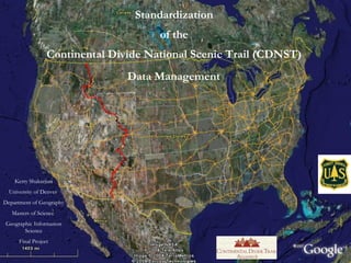
1.
Standardization of
the Continental Divide National Scenic Trail (CDNST) Data Management Kerry Shakarjian University of Denver Department of Geography Masters of Science Geographic Information Science Final Project
2.
3.
4.
5.
6.
7.
8.
9.
10.
Feature Attribute Definitions
11.
Feature Attribute Definitions
12.
Structures and Sign
Guide
13.
14.
15.
2009 Collection Examples
Switchback accuracy from GPS pilot project using a Magellan ProMark 3 GPS unit.
16.
17.
Photo Stamping
18.
19.
20.
21.
Summary
22.
Questions?
Editor's Notes
Overview: Learn what to collect Learn how to use the GPS Get collected data into GIS Share data with agencies/public