SlideShare a Scribd company logo
1 of 30
EBCI Integrated Geographic Information System (IGIS) Integrated GIS EDMS GEMS GIS WORKFLOW
Project Details – Integrated GIS Vision ,[object Object],[object Object],Enterprise  GIS  for  EBCI Enterprise IGIS Data Input & Data Users Existing Tribal Departmental Data Silos Enterprise  GIS  for  EBCI
Integrating Enterprise Systems Enrich and improve workflows to increase organizational efficiency Enterprise  GIS  for  EBCI Services Services Services Services People & Workflows ERP/ Finance EDMS CAD/ E911 GIS Enterprise Infrastructure
EBCI IGIS Geodatabase Design/Prototype Presentation DESIGN PHASES
Requirements Validation ,[object Object],[object Object],[object Object],[object Object],[object Object],[object Object],[object Object],[object Object]
Develop Conceptual Model ,[object Object],[object Object],[object Object],[object Object],[object Object],[object Object],[object Object],[object Object]
[object Object],[object Object],[object Object],[object Object],[object Object],[object Object],[object Object],Logical Database Design
Tribal Integrated Geographic Information System Turning Data and Information into Business-Relevant Knowledge   Enterprise  GIS  for  EBCI Planning Design Real Property Management Facility  Management Code Enforcement Site Selection Business Continuity Environmental Management Energy Management Emergency Preparedness & Response Permitting Infrastructure Asset Management Streets/E911 Addressing EDMS GEMS GIS WORKFLOW
[object Object],[object Object],[object Object],[object Object],[object Object],[object Object],Foundation for all EBCI Spatial Data
EBCI IGIS Geodatabase Design/Prototype Presentation DATA MODEL
Conceptual Model
Conceptual Model
Logical Model
Logical Model
Logical Model
Logical Model
Logical Model
Physical Model (ArcGIS ArcCatalog)
EBCI IGIS Geodatabase Design/Prototype Presentation SITE PLAN REVIEW PROCESS
[object Object],[object Object],[object Object],[object Object],[object Object],[object Object],Site Plan Review Process
[object Object],[object Object],[object Object],[object Object],[object Object],[object Object],[object Object],Site Plan Review Process
[object Object],[object Object],[object Object],[object Object],Project Concept
[object Object],[object Object],[object Object],[object Object],[object Object],[object Object],[object Object],[object Object],[object Object],[object Object],Initial Project Feasibility
[object Object],[object Object],[object Object],[object Object],[object Object],Initial Project Design
[object Object],[object Object],[object Object],[object Object],[object Object],[object Object],[object Object],[object Object],[object Object],Detailed Project Feasibility
[object Object],[object Object],[object Object],Detailed Project Design
 
EBCI IGIS Geodatabase Design/Prototype Presentation NEXT STEPS
Project Details – Integrated GIS Vision Enterprise  GIS  for  EBCI Integrate Site Plan Review Workflows into IGIS Implement and Roll-out Tribal EDMS Perform Joint E911 and CDOT Conflation Project Develop Integrated GIS GeoDatabase Design Perform Parcel Data Plotting Project As required, Integrate BIA Realty Land Management  Responsibility into IGIS Integrate BIA Realty Survey Review and Acceptance  Workflows into IGIS Current and Future IGIS Development Activities… Complete the EBCI Possessory Holdings Scanning Time
EBCI IGIS Geodatabase Design/Prototype Presentation QUESTIONS

More Related Content

What's hot

Esri GIS at Thames Water
Esri GIS at Thames WaterEsri GIS at Thames Water
Esri GIS at Thames WaterEsri UK
 
Benchmark in 3 Steps - BenchmarkMyBuilding.com
Benchmark in 3 Steps - BenchmarkMyBuilding.comBenchmark in 3 Steps - BenchmarkMyBuilding.com
Benchmark in 3 Steps - BenchmarkMyBuilding.comLucid
 
A sneak peek into the Viasys VDC product roadmaps
A sneak peek into the Viasys VDC product roadmapsA sneak peek into the Viasys VDC product roadmaps
A sneak peek into the Viasys VDC product roadmapsViasys VDC
 
Viasys VDC City Models
Viasys VDC City Models Viasys VDC City Models
Viasys VDC City Models Viasys VDC
 
Best practices for streamlining your project – A joint demo of Viasys VDC and...
Best practices for streamlining your project – A joint demo of Viasys VDC and...Best practices for streamlining your project – A joint demo of Viasys VDC and...
Best practices for streamlining your project – A joint demo of Viasys VDC and...Viasys VDC
 
Fy 19 PPT Community and Development
Fy 19 PPT Community and DevelopmentFy 19 PPT Community and Development
Fy 19 PPT Community and Developmentahcitycouncil
 
Bell Aliant case study
Bell Aliant case studyBell Aliant case study
Bell Aliant case studyEsri
 
Darya darvish resume
Darya darvish resumeDarya darvish resume
Darya darvish resumeDarya Darvish
 
CAD GIS Integration Workshop
CAD GIS Integration WorkshopCAD GIS Integration Workshop
CAD GIS Integration WorkshopAndrew Bashfield
 

What's hot (12)

Esri GIS at Thames Water
Esri GIS at Thames WaterEsri GIS at Thames Water
Esri GIS at Thames Water
 
Accelerating GIS Implementation in Local Government
Accelerating GIS Implementation in Local GovernmentAccelerating GIS Implementation in Local Government
Accelerating GIS Implementation in Local Government
 
Benchmark in 3 Steps - BenchmarkMyBuilding.com
Benchmark in 3 Steps - BenchmarkMyBuilding.comBenchmark in 3 Steps - BenchmarkMyBuilding.com
Benchmark in 3 Steps - BenchmarkMyBuilding.com
 
Kristin Walker's resume
Kristin Walker's resumeKristin Walker's resume
Kristin Walker's resume
 
A sneak peek into the Viasys VDC product roadmaps
A sneak peek into the Viasys VDC product roadmapsA sneak peek into the Viasys VDC product roadmaps
A sneak peek into the Viasys VDC product roadmaps
 
Viasys VDC City Models
Viasys VDC City Models Viasys VDC City Models
Viasys VDC City Models
 
Best practices for streamlining your project – A joint demo of Viasys VDC and...
Best practices for streamlining your project – A joint demo of Viasys VDC and...Best practices for streamlining your project – A joint demo of Viasys VDC and...
Best practices for streamlining your project – A joint demo of Viasys VDC and...
 
Web & Mobile GIS Overview at Middle TN Electric
Web & Mobile GIS Overview at Middle TN ElectricWeb & Mobile GIS Overview at Middle TN Electric
Web & Mobile GIS Overview at Middle TN Electric
 
Fy 19 PPT Community and Development
Fy 19 PPT Community and DevelopmentFy 19 PPT Community and Development
Fy 19 PPT Community and Development
 
Bell Aliant case study
Bell Aliant case studyBell Aliant case study
Bell Aliant case study
 
Darya darvish resume
Darya darvish resumeDarya darvish resume
Darya darvish resume
 
CAD GIS Integration Workshop
CAD GIS Integration WorkshopCAD GIS Integration Workshop
CAD GIS Integration Workshop
 

Viewers also liked

Viewers also liked (13)

2016 07--july rental-review
2016 07--july rental-review2016 07--july rental-review
2016 07--july rental-review
 
Reia news no45_may15 courtesy of carlos & linda
Reia news no45_may15 courtesy of carlos & lindaReia news no45_may15 courtesy of carlos & linda
Reia news no45_may15 courtesy of carlos & linda
 
REMOVING THE HASSLE FROM SALES & RENTALS BRISBANE WIDE
REMOVING THE HASSLE FROM SALES & RENTALS BRISBANE WIDEREMOVING THE HASSLE FROM SALES & RENTALS BRISBANE WIDE
REMOVING THE HASSLE FROM SALES & RENTALS BRISBANE WIDE
 
Month in review_february_2016_residential
Month in review_february_2016_residentialMonth in review_february_2016_residential
Month in review_february_2016_residential
 
INVEST MORETON BAY BROCHURE QLD AUSTRALIA
INVEST MORETON BAY BROCHURE QLD AUSTRALIAINVEST MORETON BAY BROCHURE QLD AUSTRALIA
INVEST MORETON BAY BROCHURE QLD AUSTRALIA
 
2016 10-core logicc-hedonic_index
2016 10-core logicc-hedonic_index2016 10-core logicc-hedonic_index
2016 10-core logicc-hedonic_index
 
Content curation basics
Content curation basicsContent curation basics
Content curation basics
 
Field Report on Hurricane Sandy's Visit to Brookline
Field Report on Hurricane Sandy's Visit to BrooklineField Report on Hurricane Sandy's Visit to Brookline
Field Report on Hurricane Sandy's Visit to Brookline
 
Yao Ming's Journey as a Giant Philanthropist
Yao Ming's Journey as a Giant PhilanthropistYao Ming's Journey as a Giant Philanthropist
Yao Ming's Journey as a Giant Philanthropist
 
Htw report month in-review-december-2014
Htw report month in-review-december-2014Htw report month in-review-december-2014
Htw report month in-review-december-2014
 
Vestige product
Vestige product Vestige product
Vestige product
 
REIQ QLD MARKET MONITOR 27 SEPTEMBER 2015
REIQ QLD MARKET MONITOR 27 SEPTEMBER 2015REIQ QLD MARKET MONITOR 27 SEPTEMBER 2015
REIQ QLD MARKET MONITOR 27 SEPTEMBER 2015
 
REIQ MARKET MONITOR JUNE 2015- ISSUE 26
REIQ MARKET MONITOR JUNE 2015- ISSUE 26 REIQ MARKET MONITOR JUNE 2015- ISSUE 26
REIQ MARKET MONITOR JUNE 2015- ISSUE 26
 

Similar to Eastern Band of Cherokee Indians Effiencey Vision

2019 Esri International User Conference, Engineering Summit
2019 Esri International User Conference, Engineering Summit2019 Esri International User Conference, Engineering Summit
2019 Esri International User Conference, Engineering SummitChris Andrews
 
Case Study about BIM on GIS platform development project with the standard model
Case Study about BIM on GIS platform development project with the standard modelCase Study about BIM on GIS platform development project with the standard model
Case Study about BIM on GIS platform development project with the standard modelTae wook kang
 
Dublinked tech workshop_15_dec2011
Dublinked tech workshop_15_dec2011Dublinked tech workshop_15_dec2011
Dublinked tech workshop_15_dec2011Dublinked .
 
lifecycle-bim-gis-user-group-april-2017
lifecycle-bim-gis-user-group-april-2017lifecycle-bim-gis-user-group-april-2017
lifecycle-bim-gis-user-group-april-2017Dale Ritchie
 
Agi big 5 - BIM & Asset Management - James Colclough
Agi big 5 - BIM & Asset Management - James ColcloughAgi big 5 - BIM & Asset Management - James Colclough
Agi big 5 - BIM & Asset Management - James ColcloughJames Colclough
 
Mapping Capital Improvement Program Projects at the City of Austin
Mapping Capital Improvement Program Projects at the City of AustinMapping Capital Improvement Program Projects at the City of Austin
Mapping Capital Improvement Program Projects at the City of AustinSafe Software
 
Geo-Enabling Retail and Property
Geo-Enabling Retail and PropertyGeo-Enabling Retail and Property
Geo-Enabling Retail and PropertyGeoEnable Limited
 
Faster is the New Fast - with Mi Express You can Analyze Location Data Faster
Faster is the New Fast - with Mi Express You can Analyze Location Data FasterFaster is the New Fast - with Mi Express You can Analyze Location Data Faster
Faster is the New Fast - with Mi Express You can Analyze Location Data FasterMISNet - Integeo SE Asia
 
Db graph a_tool_for_development_of_database_systems_based
Db graph a_tool_for_development_of_database_systems_basedDb graph a_tool_for_development_of_database_systems_based
Db graph a_tool_for_development_of_database_systems_basedAmbar Abdul
 
Leveraging ArcGIS Platform & CityEngine for GIS based Master Plans
Leveraging ArcGIS Platform & CityEngine for GIS based Master PlansLeveraging ArcGIS Platform & CityEngine for GIS based Master Plans
Leveraging ArcGIS Platform & CityEngine for GIS based Master PlansEsri India
 
A Range of CAD-GIS Integration Scenarios
A Range of CAD-GIS Integration ScenariosA Range of CAD-GIS Integration Scenarios
A Range of CAD-GIS Integration ScenariosAndrew Bashfield
 
ESRI EUC 2007 - Web-based Water Information System Using GIS in Turkey
ESRI EUC 2007 - Web-based Water Information System Using GIS in TurkeyESRI EUC 2007 - Web-based Water Information System Using GIS in Turkey
ESRI EUC 2007 - Web-based Water Information System Using GIS in Turkeymetalalp
 
ArcGIS Server 10 Applications Advancing Local Government Service Delivery
ArcGIS Server 10 Applications  Advancing Local Government Service DeliveryArcGIS Server 10 Applications  Advancing Local Government Service Delivery
ArcGIS Server 10 Applications Advancing Local Government Service DeliveryChristopher Blough
 

Similar to Eastern Band of Cherokee Indians Effiencey Vision (20)

David Miller Retired
David Miller RetiredDavid Miller Retired
David Miller Retired
 
HoLIS GIS Update
HoLIS GIS UpdateHoLIS GIS Update
HoLIS GIS Update
 
IRW 2004
IRW  2004IRW  2004
IRW 2004
 
2019 Esri International User Conference, Engineering Summit
2019 Esri International User Conference, Engineering Summit2019 Esri International User Conference, Engineering Summit
2019 Esri International User Conference, Engineering Summit
 
Case Study about BIM on GIS platform development project with the standard model
Case Study about BIM on GIS platform development project with the standard modelCase Study about BIM on GIS platform development project with the standard model
Case Study about BIM on GIS platform development project with the standard model
 
Earth Science Data and Information System (ESDIS) Project Update
Earth Science Data and Information System (ESDIS) Project UpdateEarth Science Data and Information System (ESDIS) Project Update
Earth Science Data and Information System (ESDIS) Project Update
 
Dublinked tech workshop_15_dec2011
Dublinked tech workshop_15_dec2011Dublinked tech workshop_15_dec2011
Dublinked tech workshop_15_dec2011
 
GCC Notes
GCC NotesGCC Notes
GCC Notes
 
lifecycle-bim-gis-user-group-april-2017
lifecycle-bim-gis-user-group-april-2017lifecycle-bim-gis-user-group-april-2017
lifecycle-bim-gis-user-group-april-2017
 
Agi big 5 - BIM & Asset Management - James Colclough
Agi big 5 - BIM & Asset Management - James ColcloughAgi big 5 - BIM & Asset Management - James Colclough
Agi big 5 - BIM & Asset Management - James Colclough
 
Mapping Capital Improvement Program Projects at the City of Austin
Mapping Capital Improvement Program Projects at the City of AustinMapping Capital Improvement Program Projects at the City of Austin
Mapping Capital Improvement Program Projects at the City of Austin
 
Geo-Enabling Retail and Property
Geo-Enabling Retail and PropertyGeo-Enabling Retail and Property
Geo-Enabling Retail and Property
 
Faster is the New Fast - with Mi Express You can Analyze Location Data Faster
Faster is the New Fast - with Mi Express You can Analyze Location Data FasterFaster is the New Fast - with Mi Express You can Analyze Location Data Faster
Faster is the New Fast - with Mi Express You can Analyze Location Data Faster
 
Db graph a_tool_for_development_of_database_systems_based
Db graph a_tool_for_development_of_database_systems_basedDb graph a_tool_for_development_of_database_systems_based
Db graph a_tool_for_development_of_database_systems_based
 
Enterprise GIS Planning and Framework
Enterprise GIS Planning and FrameworkEnterprise GIS Planning and Framework
Enterprise GIS Planning and Framework
 
Leveraging ArcGIS Platform & CityEngine for GIS based Master Plans
Leveraging ArcGIS Platform & CityEngine for GIS based Master PlansLeveraging ArcGIS Platform & CityEngine for GIS based Master Plans
Leveraging ArcGIS Platform & CityEngine for GIS based Master Plans
 
A Range of CAD-GIS Integration Scenarios
A Range of CAD-GIS Integration ScenariosA Range of CAD-GIS Integration Scenarios
A Range of CAD-GIS Integration Scenarios
 
ESRI EUC 2007 - Web-based Water Information System Using GIS in Turkey
ESRI EUC 2007 - Web-based Water Information System Using GIS in TurkeyESRI EUC 2007 - Web-based Water Information System Using GIS in Turkey
ESRI EUC 2007 - Web-based Water Information System Using GIS in Turkey
 
Web Based GIS
Web Based GISWeb Based GIS
Web Based GIS
 
ArcGIS Server 10 Applications Advancing Local Government Service Delivery
ArcGIS Server 10 Applications  Advancing Local Government Service DeliveryArcGIS Server 10 Applications  Advancing Local Government Service Delivery
ArcGIS Server 10 Applications Advancing Local Government Service Delivery
 

Eastern Band of Cherokee Indians Effiencey Vision

  • 1. EBCI Integrated Geographic Information System (IGIS) Integrated GIS EDMS GEMS GIS WORKFLOW
  • 2.
  • 3. Integrating Enterprise Systems Enrich and improve workflows to increase organizational efficiency Enterprise GIS for EBCI Services Services Services Services People & Workflows ERP/ Finance EDMS CAD/ E911 GIS Enterprise Infrastructure
  • 4. EBCI IGIS Geodatabase Design/Prototype Presentation DESIGN PHASES
  • 5.
  • 6.
  • 7.
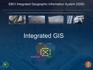
  • 8. Tribal Integrated Geographic Information System Turning Data and Information into Business-Relevant Knowledge Enterprise GIS for EBCI Planning Design Real Property Management Facility Management Code Enforcement Site Selection Business Continuity Environmental Management Energy Management Emergency Preparedness & Response Permitting Infrastructure Asset Management Streets/E911 Addressing EDMS GEMS GIS WORKFLOW
  • 9.
  • 10. EBCI IGIS Geodatabase Design/Prototype Presentation DATA MODEL
  • 18. Physical Model (ArcGIS ArcCatalog)
  • 19. EBCI IGIS Geodatabase Design/Prototype Presentation SITE PLAN REVIEW PROCESS
  • 20.
  • 21.
  • 22.
  • 23.
  • 24.
  • 25.
  • 26.
  • 27.  
  • 28. EBCI IGIS Geodatabase Design/Prototype Presentation NEXT STEPS
  • 29. Project Details – Integrated GIS Vision Enterprise GIS for EBCI Integrate Site Plan Review Workflows into IGIS Implement and Roll-out Tribal EDMS Perform Joint E911 and CDOT Conflation Project Develop Integrated GIS GeoDatabase Design Perform Parcel Data Plotting Project As required, Integrate BIA Realty Land Management Responsibility into IGIS Integrate BIA Realty Survey Review and Acceptance Workflows into IGIS Current and Future IGIS Development Activities… Complete the EBCI Possessory Holdings Scanning Time
  • 30. EBCI IGIS Geodatabase Design/Prototype Presentation QUESTIONS

Editor's Notes

  1. BENEFIT FROM THE GEOGRAPHIC APPROACH!!! IGIS will be the foundation …