Download as PDF, PPTX


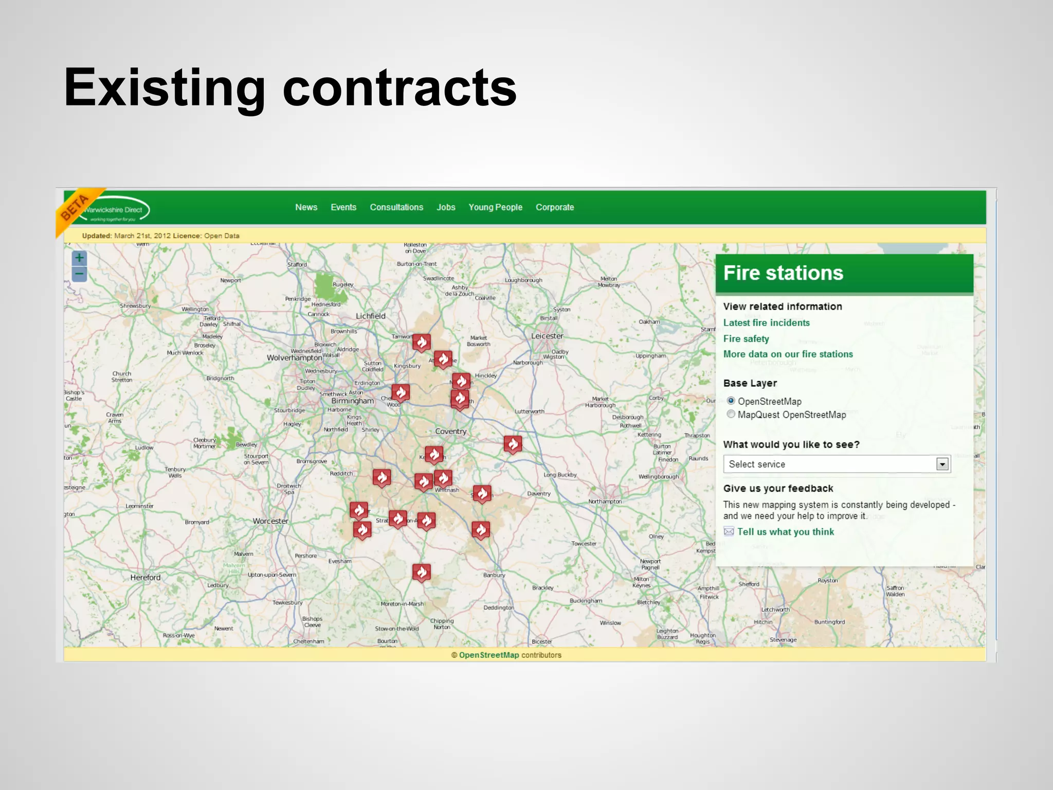

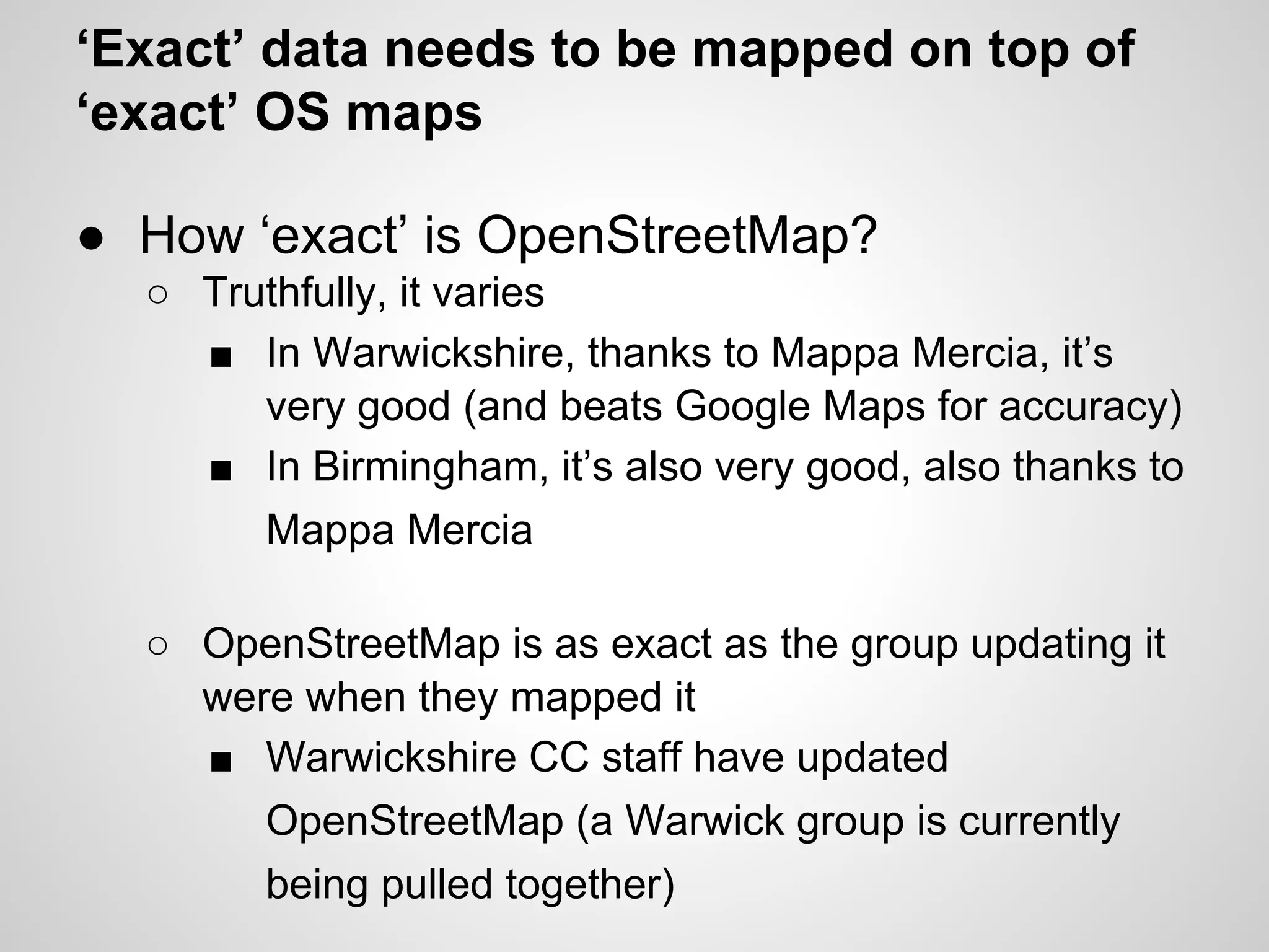
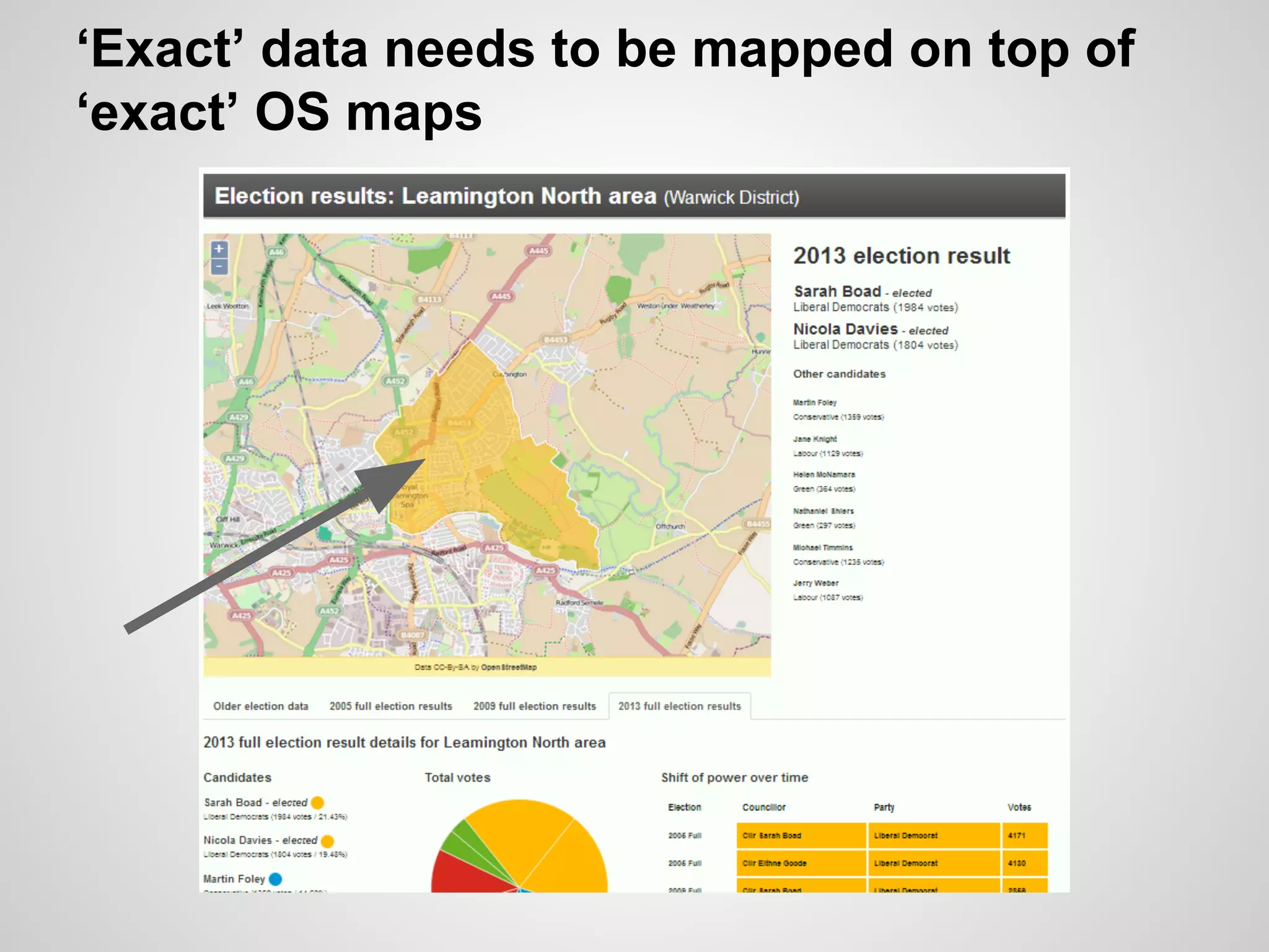

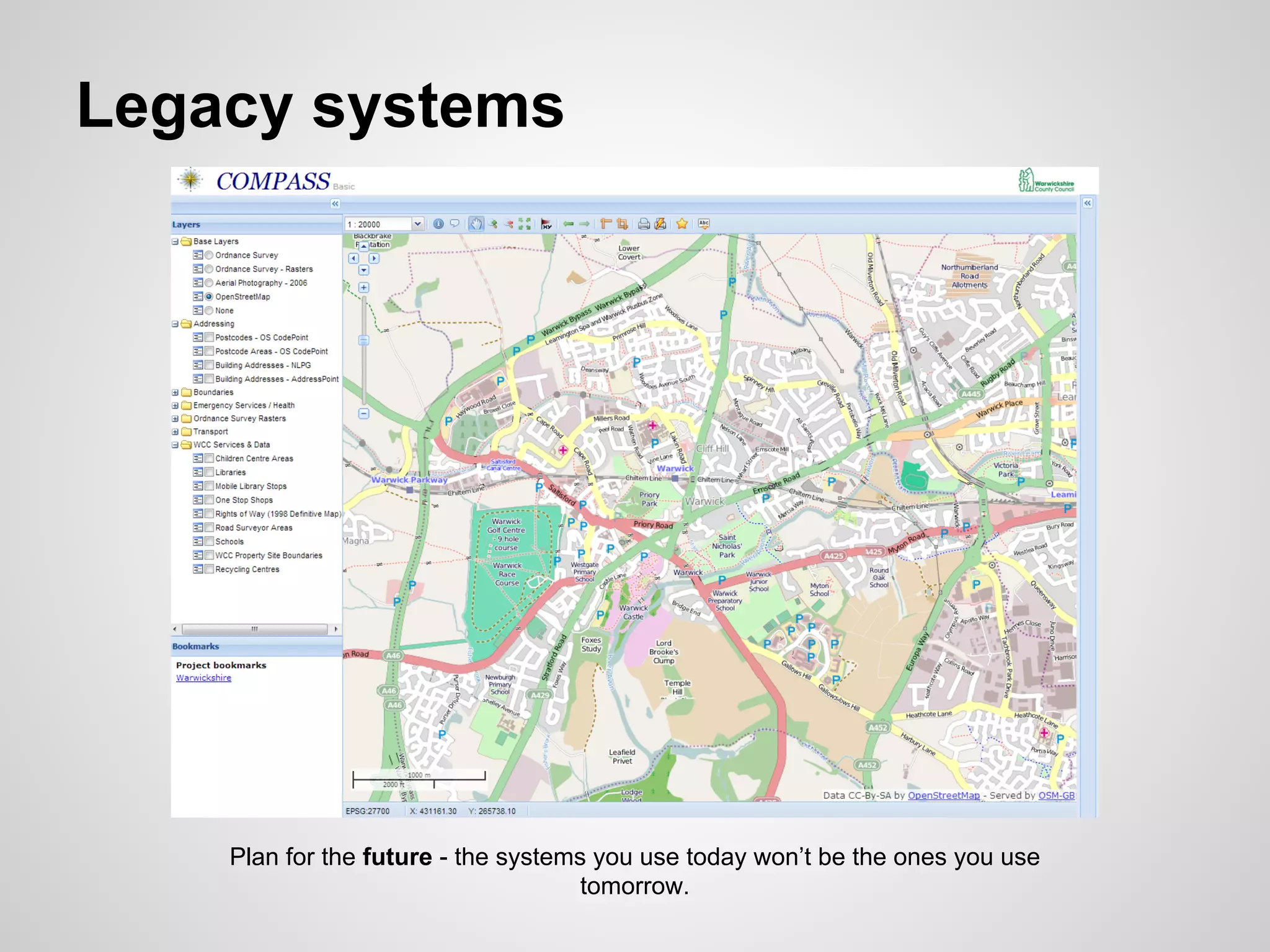


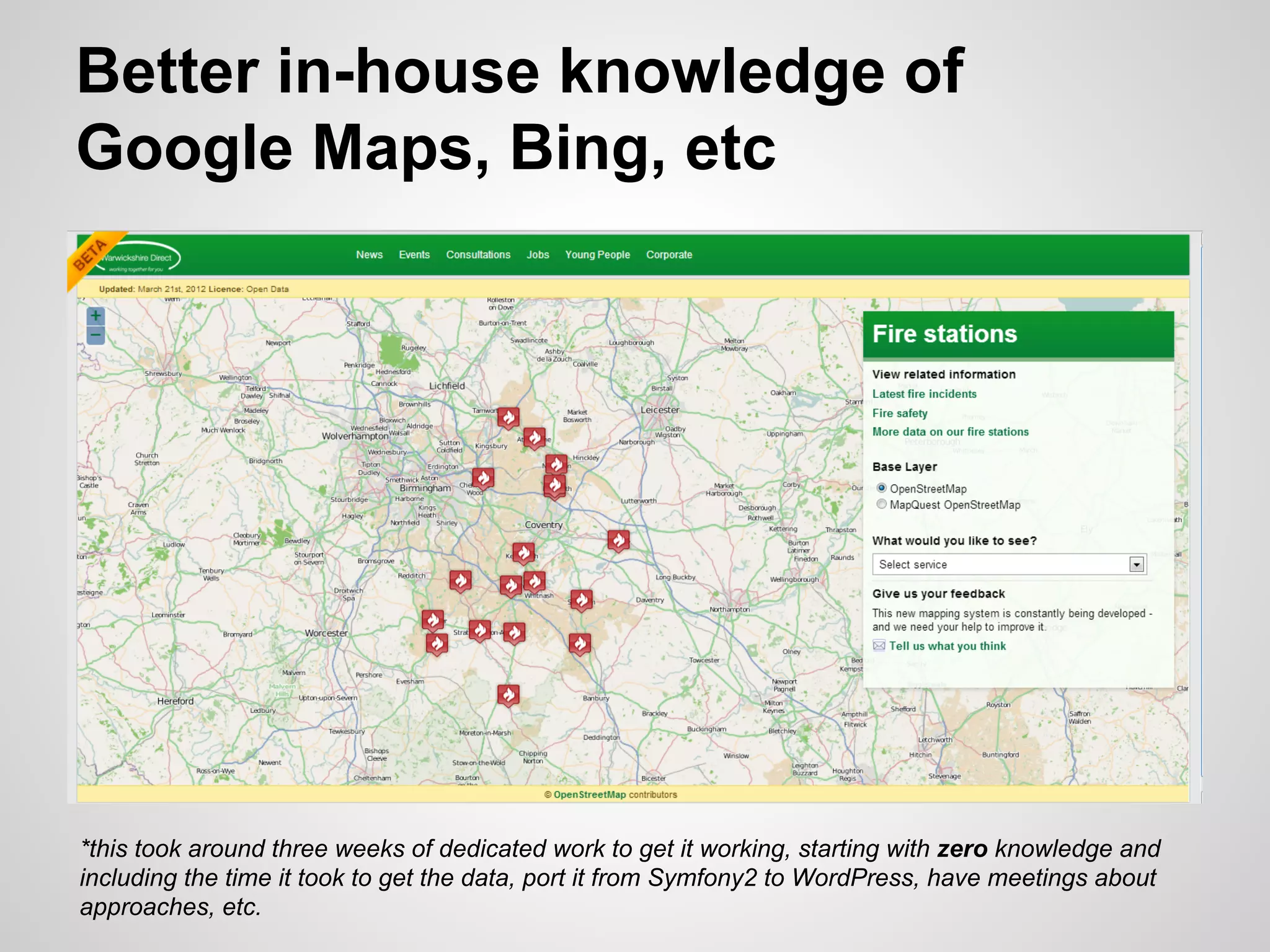


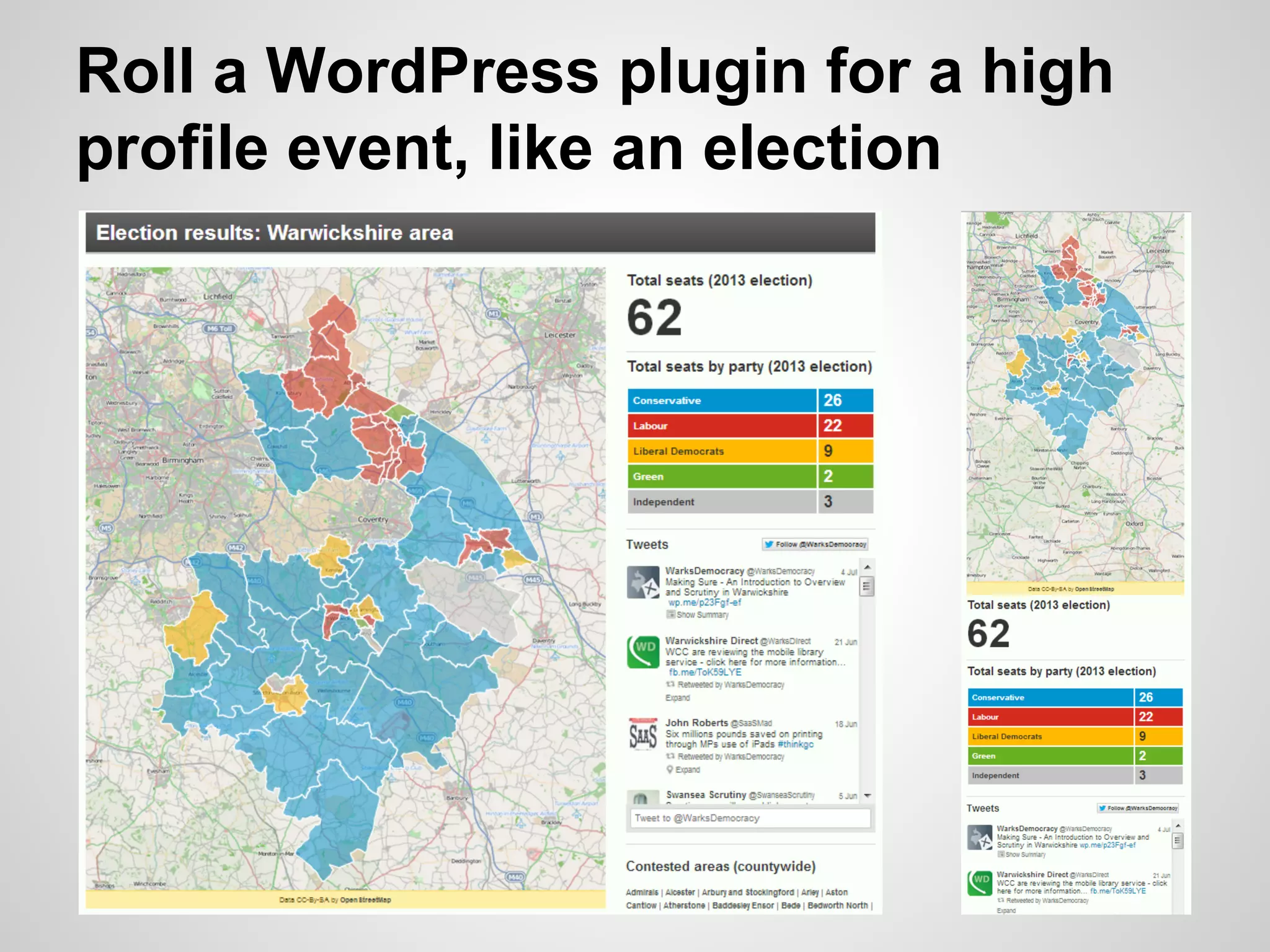


The document argues that governments should adopt OpenStreetMap (OSM) instead of relying on proprietary mapping solutions, citing outdated contracts and legacy systems as common objections. It highlights that OSM can provide superior accuracy in certain areas and encourages public bodies to integrate OSM into their projects, especially for high-profile events. Suggestions include creating plugins for elections and using OSM for various mapping needs to enhance public engagement and service delivery.


