![The situation in Hawaii mirrored scenes of devastation elsewhere in the world this summer, as
wildfires caused by record-setting heat forced the evacuation of tens of thousands of people in
Greece, Spain, Portugal and other parts of Europe. Parts of Canada — particularly in British
Columbia, Quebec and northwestern Ontario — have also seen extensive wildfires and
evacuations.
Human-caused climate change, driven by fossil fuel use, is increasing the frequency and intensity
of such extreme weather events, scientists say, having long warned that government officials
must slash emissions to prevent climate catastrophe.
The White House issued a message of condolence from U.S. President Joe Biden, who praised
the work of firefighters and ordered "all available Federal assets on the Islands to help with
response."
Besides the Hawaiian National Guard, the U.S. Coast Guard and Navy Third Fleets were assisting
search and rescue efforts on Maui and the U.S. Marines were sending helicopters to the Big
Island, while the U.S. Department of Transportation aided evacuation efforts, Biden said.
The cause in Maui had yet to be determined but the National Weather Service said the fires were
fueled by a mix of dry vegetation, strong winds, and low humidity. According to the University of
Hawai'i, large fires are an almost annual occurrence in some parts of the Hawaiian archipelago,
though the scope of these fires was unusual.
By Tuesday night, hundreds of acres had already burned and roads and schools had closed in
parts of Hawaii and Maui Counties, according to an emergency proclamation issued by acting
Hawaii Gov. Sylvia Luke. Hawaii County encompasses the Big Island, which lies south of Maui.
Air Canada, which operates one daily flight between Vancouver and Maui, told CBC News in an
email on Wednesday that it is monitoring the situation.
"Yesterday's flight from Maui to Vancouver was cancelled due to the fire impacting access to the
airport," the airline said.
Flights between Vancouver and Maui cancelled as wildfire burns across Hawaiian
island
"Road access remains affected, and we are evaluating other options, including [opportunities] to
operate an evening flight with a larger aircraft to accommodate all affected passengers, pending
airport access and other operational considerations."
Officials said the winds from Hurricane Dora fanned the flames across the state. The storm was
about 1,380 kilometres southwest of Honolulu as of 11 a.m. local time, the National Hurricane
Center said.
The worst of the high winds should end by late Wednesday or early Thursday, said Ian Martin, an
NWS forecaster in Honolulu.
With files from CBC News
CBC's Journalistic Standards and Practices | About CBC News
Corrections and clarifications | Submit a news tip | Report error
RELATED STORIES
Wildfires force locals, tourists to evacuate Greek islands
PHOTOS Firefighters battle Portugal wildfires as neighbouring Spain swelters in 40 C
heat
2 pilots killed in Canadair plane crash while fighting wildfires in Greece
A variety of newsletters you'll love, delivered straight to you.
Sign up now
My Account
Profile
CBC Gem
Newsletters
About CBC Accounts
Connect with CBC
Facebook
Twitter
YouTube
Instagram
Mobile
RSS
Podcasts
Contact CBC
Submit Feedback
Help Centre
Audience Relations, CBC
P.O. Box 500 Station A
Toronto, ON
Canada, M5W 1E6
Toll-free (Canada only):
1-866-306-4636
About CBC
Corporate Info
Sitemap
Reuse & Permission
Terms of Use
Privacy
Jobs
Our Unions
Independent Producers
Political Ads Registry
AdChoices
Services
Ombudsman
Corrections and
Clarifications
Public Appearances
Commercial Services
CBC Shop
Doing Business with Us
Renting Facilities
Radio Canada International
CBC Lite
Accessibility
It is a priority for CBC to
create products that are
accessible to all in Canada
including people with visual,
hearing, motor and
cognitive challenges.
Closed Captioning and
Described Video is available
for many CBC shows offered
on CBC Gem.
About CBC Accessibility
Accessibility Feedback
©2023 CBC/Radio-Canada. All rights reserved. Visitez Radio-Canada.ca
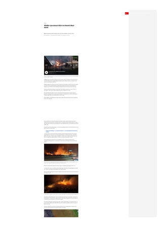
A satellite image shows wildfires in Maui on Tuesday. (European Union/Copernicus SENTINEL-2/Reuters)
A charred boat lies in the scorched waterfront in Maui on Wednesday. (Mason Jarvi/Reuters)
Members of a Hawaii Department of Land and Natural Resources wildland firefighting crew in Maui battle a
fire in Kula on Tuesday. (Matthew Thayer/The Maui News/The Associated Press)](data:image/gif;base64,R0lGODlhAQABAIAAAAAAAP///yH5BAEAAAAALAAAAAABAAEAAAIBRAA7)
Recommended
More Related Content
Similar to Wildfire 'apocalypse' kills 6 on Hawaii's Maui island
Similar to Wildfire 'apocalypse' kills 6 on Hawaii's Maui island (18)
Recently uploaded
Recently uploaded (14)
Wildfire 'apocalypse' kills 6 on Hawaii's Maui island
- 1. World Wildfire 'apocalypse' kills 6 on Hawaii's Maui island Blazes fanned by winds of distant hurricane force residents, tourists to flee Thomson Reuters · Posted: Aug 09, 2023 9:50 AM EDT | Last Updated: 4 hours ago High winds propelled fires across the Hawaiian island of Maui, killing at least six people and severely damaging the historic town of Lahaina. Wildfires fanned by winds of a distant hurricane killed at least six people and devastated much of Hawaii's Maui island on Wednesday, forcing thousands to flee and some to escape into the ocean to avoid smoke and flames. Multiple neighbourhoods were burned to the ground as the western side of the island, including the historic town of Lahaina which is popular with tourists, was nearly cut off with only one highway open as officials told of widespread devastation that was still too early to quantify. "We just had the worst disaster I've ever seen. All of Lahaina is burned to a crisp. It's like an apocalypse," said Lahaina resident Mason Jarvi, who escaped from the city. Jarvi showed Reuters pictures he took of the ashen-colored destruction along the Lahaina waterfront. Wearing shorts, he also showed blisters on his thigh that he said he suffered when riding through flames on his electric bike to save his dog. With firefighters still battling three major blazes, western Maui was closed to all but emergency workers and evacuees. At least 4,000 tourists were still trying to leave western Maui, said Ed Sniffen of the Hawaii Department of Transportation. Though at least 16 roads were closed, the Maui airport was still operating fully and airlines were dropping fares and offering waivers to get people off the island, Sniffen said. Panicked evacuees posted images on social media showing clouds of smoke billowing over once- idyllic beaches and palm trees. Expect more wildfires — in Europe and beyond — as society grapples with warming climate "I was the last one off the dock when the firestorm came through the banyan trees and took everything with it. And I just ran out and helped everyone I could along the way," said Dustin Johnson, who was in Lahaina Harbor working for a charter boat company that offers two-hour tours. He spoke from Kahului Airport, normally a 25-minute drive east of Lahaina. Some people were forced to jump into the Pacific Ocean to escape the smoke and fire conditions, prompting the U.S. Coast Guard to rescue them, according to a Maui County press release. Officials said they were looking into witness reports of people being trapped in their cars. "Our main focus now is to save lives, preventing human suffering, and mitigating great property loss," Maui County Mayor Richard Bissen told a news briefing. Bissen had few details about the deaths, saying he had just been informed of the number before the briefing started. "Everything is fluid and dynamic. They are doing search and rescue as we speak," said National Guard Maj.-Gen. Kenneth Hara, urging tourists to leave Maui, adding they could seek refuge at a convention centre in Honolulu, on the island of Oahu. Evacuation efforts were complicated by power outages and disruption to cell phone service, as communication with the west side of Maui was only available via satellite, Lieutenant Governor Sylvia Luke said. "We have shelters that are overrun. We have resources that are being taxed," Luke said. The state had opened at least five evacuation shelters, she added. Search Sign In Top Stories Local Climate World Canada Politics Indigenous Opinion The National Business Health Entertainment Science CBC News Investigates Go Public About CBC News Being Black in Canada 4 hours ago | Paradise burns as wildfires rip across Maui 2:04 Fire and smoke from wildfires fill the sky over the intersection of Hokiokio Place and Lahaina Bypass in Maui, Hawaii, on Tuesday. (Zeke Kalua/County of Maui/The Associated Press) An aerial view of a wildfire is shown in Maui on Tuesday. (Clint Hansen of Maui Real Estate Radio/TMX/Reuters) MENU
- 2. The situation in Hawaii mirrored scenes of devastation elsewhere in the world this summer, as wildfires caused by record-setting heat forced the evacuation of tens of thousands of people in Greece, Spain, Portugal and other parts of Europe. Parts of Canada — particularly in British Columbia, Quebec and northwestern Ontario — have also seen extensive wildfires and evacuations. Human-caused climate change, driven by fossil fuel use, is increasing the frequency and intensity of such extreme weather events, scientists say, having long warned that government officials must slash emissions to prevent climate catastrophe. The White House issued a message of condolence from U.S. President Joe Biden, who praised the work of firefighters and ordered "all available Federal assets on the Islands to help with response." Besides the Hawaiian National Guard, the U.S. Coast Guard and Navy Third Fleets were assisting search and rescue efforts on Maui and the U.S. Marines were sending helicopters to the Big Island, while the U.S. Department of Transportation aided evacuation efforts, Biden said. The cause in Maui had yet to be determined but the National Weather Service said the fires were fueled by a mix of dry vegetation, strong winds, and low humidity. According to the University of Hawai'i, large fires are an almost annual occurrence in some parts of the Hawaiian archipelago, though the scope of these fires was unusual. By Tuesday night, hundreds of acres had already burned and roads and schools had closed in parts of Hawaii and Maui Counties, according to an emergency proclamation issued by acting Hawaii Gov. Sylvia Luke. Hawaii County encompasses the Big Island, which lies south of Maui. Air Canada, which operates one daily flight between Vancouver and Maui, told CBC News in an email on Wednesday that it is monitoring the situation. "Yesterday's flight from Maui to Vancouver was cancelled due to the fire impacting access to the airport," the airline said. Flights between Vancouver and Maui cancelled as wildfire burns across Hawaiian island "Road access remains affected, and we are evaluating other options, including [opportunities] to operate an evening flight with a larger aircraft to accommodate all affected passengers, pending airport access and other operational considerations." Officials said the winds from Hurricane Dora fanned the flames across the state. The storm was about 1,380 kilometres southwest of Honolulu as of 11 a.m. local time, the National Hurricane Center said. The worst of the high winds should end by late Wednesday or early Thursday, said Ian Martin, an NWS forecaster in Honolulu. With files from CBC News CBC's Journalistic Standards and Practices | About CBC News Corrections and clarifications | Submit a news tip | Report error RELATED STORIES Wildfires force locals, tourists to evacuate Greek islands PHOTOS Firefighters battle Portugal wildfires as neighbouring Spain swelters in 40 C heat 2 pilots killed in Canadair plane crash while fighting wildfires in Greece A variety of newsletters you'll love, delivered straight to you. Sign up now My Account Profile CBC Gem Newsletters About CBC Accounts Connect with CBC Facebook Twitter YouTube Instagram Mobile RSS Podcasts Contact CBC Submit Feedback Help Centre Audience Relations, CBC P.O. Box 500 Station A Toronto, ON Canada, M5W 1E6 Toll-free (Canada only): 1-866-306-4636 About CBC Corporate Info Sitemap Reuse & Permission Terms of Use Privacy Jobs Our Unions Independent Producers Political Ads Registry AdChoices Services Ombudsman Corrections and Clarifications Public Appearances Commercial Services CBC Shop Doing Business with Us Renting Facilities Radio Canada International CBC Lite Accessibility It is a priority for CBC to create products that are accessible to all in Canada including people with visual, hearing, motor and cognitive challenges. Closed Captioning and Described Video is available for many CBC shows offered on CBC Gem. About CBC Accessibility Accessibility Feedback ©2023 CBC/Radio-Canada. All rights reserved. Visitez Radio-Canada.ca A satellite image shows wildfires in Maui on Tuesday. (European Union/Copernicus SENTINEL-2/Reuters) A charred boat lies in the scorched waterfront in Maui on Wednesday. (Mason Jarvi/Reuters) Members of a Hawaii Department of Land and Natural Resources wildland firefighting crew in Maui battle a fire in Kula on Tuesday. (Matthew Thayer/The Maui News/The Associated Press)