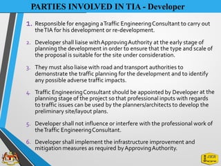
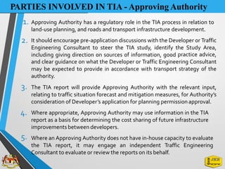
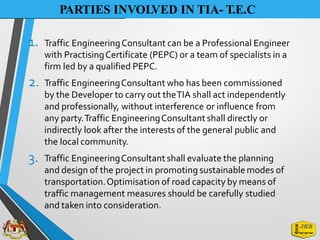
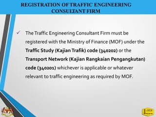
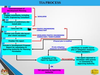
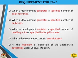
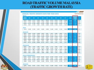
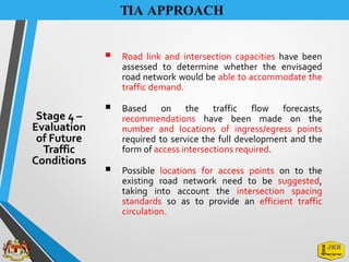
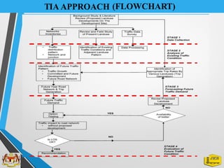
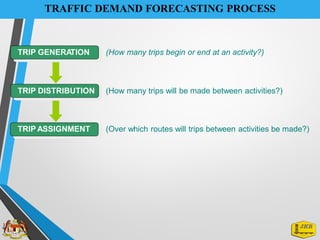
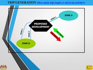
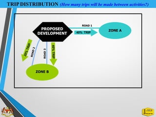
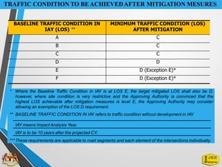
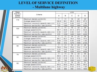
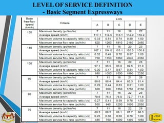
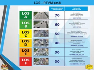
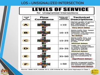
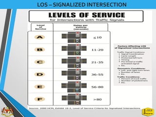
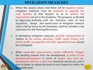
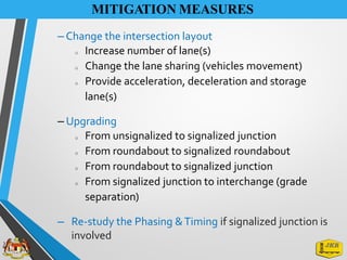
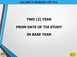
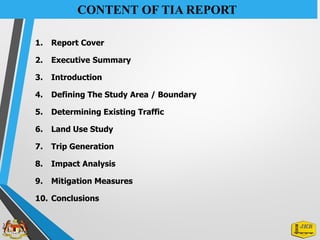
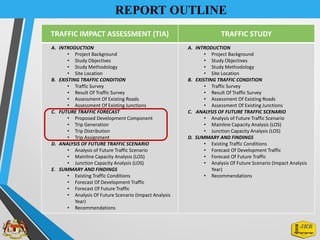
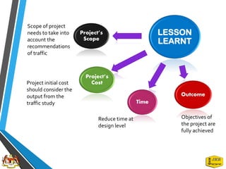
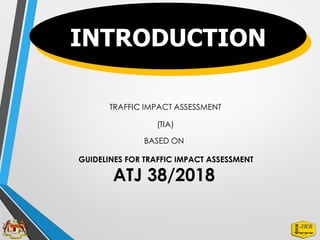
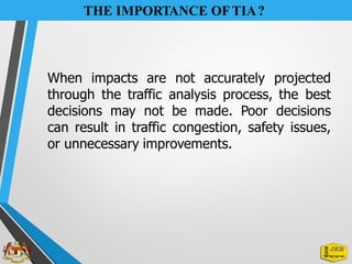
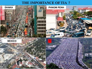
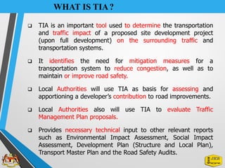
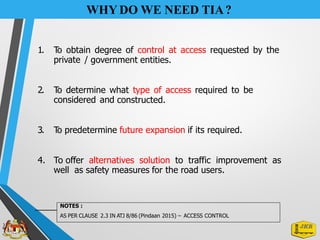
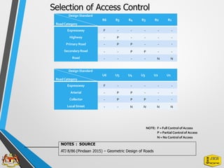
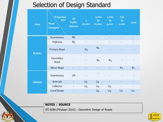
The document outlines the Traffic Impact Assessment (TIA) guidelines and processes essential for determining the traffic and transportation impact of proposed site developments in Malaysia. It highlights the importance of TIA in making informed decisions to mitigate congestion and safety issues, detailing the roles of developers, approving authorities, and traffic engineering consultants throughout the process. Furthermore, it includes regulatory requirements, necessary technical inputs, and the stages involved in conducting a TIA, with specific trigger levels for when a TIA is required.
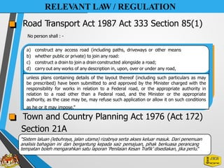
![Berdasarkan Seksyen 5 (Akta Perwakilan Kuasa 1956: Akta 358), Menteri
mewakilkan kuasanya di bawah Seksyen 85: Akta Pengangkutan Jalan 1987
berkenaan Jalan Persekutuan kepada Pegawai yang diperturunkan bagi
meluluskan permohonan untuk membina jalan masuk ke Jalan Persekutuan
kepada Pengarah Negeri melalui Warta Kerajaan P.U. (B) 44.
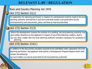
RELEV
ANT LA
W / REGULATION
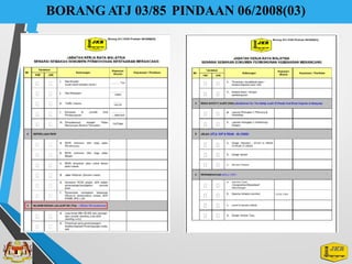
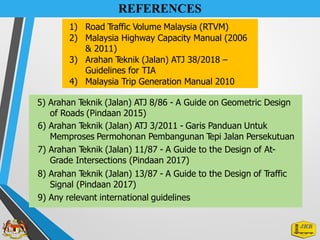
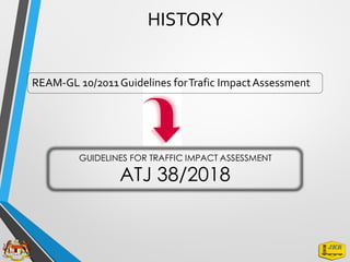
ATJ 3/2011 Garis Panduan Untuk Memproses
Permohonan
Persekutuan
Pembangunan T
epi Jalan
[RSD]
Klausa 1.3 Pegawai Yang Diberi Kuasa Meluluskan Permohonan
Penetapan jenis persimpangan yang diadakan mestilah atau berasaskan kepada
jumlah lalulintas yang akan dijanakan. Untuk skim pembangunan yang
melibatkan lebih daripada 200 unit dwellers atau 4,100 meter persegi
keluasan lantai kasar (gross floor area) pembangunan komersial, satu
laporan penilaian impak lalulintas oleh Jurutera Profesional wajib disediakan.
Klausa 2.1.7 - Polisi Am (Pembangunan Tepi Jalan)](https://image.slidesharecdn.com/pengenalantia-240711062634-0ccd843d/85/TRAFFIC-IMOACT-ASSESSMENT-AN-OVERVIEW-pdf-13-320.jpg)