1. LOCATING ACCESS POINTS FOR KAYAKING ALONG COASTAL
EAST HANTS AND THE SHUBENACADIE RIVER ESTUARY
INTRODUCTION
Nature-based, adventure activities are a grow-
ing sector of the tourism industry in Nova Scotia. Sea
kayaking is a nature-based adventure activity that
is gaining popularity and provides an exciting and
unique way to capitalize on Nova Scotia’s coastline.
The Municipality of East Hants, Nova Scotia has
identified access to the Shubenacadie River for out-
door water-based recreation as a prime opportunity
to grow their tourism sector.
The research purpose of this project was to
identify opportunities for public access along the tidal
portion of the Shubenacadie River and the coast of
East Hants for kayaking. The objective was to locate
launch sites that consider environmental sensitivity,
safety and accessibility. The goal was to analyze both
the capability and the suitability of the shoreline to
support a kayak launch. Land capability represents
the potential capacity of land to support a given use
and is determined by the biophysical characteristics
of the land. Land suitability represents how suitable
the land is to a particular use as determined by the
social and economic factors.
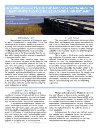
STUDY AREA
The study area for this project is the coast of the
Minas Basin and Cobequid Bay as well as the tidal por-
tion of the Shubenacadie River in East Hants.The shore
of the Shubenacadie River and coastal East Hants are
characterized by large salt marshes, mudflats, the high-
est cliffs on the mainland Nova Scotia and the highest
tidal range on earth.
The land uses in this area are mostly agricultural
and residential. The coastal zone is relatively unde-
veloped. There are also many historic sites along the
river and the coast. The village of Maitland, located at
the mouth of the Shubenacadie River, is home to Nova
Scotia’s first Heritage Conservation District. Dyked
farm land, first developed by the Acadian settlers in the
1600s, is dispersed throughout the coast. This combi-
nation of the physical environment and the historic, rural
landscape creates beautiful views for paddlers. This
area of the Shubenacadie River and coastal East Hants
possesses a picturesque charm that has potential to
draw in kayakers looking for a new and interesting
experience.
Emily Edwards
Bachelor of Community Design, Honours Environmental Planning
School of Planning, Dalhousie University
April 8, 2016
Thesis Supervisor: Dr. Patricia Manuel
LITERATURE REVIEW
A literature review was conducted and
provides an overview of two central themes that are
vital in creating access points for small craft launch
sites: elements of a successful launch site and the
legal issues associated with coastal water access.
To establish the elements that create a suc-
cessful small craft launch site, the United States
National Park Service’s Logical Lasting Launches, the
Trans Canada Blueways Guidelines and expert kay-
akers in the Province of Nova Scotia were consulted.
Also explored was the current state of public coast-
al access in Nova Scotia. Only 13% of the coastal
property is publicly owned in NS and only 2% of the
property in this study area is publicly owned.
METHOD
Multiple Criteria Evaluation (MCE) is the process
that was followed to determine site capability and
suitability. Geographic Information Systems (GIS) is the
tool that was used to conduct this analysis. MCE in GIS
is a method of decision-making that allows different
criteria to be combined to reach a set goal. The criteria
are measured on a comparative scale that uses a score
value. The higher the score, the better the criteria to
meet a set goal.
In this process, the criteria were defined, scored
and mapped using knowledge gained from site visits,
aerial photography, expert consultation, the
literature review and data supplied by the Planning
Department in the Municipality of East Hants.
Government of Nova Scotia. (2009). Coastal Technical report: Chapter 6 Public Coastal Access.
2. RESULTS &
RECOMMENDATIONS
An examination of the final capability
and suitability maps identified five
sites for kayak launches in coastal
East Hants. Four of these sites are
located on the coast and one is
located on the Shubenacadie River.
The product of this work is an
opportunities and constraints
analysis of the five sites. Also in-
cluded is a description of the safety
concerns that should be taken into
consideration when paddling in the
area. As the Municipality of East
Hants studies the expansion of its
tourism sector, the planning
department should consider adven-
ture tourism. The coast of East Hants
has the potential to attract tourists
looking for a unique sea kayaking
experience. If the Municipality
decides to expand its adventure
tourism sector, the five launch sites
proposed in this report should be
considered.
SUITABILITY CRITERIA
Distance to roads
Wharves
Distance to points of interest
Land ownership
CAPABILITY CRITERIA
Coastal slope
Coastal landforms
Marshland
PROCESS
1. Define the Objective
2. Identify the Criteria: capability and
suitability criteria
3. Score the Criteria
4. Collect the Data
5. Map the Criteria
6. Combine the Criteria: to create final
capability and suitability maps
7. Interpret the Results
8. Analysis of Best Sites
SCORING OF CRITERIA
3 = Most suitable
2 = Suitable
1 = Least Suitable
-9999 = Constraint
Committed 2 the Core Sea Kayaking. (2015). The Shubie.