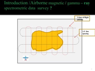
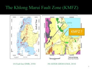
Introduction (airborne magnetic+ gamma ray + faults)
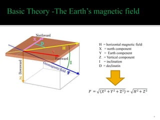
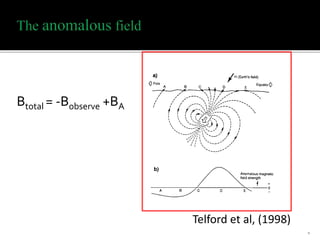
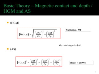
Basic theory (magnetic + gamma)
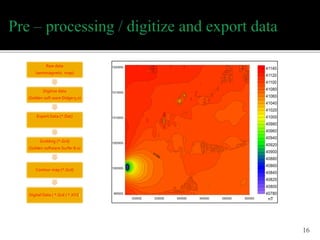
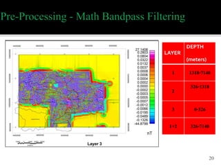
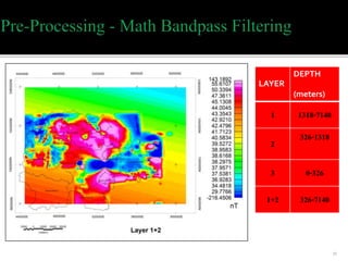
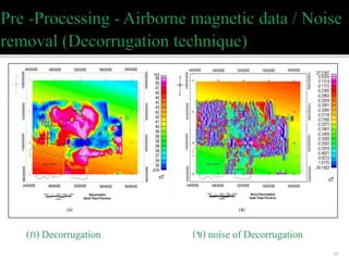
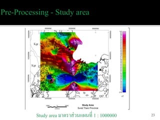
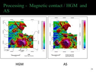
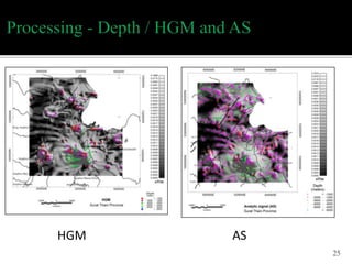
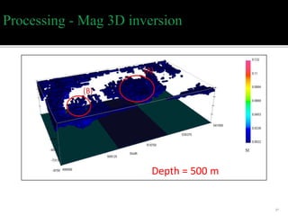
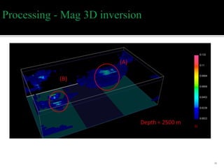
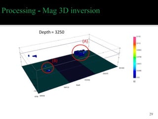
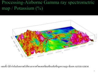
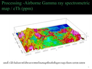
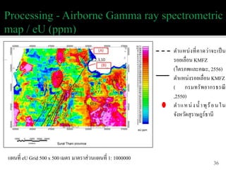
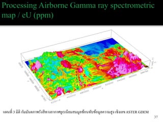
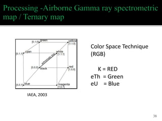
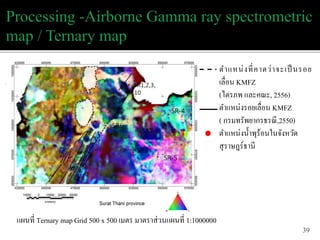
Processing data (pre-processing and processing)
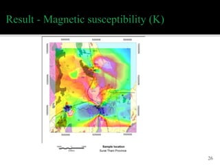
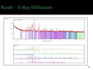
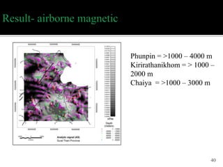
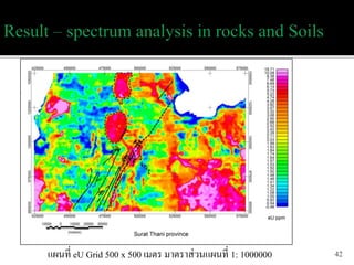
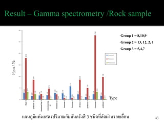
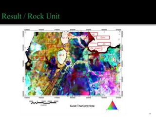
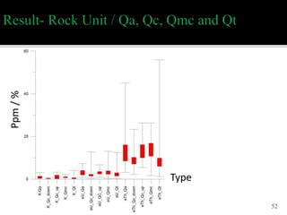
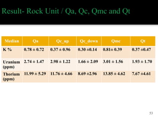
Result
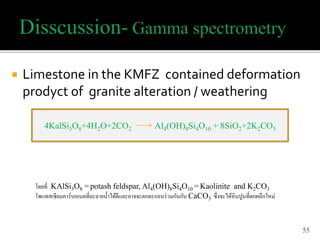
Discussion
2
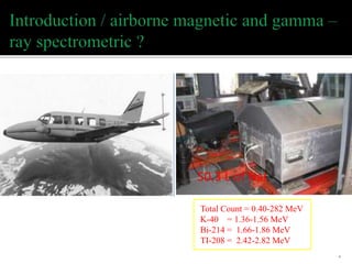
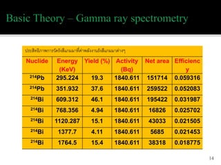
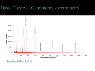
Total Count =0.40-282 MeV
K-40 = 1.36-1.56 MeV
Bi-214 = 1.66-1.86 MeV
TI-208 = 2.42-2.82 MeV
4
50.3 L of NaI
5.
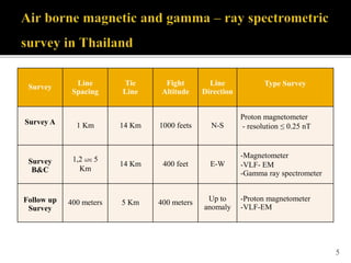
5
Survey Line
Spacing
Tie
Line
Fight
Altitude
Line
Direction
Type Survey
SurveyA 1 Km 14 Km 1000 feets N-S
Proton magnetometer
- resolution ≤ 0.25 nT
Survey
B&C
1,2 และ 5
Km
14 Km 400 feet E-W
-Magnetometer
-VLF- EM
-Gamma ray spectrometer
Follow up
Survey
400 meters 5 Km 400 meters Up to
anomaly
-Proton magnetometer
-VLF-EM
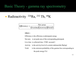
Radioactivity 226Ra,232 Th, 40K
11
YieldActivitylivetime
areaNet
Efficiency
where :
Efficiency is the efficiency at photopeakenergy
Net area is net peak area of the correspondingphotopeak
Live time is collectedtime (7200 secound )
Activity is the activity level of a certain radionuclide(Bq/kg)
Yield is the emission probability of the gamma line corresponding to
the peak energy (%)
16
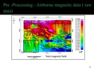
Raw data
(aeromagnetic map)
Digitizedata
(Golden soft ware Didger3.0)
Export Data (*.Dat)
Gridding (*.Grd)
(Golden software Surfer 8.0)
Contour map (*.Grd)
Digital Data ( *.Grd / *.XYZ)
nT
47
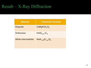
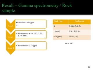
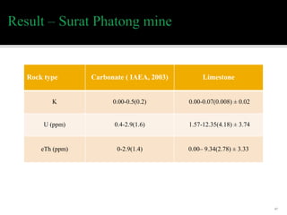
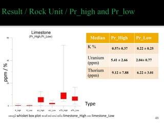
Rock type Carbonate( IAEA, 2003) Limestone
K 0.00-0.5(0.2) 0.00-0.07(0.008) ± 0.02
U (ppm) 0.4-2.9(1.6) 1.57-12.35(4.18) ± 3.74
eTh (ppm) 0-2.9(1.4) 0.00– 9.34(2.78) ± 3.33
Technique AnalyticSignal (AS) corresponded with
Mag 3D inversion in term of magnetic contact and
depth
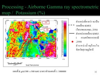
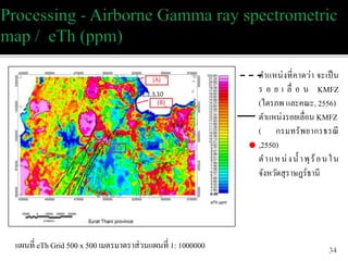
K-lineament, eU-lineament , eTh-lineament and
Ternary-lineament are related (geothermal area SR
1,2,3 and 10)
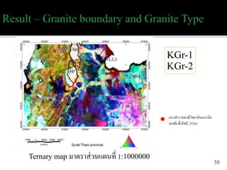
Could change the geology map of Surat Thani
Provimce such as Granite boundary
54
#4 การกำหนด line spacing ต้องพิจารณาที่รูปร่าง anomaly โดยความกว้าง และเข้ม จะเปลี่ยนตามความสูงของการบิน จะกำหนด ประมาณ 3 เท่าของความสูงจากผิวดินถึงเครื่องวัด Flight altitude ประมาณ 1 : 3 ระหว่าง อัตราส่วนความสูงกับระยะห่างของเส้นสำรวจ โดยทั่วๆ ไปอัตราส่วนระหว่าง line กับ tie ประมาณ 1 : 5 Line direction should be perpendicular with anomaly
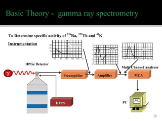
#13 ระบบวิเคราะห์สเปกโตรเมตรีรังสีแกมมาหัววัด HPGe
แหล่งจ่ายไฟฟ้าศักย์สูง (High Voltage Power Supply : HVPS) จะทำหน้าที่เปลี่ยนไฟฟ้ากระแสสลับ 220 โวลท์ ให้เป็นไฟฟ้ากระแสตรง
หัววัดรังสีจะเปลี่ยนพลังงานรังสีไปเป็น electric pulse ซึ่งจะถูกส่งไปที่ PreAmp เพื่อปรับแต่งรูปสัญญาณ
แล้วส่งไปที่ Amp เพื่อขยายสัญญานให้มีความสูง (Voltage) ที่สัมพันธ์เชิงเส้นกับพลังงานรังสี
ความสูงของพัลส์จะถูกวิเคราะห์ที่ MCA