This is a collection of photos of waterfront developments in medium-sized cities located in the southern United States. It was prepared for the City of Daytona Beach Redevelopment Department as a visioning tool for possible improvements to their own waterfront.
Sandra Kuaihelani Stevens has over 14 years of experience as the Artistic Director and Office Manager of Ohana Arts Inc. in Hollywood, FL, where she facilitated Hawaiian educational workshops and cultural arts programs. She has a Bachelor's degree in Telecommunications & Film and French from the University of Oregon. Her professional experience also includes performing hula dancing at various locations in Florida and Hawaii as well as aerobics instruction. She has served in leadership roles for several community organizations in Florida.
Revisions to Newburyport Waterfront Redevelopment Plan - July 2013unionstudio
This slideshow summarizes the design revisions made and presented to the public from the periods between September 2012 and July 2013. Please use the forward arrows to advance through the presentation.
"The Harbour" Plan: A Waterfront For Us All
Grove Bay's "The Harbour" project (The Harbour, for short)
will maintain the historic structures and enhance the boat
services that exist there today. The proposed project includes restaurants and retail establishments, consolidate parking and reclaim surface lots for green space.
This document outlines the agenda for the Excellence on the Waterfront 28 conference held on November 7, 2014 in Washington, DC. It lists the jury members and thanks sponsors Ann and Dick. It then names two waterfront plans in Chicago, Illinois and Singapore that received Honor Awards. Several waterfront redevelopment projects are also highlighted that received Project Awards, including ones in Australia, New York City, Canada, and Arizona. The Detroit Riverwalk project in Michigan is described in more detail. Events of the conference like the Waterfront Winterfest and presentations of awards like the Clearwater Award and Student Award are noted. The top honor, the MAST Center on Governors Island, NYC, is featured and quoted to have been called "the
Master Plan for the Erie, PA Bayfront, prepared for the Erie Western-Pennsylvania Port Authority by Domokur Architects. Note this is a public document paid for by tax funds, and available at http://www.porterie.org/assets/021909_Erie%20Waterfront_Public%20Mtg%202.pdf.
Uploaded for the purpose of embedding in the site, www.YourNextDevelopment.com to enable real estate developers to complete due diligence in reviewing a property in Erie, PA.
This document lists the winners of the 2010 Statewide Preservation Awards in Florida. It recognizes outstanding achievements and meritorious achievements in categories such as restoration/rehabilitation, adaptive use, infill design, preservation education/media, historic landscapes/archaeology, master craftsmanship, organizational achievement, individual distinguished service, and lifetime achievement awards. Multiple properties, organizations, and individuals are honored in each category.
Anchorages on the Atlantic Intracoastal Waterwaychuckbear
This document provides a list of locations along the Atlantic Intracoastal Waterway from Norfolk, Virginia to Key West, Florida that are suitable as anchorages for boats. It includes specific sites in Virginia, North Carolina, South Carolina, Georgia, and Florida, ending with listings for Key Biscayne and Key West. The document is copyrighted as part of "The Great Book of Anchorages" publication focusing on that coastal route.
The Recreational Boating & Fishing Foundation (RBFF) and its Take Me Fishing™ and Vamos A Pescar™ campaigns released the 2016 Top 100 Family-Friendly Places to Fish and Boat in June. Americans fell hook, line and sinker for the fishing experience at Florida’s Everglades National Park, which snagged the No. 1 position as the best place to fish and boat in the U.S. for the second consecutive year.
A well put together map and legend of the beautiful Sarasota, so when you are making plans to visit, you can see all the wonderful areas of Florida's own, Sarasota.
The document describes Taylor Davidson's travels across North America in 2007, visiting numerous national parks and places across the United States, Canada, and Baja California. It lists the locations visited in each state and province along the route, including national parks, cities, and recreational areas in Iowa, South Dakota, Colorado, Utah, California, Oregon, Washington, British Columbia, Alberta, Nevada, and Baja California. The document also provides Taylor Davidson's contact information and website.
The document lists over 50 projects completed by R. Alex Guthrie including renovations and constructions of various buildings, facilities, and casinos across the United States, Latin America, and the Caribbean ranging from airports and schools to military bases, government buildings, hotels and casinos for public and private owners.
The document summarizes the minutes from the November 20, 2008 meeting of the WCB Board. It discusses several items including land management plans in Tehama and Shasta Counties, expansions of ecological reserves and wildlife areas, habitat restoration projects, and a revised conservation easement monitoring policy which establishes requirements for grantees to monitor properties and report any violations.
The document summarizes Virginia's five geographic regions. It provides details about the characteristics of the Coastal Plain region, also known as Tidewater, including its location near the Atlantic Ocean and Chesapeake Bay, flat land, and industries like shipbuilding, tourism, fishing, and military bases. It then briefly discusses the Piedmont region between the Coastal Plain and Blue Ridge Mountains, describing its rolling hills, tobacco farming, and technology industries.
Virginia is divided into five geographic regions. The Coastal Plain region is located near the Atlantic Ocean and Chesapeake Bay. It has flat land and its major industries are seafood, shipbuilding, tourism, and military installations. The Piedmont region lies west of the Fall Line and has rolling hills. Its major products are tobacco and technology and its industries include technology, government, farming, and textiles. The Blue Ridge Mountains are located between the Piedmont and Valley/Ridge regions and are part of the Appalachian mountain system. Their major product is apples and industry is recreation. The Valley/Ridge region contains valleys and ridges and its major products are poultry and apples while its industry
Streetsboro presentation to city november 12Chris Coonan
The document repeatedly discusses "The Boardwalk at Shady Lake" located in Streetsboro, Ohio. It provides the name and location of the property over 30 times and includes two images showing the front entry corner and west facade as well as the perspective elevation of the east facade with the garage exit.
The document provides an overview of key geographical features of Georgia including major lakes and rivers that supply fresh water and transportation, prominent landforms such as the Blue Ridge and Appalachian Mountains and Okefenokee Swamp, dominant vegetation types across different regions including oak forests and floodplain forests, and sources for further information.
The Metropolitan Water District of Southern California serves 19 million people across 6 counties and supports an $800 billion economy. It provides over 50% of the region's water supply by importing water via the State Water Project, Colorado River Aqueduct, and other local sources. The governor has called a special legislative session in October to address the state's water crisis and reach an agreement on a Delta conservation strategy.
NostalgicOutdoors™- Olympic National Park Guide - Wilderness MAPNostalgicOutdoors™
This document contains a map of Olympic National Park in Washington State with information about trails, campsites, rivers, lakes, and permit offices. Key locations include the Wilderness Information Center in Port Angeles, multiple ranger stations, and trailheads throughout the park. Contact information and requirements are provided for obtaining permits and camping in certain areas. The map shows trails, elevations, and geographic features and provides some notes about road and river conditions.
The document discusses the geography and history of Virginia. It describes the five geographic regions - Coastal Plain, Piedmont, Blue Ridge Mountains, Valley and Ridge, and Appalachian Plateau. It also discusses the Chesapeake Bay, major rivers including the James and York Rivers, Lake Drummond, and the Dismal Swamp. Finally, it provides information on Native American groups that lived in each region and settlements like Werowocomoco and Jamestown.
These are the places I have traveled to within the past year. I chose some of my favorite places I traveled too and just listed some facts about each place.
The document lists the names of various waterfalls around the world, including Dark Hollow Falls in Virginia, Foot Papalua Falls in Hawaii, Aitone Water Falls in Corse-France, Angel Falls in Venezuela, Bridal Veil Falls in New Zealand, and Blackwater Falls in West Virginia in the United States. It provides the names of over 30 different waterfalls located across multiple countries on different continents.
Lower Savannah Bike Pedestrian Recommended NetworkLSCOG
This document contains a list of place names and roads located across multiple counties in South Carolina and parts of Georgia. It includes names of cities, parks, trails, nature preserves, highways and local roads spanning Aiken, Barnwell, Bamberg, Orangeburg, Calhoun, and Allendale counties. The place names and roads shown connect various towns and natural areas across the region.
The document appears to be a list of over 400 projects completed by Frederick Law Olmsted, Jr. including parks, subdivisions, schools, and other landscaping projects across several US states and Canadian provinces. The projects are listed with names of locations and clients/companies.
This document lists the names of various lakes around the world along with their locations. It includes lakes in national parks and mountain regions in places like Canada, California, South Dakota, Wisconsin, Colorado, Nevada, Washington, Alaska, Libya, Switzerland and Oregon. Many of the lakes are described as being located near specific mountains or as providing scenic views.
The document features names and locations of various lakes around the world for scenic views and outdoor relaxation activities. Some of the lakes mentioned include Vermillion Lake in Banff National Park, Canada, Mono Lake in California known for its tufa towers, Sylvan Lake in the Black Hills of South Dakota, and lakes in national parks in states like Wisconsin, Colorado, Washington, and Montana that offer beautiful natural landscapes for enjoying nature.
The document provides the names and locations of various lakes around the world for scenic views and relaxation, including lakes in national parks in Canada, the United States, Switzerland, Libya, and locations offering activities like canoeing, hiking, and photography.
RPWORLD offers custom injection molding service to help customers develop products ramping up from prototypeing to end-use production. We can deliver your on-demand parts in as fast as 7 days.
World trade center in kerala proposal- AR. DEEKSHITH MAROLI 724519251008 REPORTdeekshithmaroli666
World trade center live proposal in kerala.
Future of our nation is looking towards kerala..?
Yes, because the biggest sludge less port is going to open in kerala soon and also about the hidden massing growth of tourism, it , business sector
Value based approach to heritae conservation -.docxJIT KUMAR GUPTA
Text defines the role, importance and relevance of value based approach in identification, preservation and conservation of heritage to make it more productive and community centric.
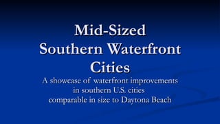
1. Mid-Sized
Southern Waterfront
Cities
A showcase of waterfront improvements
in southern U.S. cities
comparable in size to Daytona Beach
2. Methodology
How were these cities chosen?
U.S. Census data provided a list of metro areas having a
population approximately 150,000 greater or less than the
population of the Daytona Metropolitan Statistical Area which
was 443,343 in 2008 (population range of 293,000 to 589,959)
Cities lacking waterfronts were culled from the list.
Jacksonville and Cocoa were added.
How are they organized in this show?
By geographic region: Atlantic Coast, Gulf Coast, and inland
rivers or lakefronts.
28. Gulf Coast Cities
Ft. Myers (on the Caloosahatchee River)
Sarasota (Sarasota Bay / ICW)
Bradenton (on the Manatee River)
Pensacola (Pensacola Bay)
Mobile (Alabama River, Mobile Bay)
Corpus Christi (Corpus Christi Bay & shipping
channel)