South loup timeline 2.0
•Download as PPTX, PDF•
0 likes•24 views

The document consists of weekly entries from June 17, 2015 to June 8, 2016 documenting water levels or conditions along the South Loup river between the towns of Arnold and St. Michael in Nebraska. Each entry contains the date and location but no other details, suggesting routine monitoring of water levels along this stretch of river over a period of nearly one year.

Recommended
More Related Content
Recently uploaded
Recently uploaded (20)
Featured
Featured (20)
South loup timeline 2.0
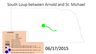
- 1. South Loup between Arnold and St. Michael 06/17/2015
- 2. South Loup between Arnold and St. Michael 06/24/2015
- 3. South Loup between Arnold and St. Michael 07/01/2015
- 4. South Loup between Arnold and St. Michael 07/08/2015
- 5. South Loup between Arnold and St. Michael 07/15/2015
- 6. South Loup between Arnold and St. Michael 07/22/2015
- 7. South Loup between Arnold and St. Michael 07/29/2015
- 8. South Loup between Arnold and St. Michael 08/05/2015
- 9. South Loup between Arnold and St. Michael 08/12/2015
- 10. South Loup between Arnold and St. Michael 08/19/2015
- 11. South Loup between Arnold and St. Michael 08/26/2015
- 12. South Loup between Arnold and St. Michael 09/02/2015
- 13. South Loup between Arnold and St. Michael 09/09/2015
- 14. South Loup between Arnold and St. Michael 09/16/2015
- 15. South Loup between Arnold and St. Michael 09/23/2015
- 16. South Loup between Arnold and St. Michael 09/30/2015
- 17. South Loup between Arnold and St. Michael 10/07/2015
- 18. South Loup between Arnold and St. Michael 10/14/2015
- 19. South Loup between Arnold and St. Michael 10/21/2015
- 20. South Loup between Arnold and St. Michael 10/28/2015
- 21. South Loup between Arnold and St. Michael 11/04/2015
- 22. South Loup between Arnold and St. Michael 11/11/2015
- 23. South Loup between Arnold and St. Michael 11/18/2015
- 24. South Loup between Arnold and St. Michael 11/25/2015
- 25. South Loup between Arnold and St. Michael 12/02/2015
- 26. South Loup between Arnold and St. Michael 12/09/2015
- 27. South Loup between Arnold and St. Michael 12/16/2015
- 28. South Loup between Arnold and St. Michael 12/23/2015
- 29. South Loup between Arnold and St. Michael 12/30/2015
- 30. South Loup between Arnold and St. Michael 01/06/2016
- 31. South Loup between Arnold and St. Michael 01/13/2016
- 32. South Loup between Arnold and St. Michael 01/20/2016
- 33. South Loup between Arnold and St. Michael 01/27/2016
- 34. South Loup between Arnold and St. Michael 02/03/2016
- 35. South Loup between Arnold and St. Michael 02/10/2016
- 36. South Loup between Arnold and St. Michael 02/17/2016
- 37. South Loup between Arnold and St. Michael 02/24/2016
- 38. South Loup between Arnold and St. Michael 03/02/2016
- 39. South Loup between Arnold and St. Michael 03/09/2016
- 40. South Loup between Arnold and St. Michael 03/16/2016
- 41. South Loup between Arnold and St. Michael 03/23/2016
- 42. South Loup between Arnold and St. Michael 03/30/2016
- 43. South Loup between Arnold and St. Michael 04/06/2016
- 44. South Loup between Arnold and St. Michael 04/13/2016
- 45. South Loup between Arnold and St. Michael 04/20/2016
- 46. South Loup between Arnold and St. Michael 04/27/2016
- 47. South Loup between Arnold and St. Michael 05/04/2016
- 48. South Loup between Arnold and St. Michael 05/11/2016
- 49. South Loup between Arnold and St. Michael 05/18/2016
- 50. South Loup between Arnold and St. Michael 05/25/2016
- 51. South Loup between Arnold and St. Michael 06/01/2016
- 52. South Loup between Arnold and St. Michael 06/08/2016