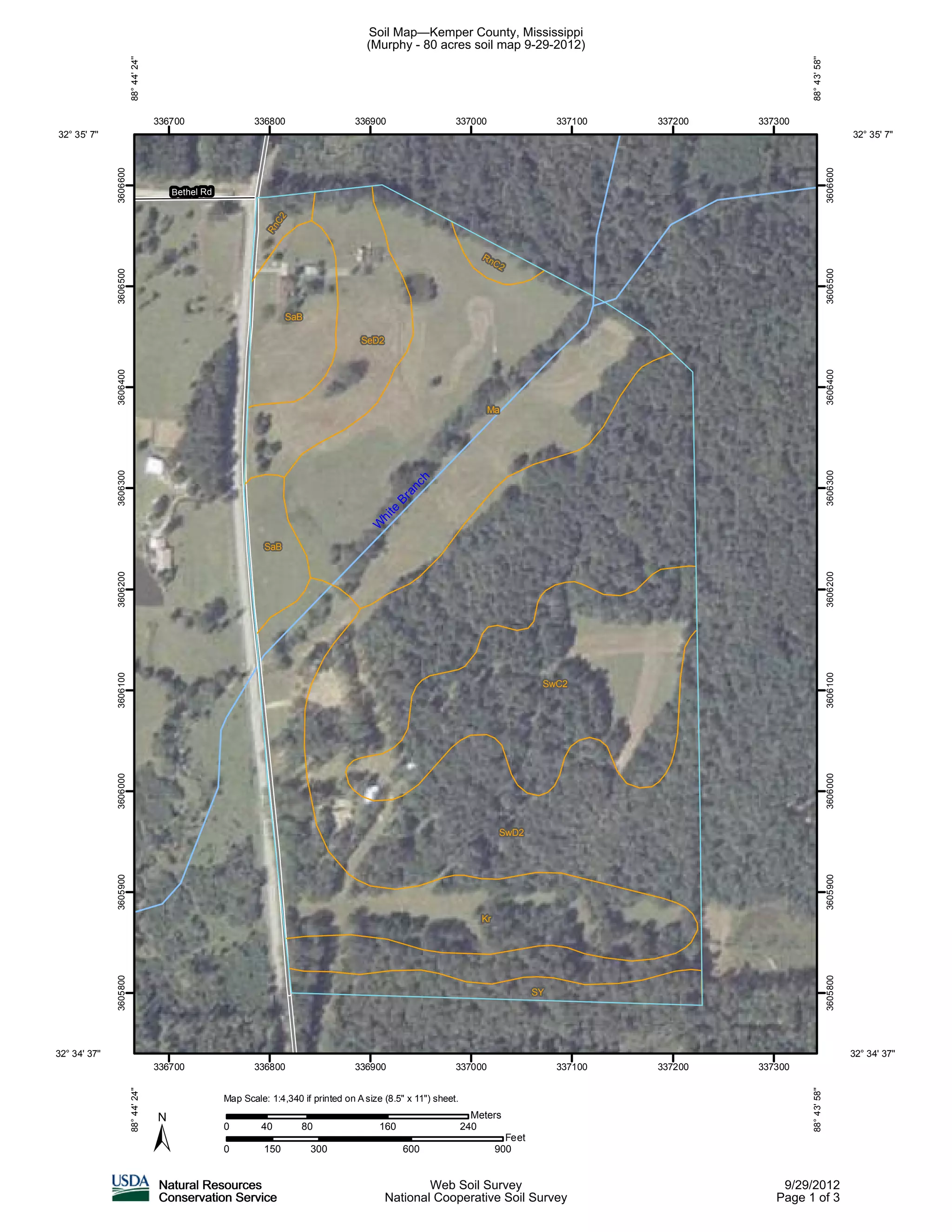
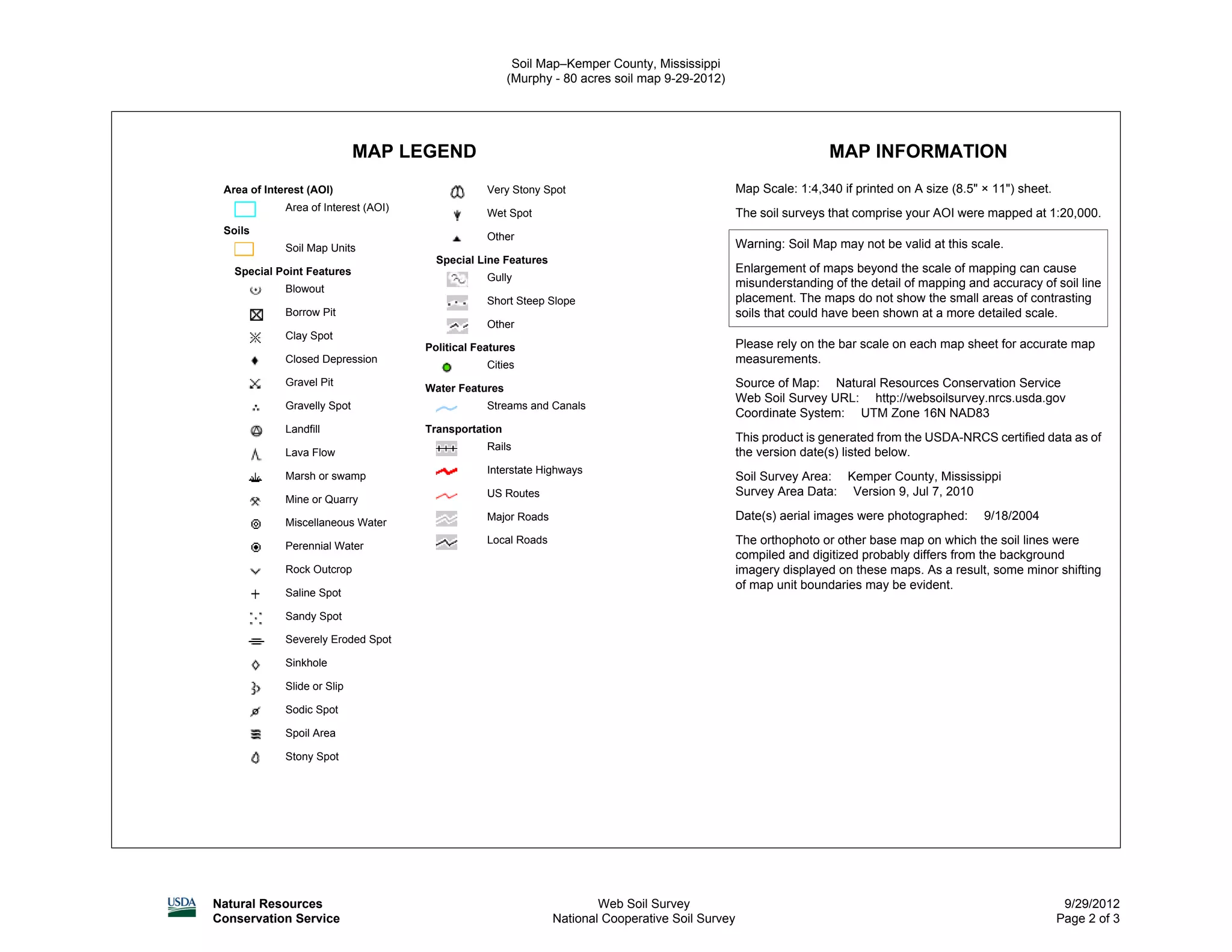
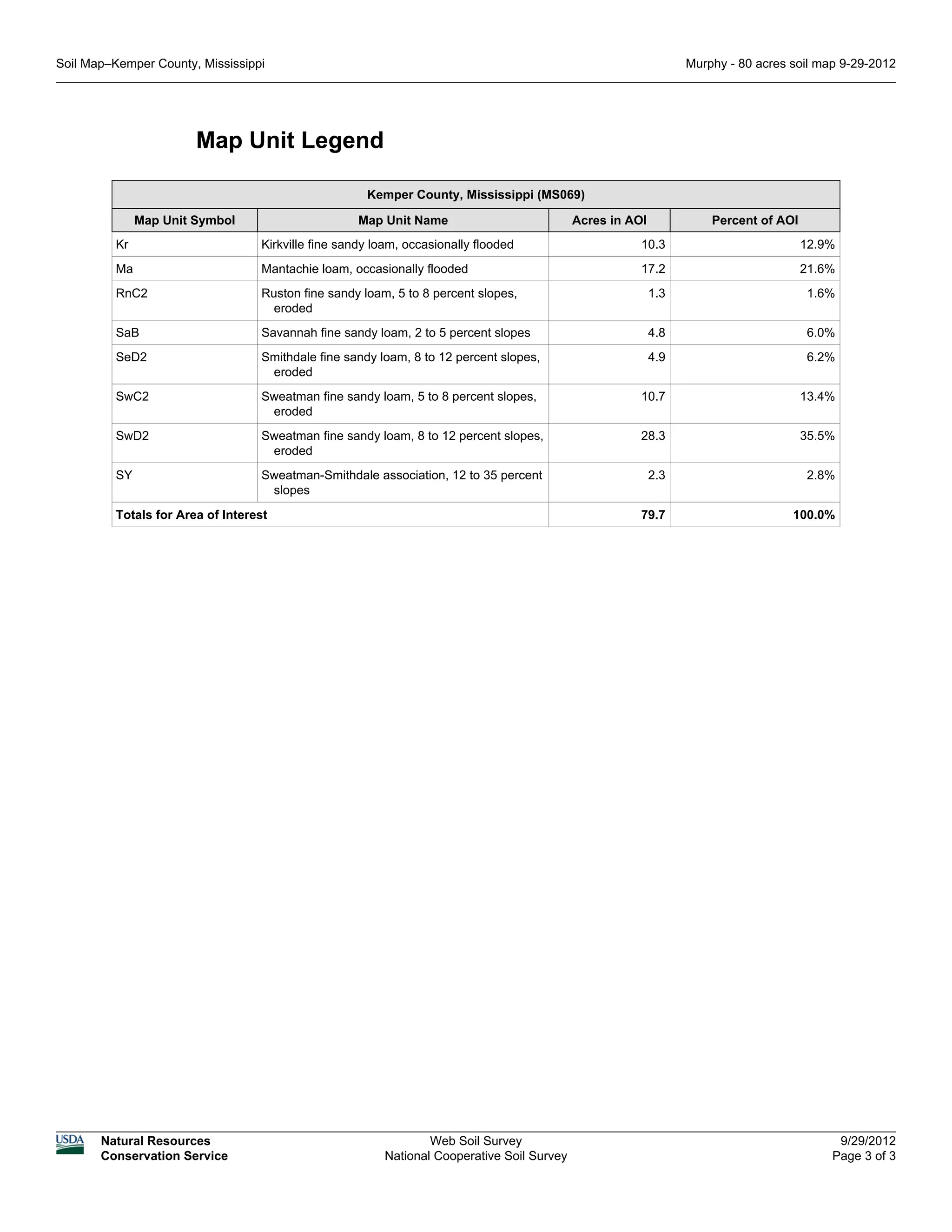
This document is a soil map of an 80-acre area of interest in Kemper County, Mississippi. The map legend identifies 8 different soil map units that are found within the area, along with their acreage and percentage of the total area. These soils include Kirkville fine sandy loam, Mantachie loam, Ruston fine sandy loam, Savannah fine sandy loam, Smithdale fine sandy loam, Sweatman fine sandy loam, and Sweatman-Smithdale association. The map also provides information on the map scale and source, and an overview of the soil survey for Kemper County, Mississippi.