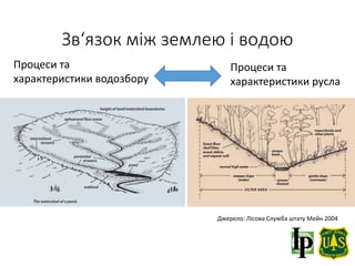
Зв‘язок між землеюі водою
Джерело: Лісова Служба штату Мейн 2004
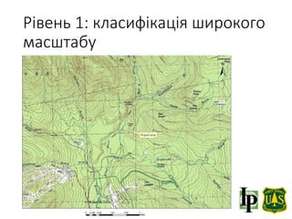
Процеси та
характеристики водозбору
Процеси та
характеристики русла
3.
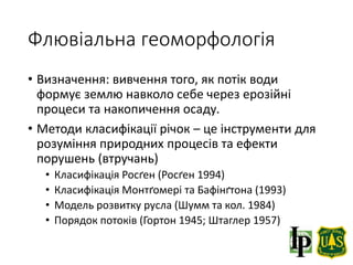
Флювіальна геоморфологія
• Визначення:вивчення того, як потік води
формує землю навколо себе через ерозійні
процеси та накопичення осаду.
• Методи класифікації річок – це інструменти для
розуміння природних процесів та ефекти
порушень (втручань)
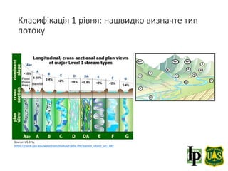
• Класифікація Росґен (Росґен 1994)
• Класифікація Монтґомері та Бафінґтона (1993)
• Модель розвитку русла (Шумм та кол. 1984)
• Порядок потоків (Гортон 1945; Штаглер 1957)
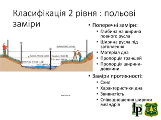
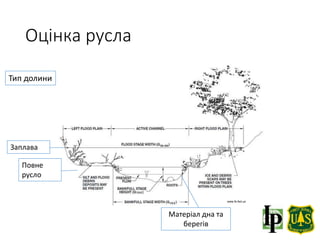
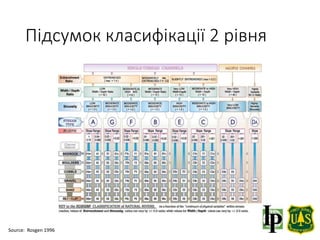
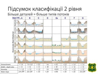
Класифікація 2 рівня: польові
заміри • Поперечні заміри:
• Глибина на ширина
повного русла
• Ширина русла під
затоплення
• Матеріал дна
• Пропорція траншей
• Пропорція ширини-
довжини
• Заміри протяжності:
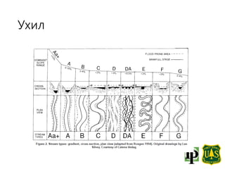
• Схил
• Характеристики дна
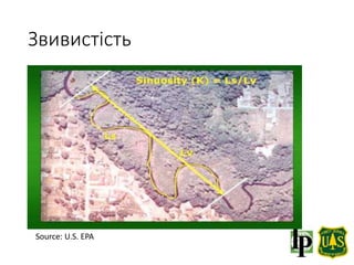
• Звивистість
• Співвідношення ширини
меандрів
www.fs.fed.us
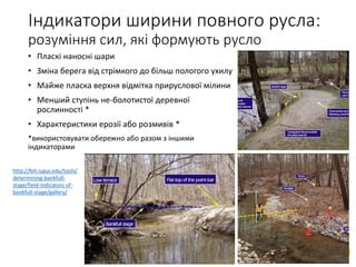
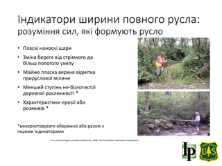
Індикатори ширини повногорусла:
розуміння сил, які формують русло
• Пласкі наносні шари
• Зміна берега від стрімкого до
більш пологого ухилу
• Майже пласка верхня відмітка
прируслової мілини
• Менший ступінь не-болотистої
деревної рослинності *
• Характеристики ерозії або
розмивів *
*використовувати обережно або разом з
іншими індикаторами
From Vermont Agency of Natural Resources, 2009. “Vermont Stream Geomorphic Assessment”
12.
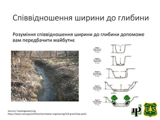
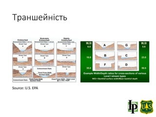
Співвідношення ширини доглибини
Sources: Cuyahogaswcd.org,
https://www.como.gov/utilities/stormwater-engineering/319-grant/step-pool/
Розуміння співвідношення ширини до глибини допоможе
вам передбачити майбутнє
Підхід A- ЗАМЕЖАМИ
БУФЕРНОЇ ЗОНИ
Підхід A –
ВСЕРЕДИНІ
БУФЕРНОЇ ЗОНИ
Структура
переходу
Русло
потоку
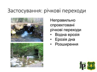
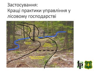
Застосування:
Кращі практики управління у
лісовому господарстві
20.
Посилання та додатковаінформація
• Rosgen, D.L. and H.L. Silvey. 1996. Applied River
Morphology. Wildland Hydrology Books, Fort Collins,
CO
• US EPA Watershed Academy Web, Fundamentals of
Rosgen Stream Classification System
https://cfpub.epa.gov/watertrain/moduleFrame.cfm?
parent_object_id=1189