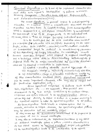
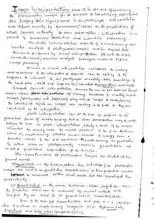
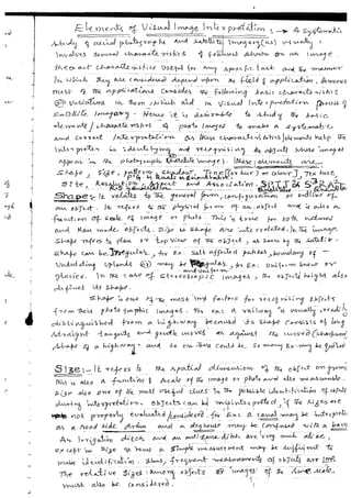
Download to read offline


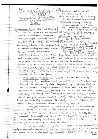
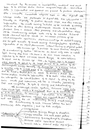
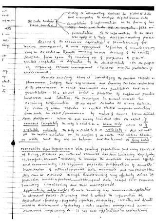
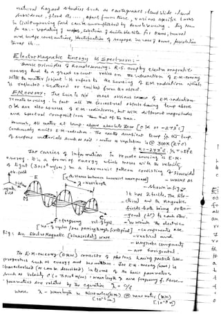


Introduction, Definition of R. S., Necessity / Importance, Application and/or Scope, Electro Magnetic Energy (E.M.E ) & Spectrum, Electro Magnetic Spectrum, Atmospheric Windows, Wave Length Regions and their applications in R S , Interaction of E M E with matter, Effect of atmosphere on E M Radiation, Absorption, Classification of Remote Sensing, Energy Interaction with Earth Surface Features, Energy Reluctance and Surface Characteristics of Earth Features/matter,Remote Sensing Sensor(s) & Platform for R S, Types of Sensor(s),Thematic Mapper,Platform for R .S., Indian Remote Sensing Satellites [ I R S ] , Air borne Platforms, Space borne Platforms, Satellite, Types: Geo Stationary & Sun Synchronus Satellites, Ideal [ and / or Real ] R S System, Spectral Signature, Image Interpretation, Elements of Visual Image Interpretation, Image Interpretation Keys, Satellite Imagery / Digital Image, Digital Image Processing,Advantages and Disadvantages &/or Limitations of R S., Practical Field Applications, R S applications in Geographical Information System [ G I S ].


![Satellite Based Positioning System [SBPS/GPS]](https://cdn.slidesharecdn.com/ss_thumbnails/unit1g-200303105743-thumbnail.jpg?width=640&height=640&fit=bounds)


