Fulton Randolph Market District Plan (Presented 4/1/14)
•
1 like•2,522 views

This was presented on April 1, 2014 to the West Loop community. It outlines the latest thinking from Chicago's Department of Planning and Development and CDOT on Chicago's Randolph Fulton Market District. The deck includes rough guidelines on: - zoning and land use - building design principles - Historic District designation - Traffic/parking studies, and streetscape recommendations - Weekly market For more information, check out http://neighborsofwestloop.com.

Recommended
More Related Content
Similar to Fulton Randolph Market District Plan (Presented 4/1/14)
Similar to Fulton Randolph Market District Plan (Presented 4/1/14) (20)
Recently uploaded
Recently uploaded (16)
Fulton Randolph Market District Plan (Presented 4/1/14)
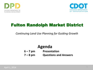
- 1. Fulton Randolph Market District Continuing Land Use Planning for Guiding Growth April 1, 2014 1 Agenda 6 – 7 pm Presentation 7 – 8 pm Questions and Answers
- 2. 2 The General Land Use Plan in the 1998 Kinzie TIF Industrial Conservation Area identifies land uses expected to result from implementation - 1998
- 3. 3 Jobs in the Kinzie Industrial Corridor Total jobs 2011 17,720 • 73% of the total jobs are in Manufacturing or Industrial categories • 29% of the total jobs are in the Manufacturing and Wholesale Trade NAICS (includes food processing and food wholesale) Source: US Census Bureau, Center for Economic Studies
- 4. 4 2000 Adopted Land Use Framework
- 8. Existing industrial properties should be protected, although appropriate transitions to new uses should be allowed. Near Northwest Side Plan Near Northwest Side Plan 2002 Central Area Action Plan 2009
- 9. Retail Environment Main Street retail Restaurant and entertainment retail Specialized retail related to wholesale business
- 10. 10 Fulton – Randolph Market District
- 11. Food and Markets have and continue to define the Fulton - Randolph Market District Historic & Current Wholesale Food District Open air market with indoor facility Historic Food Retail & Current Restaurant District 11
- 12. Nexus of historic food wholesale and Chicago’s growing culinary arts movement. The most renowned chefs are using regional farm products. 12
- 13. Fulton – Randolph Market District 13
- 14. 14 What do Market Districts look like in other Cities? Cleveland: Ohio City Market District Kansas City: River Market District Seattle: Pike Place Market New York: Ganesvoort Market District Pittsburgh: Strip District
- 15. Since 2010, 25 new businesses have opened in Ohio City District leading to its description as “home to a re-emerging merchant class of artisans including farmers, brewers, bakers, butchers, artists, chefs, retailers, and neighbourhood service providers, barkeeps and more” • 3 block district anchored by West Side Public Market building • Emerging artisanal value added enterprises locating in the district 15 Cleveland: Ohio City Market District
- 16. “The River Market today is a vigorous and exciting neighborhood. The large riverfront warehouses have become increasingly developed into residential lofts, restaurants, bars, shops, cafes, and ethnic markets. Several firms have recently relocated into the district…” • Several blocks of historic buildings • Location of historic public and wholesale markets • Anchored by City Market open air facility 16 Kansas City’s River Market District
- 17. Pittsburgh’s Strip District • 2011 Strip District plan • Goal to protect and enhance mix of uses that coexist with special emphasis on the wholesale food industry • Use zoning regulations to reinforce the character of the Strip District to protect places of City-wide or regional importance
- 18. “Established in 1907, Seattle's Pike Place Market is the oldest continuously operating and most historically authentic public market in the country. When the Pike Place Market was threatened with demolition and replacement, citizens of Seattle voted in 1971 to establish a seven-acre Pike Place Market Historical District and a Market Historical Commission to preserve its physical and social character as "the soul of Seattle." • Founded in 1907 • Encompasses 9 acres proximate to downtown Seattle and the wharfs • Designated historic district with commission and guidelines to control uses and preserve physical and social character of the district 18 Seattle: Pike Place Market
- 19. “The meat-packing businesses' numbers have shrunk dramatically in the neighborhood that bears their name. At the industry's height several decades ago, there were about 200 companies…. Ten years ago, there were about 30. Today … the nine remaining businesses are housed in the Gansevoort Market Co-op… a city owned facility….” • Historic meatpacking district • City assisted meat-packers coop • Mix of commercial uses, No residential • Design guidelines to preserve building facades and district character 19 New York: Ganesvoort Market District
- 20. Strip District – Pittsburgh, PA 20 Market Districts have: • An eclectic mix of compatible uses • A special character based on historical food wholesale • Historic districts and zoning have been used to preserve that character Market district comparisons Land uses Pittsburgh - Strip District office, warehouse, manufacturing, auto-related, wholesale retail, restaurant, entertainment, public market residential Seattle - Pike Place Market public market, market halls, farmers market, retail, restaurants residential and residential services Kansas City - River Market District public market, retail, farmers market, museum manufacturing, industrial residential Chicago - Fulton Randolph Market District wholesale, office, manufacturing, industrial restaurant, retail residential Pike Place Market – Seattle, WA River Market District – Kansas City, MO
- 21. 1. Adopt a land use map to direct character and uses 2. Adopt design guidelines 3. Designate a Historic District and create guidelines 4. Conduct a traffic & parking study and enhance the streetscape 5. Introduce a weekly outdoor chef market for regional products Fulton Randolph Market District Land Use Plan Recommendations
- 22. 1. Adopt a land use map to direct character and uses
- 23. Existing Zoning 23 Business Commercial Manufacturing Residential Planned Development Planned Manufacturing District Downtown Parks and Open Space
- 24. 24 Proposed Land Use Plan
- 25. Allowed uses Light manufacturing, wholesale and high tech office Scale 3-4 stories M1-3 and PMD zoning C3-1 zoning Allowed uses Retail, service, commercial , wholesale and light manufacturing Scale 1-3 stories C2-5 and C3-3 zoning Allowed uses Broad range of large scale business, service and commercial uses with residential Scale 3-15 stories C1-3 and DX-3 Allowed uses Broad range of small scale business, service and commercial with residential Scale 1-5 stories Potential Zoning for Land Use Plan
- 27. Fulton Street Randolph Street Morgan Street Lake Street Area Design Guidelines
- 28. 28 Opportunities for input Land Use Plan and Design Guidelines January & February Met individually with local organizations March Group meeting with 5 local organizations April Public meeting May Draft plan & guidelines posted May 21 public meeting on draft plan & guidelines June Chicago Plan Commission hearing on land use plan & guidelines
- 29. - History - Proposed Boundaries - Schedule - Incentives - Restrictions 3. Designate a Historic District and create guidelines
- 30. 30 Cleveland Kansas City New York
- 31. Chicago Landmark District Property is designated a landmark via legal ordinance approved by City Council and then administered by the Historic Preservation Division of DPD. An example of an individual landmark is Wrigley Field; Printing House Row in the South Loop is an example of a landmark district. - All buildings within a landmark district are seen as individual landmarks - Demolition is prohibited except in a few cases - Permit review is in place for any work requiring a building permit - Eligible for local financial incentives National Register of Historic Places Listing on the National Register is conveyed by the National Park Service. A nomination is reviewed by the IHPA and the Illinois State Historic Advisory Commission and then recommended to NPS. Wrigley Field and Printing House Row are also listed on the National Register. - Largely honorary, no permit review - If a property takes advantage of Federal historic incentives, a review process then kicks in - A neighborhood district or an individual building may be listed on the Register
- 32. Representative Chicago Landmark Historic Districts Armitage-Halsted District Printing House Row District Motor Row District Milwaukee Avenue District
- 33. Landmark Criteria for Designation of Chicago Landmarks An area, district, place, building, structure, work of art, or other object that meets two of the following criteria: 1. Critical part of the City’s Heritage 2. Significant Historic Event 3. Significant Person 4. Important Architecture 5. Important Architect 6. Distinctive Theme as a District 7. Unique Visual Feature
- 34. Must also meet the integrity criterion: “…must have a significant historic, community, architectural or aesthetic interest or value, the integrity of which is preserved in light of its location, design, setting, materials, workmanship, and ability to express such historic, community, architectural, or aesthetic interest or value.”
- 35. Cairo Bazaar Urban Food markets have been essential to cities throughout human history Roman Forum Covent Garden, London Market, Manchuria, Changcun Floating market, Phillipines
- 36. State Street Market, 1848 Early Food Market Buildings in Chicago
- 37. • 1850 City of Chicago widened Randolph Street at Des Plaines, and built a Market Hall in middle of the street • Grocers sold produce and meat to consumers • Established the district’s function as a food market, a use which continues to a substantial degree to the present day 1857 “Birds-eye” Lithograph of Chicago, Christian Inger, I.T. Palmatary
- 38. • Chicago’s geographic location surrounded by vast and rich agricultural regions • The city’s was at the center of rail and water transportation routes • Grain, livestock, vegetables and fruits from the Midwest and West poured into Chicago, increasing the city’s wealth and importance Chicago’s Historic Role as a Marketplace for Foodstuffs
- 39. Old South Water Market Maxwell Street Market Union Stock Yards New South Water Market
- 40. • By 1880 the Market Hall on Randolph was gone • The widened section of Randolph Street where the Market Hall once stood became an open-air produce market managed and regulated by the City of Chicago. • Regionally-grown produce sold from wagons by truck farmers • Wholesale to grocery stores, hotels and institutional buyers Open-Air Wholesale Farmers Market in the Middle of Randolph Street
- 41. • Produce Wholesale Dealers set up shop in Buildings on either side of Randolph Street • The majority of surviving historic buildings on Randolph were built in the 1910s and 1920s by or for these dealers • Wholesale to grocery stores, hotels and institutional buyers Wholesale Produce Dealers in Buildings Randolph Street
- 42. • While the Union Stock Yards were the headquarters of Chicago’s meat packing industries, none of the buildings survive there • Blocks on Fulton Market Street specialized in meat packing and the associated foodstuffs and illustrate this important Chicago industry • Philip Armour, Gustavus Swift and Nelson Morris–the nation’s “big three” packers and global brand names in the early-20th century, maintained branch houses on Fulton, lending the district exceptional significance Fulton Market Street and the Meat Packing Industry The south of two rows of meat packing buildings built in 1887 by a consortium of meat packing firms.
- 43. • Reflect a broader trend of industrial development on the Near West Side after 1900 • 1911 new NWRR Terminal one half mile to the east spurs development • Industrial buildings tend to be the larger buildings in the district • Many were complementary to the food industry: bakeries, ice plants, barrel makers, vinegar distillers, flour mills . . . • Illustrate the importance of manufacturing in the city’s history Manufacturing and Warehouse Buildings
- 44. • A rare, and possibly unique, collection of wholesale produce and meat packing in Chicago Architecture: Mercantile Buildings for Produce Marketing / Meat Packing • The buildings were, and in many case still are, places for work and trade and the primary concern was utility.
- 45. • A distinct sense of place created by marketplace functions: wide streets with broad vistas, raised sidewalks and loading docks, sidewalk canopies. Mercantile Streetscape: Wide Streets, Canopies and Loading Docks
- 46. • The historic industrial and warehouse buildings within the district exhibit a high degree of design, detail and craftsmanship in traditional brick masonry. Architecture: Industrial and Warehouse Buildings
- 49. 49 Opportunities for input Historic District and District Guidelines April – May Regular public meeting of the Commission on Chicago Landmarks [CCL]: Vote to initiate landmark designation (Brief designation report published) After the meeting: letters to property owners notifying them of the CCL’s vote. Draft District Guidelines out for public comment. June Regular meeting of the CCL: Report from the Department of Planning and Development to the CCL. (Full designation report published) After the meeting: request for consent forms sent to all property owners. July Draft Historic district guidelines to Permit Review Committee of the CCL August - December Public Hearing on Landmark Designation
- 50. A Landmark Designation Ordinance defines: • The important features to preserve to convey history. • The period of significance, when the most important history was made in the district • For the Fulton-Randolph Market District, the following is significant: The exterior elevations including rooflines and streetscapes. • No interior designation or review 50
- 51. Landmark Designation does NOT: • Force building owners to make repairs or spend money on their buildings • Change the zoning or control the use of a building • Legislate changes to properties that would hamper existing business or users 51
- 53. Rehabilitation Before Holden Block 1027 W. Madison St. after
- 54. 4. Conduct a traffic & parking study and enhance the streetscape
- 55. Traffic and Parking Considerations • Traffic and Curbside Use Study in development • Anticipated summer 2014 start Major Tasks to include: • Inventory of existing curbside uses (parking, loading, standing, valet, etc.) • Utilization of various curbside uses by time of day • Traffic analysis of major roadways • Recommendations for curbside use changes and improvements to pedestrian, bicycle and motor vehicle accommodations
- 56. Fulton Market Existing Conditions • Existing infrastructure in need of repair • Opportunities to better define the district through Streetscape improvements
- 57. Fulton Market and Randolph St. Street Improvements Improvements • Streetscape improvements on Fulton and Randolph to build off of land use planning process in 2015-2016. • Gateway identifier at Fulton Market/Halsted St. to launch implementation of streetscape visioning plan in Fall 2014. Identifiers on Randolph St. Streetscape/Flex Street on Fulton Market * * Proposed Gateway
- 60. 60 Fulton Market Gateway Concept reflecting daily Fulton Market Transformation: • Day / Night • Working / Entertainment • Tradition / Emergent Ideas
- 61. 61 Fulton Market Gateway Architecture Inspiration: Use of wood and metal in buildings on Fulton Market. Blending of past and future with building materials.
- 62. 62 Architecture Gateway Concept – Day and Night
- 63. 63 Fulton Market Gateway Food District Inspiration: Market imagery interpreted as art. Food defines the street.
- 64. 64 Fulton Food Gateway Concept – Day and Night
- 65. 65 Fulton Market Gateway Innovative Industry Inspiration: Traditional steel material and shape, bent into a new contemporary form.
- 66. 66 Innovative Industry Gateway Concept – Day and Night
- 67. 67 Opportunities for input Traffic and Streetscape Projects April Present gateway options & traffic study scope at public meeting Establish task force to refine gateway options May Finalize gateway options with task force June Initiate Streetscape stakeholder meetings September Initiate traffic & parking study Oct-Dec Complete Gateway Identifier installation 2015-2016 Streetscape Design Completion and Construction Complete traffic & parking study Begin implementing traffic & parking study recommendations
- 68. 5. Introduce a weekly outdoor chef market for regional products
- 69. 69 1878 proposal for Market Hall on Randolph
- 70. Consumer Demand for Local Food: Insights from AT Kearney’s 2013 Market Research People like to buy local food. They believe it helps local economies (66 percent), delivers a broader and better assortment of products (60 percent), and provides healthier alternatives (45 percent). People will switch stores for a better local food selection. Almost 30 percent of grocery shoppers will consider purchasing food elsewhere if their preferred store does not carry local foods. People will pay more for local food. Across all income segments, grocery shoppers indicated that they were willing to pay a premium for local food—70 percent were willing to pay more. There is room for improvement. People are inclined to buy local produce but often don’t because the products are not available (57 percent), local food is too expensive to buy regularly (37 percent), or because the selection is just not very good (31 percent).
- 71. Growth in Farmers Markets People increasingly want to connect with those who produce their food.
- 72. 72 Local food again dominated in the National Restaurant Association’s annual survey of top culinary trends. “What’s Hot?” 2014 Culinary forecast
- 73. 73 Potential location for an outdoor chef market pilot
- 74. Special Service Areas for day-to- day public outdoor areas management Additional considerations
- 75. Special Service Areas (SSA) • Initiated locally, not by City of Chicago • Provides on-going funding for enhanced services to local commercial and industrial areas • Funded by increase in property taxes within the defined service boundary • Local commission determines scope of services, size of budget, and annual tax rate • Eligible services include: • Advertising and Promotions • Public Way Maintenance • Public Way Aesthetics • Tenant Relocation/Attraction • Safety Programs • District Planning • Other Technical Assistance • Services do not replace existing City services • Can be used to maintain streetscaping amenities
- 76. 1. Adopt a land use map to direct character and uses 2. Adopt design guidelines 3. Designate a Historic District and create guidelines 4. Conduct a traffic & parking study and enhance the streetscape 5. Introduce a weekly outdoor chef market for regional products Questions?