SlideShare a Scribd company logo
1 of 5
Download to read offline
NHC East Pacific Tropical Weather Discussion
000
AXPZ20 KNHC 280945
TWDEP
TROPICAL WEATHER DISCUSSION
NWS NATIONAL HURRICANE CENTER MIAMI FL
1005 UTC THU MAY 28 2015
TROPICAL WEATHER DISCUSSION FOR THE EASTERN PACIFIC OCEAN FROM
THE EQUATOR TO 32N...EAST OF 140W. THE FOLLOWING INFORMATION IS
BASED ON SATELLITE IMAGERY...WEATHER OBSERVATIONS...RADAR...AND
METEOROLOGICAL ANALYSIS.
BASED ON 0600 UTC SURFACE ANALYSIS AND SATELLITE IMAGERY
THROUGH 0945 UTC.
...SPECIAL FEATURE...
CONVECTION ASSOCIATED WITH A TROPICAL SURFACE LOW HAS QUICKLY
BECOME ORGANIZED AND TROPICAL DEPRESSION ONE-E HAS FORMED NEAR
11.0N 110.4W AT 0900 UTC MAY 28 WITH A MINIMUM CENTRAL PRESSURE
OF 1005 MB. THE DEPRESSION IS MOVING WNW OR 295 DEG AT 13 KT.
NUMEROUS STRONG CONVECTION IS CURRENTLY OBSERVED WITHIN 30 NM OF
THE CENTER...AND ALONG A BAND W OF THE CENTER WITHIN 90 NM
EITHER SIDE OF A LINE FROM 12N112W TO 11N113W. SCATTERED STRONG
CONVECTION IS NOTED ELSEWHERE WITHIN 120 NM EITHER SIDE OF A
LINE FROM 15N107W TO 10N115W...AND WITHIN 290 NM OF CENTER OVER
THE SE QUADRANT. THE DEPRESSION IS FORECAST STRENGTHEN TO A
TROPICAL STORM NEAR 11.7N 111.5W TODAY AT 29/1800 UTC...THEN
GRADUALLY STRENGTHEN TO A HURRICANE NEAR 14.2N 114.0W FRI NIGHT
AT 30/0600 UTC. THE DEPRESSION IS FORECAST TO TRACK S OF A MID
TO UPPER RIDGE FOR A COUPLE OF DAYS...THEN TURN MORE TO TOWARDS
THE N-NW. REFER TO LATEST NHC PUBLIC/FORECAST ADVISORIES UNDER
AWIPS/WMO HEADERS MIATCPEP1/MIATCMEP1 AND WTPZ31/WTPZ21 KNHC
FOR MORE DETAILS.
...TROPICAL WAVES/LOWS...
A TROPICAL WAVE EXTENDS FROM FROM 04-14N ALONG 98W AND HAS BEEN
PROGRESSING W AT 10 KT OVER THE PAST 24 HOURS. CURRENTLY
ISOLATED MODERATE TO STRONG CONVECTION IS OBSERVED WITHIN 30 NM
OF WAVE AXIS AT 09N. THE WAVE IS FORECAST TO CONTINUE W TODAY
AND GRADUALLY LOSE IDENTITY IN BROAD CYCLONIC CIRCULATION
ASSOCIATED WITH THE TROPICAL CYCLONE IMMEDIATELY TO THE W.
A 1007 MB SURFACE LOW PRESSURE IS ANALYZED NEAR 08N123W WITH
SCATTERED MODERATE ISOLATED STRONG CONVECTION NOTED WITHIN 180
NM EITHER SIDE OF A LINE FROM 12N124W TO 00N129W. THE GRADIENT
IS SUPPORTING NE TRADES OF 15-20 KT N OF THE LOW...ROUGHLY FROM
11-18N BETWEEN 115-130W WITH COMBINED SEAS OF 6-8 FT PRIMARILY
DUE TO LONG PERIOD SOUTHERLY SWELL. THE LOW IS FORECAST TO MOVE
W TO NEAR 09N124W TONIGHT...AND THEN DISSIPATE ON FRI.
A 1008 MB LOW PRES IS ANALYZED NEAR 11N133W. ISOLATED MODERATE
TO STRONG CONVECTION IS NOTED WITHIN 120 NM OF CENTER. THE
GRADIENT IS MAINTAINING NE-E 20-25 KT TRADES WITHIN 360 NM OF
THE NW SEMICIRCLE OF CENTER WITH COMBINED SEAS TO 9 FT. THE LOW
IS FORECAST TO CONTINUE WSW TO NEAR 10N136W TONIGHT AND NEAR
09N139W ON ON FRI NIGHT. THE ASSOCIATED WINDS ARE EXPECTED TO
DIMINISH TO 20 KT WITHIN ABOUT 540 NM N SEMICIRCLE WITH THE LOW
PASSING W OF 140W ON SAT NIGHT.
...INTERTROPICAL CONVERGENCE ZONE/MONSOON TROUGH...
CURRENTLY THERE IS NOT A WELL DEFINED MONSOON TROUGH OR ITCZ.
A SURFACE LOW OVER NW COLOMBIA TRAILS A TROUGH SW ACROSS NE
COLOMBIA AND ACROSS THE EPAC FROM ABOUT 07N77W TO 06N91W.
SCATTERED MODERATE ISOLATED STRONG CONVECTION IS FLARING WITHIN
120 NM OF THE TROUGH. SCATTERED MODERATE CONVECTION IS ALSO
NOTED OVER AND WITHIN 30 NM OF THE COAST OF EL SALVADOR.
...DISCUSSION...
AN UPPER CYCLONE IS OBSERVED NW OF THE AREA NEAR 37N150W WITH
AN UPPER TROUGH EXTENDING S TO 17N150W. ASSOCIATED SURFACE
FRONTS ARE ROTATING E INTO THE FAR NW PORTION OF THE DISCUSSION
AREA. THE NEXT COLD FRONT WILL REACH ALONG A POSITION FROM
32N136W TO 27N140W ON FRI...AND FROM 32N128W TO 25N140W ON SUN
BUT ONLY BE ACCOMPANIED BY A 5-10 KT SW-W-NW WIND SHIFT ACROSS
THE DISCUSSION WATERS. AN UPPER CYCLONE IS CENTERED OVER ARIZONA
AND TRAILS AN UPPER TROUGH S ACROSS THE GULF LOW PRES...POSSIBLE
TROPICAL CYCLONE...NEAR 14N114W 999 MB.OF CALIFORNIA. A
SHORTWAVE RIDGE EXTENDS N FROM THE TROPICS ALONG 125W. UPPER
DEBRIS MOISTURE IS MOVING ACROSS THE RIDGE AND SPILLING SE OVER
SOUTHERN CALIFORNIA. OTHERWISE...THE UPPER LEVELS APPEAR VERY
DRY ACROSS THE SUBTROPICAL PORTION.
AN UPPER ANTICYCLONE IS CENTERED OVER THE TROPICS NEAR 14N103W
WITH AN UPPER RIDGE EXTENDING W TO BEYOND 13N140W. AN UPPER
RIDGE ALSO EXTENDS E TO A CREST NEAR 12N91W. THE ASSOCIATED
UPPER DIFFLUENCE IS ENHANCING CONVECTION ALONG THE TROPICAL
DEPRESSION...THE TROPICAL LOWS AND TROPICAL WAVE AS PREVIOUSLY
DESCRIBED. ALTHOUGH MOST OF THE DEBRIS MOISTURE IS ADVECTED S
ACROSS THE EQUATOR BETWEEN 100-136W...SOME OF THE DEBRIS
MOISTURE IS ADVECTED E ACROSS SOUTHERN MEXICO WHERE INTERIOR
CONVECTION HAS DEVELOPED.
AN UPPER ANTICYCLONE OVER COLOMBIA RIDGES W TO A CREST NEAR
08N86W. AN UPPER TROUGH EXTENDS SW ACROSS THE WESTERN CARIBBEAN
AND CENTRAL AMERICA TO A BASE OVER THE PACIFIC NEAR 11N90W. THIS
PATTERN SETS UP AN AREA OF UPPER DIFFLUENCE AND IS ENHANCING
CONVECTION AND THE DEEP TROPICS BETWEEN 80-90W AS PREVIOUSLY
DESCRIBED. SOME OF THE DEBRIS MOISTURE IS ADVECTED ENE ACROSS
THE SOUTHERN CARIBBEAN.
GULF OF TEHUANTEPEC...EXPECT A BRIEF NORTHERLY SURGE TO 20-25
KT LATE TONIGHT WITH SEAS BUILDING BRIEFLY TO 7 FT AT SUNRISE
TODAY. THE PATTERN WILL REPEAT AGAIN LATE TONIGHT.
GULF OF PAPAGAYO...CURRENTLY ENE 20-25 KT WINDS SHOULD DIMINISH
AFTER SUNRISE THIS MORNING. THEN EXPECT ONLY 15-20 KT NOCTURNAL
PULSES FORECAST THROUGH FRI.
$$
NELSON
http://www.nhc.noaa.gov/text/MIATWDEP.shtml

More Related Content

What's hot

Cyclones - Understanding Storm Systems
Cyclones - Understanding Storm SystemsCyclones - Understanding Storm Systems
Cyclones - Understanding Storm SystemsJohn Johnston
 
Weather around Fronts and Cyclogenesis
Weather around Fronts and CyclogenesisWeather around Fronts and Cyclogenesis
Weather around Fronts and CyclogenesisCharlie Rudolf
 
Atlantic Tropical Depression BILL Forecast/Advisory Number 6
Atlantic Tropical Depression BILL Forecast/Advisory Number 6Atlantic Tropical Depression BILL Forecast/Advisory Number 6
Atlantic Tropical Depression BILL Forecast/Advisory Number 6newsmiami
 
Atlantic Tropical Depression BILL Forecast/Advisory Number 6
Atlantic Tropical Depression BILL Forecast/Advisory Number 6Atlantic Tropical Depression BILL Forecast/Advisory Number 6
Atlantic Tropical Depression BILL Forecast/Advisory Number 6miaminewshour
 
Midlatitude cyclones
Midlatitude cyclonesMidlatitude cyclones
Midlatitude cycloneslschmidt1170
 
Lab eight midlatitude cyclones
Lab eight midlatitude cyclonesLab eight midlatitude cyclones
Lab eight midlatitude cyclonesLisa Schmidt
 
NHC Atlantic High Seas Forecast
NHC Atlantic High Seas ForecastNHC Atlantic High Seas Forecast
NHC Atlantic High Seas Forecastnewsmiami
 
Eastern Pacific Hurricane SIMON Tropical Cyclone Update
Eastern Pacific Hurricane SIMON Tropical Cyclone UpdateEastern Pacific Hurricane SIMON Tropical Cyclone Update
Eastern Pacific Hurricane SIMON Tropical Cyclone Updatenewsmiami
 
Eastern Pacific Hurricane SIMON Tropical Cyclone Update
Eastern Pacific Hurricane SIMON Tropical Cyclone UpdateEastern Pacific Hurricane SIMON Tropical Cyclone Update
Eastern Pacific Hurricane SIMON Tropical Cyclone Updatenewsmiami
 
Eastern Pacific Post-Tropical Cyclone SIMON Discussion Number 26
Eastern Pacific Post-Tropical Cyclone SIMON Discussion Number 26Eastern Pacific Post-Tropical Cyclone SIMON Discussion Number 26
Eastern Pacific Post-Tropical Cyclone SIMON Discussion Number 26miaminewsstreamingvideo
 
Hurricane facts
Hurricane factsHurricane facts
Hurricane factsjmrowde
 
Lesson 2: Winter and Summer Anticyclones
Lesson 2: Winter and Summer AnticyclonesLesson 2: Winter and Summer Anticyclones
Lesson 2: Winter and Summer AnticyclonesTyler Tonna
 
Caribbean Weather systems
Caribbean Weather systems Caribbean Weather systems
Caribbean Weather systems Rhonda Hackett
 
High Speed Aircraft
High Speed AircraftHigh Speed Aircraft
High Speed Aircraftlccmechanics
 
Lesson 1: Depressions and Anticyclones
Lesson 1: Depressions and AnticyclonesLesson 1: Depressions and Anticyclones
Lesson 1: Depressions and AnticyclonesTyler Tonna
 
Lesson 6: Weather and Climate Topic Revision
Lesson 6: Weather and Climate Topic RevisionLesson 6: Weather and Climate Topic Revision
Lesson 6: Weather and Climate Topic RevisionTyler Tonna
 
Temperate Cyclones
Temperate CyclonesTemperate Cyclones
Temperate CyclonesJohn Lanser
 
Weather cells and weather systems of atmosphere
Weather cells and weather systems of atmosphereWeather cells and weather systems of atmosphere
Weather cells and weather systems of atmosphereSunil Kumar
 

What's hot (20)

Cyclones - Understanding Storm Systems
Cyclones - Understanding Storm SystemsCyclones - Understanding Storm Systems
Cyclones - Understanding Storm Systems
 
Weather around Fronts and Cyclogenesis
Weather around Fronts and CyclogenesisWeather around Fronts and Cyclogenesis
Weather around Fronts and Cyclogenesis
 
Atlantic Tropical Depression BILL Forecast/Advisory Number 6
Atlantic Tropical Depression BILL Forecast/Advisory Number 6Atlantic Tropical Depression BILL Forecast/Advisory Number 6
Atlantic Tropical Depression BILL Forecast/Advisory Number 6
 
Atlantic Tropical Depression BILL Forecast/Advisory Number 6
Atlantic Tropical Depression BILL Forecast/Advisory Number 6Atlantic Tropical Depression BILL Forecast/Advisory Number 6
Atlantic Tropical Depression BILL Forecast/Advisory Number 6
 
Midlatitude cyclones
Midlatitude cyclonesMidlatitude cyclones
Midlatitude cyclones
 
Lab eight midlatitude cyclones
Lab eight midlatitude cyclonesLab eight midlatitude cyclones
Lab eight midlatitude cyclones
 
NHC Atlantic High Seas Forecast
NHC Atlantic High Seas ForecastNHC Atlantic High Seas Forecast
NHC Atlantic High Seas Forecast
 
Eastern Pacific Hurricane SIMON Tropical Cyclone Update
Eastern Pacific Hurricane SIMON Tropical Cyclone UpdateEastern Pacific Hurricane SIMON Tropical Cyclone Update
Eastern Pacific Hurricane SIMON Tropical Cyclone Update
 
Eastern Pacific Hurricane SIMON Tropical Cyclone Update
Eastern Pacific Hurricane SIMON Tropical Cyclone UpdateEastern Pacific Hurricane SIMON Tropical Cyclone Update
Eastern Pacific Hurricane SIMON Tropical Cyclone Update
 
Eastern Pacific Post-Tropical Cyclone SIMON Discussion Number 26
Eastern Pacific Post-Tropical Cyclone SIMON Discussion Number 26Eastern Pacific Post-Tropical Cyclone SIMON Discussion Number 26
Eastern Pacific Post-Tropical Cyclone SIMON Discussion Number 26
 
Hurricane facts
Hurricane factsHurricane facts
Hurricane facts
 
Tornado Outbreak In Oklahoma, Arkansas and Iowa April 26-27, 2014
Tornado Outbreak In Oklahoma, Arkansas and Iowa April 26-27, 2014Tornado Outbreak In Oklahoma, Arkansas and Iowa April 26-27, 2014
Tornado Outbreak In Oklahoma, Arkansas and Iowa April 26-27, 2014
 
Lesson 2: Winter and Summer Anticyclones
Lesson 2: Winter and Summer AnticyclonesLesson 2: Winter and Summer Anticyclones
Lesson 2: Winter and Summer Anticyclones
 
Caribbean Weather systems
Caribbean Weather systems Caribbean Weather systems
Caribbean Weather systems
 
High Speed Aircraft
High Speed AircraftHigh Speed Aircraft
High Speed Aircraft
 
Lesson 1: Depressions and Anticyclones
Lesson 1: Depressions and AnticyclonesLesson 1: Depressions and Anticyclones
Lesson 1: Depressions and Anticyclones
 
Lesson 6: Weather and Climate Topic Revision
Lesson 6: Weather and Climate Topic RevisionLesson 6: Weather and Climate Topic Revision
Lesson 6: Weather and Climate Topic Revision
 
Temperate Cyclones
Temperate CyclonesTemperate Cyclones
Temperate Cyclones
 
Weather cells and weather systems of atmosphere
Weather cells and weather systems of atmosphereWeather cells and weather systems of atmosphere
Weather cells and weather systems of atmosphere
 
Jemma's PowerPoint!
Jemma's PowerPoint!Jemma's PowerPoint!
Jemma's PowerPoint!
 

Viewers also liked

Atlantic Post-Tropical Cyclone GONZALO Advisory Number 30
Atlantic Post-Tropical Cyclone GONZALO Advisory Number 30Atlantic Post-Tropical Cyclone GONZALO Advisory Number 30
Atlantic Post-Tropical Cyclone GONZALO Advisory Number 30miaminewshour
 
Eastern Pacific Post-Tropical Cyclone RACHEL Advisory Number 26
Eastern Pacific Post-Tropical Cyclone RACHEL Advisory Number 26Eastern Pacific Post-Tropical Cyclone RACHEL Advisory Number 26
Eastern Pacific Post-Tropical Cyclone RACHEL Advisory Number 26miaminewshour
 
NHC NAVTEX Marine Forecast (San Juan, PR)
NHC NAVTEX Marine Forecast (San Juan, PR)NHC NAVTEX Marine Forecast (San Juan, PR)
NHC NAVTEX Marine Forecast (San Juan, PR)miaminewshour
 
Atlantic Monthly Tropical Weather Summary
Atlantic Monthly Tropical Weather SummaryAtlantic Monthly Tropical Weather Summary
Atlantic Monthly Tropical Weather Summarymiaminewshour
 
Atlantic Tropical Depression ANA Advisory Number 12
Atlantic Tropical Depression ANA Advisory Number 12Atlantic Tropical Depression ANA Advisory Number 12
Atlantic Tropical Depression ANA Advisory Number 12miaminewshour
 
Eastern Pacific Hurricane BARBARA Tropical Cyclone Update
Eastern Pacific Hurricane BARBARA Tropical Cyclone UpdateEastern Pacific Hurricane BARBARA Tropical Cyclone Update
Eastern Pacific Hurricane BARBARA Tropical Cyclone Updatemiaminewshour
 
Atlantic Hurricane GONZALO Tropical Cyclone Update
Atlantic Hurricane GONZALO Tropical Cyclone UpdateAtlantic Hurricane GONZALO Tropical Cyclone Update
Atlantic Hurricane GONZALO Tropical Cyclone Updatemiaminewshour
 
Atlantic Remnants of HANNA Advisory Number 8
Atlantic Remnants of HANNA Advisory Number 8Atlantic Remnants of HANNA Advisory Number 8
Atlantic Remnants of HANNA Advisory Number 8miaminewshour
 
NHC HF Voice Broadcast (Gulf of Mexico)
NHC HF Voice Broadcast (Gulf of Mexico)NHC HF Voice Broadcast (Gulf of Mexico)
NHC HF Voice Broadcast (Gulf of Mexico)miaminewshour
 
Eastern Pacific Post-Tropical Cyclone POLO Wind Speed Probabilities Number 26
Eastern Pacific Post-Tropical Cyclone POLO Wind Speed Probabilities Number 26Eastern Pacific Post-Tropical Cyclone POLO Wind Speed Probabilities Number 26
Eastern Pacific Post-Tropical Cyclone POLO Wind Speed Probabilities Number 26miaminewshour
 
MOTOTRBO - Haga de las entregas a tiempo una realidad constante
MOTOTRBO - Haga de las entregas a tiempo una realidad constanteMOTOTRBO - Haga de las entregas a tiempo una realidad constante
MOTOTRBO - Haga de las entregas a tiempo una realidad constanteMotorola Solutions LatAm
 
Schwartz Béla
Schwartz BélaSchwartz Béla
Schwartz BélaValasztas
 
η αρχαια ασπασια
η αρχαια ασπασιαη αρχαια ασπασια
η αρχαια ασπασιαRania Pap
 

Viewers also liked (14)

Page Not Found
Page Not FoundPage Not Found
Page Not Found
 
Atlantic Post-Tropical Cyclone GONZALO Advisory Number 30
Atlantic Post-Tropical Cyclone GONZALO Advisory Number 30Atlantic Post-Tropical Cyclone GONZALO Advisory Number 30
Atlantic Post-Tropical Cyclone GONZALO Advisory Number 30
 
Eastern Pacific Post-Tropical Cyclone RACHEL Advisory Number 26
Eastern Pacific Post-Tropical Cyclone RACHEL Advisory Number 26Eastern Pacific Post-Tropical Cyclone RACHEL Advisory Number 26
Eastern Pacific Post-Tropical Cyclone RACHEL Advisory Number 26
 
NHC NAVTEX Marine Forecast (San Juan, PR)
NHC NAVTEX Marine Forecast (San Juan, PR)NHC NAVTEX Marine Forecast (San Juan, PR)
NHC NAVTEX Marine Forecast (San Juan, PR)
 
Atlantic Monthly Tropical Weather Summary
Atlantic Monthly Tropical Weather SummaryAtlantic Monthly Tropical Weather Summary
Atlantic Monthly Tropical Weather Summary
 
Atlantic Tropical Depression ANA Advisory Number 12
Atlantic Tropical Depression ANA Advisory Number 12Atlantic Tropical Depression ANA Advisory Number 12
Atlantic Tropical Depression ANA Advisory Number 12
 
Eastern Pacific Hurricane BARBARA Tropical Cyclone Update
Eastern Pacific Hurricane BARBARA Tropical Cyclone UpdateEastern Pacific Hurricane BARBARA Tropical Cyclone Update
Eastern Pacific Hurricane BARBARA Tropical Cyclone Update
 
Atlantic Hurricane GONZALO Tropical Cyclone Update
Atlantic Hurricane GONZALO Tropical Cyclone UpdateAtlantic Hurricane GONZALO Tropical Cyclone Update
Atlantic Hurricane GONZALO Tropical Cyclone Update
 
Atlantic Remnants of HANNA Advisory Number 8
Atlantic Remnants of HANNA Advisory Number 8Atlantic Remnants of HANNA Advisory Number 8
Atlantic Remnants of HANNA Advisory Number 8
 
NHC HF Voice Broadcast (Gulf of Mexico)
NHC HF Voice Broadcast (Gulf of Mexico)NHC HF Voice Broadcast (Gulf of Mexico)
NHC HF Voice Broadcast (Gulf of Mexico)
 
Eastern Pacific Post-Tropical Cyclone POLO Wind Speed Probabilities Number 26
Eastern Pacific Post-Tropical Cyclone POLO Wind Speed Probabilities Number 26Eastern Pacific Post-Tropical Cyclone POLO Wind Speed Probabilities Number 26
Eastern Pacific Post-Tropical Cyclone POLO Wind Speed Probabilities Number 26
 
MOTOTRBO - Haga de las entregas a tiempo una realidad constante
MOTOTRBO - Haga de las entregas a tiempo una realidad constanteMOTOTRBO - Haga de las entregas a tiempo una realidad constante
MOTOTRBO - Haga de las entregas a tiempo una realidad constante
 
Schwartz Béla
Schwartz BélaSchwartz Béla
Schwartz Béla
 
η αρχαια ασπασια
η αρχαια ασπασιαη αρχαια ασπασια
η αρχαια ασπασια
 

Similar to NHC East Pacific Tropical Weather Discussion

NHC Northeast Pacific High Seas Forecast
NHC Northeast Pacific High Seas ForecastNHC Northeast Pacific High Seas Forecast
NHC Northeast Pacific High Seas Forecastnewsmiami
 
NHC NAVTEX Marine Forecast (Miami, FL)
NHC NAVTEX Marine Forecast (Miami, FL)NHC NAVTEX Marine Forecast (Miami, FL)
NHC NAVTEX Marine Forecast (Miami, FL)miaminewshour
 
NHC Marine Weather Discussion
NHC Marine Weather DiscussionNHC Marine Weather Discussion
NHC Marine Weather Discussionnewsmiami
 
NHC Marine Weather Discussion
NHC Marine Weather DiscussionNHC Marine Weather Discussion
NHC Marine Weather Discussionnewsmiami
 
Eastern Pacific Post-Tropical Cyclone ANDRES Forecast/Advisory Number 31
Eastern Pacific Post-Tropical Cyclone ANDRES Forecast/Advisory Number 31Eastern Pacific Post-Tropical Cyclone ANDRES Forecast/Advisory Number 31
Eastern Pacific Post-Tropical Cyclone ANDRES Forecast/Advisory Number 31miaminewshour
 
SPC May 28, 2015 2000 UTC Day 1 Convective Outlook
SPC May 28, 2015 2000 UTC Day 1 Convective OutlookSPC May 28, 2015 2000 UTC Day 1 Convective Outlook
SPC May 28, 2015 2000 UTC Day 1 Convective Outlookdallasbusinessnews
 
Atlantic Remnants of DOLLY Forecast/Advisory Number 8
Atlantic Remnants of DOLLY Forecast/Advisory Number 8Atlantic Remnants of DOLLY Forecast/Advisory Number 8
Atlantic Remnants of DOLLY Forecast/Advisory Number 8miaminewsstreamingvideo
 
Atlantic Remnants of DOLLY Forecast/Advisory Number 8
Atlantic Remnants of DOLLY Forecast/Advisory Number 8Atlantic Remnants of DOLLY Forecast/Advisory Number 8
Atlantic Remnants of DOLLY Forecast/Advisory Number 8miaminewsstreamingvideo
 
Atlantic Post-Tropical Cyclone GONZALO Forecast/Advisory Number 30
Atlantic Post-Tropical Cyclone GONZALO Forecast/Advisory Number 30Atlantic Post-Tropical Cyclone GONZALO Forecast/Advisory Number 30
Atlantic Post-Tropical Cyclone GONZALO Forecast/Advisory Number 30newsmiami
 
Atlantic Post-Tropical Cyclone GONZALO Forecast/Advisory Number 30
Atlantic Post-Tropical Cyclone GONZALO Forecast/Advisory Number 30Atlantic Post-Tropical Cyclone GONZALO Forecast/Advisory Number 30
Atlantic Post-Tropical Cyclone GONZALO Forecast/Advisory Number 30newsmiami
 
Atlantic Post-Tropical Cyclone GONZALO Forecast/Advisory Number 30
Atlantic Post-Tropical Cyclone GONZALO Forecast/Advisory Number 30Atlantic Post-Tropical Cyclone GONZALO Forecast/Advisory Number 30
Atlantic Post-Tropical Cyclone GONZALO Forecast/Advisory Number 30miaminewshour
 
Atlantic Post-Tropical Cyclone GONZALO Forecast/Advisory Number 30
Atlantic Post-Tropical Cyclone GONZALO Forecast/Advisory Number 30Atlantic Post-Tropical Cyclone GONZALO Forecast/Advisory Number 30
Atlantic Post-Tropical Cyclone GONZALO Forecast/Advisory Number 30miaminewshour
 
Atlantic Post-Tropical Cyclone GONZALO Forecast/Advisory Number 30
Atlantic Post-Tropical Cyclone GONZALO Forecast/Advisory Number 30Atlantic Post-Tropical Cyclone GONZALO Forecast/Advisory Number 30
Atlantic Post-Tropical Cyclone GONZALO Forecast/Advisory Number 30newsmiami
 
Eastern Pacific Remnants of TRUDY Forecast/Advisory Number 6
Eastern Pacific Remnants of TRUDY Forecast/Advisory Number 6Eastern Pacific Remnants of TRUDY Forecast/Advisory Number 6
Eastern Pacific Remnants of TRUDY Forecast/Advisory Number 6newsmiami
 
Eastern Pacific Post-Tropical Cyclone SIMON Advisory Number 26
Eastern Pacific Post-Tropical Cyclone SIMON Advisory Number 26Eastern Pacific Post-Tropical Cyclone SIMON Advisory Number 26
Eastern Pacific Post-Tropical Cyclone SIMON Advisory Number 26newsmiami
 
Eastern Pacific Post-Tropical Cyclone SIMON Advisory Number 26
Eastern Pacific Post-Tropical Cyclone SIMON Advisory Number 26Eastern Pacific Post-Tropical Cyclone SIMON Advisory Number 26
Eastern Pacific Post-Tropical Cyclone SIMON Advisory Number 26miaminewsstreamingvideo
 
Eastern Pacific Post-Tropical Cyclone SIMON Advisory Number 26
Eastern Pacific Post-Tropical Cyclone SIMON Advisory Number 26Eastern Pacific Post-Tropical Cyclone SIMON Advisory Number 26
Eastern Pacific Post-Tropical Cyclone SIMON Advisory Number 26newsmiami
 

Similar to NHC East Pacific Tropical Weather Discussion (20)

NHC Northeast Pacific High Seas Forecast
NHC Northeast Pacific High Seas ForecastNHC Northeast Pacific High Seas Forecast
NHC Northeast Pacific High Seas Forecast
 
NHC NAVTEX Marine Forecast (Miami, FL)
NHC NAVTEX Marine Forecast (Miami, FL)NHC NAVTEX Marine Forecast (Miami, FL)
NHC NAVTEX Marine Forecast (Miami, FL)
 
NHC Atlantic High Seas Forecast
NHC Atlantic High Seas ForecastNHC Atlantic High Seas Forecast
NHC Atlantic High Seas Forecast
 
NHC Marine Weather Discussion
NHC Marine Weather DiscussionNHC Marine Weather Discussion
NHC Marine Weather Discussion
 
NHC Marine Weather Discussion
NHC Marine Weather DiscussionNHC Marine Weather Discussion
NHC Marine Weather Discussion
 
NHC Marine Weather Discussion
NHC Marine Weather DiscussionNHC Marine Weather Discussion
NHC Marine Weather Discussion
 
Eastern Pacific Post-Tropical Cyclone ANDRES Forecast/Advisory Number 31
Eastern Pacific Post-Tropical Cyclone ANDRES Forecast/Advisory Number 31Eastern Pacific Post-Tropical Cyclone ANDRES Forecast/Advisory Number 31
Eastern Pacific Post-Tropical Cyclone ANDRES Forecast/Advisory Number 31
 
SPC May 28, 2015 2000 UTC Day 1 Convective Outlook
SPC May 28, 2015 2000 UTC Day 1 Convective OutlookSPC May 28, 2015 2000 UTC Day 1 Convective Outlook
SPC May 28, 2015 2000 UTC Day 1 Convective Outlook
 
Atlantic Remnants of DOLLY Forecast/Advisory Number 8
Atlantic Remnants of DOLLY Forecast/Advisory Number 8Atlantic Remnants of DOLLY Forecast/Advisory Number 8
Atlantic Remnants of DOLLY Forecast/Advisory Number 8
 
Atlantic Remnants of DOLLY Forecast/Advisory Number 8
Atlantic Remnants of DOLLY Forecast/Advisory Number 8Atlantic Remnants of DOLLY Forecast/Advisory Number 8
Atlantic Remnants of DOLLY Forecast/Advisory Number 8
 
SPC MD 1564
SPC MD 1564SPC MD 1564
SPC MD 1564
 
Atlantic Post-Tropical Cyclone GONZALO Forecast/Advisory Number 30
Atlantic Post-Tropical Cyclone GONZALO Forecast/Advisory Number 30Atlantic Post-Tropical Cyclone GONZALO Forecast/Advisory Number 30
Atlantic Post-Tropical Cyclone GONZALO Forecast/Advisory Number 30
 
Atlantic Post-Tropical Cyclone GONZALO Forecast/Advisory Number 30
Atlantic Post-Tropical Cyclone GONZALO Forecast/Advisory Number 30Atlantic Post-Tropical Cyclone GONZALO Forecast/Advisory Number 30
Atlantic Post-Tropical Cyclone GONZALO Forecast/Advisory Number 30
 
Atlantic Post-Tropical Cyclone GONZALO Forecast/Advisory Number 30
Atlantic Post-Tropical Cyclone GONZALO Forecast/Advisory Number 30Atlantic Post-Tropical Cyclone GONZALO Forecast/Advisory Number 30
Atlantic Post-Tropical Cyclone GONZALO Forecast/Advisory Number 30
 
Atlantic Post-Tropical Cyclone GONZALO Forecast/Advisory Number 30
Atlantic Post-Tropical Cyclone GONZALO Forecast/Advisory Number 30Atlantic Post-Tropical Cyclone GONZALO Forecast/Advisory Number 30
Atlantic Post-Tropical Cyclone GONZALO Forecast/Advisory Number 30
 
Atlantic Post-Tropical Cyclone GONZALO Forecast/Advisory Number 30
Atlantic Post-Tropical Cyclone GONZALO Forecast/Advisory Number 30Atlantic Post-Tropical Cyclone GONZALO Forecast/Advisory Number 30
Atlantic Post-Tropical Cyclone GONZALO Forecast/Advisory Number 30
 
Eastern Pacific Remnants of TRUDY Forecast/Advisory Number 6
Eastern Pacific Remnants of TRUDY Forecast/Advisory Number 6Eastern Pacific Remnants of TRUDY Forecast/Advisory Number 6
Eastern Pacific Remnants of TRUDY Forecast/Advisory Number 6
 
Eastern Pacific Post-Tropical Cyclone SIMON Advisory Number 26
Eastern Pacific Post-Tropical Cyclone SIMON Advisory Number 26Eastern Pacific Post-Tropical Cyclone SIMON Advisory Number 26
Eastern Pacific Post-Tropical Cyclone SIMON Advisory Number 26
 
Eastern Pacific Post-Tropical Cyclone SIMON Advisory Number 26
Eastern Pacific Post-Tropical Cyclone SIMON Advisory Number 26Eastern Pacific Post-Tropical Cyclone SIMON Advisory Number 26
Eastern Pacific Post-Tropical Cyclone SIMON Advisory Number 26
 
Eastern Pacific Post-Tropical Cyclone SIMON Advisory Number 26
Eastern Pacific Post-Tropical Cyclone SIMON Advisory Number 26Eastern Pacific Post-Tropical Cyclone SIMON Advisory Number 26
Eastern Pacific Post-Tropical Cyclone SIMON Advisory Number 26
 

More from miaminewshour

Atlantic Hurricane GONZALO Tropical Cyclone Update
Atlantic Hurricane GONZALO Tropical Cyclone UpdateAtlantic Hurricane GONZALO Tropical Cyclone Update
Atlantic Hurricane GONZALO Tropical Cyclone Updatemiaminewshour
 
Eastern Pacific Hurricane CRISTINA Tropical Cyclone Update
Eastern Pacific Hurricane CRISTINA Tropical Cyclone UpdateEastern Pacific Hurricane CRISTINA Tropical Cyclone Update
Eastern Pacific Hurricane CRISTINA Tropical Cyclone Updatemiaminewshour
 
Atlantic Tropical Depression BILL Wind Speed Probabilities Number 6
Atlantic Tropical Depression BILL Wind Speed Probabilities Number 6Atlantic Tropical Depression BILL Wind Speed Probabilities Number 6
Atlantic Tropical Depression BILL Wind Speed Probabilities Number 6miaminewshour
 
NHC Pan American Temperature & Precipitation Reports
NHC Pan American Temperature & Precipitation ReportsNHC Pan American Temperature & Precipitation Reports
NHC Pan American Temperature & Precipitation Reportsmiaminewshour
 
Eastern Pacific Hurricane BARBARA Tropical Cyclone Update
Eastern Pacific Hurricane BARBARA Tropical Cyclone UpdateEastern Pacific Hurricane BARBARA Tropical Cyclone Update
Eastern Pacific Hurricane BARBARA Tropical Cyclone Updatemiaminewshour
 
Atlantic Remnants of DOLLY Wind Speed Probabilities Number 8
Atlantic Remnants of DOLLY Wind Speed Probabilities Number 8Atlantic Remnants of DOLLY Wind Speed Probabilities Number 8
Atlantic Remnants of DOLLY Wind Speed Probabilities Number 8miaminewshour
 
Eastern Pacific Monthly Tropical Weather Summary
Eastern Pacific Monthly Tropical Weather SummaryEastern Pacific Monthly Tropical Weather Summary
Eastern Pacific Monthly Tropical Weather Summarymiaminewshour
 
Collier Offshore Waters
Collier Offshore WatersCollier Offshore Waters
Collier Offshore Watersmiaminewshour
 
Atlantic Tropical Storm ERNESTO TROPICAL Cyclone Update
Atlantic Tropical Storm ERNESTO TROPICAL Cyclone UpdateAtlantic Tropical Storm ERNESTO TROPICAL Cyclone Update
Atlantic Tropical Storm ERNESTO TROPICAL Cyclone Updatemiaminewshour
 
Eastern Pacific Post-Tropical Cyclone BLANCA Discussion Number 35
Eastern Pacific Post-Tropical Cyclone BLANCA Discussion Number 35Eastern Pacific Post-Tropical Cyclone BLANCA Discussion Number 35
Eastern Pacific Post-Tropical Cyclone BLANCA Discussion Number 35miaminewshour
 
Eastern Pacific Hurricane CRISTINA Tropical Cyclone Update
Eastern Pacific Hurricane CRISTINA Tropical Cyclone UpdateEastern Pacific Hurricane CRISTINA Tropical Cyclone Update
Eastern Pacific Hurricane CRISTINA Tropical Cyclone Updatemiaminewshour
 
Eastern Pacific Post-Tropical Cyclone SIMON Wind Speed Probabilities Number 26
Eastern Pacific Post-Tropical Cyclone SIMON Wind Speed Probabilities Number 26Eastern Pacific Post-Tropical Cyclone SIMON Wind Speed Probabilities Number 26
Eastern Pacific Post-Tropical Cyclone SIMON Wind Speed Probabilities Number 26miaminewshour
 
Eastern Pacific Post-Tropical Cyclone RACHEL Discussion Number 26
Eastern Pacific Post-Tropical Cyclone RACHEL Discussion Number 26Eastern Pacific Post-Tropical Cyclone RACHEL Discussion Number 26
Eastern Pacific Post-Tropical Cyclone RACHEL Discussion Number 26miaminewshour
 
Miami Nearshore Waters
Miami Nearshore WatersMiami Nearshore Waters
Miami Nearshore Watersmiaminewshour
 
Weather Reconnaissance Flights Plan of the Day
Weather Reconnaissance Flights Plan of the DayWeather Reconnaissance Flights Plan of the Day
Weather Reconnaissance Flights Plan of the Daymiaminewshour
 
NHC Pan American Temperature & Precipitation Reports
NHC Pan American Temperature & Precipitation ReportsNHC Pan American Temperature & Precipitation Reports
NHC Pan American Temperature & Precipitation Reportsmiaminewshour
 

More from miaminewshour (20)

Glades County
Glades CountyGlades County
Glades County
 
Atlantic Hurricane GONZALO Tropical Cyclone Update
Atlantic Hurricane GONZALO Tropical Cyclone UpdateAtlantic Hurricane GONZALO Tropical Cyclone Update
Atlantic Hurricane GONZALO Tropical Cyclone Update
 
Eastern Pacific Hurricane CRISTINA Tropical Cyclone Update
Eastern Pacific Hurricane CRISTINA Tropical Cyclone UpdateEastern Pacific Hurricane CRISTINA Tropical Cyclone Update
Eastern Pacific Hurricane CRISTINA Tropical Cyclone Update
 
Atlantic Tropical Depression BILL Wind Speed Probabilities Number 6
Atlantic Tropical Depression BILL Wind Speed Probabilities Number 6Atlantic Tropical Depression BILL Wind Speed Probabilities Number 6
Atlantic Tropical Depression BILL Wind Speed Probabilities Number 6
 
NHC Pan American Temperature & Precipitation Reports
NHC Pan American Temperature & Precipitation ReportsNHC Pan American Temperature & Precipitation Reports
NHC Pan American Temperature & Precipitation Reports
 
Eastern Pacific Hurricane BARBARA Tropical Cyclone Update
Eastern Pacific Hurricane BARBARA Tropical Cyclone UpdateEastern Pacific Hurricane BARBARA Tropical Cyclone Update
Eastern Pacific Hurricane BARBARA Tropical Cyclone Update
 
Atlantic Remnants of DOLLY Wind Speed Probabilities Number 8
Atlantic Remnants of DOLLY Wind Speed Probabilities Number 8Atlantic Remnants of DOLLY Wind Speed Probabilities Number 8
Atlantic Remnants of DOLLY Wind Speed Probabilities Number 8
 
Eastern Pacific Monthly Tropical Weather Summary
Eastern Pacific Monthly Tropical Weather SummaryEastern Pacific Monthly Tropical Weather Summary
Eastern Pacific Monthly Tropical Weather Summary
 
Coastal Miami
Coastal MiamiCoastal Miami
Coastal Miami
 
Collier Offshore Waters
Collier Offshore WatersCollier Offshore Waters
Collier Offshore Waters
 
Eastern Pacific
Eastern PacificEastern Pacific
Eastern Pacific
 
Atlantic Tropical Storm ERNESTO TROPICAL Cyclone Update
Atlantic Tropical Storm ERNESTO TROPICAL Cyclone UpdateAtlantic Tropical Storm ERNESTO TROPICAL Cyclone Update
Atlantic Tropical Storm ERNESTO TROPICAL Cyclone Update
 
Eastern Pacific Post-Tropical Cyclone BLANCA Discussion Number 35
Eastern Pacific Post-Tropical Cyclone BLANCA Discussion Number 35Eastern Pacific Post-Tropical Cyclone BLANCA Discussion Number 35
Eastern Pacific Post-Tropical Cyclone BLANCA Discussion Number 35
 
Eastern Pacific Hurricane CRISTINA Tropical Cyclone Update
Eastern Pacific Hurricane CRISTINA Tropical Cyclone UpdateEastern Pacific Hurricane CRISTINA Tropical Cyclone Update
Eastern Pacific Hurricane CRISTINA Tropical Cyclone Update
 
Eastern Pacific Post-Tropical Cyclone SIMON Wind Speed Probabilities Number 26
Eastern Pacific Post-Tropical Cyclone SIMON Wind Speed Probabilities Number 26Eastern Pacific Post-Tropical Cyclone SIMON Wind Speed Probabilities Number 26
Eastern Pacific Post-Tropical Cyclone SIMON Wind Speed Probabilities Number 26
 
Eastern Pacific Post-Tropical Cyclone RACHEL Discussion Number 26
Eastern Pacific Post-Tropical Cyclone RACHEL Discussion Number 26Eastern Pacific Post-Tropical Cyclone RACHEL Discussion Number 26
Eastern Pacific Post-Tropical Cyclone RACHEL Discussion Number 26
 
Miami Nearshore Waters
Miami Nearshore WatersMiami Nearshore Waters
Miami Nearshore Waters
 
Weather Reconnaissance Flights Plan of the Day
Weather Reconnaissance Flights Plan of the DayWeather Reconnaissance Flights Plan of the Day
Weather Reconnaissance Flights Plan of the Day
 
Lake Okeechobee
Lake OkeechobeeLake Okeechobee
Lake Okeechobee
 
NHC Pan American Temperature & Precipitation Reports
NHC Pan American Temperature & Precipitation ReportsNHC Pan American Temperature & Precipitation Reports
NHC Pan American Temperature & Precipitation Reports
 

NHC East Pacific Tropical Weather Discussion

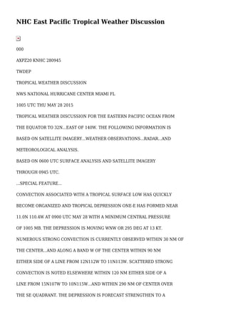
  • 1. NHC East Pacific Tropical Weather Discussion 000 AXPZ20 KNHC 280945 TWDEP TROPICAL WEATHER DISCUSSION NWS NATIONAL HURRICANE CENTER MIAMI FL 1005 UTC THU MAY 28 2015 TROPICAL WEATHER DISCUSSION FOR THE EASTERN PACIFIC OCEAN FROM THE EQUATOR TO 32N...EAST OF 140W. THE FOLLOWING INFORMATION IS BASED ON SATELLITE IMAGERY...WEATHER OBSERVATIONS...RADAR...AND METEOROLOGICAL ANALYSIS. BASED ON 0600 UTC SURFACE ANALYSIS AND SATELLITE IMAGERY THROUGH 0945 UTC. ...SPECIAL FEATURE... CONVECTION ASSOCIATED WITH A TROPICAL SURFACE LOW HAS QUICKLY BECOME ORGANIZED AND TROPICAL DEPRESSION ONE-E HAS FORMED NEAR 11.0N 110.4W AT 0900 UTC MAY 28 WITH A MINIMUM CENTRAL PRESSURE OF 1005 MB. THE DEPRESSION IS MOVING WNW OR 295 DEG AT 13 KT. NUMEROUS STRONG CONVECTION IS CURRENTLY OBSERVED WITHIN 30 NM OF THE CENTER...AND ALONG A BAND W OF THE CENTER WITHIN 90 NM EITHER SIDE OF A LINE FROM 12N112W TO 11N113W. SCATTERED STRONG CONVECTION IS NOTED ELSEWHERE WITHIN 120 NM EITHER SIDE OF A LINE FROM 15N107W TO 10N115W...AND WITHIN 290 NM OF CENTER OVER THE SE QUADRANT. THE DEPRESSION IS FORECAST STRENGTHEN TO A
  • 2. TROPICAL STORM NEAR 11.7N 111.5W TODAY AT 29/1800 UTC...THEN GRADUALLY STRENGTHEN TO A HURRICANE NEAR 14.2N 114.0W FRI NIGHT AT 30/0600 UTC. THE DEPRESSION IS FORECAST TO TRACK S OF A MID TO UPPER RIDGE FOR A COUPLE OF DAYS...THEN TURN MORE TO TOWARDS THE N-NW. REFER TO LATEST NHC PUBLIC/FORECAST ADVISORIES UNDER AWIPS/WMO HEADERS MIATCPEP1/MIATCMEP1 AND WTPZ31/WTPZ21 KNHC FOR MORE DETAILS. ...TROPICAL WAVES/LOWS... A TROPICAL WAVE EXTENDS FROM FROM 04-14N ALONG 98W AND HAS BEEN PROGRESSING W AT 10 KT OVER THE PAST 24 HOURS. CURRENTLY ISOLATED MODERATE TO STRONG CONVECTION IS OBSERVED WITHIN 30 NM OF WAVE AXIS AT 09N. THE WAVE IS FORECAST TO CONTINUE W TODAY AND GRADUALLY LOSE IDENTITY IN BROAD CYCLONIC CIRCULATION ASSOCIATED WITH THE TROPICAL CYCLONE IMMEDIATELY TO THE W. A 1007 MB SURFACE LOW PRESSURE IS ANALYZED NEAR 08N123W WITH SCATTERED MODERATE ISOLATED STRONG CONVECTION NOTED WITHIN 180 NM EITHER SIDE OF A LINE FROM 12N124W TO 00N129W. THE GRADIENT IS SUPPORTING NE TRADES OF 15-20 KT N OF THE LOW...ROUGHLY FROM 11-18N BETWEEN 115-130W WITH COMBINED SEAS OF 6-8 FT PRIMARILY DUE TO LONG PERIOD SOUTHERLY SWELL. THE LOW IS FORECAST TO MOVE W TO NEAR 09N124W TONIGHT...AND THEN DISSIPATE ON FRI.
  • 3. A 1008 MB LOW PRES IS ANALYZED NEAR 11N133W. ISOLATED MODERATE TO STRONG CONVECTION IS NOTED WITHIN 120 NM OF CENTER. THE GRADIENT IS MAINTAINING NE-E 20-25 KT TRADES WITHIN 360 NM OF THE NW SEMICIRCLE OF CENTER WITH COMBINED SEAS TO 9 FT. THE LOW IS FORECAST TO CONTINUE WSW TO NEAR 10N136W TONIGHT AND NEAR 09N139W ON ON FRI NIGHT. THE ASSOCIATED WINDS ARE EXPECTED TO DIMINISH TO 20 KT WITHIN ABOUT 540 NM N SEMICIRCLE WITH THE LOW PASSING W OF 140W ON SAT NIGHT. ...INTERTROPICAL CONVERGENCE ZONE/MONSOON TROUGH... CURRENTLY THERE IS NOT A WELL DEFINED MONSOON TROUGH OR ITCZ. A SURFACE LOW OVER NW COLOMBIA TRAILS A TROUGH SW ACROSS NE COLOMBIA AND ACROSS THE EPAC FROM ABOUT 07N77W TO 06N91W. SCATTERED MODERATE ISOLATED STRONG CONVECTION IS FLARING WITHIN 120 NM OF THE TROUGH. SCATTERED MODERATE CONVECTION IS ALSO NOTED OVER AND WITHIN 30 NM OF THE COAST OF EL SALVADOR. ...DISCUSSION... AN UPPER CYCLONE IS OBSERVED NW OF THE AREA NEAR 37N150W WITH AN UPPER TROUGH EXTENDING S TO 17N150W. ASSOCIATED SURFACE FRONTS ARE ROTATING E INTO THE FAR NW PORTION OF THE DISCUSSION
  • 4. AREA. THE NEXT COLD FRONT WILL REACH ALONG A POSITION FROM 32N136W TO 27N140W ON FRI...AND FROM 32N128W TO 25N140W ON SUN BUT ONLY BE ACCOMPANIED BY A 5-10 KT SW-W-NW WIND SHIFT ACROSS THE DISCUSSION WATERS. AN UPPER CYCLONE IS CENTERED OVER ARIZONA AND TRAILS AN UPPER TROUGH S ACROSS THE GULF LOW PRES...POSSIBLE TROPICAL CYCLONE...NEAR 14N114W 999 MB.OF CALIFORNIA. A SHORTWAVE RIDGE EXTENDS N FROM THE TROPICS ALONG 125W. UPPER DEBRIS MOISTURE IS MOVING ACROSS THE RIDGE AND SPILLING SE OVER SOUTHERN CALIFORNIA. OTHERWISE...THE UPPER LEVELS APPEAR VERY DRY ACROSS THE SUBTROPICAL PORTION. AN UPPER ANTICYCLONE IS CENTERED OVER THE TROPICS NEAR 14N103W WITH AN UPPER RIDGE EXTENDING W TO BEYOND 13N140W. AN UPPER RIDGE ALSO EXTENDS E TO A CREST NEAR 12N91W. THE ASSOCIATED UPPER DIFFLUENCE IS ENHANCING CONVECTION ALONG THE TROPICAL DEPRESSION...THE TROPICAL LOWS AND TROPICAL WAVE AS PREVIOUSLY DESCRIBED. ALTHOUGH MOST OF THE DEBRIS MOISTURE IS ADVECTED S ACROSS THE EQUATOR BETWEEN 100-136W...SOME OF THE DEBRIS MOISTURE IS ADVECTED E ACROSS SOUTHERN MEXICO WHERE INTERIOR CONVECTION HAS DEVELOPED. AN UPPER ANTICYCLONE OVER COLOMBIA RIDGES W TO A CREST NEAR 08N86W. AN UPPER TROUGH EXTENDS SW ACROSS THE WESTERN CARIBBEAN AND CENTRAL AMERICA TO A BASE OVER THE PACIFIC NEAR 11N90W. THIS PATTERN SETS UP AN AREA OF UPPER DIFFLUENCE AND IS ENHANCING CONVECTION AND THE DEEP TROPICS BETWEEN 80-90W AS PREVIOUSLY DESCRIBED. SOME OF THE DEBRIS MOISTURE IS ADVECTED ENE ACROSS THE SOUTHERN CARIBBEAN.
  • 5. GULF OF TEHUANTEPEC...EXPECT A BRIEF NORTHERLY SURGE TO 20-25 KT LATE TONIGHT WITH SEAS BUILDING BRIEFLY TO 7 FT AT SUNRISE TODAY. THE PATTERN WILL REPEAT AGAIN LATE TONIGHT. GULF OF PAPAGAYO...CURRENTLY ENE 20-25 KT WINDS SHOULD DIMINISH AFTER SUNRISE THIS MORNING. THEN EXPECT ONLY 15-20 KT NOCTURNAL PULSES FORECAST THROUGH FRI. $$ NELSON http://www.nhc.noaa.gov/text/MIATWDEP.shtml