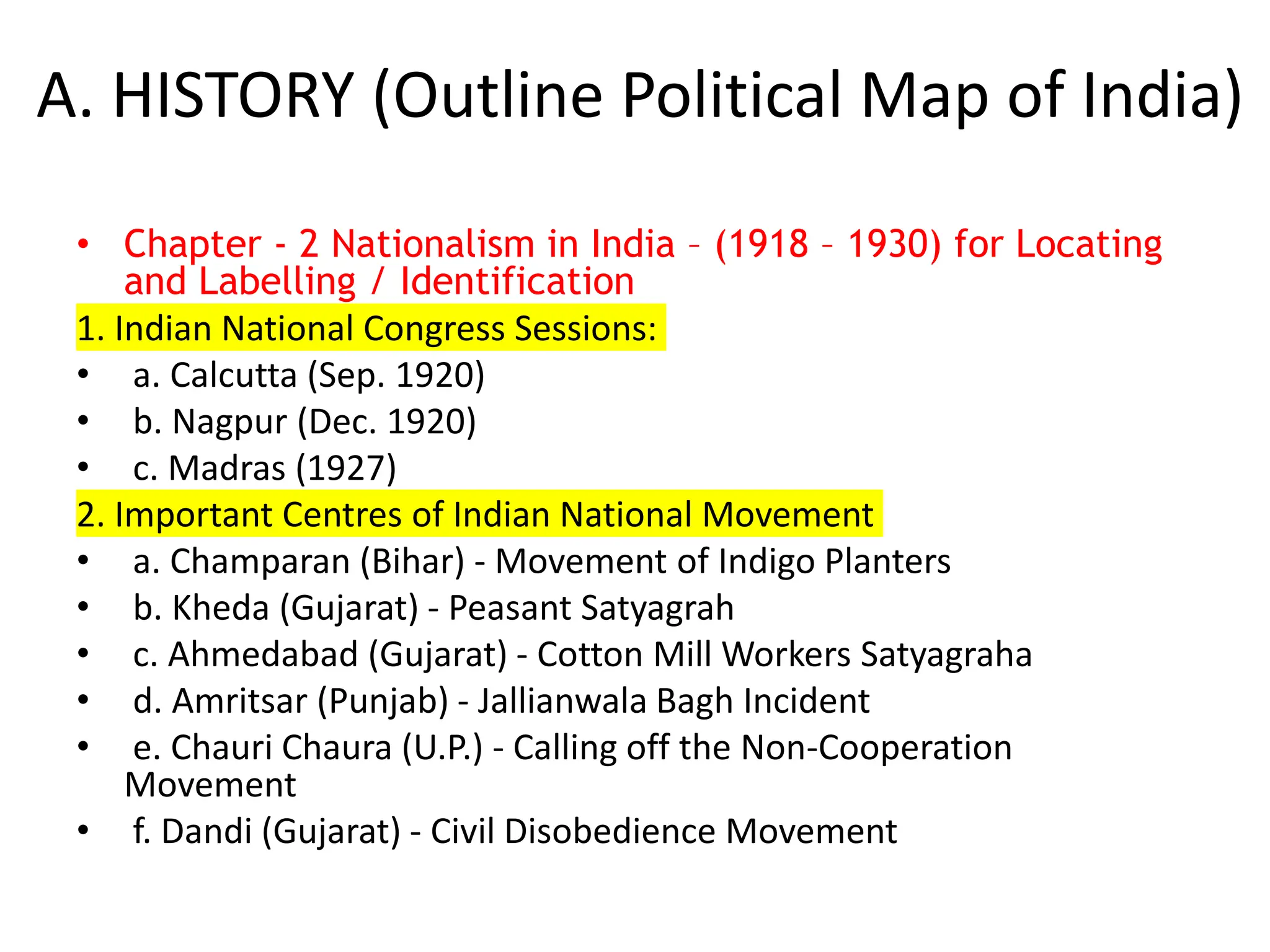
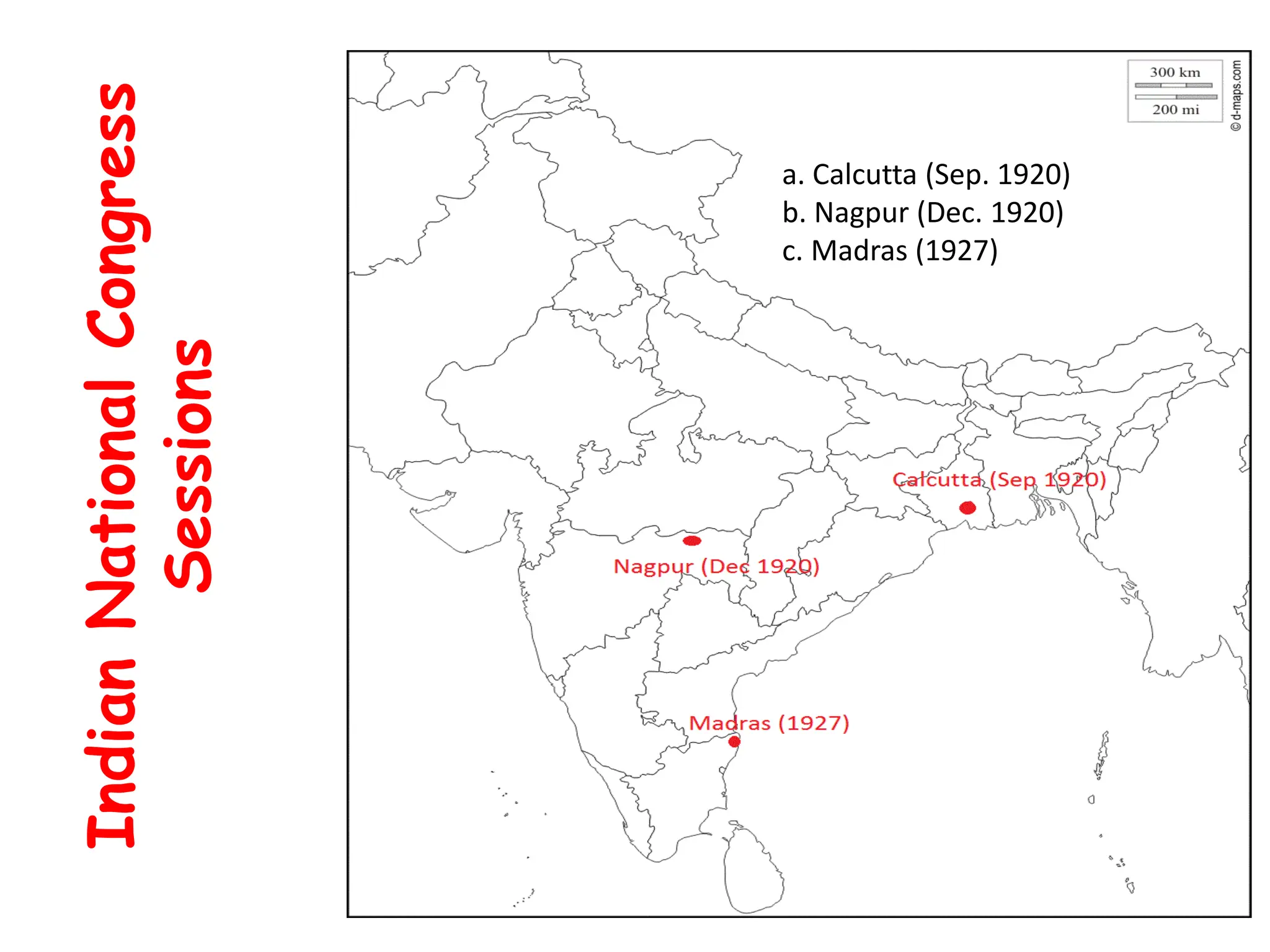
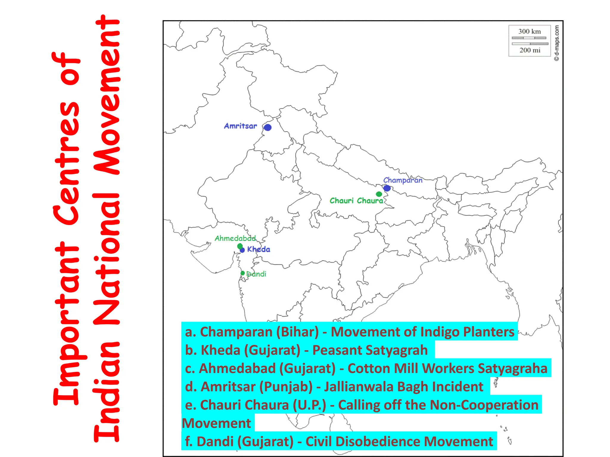
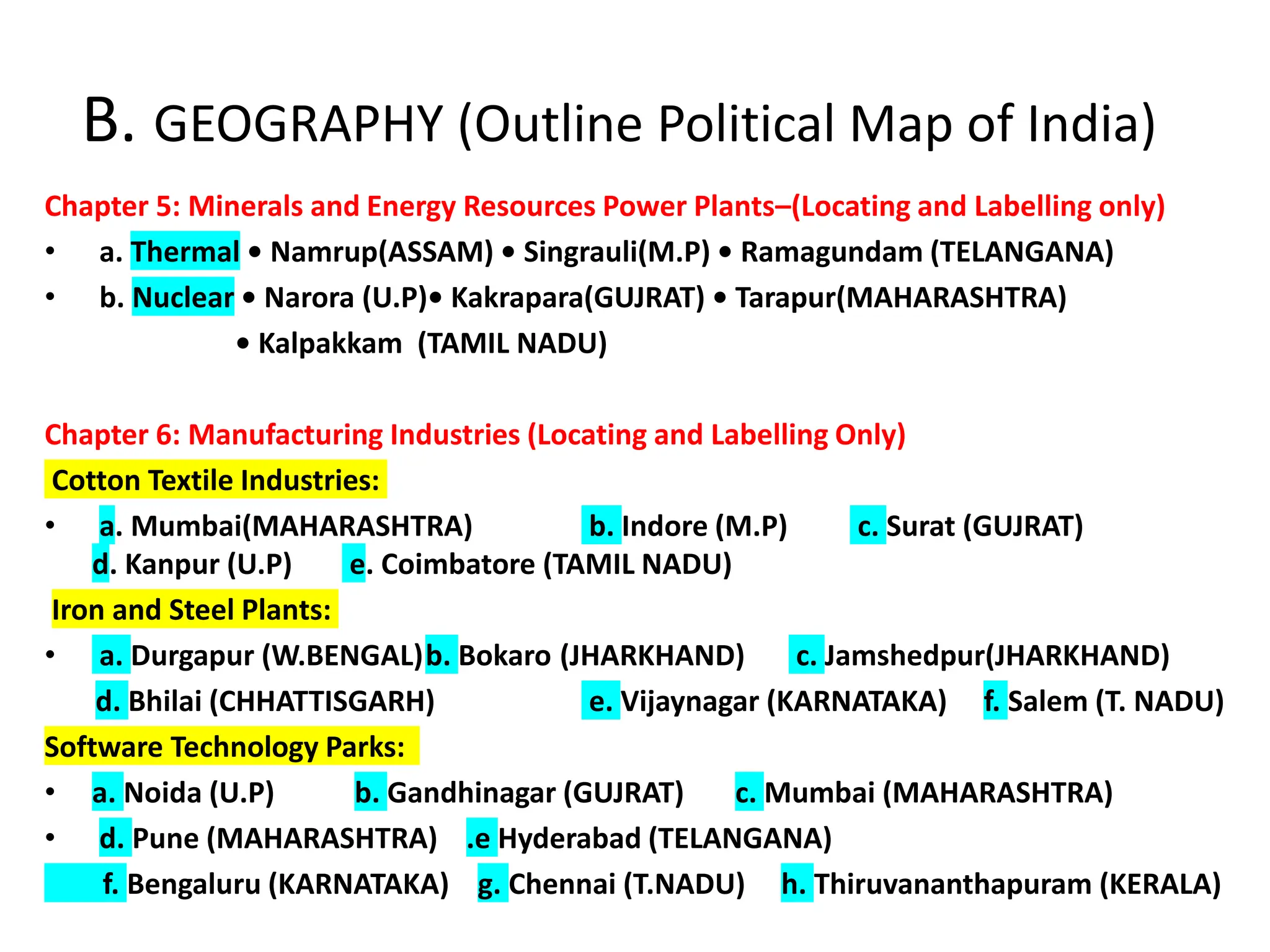
This document provides guidance on key locations to label on an outline political map of India for a social science class. It includes locations related to:
1. Important centers of the Indian national movement from 1918-1930, including cities that hosted Indian National Congress sessions and sites of key independence protests.
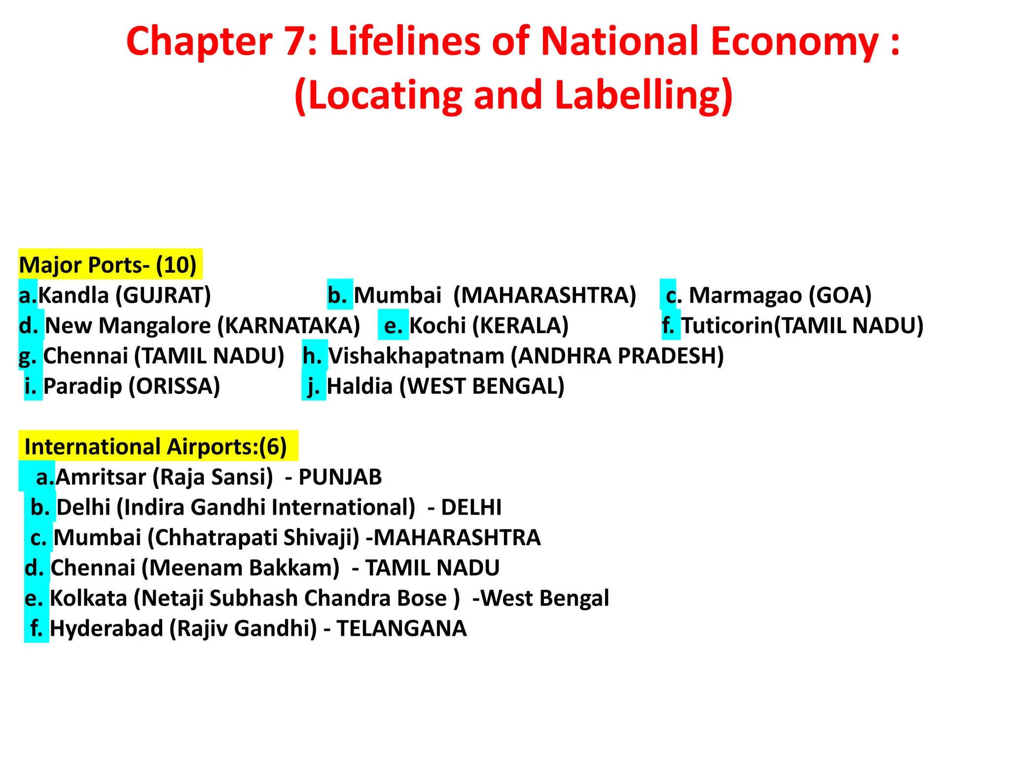
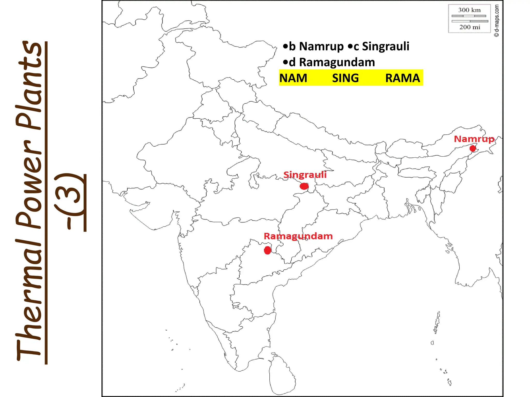
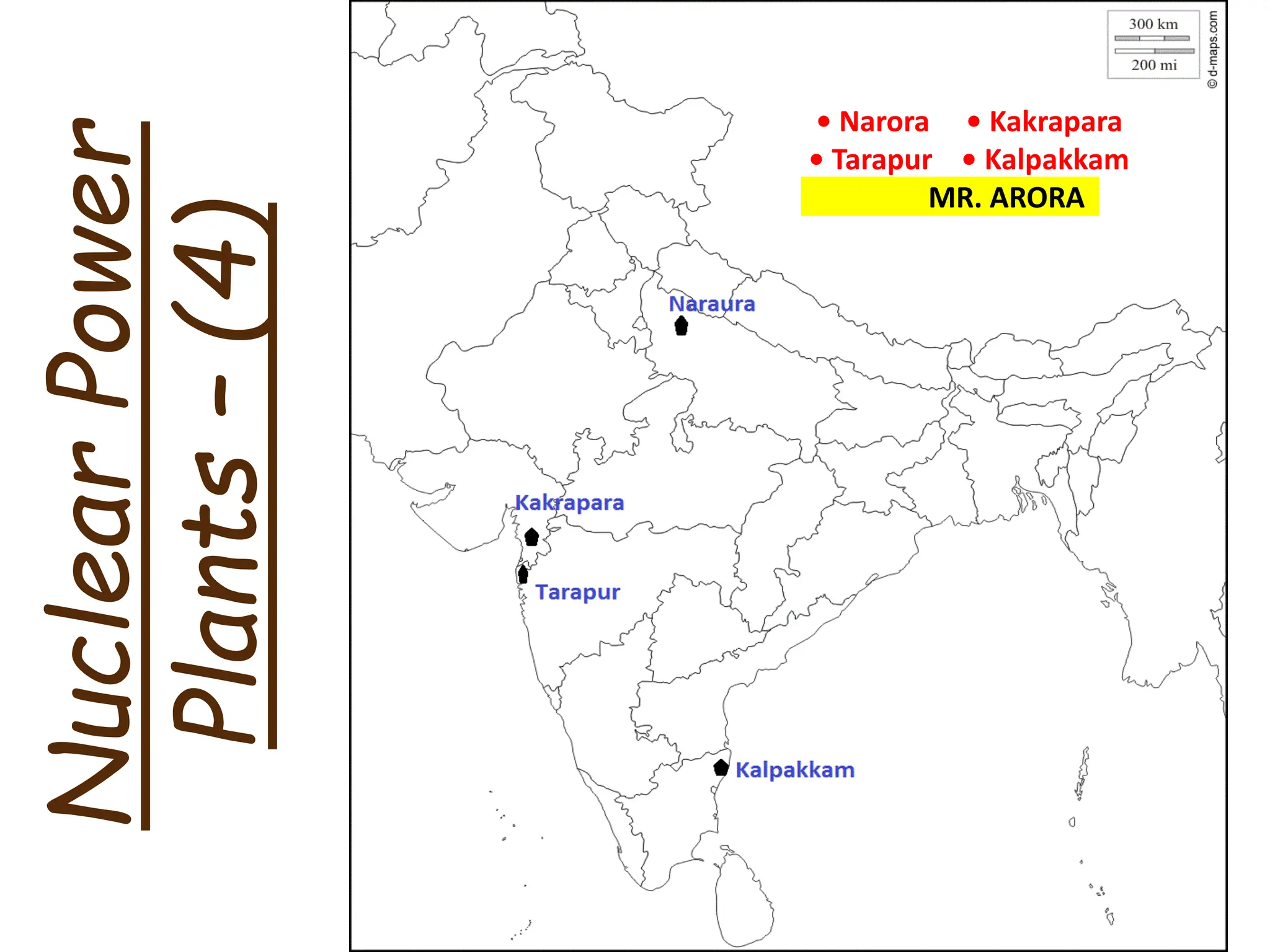
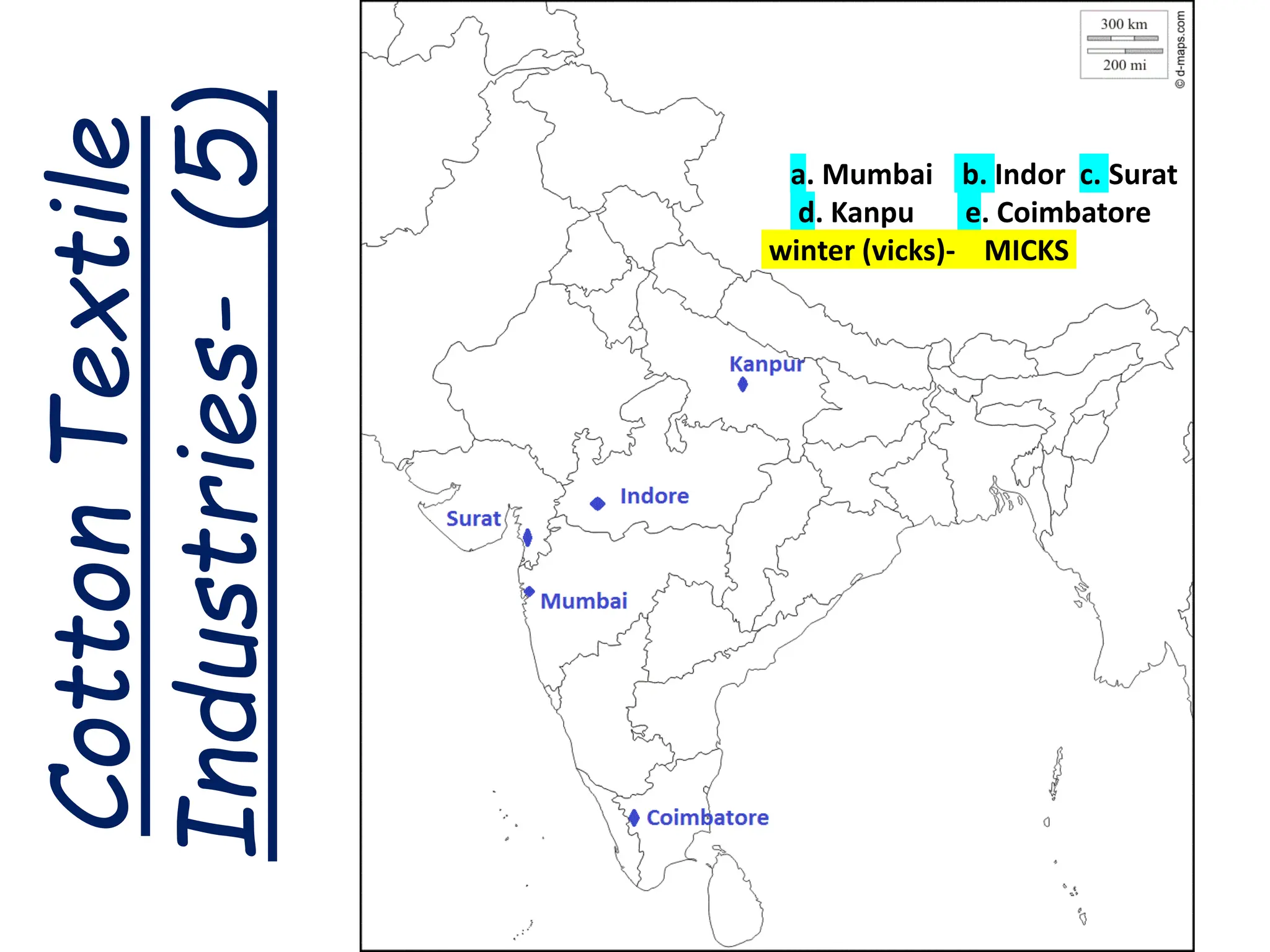
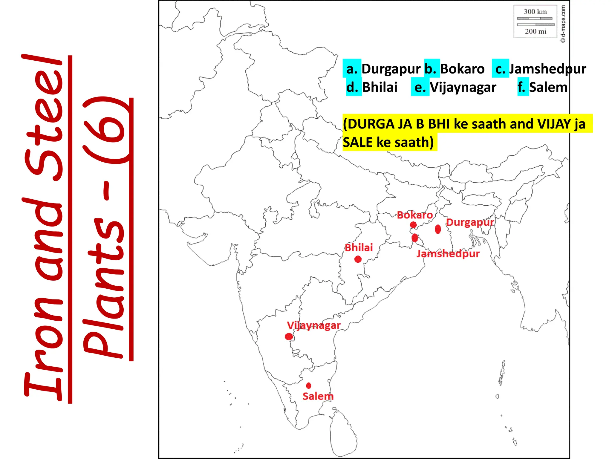
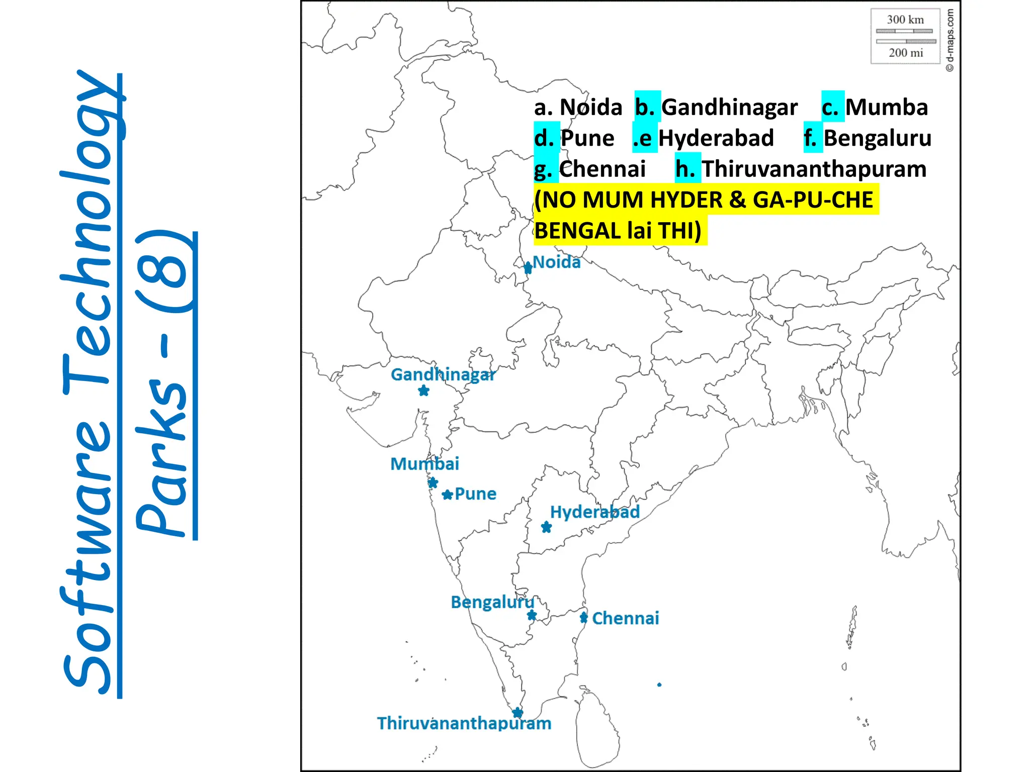
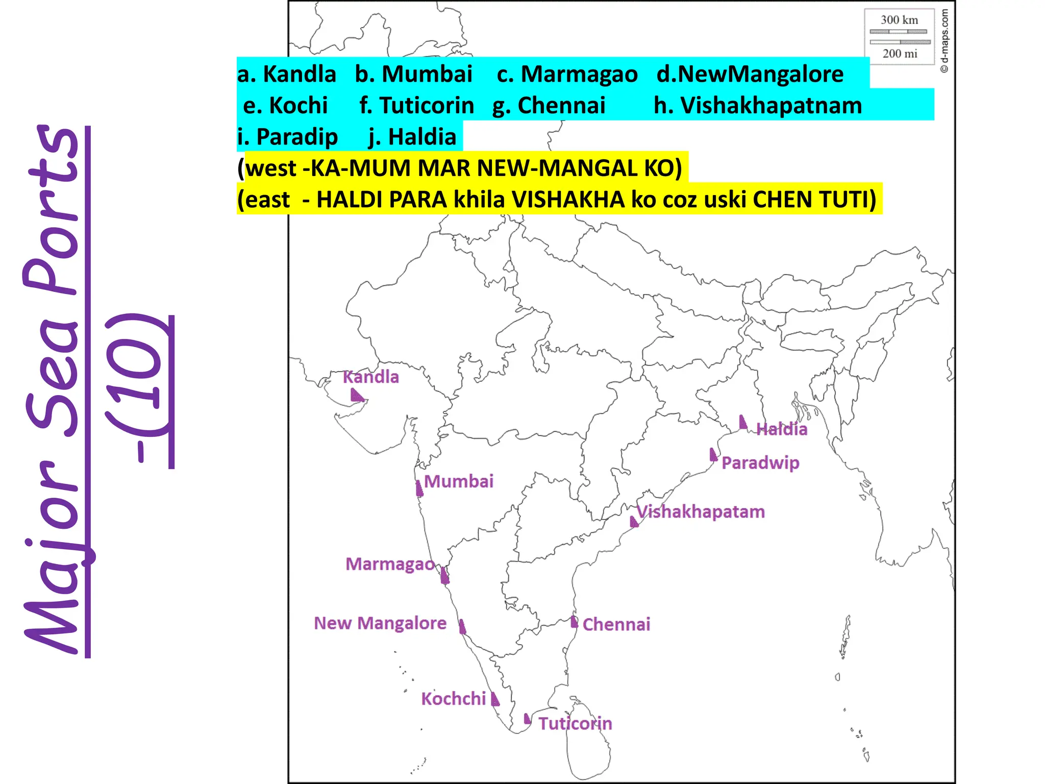
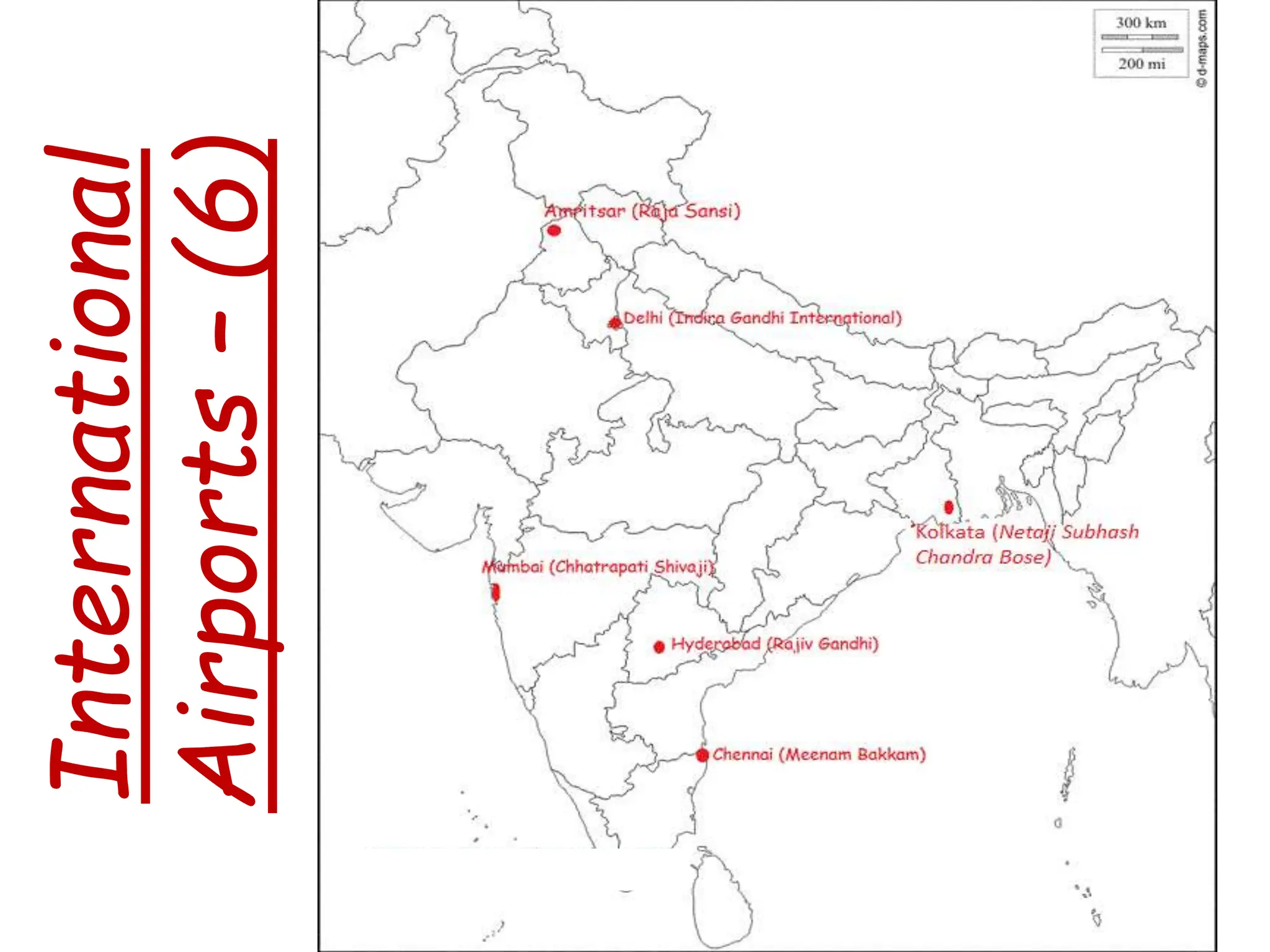
2. Thermal and nuclear power plants, cotton and steel industries, software technology parks, major sea ports, and international airports to label on maps related to geography chapters on resources, manufacturing, and transportation infrastructure.
3. A reminder to revise all the material well and wishes of good luck for the class.


![class 10th all imp maps [Autosaved].pptx](https://cdn.slidesharecdn.com/ss_thumbnails/class10thallimpmapsautosaved-251116074902-ad56a380-thumbnail.jpg?width=640&height=640&fit=bounds)


