Öğlen Seminerleri: Marmara'da Deprem Kümeleri
•Download as PPT, PDF•
1 like•196 views

Cluster
Report
Share
Report
Share
Recommended
ÖNCEL AKADEMİ: MÜHENDİSLİK BİLİMLERİ
Lionel Laroche is a geophysicist who immigrated to Canada from France. He discusses how understanding Canadian culture can help immigrants prosper. Key aspects of Canadian culture include individualism, flexibility, and soft skills like communication and influence. Laroche recommends immigrants balance technical skills with soft skills to succeed. He also suggests finding a cultural mentor to help with adaptation. With the right approach, immigrants can prosper in Canada, as 30% of the richest people are immigrants themselves.
Gravimetri : Ders 12
Gravimetri Dersi için aşağıda ki videoları izleyebilirsiniz.
Link 01: https://www.youtube.com/watch?v=HTyjVaVGx0k
Link 02: https://www.youtube.com/watch?v=fUkfgI8XaOE
Gravimetri: Ders 05
Gravimetry Ders II. Öğretim Ders Videosu Linki
https://youtu.be/xwNnvRLneWY
Gravimetry Ders I. Öğretim Ders Videosu Linki
https://youtu.be/Tb-Ka1bDuSY
Gravimetri : Ders 04
The document discusses gravity anomalies and density variations in different regions based on gravity data. It shows how gravity maps reveal details about crustal thickness, tectonic features like faults and volcanic zones, and plate boundaries. Specific examples discussed include the Tibetan Plateau, Central America subduction zone, an area in Chugoku, Japan, and the state of Florida in the US. Regional gravity data can be used to model density changes associated with plate tectonics, crustal evolution, and volcanic and tectonic activity.
Kar Kar Geothermal Field Work
The USF team reviewed a geophysical investigation of the Kar Kar region conducted by WesternGeco in 2011. They found that WesternGeco's magnetotelluric (MT) data and models were of high quality. Both the WesternGeco and USF MT models identified a low resistivity zone at 300m depth that correlates with a water-bearing zone found in Borehole 4. USF performed gravity modeling which identified a north-south trending basin reaching 1500m depth, consistent with mapped faults. A preliminary hydrothermal model suggested observed temperatures could result from deep circulation of meteoric waters in the basin without needing a localized heat source. Additional geophysical data is recommended around the Jermaghbyur hot springs to
Beppu geothermal field
This document summarizes a study that used gravity data to delineate underground structure in the Beppu geothermal field in Japan. Analysis of Bouguer anomaly maps revealed high anomalies in the southern and northern parts of the study area that correspond to known geological formations. Edge detection filtering of the gravity data helped identify subsurface faults, including the northern edge of the high southern anomaly corresponding to the Asamigawa Fault. Depth modeling of the gravity basement showed differences between the southern and northern hot spring areas, with steep basement slopes along faults in the south and uplifted basement in the north.
High Resolution Earth's Gravitational Field
This document summarizes the development of a new ultra-high resolution model of Earth's gravity field called GGMplus. Key points:
- GGMplus combines satellite gravity data from GOCE and GRACE with terrestrial gravity data and topography to achieve unprecedented 200m spatial resolution globally.
- It provides gridded estimates of gravity, horizontal and radial field components, and quasi-geoid heights at over 3 billion points covering 80% of the Earth's land.
- GGMplus reveals new details of small-scale gravity variations and identifies locations of minimum and maximum gravity, suggesting peak-to-peak variations are 40% larger than previous estimates. The model will benefit scientific and engineering applications.
Gravity Predictions for Earthquakes
Gravity measurements were taken in a region of China covering the south-north earthquake belt in 1998, 2000, 2002, and 2005. Researchers noticed significant gravity changes in the region surrounding Wenchuan and suggested in 2006 that a major earthquake could occur there in 2007 or 2008. While gravity changes were significant at some locations, more research is needed to determine if they could be considered a precursor. Uncertainties exist from measurement errors, hydrologic effects, and crustal movements. Improved data collection and analysis could enhance using gravity monitoring for earthquake research.
Nakamura Technique for Soil Characterization
Multidisipliner Jeofizik Yöntemler, deprem güvenli jeofizik 'fiziksel zeminleri' çok net ortaya çıkarıyor.
H/V User Guidelines
The document provides guidelines for implementing the H/V spectral ratio technique using ambient vibration measurements to evaluate site effects. It recommends procedures for experimental design, data processing, and interpretation. The key recommendations include measuring for sufficient duration depending on expected frequency, using multiple measurement points, avoiding disturbances, and interpreting H/V peaks in context with geological and geophysical data. Reliable H/V peaks are defined as having a clear maximum within expected frequency ranges and uncertainties. The guidelines aim to help apply the technique while accounting for its limitations.
Geopsy: Seismic Vibration Processing
Geopsy yaygın olarak kullanılan profesyonel bir program. Özellikle, profesyonel program deneyimi yeni mezunlarda çok aranan bir özellik. Bir öğrencim çalışmasında kullanmayı planlıyor.
M6.0 2004 Parkfield Earthquake : Seismic Attenuation
HRSN isimli kuyu içi sismik istasyonlar kullanılarak, San Andreas fayı boyunca meydana gelen büyük depremler öncesi sismik azalımın varlığının olup olmadığı araştırılıyor.
Deprem Verilerinin H/V Oranının Mevsimsel Değişimi
H/V oranının zaman içinde değişimi konusu bana oldukça ilginç gelmişti ve bu tür bir çalışma yapıldı mı sorusunu netleştirmek için araştırma yaptım ve 2021 yılında bu konuda GJI gibi bir dergide yayınlanmış bir çalışma buldum. Bu çalışma oldukça iyi bir referans H/V çalışmaları için. Önemli referans düşünceler şöyle; 1) Mevsimsel olarak yağışa bağlı olarak yeraltı kaynaklarında ki azalma ve yükselmeye bağlı olarak H/V yükseliyor, 2) H/V pik değerleri kaya zemin üzerinde yaklaşık BİR (1) oranında seyreder ve PİK vermezken, kaya zeminden uzaklaşıldıkça zemin etkisi ile PİK değerleri değişir, 3) Deprem ve Gürültü sinyallerinden hesap edilen F(PİK) nerede ise sabitken, H/V oranları %10 değişir, 4) M6.8 büyüklüğünde meydana gelen bir deprem H/V değişimlerini etkiler.
Yapılan çalışmada kullanılan yaklaşım SESAME (2004) kriterlerine uygun olarak 1) 60 dakikalık veriler analizi, 2) 1000 günden fazla gözlem süresi 3) 10'dan fazla farklı zeminlerde istasyon 4) 60 dakikalık birbirinden ayrı verilerin analiz edilmesi. Oldukça emek yoğun bir çalışma
More Related Content
More from Ali Osman Öncel
Gravimetri : Ders 12
Gravimetri Dersi için aşağıda ki videoları izleyebilirsiniz.
Link 01: https://www.youtube.com/watch?v=HTyjVaVGx0k
Link 02: https://www.youtube.com/watch?v=fUkfgI8XaOE
Gravimetri: Ders 05
Gravimetry Ders II. Öğretim Ders Videosu Linki
https://youtu.be/xwNnvRLneWY
Gravimetry Ders I. Öğretim Ders Videosu Linki
https://youtu.be/Tb-Ka1bDuSY
Gravimetri : Ders 04
The document discusses gravity anomalies and density variations in different regions based on gravity data. It shows how gravity maps reveal details about crustal thickness, tectonic features like faults and volcanic zones, and plate boundaries. Specific examples discussed include the Tibetan Plateau, Central America subduction zone, an area in Chugoku, Japan, and the state of Florida in the US. Regional gravity data can be used to model density changes associated with plate tectonics, crustal evolution, and volcanic and tectonic activity.
Kar Kar Geothermal Field Work
The USF team reviewed a geophysical investigation of the Kar Kar region conducted by WesternGeco in 2011. They found that WesternGeco's magnetotelluric (MT) data and models were of high quality. Both the WesternGeco and USF MT models identified a low resistivity zone at 300m depth that correlates with a water-bearing zone found in Borehole 4. USF performed gravity modeling which identified a north-south trending basin reaching 1500m depth, consistent with mapped faults. A preliminary hydrothermal model suggested observed temperatures could result from deep circulation of meteoric waters in the basin without needing a localized heat source. Additional geophysical data is recommended around the Jermaghbyur hot springs to
Beppu geothermal field
This document summarizes a study that used gravity data to delineate underground structure in the Beppu geothermal field in Japan. Analysis of Bouguer anomaly maps revealed high anomalies in the southern and northern parts of the study area that correspond to known geological formations. Edge detection filtering of the gravity data helped identify subsurface faults, including the northern edge of the high southern anomaly corresponding to the Asamigawa Fault. Depth modeling of the gravity basement showed differences between the southern and northern hot spring areas, with steep basement slopes along faults in the south and uplifted basement in the north.
High Resolution Earth's Gravitational Field
This document summarizes the development of a new ultra-high resolution model of Earth's gravity field called GGMplus. Key points:
- GGMplus combines satellite gravity data from GOCE and GRACE with terrestrial gravity data and topography to achieve unprecedented 200m spatial resolution globally.
- It provides gridded estimates of gravity, horizontal and radial field components, and quasi-geoid heights at over 3 billion points covering 80% of the Earth's land.
- GGMplus reveals new details of small-scale gravity variations and identifies locations of minimum and maximum gravity, suggesting peak-to-peak variations are 40% larger than previous estimates. The model will benefit scientific and engineering applications.
Gravity Predictions for Earthquakes
Gravity measurements were taken in a region of China covering the south-north earthquake belt in 1998, 2000, 2002, and 2005. Researchers noticed significant gravity changes in the region surrounding Wenchuan and suggested in 2006 that a major earthquake could occur there in 2007 or 2008. While gravity changes were significant at some locations, more research is needed to determine if they could be considered a precursor. Uncertainties exist from measurement errors, hydrologic effects, and crustal movements. Improved data collection and analysis could enhance using gravity monitoring for earthquake research.
Nakamura Technique for Soil Characterization
Multidisipliner Jeofizik Yöntemler, deprem güvenli jeofizik 'fiziksel zeminleri' çok net ortaya çıkarıyor.
H/V User Guidelines
The document provides guidelines for implementing the H/V spectral ratio technique using ambient vibration measurements to evaluate site effects. It recommends procedures for experimental design, data processing, and interpretation. The key recommendations include measuring for sufficient duration depending on expected frequency, using multiple measurement points, avoiding disturbances, and interpreting H/V peaks in context with geological and geophysical data. Reliable H/V peaks are defined as having a clear maximum within expected frequency ranges and uncertainties. The guidelines aim to help apply the technique while accounting for its limitations.
Geopsy: Seismic Vibration Processing
Geopsy yaygın olarak kullanılan profesyonel bir program. Özellikle, profesyonel program deneyimi yeni mezunlarda çok aranan bir özellik. Bir öğrencim çalışmasında kullanmayı planlıyor.
M6.0 2004 Parkfield Earthquake : Seismic Attenuation
HRSN isimli kuyu içi sismik istasyonlar kullanılarak, San Andreas fayı boyunca meydana gelen büyük depremler öncesi sismik azalımın varlığının olup olmadığı araştırılıyor.
Deprem Verilerinin H/V Oranının Mevsimsel Değişimi
H/V oranının zaman içinde değişimi konusu bana oldukça ilginç gelmişti ve bu tür bir çalışma yapıldı mı sorusunu netleştirmek için araştırma yaptım ve 2021 yılında bu konuda GJI gibi bir dergide yayınlanmış bir çalışma buldum. Bu çalışma oldukça iyi bir referans H/V çalışmaları için. Önemli referans düşünceler şöyle; 1) Mevsimsel olarak yağışa bağlı olarak yeraltı kaynaklarında ki azalma ve yükselmeye bağlı olarak H/V yükseliyor, 2) H/V pik değerleri kaya zemin üzerinde yaklaşık BİR (1) oranında seyreder ve PİK vermezken, kaya zeminden uzaklaşıldıkça zemin etkisi ile PİK değerleri değişir, 3) Deprem ve Gürültü sinyallerinden hesap edilen F(PİK) nerede ise sabitken, H/V oranları %10 değişir, 4) M6.8 büyüklüğünde meydana gelen bir deprem H/V değişimlerini etkiler.
Yapılan çalışmada kullanılan yaklaşım SESAME (2004) kriterlerine uygun olarak 1) 60 dakikalık veriler analizi, 2) 1000 günden fazla gözlem süresi 3) 10'dan fazla farklı zeminlerde istasyon 4) 60 dakikalık birbirinden ayrı verilerin analiz edilmesi. Oldukça emek yoğun bir çalışma
More from Ali Osman Öncel (20)
M6.0 2004 Parkfield Earthquake : Seismic Attenuation
M6.0 2004 Parkfield Earthquake : Seismic Attenuation
Deprem Verilerinin H/V Oranının Mevsimsel Değişimi
Deprem Verilerinin H/V Oranının Mevsimsel Değişimi
Öğlen Seminerleri: Marmara'da Deprem Kümeleri
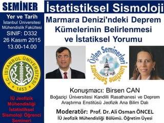
- 1. SEMİNER Yer ve Tarih İstanbul Üniversitesi Mühendislik Fakültesi SINIF: D332 26 Kasım 2015 13.00-14.00 Konuşmacı: Birsen CAN Boğaziçi Üniversitesi Kandilli Rasathanesi ve Deprem Araştırma Enstitüsü Jeofizik Ana Bilim Dalı İstatistiksel Sismoloji Marmara Denizi'ndeki Deprem Kümelerinin Belirlenmesi ve İstatiksel Yorumu İÜ Jeofizik Mühendisliği İstatistiksel Sismoloji Öğrenci Semineri