Kentsel Risk Yönetimi Sertifika Programı için katılım 50 kişiyle sınırlıdır, ve bu nedenle katılım için isminizi JFMO İstanbul Şube sekreterliğine yazdırmanız ve teyit almanız gerekmektedir. Öncelik, Kentsel Risk Yönetimiyle ilgili çalışan Profesyonel Mühendislere ve Yöneticilere verilecektir.
LİNK: https://www.facebook.com/events/214397928712765/
Gravimetri Dersi için aşağıda ki videoları izleyebilirsiniz.
Link 01: https://www.youtube.com/watch?v=HTyjVaVGx0k
Link 02: https://www.youtube.com/watch?v=fUkfgI8XaOE
The document discusses gravity anomalies and density variations in different regions based on gravity data. It shows how gravity maps reveal details about crustal thickness, tectonic features like faults and volcanic zones, and plate boundaries. Specific examples discussed include the Tibetan Plateau, Central America subduction zone, an area in Chugoku, Japan, and the state of Florida in the US. Regional gravity data can be used to model density changes associated with plate tectonics, crustal evolution, and volcanic and tectonic activity.
The USF team reviewed a geophysical investigation of the Kar Kar region conducted by WesternGeco in 2011. They found that WesternGeco's magnetotelluric (MT) data and models were of high quality. Both the WesternGeco and USF MT models identified a low resistivity zone at 300m depth that correlates with a water-bearing zone found in Borehole 4. USF performed gravity modeling which identified a north-south trending basin reaching 1500m depth, consistent with mapped faults. A preliminary hydrothermal model suggested observed temperatures could result from deep circulation of meteoric waters in the basin without needing a localized heat source. Additional geophysical data is recommended around the Jermaghbyur hot springs to
This document summarizes a study that used gravity data to delineate underground structure in the Beppu geothermal field in Japan. Analysis of Bouguer anomaly maps revealed high anomalies in the southern and northern parts of the study area that correspond to known geological formations. Edge detection filtering of the gravity data helped identify subsurface faults, including the northern edge of the high southern anomaly corresponding to the Asamigawa Fault. Depth modeling of the gravity basement showed differences between the southern and northern hot spring areas, with steep basement slopes along faults in the south and uplifted basement in the north.
This document summarizes the development of a new ultra-high resolution model of Earth's gravity field called GGMplus. Key points:
- GGMplus combines satellite gravity data from GOCE and GRACE with terrestrial gravity data and topography to achieve unprecedented 200m spatial resolution globally.
- It provides gridded estimates of gravity, horizontal and radial field components, and quasi-geoid heights at over 3 billion points covering 80% of the Earth's land.
- GGMplus reveals new details of small-scale gravity variations and identifies locations of minimum and maximum gravity, suggesting peak-to-peak variations are 40% larger than previous estimates. The model will benefit scientific and engineering applications.
Gravity measurements were taken in a region of China covering the south-north earthquake belt in 1998, 2000, 2002, and 2005. Researchers noticed significant gravity changes in the region surrounding Wenchuan and suggested in 2006 that a major earthquake could occur there in 2007 or 2008. While gravity changes were significant at some locations, more research is needed to determine if they could be considered a precursor. Uncertainties exist from measurement errors, hydrologic effects, and crustal movements. Improved data collection and analysis could enhance using gravity monitoring for earthquake research.
The document provides guidelines for implementing the H/V spectral ratio technique using ambient vibration measurements to evaluate site effects. It recommends procedures for experimental design, data processing, and interpretation. The key recommendations include measuring for sufficient duration depending on expected frequency, using multiple measurement points, avoiding disturbances, and interpreting H/V peaks in context with geological and geophysical data. Reliable H/V peaks are defined as having a clear maximum within expected frequency ranges and uncertainties. The guidelines aim to help apply the technique while accounting for its limitations.
Geopsy yaygın olarak kullanılan profesyonel bir program. Özellikle, profesyonel program deneyimi yeni mezunlarda çok aranan bir özellik. Bir öğrencim çalışmasında kullanmayı planlıyor.
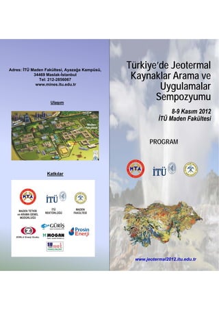
1. Adres: İTÜ Maden Fakültesi, Ayazağa Kampüsü,
Türkiye’de Jeotermal
34469 Maslak-İstanbul
Tel: 212-2856067 Kaynaklar Arama ve
K kl A
www.mines.itu.edu.tr
Uygulamalar
Ulaşım
Sempozyumu
8-9 Kasım 2012
İTÜ Maden Fakültesi
PROGRAM
Katkılar
www.jeotermal2012.itu.edu.tr
2. 8‐9 Kasım 2012, İstanbul Teknik Üniversitesi Maden Fakültesi 2.Gün: 9 Kasım 2012, Cuma
(İhsan Ketin Konferans Salonu ve Fuayesi) (İhsan Ketin Konferans Salonu ve Fuayesi)
1.Gün: 8 Kasım 2012, Perşembe Saat/Kodu OTURUM – 4: Jeokimya (Başkan: Tolga YALÇIN)
09:00 – 09:20 Jeotermal Akışkanların Köken İlişkisi: Tuzla ve Babadere (Çanakkale)
08:30 – 10:00
Kayıt * S‐13 Sahaları Örneği. Düzgün ÇAM, Engin BÜLBÜL, Orhan KILINÇ, Ömür ŞAN
Saat/Kodu AÇILIŞ OTURUMU (MTA Genel Müdürlüğü)
10:00 – 11:00 AÇILIŞ KONUŞMALARI 09:20 – 09:40 Jeotermal Kaynakların Aranmasında Gaz Jeokimyası Çalışmaları: Great
İlyas ÇAĞLAR (Düzenleme Kurulu Ad.) S‐14 Artesian Basin (GAB, Avustralya) ve Amik Ovası (Hatay) Örnekleri
( , y ) ( y)
Serdar AKYÜZ (Maden Fakültesi Dekan V.)
Ü Galip YÜCE, Francesco ITALIANO, Tolga H. YALÇIN, Tonguç UYSAL, T.
Mehmet ÜZER (MTA Genel Müdürü) Frank YANG, Fu CHING‐CHOU, Bora ROJAY, Volkan KARABACAK,
Mehmet KARACA (İTÜ Rektörü) Walter G. C. ALESSANDRO, Sergio BELLOMO, Guia MORELLI, Massimo
11:00 – 11:50 Türkiye’de Jeotermal Kaynak Potansiyeli, Uygulamalar, Sektörel GASPARON, Lai CHUN‐WEI, Ahmet H. GÜLBAY, Didem YASİN, Arda
S‐1 Gelişim ve 2015 Projeksiyonu OZACAR, Vivek WALIA, Nur OZYURT, Ayberk ERDOĞAN, Burak KOCA
Hayrullah DAĞISTAN (MTA Genel Müdür Yard.) (Eskişehir Osmangazi Üniversitesi)
11:50 – 13:30 MTA Dökümantasyon Standı Açılışı ve ÖĞLE ARASI 09:40 – 10:00 Eskişehir İli’nde Yeni Bir Jeotermal Alan; Şerefiye Sahası
OTURUM – 1: Jeoloji (Başkan: Remzi KARAGÜZEL) S‐15 Lütfi TAŞKIRAN, Ünsal TURALI (MTA Genel Müdürlüğü)
13:30 – 13:50 Türkiye’nin Tektoniği ve Jeotermal Kaynakları 10:00 – 10:20 Diyarbakır (Çermik) Ve Şanlıurfa (Karaali) İllerinde Yer Alan Kaplıca
S‐2
S2 Aral OKAY (İstanbul Teknik Üniversitesi)
l (İ b l k kÜ ) S‐16
S 16 Kaynaklarının Kökensel İncelenmesi.
kl k lİ l
13:50 – 14:10 Örtülü Jeotermal Sahaların Aranmasında Yeni Yaklaşımlar; Kütahya‐ Nedret ÖZEL, Osman PARLAK (T.C. Kalkınma Bakanlığı)
S‐3 Şaphane‐Karacaderbent Gömülü Jeotermal Sahasının Bulunması ve 10:20 – 10:35 Çay/Kahve Arası
Geliştirilmesi. Musa BURÇAK,Hüseyin DÜNYA,Ömer HACISALİHOĞLU OTURUM – 5: Jeofizik (Başkan: Emin DEMİRBAĞ)
(MTA Genel Müdürlüğü) 10:35 – 10:55 Jeotermal Aramalarda Manyetotellürik Yöntem
14:10 – 14:30 Anadolu’daki Sıcak Suların Kökeninin Kimyasal ve İzotopik Açıdan S‐17 Ahmet T. BAŞOKUR (Ankara Üniversitesi)
S‐4 İncelenmesi. Halim MUTLU, Nilgün GÜLEÇ, David R. HILTON 10:55 – 11:15 Jeotermal Kaynak Araştırmalarında Kuyu Ölçülerinin Yeri ve Önemi
(Eskişehir Osmangazi Üniversitesi) S‐18 Uğur ZAMAN (MTA Genel Müdürlüğü)
14:30‐14:50 Umurlu (Aydın) Jeotermal Sahası’nın Hidrojeokimyasal ve İzotopik 11:15 – 11:35 Batı Anadolu’da Derin Elektriksel Yapı ile Jeotermal Sistemler
S‐5 Veriler Işığı Altında Büyük Menderes Grabeni İçindeki Yeri
Veriler Işığı Altında Büyük Menderes Grabeni İçindeki Yeri S‐19 Arasındaki İlişki.
Arasındaki İlişki
Engin BÜLBÜL (MTA Genel Müdürlüğü) İlyas ÇAĞLAR (İstanbul Teknik Üniversitesi)
14:50 – 15:05 Çay/Kahve Arası ve Poster Bildiriler 11:35 – 11:55 Pasif Mikrosismik İzleme Yöntemlerinin Hidrotermal Sahalarda
S‐20 Kullanımı ve Jeotermal İşletmeler Açısından Önemi
OTURUM – 2: Uygulamalar (Başkan: Abdurrahman SATMAN)
15:05 – 15:25 Jeotermal Projelerin Geliştirilmesinde Dikkat Edilecek Ana Unsurlar Bülent KAYPAK, G. Gülsev UYAR ALDAŞ (Ankara Üniversitesi)
S‐6 11:55 – 12:15 Jeotermal Kaynakların Aranmasında Jeofizik (Gravite ve Manyetik)
Ali KARADUMAN (GÜRİŞ Holding Genel Müd.)
15:25 – 15:45 S‐21 Uygulamalar.
Jeotermal Akışkan Kaynaklı Kabuklaşma Oluşumu ve
S‐7 EngellenmesindeKontrol Parametrelerinin İzlenmesinin Önemi Şevket DEMİRBAŞ (MTA Genel Müdürlüğü)
12:15 – 13:45 ÖĞLE ARASI
Füsun S. TUT HAKLIDIR (Zorlu Enerji)
15:45 – 16:05 Jeotermal Isı Pompaları ve Konutlarda Kullanımı
Jeotermal Isı Pompaları ve Konutlarda Kullanımı OTURUM – 6: Arama ‐ Koruma ‐ Kullanım (Başkan: İnanç TÜREYEN)
S‐8 13:45‐14:05 Jeotermal Alanlarda Koruma Alanı Çalışmaları: Sandıklı‐Afyon
Nazife DİKENOĞLU, Erdal APAÇIK (DSİ Genel Müdürlüğü)
16:05 – 16:25
S‐22 Jeotermal Alanı
Jeotermal Sistemlerin Üretim Performanslarının Modellenmesi
S‐9 İnanç TÜREYEN, Abdurrahman SATMAN (İstanbul Teknik Üniv.) Nilgün DOĞDU, Berrin AKAN, Ö.Faruk TAMGAÇ (MTA Genel Müd.)
14:05‐14:25 Çanakkale Bölgesindeki Sıcak Su Kaynaklarının Hidrojeokimyasal
16:25 – 16:40 Çay/Kahve Arası
S‐23 Özellikleri ve Kullanım Olanakları
OTURUM –3: Jeofizik ‐ Kuyu (Başkan: Gülçin ÖZÜRLAN AĞAÇGÖZGÜ)
16:40 – 17:00 Jeotermal Aramalarda Jeofizik Manyetotellürik Yöntem Uygulamaları Ozan DENİZ, Alper BABA (Çanakkale Onsekiz Üniversitesi)
S‐10 14:25 – 14:45 Jeotermal Kaynak Aramalarında Uzaktan Algılama Çalışmaları: Yozgat‐
Ali Rıza KILIÇ (MTA Genel Müdürlüğü)
S‐24 Akdağmadeni Örneği
17:00 – 17:20 Yalova Termal Bölgesinde Toprak Gazı ve Zaman Ortamı IP Yöntemi
S‐11 Ölçümleri ile Jeotermal Potansiyelin Belirlenmesi. Tolga ÖZBİLGE, Engin Ö.SÜMER (MTA Genel Müdürlüğü)
14:45 –
14:45 15:05 MTA G
MTA Genel Müdürlüğü Kurumsal Danışmanlık Çalışmaları
l Müdü lüğü K lD lkÇ l l
Hakan HOŞGÖRMEZ, Ali Malik GÖZÜBOL, Okan TEZEL
S‐25 Oktay ÇELMEN (MTA Genel Müdürlüğü)
( İstanbul Üniversitesi)
15:05 – 15:20 Çay/Kahve Arası
17:20 – 17:40 Jeotermal Aramalarda Kuyularda Yapılan Kuyu Bitirme Testleri OTURUM – 7: Jeoloji ‐ Jeofizik – Sondaj (Başkan: Nilgün DOĞDU)
S‐12 Hüseyin DÜNYA, Mebrure DÜNYA (MTA Genel Müdürlüğü) 15:20 – 15:40 Çatalca Bölgesi Granitik Kayaçlarının Radyojenik Isı Üretimi ve
(*) Kayıtlar Sempozyum ilk gün boyunca sürecektir S‐26 Litosferik Yapıya Katkısı
Nurdan SAYIN (İstanbul Üniversitesi)
POSTER BİLDİRİLER (İhsan Ketin Konferans Salonu Fuayesi) 15:40 – 16:00 Jeotermal Sondaj Çalışmalarında Matkap Seçimi ve Matkap kullanma
P – 1: Çankırı Havzası, Kırıkkale‐Sulakyurt‐Sarımbey Köyü ve Çevresi Jeotermal
S‐27 Parametrelerinin Önemi
Enerji Araştırmaları. Sinan SARP (MTA Genel Müdürlüğü)
P – 2: Yozgat İli Jeotermal Alanları Potansiyeli, Uygulamaları ve Jeoistatistiksel
İl l l l l l l k l Sedat TORAMAN, Bahadır ERGENER, Pelin KOÇAK (MTA Genel
S d t TORAMAN B h d ERGENER P li KOÇAK (MTA G l
Değerlendirilmesi. Nilgün DOĞDU, Oktay ÇELMEN (MTA Genel Müdürlüğü) Müdürlüğü)
P – 3: Bursa İlinde Yer alan Jeotermal Alanların Hidrojeokimyasal İncelemesi 16:00 – 16:20 POSTER BİLDİRİ SUNUMLARI
Murat ŞAHAN, Berrin AKAN, Ö. Faruk TAMGAÇ, Fatih İNCEGİL (MTA Genel Müd.) Poster Bildiri
P – 1, P – 2, P – 3, P – 4
P – 4: Jeotermal Çalışmalarda Kullanılan Elektrik Yöntemler ve Arazi
16:20 – 16:40 Kapanış Konuşmaları
Uygulamaları. Hayrettin KARZAOĞLU (MTA Genel Müdürlüğü)
Posterler 8 Kasım 2012 Perşembe günü panolara asılacak, 9 Kasım 2012 Cuma www.jeotermal2012.itu.edu.tr
günü Poster Sunumlar’ından sonra (Saat 17:00) kaldırılacaktır.