
More Related Content
Featured
Featured (20)
Internship Power Point Presentation
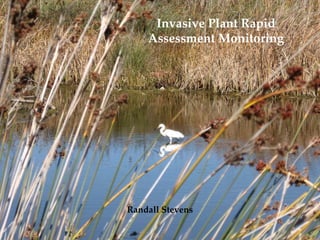
- 1. Invasive Plant Rapid Assessment Monitoring Randall Stevens
- 2. San Diego River • Unique 52 mile ecosystem from Julian area to Dog Beach • One of few remaining riparian habitats in the County
- 3. Goals of Project • Habitat assessment • Establish a baseline • Collect data to plan for treatment and removal
- 4. BIODIVERSITY • What do we have? • What is disappearing? • What have we lost?
- 5. Native Flora Conservation • Primary producers that provide ecosystem stability • San Diego is a “Hot Spot” • Historical value of S.D. River
- 6. Salix lasiolepis (Arroyo Willow)
- 7. Methods • Design Field Data Sheet and Protocol • Establish Survey Method • Determine Statistics to Analyze • Test Run
- 8. Field Data Sheet Sample Invasive Plant Rapid Assessment Monitoring File #: 4_S1_02272008 GPS Unit: Garmin eTrex Legend____________ Date: 2/27/2008 Time In:10:15 am Time Out: 12:00 pm Location: Mission Valley Preserve South Stand #: 1 Surveyors: R. Stevens Stand Boundaries NE SE SW NW Wypts. 043 058 005 059 N E S W Structure River Eucalyptus OB Bike Path Coaster Track Wypt. Plant ID # Ht (ft) dbh (in) Canopy (ft) Resprout Structure Access 6 3 15 2 5,5 N G E 12 5 35 30 12 N T1 E
- 9. Survey Statistics Example SURVEY STATISTICS: FILE #: 4_S1_02272008 Species # Ind. Median Canopy (m2) Total Canopy (m2) % Cover Schinus terebinthifolius 9 7.3 115.97 0.701 Ricinus communis 6 0.31 4.91 0.030 Arundo donax 3 58.06 176.51 1.070 Phoenix canariensis 29 29.19 1278.82 7.820 Washingtonia robusta 1 7.3 7.3 0.040 Carpobrotus edulis 3 9.29 35.3 0.210 TOTALS 51 1618.81 9.871 Species Median Ht (m) Height Range Median dbh dbh Range (m) (cm) (cm) Schinus terebinthifolius 3.66 1.83-6.10 7.62 2.54-12.70 Ricinus communis 0.91 0.91-1.83 2.54 2.54-2.54 Arundo donax 6.1 4.57-6.10 5.08 2.54-5.08 Phoenix canariensis 6.1 1.83-15.24 50.8 5.08-76.2 Washingtonia robusta 3.05 3.05-3.05 10.16 10.16-10.16 Carpobrotus edulis 0.31 0.31-0.31 2.54 2.54-2.54
- 10. Survey Statistics Example % Canopy Cover: 4_S1_02272008 Nonnative Cover 9.81% % Composition of Nonnative Canopy Cover: 4_S1_02272008 S. terebinthifolis 7.10% C. edulis 2.13% Native Cover R. communis 90.19% 0.30% W. robusta 0.41% A. donax 10.84% P. canariensis 79.22%
- 11. Plant ID List Example INVASIVE PLANT ID # MASTER LIST Plant ID # Species Date Added 1 Schinus terebinthifolius Brazilian Pepper Tree 12.01.2007 2 Phoenix canariensis Canary Island Date Palm 12.01.2007 3 Arundo donax Giant Reed 12.01.2007 4 Tamarisk ramosissima Salt Cedar 12.01.2007 5 Ricinus communis Castor Bean 12.01.2007 6 Eucalyptus spp. Eucalyptus 12.01.2007 7 Washingtonia robusta Mexican Fan Palm 12.01.2007 8 Carpobrotus edulis Hottentot Fig 12.01.2007 9 Mesembryanthemum crystallinum Ice Plant 3.01.2008 10 Cortaderia selloana Pampas Grass 3.01.2008 11 Foeniculum vulgare Fennel 3.01.2008 12 Brassica nigra Black Mustard 3.01.2008 13 Myoporum laetum Mousehole Tree 3.01.2008 14 Nicotiana glauca Tree Tobacco 3.01.2008 15 Salsola tragus Russian Thistle 3.01.2008 16 17
- 12. Final Product • Field Data Sheet • Survey Statistics Sheet and Charts • Ariel image printout of location • GIS map of distribution
- 13. Arundo donax (Giant Reed)