GPS uses a constellation of satellites to provide location and time information to GPS receivers. It functions using triangulation based on distance measurements from multiple satellites. New applications and technologies continue to improve GPS precision and integration with other systems. Future advancements may include smaller and more portable receivers as well as integration with additional satellite systems.
Latest Advances in GPS technology Seminar reportMode Gautam Raj
The document summarizes the latest advances in GPS technology. It provides an overview of how GPS works with 24 satellites that orbit Earth and transmit radio signals. A GPS receiver can locate 4 or more satellites to calculate the user's position via trilateration. The document then describes the 3 segments of GPS - the space segment consisting of satellites, the control segment that tracks satellites, and the user segment of receivers. It outlines objectives of GPS for military like navigation and targeting, and for other uses such as automotive navigation, aviation, agriculture, and disaster relief.
World Global Network
شركة عالمية للتسويق الشبكي تعمل في عديد الأختصاصات منها (تكنولوجيا - الإتصالات -- الدعايا والإعلان - الطاقة المتجددة) و هي التجارة الأقوى في العالم
- إنظمت لمنظمة البيع المباشر الدولية D.S.A وصنفت ضمن أفضل 200 شركة في العالم و خاضعة للقوانين الأمريكية
- رئـــــيسها / د.فابيو جالدي مخترع أمريكي من أصل إيطالي
في مجال التكنولوجيا
تنتج الشركة حاليا وحصريا اجهزة تليفونات ذكية لا مثيل لها بالمقارنة بالأجهزة الموجودة..
(كارت فون -- دايموند فون -- تبليت رائع -- دايموند فون4 -- شاحن بالطاقة الشمسية)
في مجال الإتصالات:
تملك الشركة قمر صناعي يتيح لها عمل اتصالات لشركائها بتخفيض يصل الي 90% علي فيمة المكالمة كما انشأت برنامج يتيح لك التحدث من خلالة بالصوت والصورة والشات ايضا.
في مجال الدعاية والإعلان: فقد اخترع د.فابيو جالدي برنامج من خلاله تجني ارباح علي كل استقبال مكالمة او استفبال رسالة
في مجال الطاقة المتجددة:
تقوم الشركة بالإتفاق مع حكومات لإنشاء محطات توليد الطاقة المتجددة يقوم الشركاء بشراء خلايا للطاقة الشمسية في تلك المحطات و يحصلون على ربح سنوي 20% من قيمة الخلية و قد أمنت الشركة هذه الخلايا لمدة 20 سنة لدى أقوى شركة تأمين في العالم شركة أليانز الألمانية كما اتاحت الفرصة امام كل المستثمرين لإنشاء هذه المحطات الشمسية لتوليد الطاقة
إدراج أسهم الشركة في بورصة لندن .
بامكانكم التواصل معي عبر السكايب : skype : sayari.naim
الفايسبوك أو: https://www.facebook.com/pages/World-GN-NaimIvy/465570430239077
أو E-mail : WorldGn.ssyyrr@gmail.com
Future Sat Africa - Space Applications for Sustainable Development of AfricaMyles Freedman
This document discusses space applications as a strategy for sustainable development in Africa. It provides an overview of the Entoto Observatory and Research Center (EORC) in Ethiopia, including its vision, mission, training programs, and research areas like astronomy, space science, remote sensing, and geodesy. Benefits of investing in space education and research include economic gains in agriculture, land management, and more, as well as social benefits like education, communication, and disaster response. The document recommends expanding education and research collaboration between African institutions, conducting joint projects with international partners, and collectively addressing legal issues to help develop African space programs and applications.
This document discusses next generation internet over satellite networks. It covers new services and applications for internet integrated services, modeling elastic and inelastic traffic, quality of service provisioning, traffic modeling techniques, and statistical methods for modeling different types of traffic including renewal processes and Markov models. It also discusses traffic engineering principles, multi-protocol label switching, internet protocol version 6, and the future development of satellite networking.
قائمة العشر الأوائل لأخبار التكنولوجيا 6MOTC Qatar
لأن عالم التكنولوجيا في تطور مستمر وسريع، قمنا بإعداد هذا التقرير الذي يلخص أهم تطورات التكنولوجيا في الشهر السابق (نوفمبر-ديسمبر).
يحتوي التقرير على:
1. أكس بوكس ون (Xbox One)، ما الجديد؟
2. تفتح Google المجال أمام مبرمجين التطبيقات لبرنامج Google Glass
3. تطبيق Washio لتنظيم عملية الغسيل بواسطة الهواتف الذكية
4. قناع نوم يتيح لمرتديه التحكم بأحلامه
5. "تويتر" تضاعف سرية البيانات
6. منتج يبث تطبيقات الهاتف على زجاج السيارة
7. تعرف على «ناو» الروبوت الذكي عاطفياً
8. جهاز GPS جديد من شركة Garmin
9. برنامج إدارة الإعلانات الالكترونية الشامل
10. خزن معلوماتك على جهاز الذاكرة الجديد من WD
قم بزيارة: http://www.slideshare.net/ictQATAR/ للنشرات السابقة والقادمة.
Soil is formed through the weathering of rocks over long periods of time. The key factors that influence soil formation are parent material, climate, organisms, topography, and time. Soil is made up of minerals, water, air, organic matter, and microorganisms. It performs important functions like supporting plant growth and regulating water flow. In India, the main soil types are black, red, laterite, alluvial, desert, and marshy soils which differ based on the underlying rocks and climate of the regions. Conservation of soil through practices like tree planting, minimal tilling, and preventing erosion is important to sustain agriculture and life.
Soil is a complex layer that provides resources for plant and animal growth. It is composed of mineral matter, organic matter, air pores, and water pores. A variety of organisms live in soil and help break down organic matter, improving the soil structure. Plants rely on soil to provide anchorage, water, oxygen, and nutrients. Soil quality and productivity can be degraded through processes like erosion from construction, contamination from chemicals, and loss of topsoil from accelerated erosion caused by human activities like plowing. Proper soil management is important to sustainably produce food and conserve this fragile resource.
The document provides an overview of existing radio navigation systems prior to and leading up to the development of GPS. It describes ground-based low and high frequency systems like Omega, Loran, VOR/DME, and ILS, as well as early space-based systems like Transit. It explains that higher frequency systems enable higher precision but require line-of-sight, while lower frequencies can propagate further but with lower precision. The development of GPS aimed to leverage satellites to provide worldwide coverage without line-of-sight limitations, building on lessons from prior navigation systems.
Soil science for teachers (massive-the real dirt on soil)Moira Whitehouse
A very large Slide Show on soil. Useful for anyone without formal earth science training who might need to bone up or teach any aspect of soil. It's huge, 159 slides. It could also be split up into several lessons for students.
Soil is the top layer of earth's crust consisting of organic and inorganic matter that supports plant growth and living organisms. Soil formation is influenced by factors like relief, parent rock, climate, vegetation, and time. The major soil types in India are alluvial, black, red and yellow, laterite, arid, and forest soils. Alluvial soils are the most widespread and fertile soils, deposited by Himalayan river systems in northern India. Black soils, also known as regur soils, are clay-rich and moisture-retentive, found in the Deccan trap region. Red and yellow soils develop in dry, crystalline rock areas with low rainfall. Laterite soils form in hot,
This document presents information about soil profiles and horizons. It discusses the key components of soil including minerals, organic material, air and water. It describes the distinct layers that make up a soil profile from the surface down to the bedrock. These layers are known as horizons, including the O, A, E, B, C and R horizons. Each horizon is defined by its composition, depth and role in soil formation and nutrient transport. The document provides details on the characteristics of each individual horizon that makes up the soil profile.
GPS is a satellite-based navigation system consisting of 24 satellites operated by the US Department of Defense. It provides positioning anywhere in the world without subscription fees. GPS determines location by measuring the time it takes signals from satellites to reach a receiver and using that to calculate the distance to the satellites, whose locations are known. Combining distance measurements to multiple satellites triangulates the receiver's position.
The document provides an overview of GPS (Global Positioning System), including its history, core components, working principles, accuracy limitations, and applications. GPS is a satellite-based navigation system consisting of 3 segments - space, control, and user. It works by precisely measuring the time it takes signals from GPS satellites to reach a GPS receiver and triangulating its position based on distances to 4 or more satellites. Various methods can improve its accuracy to within a few centimeters.
The document describes the iPhone, noting it comes in 64GB, 32GB, and 16GB storage sizes. It lists the iPhone's software features such as apps for Twitter, WhatsApp, and Facebook. The document promotes the iPhone's capabilities and popularity for social media use.
The document discusses the benefits of exercise for mental health. Regular physical activity can help reduce anxiety and depression and improve mood and cognitive functioning. Exercise causes chemical changes in the brain that may help protect against mental illness and improve symptoms.
Artificial intelligence is the study and creation of intelligent machines and computer programs. There are two major types: robots and expert systems. Expert systems use symbolic processing and a knowledge base of rules to solve complex problems like a human expert. Knowledge engineers work with domain experts to build the knowledge base and heuristics. Early development of AI included symbolic languages like LISP and PROLOG. Key developments included expert systems, speech recognition, and machine learning including neural networks. Current areas of focus include self-driving cars, online assistants, and knowledge management tools.
Artificial intelligence is the study and creation of intelligent machines and computer programs. There are two major types: robots and expert systems. Expert systems use symbolic processing and a knowledge base of rules to solve complex problems, often mimicking human expertise. Knowledge engineers work with domain experts to build expert systems using programming languages like LISP and PROLOG. Key developments included symbolic processing, heuristic search, knowledge representation, and the creation of knowledge bases. Major funding came from DARPA in the 1960s, which helped launch the field of AI research. Modern applications include online assistants, automated journalism, and note-taking apps. Challenges remain in areas like commonsense reasoning and embodied cognition.
Artificial intelligence is the study and creation of intelligent machines and computer programs. There are two major types: robots and expert systems. Expert systems use symbolic processing and a knowledge base of rules to solve complex problems, often mimicking human expertise. Knowledge engineers work with domain experts to build expert systems using programming languages like LISP and PROLOG. Key developments included symbolic processing, heuristic search, knowledge representation, and the creation of knowledge bases. Major funding came from DARPA in the 1960s, which helped launch the field of AI research. Modern applications include online assistants, automated journalism, and note-taking apps. Challenges remain in areas like commonsense reasoning and embodied cognition.
Artificial intelligence is the study and creation of intelligent machines and computer programs. There are two major types: robots and expert systems. Expert systems use a knowledge base, heuristics, and knowledge engineers to solve complex problems through symbolic processing languages like LISP and PROLOG. The history of AI includes the development of logic theory in the 1950s, expert systems in the 1970s-80s, the creation of DARPA in the 1950s, and the rise of AI assistants like Siri in the 2010s that can understand natural language. Modern AI techniques are used in applications such as online journalism, digital assistants, music identification, and note taking applications.
iPad is a new product from Apple that features a large multi-touch screen and is highly portable, running both Mac-like and iOS apps. It will be available in late March with Wi-Fi models starting at $499 and 3G & Wi-Fi models from $629. The iPad was designed to be thin and light for comfortable one-handed use.
iPad is a revolutionary device from Apple that features a large multi-touch screen and mobile OS designed for web browsing, email, photos, videos, music, games and more. The iPad comes in both Wi-Fi and Wi-Fi + 3G models that allow internet access from anywhere, and it has a long battery life and apps available from the App Store.
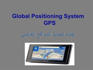
2. ما هو GPS
• وهو عبارة عن نظام ملحي مكون من شبكة أقمار صناعية يصل عددها إلى 42 قمرً مثبتة في
ا
مدارات محددة من الفضاء الخارجي من قبل وزارة الدفاع المريكية . كان الهدف الساسي من
هذه الشبكة من القمار الصناعية هدفً عسكريً بحتً ، ولكن في عام 0891م سمحت الحكومة
ا ا ا
المريكية بأن يكون هذا النظام متاحً للستخدامات المدنية . ونظام ال GPSيعمل تحت جميع
ا
أنواع الظروف الجوية ، وفي كل مكان في العالم ، وعلى مدار 42 ساعة في اليوم ، ول يجب
الشتراك من أجل الحصول على هذه الخدمة كما أنها مجانية .
3. • هذه القمار تدور في مدارات حول الرض بسرعة تبلغ 000.7 ميل
في الساعة ، وتعتمد على الطاقة الشمسية ، كما أنها مزودة ببطاريات
قابلة للشحن من أجل ضمان استمرار عملها في حالة انعدام الطاقة
الشمسية ، ويوجد على كل قمر صاروخ صغير من أجل أن يس ّر
ي
القمر في طريقة الصحيح
4. بعض الحقائق عن GPS
- أول قمر صناعي أطلق كان في عام 8791م •
- تم النتهاء من اطلق جميع القمار وعددها 42 قمرً في عام 4991م
ا •
-العمر الفتراضي لكل قمرهو عشر سنوات . علمً بأن البدائل لهذه القمار أطلقت في مداراتها .
ا •
- يزن القمر الصناعي ما يقارب الطن الواحد ، وقطره 6 أمتار تقريبً بما في ذلك شرائح الطاقة
ا •
الشمسية الممتدة على جانبي القمر.
- يستهلك القمر فقط 05 وات أو أقل من الطاقة في حالة الرسال . •
- هذه القمار الصناعية تبث نوعين من الشارات المنخفضة : 1 Lو 2 . Lو 1 Lللستخدامات •
المدنية بذبذبة مقدارها 24.5751 MHعلى . UHF
5. ا
- أقمار ال GPSتدور حول الكرة الرضية في مدارات محددة ودقيقة جدً
مرتين في اليوم الواحد )42 ساعة( وخلل دورانها تبث إشارات تحمل
معلومات عن الرض .
• جهاز الستقبال لديك يستقبل هذه المعلومات ويعمل بعض العلميات
الحسابية ليحدد بالضبط موقع المستخدم .
• هناك أيضً محطات أرضية تستقبل المعلومات من القمر الصناعي وعلى
ا
أساسها تقوم هذه المحطات بتزويد القمر بمعلومات مهمة من أجل أن
يعمل على الوجه الفضل مثل التوقيت والمدار والموقع .. الخ وهذا يعني
أن التصال مزدوج بين هذه المحطات الرضية والقمار الصناعية
6. وصف مكونات شبكة GPS
1. قسم التحكم و المراقبة : وحدات تراقب اداء القمار الصناعية •
و تصحح الخطاء فور حدوثها
2. قسم الفضاء : 42 قمر صناعى فى ستة مستويات , فى كل •
مستوى اربعة اقمار صناعية , على ارتفاع حوالى 00391
كيلو متر
3. قسم المستخدمين : أجهزة إستقبال لها عدة مميزات : •
تعمل طوال الربعة و عشرون ساعة , طوال السبعة ايام , •
طوال السنة .
تغطى جميع انحاء الرض . •
ل يتاثر بالظروف الجوية ) الحرارة و المطر و الجليد و •
العواصف و الرعد و البرق ( .
دقة عالية جدا قد تصل الى سنتيمترات . •
انخفاض تكلفته القتصادية بالنسبة للطرق الخرى . •
ليحتاج الى خبرة متخصصة لتشغيله . •
7. أنواع أجهزة الستقبال
1.الجهزة الملحية ( الجهزة المحمولة يدويا Hand Held •
: Receivers) Navigational Receiversو هى
الجهزة سهلة الستخدام و التى لتحتاج الى خبرة كبيرة
لتشغيلها ,بالضافة الى رخص ثمنها ) 054 : 0054 جنيه
مصرى ( و ذلك لرخص مكوناتها الداخلية من الناحية التقنية
للتعامل مع الشارات المستقبلة.
• 2. الجهزة الچيوديسية ) : ( Geodetic Receiversو
هى الجهزة الهندسية دات الدقة العالية فى الستقبال و تحديد
الحداثيات حيث يصل الخطأ فى حساب الحداثيات الى اقل من
واحد سنتيمتر , و تتميز بمكونات داخلية عالية التقنية و
أسعارها اغلى من ) 0054 جنيه مصرى ( كما أنها تتطلب
خبرة هندسية كبيرة و برامج حاسب آلي متخصصة.
8. إستخدامات GPSالعامة
يستخدم GPSفى مجالت عديدة مثل الملحة و الزراعة و الجغرافيا و •
السياحة و أنشاء الطرق و الجسور و السكك الحديدة و المطارات و إعداد
و تحديث الخرائط , حيث يعتبر الخطوة الولى فى نظم المعلومات
الجغرافية . GIS
تستخدمه البواخر و القوارب الخاصة لتحديد موقعها فى البحار . •
شركات النقل لتحديد موقع سياراتها فمثل سيارات الجرة فى اوروبا •
تستخدم GPSحتى ترسل أقرب سيارة اجرة متواجدة بجوار صاحب
الطلب .
قريبا جدا سوف يوضع فى كل سيارة جهاز إستقبال يقوم بارشاد السائق •
الى اسهل الطرق ليصل الى مقصده , وهذا الجهاز مزود بخرائط
الكترونية بشوارع العالم و عن طريق المعلومات التى يستقبلها من
القمار الصناعية يمكن معرفة الشوارع المزدحمة و تجنبها و حاليا فى
اليابان يتم تطوير سيارة تستعين بالــ GPSو الخرائط اللكترونية فى
تمكين السيارة من معرفة الطريق دون الحاجة الى قائد عن طريق
مجسات الكترونية فى السيارة .
أما فى مجال الطائرات فاستخدام هدا النظام يمكن من التحكم فى حركة •
الطائرات فى الجو و السماح للطائرات بالطيران على مسافات متقاربة
من بعضها البعض للتخفيف من الزدحام الملحوظ فى المطارات .
9. فــــــــــوائد GPS
يساهم GPSفى : •
زيادة كفاءة جميع وسائل و انواع المواصلت و •
تقليل مخاطرها .
مراقبة كل التحركات فى الرض سواء بشرية أو •
تغيرات فى الظروف المناخية مثل العواصف
و الزلزل . •
فى الزراعة يستخدم GPSفى تطبيق تقنية •
الحكام الزراعى Precision Farming
و دلك فى محاولة لتنفيد أنسب المهام فى أنسب •
المواقع فى أنسب الوقات .
10. و يستخدم GPSفى : •
1( تحديد الموقع و الرتفاع بالتحديد •
) الحداثيات و المنسوب ( .
2( السرعة اللحظية و المتوسطة . •
3( تحديد الوضع . •
4( تحديد المسار . •
5( مسافة الرحلة من موقعك الى مقصدك •
.
6( مسافة الرحلة من مكان الى مكان اخر •
.
7( أوقات الشروق و الغروب . •
8( الوقت المتوقع للوصول الى وجهتك . •
9( أفضل طريقة لبلوغ هدفك بإستخدام •
خرائط رقمية مخزنة فى داكرة جهاز
الستقبال .
11. • تحت اشراف : د/ دينا ابو زيد
• مقدم من : نيرين طارق حسنى احمد