Download as PDF, PPTX

![DISIT Lab, Distributed Data Intelligence and Technologies
Distributed Systems and Internet Technologies
Department of Information Engineering (DINFO)
http://www.disit.dinfo.unifi.it
http://www.disit.org
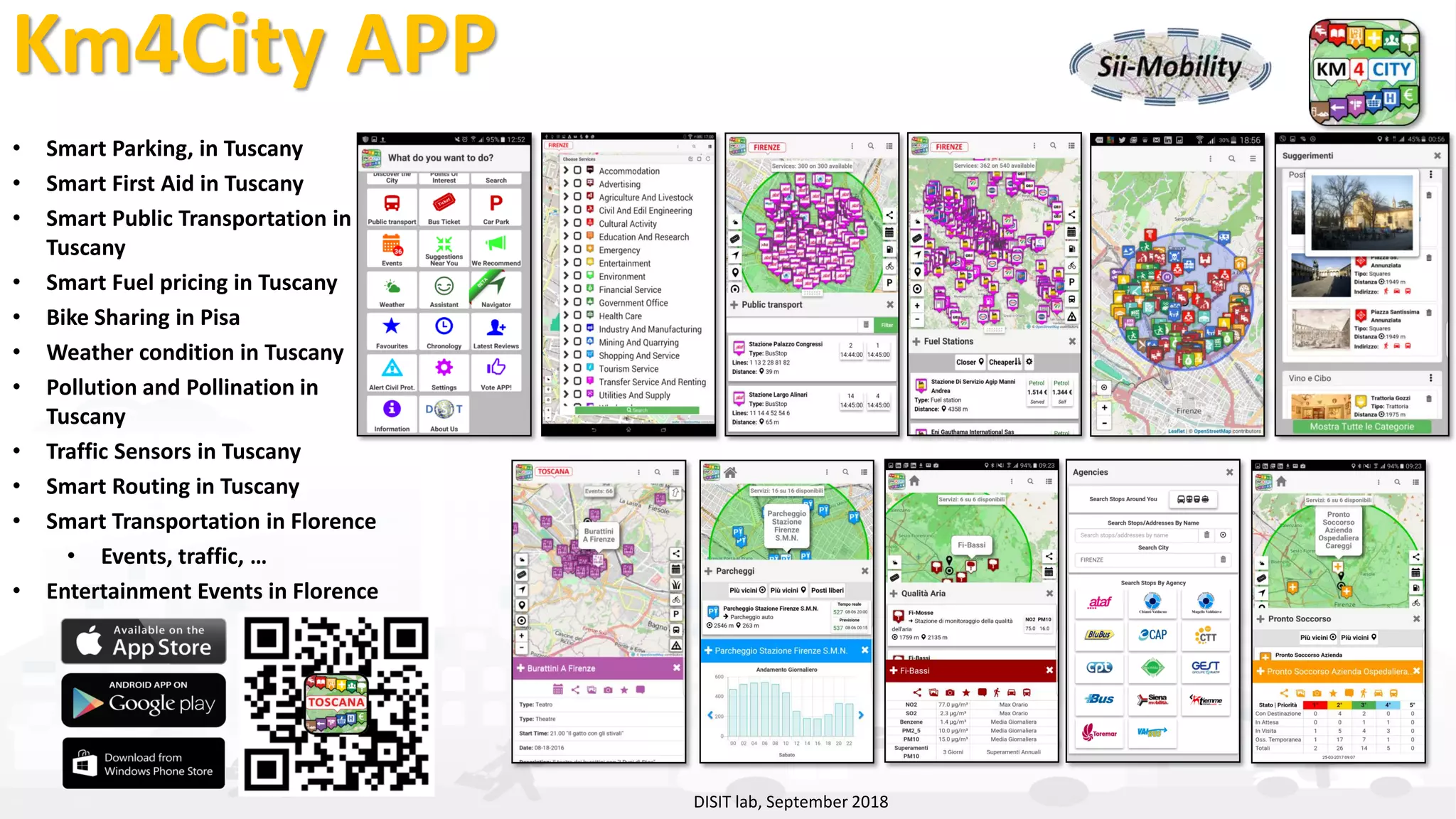
Km4City in Tuscany Area
Road Graph (Tuscany region)
132,923 Roads , 389,711 Road Elements
318,160 Road Nodes, 1,508,207 Street Numbers
Info on: points, paths, areas, etc.
Services (20 cat, 512 cat.)
16 Public Transport Operators
21.280 Bus stops & 1081 bus lines
Dynamic/real-time in Tuscany Region
• Real time bus lines: 144 updates X day X line
• 1081 Transport Pub Lines: 1-2 up per day, time-path
• >210 parking lots status: 76 updates X day X sensor
• >796 traffic Sensors: 288 updates X day X sensor
• 285 weather area: 2 updates X day X area
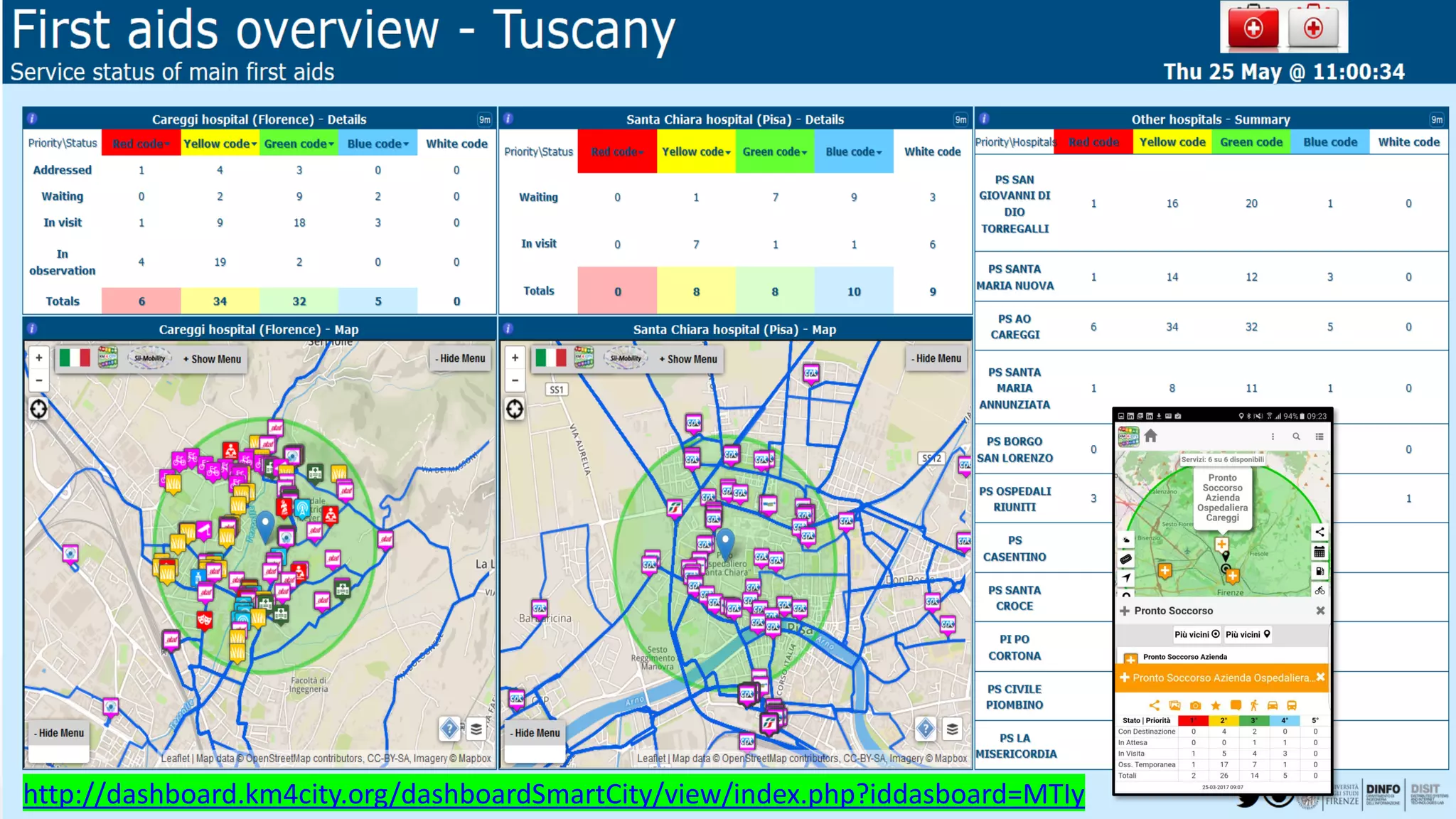
• >12 hospital Triage status: 96 updates X day X FA
• 22 Environmental data: 20 updates X day X sensor
• 39 Bike Sharing data: Pisa and Siena
• 12 Pollination data
• 140 recharging stations
• Smart benches, waste mng, irrigators, lighting,…
• Florence ent.events: about 60 new events X day
• Different kinds of Florence traffic events,
• [1600 Fuel stations: 1 update X day X station]
• Wi-Fi: > 400.000 measures X day
• App mobiles: >50.000 measures X day
• more than 40.000 distinct users X day
• From 600.000 to 4.5 M Tweets X day
• many IOT sensors ……http://servicemap.km4city.org](https://image.slidesharecdn.com/km4city-snap4city-geomarketing-v10-8-181012173357/75/Gli-open-data-nella-citta-intelligente-5-2048.jpg)


The document outlines the capabilities and features of the DISIT Lab's km4city platform, which integrates various urban data sources including IoT, open data, and real-time sensors to support smart city initiatives. Key functionalities include data aggregation, real-time monitoring, smart applications for transport and mobility, and tools for decision-making. The platform aims to enhance user engagement and optimize city services through predictive analytics and user-driven functionalities.


