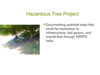
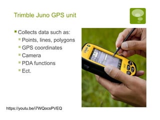
The document describes how East Bay Regional Parks District uses GIS technology to manage parks and natural resources. It discusses several projects involving data collection and mapping of issues like invasive plants, hazardous trees, infrastructure improvements. GIS data is collected using a Trimble Juno GPS unit and uploaded into the ParkView system to analyze spatial information and document maintenance needs across the 13 park sites in the district.


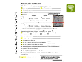


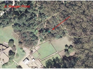
![Dredge Silt Basin 1. Work Request or Appendix #:___________________________________
2. Observer name: __________________________ 3. Date of field assessment: ____________________
4. Park or Regional Trail name: ____________________________________________________________
5. Brief project site name: ____________________________________________________________________________
6. GPS location:
Latitude: Longitude*:
Units in Decimal
Degrees? (check if in same
format as example)
__ __ . __ __ __ __ __ __ __ . __ __ __ __
(Example: 37.xxxx or 38.xxxx) (Example: -121.xxxx or -122.xxxx)
**Decimal degrees is the default unit on your Juno**
------------------------------------------------------------ OR --------------------------------------------------------------
Units in Degrees,
Minutes, Seconds? (check
if in same format as example)
__ __ °__ __’ __ __” __ __ __ °__ __’ __ __”
(Example: 37°xx’xx” or 38°xx’xx”) (Example: 121°xx’xx” or 122°xx’xx”)
**If units are in this format, GPS coordinates will need to be converted. Please go to the TCP ParkView page for more
information.**
7. Source of the Lat/Long values (check one): GPS (Juno) OR ParkView
8. Take photos of site using the Juno GPS camera (complete all and check when completed):
Upstream view Downstream view Side view
9. Drainage name description: ____________________________________________________________
10. Average length of dredging area (in feet): _______________________________________________
11. Average width of dredging area (in feet): ________________________________________________
12. Average depth of dredging (in feet): ____________________________________________________
13. Volume of silt to be dredged (in cubic yards) [= (length x width x depth)/27]: __________________
14. Equipment required to complete project: Mechanized equipment includes an excavator, backhoe,
ten-wheel dump truck, and small trucks.
15. Days required to complete project: __________1 – 7 days_____________________
16. Project description: Use the example and space provided on the back of this form to write the
project description
(Example: 45 feet)
(Example: 20 feet)
Example: Tilden Nature Area, Silt Basin 2
Example: Wildcat Creek
Highlighted fields = need to be filled out in the field
(Example: 6 feet)
Example: (45 x 20 x 6)/27 = 200 CY
Contact Renee Robinson (RRobinson@EBParks.org; (510) 690-6650) with questions
* Remember to include the negative sign,
even if it is not shown on the Juno!
_
When you return from the field, use the instructions
downloaded from the TCP ParkView site to upload the
photos and submit the information to ParkView.
DredgeSiltBasinform](https://image.slidesharecdn.com/502da70c-9ee2-471a-97d0-4ec70e433a68-150526080653-lva1-app6891/85/GIS-Presentation-15-320.jpg)