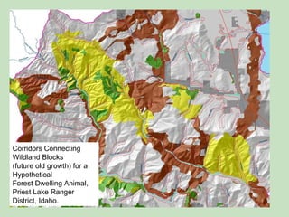
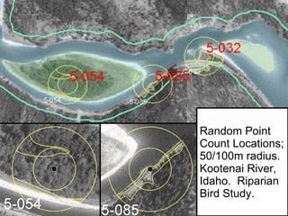
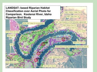
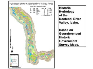
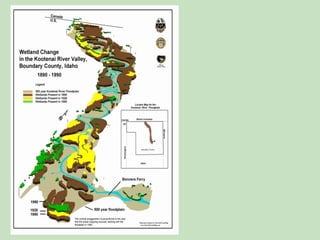
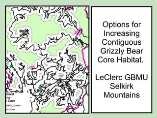
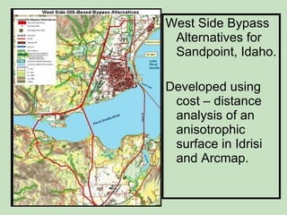
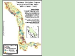
GIS   Analysis and  Imagery  Classification  Examples .
Corridors Connecting Wildland Blocks  (future old growth) for a Hypothetical  Forest Dwelling Animal,  Priest Lake Ranger District, Idaho.
Random Point Count Locations; 50/100m radius.  Kootenai River, Idaho.  Riparian Bird Study.
LANDSAT- based Riparian Habitat Classification over Aerial Photo for Comparison.  Kootenai River, Idaho Riparian Bird Study
Historic Hydrology of the  Kootenai River Valley, Idaho. Based on Georeferenced Historic Government Survey Maps.
 
Options for Increasing Contiguous Grizzly Bear Core Habitat.  LeClerc GBMU Selkirk Mountains
West Side Bypass Alternatives for Sandpoint, Idaho. Developed using cost – distance analysis of an anisotrophic surface in Idrisi and Arcmap.
 

GIS analysis examples

  • 1.
    GIS Analysis and Imagery Classification Examples .
  • 2.
    Corridors Connecting WildlandBlocks (future old growth) for a Hypothetical Forest Dwelling Animal, Priest Lake Ranger District, Idaho.
  • 3.
    Random Point CountLocations; 50/100m radius. Kootenai River, Idaho. Riparian Bird Study.
  • 4.
    LANDSAT- based RiparianHabitat Classification over Aerial Photo for Comparison. Kootenai River, Idaho Riparian Bird Study
  • 5.
    Historic Hydrology ofthe Kootenai River Valley, Idaho. Based on Georeferenced Historic Government Survey Maps.
  • 6.
  • 7.
    Options for IncreasingContiguous Grizzly Bear Core Habitat. LeClerc GBMU Selkirk Mountains
  • 8.
    West Side BypassAlternatives for Sandpoint, Idaho. Developed using cost – distance analysis of an anisotrophic surface in Idrisi and Arcmap.
  • 9.