Geospatial Native Title Information: Reality, not a Dream
•
1 like•173 views

Why should it be hard to share geospatial native title information? The focus of this presentation will be to highlight geospatial information sharing initiatives which been flourished in the native title landscape and the reasons for their success

Recommended
More Related Content
Similar to Geospatial Native Title Information: Reality, not a Dream
Similar to Geospatial Native Title Information: Reality, not a Dream (20)
Recently uploaded
Recently uploaded (20)
Geospatial Native Title Information: Reality, not a Dream
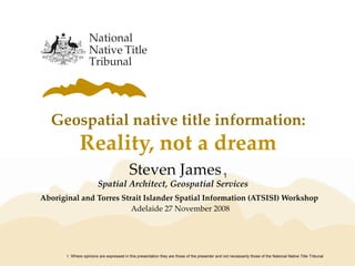
- 1. Geospatial native title information: Reality, not a dream Aboriginal and Torres Strait Islander Spatial Information (ATSISI) Workshop Adelaide 27 November 2008 1. Where opinions are expressed in this presentation they are those of the presenter and not necessarily those of the National Native Title Tribunal Steven James1 Spatial Architect, Geospatial Services
- 2. provocative question is access to geospatial native title information a reality ? … from the perspective of an ordinary user?
- 3. presentation objective ‘Discover’ the availability accessibility user friendliness, of geospatial native title information based on criteria, and access methods
- 4. what criteria? 2006 e-Government Strategy “govt. information services will be easy to understand and locate” vision for 2010 Meeting users’ needs Connected service delivery Value for money Public sector capability 1. 2006 e-Government Strategy, Responsive Government: A New Service Agenda 1
- 5. criterion 1 – meeting users’ needs information services easy to locate interaction is quick easy to pinpoint information range of delivery modes native title
- 6. criterion 2 – connected service delivery consistent and unified PUBLIC SECTOR CONNECTED SERVICE DELIVERY MULTIPLE CHANNELS source: 2006 e-Government Strategy, Responsive Government - A New Service Agenda
- 7. criterion 3 – value for money less double handling more informed users common standards information sharing
- 8. criterion 4 – public sector capability enhanced capability enhanced skills public sector capability source: Shared Land Implementation Platform Final Implementation Plan, October 2004
- 9. methods of access 3 types of access methods desktop datasets browser number of users ‘personal’ datasets e.g. ESRI, Mapinfo intranet, extranet, internet web maps accessmethod linked services OGC services e.g. WMS, WFS
- 10. the challenge using only datasets and tools available on the internet, build a visual picture of native title over the recent Witjara National Park determination area
- 11. browsers typical model user browser internet
- 12. generic browser native title applications native title determination area
- 13. thematic browser Native TitleVision - topography
- 14. thematic browser Native TitleVision - tenure
- 15. Native TitleVision – check it out accessed via the web URL http://www.ntv.nntt.gov.au user name & password: nntt_guest Australia wide coverage easy to use !
- 16. at a glance browser advantages simple to use only a browser is needed available for Windows, Apple and Linux computers
- 17. at a glance browser disadvantages internet access required currency may be a issues with non- custodial datasets may need to visit many websites inconsistent functions
- 18. scorecard browsers meeting users’ needs connected service delivery value for money public sector capability verdict : Reality 2 1.5 2 1.5 7 out of 10total
- 19. desktop datasets typical model skilled user desktop GIS geospatial datasets
- 20. sources of desktop datasets native title NNTT – ESRI, Mapinfo, KML formats topography Geoscience Australia – above + GeoPDF land administration & use SA Dept for Environment & Heritage SA Dept of Planning & Local Govt. resource development Primary Industries & Resources SA imagery Dept of Climate Change refer to Appendix A of this presentation for website addresses for the above themes
- 21. Open Source desktop GIS Quantum GIS (QGIS) Linux, Mac and Windows platforms vector, raster and database formats wide range of formats user friendly free refer to Appendix B of this presentation for website address for the above Open Source application
- 22. Open Source desktop GIS Portable GIS by Archaegeek GIS on a USB stick Desktop GIS Webserver Database server WMS/WFS servers free refer to Appendix B of this presentation for website address for the above Open Source applications
- 23. combining datasets & desktop GIS
- 24. at a glance desktop data advantages assign symbology select layers portability collect new data integrate imagery ad hoc queries combine formats better labelling quality output
- 25. at a glance desktop data disadvantages skilled users manage datasets maintain currency manage datums initial setup
- 26. scorecard desktop data meeting users’ needs connected service delivery value for money public sector capability verdict : Reality 1.5 1.5 2 1.5 6.5 out of 10total
- 27. linked services typical model highly skilled user OGC web services geospatial datasets
- 28. example of linked services Geoscience Australia - MapConnect interactive find, select, order & deliver easy and free
- 29. workflow 2 1 3 download unziporder refer to Appendix C of this presentation for website address for the above resource
- 30. result4
- 31. at a glance services advantages integration automation up-to-date convenient multi-platform
- 32. at a glance services disadvantages high skill level tailoring required dependency on service providers
- 33. scorecard desktop data meeting users’ needs connected service delivery value for money public sector capability verdict : Reality 2 2 2 1 7 out of 10total
- 34. conclusions browser ideal for infrequent users Open Source desktop GIS is mature, flexible and cost effective online availability of native title is a reality further work needed to get more datasets online
- 35. questions & answers thank you
- 36. appendix A – dataset resources native title https://www.ga.gov.au/products/servlet/controller?event=DEFINE_PRODUCTS topography - mapsheets https://www.ga.gov.au/products/servlet/controller?event=DEFINE_PRODUCTS topography - MapConnect http://www.ga.gov.au/mapconnect/ land administration & use SA DEH - http://www.environment.sa.gov.au/mapland/spatial_products SA DPLG - http://www.planning.sa.gov.au/go/spatial-data-download resource development PIRSA - https://egate.pir.sa.gov.au/geoserver/sarig/frameSet.jsp imagery http://www.climatechange.gov.au/ncas/dataviewer/index.html
- 37. appendix B – desktop GIS resources Quantum GIS http://qgis.org/ Portable GIS http://www.archaeogeek.com/download.php Other GIS viewers https://www.ga.gov.au/nmd/products/faq.jsp#viewers
- 38. appendix C – WMS resources MapConnect http://www.ga.gov.au/mapconnect/ Geoscience Australia http://www.ga.gov.au/map/broker/index.jsp