Syllabus
Relevance ofgeology in Civil Engineering
Hydrogeology
Minerals
Rocks as aggregates of minerals
Attitude of geological structures
Introduction to natural hazards
3.
References
Duggal, SK,Rawal,Nand Pandey, HK (2014) Engineering Geology, McGraw Hill
Education, New Delhi
Garg, SK (2012) Introduction to Physical and Engineering Geology, Khanna
Publishers, New Delhi
Gokhale, KVGK (2010) Principles of Engineering Geology, BS Pubications,
Hyderabad
Kanithi V (2012) Engineering Geology, Universities Press (India) Ltd., Hyderabad
Singh, P (2004) Engineering and General Geology, S. K. Kataria and Sons, New Delhi
Bennison, GM, Olver, PA and Moseley, KA (2013) An introduction to geological
structures and maps, Routledge, London
Gokhale, NW (1987) Manual of geological maps, CBS Publishers, New Delhi
4.
Geology
Origin, ageand structure of Earth.
Evolution, modification and extinction of various surface and sub-surface
physical features like mountains, plateaus, plains, valleys, basin, caves, etc.
Materials making up the earth
Nature and functioning of atmosphere
The study of all water bodies existing on surface or underground
Interaction of atmosphere, lithosphere and hydrosphere
Physical, dynamic and physicochemical processes operating on and within the
earth
Agents and forces involved and evolved in such processes
5.
RELEVANCE OF GEOLOGYIN
CIVIL ENGINEERING
Scope of Engineering Geology
Engineering geology is the application of geology in design, construction and
performance of civil engineering works. The objectives of engineering geology are:
It enables a civil engineer to understand engineering implications of certain
conditions related to the area of construction, which are geological in nature.
It enables a geologist to understand the nature of geological information that is
essential for a safe design and construction of a civil engineering project.
The principle objective of an engineering geologist is the protection of life and
property against damage caused by various geological conditions.
6.
RELEVANCE OF GEOLOGYIN CIVIL
ENGINEERING (Contd…)
The area covered by Engineering geology includes geological hazards, geotechnical
data, material properties, landslide and slope stability, erosion, flooding, dewatering,
seismic studies etc.
The most important role of an engineering geologist is to interpret the landforms and
earth processes, to identify potential geologic and related man-made hazards that may
impact civil engineering structures and human development.
7.
Importance of EngineeringGeology
The importance of Engineering geology in development can
hardly be exaggerated. It helps to:
Identify areas susceptible to failure due to geological hazards
Establish design specifications
Select the best site for engineering purposes
Select best engineering materials for construction
Recognize potential difficult ground conditions prior to detailed design and
construction
8.
The scope ofengineering geology is best studied with reference to
major activities of the profession of a civil engineer which are:
Construction
Water Resource Development
Town and Regional Planning
9.
Geology in ConstructionJobs
Full geological information about the site of construction or
excavation and about the natural materials of construction is of
great importance
The aspect of geology has full relevance in all the three aspects of
each construction i.e. Planning, designing and execution.
10.
Construction
Similarly for constructionin geologically sensitive areas as those of coastal
area, seismic zones and permafrost regions, knowledge of geological
history of the area is of great importance.
Coastal area: behaviour of rocks towards waves, current and marine environment
must fully be understood in planning and execution stage. Special type of
construction may become essential in this area.
Seismic region: Construction should be well balanced and light weight. Hence
lightweight materials are used and architectural fancies are to be avoided.
Permafrost region (soil remains permanently frost up to certain depth): Problems
can be solved only by proper understanding of the ground below.
Construction of underground projects like tunnels cannot be undertaken
without a thorough knowledge of the geological characters and setting of the rocks
and their relevance to the loads imposed on or relieved from them.
Design
Some of thegeological characters that have a direct or indirect influence on
the design of a proposed project are:
The existence of hard bed rocks and their depth from and inclination with the
surface.
The mechanical properties like compressive strength, shear and transverse
strength, modulus of elasticity, porosity and permeability, resistance to decay
and disintegration along and across the site of the proposed project.
Presence, nature and distribution pattern of planes of structural weakness like
joints, faults, folds etc.
Presence nature and distribution pattern of zones of weak materials like shear
zones, clay bands etc.
The position of ground water table including points of recharge and discharge and
variations during different periods of the year.
Seismic character of the area as studied from the seismic history and prediction
about future seismicity.
13.
Geology in WaterResource Development
Exploration and development of water resources have become very
important areas of activities for scientists, technologists and engineers in all
parts of the world. The water resource engineers have to understand the
water cycle in all essential details.
The study of water cycle is an essential prerequisite for effective planning
and execution of major water resource development programmers on
national and regional level.
Geological information is of fundamental importance in exploration and
exploitation of water resources of a region from surface and sub-surface
reserves of water.
The water bearing properties of rock bodies and factors that influence
storage, movement and yield of water from aquifers are geological problems
A thorough geological knowledge about the rock strata is essential is
essential for designing a water supply project.
14.
Geology in Townand Regional Planning
A town planner is concerned essentially with utilization of land in a best and
aesthetic manner possible for developing cities and towns for meeting social
needs in different areas.
The primary aim of a town planner is to derive maximum benefit from natural
environment with minimum disturbance.
The roles played by the materials making the land like rocks, soils, vegetation,
water bodies etc. in the evolution of natural landscape must be understood.
The regional Town Planner is responsible for adopting an integrated approach
in all such cases of allocation of land for developmental projects. Thus a
change induced in the natural setup of an area due to a proposed new project is
going to lead a series of changes in the adjoining and even in distant places.
As such all sound planning must be in tune with the natural features and
processes of a region.
Physical geology:deals with study of Erosion, Transportation and Deposition
(ETD)
Geomorphology: deals with the study of surface features of the earth
Mineralology: deals with formation, occurrence, aggregation, properties and
use of minerals
Historical geology: deals with the past history of the earth
Paleontology: deals with the study of fossils
Economic geology: deals with the study of minerals and rocks and other
materials occurring in or on the earth and that can be exploited for the benefit
of man
Engg geology- deals with the geological study of the site and location for
major engg projects
Mining geology- deals with the exploring and exploitation of minerals by
mining and quarrying practice
Petrology: study of rocks
18.
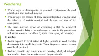
Weathering
Weathering isthe disintegration or structural breakdown or chemical
alteration of rock and soil minerals
Weathering is the process of decay and disintegration of rocks under
the influence of certain physical and chemical agencies of the
atmosphere.
The most important aspect of weathering is that the weathered
product remains lying over and above or near to the parent rock
unless it is removed from there by some other agency of the nature.
Examples:
Rocks exposed to frost action at higher altitude in cold climates
disintegrate into small fragments. These fragments remain strewn
over the slopes itself.
Rocks exposed to high temperatures in deserts gradually disintegrate
into smaller pieces that remain close to the parent rock.
19.
Factors affecting weathering
Susceptibility to weathering
Structure
Joints, faults and bedding.; their
frequency
Stratification
Mineralogy (Bowen’s Reaction Series)
Environmental factors
Temperature
Warm climate yields faster process
Rainfall
Heavy rainfall means faster weathering
Freezing and thawing may occur
Biological activity
Presence of roots, breaking of rocks,
mining
Topography
Amount of rocks exposed to agents of
weathering
Time
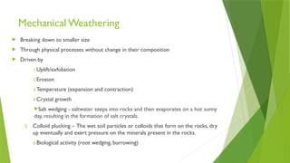
Mechanical Weathering
Breakingdown to smaller size
Through physical processes without change in their composition
Driven by
1.Uplift/exfoliation
2.Erosion
3.Temperature (expansion and contraction)
4.Crystal growth
Salt wedging - saltwater seeps into rocks and then evaporates on a hot sunny
day, resulting in the formation of salt crystals.
5. Colloid plucking – The wet soil particles or colloids that form on the rocks, dry
up eventually and exert pressure on the minerals present in the rocks.
6.Biological activity (root wedging, burrowing)
22.
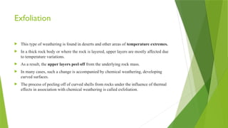
Exfoliation
This typeof weathering is found in deserts and other areas of temperature extremes.
In a thick rock body or where the rock is layered, upper layers are mostly affected due
to temperature variations.
As a result, the upper layers peel off from the underlying rock mass.
In many cases, such a change is accompanied by chemical weathering, developing
curved surfaces.
The process of peeling off of curved shells from rocks under the influence of thermal
effects in association with chemical weathering is called exfoliation.
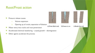
Root/Frost action
Pressurerelease causes
1. Volume expansion
2. Opening up of cracks, separation of foliation
Water entry into cracks and root penetration
Accelerated chemical weathering – crystal growth – disintegration
Other agents accelerate the process
25.
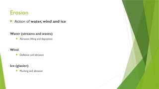
Erosion
Action ofwater, wind and ice
Water (streams and waves)
Abrasion, lifting and deposition
Wind
Deflation and abrasion
Ice (glacier)
Plucking and abrasion
26.
Chemical Weathering
Altersthe chemistry of parent material
Main processes include
1. Dissolution and precipitation
2. Hydrolysis
3. Carbonation
4. Oxidation and reduction
5. Ion exchange
6. Chelation
7. Leaching
27.
Dissolution and precipitation
Some rocks contain one or minerals that are soluble in water to some
extent. Rock salt, gypsum and calcite are some of the minerals soluble
in water.
Some minerals are not soluble in water.
The solvent action of water for many common minerals is enhanced
when carbonated.
For example limestone which is not soluble in water is soluble in
carbonated water.
28.
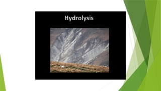
Hydration and hydrolysis
These two processes indicate the direct attack of atmospheric moisture on individual minerals of a
rock that affect its structural make up. When the surfaces of many crystals (having partially
unsatisfied valences) come in contact with polarized water molecules, any one of the following
reactions can occur:
(1)The ions tend to hold the polarized side of water molecule and form a hydrate. This process of
addition of the water molecule is called hydration. For example:
CaSO4 + 2H2O CaSO4.2H2O
Anhydrite gets slowly converted to gypsum by hydration as shown above.
(2) The process in which exchange of ions occur whereby water enters into the crystal lattice of
mineral, is called hydrolysis.
K + AlSi3O8 + H+
H Al Si3 O8 + K+
Weathering of Orthoclase (K + AlSi3O8) occurs as shown above.
30.
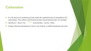
Carbonation
It isthe process of weathering of rocks under the combined action of atmospheric CO2
and moisture. The carbonic acid formed corrodes silicate bearing rocks. For example:
2KAlSi3O8 + 2H2O+ CO2 Al2Si2O5(OH)4 + K2CO3+ 4SiO2
Felspar orthoclase decomposes to form a clay mineral, a soluble bicarbonate and silica.
32.
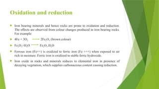
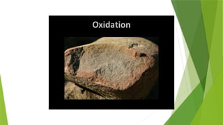
Oxidation and reduction
Iron bearing minerals and hence rocks are prone to oxidation and reduction.
The effects are observed from colour changes produced in iron bearing rocks.
For example:
4Fe + 3O2 2Fe2O3 (brown colour)
Fe2O3+H2O Fe2O3.H2O
Ferrous iron (Fe++) is oxidized to ferric iron (Fe +++) when exposed to air
rich in moisture. Ferric iron is oxidized to stable ferric hydroxide.
Iron oxide in rocks and minerals reduces to elemental iron in presence of
decaying vegetation, which supplies carbonaceous content causing reduction.
34.
Ion Exchange
Theprocesses of hydration, hydrolysis, oxidation and reduction on rocks and minerals
often result in splitting of particles into smaller particles called colloids.These colloids
are characterized by atoms with only partially satisfied electrical charges.
Weathering of clay minerals, silica and iron oxides often results in colloid formation.
These colloids are easily precipitated as their charges are satisfied and form stable
products.
35.
Chelation
The chemicalremoval of metallic ions from a mineral or rock by weathering can provide
their combination with organic compounds.
The decomposition of dead plants in soil may form organic acids which, when dissolved in
water, cause chemical weathering.
36.
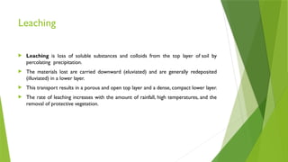
Leaching
Leaching isloss of soluble substances and colloids from the top layer of soil by
percolating precipitation.
The materials lost are carried downward (eluviated) and are generally redeposited
(illuviated) in a lower layer.
This transport results in a porous and open top layer and a dense, compact lower layer.
The rate of leaching increases with the amount of rainfall, high temperatures, and the
removal of protective vegetation.
37.
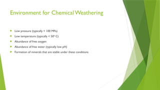
Environment for ChemicalWeathering
Low pressure (typically < 100 MPa)
Low temperature (typically < 500
C)
Abundance of free oxygen
Abundance of free water (typically low pH)
Formation of minerals that are stable under these conditions
38.
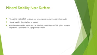
Mineral Stability NearSurface
Minerals formed at high pressure and temperature environment are least stable
Mineral stability from highest to lowest
Iron/aluminium oxides – quartz – clay minerals – muscovite – K/Na spar – biotite –
amphiboles – pyroxenes – Ca plagioclase - olivine
39.
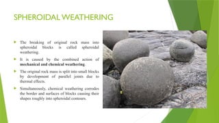
SPHEROIDAL WEATHERING
Thebreaking of original rock mass into
spheroidal blocks is called spheroidal
weathering.
It is caused by the combined action of
mechanical and chemical weathering.
The original rock mass is split into small blocks
by development of parallel joints due to
thermal effects.
Simultaneously, chemical weathering corrodes
the border and surfaces of blocks causing their
shapes roughly into spheroidal contours.
40.
ROLE OF PLANTSAND ORGANISMS –
Organic weathering
Hydrogen ions (H+
) are released at the roots of plants during their growth and
metabolism.
These ions replace K+, Ca2+
, Mg2+
ions etc. from the rocks surrounding the root system.
Thus these rocks and minerals undergo decomposition.
Root systems of big plants and trees creep into the pre-existing cracks in the nearby
rocks. Thus the cracks widen and the rocks break into fragments.
Action of rodents on rocks will also cause the disintegration of rocks. Man has been
breaking the rocks since very beginning for many purposes.
The decay and disintegration of rocks by living things is called organic weathering.
41.
PRODUCTS OF WEATHERING
Theproduct of weathering include (a)
Regolith (b) Mineral and rock
formation
(a)Regolith: It includes all the weathered
material, which covers the parent rock or
is lying close to it. These materials deposit
on the surface of the parent rock in huge
thickness. In many cases, the weathering
of rocks becomes slow after the formation
of weathered layers at the top.
It is because the overlying cover acts as a
barrier for the atmospheric agencies to
further act on the parent rock. The upper
part of regolith is termed a soil.
42.
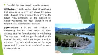
Regolith hasbeen broadly used to express:
(i)Eluvium: It is the end product of weathering
that happens to lie over and above the parent
rock. Eluvium forms a thin or thick layer on the
parent rock, depending on the duration for
which weathering has been operative on it.
Regolith is another term for eluvium.
(ii)Deluvium: It is the end product of
weathering that has been moved to some
distance after its formation due to weathering.
The weathered products get deposited at the
base of the slope and form heaps of various
thickness. Gravity and rain-wash are the major
agents which remove these weathered products
to some distance.
43.
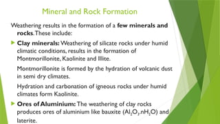
Mineral and RockFormation
Weathering results in the formation of a few minerals and
rocks.These include:
Clay minerals: Weathering of silicate rocks under humid
climatic conditions, results in the formation of
Montmorillonite, Kaolinite and Illite.
Montmorillonite is formed by the hydration of volcanic dust
in semi dry climates.
Hydration and carbonation of igneous rocks under humid
climates form Kaolinite.
Ores of Aluminium: The weathering of clay rocks
produces ores of aluminium like bauxite (Al2O3.nH2O) and
laterite.
44.
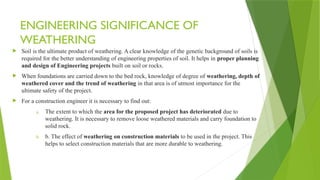
ENGINEERING SIGNIFICANCE OF
WEATHERING
Soil is the ultimate product of weathering. A clear knowledge of the genetic background of soils is
required for the better understanding of engineering properties of soil. It helps in proper planning
and design of Engineering projects built on soil or rocks.
When foundations are carried down to the bed rock, knowledge of degree of weathering, depth of
weathered cover and the trend of weathering in that area is of utmost importance for the
ultimate safety of the project.
For a construction engineer it is necessary to find out:
a. The extent to which the area for the proposed project has deteriorated due to
weathering. It is necessary to remove loose weathered materials and carry foundation to
solid rock.
b. b. The effect of weathering on construction materials to be used in the project. This
helps to select construction materials that are more durable to weathering.
45.
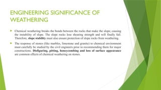
ENGINEERING SIGNIFICANCE OF
WEATHERING
Chemical weathering breaks the bonds between the rocks that make the slope, causing
the instability of slope. The slope rocks lose shearing strength and will finally fail.
Therefore, slope stability must also ensure protection of slope rocks from weathering.
The response of stones (like marbles, limestone and granite) to chemical environment
must carefully be studied by the civil engineers prior to recommending them for major
constructions. Disfiguring, pitting, honeycombing and loss of surface appearance
are common effects of chemical weathering on stones.
46.
Dearman Classification ofweathering
Descriptive terms for weathering of rock material were established on the
basis that weathering involves a combination of mechanical disintegration,
chemical decomposition and solution.
47.
Soil Profile
Soilis formed as a result of weathering of parent rock.
Soil is a mixture of organic matter, various minerals and water which can support plant
life on the surface of earth.
A vertical section from the surface down to the bed rock reveals various layers of soil,
which is termed as soil profile.
Pedologists have identified these layers of soils and have designated them as different
horizons.
During the development of soil from a parent material, the actual transformation
proceeds through certain well defined stages.
In mature soils, these stages appear as a series of horizons. Such horizons, when
arranged in descending order, are collectively said to form a Soil Profile for that
particular area.
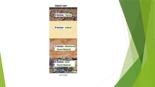
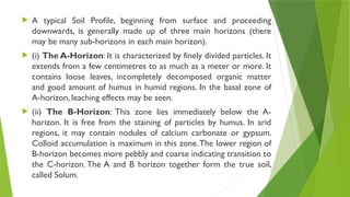
A typicalSoil Profile, beginning from surface and proceeding
downwards, is generally made up of three main horizons (there
may be many sub-horizons in each main horizon).
(i) The A-Horizon: It is characterized by finely divided particles. It
extends from a few centimetres to as much as a meter or more. It
contains loose leaves, incompletely decomposed organic matter
and good amount of humus in humid regions. In the basal zone of
A-horizon, leaching effects may be seen.
(ii) The B-Horizon: This zone lies immediately below the A-
horizon. It is free from the staining of particles by humus. In arid
regions, it may contain nodules of calcium carbonate or gypsum.
Colloid accumulation is maximum in this zone.The lower region of
B-horizon becomes more pebbly and coarse indicating transition to
the C-horizon. The A and B horizon together form the true soil,
called Solum.
50.
(iii) TheC-Horizon: It is more a zone of weathered rock. In
texture, it is often coarse grained and pebbly; in composition, it
retains all the evidence of its parent rock.
(iv)The D-Horizon: In a true soil profile, a sample from this
horizon is the parent rock itself, unaltered as yet. In some cases, it
may the solid rock mass on which the other zones are resting.
O (humus or organic) Horizon: Mostly organic matter such as
decomposing leaves. The O horizon is thin in some soils, thick in
others, and not present at all in others.
E (eluviated) Horizon: Leached of clay, minerals, and organic
matter, leaving a concentration of sand and silt particles of quartz
or other resistant materials – missing in some soils but often found
in older soils and forest soils.
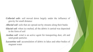
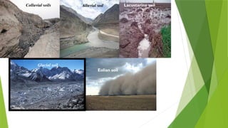
Colluvial soils: soilmoved down largely under the influence of
gravity for small distance
Alluvial soil: soils that are spread out by streams along their banks
Glacial soil: when ice melted, all the debris it carried was deposited
in the form of soil
Aeolian soil: wind is an active agent for transporting dust, silt and
sand grade particles
Lacustrine soil: accumulation of debris in lakes and other bodies of
stagnant water
Soil Erosion
Lossor removal of superficial layer of soil by the action of wind,
water or human action
Causes
1. Removing plant cover by burning pasture or felling trees
2. Grazing too many animals on the land
3. Bad cultivation practices
4. Wind
5. Frost
6. Rain and water runoff
7. Extreme climatic effects
55.
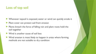
Loss of topsoil
Whenever topsoil is exposed, water or wind can quickly erode it
Plant cover can protect soil from erosion
Plants breach the force of falling rain and plant roots hold the
soil together
Wind is another cause of soil loss
Wind erosion is most likely to happen in areas where farming
methods are not suitable to dry condition
56.
Effects of soilerosion
Loss of valuable top soil
Burying valuable topsoil
Damage to fields
Plant productivity decline
Desertification
57.
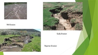
Types of soilerosion
Sheet erosion – Removal of thin layer of topsoil by raindrop
splash or water run-off
Rill erosion – If sheet erosion occurs with full force, the run off
water moves rapidly over the soil surface. It cuts well-defined
finger shaped groove like structures. It appears as thin channels
or streams.
Gully erosion – Here surface run-off is very high. Gullies
resemble large ditches or small valleys and are metres to 10
metres in depth and width
Stream bank erosion - The rivers during floods splash their
water against the banks. In this way the water cuts through them.
Particularly at curves, water strikes with great speed and the
bank caves in alongside.This type of erosion is also known as
Other types
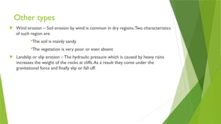
Winderosion – Soil erosion by wind is common in dry regions.Two characteristics
of such region are:
The soil is mainly sandy
The vegetation is very poor or even absent
Landslip or slip erosion – The hydraulic pressure which is caused by heavy rains
increases the weight of the rocks at cliffs.As a result they come under the
gravitational force and finally slip or fall off.
60.
Soil Conservation
Engineering Practices
Windbreaks / Shelter Belts – Barriers formed by trees and plants with many leaves
Check dams – Small check dams are constructed out of various materials like stones, timber,
steel etc. to control erosion by reducing velocity of water flow.
Contour Ploughing –The tractor operator follows the contours of hillside.The furrows thrown
up by the plough stop the flow of water and encourage percolation in the soil
Terraces – Large steps cut into a hillside which reduces slope length and steepness to limit the
energy of running water and its ability to carry soil away.
Agronomic Practices
Strip farming – Different crops are planted and harvested at different times meaning that the
amount of bare soil is minimised.
Crop rotation – It is a method of growing a series of dissimilar crops in an area sequentially.
Hence different crops are grown in the same area by rotation, that is , one after another. It
helps in the improvement of soil structure and fertility.
Water erosion
Wateris the main agent of erosion; its power increases greatly with velocity.
Rivers erode by downcutting and sides degrade to fromV-profile valleys. On low
gradients downcutting reduces so lateral erosion dominates notably on the outside of
river bends
Sediment is transported as rolled bedload and in suspension; particle size increases
with velocity. Deposition is due to velocity loss, on gradient loss and inside bends so
sediment is sorted by size
63.
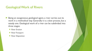
Geological Work ofRivers
Being an exogeneous geological agent, a river carries out its
work in a methodical way. Generally it is a slow process, but a
steady one. Geological work of a river can be subdivided into
three stages:
River Erosion
RiverTransport
River Deposition
64.
River Erosion
Erosionmeans mechanical disintegration or chemical decomposition of rocks and their
subsequent displacement.
A river is a very powerful eroding agent and carries out its work in different ways such
as hydraulic action, abrasion, attrition and solution (corrosion)
Hydraulic action
The inherent kinetic energy of running river water only takes part in causing the physical
breakdown of rocs. Naturally, greater the momentum, greater will the erosion be.
In the initial and youth stages, rivers which move faster along steep slopes acquire
considerable kinetic energy.
When such river water dashes against the rocks forcefully, it will break them down
mechanically.This will be more effective if
(a) the rocks have already weathered considerably
(b) they are porous or not well cemented
(c) they have easily soluble cementing material
(d) they possess fractures, cracks or any other weak planes
65.
The hydraulicaction of rivers is due to inherent kinetic energy of river water
The velocity of the river is the source of kinetic energy
The river velocity or momentum is controlled by different factors like:
(i) surface gradient
(ii) form of the river
(iii) rate of discharge
The river gradient influences the velocity; if gradient is more, the velocity will
also be more.When velocity is doubled, the erosive power of the river water
increases four times
The form of a river also influences the velocity; a river flows faster in a deep,
narrow valley than in a shallow broad valley.This is so because the flow
encounters greater friction from the ground.Therefore, erosion will be more
pronounced in a deep and narrow river.
The influence of volume of a river water on velocity is also considerable.The
velocity increases with the volume.When a river has eight times larger volume, it
will flow with a velocity doubly quicker.This is the reason why rivers become
destructive during floods. Further, rivers which undergo considerable variations
in velocity and volume cause more erosion than those which are uniform
66.
Abrasion
Physical breakdownof rock masses which are exposed along the sides and
bottom of the river valley by the force of colliding sediments which are being
transported by the river.
The river along the course transports a a large quantity of sediments of
various sizes and types
By virtue of their movement, they possess energy and hence momentum
During transport they hit the exposed rocks relentlessly leading to their
breakdown
67.
The precedingprocess is mainly influenced by
1. The nature of transported sediments
2. The nature of exposed rocks
3. The nature of river water
4. The attitude of rocks exposed
5. Presence of joints in rocks
6. Time factor
68.
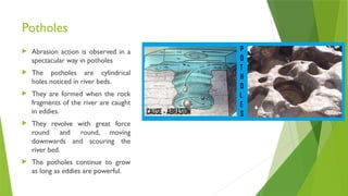
Potholes
Abrasion actionis observed in a
spectacular way in potholes
The potholes are cylindrical
holes noticed in river beds.
They are formed when the rock
fragments of the river are caught
in eddies.
They revolve with great force
round and round, moving
downwards and scouring the
river bed.
The potholes continue to grow
as long as eddies are powerful.
69.
Attrition
Erosion iswith reference to transported sediments themselves
When rock fragments hit the exposed rocks, not only the country rocks are
affected but also an equal effect is borne by fragments
Thus rock fragments during abrasion undergo wear and tear which is called
attrition
Attrition also occurs during the transportation of sediments
When heterogeneous sediments are under transport, heavier and larger materials
move slowly while finer and lighter materials move fast.
The differential movement results in mutual collisions which occur again and again
and causes attrition
Large pebbles and small rocks generally roll down the valley floor, smoothening
their edges.
When attrition takes place first the angular edges disappear and the spherical,
spheroidal and ellipsoidal stones are formed after a long journey.
70.
Solution
This processinvolves only chemical decay of rocks and no mechanical wear
and tear .
Among liquids, water is the most powerful solvent and dissolves many kind of
materials
When river water passes through different areas over different rocks its
chemical potential increases with time.
Depending upon their nature, some minerals are immediately affected while
others are slowly affected
Virtually there are no minerals which are completely unaffected
Humid and temperate climates promote attack by corrosion process
Eg., Carbonate rocks (Limestone), marls, calcareous shales, dolomitic rocks
Solution process will be more effective when
1.River water has chemically more potential
2.Time of contact between solutions and rocks is more
3.The country rocks are calcareous
71.
River Transport
Theload transported by a river can be grouped into three:
1. Bed load – heavier particles of sand, pebbles, gravels etc..
Transported mainly by rolling, skipping, bouncing or gliding along the
bottom of the stream
2. Suspended load - fine silt, clay, fine sands etc carried by the river
in its body of water in suspension
3. Dissolved load – Comprises all soluble matter and is transported
in solution condition
72.
Influencing factors ofriver transport
Velocity of the river is its primary source of energy which enables it not
only to carry out erosion but also to do transport work.
The transporting ability of the river abnormally increases when the velocity increases. In the
case of coarser sediments, when the velocity is doubled its transporting power increases 64
times
The sediments with a higher density have a higher tendency to settle down,
whereas the lighter sediments have a tendency to keep floating and are
therefore transported over longer distances.
73.
River Deposition
Aggradationoccurs
The phenomenon of river deposition links up to the factors contributing to
the loss of energy either temporary or otherwise
Different kinds of river deposits:
(i) alluvial cones and fans
(ii) placer deposits
(iii) delta deposits
(iv) natural levees
74.
Alluvial cones andfans
In the youth stage, the river suddenly loses its energy
partially because in the foothill regions it emerges
out of the mountainous area and enters into a
relatively plain ground.
This transition involves loss of gradient which is
responsible for loss if its velocities and consequently
its energy.
This leads to some deposition of river sediments at
the foothills along its valley.
If the deposit is spread over a small area but has a
relatively steep slope, it is called an alluvial cone.
If the deposit is spread over a large area and has a
gentle slope, it is called an alluvial fan.
75.
Placer deposits
Inthe mature stage, the river is generally in balanced
equilibrium condition i.e., its energy is just enough to
transport its load
Under such conditions when the river encounters any
formidable obstacle or impediment, it shall not have capacity
to uproot it and therefore it takes a diversion and continues
its downward course.
In this process the river loses a part of energy in dashing the
obstacle and results in formation of deposits known as placer
deposits.
By virtue of its relatively weak condition, the river
compulsorily undergoes a number of curves or bends which
makes its path zig-zag and this process is called meandering
76.
Meandering isa characteristic
feature of the mature stage.
In due course of time, these
bends become more and more
acute due to deposition of
sediments along the inner curve
and erosion along the outer
curve
Ultimately under favourable
conditions such as floods these
loops are cut off from the main
course of the river.
Such cut off bodies which are
curved in plan are called cut off
lakes or horse shoe lakes or ox
bow lakes
78.
Delta deposits
Deltadeposits are characteristic of old stage of
the river
The occurrence of these deposits is due to the
exhaustion of the river energy which is spent by in
transporting the load over a long distance.
The favourable conditions for the formation of
delta are:
(i) the river should have large amount of load
(ii) the river should have fully exhausted its energy at the
time of its merger with the sea
(iii) the ocean at the mouth of the river should not be
turbulent otherwise as and when loose sediments are
deposited, they are washed away by the waves and
currents of the sea
79.
Natural levees
Theseare essentially
riverbank deposits made by
a river along its bank during
floods.
The natural levees are
sometimes helpful in
preventing further flooding
in a river provided the
volume of water a new
prospective flood is not
much higher than that of a
previous floods.
80.
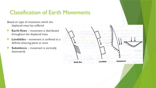
Classification of EarthMovements
Based on type of movement which the
displaced mass has suffered
Earth flows – movement is distributed
throughout the displaced mass
Landslides – movement is confined to a
definite shearing plane or zone
Subsidence – movement is vertically
downwards
82.
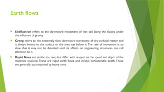
Earth flows
Solifluctionrefers to the downward movement of wet soil along the slopes under
the influence of gravity
Creep refers to the extremely slow downward movement of dry surficial matter and
is always limited to the surface or the area just below it.The rate of movement is so
slow that it may not be detected until its effects on engineering structures can call
attention to it.
Rapid flows are similar to creep but differ with respect to the speed and depth of the
materials involved. These are rapid earth flows and involve considerable depth. These
are generally accompanied by heavy rains.
83.
Landslides
Downward slidingof huge quantities of landmasses
Sliding occurs along steep slopes of hills or mountains
May be sudden or slow in occurrence
Loose and unconsolidated surficial material undergoes sliding
Importance of landslides
If they occur in places of importance such as highways, railway lines, valleys, reservoirs,
inhabited areas and agricultural lands, they lead to blocking of traffic, collapse of buildings,
harm to fertile lands and heavy loss of life and property
84.
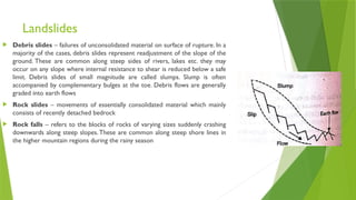
Landslides
Debris slides– failures of unconsolidated material on surface of rupture. In a
majority of the cases, debris slides represent readjustment of the slope of the
ground. These are common along steep sides of rivers, lakes etc. they may
occur on any slope where internal resistance to shear is reduced below a safe
limit. Debris slides of small magnitude are called slumps. Slump is often
accompanied by complementary bulges at the toe. Debris flows are generally
graded into earth flows
Rock slides – movements of essentially consolidated material which mainly
consists of recently detached bedrock
Rock falls – refers to the blocks of rocks of varying sizes suddenly crashing
downwards along steep slopes.These are common along steep shore lines in
the higher mountain regions during the rainy season
85.
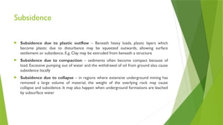
Subsidence
Subsidence dueto plastic outflow – Beneath heavy loads, plastic layers which
become plastic due to disturbance may be squeezed outwards, allowing surface
settlement or subsidence. E.g. Clay may be extruded from beneath a structure
Subsidence due to compaction – sediments often become compact because of
load. Excessive pumping out of water and the withdrawal of oil from ground also cause
subsidence locally
Subsidence due to collapse – in regions where extensive underground mining has
removed a large volume of material, the weight of the overlying rock may cause
collapse and subsidence. It may also happen when underground formations are leached
by subsurface water
86.
Causes of landslides
Immediatecauses
Factors such as frictional resistance will cause the overlying mass to
remain in a critical condition. When there is a sudden jolt or jerk or
vibration occurs, the frictional resistance will be overcome and leads to
destruction.
Sudden jolting due to avalanche, violent volcanic eruption, fall of a
meteorite, occurrence of an earthquake, tsunamis or blasting of
explosives in quarrying, tunnelling, road cutting or mining.
87.
Internal causes
Effectof slope – steeper slopes are prone to landslips of loose overburdens due to greater
gravity influence whereas gentle slopes are not prone to such land slips because in such cases
loose overburden encounters greater frictional resistance and any possible slip is stalled
Effect of water –Presence of water reduces the intergranular cohesion of particles of loose
ground.This weakens the ground inherently and therefore makes it prone to landslide occurrence
Effect of lithology – Rocks which are highly fractured, porous and permeable are prone to
landslide occurrence.The clay content contributes to the slippery effect.Thinner strata are more
susceptible to sliding.
Effect of associated structures – Inclined bedding planes, joints, faults or shear zones increase
the chances of landslide. When their dip coincides with that of the surface slope they create
conditions of instability. Joints and faults provide scope for easy percolation of rain water and
increases instability.
Effect of human factors – Sometimes human beings interfere with nature by virtue of their
activities and causes landslides.This may happen when undercutting are made along the hill slopes
for laying roads or railway tracks. Such an activity eliminates lateral support which means gravity
will become more effective leading to landslide occurrence
88.
Effects of Landslides
Disruption of transport or blocking of communications by damaging roads and railways
and telegraph poles
Obstruction to the river flow in valleys leading to their overflow and floods
Damage to sewer and other pipelines
Burial or destruction of buildings and other constructions
Causes earthquakes
89.
Preventive measures forlandslides
To counter the effect of slope: Retaining walls may be constructed against the slopes so that the
material which rolls down is not only prevented from further fall but also reduces the slope.Terracing of
the slope is another effective measure.
To counter the effect of water: A proper drainage system is the suitable measure.This involves the
quick removal of percolated moisture by means of surface drainage and subsurface drainage.
Construction of suitable ditches and waterways along slopes and provision of trenches at the bottom,
and drainage tunnels help in draining off the water from the loose overburden.
To counter the structural effects: the different structural defects such as weak planes and zones may
be either covered or grouted suitably so that they are effectively sealed off. These measures not only
prevent the avenues of percolation of water but also increase the compaction or cohesion of the
material concerned.
Not to resort to reduce the stability of existing slopes: This is done by not undertaking any
undercutting on the surface slope and by not undertaking any construction at the top of the hills
To counter the loose nature of overburden: Growing vegetation, plants and shrubs on loose ground
helps in keeping the loose soil together
Avoiding heavy traffic and blasting operations near the vulnerable places naturally helps in
preventing the occurrence of landslides
90.
Sea Waves andCurrents
Waves
Undulatory disturbances on the surface of the seawater due to strong rushing winds,
earthquakes, attraction of sea water by sun and moon and similar reasons
During the propagation of a wave, each water drop is distributed from its original place
of rest and forced to follow a motion in a circular, ellipsoidal, elongated or irregular
orbit before coming to rest again
91.
Types of seawaves
1. Oscillatory Waves
Each particle moves in a circular orbit
The waves start from the deep portions of sea, when it reaches the shallow depth
portions (i.e. near shore), these particles cannot follow a perfect circular motion.
Consequently an oscillatory wave rushing towards the shore breaks at the crest
region.
A zone may be identified along the seashore where these waves regularly break is
called a breaker zone.
92.
2. Translatory Waves
Typically occurs at shallower depths (near shore) in the sea and thus move along the
seashore
They are commonly produced after the oscillatory waves break and rush forward
In these waves, the water particles are actually moved or translated forward, rising and
falling again and again in the process
93.
Currents
These arelayers or strips of seawater that are actually pushed forward in any particular
direction
In most cases, sea currents are the results of dissipation of extra volume of water thrust on the
shore by the advancing waves.
Types
1. Littoral currents
These are bodies of seawater of considerable volume moving along and parallel to the shore
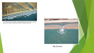
2. Rip Currents
These are bodies of seawater moving backwards to sea after having reached and struck the
seashore
They often move below the surface of the sea and reach varying distances up to the middle of
the sea
These are believed to represent that part of sea wave, which has been unable to form a part of
littoral current but rip current’s development is independent of littoral currents
Marine Erosion
Marine watererodes the rocks at the shore by 3 ways:
Hydraulic action:That is, by its very high wave velocity
Abrasion: Sea water carries lot of sediment particle during its motion. These
sediment particles have erosive power to erode the shore
Corrosion: Sea water is Salish so due to its chemical properties it adversely
affect the shore materials.
96.
FEATURES OF MARINEEROSION
Continued marine erosion results in considerable or even
total modification of the original shoreline.
Some very common features of marine erosion are
headlands
bays
sea cliffs
wave-cut terraces.
97.
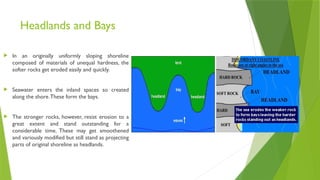
Headlands and Bays
In an originally uniformly sloping shoreline
composed of materials of unequal hardness, the
softer rocks get eroded easily and quickly.
Seawater enters the inland spaces so created
along the shore.These form the bays.
The stronger rocks, however, resist erosion to a
great extent and stand outstanding for a
considerable time. These may get smoothened
and variously modified but still stand as projecting
parts of original shoreline as headlands.
Sea Cliffs
Seacliff is a seaward facing steep front of a
moderately high shoreline and indicates
the first stage of the work of waves on the
shore rocks. There may be a number of
sea cliffs seen on a shoreline.
They are outstanding rock projections
having been smoothened here and
plucked there, pitted at one place and
polished at another spot by a combined
action of waves and currents.
These cliffs may ultimately be worn
due to continued undercutting by the
action of waves.
Thus shoreline is reduced to a smooth,
free from irregularities, seaward sloping
surface ie cliff.
100.
Wave-Cut Terraces
Wavecut terrace is a shallow shelf type structure, caned
out from the shore rocks by the advancing sea waves
The waves first of all cut a notch where they strike
against the cliff rock again and again. The notch is
gradually extended backwards to such a depth below the
overlying rock that the latter becomes unsupported from
below.
The cliff eventually falls down along the notch.
A platform or bench is thus created over which the
seawater may rush temporarily and periodically. The
resulting structure is often called a wave-cut terrace, a
platform or simply a bench.
102.
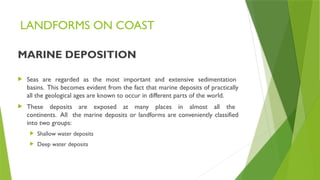
LANDFORMS ON COAST
MARINEDEPOSITION
Seas are regarded as the most important and extensive sedimentation
basins. This becomes evident from the fact that marine deposits of practically
all the geological ages are known to occur in different parts of the world.
These deposits are exposed at many places in almost all the
continents. All the marine deposits or landforms are conveniently classified
into two groups:
Shallow water deposits
Deep water deposits
103.
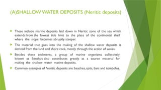
(A)SHALLOW WATER DEPOSITS(Neritic deposits)
These include marine deposits laid down in Neritic zone of the sea which
extends from the lowest tide limit to the place of the continental shelf
where the slope becomes abruptly steeper.
The material that goes into the making of the shallow water deposits is
derived from the land and shore rock, mostly through the action of waves.
Besides these sediments, a group of marine organisms collectively
known as Benthos also contributes greatly as a source material for
making the shallow water marine deposits.
Common examples of Neritic deposits are: beaches, spits, bars and tombolos.
104.
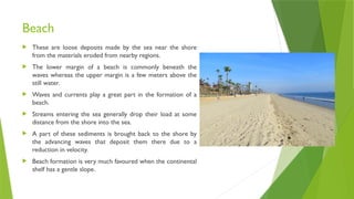
Beach
These areloose deposits made by the sea near the shore
from the materials eroded from nearby regions.
The lower margin of a beach is commonly beneath the
waves whereas the upper margin is a few meters above the
still water.
Waves and currents play a great part in the formation of a
beach.
Streams entering the sea generally drop their load at some
distance from the shore into the sea.
A part of these sediments is brought back to the shore by
the advancing waves that deposit them there due to a
reduction in velocity.
Beach formation is very much favoured when the continental
shelf has a gentle slope.
105.
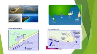
SPITS AND BARS
These are ridge shaped deposits of sand and shingle that often extend
across the embayment.
A spit is formed when a sediment laden shore current comes near an
embayment on the coast, there is strong tendency for it to keep its normal
course rather than to follow the shore line of the embayment; hence it moves
through deeper and quieter waters where it lays down much of its sediments.
This process may result in an incomplete ridge in continuity with the
shore but terminating in open waters.This is the spit.
When the ridge (spit) so formed in the above manner closes the
mouth of the embayment completely, it is known as bar.
107.
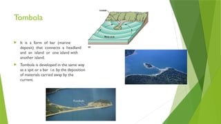
Tombola
It isa form of bar (marine
deposit) that connects a headland
and an island or one island with
another island.
Tombola is developed in the same way
as a spit or a bar i.e. by the deposition
of materials carried away by the
current.
108.
(B) DEEP WATERDEPOSITS
These deposits consist mostly of mud and oozes (a sea organism)
The oozes that form bulk of some of such deposits consist of small organisms
known collectively as planktons.
Death and decay of these organisms and plants followed by their
accumulation in regular and irregular shapes eventually results in huge
deposits.
Sometimes these deposits take the shape of extensive ridge like formations
that are partly or totally submerged under seawater thereby creating a
great risk for ships and boats navigating on the sea.
These deposits are commonly called reefs.
109.
CORAL REEFS
Definition
Theseare peculiar type of ridge-like marine deposits that have been
formed due to accumulation of dead parts of certain types of sea-organisms.
Corals - a type of calcium secreting organisms - predominate among
the source organisms for such reefs; hence they are commonly designated as
coral reefs.
These reefs may or may not be visible above the seawater depending upon
the tide.
Types
1. Fringing reefs
2. Barrier reefs
3. Atolls
110.
The Fringing Reefs
These are thin, tabular sheets of coral accumulations that are developed
along the border (fringe) of a mainland coast or along the rim of an island.
When they accumulate on border region of islands, they appear like
a ring shaped deposit around the island during the low-tide.
A simple fringing reef has a steeply sloping sea front and a flat
pavement surface covered with veneer of growth.
111.
The Barrier Reefs
These are more common type of reefs and occur at a distance from the
Shore or the island running in the form of parallel, flat-topped ridges.
There is a body of water in between called lagoon that separate the reef
from the shore or the island.
The ridge may be continuous or broken here and there; it has a steep slope
facing the sea and a gentle slope towards the lagoon.
112.
Atoll
An atollis essentially an annular, circular or semi-circular coral reef
surrounding a central body of water that is as usual called a lagoon.
In a typical atoll, the ring made of coral deposits may be continuous or
discontinuous, more often broken at places.
The top of an atoll is generally flat and pavement like in appearance.
115.
Origin of Reefs
They are known to grow only in relatively warm waters (68-78°F), and at
depths ranging between 20-60 m.
The seawater should be clear and saltish.
The direction of wind is also known to exert considerable influence on the growth of
the corals.
Darwin suggests that the coral reefs are formed on a subsiding or sinking
platform which is formed due to the occurrence of earthquakes on the sea floor
According to Darwin, the three types of reefs -the fringing reef, the barrier reef and
the atoll, actually represent three stages in the development of a single reef deposit.
Origin of reefs is based on Glacial ControlTheory.
According to him, the submergence of an old reef framework is due to rise in the
level because of melting of ice.
116.
COASTAL PROTECTION STRATEGIES
HARD Engineering Strategies : Building or creating something which will
interfere with coastal processes – usually to reduce the power of breaking waves
against cliffs.
SOFT Engineering Strategies :With the natural processes of sea and sand.
117.
HARD Engineering Strategies
(a)Groynes
A barrier extending from the beach or offshore into the sea in the transverse
direction to the sea shore.
Groynes are used to reduce the loss of beach grade sediment through long shore
drift.
With proper groyne field design, beach erosion can be reduced due to
trapped sediment on the up-drift side of the groyne.
Groynes can be constructed out of wood, stone or concrete depending on the size
of native beach material.
Although acting to reduce the erosion on site, groynes typically cause sediment
starvation down-drift, shifting the erosion further down the coastline.
119.
HARD Engineering Strategies
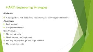
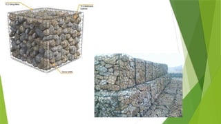
(b)Gabions
Wire cages filled with stones/rocks stacked along the cliff base protect the shore.
Advantages
Easily installed
Cheaper than sea wall
Disadvantages
Not very attractive
Needs frequent checking & repair
Not easy for people to get over to get to beach
May contain rats nests
121.
HARD Engineering Strategies
(c)Rock Armour/ Rip-Rap
Huge blocks of rocks is placed along the shore
Advantages
Popular option in recent years – seen to be effective
Cheaper than sea wall
Disadvantages
Not very attractive
Not easy for people to get over to get to the beach (broken
ankles)
Rats may live in spaces
122.
HARD Engineering Strategies
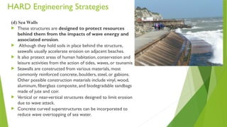
(d)Sea Walls
These structures are designed to protect resources
behind them from the impacts of wave energy and
associated erosion.
Although they hold soils in place behind the structure,
seawalls usually accelerate erosion on adjacent beaches.
It also protect areas of human habitation, conservation and
leisure activities from the action of tides, waves, or tsunamis
Seawalls are constructed from various materials, most
commonly reinforced concrete, boulders, steel, or gabions.
Other possible construction materials include vinyl, wood,
aluminum, fiberglass composite, and biodegradable sandbags
made of jute and coir.
Vertical or near-vertical structures designed to limit erosion
due to wave attack.
Concrete curved superstructures can be incorporated to
reduce wave overtopping of sea water.
123.
HARD Engineering Strategies
Advantages
Deflects Waves
Strong
Effective
Lasts a long time
Disadvantages
Expensive
Likely to need repair fairly regularly
Deflected waves can scour sea bed and
undermine the sea wall foundations
124.
HARD Engineering Strategies
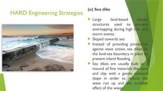
(e)Sea dike
Large land-based sloped
structures used to prevent
overtopping during high tide and
storm events.
Sloped towards sea
Instead of providing protection
against wave action, sea dikes fix
the land-sea boundary in place to
prevent inland flooding.
Sea dikes are usually built as a
mound of fine materials like sand
and clay with a gentle seaward
slope in order to reduce the
wave run up and the erodible
effect of the waves.
125.
HARD Engineering Strategies
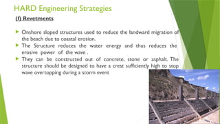
(f)Revetments
Onshore sloped structures used to reduce the landward migration of
the beach due to coastal erosion.
The Structure reduces the water energy and thus reduces the
erosive power of the wave .
They can be constructed out of concrete, stone or asphalt. The
structure should be designed to have a crest sufficiently high to stop
wave overtopping during a storm event
126.
HARD Engineering Strategies
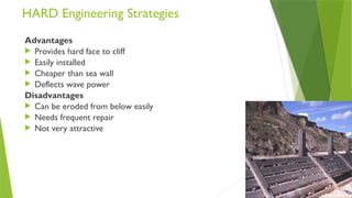
Advantages
Provides hard face to cliff
Easily installed
Cheaper than sea wall
Deflects wave power
Disadvantages
Can be eroded from below easily
Needs frequent repair
Not very attractive
127.
HARD Engineering Strategies
(g)Breakwater
These are offshore sloped or
vertical structures reducing
incoming wave energy arriving at
the coastline.
As well as reducing erosion, this
also creates calmer waters for
harbours and shipping.
They can be constructed out of
concrete or stone and rock.
128.
SOFT engineering strategies
(a)Beach
Beach - a beach in itself acts as a coastal defence as it reduces
wave impact and prevents inland flooding.
However the beach needs to be properly managed to ensure, it
is wide and high enough to prevent from being overtopped
during high sea levels.
This can be done through beach replenishment where beach-
grade sediments are used to top-up the beach, increasing its level
of protections.
129.
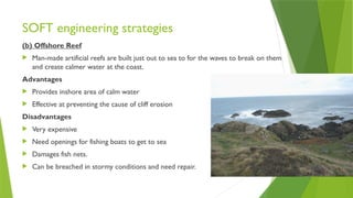
SOFT engineering strategies
(b)Offshore Reef
Man-made artificial reefs are built just out to sea to for the waves to break on them
and create calmer water at the coast.
Advantages
Provides inshore area of calm water
Effective at preventing the cause of cliff erosion
Disadvantages
Very expensive
Need openings for fishing boats to get to sea
Damages fish nets.
Can be breached in stormy conditions and need repair.
130.
SOFT engineering strategies
(c)Reprofiling
The sediment is redistributed from the lower part of the beach to the
upper part of the beach
Advantages
Cheap and simple
Reduces energy of waves
Disadvantages
Only works when wave energy is low
Needs to be repeated continuously