
Recommended
More Related Content
What's hot
What's hot (20)
Viewers also liked
Viewers also liked (20)
Similar to Doctoral Training Heriot Watt University FINAL
Similar to Doctoral Training Heriot Watt University FINAL (20)
Doctoral Training Heriot Watt University FINAL
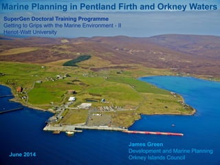
- 1. Marine Planning in Pentland Firth and Orkney Waters James Green Development and Marine Planning Orkney Islands Council SuperGen Doctoral Training Programme Getting to Grips with the Marine Environment ‐ II Heriot‐Watt University June 2014
- 2. Content • Brief introduction to marine planning • Pilot Pentland Firth and Orkney Waters Marine Spatial Plan • Land use planning and marine infrastructure
- 3. What is marine spatial planning? ‘Marine spatial planning is a public process of analysing and allocating the spatial and temporal distribution of human activities in marine areas to achieve ecological, economic, and social objectives that usually have been specified through a political process’ (UNESCO).
- 4. Why develop a plan? • Sustainable development • Strategic vision and spatial strategy • Promote efficient use of space • Stakeholder knowledge and buy-in • Engage local communities • Build consensus and find common ground • Provide greater certainty for developers • Reduce risk in the licensing process • Monitoring and adaption
- 5. Marine Planning in Scotland • Marine (Scotland) Act 2010 - National marine plan and atlas - Regional marine plans - Provision for Marine Planning Partnerships - Licensing - Marine Protected Areas ‘A public authority must take any authorisation or enforcement decision in accordance with the appropriate marine plans, unless relevant considerations indicate otherwise’ Section 15(1).
- 6. Pilot Pentland Firth and Orkney Waters Marine Spatial Plan www.scotland.gov.uk/Topics/marine/seamanagement/regional/pentlandorkney
- 7. The plan area The plan area Pilot Pentland Firth and Orkney Waters Marine Spatial Plan
- 8. Pilot Pentland Firth and Orkney Waters Marine Spatial Plan Working Group • Marine Scotland (Lead) • Highland Council • Orkney Islands Council Advisory Group • Scottish Natural Heritage • Scottish Environment Protection Agency • Historic Scotland • Highlands and Islands Enterprise • Orkney Harbour Authority • Scrabster Harbour Trust • Royal Yachting Association Stakeholders For example: • Local communities; • Commercial fisheries; • Marine renewables; • Aquaculture; and • Recreational interests. How is the plan being delivered?
- 9. Working Group Advisory Group Stakeholders Stakeholders Stakeholders Orkney Local Communities Caithness and Sutherland Local Communities Pilot Pentland Firth and Orkney Waters Marine Spatial Plan
- 10. Pilot Pentland Firth and Orkney Waters Marine Spatial Plan • Set out the plan making process for consultation, November 2012Plan Scheme • Stakeholder Events in July 2013 • Included draft Environmental Report Planning Issues and Options • Responded to stakeholder contributions • Outlines Working Group actions for drafting the plan Consultation Analysis and Report • Structured discussion to develop policies • Will take place from July to the end of 2014 Stakeholder Focus Groups • Formal 12 week consultation (Start 2015) Draft Marine Spatial Plan • Will include Post Adoption Statement and HRA, 2015 Final Plan and associated documents • Lessons learned • Review of pilot process Review
- 11. Pilot Pentland Firth and Orkney Waters Marine Spatial Plan
- 12. The PFOW marine spatial plan is non statutory and, if approved by Scottish Ministers, will be: • A material consideration in the determination of marine licensing, works licenses and Section 36 applications • Can be adopted as Planning Policy Advice or as Supplementary Guidance to the appropriate Local Development Plan Pilot Pentland Firth and Orkney Waters Marine Spatial Plan The status of the plan
- 13. • Local Development Plans and planning guidance • Masterplanning and Development Briefs • Investment in port and harbour infrastructure Land use planning and marine infrastructure
- 14. Land use planning • Overlap with marine plans across the intertidal zone • Local Development Plans and the coastal zone • Integrating land based and marine development • The aquaculture anomaly
- 15. Masterplanning and Development Briefs • Coordinate development and infrastructure • Engage businesses and end users • Identifies environmental constraints / sensitivities • Developer contributions and funding
- 16. Hatston Stromness Lyness Port and harbour investment
- 17. Lyness Hoy
- 18. Lyness • Marine renewables (O&M), aquaculture, heritage • Land in Council ownership • Enterprise Area • £2.97m investment to upgrade the wharf (OIC and ERDF) • Over 300,000 sq.m. of lay down areas available adjacent to quay edge • Sheltered deep water anchorage within Scapa Flow • HIE Engineering hubs in planning • Regular connectivity to Orkney Mainland
- 20. • Ferry terminal, cruise ships, marine renewables • Council owned land and Enterprise Area • £8 million to extend the pier (OIC and ERDF) • Accommodate vessels up to 385 meters LOA and 10.5 meter drafts • Support marine renewables in the North Isles • Regular connectivity to Aberdeen (Sea) and UK (Air) Hatston, Kirkwall
- 22. Copland's Dock Stromness • Council land • Ten hectares of laydown land • Total quay edge of 337 meters • £10.6m jointly funded by OIC, ERDF and Scottish Government • Renewables support vessels, aquaculture, fishing vessels and freight • Access to sheltered waters in Scapa Flow
- 23. Marine Planning – A Council Perspective James Green Development and Marine Planning Orkney Islands Council james.green@orkney.gov.uk