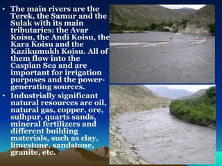
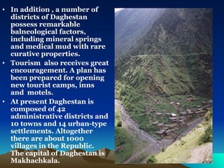
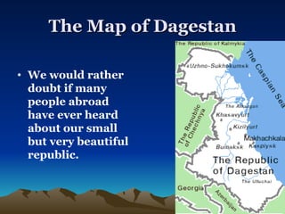
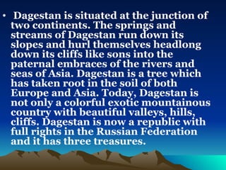
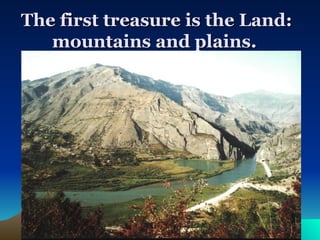
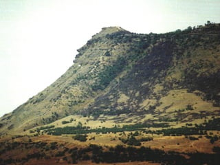
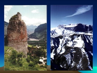
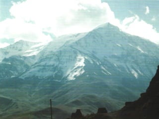
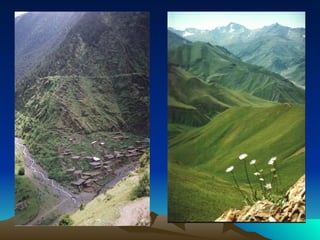
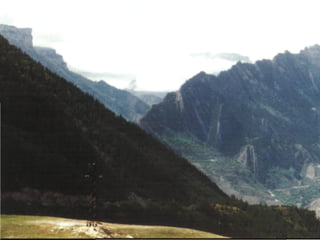
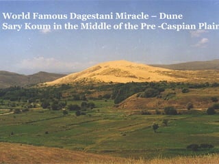
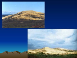
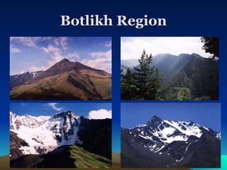
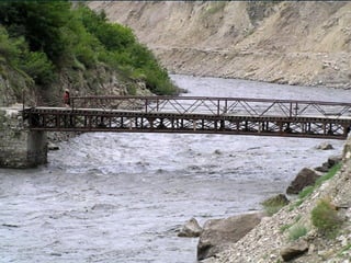
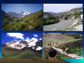
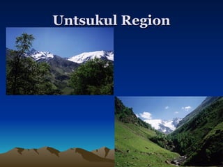
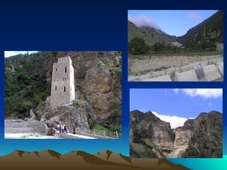
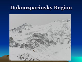
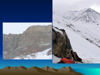
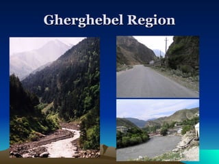
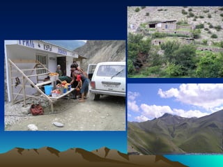
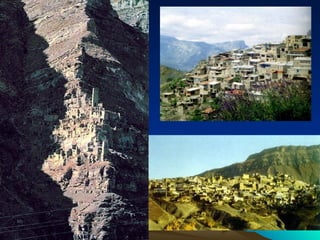
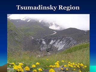
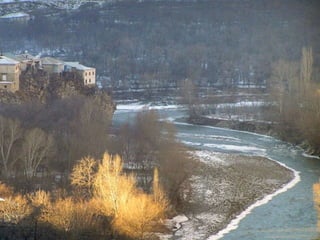
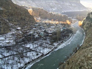
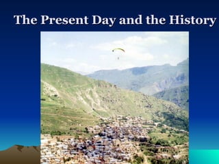
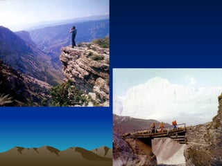
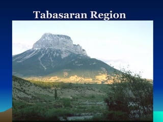
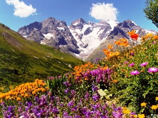
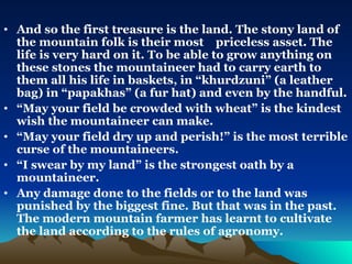
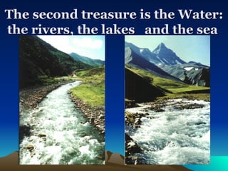
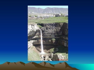
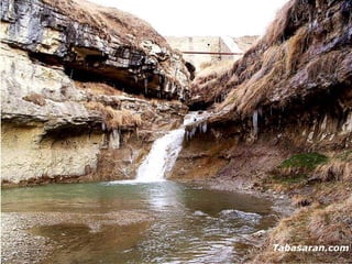
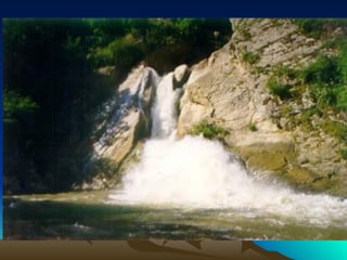
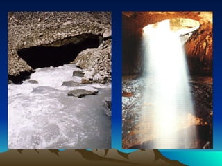
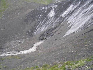
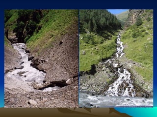
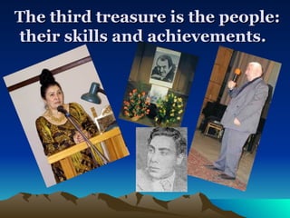
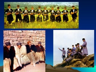
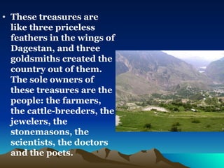
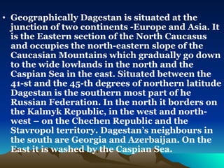
Dagestan is my Home and Hearth
The First President of Dagestan Mukhu G. Aliev
“ Where is Dagestan of yours?”, a mountaineer was asked, he was an Andian, a son of wise and witty people who live high up in the  mountains and in fertile valleys. “Above and below an eagle’s wing,” the mountaineer answered.  It would be difficult to find a person in our country who doesn’t know where Dagestan is on the map.   Rasul Gamzatov  - a National Poet of Dagestan
The Map of Dagestan We would rather doubt if many people abroad have ever heard about our small but very beautiful republic.
Dagestan is situated at the junction of two continents. The springs and streams of Dagestan run down its slopes and hurl themselves headlong down its cliffs like sons into the paternal embraces of the rivers and seas of Asia. Dagestan is a tree which has taken root in the soil of both Europe and Asia. Today, Dagestan is not only a colorful exotic mountainous country with beautiful valleys, hills, cliffs. Dagestan is now a republic with full rights in the Russian Federation and it has three treasures.
The first treasure is the Land: mountains and plains.


World Famous Dagestani Miracle – Dune  Sary Koum in the Middle of the Pre -Caspian Plain
 
Botlikh Region
 
 
Untsukul Region
 
Dokouzparinsky Region
 
Gherghebel Region
 
 
Tsumadinsky Region
 
 
The Present Day and the History
 
Tabasaran Region
 
 
And so the first treasure is the land. The stony land of the mountain folk is their most  priceless asset. The life is very hard on it. To be able to grow anything on these stones the mountaineer had to carry earth to them all his life in baskets, in “khurdzuni” (a leather bag) in “papakhas” (a fur hat) and even by the handful.  “ May your field be crowded with wheat” is the kindest wish the mountaineer can make. “ May your field dry up and perish!” is the most terrible curse of the mountaineers. “ I swear by my land” is the strongest oath by a mountaineer.  Any damage done to the fields or to the land was punished by the biggest fine. But that was in the past. The modern mountain farmer has learnt to cultivate the land according to the rules of agronomy.
The second treasure is the Water: the rivers, the lakes  and the sea


The second treasure of Daghestan is the water. There is a saying: “The hearth is the heart of the home and the spring is the heart of the aul”. Not for nothing does a mountain curse say: “May the horse of the rider who befouls a spring perish”. Many wells have been dug in memory of brave men who died in battle, many springs bear their names.
The third treasure is the people: their skills and achievements.
Mourad Kozhlayev  leading Dagestani Composer
 
 
These treasures are like three priceless feathers in the wings of Dagestan, and three goldsmiths created the country out of them. The sole owners of these treasures are the people: the farmers, the cattle-breeders, the jewelers, the stonemasons, the scientists, the doctors and the poets.
The third treasure is immense – it is friendship of our hard-working, courageous and affectionate people with other people of Russia and especially their hospitality.
 
 
Geographically Dagestan is situated at the junction of two continents -Europe and Asia. It is the Eastern section of the North Caucasus  and occupies the north-eastern slope of the Caucasian Mountains which gradually go down to the wide lowlands in the north and the Caspian Sea in the east. Situated between the 41-st and the 45-th degrees of northern latitude Dagestan is the southern most part of he Russian Federation. In the north it borders on the Kalmyk Republic, in the west and north-west – on the Chechen Republic and the Stavropol territory. Dagestan’s neighbours in the south are Georgia and Azerbaijan. On the East it is washed by the Caspian Sea.
Cherkey Hydropower Station


Gounib Hydropower Station


Dagestan occupies an area of 50,000 square kilometres. It stretches  for some 400 kilometres from north to south and for 200 kilometres from east to west. Despite the small area it occupies, the landscape of the republic is quite varied ranging from magnificent mountains of central and south Daghestan to the wide plains in the north, which include the semi-arid Nogai steppe.
Therefore the whole republic can be roughly divided into three main parts: highland Daghestan , foothill Daghestan and lowland Daghestan. Mountains occupy more than half  of the territory of the republic. The highest points are Mount Bazardyuzi on the border with Azerbaijan and Mount Diklos-Mta on the border with Georgia. In many place the Mountai ranges are cut through by the deep rivers and canyons, the Sulak River Canyon is the deepest.
The main rivers are the Terek, the Samur and the Sulak with its main tributaries: the Avar Koisu, the Andi Koisu, the Kara Koisu and the Kazikumukh Koisu. All of them flow into the Caspian Sea and are important for irrigation purposes and the power-generating sources.  Industrially significant natural resources are oil, natural gas, copper, ore, sulhpur, quarts sands, mineral fertilizers and different building materials, such as clay, limestone, sandstone, granite, etc.
In addition , a number of districts of Daghestan possess remarkable balneological factors, including mineral springs and medical mud with rare curative properties.  Tourism  also receives great encouragement. A plan has been prepared for opening new tourist camps, inns and  motels.  At present Daghestan is composed of 42 administrative districts and 10 towns and 14 urban-type settlements. Altogether there are about 1000 villages in the Republic. The capital of Daghestan is Makhachkala.

Dagestan

  • 1.
    Dagestan is myHome and Hearth
  • 2.
    The First Presidentof Dagestan Mukhu G. Aliev
  • 3.
    “ Where isDagestan of yours?”, a mountaineer was asked, he was an Andian, a son of wise and witty people who live high up in the mountains and in fertile valleys. “Above and below an eagle’s wing,” the mountaineer answered. It would be difficult to find a person in our country who doesn’t know where Dagestan is on the map. Rasul Gamzatov - a National Poet of Dagestan
  • 4.
    The Map ofDagestan We would rather doubt if many people abroad have ever heard about our small but very beautiful republic.
  • 5.
    Dagestan is situatedat the junction of two continents. The springs and streams of Dagestan run down its slopes and hurl themselves headlong down its cliffs like sons into the paternal embraces of the rivers and seas of Asia. Dagestan is a tree which has taken root in the soil of both Europe and Asia. Today, Dagestan is not only a colorful exotic mountainous country with beautiful valleys, hills, cliffs. Dagestan is now a republic with full rights in the Russian Federation and it has three treasures.
  • 6.
    The first treasureis the Land: mountains and plains.
  • 7.
  • 8.
  • 9.
  • 10.
  • 11.
  • 12.
  • 13.
    World Famous DagestaniMiracle – Dune Sary Koum in the Middle of the Pre -Caspian Plain
  • 14.
  • 15.
  • 16.
  • 17.
  • 18.
  • 19.
  • 20.
  • 21.
  • 22.
  • 23.
  • 24.
  • 25.
  • 26.
  • 27.
  • 28.
    The Present Dayand the History
  • 29.
  • 30.
  • 31.
  • 32.
  • 33.
    And so thefirst treasure is the land. The stony land of the mountain folk is their most priceless asset. The life is very hard on it. To be able to grow anything on these stones the mountaineer had to carry earth to them all his life in baskets, in “khurdzuni” (a leather bag) in “papakhas” (a fur hat) and even by the handful. “ May your field be crowded with wheat” is the kindest wish the mountaineer can make. “ May your field dry up and perish!” is the most terrible curse of the mountaineers. “ I swear by my land” is the strongest oath by a mountaineer. Any damage done to the fields or to the land was punished by the biggest fine. But that was in the past. The modern mountain farmer has learnt to cultivate the land according to the rules of agronomy.
  • 34.
    The second treasureis the Water: the rivers, the lakes and the sea
  • 35.
  • 36.
  • 37.
  • 38.
  • 39.
  • 40.
  • 41.
    The second treasureof Daghestan is the water. There is a saying: “The hearth is the heart of the home and the spring is the heart of the aul”. Not for nothing does a mountain curse say: “May the horse of the rider who befouls a spring perish”. Many wells have been dug in memory of brave men who died in battle, many springs bear their names.
  • 42.
    The third treasureis the people: their skills and achievements.
  • 43.
    Mourad Kozhlayev leading Dagestani Composer
  • 44.
  • 45.
  • 46.
    These treasures arelike three priceless feathers in the wings of Dagestan, and three goldsmiths created the country out of them. The sole owners of these treasures are the people: the farmers, the cattle-breeders, the jewelers, the stonemasons, the scientists, the doctors and the poets.
  • 47.
    The third treasureis immense – it is friendship of our hard-working, courageous and affectionate people with other people of Russia and especially their hospitality.
  • 48.
  • 49.
  • 50.
    Geographically Dagestan issituated at the junction of two continents -Europe and Asia. It is the Eastern section of the North Caucasus and occupies the north-eastern slope of the Caucasian Mountains which gradually go down to the wide lowlands in the north and the Caspian Sea in the east. Situated between the 41-st and the 45-th degrees of northern latitude Dagestan is the southern most part of he Russian Federation. In the north it borders on the Kalmyk Republic, in the west and north-west – on the Chechen Republic and the Stavropol territory. Dagestan’s neighbours in the south are Georgia and Azerbaijan. On the East it is washed by the Caspian Sea.
  • 51.
  • 52.
  • 53.
  • 54.
  • 55.
  • 56.
  • 57.
  • 58.
  • 59.
    Dagestan occupies anarea of 50,000 square kilometres. It stretches for some 400 kilometres from north to south and for 200 kilometres from east to west. Despite the small area it occupies, the landscape of the republic is quite varied ranging from magnificent mountains of central and south Daghestan to the wide plains in the north, which include the semi-arid Nogai steppe.
  • 60.
    Therefore the wholerepublic can be roughly divided into three main parts: highland Daghestan , foothill Daghestan and lowland Daghestan. Mountains occupy more than half of the territory of the republic. The highest points are Mount Bazardyuzi on the border with Azerbaijan and Mount Diklos-Mta on the border with Georgia. In many place the Mountai ranges are cut through by the deep rivers and canyons, the Sulak River Canyon is the deepest.
  • 61.
    The main riversare the Terek, the Samur and the Sulak with its main tributaries: the Avar Koisu, the Andi Koisu, the Kara Koisu and the Kazikumukh Koisu. All of them flow into the Caspian Sea and are important for irrigation purposes and the power-generating sources. Industrially significant natural resources are oil, natural gas, copper, ore, sulhpur, quarts sands, mineral fertilizers and different building materials, such as clay, limestone, sandstone, granite, etc.
  • 62.
    In addition ,a number of districts of Daghestan possess remarkable balneological factors, including mineral springs and medical mud with rare curative properties. Tourism also receives great encouragement. A plan has been prepared for opening new tourist camps, inns and motels. At present Daghestan is composed of 42 administrative districts and 10 towns and 14 urban-type settlements. Altogether there are about 1000 villages in the Republic. The capital of Daghestan is Makhachkala.