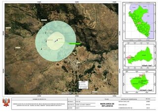
This document is a map showing an area of Peru located in the regions of Pasco and Daniel Alcides Carrión. The map outlines the project area and area of influence for a reforestation plan. It displays geographical features, boundaries, and locations of towns and settlements in the district of Paucar in Daniel Alcides Carrión province, Pasco department. Scale, projection, and coordinate details are provided in the legend.