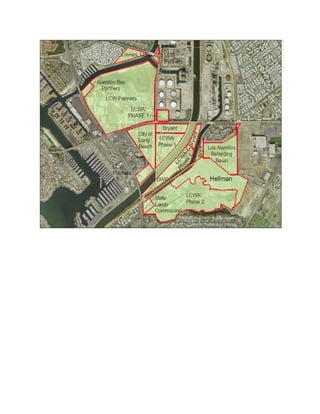
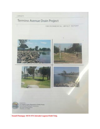
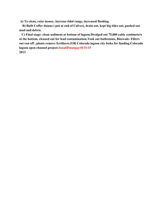
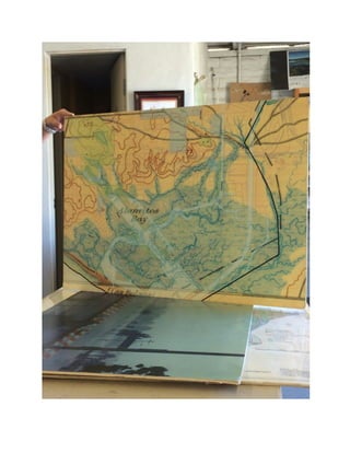
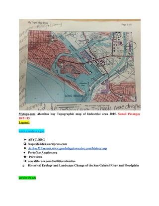
- The document contains journal entries from researchers recording their work analyzing the industrial site in Alamitos Bay, Long Beach.
- The entries document research into maps of the site and surrounding areas, zoning plans, development plans, environmental reports and historical analyses of the wetlands and land use over time.
- The goal is to traceably document all sources to understand the current state of the industrial lands and fiture development plans being considered.


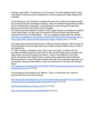
![and final section describes the Mission Dolores Indians and the San Francisco
Peninsula landscape during the early and mid1840s”.
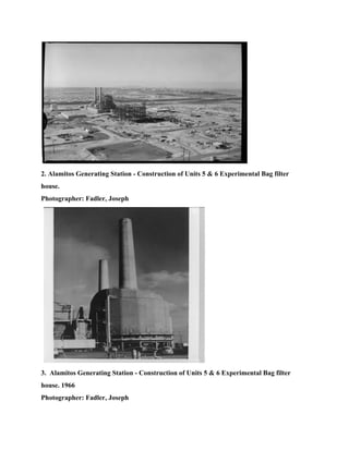
This was a “ partial emancipation policy” that first only included the Monterey
district. However, it was extended to other districts in 1828, but did not include Mission
San Rafael or Mission San Francisco Solano on the Northern frontier ( Bancroft
1886:III:102).
Sonali Patangay 11/24/15 Week 9 Journal (2) 1833 Secularization Act specifics
and effects on local jurisdiction and laws and Regulations of 1834
http://www.nps.gov/goga/learn/historyculture/upload/Chapter8.pdf
“On July 2, 1833 southern Mission Prefect Narciso Duran wrote Figueroa with regard to
the difference of life quality of the Indians who were living at the missions and those
who were emancipated and living in the pueblo of Los Angeles: I have seen with the
greatest amazement that [the Indians who dwell in the pueblo of Los Angeles] . . . live
far more wretched and oppressed than those in the missions. There is not one who has
a garden of his own, or a yoke of oxen, a horse, or a house fit for a rational being. The
equality with the white people, which is preached to them, consists in this, that these
Indians are subject to a white comisionado, and are the only ones who do the menial
work . . . All in reality are slaves, or servants of white men who know well the manner of
securing their services by binding them a whole year for an advanced trifle . . . The
benevolent ideas of the Government will never be realized, because the Indian evinces
no other ambition than to possess a little more savage license, even though it involved a
thousand oppressions of servitude (Duran [1833] in Geary 1934:137)”.](https://image.slidesharecdn.com/31c03841-96d5-4684-be0d-24d90cab4ca2-160818172837/85/AlamitosBay-Group1-27-320.jpg)

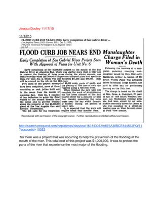
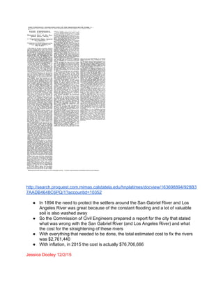

![An explosion occurred during the night of March 13, shortly after midnight.
The damage is estimated at about $800.00
http://cdnc.ucr.edu/cgibin/cdnc?a=d&d=LAH19070314.2.133&e=en201txttxINBi
xby+Becomes+Head+of+a+Big+Corporation1
Ignacio 12/07/15 Popular Media ( ARTICLE # 2 )
AES Corp. seeking approval for Alamitos Energy Center in east Long Beach
Source: SyndGate Media Inc
Energy Monitor Worldwide 12 May 2014
Power company AES Corp. anticipates its plans to build a replacement power plant in east
Long Beach will require a twoyear review process before the construction itself expected
to take more than a decade can begin.
"AES Corp. seeking approval for Alamitos Energy Center in east Long Beach." Energy
Monitor Worldwide [Amman, Jordan] 12 May 2014. General OneFile. Web. 7 Dec. 2015.
http://libproxy.csun.edu/login?url=http://go.galegroup.com/ps/i.do?id=GALE%7CA377008043
&v=2.1&u=csunorthridge&it=r&p=&sw=w&asid=5de34e557483764a6895b1b1fde17fd5
Ignacio 12/07/15 Popular Media ( ARTICLE # 3 )
Source: Energy Monitor Worldwide (Amman, Jordan). (May 12, 2014)
SNL Energy Power Daily (14 March 2014)
AES Corp. subsidiary AES Southland plans to build four 3on1 combinedcycle gasturbine
power blocks consisting of 12 gasfired combustionturbine generators, 12 heat recovery
steam generators, four steam turbine generators, four aircooled condensers, and related
ancillary equipment.
AES Corp. seeking approval for Alamitos Energy Center in east Long Beach." Energy Monitor
Worldwide [Amman, Jordan] 12 May 2014. General OneFile. Web. 7 Dec. 2015.
URL
http://libproxy.csun.edu/login?url=http://go.galegroup.com/ps/i.do?id=GALE%7CA377008043
&v=2.1&u=csunorthridge&it=r&p=&sw=w&asid=5de34e557483764a6895b1b1fde17fd5](https://image.slidesharecdn.com/31c03841-96d5-4684-be0d-24d90cab4ca2-160818172837/85/AlamitosBay-Group1-87-320.jpg)

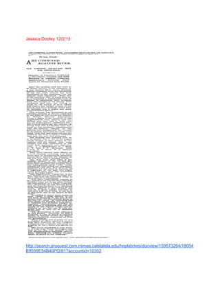
![We find the Commission’s approval of the exchange not supported by the evidence. Therefore,
we reverse the trial court’s judgment and grant Earth Corps’s petition for writ of mandate.
31 1833 Secularization Act
http://www.nps.gov/goga/learn/historyculture/upload/Chapter8.pdf
“This chapter on the secularization and Rancho Era contains sections with a wide central
California perspective and sections with a narrow San Francisco Peninsula perspective. The
initial section follows the mission secularization process whereby Mission Indians lost legal title
to their lands and became a servant class within the Hispanic community. The second section
describes land grants received by Indian people in the San Francisco and Monterey Bay Areas.
The third section examines various themes pertinent to the San Francisco Bay Area and the
larger central California area. The fourth section documents secularization at Mission Dolores
and the family groups of the San Francisco Peninsula Indian community up to 1840. The fifth
and final section describes the Mission Dolores Indians and the San Francisco Peninsula
landscape during the early and mid1840s”.
This was a “partial emancipation policy” that first only included the
Monterey district. However, it was extended to other districts in 1828, but did not include
Mission San Rafael or Mission San Francisco Solano on the Northern frontier (Bancroft
1886:III:102).
32. 1833 Secularization Act specifics and effects on local jurisdiction and laws and Regulations
of 1834
http://www.nps.gov/goga/learn/historyculture/upload/Chapter8.pdf
“On July 2, 1833 southern Mission Prefect Narciso Duran wrote Figueroa with regard to the
difference of life quality of the Indians who were living at the missions and those who were
emancipated and living in the pueblo of Los Angeles: I have seen with the greatest amazement
that [the Indians who dwell in the pueblo of Los Angeles] . . . live far more wretched and
oppressed than those in the missions. There is not one who has a garden of his own, or a yoke of
oxen, a horse, or a house fit for a rational being. The equality with the white people, which is
preached to them, consists in this, that these Indians are subject to a white comisionado, and are
the only ones who do the menial work . . . All in reality are slaves, or servants of white men who
know well the manner of securing their services by binding them a whole year for an advanced
trifle . . . The benevolent ideas of the Government will never be realized, because the Indian
evinces no other ambition than to possess a little more savage license, even though it involved a
thousand oppressions of servitude (Duran [1833] in Geary 1934:137)”.
33.
https://books.google.com/books?id=rCy634h9_oYC&pg=PA8&lpg=PA8&dq=1884+willmore+c
ity+becomes+long+beach&source=bl&ots=0VP5GIUkFh&sig=3MVkKmdIpSK5Iz7eYfE2aLdl](https://image.slidesharecdn.com/31c03841-96d5-4684-be0d-24d90cab4ca2-160818172837/85/AlamitosBay-Group1-101-320.jpg)