The CubiScan 1000-VS is a ceiling-mounted dimension and weight scanning device that maximizes efficiency by allowing 360 degree access to items below without taking up floor space. It uses laser and camera sensors to measure items from 1 cubic foot to 6x6x8 feet in size with 1 inch resolution. Connected to a PC and Quantronix's Qbit interface software, it can process multi-piece shipments and prepare dimensional and weight data to calculate appropriate shipping charges.
The CubiScan 1200-AKL is a large-scale static dimension scanning device that uses overhead-mounted infrared laser sensors to quickly and accurately measure freight dimensions and weight. It can measure items in any orientation from 1 cubic foot to 8x8x8 feet in size. The system includes a panel-mounted PC, touchscreen monitor, and software to transfer measurement data to warehouse and shipping systems. It is suitable for dimensions tasks in warehouses, freight facilities, and during freight manifesting and auditing.
Douglas E. Sleep Jr. seeks a leadership position utilizing over 30 years of project management experience in the commercial industry. He holds an MBA from Northwood University and a BS in Mechanical Engineering from Michigan State University. As a Project Manager at General Motors, he has led multiple capital projects from concept through delivery, ensuring they were completed on schedule, budget, and met quality standards. His skills include managing teams, developing project plans, negotiating contracts, and supporting commissioning and validation activities.
The Black Sea Strategic Action Plan (BSERP) aims to implement measures to restore and protect the Black Sea environment as agreed by coastal countries. The 2007 update of the Black Sea SAP provides more detailed targets and indicators than the original 1996 SAP. It includes over 100 proposed short, medium, and long-term management targets across 4 priority issues - preserving living resources, biodiversity, reducing eutrophication, and water quality. Next steps include estimating costs of implementing targets, adjusting targets based on available budgets, and producing a negotiated document.
Cody Bordeau has over 5 years of experience in administrative and event coordination roles. He currently works as an Administrative Assistant at Madison Square Garden in New York City where he provides support to two Vice Presidents, including managing their calendars, presentations, and expenses. Additionally, Bordeau walks dogs as a side job with Pawsitively Love in Manhattan. He has a Bachelor's degree in Business Management from Hofstra University and volunteers with organizations like FindSpark and Project Sunshine.
This document provides a summary of an individual's experience and qualifications as a marine engineer and safety consultant. It details his educational background which includes a BSc in engineering and safety certifications. It then outlines his work history over the past 15 years, including roles as a safety consultant, service engineer, technical instructor, and engineer aboard a naval aircraft carrier and smaller vessels. His experience encompasses engineering, maintenance, safety management, training, and instruction. Personal interests are also listed.
This document contains Madhulika H's resume. It includes her contact information, career objective, academic credentials, technical skills, work experience, co-curricular activities, projects, and personal details. Madhulika has a Bachelor's degree in Computer Science and Engineering from VTU. She currently works as a software developer at Inbridge Solutions building websites and software using technologies like PHP, HTML, and MySQL.
Este documento proporciona instrucciones para crear una lista de reproducción de las 10 canciones más escuchadas de The Rolling Stones en Paraguay y compartirla a través de correo electrónico. Explica los pasos para seleccionar canciones de la lista de Rolling Stones en Tigo Music, agregarlas a una nueva lista personalizada, y luego compartir la lista completa a través de Deezer utilizando un correo electrónico.
The document discusses performance indicators for international waters programs. It outlines four levels of indicators: coverage, process, stress reduction, and environmental status. Implementation indicators measure project progress, while impact indicators measure actual effects. Baselines are important for measuring degree of change. Coverage indicators reflect program scope. Process indicators measure government actions and quality. Stress reduction indicators track reductions in threatening human activities. Environmental status indicators are difficult to apply consistently across projects. Data on indicators can be aggregated and compared in various ways.
La biblioteca pública sota el franquisme: els inicis de la Biblioteca Sant Pa...BibliotecaSantPauSantaCreu
A l'exposició commemorativa dels 75 anys de l'actual Biblioteca Sant Pau-Santa Creu es mostren els clarobscurs de les primeres biblioteques de l'època franquista. Aquest període fosc va tenir alguns clars, alguns "malgrat tot", que també hem volgut ressaltar en cadascun dels àmbits de la mostra, i especialment els protagonitzats per les bibliotecàries i els lectors. La Marga Losantos és bibliotecària de la Biblioteca de Catalunya i és la comissària de l'exposició.
Sterling Medical Devices is your Partner in Medical Device Development
System Design, Development and Test
- Software and Electronics Experts
- Any Phase
Risk planning and hazard identification
DHF Remediation
Project Rescue
Quality System Consulting
450+ Medical Projects, 125+ Clients
The document provides an overview of Landed Cost Management (LCM) integration with Oracle applications including key setups, functional flows, data flows and a test case. It describes the process of creating a purchase order, generating estimated landed costs, importing costs into inventory, matching actual invoices, updating costs and accounting entries. Scripts and diagnostic tools for analyzing integration setups and transactional data are also outlined.
1) A synthetic pseudo-source rock was prepared by depositing clay through an oil column to test for pseudo-source rock characteristics.
2) The synthetic rock showed good source rock potential through pyrolysis and biomarker analysis, matching the oil it was deposited with.
3) However, the rock was not mature enough on its own to generate hydrocarbons, showing it is a pseudo-source rock rather than a true source rock, as the kerogen incorporated was already mature rather than the rock itself reaching maturity.
Robots have now replaced many daily functions of humans. Our world has become more automated than ever with machines that do some amazing tasks - functionally and just for fun.
El documento describe un experimento de laboratorio para observar el suelo. Los estudiantes midieron la masa de una muestra de suelo antes y después de agregar agua y calentarla. Descubrieron que el suelo absorbió el agua y que su masa disminuyó después de calentarlo, lo que indica que contiene componentes sólidos, líquidos y gaseosos. Concluyeron que el suelo es una mezcla heterogénea de diferentes materiales y no un elemento o compuesto puro.
This document summarizes an inspection machine for printed circuit boards. The machine uses a 3-CCD camera and ring-shaped LED illumination to provide high-performance inspections of post-printing, post-placement, and post-reflow circuit boards. It can inspect for defects such as missing or insufficient solder and detect issues like bridging or component shifting. The machine offers customizable inspection programs and data storage of results.
Failure of the component or failure of the whole system can be caused by any contamination in the fiber connection. An important component in fiber connection is Fiber optic connector. As we know, end-surface treatment is required by fiber optic cables for proper light transmission. For almost all glass-based fibers, Polishing and fiber polishing pad is an essential step with diameters and cladding larger than 200 microns. Polishing is also needed by all fiber optic connectors.
MGISS specializes in enabling accurate spatial data collection on mobile devices using cost-effective workflows. Their mission is to improve field data collection workflows by providing efficient and accurate positioning solutions. This includes choosing the appropriate global navigation satellite system and correction service to meet the required accuracy level for applications like mapping, inspections, and asset surveys. MGISS helps customers implement spatial data collection solutions that deliver a return on investment within a single project.
A remote-controlled global navigation satellite system based rover for accur...IJECEIAES
One of the main tasks of a cadastral surveyor is to accurately determine property boundaries by measuring control points and calculating their coordinates. This paper proposes the development of a remotely-controlled tracking system to perform cadastral measurements. A Bluetooth-controlled rover was developed, including a Raspberry Pi Zero W module that acquires position data from a VBOX 3iSR global navigation satellite system (GNSS) receiver, equipped with a specific modem to download real-time kinematic (RTK) corrections from the internet. Besides, the Raspberry board measures the rover speed with a hall sensor mounted on a track, adjusting the acquisition rate to collect data at a fixed distance. Position and inertial data are shared with a cloud platform, enabling their remote monitoring and storing. Besides, the power supply section was designed to power the different components included in the acquisition section, ensuring 2 hours of energy autonomy. Finally, a mobile application was developed to drive the rover and real-time monitor the travelled path. The tests indicated a good agreement between rover measurements and those obtained by a Trimble R10 GNSS receiver (+0.25% mean error) and proved the superiority of the presented system over a traditional metric wheel.
What is the best UAV system for running Lidar, GIS mapping, aerial survey, vo...3D Pointshot
UAV mapping is revolutionizing data collection in India, and 3D PointShot is at the forefront of this transformative technology with its advanced UAV Mapping System. Equipped with cutting-edge equipment featuring RGB and multispectral cameras, UAV surveys offer cost-effective and accurate data collection from previously inaccessible areas. From agriculture and construction to disaster management and environmental monitoring, UAV aerial mapping finds versatile applications. It captures vast areas efficiently, reducing surveying time and noise pollution while ensuring pilot safety. 3D PointShot is dedicated to providing top-quality products and services, staying at the forefront of the ever-evolving drone industry. As pioneers in UAV aerial mapping and surveys, they offer the latest technology, promising maximum client satisfaction. Explore their range of UAV and scanning products for your industrial needs today.
The document describes the M1400 airship and its capabilities for intelligence, surveillance and reconnaissance (ISR) missions. It can carry over 6,500 lbs of payload including multiple ISR sensors. With a range of over 100,000 square miles, a single M1400 can provide the ISR of multiple current systems and stay aloft for up to 78 hours, at a fraction of the cost. It provides unprecedented persistence and payload capacity for military and civilian missions.
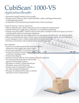
1. CubiScan 1000-VS
®
Applications/Benefits
• Dimensions freight instantly and accurately
• Provides actual volume or cubic volume (the tallest, widest, and deepest dimensions
of object being measured)
• Compatible with load planning and optimization software packages
Freight Manifesting / Auditing Applications
• With an optional scale, capture dimensional and reweigh data simultaneously
• Handles multi-piece, single piece, palletized, or non-palletized shipments
• Features innovative QBIT™ interface software that allows multiple air bills to be open at one time—
including both single and multi-piece shipments
• Includes dimensional tare and weight tare for net versus gross calculations (i.e., can subtract pallet)
• Offers user definable dim-factors which can be calculated in imperial, metric, or any combination
• Can be equipped with or without optional floor-mounted deck scale
• Interfaces conveniently with computer-based manifesting systems
More Highlights
• Features an overhead readout that instantly displays
dimensions, dim-weight, and actual weight
• Can be used with Qbit™ PC interface software
• Control the CubiScan directly from your own host
warehouse/shipping system
• Protects data integrity
• Interfaces directly with bar code scanning and scale equipment
• Uses sensing technology that is safe for both
operators and package contents
• Mounted to a facility’s ceiling allowing for
360 degree access to the floor scale
• System cannot be damaged by forklifts or
any other operational equipment
• Occupies no additional floor space so facility
operations are not compromised