
Recommended
Recommended
More Related Content
Similar to Cwrmp
Similar to Cwrmp (20)
Recently uploaded
Recently uploaded (20)
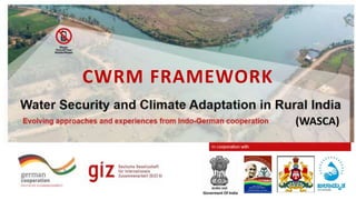
Cwrmp
- 2. Composite Water Resource Management (CWRM) • Need for Composite Water Resource Management (CWRM) Plan • CWRM Template • Data Sections • Water Budgeting • Output
- 3. Need for CWRM Fa m i l y P e o p l e A n i m a l s C r o p s
- 4. Need for CWRM • Amount of Rain • Number of Ponds • Other Water resources • Water budgeting • Plan Activities Information/Data
- 5. Socio- economic Land Resources Agriculture Hydro- meteorology CWRM Water Budgeting Outputs Natural Resource Management Activities Key Challenges Soil Resources CWRM Template Water Resources
- 7. Socio-Economic Information • Population & Households information • Male • Female • Household • Category wise population The data can be used to approximate the water consumption and usage • MGNREGA Job Card Holders Information • Numbers of registered Job cards • Active Job cards • Expenditure information The data can be used to approximate the labour force available for carrying out proposed activities Socio- Economic Land Resources Agriculture Hydro- metrology Soil Resources Socio- Economic Population & Households MGNREGA Job Card holders Water Resources
- 9. Land Resources Land Resource Information • Area under Non-Agricultural • Barren & Un-cultivable Land • Permanent Pastures and Other Grazing Land • Land Under Miscellaneous Tree Crops • Culturable Waste Land • Fallows Land other than Current Fallows • Current Fallows • Total Unirrigated Land • Area Irrigated by Source The data is useful in understanding the land use and land cover pattern to take corrective actions. Socio- Economic Land Resources Agriculture Hydro- metrology Soil Resources Land Resources Land Use Water Resources
- 10. Land Resource Section Source: https://censusindia.gov.in/2011census/dchb/DCHB.html
- 11. Soil Resources Major Nutrients • Nitrogen (N) • Phosphorus (P) • Potassium (K) • Organic Carbon Micronutrients • Boron (B) • Copper (Cu) • Iron (Fe) • Manganese (Mn) • Sulpher (S) • Zinc (Zn) Physical Parameters • Acidic Sulphate (AS) • Strongly Acidic (SrAc) • Highly Acidic (HAc) • Moderately Acidic (MAc) • Slighly Acidic (SlAc) • Neutral (N) • Moderately Alkaline (MAI) • Strongly Alkaline (SIAI) Socio- Economic Land Resources Agriculture Hydro- metrology Soil Resources Soil Resources Major Nutrients Micro Nutrients Physical Parameter Water Resources
- 12. Soil Resource Section Source: https://soilhealth.dac.gov.in/NewHomePage/NutriPage
- 13. Water Resources Existing water resources • Tap supply • Handpump • Open well • Borewell • RTRWHS • Tanks/ponds Socio- Economic Land Resources Agriculture Hydro- metrology Soil Resources Water Resources Drinking water Water Resources Status of irrigation facilities – surface water • Canal area • Well/Tube well area • Tanks/Lakes area • Waterfall area Water quality profile Chemical contaminants • Iron • Fluoride • Salinity • Nitrate • Arsenic Biological contaminants • Faecal Coliform • TDS • Hardness • Chloride • Sulphates Irrigation water Water Quality
- 14. Availability of drinking water Source: https://ejalshakti.gov.in/jjmreport/JJMIndia.aspx https://censusindia.gov.in/2011census/dchb/DCHB.html
- 15. Status of Irrigation facilities – surface water Source: https://censusindia.gov.in/2011census/dchb/DCHB.html
- 17. Agriculture Data Crop Data • Type of crop • Irrigated Area • Rainfed Area Livestock Data • Type of animals • Number of animals • Water requirement Socio- Economic Land Resources Agriculture Hydro- metrology Soil Resources Agriculture Crop Livestock Water Resources
- 20. Hydrometeorology Temperature • Maximum • Minimum • Average Rainfall • Maximum • Minimum • Average Soil Moisture • Monthly Socio- Economic Land Resources Agriculture Hydro- metrology Soil Resources Hydro- Meteorology Temperature Rainfall Soil Moisture Water Resources
- 22. Water Budgeting Water Budgeting – GP wise • Individual water required • GP wise water required • Available run-off from rainwater • Harvested Runoff from Water Harvesting Activities Water Budgeting Water Budgeting Village wise Water Budgeting
- 24. Outputs Natural Resources • Identification of NR • Utilization Activities • Upper Slopes • Middle Slopes • Lower Key Challenges • Identification of needs • Water Deficiency/ Sufficiency Outputs Decision support system Proposed Activities Key challenges NRM
- 25. Output Section
- 26. Conclusion • CWRM Framework • Six Sections of Data Collation • Prepare water budget based on the Data gathered • Plan the activities considering the water budget prepared
- 27. Next… • My colleague will now take you through the GIS Technology and its use on planning activities.
- 28. Deutsche Gesellschaft für Internationale Zusammenarbeit (GIZ) GmbH Registered offices Bonn and Eschborn Friedrich-Ebert-Allee 36 + 40 53113 Bonn, Germany T +49 228 44 60 - 0 F +49 228 44 60 - 17 66 E info@giz.de I www.giz.de Dag-Hammarskjöld-Weg 1 - 5 65760 Eschborn, Germany T +49 61 96 79 - 0 F +49 61 96 79 - 11 15