Download as PDF, PPTX
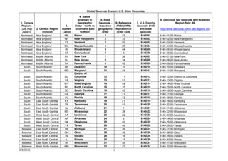
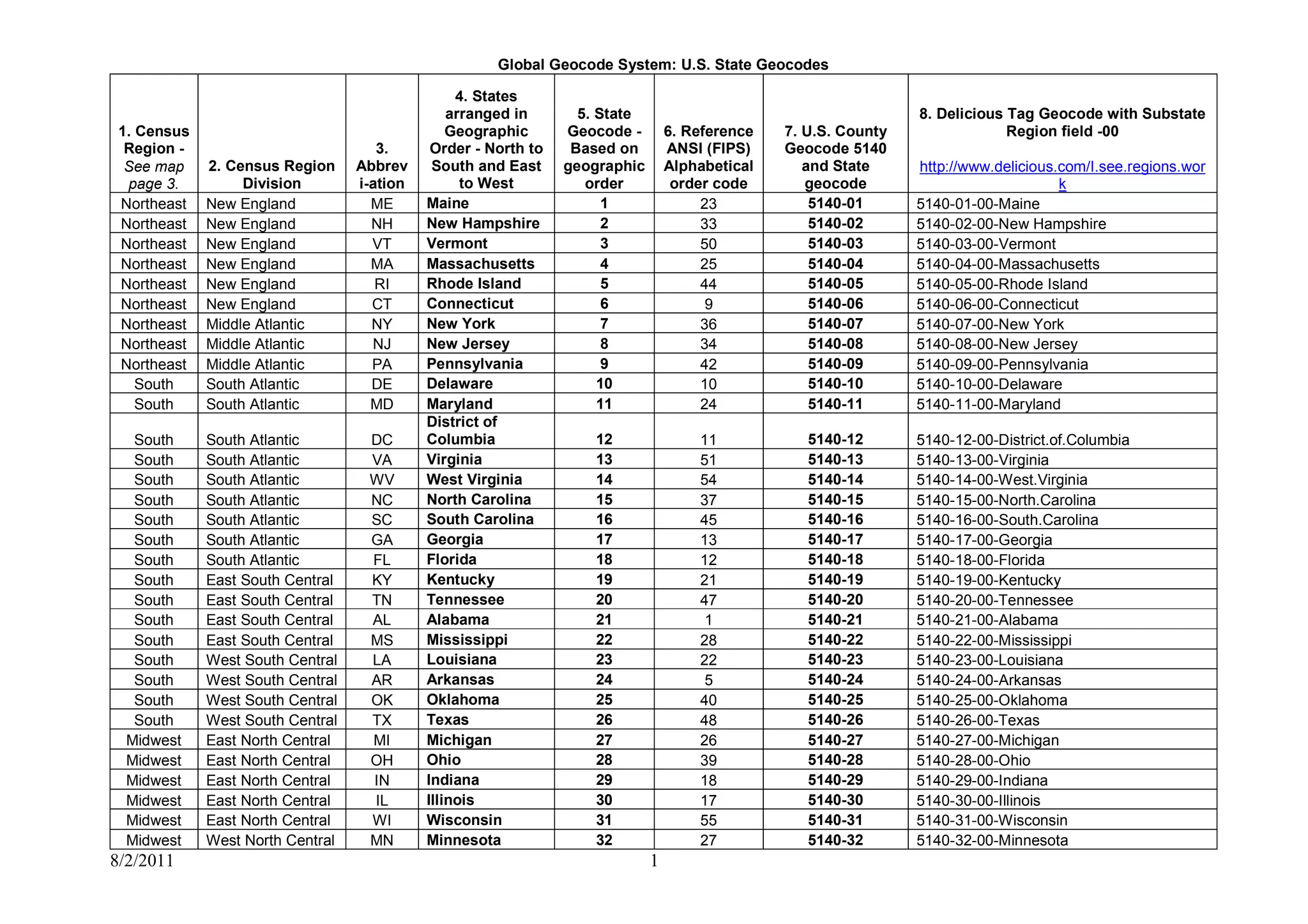
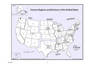

This document outlines a geocode system for U.S. states that includes the state name, FIPS code, census region, and delicious tag geocode with substate region field for each state. States are arranged in geographic order from north to south and east to west within their census region. Each state is also assigned a number that corresponds to its position within its census region.


