What if... you could use existing open source data to make it even more awesome? How about adding building heights to footprint polygons with Lidar? Workflow description to showcase how to combine Lidar data and Building footprints to derive building height attributes.
Chintamani Call Girls: 🍓 7737669865 🍓 High Profile Model Escorts | Bangalore ...
GeoNB Lidar and Building Footprints
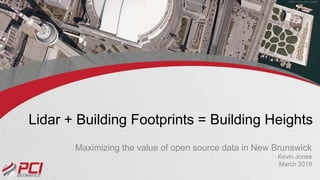
1. Lidar + Building Footprints = Building Heights
Maximizing the value of open source data in New Brunswick
Kevin Jones
March 2019
2. Problem Statement
• Province of NB is leading the way in
publishing open data (LIDAR)
• Building footprints are available for
cities
– Building heights are not included in
attributes
• Can these two datasets be combined
to produce valuable attribute
information?
2
http://www.snb.ca/geon
b1/e/dc/catalogue-
E.asp
http://catalogue-
saintjohn.opendata.arcgis.co
m/datasets/34b6e31364f442
f883035946b7d2c9a5_0
IS IT POSSIBLE?
4. But how?
Download
GeoNB Lidar
Data
Interpolate
point cloud to
DSM
Filter DSM to
DTM
DSM – DTM
= Height Map
4
Download
building
footprints
Attribute
building
footprints
with H Map
Classify /
Represent
building
Produce Map
16. Improvements / options
• Automate the process (all automatable through Python)
• Use other sources of elevation (stereo data to derive
DSMs using Geomatica)
• Perform change detection over time
• Replicate workflow anywhere Lidar data and building
footprints are found!
16