SlideShare a Scribd company logo
1 of 82
Download to read offline
Academic year 2019-2020
gfg
Tunis El Manar University
Faculty of Sciences of Tunis
Department of Geology
THESIS FOR OBTAINING THE DIPLOMA OF PROFESSIONAL MASTER'S DEGREE IN
GEOMATICS AND REMOTE SENSING APPLIED TO THE ENVIRONMENT
Prepared by :
KHOULOUD DRIDI
Entitled:
DIGITAL AERONAUTICAL DATA
VIEWER: REAL TIME
Defended on 13/03/2021 in front of the jury composed of:
Dr Dridi Imene Assistant professor at FST President
Ms Henchiri Hejer Engineer at OACA Examiner
Dr Sboui Tarek Professor at FST FST Supervisor
Mr Mechergui
Mohamed Wassim
Head of section at OACA OACA Supervisor
ACKNOWLEDGEMENT
Accomplishing this project would have been impossible without the help and
encouragement of many people, I must begin by acknowledging my company framer
Mechergui Mohamed Wassim I would like to thank him for his guidance and all the
know-how he has passed on to me.
And I would like to thank my university framer Mr Sboui for agreeing to be my
academic supervisor for his unfailing availability, advice and support.
.
I also want to thank my colleague Rim MZOUGHI for helping me with her
brilliant idea to write down this thesis, since I have chosen to share it in English.
Next, I want to express my gratitude to the teaching staff of geology
department for helping me reaching this point of knowledge in GIS domain.
And finally, I would like to thank my family for their support and
encouragement.
ABSTRACT
ICAO, Eurocontrol and FAA led the idea of moving from AIS towards AIM
under the slogan “providing the right information at the right time to the right people “.
Tunisia and precisely OACA rushed to the main objective of this new era:
automation which has been proved to be essential.
Web map applications are part of this automation since it provides a high
quality of aeronautical data and ensures that the right information is delivered to the
right users at the right time.
To achieve this goal OACA hosted the idea of creating an aeronautical web
map application under the name of “digital aeronautical data viewer: real-time” in
order to catch up with the fast pace of the aviation industry evolution around the
world.
RÉSUMÉ
L’OACI, Eurocontrol et la FAA ont lancé l’idée de passer de l’AIS à l’AIM sous
le slogan « fournir la bonne information au bon moment aux bonnes personnes ».
La Tunisie et précisément l’OACA se sont précipités sur l’objectif principal de
cette nouvelle technologie : l’automatisation qui s’est avérée être essentielle.
Les applications cartographiques web font partie de cette réalisation
puisqu’elle permet d’obtenir une haute qualité de données aéronautiques et de
s’assurer que la bonne information est délivrée aux bons utilisateurs au bon
moment.
Pour atteindre cet objectif, l’OACA a eu l’idée de créer une application
cartographique web mapping sous le nom de “visualisation numérique de données
aéronautiques : temps réel” afin de suivre le rythme rapide de l’évolution de
l’industrie aéronautique dans le monde.
SUMMARY
INTRODUCTION ............................................................................................................. 1
GENERAL CONTEXT AND CONCEPT DEFINITION ...................................................... 3
I. HOST COMPANY: OACA .................................................................................... 4
3. AIS Diagram ................................................................................................ 5
II. THE HISTORIC OF AIS SCOPE .............................................................................. 6
III. PROBLEM STATEMENT..................................................................................... 8
1. AIS/AIM shortcoming ................................................................................... 8
2. Proposed solution ........................................................................................ 9
3. Objective...................................................................................................... 9
IV. CONCEPT DEFINITION.................................................................................... 10
1. Aeronautical Information Services ............................................................. 10
2. Aeronautical Information Management ...................................................... 10
3. Air Traffic Management system ................................................................. 11
4. Aeronautical Information product ............................................................... 11
5. Aerodrome mapping database................................................................... 12
6. Metadata (ISO 19115*).............................................................................. 12
7. Aeronautical data....................................................................................... 12
8. NOTAM...................................................................................................... 12
9. Flight Information Region........................................................................... 12
10. Air Traffic Services airspaces .................................................................. 12
11. Particular areas........................................................................................ 13
12. Air Navigation aids................................................................................... 15
13. AIP........................................................................................................... 17
14. GIS........................................................................................................... 17
V. GIS AND AVIATION TWINNING ........................................................................... 18
METHODOLOGY AND MATERIEL .............................................................................. 19
METHODOLOGY ............................................................................................... 20
I.
MATERIAL........................................................................................................ 21
II.
1. Software..................................................................................................... 21
2. Hardware ................................................................................................... 22
DATA PROCESSING.................................................................................................. 23
DATA COLLECTION ........................................................................................... 24
I.
DATA PROCESSING........................................................................................... 25
II.
1. Sorting the information: the data sets ........................................................ 25
2. Storing the information............................................................................... 28
Verification and validation .......................................................................... 30
III.
1. Verification: ................................................................................................ 30
2. Validation ................................................................................................... 30
3. Geometric requirements ............................................................................ 32
REALIZATION AND IMPLEMENTATION ..................................................................... 36
ESRI WEBMAP APPLICATION ............................................................................ 37
I.
CREATION OF THE WEB MAP APPLICATION .......................................................... 37
II.
1. What’s a WEB GIS ?.................................................................................. 38
2. ArcGIS platform ......................................................................................... 38
3. Mapping the data ....................................................................................... 47
4. Building a Web GIS application ................................................................. 48
INTEGRATION AND VISUALIZATION ........................................................................ 50
I. WHAT DOES THE APPLICATION DISPLAY?............................................................ 52
1. Aeronautical static data.............................................................................. 52
2. Aeronautical dynamic data......................................................................... 53
3. AMDB ........................................................................................................ 53
II. THE WIDGETS .................................................................................................. 54
1. The table of content ................................................................................... 55
2. Basemap Gallery ....................................................................................... 56
3. NOTAM widget........................................................................................... 57
4. Direction and distance widget .................................................................... 59
5. Coordinates conversion widget.................................................................. 60
6. Add a Data widget...................................................................................... 61
7. The attribute tables .................................................................................... 62
8. Metadata of layers ..................................................................................... 63
III. EASY TO REACH........................................................................................... 64
CONCLUSION AND PERSPECTIVE .................................................................................. 65
BIBLIOGRAPHY ........................................................................................................... 67
ANNEX A.................................................................................................................... 68
ANNEX B.................................................................................................................... 69
ANNEX C ................................................................................................................... 70
LIST OF ABBREVIATIONS
A
AIS Aeronautical Information Services
AIM Aeronautical Information Management
ATM Air traffic Management
AMDB Aeronautical Mapping Database
AIP Aeronautical Information Publication
ATC Air Traffic Control
ATS Air Traffic Services
AIC Aeronautical Information Circular
AIRAC Aeronautical Information Regulation And Control
AFTN Aeronautical Fixed Telecommunications Network
ADQ Aeronautical Data Quality
C
CDM Collaborative Decision Making
CTR Controlled Traffic Region
CTA Controlled Traffic Area
D
DME Distance Measuring Equipment
E
ESRI Environmental Systems Research Institute
F
FIR Flight Information Region
G
GIS Geographic Information System
I
ICAO International Civil Aviation Organization
IFR Instrument Flight Rules
N
NOTAM Notice To Airmen
NDB Non-Directional Beacon
O
OACA Office d’Aviation Civil et des Aéroports
P
PANS-AIM Procedures for Air Navigation Services of Aeronautical Information Management
S
SLA Service-Level Agreement
SWIM System Wide Information Management
T
TMA Terminal Area
U
UIR Upper Information Region
V
VFR Visual Flight Rules
VOR VHF Omnidirectional Range
TABLES LIST
TABLE 3 THE USED SOFTWARE TABLE................................................................................................................................................... 22
TABLE 4 HARDWARE DESCRIPTION ....................................................................................................................................................... 22
TABLE 1 PERSONAL VS FILE GEODATABASES........................................................................................................................................ 29
TABLE 2 THE DIFFERENCE BETWEEN THE EMBEDDED LAYER AND THE HOSTED LAYER .............................................................. 46
FIGURES LIST
FIGURE 1 AIS DIAGRAM...............................................................................................................................................................................5
FIGURE 2 AIS TO AIM ROADMAP ..............................................................................................................................................................7
FIGURE 3 AIR TRAFFIC MANAGEMENT SYSTEM .................................................................................................................................. 11
FIGURE 4 PARTICULAR AREAS OF TUNISIAN FIR'S CHART................................................................................................................. 14
FIGURE 5 AIR NAVIGATION AIDS OF TUNISIAN FIR'S CHART............................................................................................................. 16
FIGURE 6 GEOGRAPHIC INFORMATION SYSTEM................................................................................................................................... 17
FIGURE 7 METHODOLOGY DIAGRAM ...................................................................................................................................................... 20
FIGURE 8 DATA COLLECTION DIAGRAM................................................................................................................................................. 24
FIGURE 9 AIRAC CYCLE........................................................................................................................................................................... 25
FIGURE 10 AERONAUTICAL DATA CATALOG OF TUNIS CARTHAGE INTERNATIONAL AIRPORT.................................................... 28
FIGURE 11 AERONAUTICAL DATA CATALOG SYSTEM .......................................................................................................................... 28
FIGURE 12 THE ALIGNING UP BETWEEN THE WAYPOINTS AND THE LIMIT OF THE TUNISIAN FIR............................................. 31
FIGURE 13 THE NON-OVERLAPPING BETWEEN CTR AND THE RESTRICTED AREA DTR2........................................................... 31
FIGURE 14 THE DEMONSTRATION AND THE VALIDATION OF THE BELVEDERE FLAG WITH THE OBSTACLE COORDINATION
THAT COMPLIES WITH THE IMAGERY MAP ................................................................................................................................. 32
FIGURE 15 TOPOLOGY RULE FOR LINE SEGMENT................................................................................................................................ 33
FIGURE 16 TOPOLOGICAL VERIFICATION FOR UNINTENTIONAL DANGLE......................................................................................... 33
FIGURE 17 TWO OVERLAPPING OF SAME TYPE POLYGON (RUNWAY LAYER).................................................................................. 34
FIGURE 18 THE DIFFERENT COMPONENT OF THE ARCGIS SYSTEM ................................................................................................. 39
FIGURE 19 WEBGIS MODELS DEPLOYMENT......................................................................................................................................... 40
FIGURE 20 CUSTOMIZING THE LAYER WIDGET AND ADD THE SUBLAYER ........................................................................................ 41
FIGURE 21 -FULL-STACK DEVELOPER SYSTEM..................................................................................................................................... 42
FIGURE 22 COMMAND WINDOWS.......................................................................................................................................................... 43
FIGURE 23 THE SPECIFICATION OF DEVELOPMENT ACCOUNT THE LICENSING AND ACCESS......................................................... 45
FIGURE 24 IMPORTING LAYER TO CONTENT IN GIS CLOUD ............................................................................................................... 45
FIGURE 25 MY CONTENT CREATED IN THE ARCGIS CLOUD............................................................................................................... 46
FIGURE 26 LABELING OF THE MAP......................................................................................................................................................... 47
FIGURE 27 WEB MAP BY ARCGIS ONLINE ............................................................................................................................................ 48
FIGURE 28 THE ID OF WEB MAP............................................................................................................................................................. 48
FIGURE 29 STEPS TO CREATE A WEB MAP APPLICATION.................................................................................................................... 49
FIGURE 30 WEB MAP APPLICATION INTERFACE .................................................................................................................................. 51
FIGURE 31 THE LEGEND OF STATIC DATA............................................................................................................................................. 53
FIGURE 32 AMDB OF ENFIDHA-HAMMAMET INTERNATIONAL AIRPORT ..................................................................................... 54
FIGURE 33 THE WIDGETS ........................................................................................................................................................................ 54
FIGURE 34 TABLE OF CONTENT.............................................................................................................................................................. 55
FIGURE 35 LAYER AND SUBLAYER OF AREA.......................................................................................................................................... 56
FIGURE 36 BASE MAP GALLERY WIDGET............................................................................................................................................... 57
FIGURE 37 THE NOTAM WIDGET.......................................................................................................................................................... 58
FIGURE 38 THE REQUESTED LAYER WITH THE AVAILABLE INFORMATION ..................................................................................... 59
FIGURE 39 DISTANCE AND DIRECTION WIDGET................................................................................................................................... 59
FIGURE 40 IMPORT A HOSTED FEATURE LAYER TO ARCGIS ONLINE............................................................................................... 60
FIGURE 41 COORDINATS CONVERSION WIDGET................................................................................................................................... 61
FIGURE 42 ADD DATA WIDGET ............................................................................................................................................................... 62
FIGURE 43 ATTRIBUTE TABLE OF RUNWAY LAYER.............................................................................................................................. 63
FIGURE 44 THE METADATA OF BUFFER LINE OF THE NORTH CORRIDOR......................................................................................... 63
1
INTRODUCTION
Air transport has evolved to become the key enabling component of the
world’s economy which has contributed to the global international business.
As the global economies expand, airspaces and airport capacity must be
increased to ingest this demand.
While traditional methods to absorb this increased capacity have been proved
to be exhausted and useless, new and improved methods are needed to take shape
to manage the use of the current capacity.
“For all phases of flight, to enable the safe, economic, expeditious, and
orderly flow of traffic through the provision of ATM services which are adaptable and
scalable to the requirements of all users and areas of the global airspace. The
services shall meet demand cost-effectively way, be globally interoperable, operate
to uniform principles, be environmentally sustainable, and satisfy national security
requirements “. (1)
So the main objective is to ensure that Aeronautical Information Services
(AIS) will be developed to provide harmonized and coordinated service providing the
most efficient accurate and up-to-date quality-assured information through the
different flight phases for all users.
Therefore, AIS should shift from providing predetermined aeronautical
information to managing aeronautical information in order to meet the future ATM
requirements.
As a viable solution, inwards, the field of aviation GIS can be useful to present
geographic data, so that safety is enhanced through a decision making process of
improved threat management.
2
It is in this framework that my project entitled “DIGITAL AERONAUTICAL
DATA VIEWER: REAL-TIME” takes place within the premises of the Office of Civil
Aviation and Airports (OACA), particularly in AIS department.
The main purpose of this work is to visualize the aeronautical information
whether it is static: e-AIP, charting, or dynamic: NOTAMs inside a web map
application to provide aeronautical information on Tunisia Flight Information Region
(FIR) under different forms/shapes to air users efficiently and precisely.
This web mapping application is a platform for the digitalization of aeronautical
data, which will allow users to manage safety-critical data and optimize processes.
These digital products based on various formats could be downloaded and would
meet ICAO recommendations.
This digital information which will be available in time, with geographical
representation, and in various formats:
- Could be downloaded
- Complies with ICAO recommendations
- Brings actual situation to the systems (e.g. available routes, prohibited and
dangerous areas, closed runways and taxiways, work in progress area, etc…)
Chapter
I
GENERAL CONTEXT
AND CONCEPT
DEFINITION
GENERAL CONTEXT AND CONCEPT DEFINITION
4
I. HOST COMPANY: OACA
Tunisian Civil Aviation and Airports Authority is a commercial and industrial
public establishment endowed with civil personality and financial autonomy.
The current name of Tunisian Civil Aviation and Airports Authority (OACA) has
replaced that Tunisian Airports and ATC Authority (OPAT) created by act 70-30
dated July 3rd
, 1970.
(By Decree No. 98-1374 of June 30th
, 1998)
It is under the Ministry of Transport and has the responsibility for managing,
developing, and operating 7 airports in Tunisia:
● Tunis Carthage
● Djerba Zarzis
● Tozeur Nefta
● Thyna Sfax
● Tabarka Ain Draham
● Ksar Gafsa
● Gabes and Matmata.
The OACA granted the operation of Monastir Habib Bourguiba Airport from
January 1st
, 2008 to a private company.
The Tunisian Civil Aviation and Airports Authority (OACA) is responsible in
particular for the following missions:
● Regional and local air navigation control and participation in the
execution of search and rescue plans;
● The operation, organization, and development of airports as well
as the performance of all operations and services necessary for travelers, the
public, aircraft, cargo, and airmail at airports;
● The issuance of all documents required for aeronautical
personnel, aircraft, and air navigation in accordance with current
legislation.(2)
GENERAL CONTEXT AND CONCEPT DEFINITION
5
3. AIS Diagram
Aeronautical Information Services (AIS): is a service established in support
of international civil aviation, whose objective is to ensure the flow of
information necessary for the safety, regularity, and efficiency of international
air navigation.
“AIS shall receive, collate or assemble, edit, format, publish/store and
distribute aeronautical data and aeronautical information concerning the entire
territory of the State as well as those areas over the high seas for which the State is
responsible for the provision of Air Traffic Services (ATS).” (3)
Figure 1 AIS diagram
GENERAL CONTEXT AND CONCEPT DEFINITION
6
II. THE HISTORIC OF AIS SCOPE
Since the Air Traffic Management industry has been facing a new evolutionary
challenge in the face of the increasing globalization and evolution, it has turned out
that traditional AIS no longer meets ATM needs facing the paradigm shift on the
scope of aviation.
As an essential step ICAO and AIS community have organized an
International Immigration Conference (AN-CONF/11) which was held in Montreal in
September 2003 to endorse that the aeronautical information services AIS have
become one of the most important enabling services as they have realized that the
movement of information is as important as the movement of people or goods.
In 2006, a global AIS Congress was held in Madrid, Spain, organized by
EUROCONTROL in partnership with ICAO, on purpose to put the significant
milestone and create a roadmap to help the transition from AIS to AIM, the
consensus from these congresses is addressing the future ATM needs.
“It noted that computer-based navigation systems and area navigation
(RNAV), required navigation performance (RNP) and ATM requirements introduced
a need for new corresponding AIS requirements for quality and timeliness of the
information. The role of AIS would therefore need to transition to an information
management service, changing duties, responsibilities and scope to satisfy these
new requirements and to cope with and manage the provision of information.” (4)
GENERAL CONTEXT AND CONCEPT DEFINITION
7
Figure 2 AIS to AIM roadmap
This roadmap urged AIS to look beyond its traditional form and focus on AIM
by offering:
● Timeliness and accuracy to support the operation in an
automation environment
● Information to support the collaborative decision-making CDM
among airspace users
● Customization to provide products and services to support a
diverse set of end-users
● Information lifecycle management including digital data
collection, higher levels of data integrity, and higher levels of quality
● Increased scope of aeronautical information to support
efficiency, capacity, and environmental performance requirements as
identified in future ATM concepts of operation
GENERAL CONTEXT AND CONCEPT DEFINITION
8
● Aeronautical information exchange through international
standards
III. PROBLEM STATEMENT
1. AIS/AIM shortcoming
The ICAO as the leader company charged with the international
regulation of civil aviation has established ambitious goals towards
modernizing the world of air traffic management. As a primary aim, they have
authorized the production of tools and extensive sets to improve the providing
of digital aeronautical data.
Many member states and agencies are struggling to meet this
ambitious modernization, particularly due to the challenge of complying with
the exacting standards set for data collection and organization, besides
communicating the aeronautical information to the appropriate air users at the
right time.
Along this side, OACA and specially AIS department has recognized
the shortcomings that the aeronautical information management has been
facing and how the Tunisian airspace users’ customers are looking for a
renewed system in order to respond to their needs.
As a basic sets required the aeronautical data sets whatever it been
the static data which usually presented in AIP (routes, navaids, obstacles ..),
and the dynamic data (NOTAM) which disseminated via aeronautical fixed
telecommunication network (civil and military information) are not surprisingly
in digital form, furthermore are presented separately which seem to be tightly
connected to each other, although this connection is not embodied in the
current AIS situation.
The existed aeronautical information often does not conform to the
potential needs to a larger air users that the aviation scope face , whereas
they cannot access to Tunisian aeronautical data through a reliable database
beside the timeliness of information ;than it requires geodatabase to transform
the complex textual information and tools to communicate the efficient
information within timeliness.
GENERAL CONTEXT AND CONCEPT DEFINITION
9
Do the current information and manners used within the aeronautical
information service respond to the Tunisian’ airspace users’ needs?
2. Proposed solution
The fundamental purpose of this project is to offer to Tunisian airspace users
the opportunities to access the data /information at the right time easily, so we
propose:
 creating a geodatabase easy to reach via internet that allows the
Tunisian airspace users to access and download the aeronautical datasets
published according to ICAO criterions
 creation a web map application that provides the aeronautical
static and dynamic data to facilitate the access of information with efficient
manner and appropriate timeliness
3. Objective
To meet the current needs of the aviation and ATM community OACA and its
interested parties may use GIS and its web mapping applications to create and
maintain data for analysis since web map ESRI’s GIS seem to be ideal for
aeronautical production.
This is what my master’s degree revolves around a web map application:”
Digital aeronautical data viewer: real-time “
Where we present the different entities of Tunisian AIS:
Static Data
➢ Navaids
➢ FIR
➢ Routs upper and lower
➢ Obstacle
➢ Enfidha-Hammemt international airport AMDB
➢ CTR
➢ TMA
➢ Airports
➢ Waypoints
GENERAL CONTEXT AND CONCEPT DEFINITION
10
Dynamic data
➢ NOTAM : civil and military information
The main objective of this web map application is to:
● Allow data to be generated, edited, and stored in a centralized
manner such as :
○ AIP data visualization
○ aeronautical data creation tasks
○ data standardization
● Provide web mapping services :
○ generation, viewing and analyzing data
○ timeliness and efficiency
● Give a replicable workflow which can make AIS updating easier
● Improve collaborative decision making
IV. CONCEPT DEFINITION
1. Aeronautical Information Services
The object of the aeronautical information service (AIS) is to ensure the flow
of aeronautical data and aeronautical information necessary for global air traffic
management (ATM) system safety, regularity, economy, and efficiency in an
environmentally sustainable manner. The role and importance of aeronautical data
and aeronautical information changed significantly with the implementation of area
navigation (RNAV), performance-based navigation (PBN), airborne computer-based
navigation systems, performance-based communication (PBC). Corrupt, erroneous,
late, or missing aeronautical data and aeronautical information can potentially affect
the safety of air navigation.
2. Aeronautical Information Management
The dynamic, integrated management of aeronautical information through the
provision and exchange of quality-assured digital aeronautical data in collaboration
with all parties.
GENERAL CONTEXT AND CONCEPT DEFINITION
11
3. Air Traffic Management system
The dynamic, integrated management of air traffic and airspace (including air
traffic
Services, airspace management, and air traffic flow management) safely,
economically and efficiently through the provision of facilities and seamless services
in collaboration with all parties and involving airborne and ground-based functions.
Figure 3 Air Traffic Management System
4. Aeronautical Information product
Aeronautical data and aeronautical information provided either as digital data
sets or as a standardized presentation in paper or electronic media. Aeronautical
information products include:
● Aeronautical Information Publication (AIP), including
Amendments and Supplements;
● Aeronautical Information Circulars (AIC) ;
● Aeronautical charts ;
● NOTAM ; and
● Digital data sets.
GENERAL CONTEXT AND CONCEPT DEFINITION
12
5. Aerodrome mapping database
A collection of aerodrome mapping data organized and arranged as a
structured data set.
6. Metadata (ISO 19115*)
The standard is part of the ISO geographic information suite of standards
(19100 series). ISO 19115 and its parts define how to describe geographical
information and associated services, including contents, spatial-temporal purchases,
data quality, access, and rights to use.
7. Aeronautical data.
A representation of aeronautical facts, concepts, or instructions in a
formalized manner suitable for communication, interpretation, or processing.
8. NOTAM
A notice distributed using telecommunication containing information
concerning the establishment, condition or change in any aeronautical facility,
service, procedure or hazard, the timely knowledge of which is essential to personnel
concerned with flight operations.
9. Flight Information Region
A flight information region is a specified region of airspace in which a flight
information service and an alerting service (ALRS) are provided. It is the largest
regular division of airspace in use in the world today.
10. Air Traffic Services airspaces
A detailed description of flight information regions (FIR), upper flight
information regions (UIR), and control areas (CTA) (including specific CTA such as
TMA).
GENERAL CONTEXT AND CONCEPT DEFINITION
13
11. Particular areas
● Danger area: airspace of defined dimensions within which
activities dangerous to the flight of aircraft may exist at specified times.
● Prohibited area: airspace of defined dimensions, above the land
areas or territorial waters of a State, within which the flight of aircraft is
prohibited.
● Restricted area: airspace of defined dimensions, above the land
areas or territorial waters of a State, within which the flight of aircraft is
restricted following certain specified conditions.
GENERAL CONTEXT AND CONCEPT DEFINITION
14
Figure 4 Particular areas of Tunisian FIR’s chart
GENERAL CONTEXT AND CONCEPT DEFINITION
15
12. Air Navigation aids
Navigation by radio aids is navigation mainly by reference to indications of
bearing and distance indicated on VOR, DME, and ADF equipment located on the
aircraft. This information is derived from ground radio beacons (VOR, DME, and
NDBs or broadcast stations.
GENERAL CONTEXT AND CONCEPT DEFINITION
16
Figure 5 Air navigation aids of Tunisian FIR’s chart
GENERAL CONTEXT AND CONCEPT DEFINITION
17
13. AIP
A publication issued by or with the authority of a State and containing
aeronautical information of a lasting character essential to air navigation.
14. GIS
A Geographic Information System is an information system capable of
organizing and presenting spatially referenced alphanumeric data. The GIS makes it
possible to acquire, organize, manage, process, and restore geographical data in the
form of plans and maps.
GIS applications are tools that allow users to create interactive queries,
analyze spatial information, modify and edit data through maps, and respond
cartographically.
GIS also allows the linking of data that may, on paper, seem far apart.
Regardless of how we identify and represent the objects and events that illustrate
our environment (coordinates, latitude & longitude, address, altitude, time, etc.), GIS
makes it possible to bring together all these dimensions around a single reference
frame, the true backbone of the information system.
This key feature of GIS makes it possible to imagine new applications and
new opportunities for scientific research.
Figure 6 Geographic Information System
GENERAL CONTEXT AND CONCEPT DEFINITION
18
V.GIS AND AVIATION TWINNING
Where the fields of application of geographic data are constantly evolving the
use of geographic information systems is becoming essential, and off the shelf, the
aviation field is not showing an exception; while aviation is one of the biggest
beneficiaries of the GIS domain.
The visualization of GIS data refers to the presentation of data by a digital
image, vector data, digital elevation, and surface models DEM and DSM, whereas it
has been in two or three dimensions and dynamic or static presentation.
In order to serialize data management, GIS offers various tools for the aviation
industry and facilitates decision making.
In this context, in SAN DIEGO, ESRI congratulated ICAO for being selected
as a winner of ESRI achievement in GIS awards, in July 2013.
Whereas ESRI Canada president Alex Miller stated “ArcGIS has evolved to
support nearly all devices and technology platforms, and is accelerating the way we
use geographic information to solve problems”.
The geographic system is used in many aviation tasks like the airports, traffic
management, so GIS used in aviation should be accurate, efficient, and reliable and
also work on a real-time base to provide appropriate result so the correct decision
making has been taken
list of application of GIS in aviation :
● Aviation structure management
● Airport layout planning
● Flight path monitoring
● Capacity planning
● Drone Domaine
And many other applications.
Chapter
II
METHODOLOGY
AND MATERIEL
METHODOLOGY AND MATERIAL
20
METHODOLOGY
I.
Nowadays the aviation industry needs new technology to enhance the safety
of airspace operations through better data quality in order to meet growing traffic
demands.
Establishing new standards to provide aeronautical information is a complex
process since the aeronautical data chain involves numerous actors who play a
critical role in producing appropriate quality data to meet the requirements of air
users and ATM communities.
At OACA, AIS department we support the implementation of a new concept of
data deployment intending to ensure the availability of aeronautical data and
aeronautical information optimal quality in the Tunisian airspace.
Figure 7 Methodology diagram
METHODOLOGY AND MATERIAL
21
MATERIAL
II.
1. Software
Server Description Version Logo
ArcCatalog -Organize GIS content
-Manage geodatabase
schema
-Add content to the
ArcGIS application
-Manage stander based
metadata
used version10.3.1
ArcMap -The main component of
ESRI ArcGIS of
geospatial processing
- Used to edit, view create
and analyze geospatial
data
used version
10.3.1
Qgis -Open-source geographic
information system
-Licensed under GNU
general public license
-Support numerous vector
raster and database
format
used version
3.12.0
ArcGIS
Online
-A cloud-based mapping
and analysis solution
-Makes maps, analyze
data, share and
collaborate
-Access to workflow
specific apps
METHODOLOGY AND MATERIAL
22
ArcGIS for
developer
-Platform for an
organization: create,
manage, share and
analyze spatial data
-Consist of a server
component: mobile and
desktop application and
developer tools
-Deployed in the cloud
with ArcGIS enterprise
used via ArcGIS online
used version 2.15
Node.js -An open-source
development platform for
executing JavaScript code
server-side. –Node is
useful for developing
applications that require a
persistent connection from
the browser to the server
and is often used for real-
time application
Table 1 The used software table
2. Hardware
Name Processor RAM System type
Lenovo IntelI core™ i7-3632QM CPU
2.20GHz
8GO 64bits
Table 2 Hardware description
Chapter
III
DATA PROCESSING
DATA PROCESSING
24
DATA COLLECTION
I.
The AIS has always been relying on accountable sources to supply raw
aeronautical data such as static data from the AIP all the textual information
alongside the different procedures and charts, and the dynamic data the NOTAM
which is immediate information considered to be a time-critical for air users and the
ATM community and to collect those data we should reach three different sections
inside the AIS department to deploy that information at the right time in an efficient
manner.
Figure 8 Data collection diagram
The collection of the information contained in our application requires starting
from the textual data of the Tunisian AIP’s lines. This international document (AIP) is
the official reference of aeronautical information for each state. This data is most of
the time amended within the framework of AIRAC standards or “the AIRAC cycle”.
DATA PROCESSING
25
On the other hand, we have NOTAMs which are usually distributed via AFTN
and which validity varies from a few minutes to three months.
Figure 9 AIRAC cycle
The aeronautical information will be collected in an XL sheet with the
metadata which summarizes the basic information including the date of the last
change of the origin of this information besides the data like the geographic
information WGS-84, the Cartesian coordinates and the appropriate attributes.
DATA PROCESSING
II.
Data processing is synchronizing the entered data into software to filter out
the most important output information. This is a very important step to create the web
map application, as it helps in the extraction of the most relevant aeronautical
information to improve the useful information to the appropriate air users.
With the proper processing of data, a lot of information can be stored so the
user can have a clearer view of manners and better understanding hence making the
appropriate decision.
1. Sorting the information: the data sets
Sorting the appropriate aeronautical information to air users is a good start to
data processing, according to ICAO documentation, Annex 15 and PANS-AIM, the
aviation scope tend to use the term of the dataset as a way to present the sorted
data to a user in the appropriate manner, as a way to unify information and facilitate
its understanding.
DATA PROCESSING
26
“The purpose of the AIP data set is to support the transition of the ATM
domain towards the use of digital data sets instead of paper products. Therefore, its
scope is defined considering the likelihood that the data contained in this set is being
used in digital format by service providers, ATC and instrument flight rules/visual
flight rules (IFR/VFR) airspace users.”
On the global level, the AIS/AIM study groups, ICAO, and EUROCONTROL
have finalized the development of annex 15 complemented by PANS –AIM
document this will enable the global transition towards the provision of digital
datasets, which will gradually replace documents and paper.
Datasets present a bridge between the internal state databases, in use for the
production of AIP, Charts, and NOTAM, and a created set of data that can be
published for external use by the state, in a format that is more useful, easily
digestible, and which requires less delay/rework by the AIM/AIS users.
According to the PANS-AIM, our application present the minimum data with
their properties
● ATS airspace: TMA, CTR ((type, name, lateral limits, vertical
limits, class of airspace)
● Special activity airspace: restricted, prohibited, and dangerous
areas (type, name, lateral limits, vertical limits, restriction, activation);
● Route (designator, flight rules) ;
● Route segment (navigation specification from point to point,
track, length, upper limit, lower limit, minimum en-route altitude (MEA),
minimum obstacle clearance altitude (MOCA), the direction of cruising level,
required navigation performance);
● Waypoint – en-route (identification, location, formation) ;
● Aerodrome/Heliport (ICAO location indicator, name, designator
IATA, served the city, certified ICAO, certification date, certification expiration
date, control type, field elevation, reference temperature, magnetic variation,
reference point);
● Radio navigation aid: NDB, VOR, VOR/DME (type, identification,
name, aerodrome/heliport served, hours of operation, magnetic variation,
DATA PROCESSING
27
frequency/channel, position, elevation, magnetic bearing, true bearing, zero
bearing direction).
● Runway (designator, nominal length, nominal width, surface
type, strength)(5)
1. Data catalog
Given the importance of the accuracy and efficiency of data sets ICAO and
Eurocontrol tend to use Aeronautical Data Quality system to improve data quality
and metadata in order to facilitate the identification of the organizations and the
responsible entities.
And within the ADQ, aeronautical data catalog was the final solution to
present data and metadata, the data catalog is a general description of AIM data
scope that consolidates all data that can be collected and maintained by the
aeronautical information service, according to PANS-AIM appendix1.
The Aeronautical Data Catalog contains the aeronautical data subjects,
properties, and sub-properties organized in:
Table A1-1 Aerodrome data;
Table A1-2 Airspace data;
Table A1-3 ATS and other routes data;
Table A 1-4 Instrument flight procedure data;
Table A1-5 Radio navigation aids/systems data;
Table A1-6 Obstacle data;
Table A1-7 Geographic data;
Table A1-8 Terrain data;
Table A1-9 Data types; and
Table A1-10 Information about national and local regulation, services, and
procedures.(6)
DATA PROCESSING
28
Figure 10 Aeronautical data catalog of Tunis Carthage International airport
Figure 11 Aeronautical data catalog system
2. Storing the information
The use of automation shall be applied to ensure timeliness, quality, and
efficiency in order to improve collaborative decision making.
DATA PROCESSING
29
Thus to meet the data quality requirement the automation shall digitize the
aeronautical data exchange between the parties involved in the processing chain,
whereas the ATM community present many data chain actors with the creation of an
appropriate database to facilitate the exchange, and with the help of arc catalog we
manage to move from textual and simple coordinates to readable and easy to
download data and we have presented the data in an appropriate way presented in
understandable layers.
All those layers could be stored in a file geodatabase or personal
geodatabase, and in a better way to present the aeronautical database we choose
the file geodatabase since we are presenting a varied type of geometric format with
plenty information and metadata.
Table 3 Personal vs file geodatabases
Key
characteristics
File geodatabase Personal geodatabase
Description Various type of GIS datasets in the
file system folder
The original data format for
ArcGIS geodatabase
stored, limited in size
Actability -Single-user as small groups
-Some readers and one writer per
feature dataset, standalone feature
class, or table.
-Single user and small
workgroups with smaller
datasets.
-Some readers and one
writer.
Storage format Each dataset is a separate file on
disk
All the contents in each
personal geodatabase are
held in a single Microsoft
Access file (.mdb).
Size limits -One TB for each dataset. Each file
geodatabase can hold many
datasets.
-Each feature class can scale up to
hundreds of millions of vector
features per dataset.
- Two GB per Access
database.
-Effective limit before
performance degrades is
typically between 250 and
500 MB per Access
database file.
DATA PROCESSING
30
Verification and validation
III.
The aeronautical data /information has always been presented as critical data
as it has a direct impact on aviation security and because the data went through
many steps like creation, collection, processing, and publication we need to make
sure that the published data has complied with ICAO documentation: annex 4,
PANS-AIM annex15.
There are two methods of evaluating the data/information quality
1. Verification:
Confirmation through the provision of objective evidence that specified
requirements, this confirmation can compromise many activities like:
● Making a comparison with other similar products
● Undertaking tests and demonstration
2. Validation
● Confirmation through the provision of objective evidence that the
requirements for the application and the final user needs have been fulfilled
● Data validation described as a process that extends the
evaluation of data yonder of verification to determine the analytical quality of
the data
● Validation focus on particular needs to comply with the
application and responds to the users like georeferencing, overlaying, and
demonstration of reasonableness check
DATA PROCESSING
31
Figure 12 The aligning up between the waypoints and the limit of the Tunisian FIR
Figure 13 The non-overlapping between CTR and the restricted area DTR2
DATA PROCESSING
32
Figure 14 The demonstration and the validation of the belvedere flag with the obstacle
coordination that complies with the imagery map
3. Geometric requirements
3.1. Complex geometry
The complex geometry type such as arcs, circles and ellipsoid can be
presented by lines and polygons .this standard intended use is to facilitate data
exchange between the software and handle any complex data types.
3.2. Topological integrity
The placement of geometric elements in correlation to another (next to,
connected to and on top to) is referred to as a topological relation. The placement of
feature type (polygon, circle, line...) in relation to another feature type complies with
topological rules requirement.
To establish these requirements a guideline to ensure the topological integrity
should be follow:
 Lines :
DATA PROCESSING
33
 Start-nodes and end-nodes of connected line segments
within a single feature type must be identical (collocated).
 Define the intersections of lines of the same feature type
by a vertex/node shared by the intersecting lines.
Figure 15 Topology rule for line segment
 Eliminate all unintentional dangles (line segments
extending beyond the intended end) and gaps (spaces between line
segments intended to connect) between lines. (7)
Figure 16 topological verification for unintentional dangle
Line 1
Line 2
Vertex/node
Line segement
extending
DATA PROCESSING
34
Some topological validation can be established with arc map by making some
entities like the route layer subject to verification as it shown (figure16) some error
appeared whereas the line of route layer should not extend outside the FIR
boundary which elucidate the displayed data of Tunisian AIP should be revised to
comply with the ICAO manual WGS84
 Polygons :
 Geospatial locations of the start-node and end-node of
any line forming the edge of a polygon must be identical.
 Polygons sharing an edge must share all vertices along
this edge. This rule applies to features of the same type and for
features of different feature types
 No polygon will overlap, intersect or fall within another
polygon of the same type except for the Runway feature type, whose
polygons can overlap.
Figure 17 Two overlapping of same type polygon (runway layer)
 Any single polygon should not overlap itself or contain
duplicate vertices or nodes (with the exception of the start and end
nodes which must be coincident).
DATA PROCESSING
35
 Close all polygons the start-node and end-node of the
multi-segment line that forms the polygon must be collocated, meaning
that they meet at the same coordinate in three dimensions.
.
Chapter
IV
REALIZATION AND
IMPLEMENTATION
REALIZATION AND IMPLEMENTATION
37
ESRI WEBMAP APPLICATION
I.
Like many other servers like Geoserver and Wamp server, ESRI offers us the
opportunities to use ArcGIS server via their free account ArcGIS online to create a
web map application and within this framework, This project is sponsored by ESRI,
produces the well-known ArcGIS suite of GIS computer software and the technology
of ArcGIS online.
With the evolution of the aviation industry, ICAO with ESRI partnership
resorted to the web map application as a solution in order to share the right
information at the right time to their current and potential airspace users.
Aeronautical information services presents the official link between the
aeronautical navigation providers and airspace users, the ESRI’s employ develop
the web map application to comply with aviation particular needs, and provide the
appropriate data/information to the users.
This project compliments ESRI’s current aeronautical information
management offering to the air users the essentials tools to check the critical
aeronautical information to improve the collaborative decision making.(8)
CREATION OF THE WEB MAP APPLICATION
II.
In this project, we used the predevelopment of a web map application
presented by Esri for a developer which is an extensible application to comply with
the user’s needs.
In order to manage the creation of the application we need to go through two
steps:
1. creating an account in web map application for the developer so
I can develop my application and add what I need such as creating my own
widgets and adding my theme and links, so I can visualize the different
coordinates and attribute tables which I created in ArcGIS online database;
2. mapping with the help of ArcGIS online: to import the datasets
and create the different layers and customizing beside labeling, importing and
creating my database inside the ArcGIS community .
.
REALIZATION AND IMPLEMENTATION
38
Since this project presents the merging between the web services and GIS a new
concept appeared the webGIS.
1. What’s a WEB GIS ?
Web GIS is a combination between Web and GIS, it offers the exchange
between the geospatial products into cyberspace, hence allowing users the freedom
to interact with GIS applications globally and instant access to the available
information.
The Web GIS use a various type of a web technology Hypertext Transfer
Protocol(HTTP),
HyperText Make up Language (HTML), uniform resource locator (URL),
javascript, web graphical library, and web socket.
Web GIS is a central database based on a client/server system, with multiple
servers and many client computers, it functions with web services which can be
accessed by cloud, as it present by ESRI platform and can be used to visualize the
aeronautical information by the web map application
2. ArcGIS platform
An ArcGIS platform is an implemented strategy by ESRI centralized by
webGIS in purpose to present a cutting-edge and complete webGIS platform that
enable users to develop and customize a web application upload a geodatabases or
spatial data within a cloud portal to be eventually shared to internal and external
users.
ArcGIS platform present 3 different components the ArcGIS server, ArcGIS
online cloud and the end-user HMI.
REALIZATION AND IMPLEMENTATION
39
Figure 18 The different component of the ArcGIS system
2.1. ArcGIS server:
It’s a back-end software component of ArcGIS enterprise to visualize graphic
information and make it available to create an organization or optionally to anyone
with the internet; to create our ArcGIS server we prepared software, hardware and
data so we can begin publishing services via Web.
Usually ArcGIS server available in cloud or on-promises, with ArcGIS server
we can enable web GIS pattern within own infrastructure than it requires, a web
adopter enterprise geodatabase and GIS database, available in the box to make the
server function.
GIS server offers special options:
 Enables “web GIS” in user infrastructure whatever it been on-promises or in
cloud
 A ready to use application and GIS services
 Spatial data management
 Visualization
 Analysis
The whole idea of ArcGIS server is to share the data which cloud be a
shapefile, geodatabase or feature class as a web services to be lately easy to
access, use and sharing with a larger audience.
To configure the ArcGIS server ESRI platform offers two ways to do:
The primary way, on-promises is as part of an ArcGIS Enterprise deployment
in which ArcGIS Server is federated with an ArcGIS Enterprise portal. This is the
deployment that most users should use.
REALIZATION AND IMPLEMENTATION
40
In this deployment, your geographic data is made available through layers and
web maps in the portal. Those items can then be consumed in a variety of apps,
including browser-based web apps and native apps on mobile devices, with little to
no custom development required.
The other way is a stand-alone deployment in which ArcGIS Server is not
federated with an ArcGIS Enterprise portal. This was a common deployment in
previous releases. This type of deployment should now only be used in limited
circumstances.
Stand-alone sites commonly use ArcGIS Server to provide foundational
content and services as a data provider, with little to no security controls on the
services.
This allows users to provide their applications to interact with the content.
Users will typically have ArcGIS Enterprise or ArcGIS Online to use the data in the
various applications.(9)
2.2. The hybrid model
Figure 19 WebGIS models deployment
It’s combining between two parts, the online-based model and the on-
promises model, the hybrid deployment model is the most common WebGIS partner
comparing to ArcGIS Enterprise and ArcGIS Online, ArcGIS hybrid provides the
REALIZATION AND IMPLEMENTATION
41
ability to extend to ready to use content offered by ArcGIS online and the ArcGIS
enterprise to create more types of services.
And to create our Web map application, we tended to use the hybrid model
as a model of deployment; whereas on the creation of the application to visualize
the aeronautical information we anticipate a local database important via ArcGIS
online portal and we connect one server machine connected to ArcGIS enterprise
server via HTTP, in the ability to add the extension and customize the Web Map
application to comply with what we need to visualize, so we use the Software
Development Kit (SDK) and the Application Programming Interface (APIs) and
synchronize between them ;
by definition, the SDK is a kit that includes instructions so it can allow
developing and creating an application, on the other hand, the APIs is purpose-built
for an express-use so we can customize widgets for example in a better way to
visualize the layout of the pre-development application does not offer the option of
sub-layer option in visualization layer so customize the widget on purpose (10)
Figure 20 Customizing the layer widget and add the sublayer
REALIZATION AND IMPLEMENTATION
42
The web application builder works on a full-stack web developer system,
indeed it gives us the privilege to develop both client and server software generally
this type of web map function with client software which present the front-end and
responsible about the visualization and Human Machine Interface (HMI) relation so
using languages like HTML, CSS Bootstrap JavaScript, and many others; in another
hand, the back-end software it is like the background of the web application, it’s like
the kitchen where we can control the database and main part of the application and
usually, we can use server like PHP,Node.js C++ JavaScript and other servers.
Figure 21 –Full-stack developer system
To start our application for development we use node.js as a server runner
besides web map builder by ESRI. It’s a back-end JavaScript runtime environment
which will allow us to write down or add the script to customize so we can eventually
run the dynamic web page content and visualize any Change placed on the base
web application.
Since we are using windows platform on my device Lenovo, the batch file
launches the node.js backend server in command (cmd) of windows and web app
REALIZATION AND IMPLEMENTATION
43
builder and connects automatically to my machine and the hypertext
http://lenovo:3346/webapp can eventually be hosted on web service.
As a final step, to specify my portal URL we need to connect the created
account of ArcGIS online to the downloaded web app builder so we can
automatically connect the application to my database and to the created map in the
ArcGIS cloud portal. So the application could be visualized by the user and
confirmed by registration, we need to have an ID to support the authentication and
rent a place inside ArcGIS enterprise.
Figure 22 Command Windows
2.3. Cloud GIS
It’s an emerging environment, cloud GIS can utilize public or private cloud
computing to provide GIS software and content, it is delivered on-demand as
services via standard internet protocol. The consumers of public cloud services don’t
own the assets of the cloud model. It is rather like renting a physical infrastructure
and application within a shared architecture, by under the fast content and function
available from the GIS cloud it reduces the complexity and increases the availability
of services. (11)
The difference between traditional and cloud computing is as follow:
● Instead of static system architecture, cloud computing supports
the ability to dynamically scale up and down easily
● High reliability and quick response time
REALIZATION AND IMPLEMENTATION
44
● Providing a configured system that can be shared by any
organization or individuals.
ArcGIS Online uses a cloud computing technology to deliver GIS
capabilities so we can use and create web map access ready to use maps,
layers, and publishing data and web services.
Three core options compose the service models within the cloud computing
environment:
● Software as a service (SaaS):
We can use the provided service from the cloud, it’s a rich collection of the
base map, thematic layer analytic capabilities, and numerous numbers of apps are
hosted by ArcGIS online
● Platform as a Services (PaaS):
We use ArcGIS online as a development platform for creating an application;
hence with programming by using ArcGIS web API and ArcGIS runtime SDK and
building web GIS application or without programming by using the configurable
application
● Infrastructure as a Services (IaaS) :
We can upload data and publish web layers to ArcGIS online and host them
on ArcGIS online infrastructure or storage. (12)
To connect cloud GIS by ESRI to our web map created in GIS cloud we need
to connect our machine to the application by the URL and the ID of the created
application and the account created in ArcGIS online
To use Web App Builder, you must have an ArcGIS organizational account or
an ArcGIS for Developers account, so it can specify the URL for the ArcGIS
organization
REALIZATION AND IMPLEMENTATION
45
Figure 23 The specification of development account the licensing and access
After connecting my machine Lenovo to the GIS enterprise server and
creating my account in the GIS cloud portal I can access to the library of GIS cloud
so I use the available contents and the different layers.
Since we are creating our own database and layers and creating personalized
services we upload our specific layers: CTR, TMA airport, routes, Navaids, specific
areas, FIR and NOTAM.
Figure 24 Importing layer to content in GIS cloud
REALIZATION AND IMPLEMENTATION
46
Figure 25 My content created in the ArcGIS cloud
ArcGIS cloud offers two types of layer import in ArcGIS online account: the
embedded layer and the hosted layer.
While the embedded layer can be used for small data and can be imported
directly into the map viewer, the hosted layer has better reusability since it supports
larger data sizes and more operations.
Table 4 The difference between the embedded layer and the hosted layer
Embedded layer Hosted layer
Storage The data is stored or hard
coded in the web map.
The data is stored in its layer. Web
maps just store a reference to this
layer.
Data size
limitation
Limited. Up to 1,000 features
per layer, or 250 features per
layer if using geocoding
1G per hosted feature layer;
Unlimited for feature services
(requires ArcGIS Enterprise).
Reusability -Not reusable
-You have to add the CVS to
-Reusable
-Can reference a feature layer
REALIZATION AND IMPLEMENTATION
47
the web more than one time to
use the data in the different
web map
-One copy of truth in one application
or web application
Capability Doesn’t support query, search
and charting the most Arc GIS
client
Support query, search and charting
in most ArcGIS client apps
3. Mapping the data
This step is about creating an interactive map to visualize and explore the
processed data, it’s about the transformation from raw data such as a simple
polygon, line, and point to useful information with the appropriate symbolizing and
color accompanied with the useful information to present the right form for the benefit
of the user.
With the help of ArcGIS online we can build an interactive map, for example
as a zoom in an additional data and insight become available.
Beside the pop-up option, while every displayed layer in the map bring with it
the appropriate information with a little table shown in pop-up option.
And because we are visualizing and aeronautical map some specification of
symbolizing we need to comply with according to ICAO documentation, the
displayed data should be visualize with aeronautical symbolization in order to
uniform the information and facilitate the understanding of the different actors and
external users.
Figure 26 Labeling of the map
REALIZATION AND IMPLEMENTATION
48
4. Building a Web GIS application
After creating my content and the different services and features inside the
GIS online portal we need to identify my web map inside GIS maps and the specific
ID so we move to the creation of the application and customize my map with labeling
and show data.
Figure 27 Web map by ArcGIS online
Figure 28 The ID of web map
To manage to build a web map application five main types of content should
be available.
● Data: ArcGIS online supports a variety of formats: CSV, TXT,
Shapefile, geodatabase...
● layer: hosting layer and data that can refer to the loaded data
including feature layers services, vector tiles, CVS layer, shapefile layer
REALIZATION AND IMPLEMENTATION
49
● web map: web map is an interactive display of geographic
information that can be used to visualize the coordinates in an appropriate
shape and helps for the CDM
● Tools: They perform analytical functions, such as geocoding,
routing, generating PDFs, summarizing data, finding hot spots and analyzing
proximity
● Web App: it is the face of Web GIS which displays the final
results. It’s what brings the map to life.
Figure 29 Steps to create a web map application
Chapter
V
INTEGRATION AND
VISUALIZATION
INTEGRITY AND VISUALIZATION
51
Tunisian civil and military organizations should create and maintain digital
aeronautical datasets and produce high-quality database-driven charts that meet the
aviation scope’s unique specifications.
With the help of ESRI organization and GIS we can manage to maintain
control of data and disseminate data that meet their rigorous requirements.
Throughout this final chapter we will be presenting our final product as it is
defined “a Web Map application to visualize aeronautical data: real-time”.
Figure 30 Web map application interface
Hereafter we will be presenting the demo of using the application to the users
and list what it can offer as benefits:
 This is web map application which presents a centralized
reference database of quality-assured aeronautical information that enables
the user to retrieve and download Tunisia AIS data.
 It provides instant access to the most up-to-date aeronautical
information: from the static data of the AIP library ( routes, ATS airspace,
runway information…) to the dynamic data (NOTAM) beside of Enfidha-
Hammamet international airport AMDB
INTEGRITY AND VISUALIZATION
52
 It increases the availability and accessibility of AIS information
and contributes to reducing safety risks related to the distribution of Tunisia
publication
 This web map provides data sourced from the contributing chain
actors of Tunisia AIS. It covers almost the full set of aeronautical information
published in the Tunisian AIP such as aerodrome information, obstacles, en-
route information such as airspace, navaids, ways points, etc...
 This application provides a central repository of Tunisian
aeronautical information presenting the interoperability between the different
chain actors.
I.WHAT DOES THE APPLICATION DISPLAY?
This web map application presents what an Air Navigation Service Provider
(ANSP) provides through AIS department.
Like any ANSP in the world, Tunisian AIS presents two different types of
information: static data and dynamic data.
1. Aeronautical static data
Airspace users and Tunisian navigation services providers use static
aeronautical data to receive long term or permanent information such as permanent
notice or Change published via AIRAC or AMDT about any operation status of
Tunisian airspace.
This web map application presents the feasibility of providing the static
information in digital form at network level so that it becomes effectively accessible
as a common service to different ATM community whether it is a civil or military
system.
This static information is presented in a clear and easy-to-read manner in a
common way to all air users. Each static or dynamic information is labeled according
to what has been stated in ICAO annex 4 hence we comply with.
INTEGRITY AND VISUALIZATION
53
Figure 31 The legend of static data
2. Aeronautical dynamic data
Tunisian Airspace users need to access to accurate and timely aeronautical
data and information which is delivered in a harmonized manner. Besides static data,
dynamic data is based on digital information to visualize the NOTAM’s event
specification such as a runway closure, airspace activation or navaids….
3. AMDB
AMDB is a GIS database describing the spatial layout of Enfidha-Hammamet
International airport. The geometry of features (runway, taxiway, and building) was
described as points, lines, and polygons, as for, the feature characters and their
functionalities and they were stored as attributes (surface type, the name identifier,
and runway slope).
Many users such as pilots, ATC and aerodrome managers can benefit from
the AMDB while it improves situational awareness thereby increasing safety margins
and operational efficiency.
The hereafter AMDB which I used belongs to RIAHI SEIF (Master thesis
2020)
INTEGRITY AND VISUALIZATION
54
Figure 32 AMDB of Enfidha-Hammamet International Airport
II.THE WIDGETS
This web map application provides a variety of widgets that facilitate the use
of the application to reach the appropriate data.
Figure 33 The widgets
INTEGRITY AND VISUALIZATION
55
1. The table of content
Figure 34 Table of content
The table of content is like a layer’s presenter: each layer displays the data
sets mentioned in chap 3 with its appropriate attributes. Some layers are presented
under a sub-layer function like “areas” layer which presents the prohibited, restricted
and danger areas and the CTR layers to better manage the information, the same for
DTNH layer which presents the AMDB of Enfidha-Hammamet international airport
attribute.
INTEGRITY AND VISUALIZATION
56
Figure 35 Layer and sublayer of area
2. Basemap Gallery
The base map gallery presents a gallery of the base to allow the user to
select the appropriate one from the gallery as a base map.
For the map, all base maps added to the Basemap Gallery widget have the
same spatial reference.
This gallery of the base map offers a variety of options of the base maps like
Imagery, colored pencil maps, human geography and other options depending on
the user’s needs.
INTEGRITY AND VISUALIZATION
57
Figure 36 Base map gallery widget
3. NOTAM widget
This widget presents the dynamic data which is displayed via NOTAM. It
presents temporary information with the importance of the time option. It functions
like a query widget to allow the user to retrieve information from the data by
executing a predefined query.
Each NOTAM is presented in a single layer with the appropriate information
(coordinates, the description of the NOTAM beside the start and end time of the
action).
This widget retrieves the information in two results: tasks and results.
 The tasks part presents the table of all the activated NOTAM
under a layer named with a number
INTEGRITY AND VISUALIZATION
58
Example: A2350/20
A: the serie
2350: the number of the issued
NOTAM
20: the year 2020
Figure 37 the NOTAM widget
 The result part presents the result: once the user presses on the
NOTAM number the widget zooms on the result which is the geometry and
the description.
INTEGRITY AND VISUALIZATION
59
Figure 38 The requested layer with the available information
4. Direction and distance widget
The Distance and Direction widget allows users to draw lines, circles, ellipses,
and range rings to visualize important information.
Figure 39 Distance and direction widget
INTEGRITY AND VISUALIZATION
60
This widget is very useful for visualizing immediate information wherever it
been a user or the admin of the application so that we can publish the layer as a
hosted feature on ArcGIS online and customize it later and add the appropriate field
to the attribute table.
Figure 40 Import a hosted feature layer to ArcGIS Online
5. Coordinates conversion widget
To facilitate the application use as well as the coordinate’s visualization, this
widget offers the option of coordinate’s conversion.
While it’s common for this web map application to work across various
systems and use different coordination systems, For example, one system might use
decimal degrees (DD) and another system might require the same location to be
specified in Military Grid Reference System (MGRS), the Coordinates Conversion
widget allows to input coordinates using one coordinate system and outputs them to
different coordinate system using multiple notation formats.
INTEGRITY AND VISUALIZATION
61
Figure 41 Coordinats conversion widget
6. Add a Data widget
Like many other GIS applications such as AutoCAD, Qgis and other web
applications (Google Earth) which are very popular and familiar to the user, this web
application offers the opportunity:
 To access all data from another application
INTEGRITY AND VISUALIZATION
62
 To import data from the device to be visualized in our localized
data and to be analyzed logically
 To make the right decision.
The Add Data widget enables the user to add data to the map by searching
for layers in ArcGIS Online or ArcGIS Enterprise content, entering URLs, or
uploading local files. In this way, the user can temporarily add layers to the map
and/or remove layers from it. (13)
Figure 42 Add data widget
7. The attribute tables
We cannot manage and visualize the information without the table attribute
which is considered to be one of the most important information a user can find.
Each data set/ information layer whether static or dynamic has an attribute table
visualized to users. When more than one layer’s attributes are displayed, multiple
tabs are automatically generated in the attribute panel allowing switching between
the attribute tables.
INTEGRITY AND VISUALIZATION
63
Figure 43 Attribute table of runway layer
8. Metadata of layers
Each system should establish his own policy, processes, and procedures for
metadata use in order to ensure that aeronautical data is traceable throughout the
aeronautical information data chain to:
 Spot the errors by root cause;
 Correct these errors; and
 Communicate them to the next intended user.
Figure 44 The metadata of buffer line of the north corridor
INTEGRITY AND VISUALIZATION
64
III.EASY TO REACH
Since we are living in the internet era, this web map application fills the gap
that the aviation industry is suffering from. Air users can easily connect to the
application via small devices such as phones and laptops rather than the traditional
aeronautical applications.
As this web map application presents the Tunisian aeronautical information
products beside the critical immediate information (NOTAM) , air users and the
different actors chain of Tunisian ANSP have huge benefits from this web map
application , for example the Tunisian AIS has deploy daily a tens of NOTAMs which
present a highly risky immediate information for the Tunisian air space which
demand a professional advice from other chain actors like Aeronautical procedures
study service(SECA),where ever it been during the famous lockdown because of
covid19 pandemic, the appropriate actors can reach easily to the appropriate data
and be eventually disseminated at the right time minimizing the risk of erroneous and
tardiness of the information .
One of the most famous short coming that the Tunisian AIS suffers in front of
the air users of the Tunisian airspace was the timeliness of the information , since
every pilots ask himself before taking-off was “can I land in this airport at this
runway? “ , and during the taking off and landing of the airplane from different points
a hundred of information and data can be changed and issued can present a
potential dangers in case of non-acknowledgement , this web map application
present the aeronautical information in the appropriate time , it offers to the users the
check the new issued information and answer to his question .
65
CONCLUSION AND PERSPECTIVE
The primary purpose of this project was to provide a framework to carry out
the organization by digitizing the aeronautical datasets and arranging it within a
database.
Besides visualizing the dataset in order to be provided in a web map
application for Tunisian aeronautical information; the database and the visualized
datasets were designed to assist the potential clients of Tunisian airspace and the
ATM community to access and see the data/information clearly at the right time
which helps to improve collaborative decision making.
In order to do so, I followed a process that consists first of collecting data of
the different chain actors of AIS Tunisia.
Secondly digitizing the aeronautical information and collected within a
datasets and create a geodatabase to accomplish a primary tasks is to facilitate the
access to the data to the air users and could be easily visualized later with in a web
map application.
And finally mapping the datasets inside a web map application predeveloped
by ESRI and creating the appropriate widget and pop-up to facilitate the use to the
appropriate air users.
Eventually, all this work was dedicated to ATM community and all air users to
create a new type of audience (web map application user) who is main element of
the whole concept.
This web map application:
● Gives the opportunity to the user to access aeronautical data
immediately from wherever he is (aircraft in flight or on the ground when able
to catch an appropriate connection);
● Will be an independent scalable system which will meet the
expectations of aeronautical information users from a broad spectrum;
● Is a bridge between textual and graphical formats that will
dissolve and display aeronautical information in whichever format textual or
graphical;
66
● Only data of requirement will be managed and available, and it
will be the role of users to select
This work is only a first step in the process of shift-in-responsibilities in Tunisia
AIS as the aeronautical data originator which will take a new role as a digital set
provider due to web map application.
This application presents an opportunity for OACA to introduce this product
among AIS products and to think carefully about the tools and methods to be used in
order to optimize the providing services and satisfy eventually the requirements of air
users.
Evolving this study may have the opportunity to take the Tunisian AIS to
another level by moving to ArcGIS enterprise which is the foundational software
system of is by powering the map visualization analytics and data management.
It’s like creating our own AIS enterprise between the different main chain
actors of Tunisian AIS which are e-charting procedure design , international NOTAM
office e-AIP and data managers and exchange the data via GIS system allows all the
participant to reach the data equally and can edit , create , correct and control within
one server and several physics machines can seamlessly connects with ArcGIS
online to share content between all participants and eventually sharing the
appropriate data in a web map application.
And because what the world has witness during this pandemic which requires
teleworking, OACA suffers to continue to provide the same level of data/information
quality and reducing employees at the same time.
Thus creating ArcGIS enterprise can be one of the proposed solutions that
can be relied upon in such circumstances
67
BIBLIOGRAPHY
Documents
● ICAO Annex15 Aeronautical Information Services Sixteenth Edition, July
2018
● The use of GIS IN aviation
● ICAO Annex 11
● ICAO PANS-AIM DOC 10066 1st
edition
● Roadmap for the Transition from AIS to AIM 1st
edition 2009
● The transition from AIS to AIM CANSO
● ICAO Annex 4
● Master Thesis of Riehi.Seif 2020: Establishment of a cartographic database of
Nfidha-Hammamet International Airport
Web links
(1) https ://waynefarleyaviation.com/2009/05/from-ais-to-aim/
(2) http ://www.oaca.nat.tn/index.php?id=931
(3) https ://www.icao.int/NACC/Documents/Meetings/2014/ECARAIM/REF05-
Annex15.pdf
(4) https ://www.icao.int/safety/informatio-
management/Documents/ROADMAP%20First%20Edition.pdf
(5) https ://ext.eurocontrol.int/aixm_confluence/display/ACGAIP/Mapping+PANS-
AIM+AIP+Data+Set+to+AIXM+5
(6) https ://nordicapis.com/what-is-the-difference-between-an-api-and-an-sdk/
(7) https ://www.icao.int/safety/pbn/Documentation/EUROCONTROL/Eurocontrol
%20WGS%2084%20Implementation%20Manual.pdf
(8) https ://en.wikipedia.org/wiki/Esri
(9) https ://enterprise.arcgis.com/en/server/latest/get-started/windows/what-is-
arcgis-for-server-.htm
(10) https://nordicapis.com/what-is-the-difference-between-an-api-and-an-sdk/
(11) https ://www.esri.com/library/ebooks/gis-in-the-cloud.pdf
(12) https://www.ibm.com/cloud/learn/iaas-paas-saas
(13) https://enterprise.arcgis.com/en/portal/10.5/use/widget-add-data.htm
68
ANNEX A: SIGNIFICANT POINT FUNCTIONALITY
Significant Point Functionality
Significant point
depiction for
conventional
navigation
Significant point depiction for area
navigation
121
REPORTING FLY-BY/FLY-
OVER
On
reques
t (NA)
Compu
lsory
(NA)
On
reques
t fly-
by
Comp
ulsory
fly-by
On
request
flyover
Compulsory
flyover
Basic Symbols
with functionality
VFR reporting point h g h g h g
Intersection INT
h g h g h g
VORTAC
_ _ _
TACAN
    
VOR
b b b
VOR/DME
Y Y Y
NDB
Waypoint WPT Not
use
d
Not
use
d
122 Change-over point
Tobesuperimposed
onthe appropriate
route symbol atright
anglestotheroute
COP
36
26
12
3
ATS/MET
reporting
point
MR
P
Compulsory 12
4
Final approach
fix
FAF
On request
69
ANNEX B: DATA CATALOG OF AIRSPACE DATA
70
ANNEX C:AERONAUTICAL INFORMATION INTEGRITY
SPECIFICATION
Latitude and longitude
Accurac
y data
type
Publicatio
n
resolution
Chart
resolution
Integrity
classification
Flight information region boundary
points
2 km (1 NM)
declared
1 min as
plotted
1 × 10⁻³
routine
P, R, D area boundary
points (outside CTA/CTZ
boundaries)
2 km (1 NM)
declared
1 min as
plotted
1 × 10⁻³
routine
P, R, D area boundary
points (inside CTA/CTZ
boundary)
100 m calculated 1 sec as
plotted
1 × 10⁻⁵
essential
CTA/CTZ boundary points 100 m calculated 1 sec as
plotted
1 × 10⁻⁵
essential
En-route NAVAIDS and fixes,
holding, STAR/SID points
100 m surveyed/
calculated
1 sec 1 sec 1 × 10⁻⁵
essential
Obstacles en-route 100 m surveyed 1 sec as
plotted
1 × 10⁻³
routine
Aerodrome/heliport reference point 30 m surveyed/
calculated
1 sec 1 sec 1 × 10⁻³
routine
NAVAIDS located at the
aerodrome/ heliport
3 m surveyed 1/10 sec as
plotted
1 × 10⁻⁵
essential
Obstacles in the circling area and at
the aerodrome/heliport
3 m surveyed 1/10 sec 1/10 sec
(AOC Type
C)
1 × 10⁻⁵
essential
Significant obstacles in the
approach and take-off area
3 m surveyed 1/10 sec 1/10 sec
(AOC Type
C)
1 × 10⁻⁵
essential
Final approach fixes/points and other
essential fixes/points comprising
instrument approach procedures
3 m surveyed/
calculated
1/10 sec 1 sec 1 × 10⁻⁵
essential
Runway threshold 1 m surveyed 1/100
sec
1 sec 1 × 10⁻⁸
critical
Runway end (flight path alignment
point)
1 m surveyed 1/100
sec
— 1 × 10⁻⁸
critical
Runway centre line points 1 m surveyed 1/100
sec
1/100
sec
1 × 10⁻⁸
critical
Taxiway centre line points 0.5 m surveyed 1/100
sec
1/100
sec
1 × 10⁻⁵
essential
Ground taxiway centre line points, air
taxiways and transit routes points
0.5 m surveyed/
calculated
1/100
sec
1/100
sec
1 × 10⁻⁵
essential
Aircraft/helicopter
standpoints/INS checkpoints
0.5 m surveyed 1/100
sec
1/100
sec
1 × 10⁻³
routine
Geometric centre of TLOF or FATO
thresholds, heliports
1 m surveyed 1/100
sec
1 sec 1 × 10⁻⁸
critical
71

More Related Content

Similar to Real data viewer_final_edition

computer science internship report
computer science  internship reportcomputer science  internship report
computer science internship reportkaahwa Armstrong
 
Kaahwa armstrong intern report
Kaahwa armstrong intern reportKaahwa armstrong intern report
Kaahwa armstrong intern reportkaahwa Armstrong
 
Automated_Drones_-_Giant_Step_in_Mining_Value_Chain
Automated_Drones_-_Giant_Step_in_Mining_Value_ChainAutomated_Drones_-_Giant_Step_in_Mining_Value_Chain
Automated_Drones_-_Giant_Step_in_Mining_Value_ChainSean Jefferys
 
Rethinking the Jonio Metro station as a Transport Hub
Rethinking the Jonio Metro station as a Transport HubRethinking the Jonio Metro station as a Transport Hub
Rethinking the Jonio Metro station as a Transport HubOleg Buyanov
 
Esa technology strategy_version_1_0
Esa technology strategy_version_1_0Esa technology strategy_version_1_0
Esa technology strategy_version_1_0Champs Elysee Roldan
 
Camara for uav jan2012 eas 021
Camara for uav jan2012 eas 021Camara for uav jan2012 eas 021
Camara for uav jan2012 eas 021M.L. Kamalasana
 
The Green Evolution of EMOTIVE Cloud EMOTIVE Cloud: The BSC’s IaaS open-sourc...
The Green Evolution of EMOTIVE Cloud EMOTIVE Cloud: The BSC’s IaaS open-sourc...The Green Evolution of EMOTIVE Cloud EMOTIVE Cloud: The BSC’s IaaS open-sourc...
The Green Evolution of EMOTIVE Cloud EMOTIVE Cloud: The BSC’s IaaS open-sourc...Alex Vaqué
 
Innovative Payloads for Small Unmanned Aerial System-Based Person
Innovative Payloads for Small Unmanned Aerial System-Based PersonInnovative Payloads for Small Unmanned Aerial System-Based Person
Innovative Payloads for Small Unmanned Aerial System-Based PersonAustin Jensen
 
Gopi GIS Masters Project Report
Gopi GIS Masters Project ReportGopi GIS Masters Project Report
Gopi GIS Masters Project ReportGopi Padmanabhan
 
Student's Work Experience Program (SWEP) by IGINA PAUL
Student's Work Experience Program (SWEP) by IGINA PAUL Student's Work Experience Program (SWEP) by IGINA PAUL
Student's Work Experience Program (SWEP) by IGINA PAUL iginapaul
 
European Defence Agency annual report 2014
European Defence Agency annual report 2014European Defence Agency annual report 2014
European Defence Agency annual report 2014Giuliano Tavaroli
 
WIRELESS SENSOR NETWORK FOR REAL TIME AIR QUALITY MONITORING
WIRELESS SENSOR NETWORK FOR REAL TIME AIR QUALITY MONITORINGWIRELESS SENSOR NETWORK FOR REAL TIME AIR QUALITY MONITORING
WIRELESS SENSOR NETWORK FOR REAL TIME AIR QUALITY MONITORINGnuru kessy
 
Training_report23155.ppt
Training_report23155.pptTraining_report23155.ppt
Training_report23155.pptsatyam537911
 
John Arigho (X00075278) Final Project [Porcine Vertebra Simulation](Print)
John Arigho (X00075278) Final Project [Porcine Vertebra Simulation](Print)John Arigho (X00075278) Final Project [Porcine Vertebra Simulation](Print)
John Arigho (X00075278) Final Project [Porcine Vertebra Simulation](Print)John Arigho
 
Egyptian Museum -by Augmented Reality- (Graduation Project Documentation)
Egyptian Museum -by Augmented Reality- (Graduation Project Documentation)Egyptian Museum -by Augmented Reality- (Graduation Project Documentation)
Egyptian Museum -by Augmented Reality- (Graduation Project Documentation)Youssef Shehab
 

Similar to Real data viewer_final_edition (20)

computer science internship report
computer science  internship reportcomputer science  internship report
computer science internship report
 
Kaahwa armstrong intern report
Kaahwa armstrong intern reportKaahwa armstrong intern report
Kaahwa armstrong intern report
 
Siwes report on networking by abdullahi yahaya
Siwes report on networking by abdullahi yahayaSiwes report on networking by abdullahi yahaya
Siwes report on networking by abdullahi yahaya
 
Aligning access rights to governance needs with the responsibility meta model...
Aligning access rights to governance needs with the responsibility meta model...Aligning access rights to governance needs with the responsibility meta model...
Aligning access rights to governance needs with the responsibility meta model...
 
Automated_Drones_-_Giant_Step_in_Mining_Value_Chain
Automated_Drones_-_Giant_Step_in_Mining_Value_ChainAutomated_Drones_-_Giant_Step_in_Mining_Value_Chain
Automated_Drones_-_Giant_Step_in_Mining_Value_Chain
 
Rethinking the Jonio Metro station as a Transport Hub
Rethinking the Jonio Metro station as a Transport HubRethinking the Jonio Metro station as a Transport Hub
Rethinking the Jonio Metro station as a Transport Hub
 
Esa technology strategy_version_1_0
Esa technology strategy_version_1_0Esa technology strategy_version_1_0
Esa technology strategy_version_1_0
 
Camara for uav jan2012 eas 021
Camara for uav jan2012 eas 021Camara for uav jan2012 eas 021
Camara for uav jan2012 eas 021
 
The Green Evolution of EMOTIVE Cloud EMOTIVE Cloud: The BSC’s IaaS open-sourc...
The Green Evolution of EMOTIVE Cloud EMOTIVE Cloud: The BSC’s IaaS open-sourc...The Green Evolution of EMOTIVE Cloud EMOTIVE Cloud: The BSC’s IaaS open-sourc...
The Green Evolution of EMOTIVE Cloud EMOTIVE Cloud: The BSC’s IaaS open-sourc...
 
Innovative Payloads for Small Unmanned Aerial System-Based Person
Innovative Payloads for Small Unmanned Aerial System-Based PersonInnovative Payloads for Small Unmanned Aerial System-Based Person
Innovative Payloads for Small Unmanned Aerial System-Based Person
 
Gopi GIS Masters Project Report
Gopi GIS Masters Project ReportGopi GIS Masters Project Report
Gopi GIS Masters Project Report
 
Student's Work Experience Program (SWEP) by IGINA PAUL
Student's Work Experience Program (SWEP) by IGINA PAUL Student's Work Experience Program (SWEP) by IGINA PAUL
Student's Work Experience Program (SWEP) by IGINA PAUL
 
European Defence Agency annual report 2014
European Defence Agency annual report 2014European Defence Agency annual report 2014
European Defence Agency annual report 2014
 
WIRELESS SENSOR NETWORK FOR REAL TIME AIR QUALITY MONITORING
WIRELESS SENSOR NETWORK FOR REAL TIME AIR QUALITY MONITORINGWIRELESS SENSOR NETWORK FOR REAL TIME AIR QUALITY MONITORING
WIRELESS SENSOR NETWORK FOR REAL TIME AIR QUALITY MONITORING
 
Master Thesis
Master ThesisMaster Thesis
Master Thesis
 
LC_Thesis_Final (1).pdf
LC_Thesis_Final (1).pdfLC_Thesis_Final (1).pdf
LC_Thesis_Final (1).pdf
 
MSSMT
MSSMTMSSMT
MSSMT
 
Training_report23155.ppt
Training_report23155.pptTraining_report23155.ppt
Training_report23155.ppt
 
John Arigho (X00075278) Final Project [Porcine Vertebra Simulation](Print)
John Arigho (X00075278) Final Project [Porcine Vertebra Simulation](Print)John Arigho (X00075278) Final Project [Porcine Vertebra Simulation](Print)
John Arigho (X00075278) Final Project [Porcine Vertebra Simulation](Print)
 
Egyptian Museum -by Augmented Reality- (Graduation Project Documentation)
Egyptian Museum -by Augmented Reality- (Graduation Project Documentation)Egyptian Museum -by Augmented Reality- (Graduation Project Documentation)
Egyptian Museum -by Augmented Reality- (Graduation Project Documentation)
 

Recently uploaded

Hyderabad ❤CALL GIRL 9874883814 ❤CALL GIRLS IN Hyderabad ESCORT SERVICE❤CALL ...
Hyderabad ❤CALL GIRL 9874883814 ❤CALL GIRLS IN Hyderabad ESCORT SERVICE❤CALL ...Hyderabad ❤CALL GIRL 9874883814 ❤CALL GIRLS IN Hyderabad ESCORT SERVICE❤CALL ...
Hyderabad ❤CALL GIRL 9874883814 ❤CALL GIRLS IN Hyderabad ESCORT SERVICE❤CALL ...oyomaster143
 
Udupi Call girl service 6289102337 Udupi escort service
Udupi Call girl service 6289102337 Udupi escort serviceUdupi Call girl service 6289102337 Udupi escort service
Udupi Call girl service 6289102337 Udupi escort servicemaheshsingh64440
 
Bhopal ❤CALL GIRL 9874883814 ❤CALL GIRLS IN Bhopal ESCORT SERVICE❤CALL GIRL IN
Bhopal ❤CALL GIRL 9874883814 ❤CALL GIRLS IN Bhopal ESCORT SERVICE❤CALL GIRL INBhopal ❤CALL GIRL 9874883814 ❤CALL GIRLS IN Bhopal ESCORT SERVICE❤CALL GIRL IN
Bhopal ❤CALL GIRL 9874883814 ❤CALL GIRLS IN Bhopal ESCORT SERVICE❤CALL GIRL INoyomaster143
 
Mysore 💋 Call Girl 9748763073 Call Girls in Mysore Escort service book now
Mysore 💋 Call Girl 9748763073 Call Girls in Mysore Escort service book nowMysore 💋 Call Girl 9748763073 Call Girls in Mysore Escort service book now
Mysore 💋 Call Girl 9748763073 Call Girls in Mysore Escort service book nowapshanarani255
 
BARASAT CALL GIRL 7857803690 LOW PRICE ESCORT SERVICE
BARASAT CALL GIRL 7857803690  LOW PRICE  ESCORT SERVICEBARASAT CALL GIRL 7857803690  LOW PRICE  ESCORT SERVICE
BARASAT CALL GIRL 7857803690 LOW PRICE ESCORT SERVICEayushi9330
 
NAGPUR CALL GIRL 7857803690 LOW PRICE ESCORT SERVICE
NAGPUR CALL GIRL 7857803690  LOW PRICE  ESCORT SERVICENAGPUR CALL GIRL 7857803690  LOW PRICE  ESCORT SERVICE
NAGPUR CALL GIRL 7857803690 LOW PRICE ESCORT SERVICEayushi9330
 
Call Girls In Lahore || 03274100048 ||Lahore Call Girl Available 24/7
Call Girls In Lahore || 03274100048 ||Lahore Call Girl Available 24/7Call Girls In Lahore || 03274100048 ||Lahore Call Girl Available 24/7
Call Girls In Lahore || 03274100048 ||Lahore Call Girl Available 24/7Sana Rajpoot
 
Call Girls in Saket (delhi) call me [8264348440 ] escort service 24X7
Call Girls in Saket (delhi) call me [8264348440 ] escort service 24X7Call Girls in Saket (delhi) call me [8264348440 ] escort service 24X7
Call Girls in Saket (delhi) call me [8264348440 ] escort service 24X7soniya singh
 
Nagpur ❤CALL GIRL 9874883814 ❤CALL GIRLS IN nagpur ESCORT SERVICE❤CALL GIRL I...
Nagpur ❤CALL GIRL 9874883814 ❤CALL GIRLS IN nagpur ESCORT SERVICE❤CALL GIRL I...Nagpur ❤CALL GIRL 9874883814 ❤CALL GIRLS IN nagpur ESCORT SERVICE❤CALL GIRL I...
Nagpur ❤CALL GIRL 9874883814 ❤CALL GIRLS IN nagpur ESCORT SERVICE❤CALL GIRL I...oyomaster143
 
Rajkot Call Girls Contact Number +919358341802 Call Girls In Rajkot
Rajkot Call Girls Contact Number +919358341802 Call Girls In RajkotRajkot Call Girls Contact Number +919358341802 Call Girls In Rajkot
Rajkot Call Girls Contact Number +919358341802 Call Girls In RajkotSivanyaPandeya
 
Jodhpur Call Girl 97487*63073 Call Girls in Jodhpur Escort service book now
Jodhpur  Call Girl 97487*63073 Call Girls in Jodhpur Escort service book nowJodhpur  Call Girl 97487*63073 Call Girls in Jodhpur Escort service book now
Jodhpur Call Girl 97487*63073 Call Girls in Jodhpur Escort service book nowapshanarani255
 
Haldwani call girls 📞 8617697112 At Low Cost Cash Payment Booking
Haldwani call girls 📞 8617697112 At Low Cost Cash Payment BookingHaldwani call girls 📞 8617697112 At Low Cost Cash Payment Booking
Haldwani call girls 📞 8617697112 At Low Cost Cash Payment BookingNitya salvi
 
Shimla 💋 Call Girl 9748763073 Call Girls in Shimla Escort service book now
Shimla 💋  Call Girl 9748763073 Call Girls in Shimla Escort service book nowShimla 💋  Call Girl 9748763073 Call Girls in Shimla Escort service book now
Shimla 💋 Call Girl 9748763073 Call Girls in Shimla Escort service book nowapshanarani255
 
Thane 💋 Call Girls 7091864438 Call Girls in Thane Escort service book now
Thane 💋 Call Girls 7091864438 Call Girls in Thane Escort service book nowThane 💋 Call Girls 7091864438 Call Girls in Thane Escort service book now
Thane 💋 Call Girls 7091864438 Call Girls in Thane Escort service book nowapshanarani255
 
Nagpur ❤CALL GIRL 9874883814 ❤CALL GIRLS IN nagpur ESCORT SERVICE❤CALL GIRL I...
Nagpur ❤CALL GIRL 9874883814 ❤CALL GIRLS IN nagpur ESCORT SERVICE❤CALL GIRL I...Nagpur ❤CALL GIRL 9874883814 ❤CALL GIRLS IN nagpur ESCORT SERVICE❤CALL GIRL I...
Nagpur ❤CALL GIRL 9874883814 ❤CALL GIRLS IN nagpur ESCORT SERVICE❤CALL GIRL I...oyomaster143
 
Mysore Call girl service 6289102337 Mysore escort service
Mysore Call girl service 6289102337 Mysore escort serviceMysore Call girl service 6289102337 Mysore escort service
Mysore Call girl service 6289102337 Mysore escort servicemaheshsingh64440
 
Call Girls in Sialkot || 🥵👙 || 03280288848
Call Girls in Sialkot || 🥵👙 || 03280288848Call Girls in Sialkot || 🥵👙 || 03280288848
Call Girls in Sialkot || 🥵👙 || 03280288848Ifra Zohaib
 
Raipur ❣️ Call Girl 97487*63073 Call Girls in Raipur Escort service book now
Raipur  ❣️ Call Girl 97487*63073 Call Girls in Raipur Escort service book nowRaipur  ❣️ Call Girl 97487*63073 Call Girls in Raipur Escort service book now
Raipur ❣️ Call Girl 97487*63073 Call Girls in Raipur Escort service book nowapshanarani255
 
Hyderabad ❣️ Call Girl 9748763073 Call Girls in Hyderabad Escort service boo...
Hyderabad ❣️  Call Girl 9748763073 Call Girls in Hyderabad Escort service boo...Hyderabad ❣️  Call Girl 9748763073 Call Girls in Hyderabad Escort service boo...
Hyderabad ❣️ Call Girl 9748763073 Call Girls in Hyderabad Escort service boo...apshanarani255
 

Recently uploaded (20)

Hyderabad ❤CALL GIRL 9874883814 ❤CALL GIRLS IN Hyderabad ESCORT SERVICE❤CALL ...
Hyderabad ❤CALL GIRL 9874883814 ❤CALL GIRLS IN Hyderabad ESCORT SERVICE❤CALL ...Hyderabad ❤CALL GIRL 9874883814 ❤CALL GIRLS IN Hyderabad ESCORT SERVICE❤CALL ...
Hyderabad ❤CALL GIRL 9874883814 ❤CALL GIRLS IN Hyderabad ESCORT SERVICE❤CALL ...
 
➥🔝9953056974 🔝▻ Anand Vihar Call-girl in Women Seeking Men 🔝Delhi🔝 NCR
➥🔝9953056974 🔝▻ Anand Vihar Call-girl in Women Seeking Men 🔝Delhi🔝 NCR➥🔝9953056974 🔝▻ Anand Vihar Call-girl in Women Seeking Men 🔝Delhi🔝 NCR
➥🔝9953056974 🔝▻ Anand Vihar Call-girl in Women Seeking Men 🔝Delhi🔝 NCR
 
Udupi Call girl service 6289102337 Udupi escort service
Udupi Call girl service 6289102337 Udupi escort serviceUdupi Call girl service 6289102337 Udupi escort service
Udupi Call girl service 6289102337 Udupi escort service
 
Bhopal ❤CALL GIRL 9874883814 ❤CALL GIRLS IN Bhopal ESCORT SERVICE❤CALL GIRL IN
Bhopal ❤CALL GIRL 9874883814 ❤CALL GIRLS IN Bhopal ESCORT SERVICE❤CALL GIRL INBhopal ❤CALL GIRL 9874883814 ❤CALL GIRLS IN Bhopal ESCORT SERVICE❤CALL GIRL IN
Bhopal ❤CALL GIRL 9874883814 ❤CALL GIRLS IN Bhopal ESCORT SERVICE❤CALL GIRL IN
 
Mysore 💋 Call Girl 9748763073 Call Girls in Mysore Escort service book now
Mysore 💋 Call Girl 9748763073 Call Girls in Mysore Escort service book nowMysore 💋 Call Girl 9748763073 Call Girls in Mysore Escort service book now
Mysore 💋 Call Girl 9748763073 Call Girls in Mysore Escort service book now
 
BARASAT CALL GIRL 7857803690 LOW PRICE ESCORT SERVICE
BARASAT CALL GIRL 7857803690  LOW PRICE  ESCORT SERVICEBARASAT CALL GIRL 7857803690  LOW PRICE  ESCORT SERVICE
BARASAT CALL GIRL 7857803690 LOW PRICE ESCORT SERVICE
 
NAGPUR CALL GIRL 7857803690 LOW PRICE ESCORT SERVICE
NAGPUR CALL GIRL 7857803690  LOW PRICE  ESCORT SERVICENAGPUR CALL GIRL 7857803690  LOW PRICE  ESCORT SERVICE
NAGPUR CALL GIRL 7857803690 LOW PRICE ESCORT SERVICE
 
Call Girls In Lahore || 03274100048 ||Lahore Call Girl Available 24/7
Call Girls In Lahore || 03274100048 ||Lahore Call Girl Available 24/7Call Girls In Lahore || 03274100048 ||Lahore Call Girl Available 24/7
Call Girls In Lahore || 03274100048 ||Lahore Call Girl Available 24/7
 
Call Girls in Saket (delhi) call me [8264348440 ] escort service 24X7
Call Girls in Saket (delhi) call me [8264348440 ] escort service 24X7Call Girls in Saket (delhi) call me [8264348440 ] escort service 24X7
Call Girls in Saket (delhi) call me [8264348440 ] escort service 24X7
 
Nagpur ❤CALL GIRL 9874883814 ❤CALL GIRLS IN nagpur ESCORT SERVICE❤CALL GIRL I...
Nagpur ❤CALL GIRL 9874883814 ❤CALL GIRLS IN nagpur ESCORT SERVICE❤CALL GIRL I...Nagpur ❤CALL GIRL 9874883814 ❤CALL GIRLS IN nagpur ESCORT SERVICE❤CALL GIRL I...
Nagpur ❤CALL GIRL 9874883814 ❤CALL GIRLS IN nagpur ESCORT SERVICE❤CALL GIRL I...
 
Rajkot Call Girls Contact Number +919358341802 Call Girls In Rajkot
Rajkot Call Girls Contact Number +919358341802 Call Girls In RajkotRajkot Call Girls Contact Number +919358341802 Call Girls In Rajkot
Rajkot Call Girls Contact Number +919358341802 Call Girls In Rajkot
 
Jodhpur Call Girl 97487*63073 Call Girls in Jodhpur Escort service book now
Jodhpur  Call Girl 97487*63073 Call Girls in Jodhpur Escort service book nowJodhpur  Call Girl 97487*63073 Call Girls in Jodhpur Escort service book now
Jodhpur Call Girl 97487*63073 Call Girls in Jodhpur Escort service book now
 
Haldwani call girls 📞 8617697112 At Low Cost Cash Payment Booking
Haldwani call girls 📞 8617697112 At Low Cost Cash Payment BookingHaldwani call girls 📞 8617697112 At Low Cost Cash Payment Booking
Haldwani call girls 📞 8617697112 At Low Cost Cash Payment Booking
 
Shimla 💋 Call Girl 9748763073 Call Girls in Shimla Escort service book now
Shimla 💋  Call Girl 9748763073 Call Girls in Shimla Escort service book nowShimla 💋  Call Girl 9748763073 Call Girls in Shimla Escort service book now
Shimla 💋 Call Girl 9748763073 Call Girls in Shimla Escort service book now
 
Thane 💋 Call Girls 7091864438 Call Girls in Thane Escort service book now
Thane 💋 Call Girls 7091864438 Call Girls in Thane Escort service book nowThane 💋 Call Girls 7091864438 Call Girls in Thane Escort service book now
Thane 💋 Call Girls 7091864438 Call Girls in Thane Escort service book now
 
Nagpur ❤CALL GIRL 9874883814 ❤CALL GIRLS IN nagpur ESCORT SERVICE❤CALL GIRL I...
Nagpur ❤CALL GIRL 9874883814 ❤CALL GIRLS IN nagpur ESCORT SERVICE❤CALL GIRL I...Nagpur ❤CALL GIRL 9874883814 ❤CALL GIRLS IN nagpur ESCORT SERVICE❤CALL GIRL I...
Nagpur ❤CALL GIRL 9874883814 ❤CALL GIRLS IN nagpur ESCORT SERVICE❤CALL GIRL I...
 
Mysore Call girl service 6289102337 Mysore escort service
Mysore Call girl service 6289102337 Mysore escort serviceMysore Call girl service 6289102337 Mysore escort service
Mysore Call girl service 6289102337 Mysore escort service
 
Call Girls in Sialkot || 🥵👙 || 03280288848
Call Girls in Sialkot || 🥵👙 || 03280288848Call Girls in Sialkot || 🥵👙 || 03280288848
Call Girls in Sialkot || 🥵👙 || 03280288848
 
Raipur ❣️ Call Girl 97487*63073 Call Girls in Raipur Escort service book now
Raipur  ❣️ Call Girl 97487*63073 Call Girls in Raipur Escort service book nowRaipur  ❣️ Call Girl 97487*63073 Call Girls in Raipur Escort service book now
Raipur ❣️ Call Girl 97487*63073 Call Girls in Raipur Escort service book now
 
Hyderabad ❣️ Call Girl 9748763073 Call Girls in Hyderabad Escort service boo...
Hyderabad ❣️  Call Girl 9748763073 Call Girls in Hyderabad Escort service boo...Hyderabad ❣️  Call Girl 9748763073 Call Girls in Hyderabad Escort service boo...
Hyderabad ❣️ Call Girl 9748763073 Call Girls in Hyderabad Escort service boo...
 

Real data viewer_final_edition

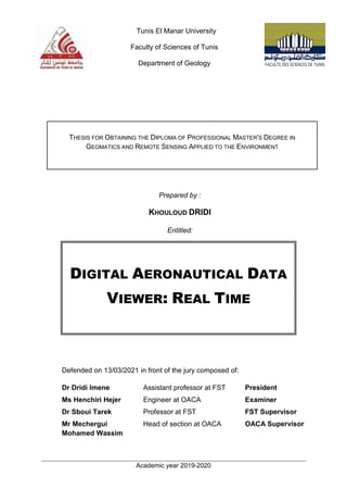
  • 1. Academic year 2019-2020 gfg Tunis El Manar University Faculty of Sciences of Tunis Department of Geology THESIS FOR OBTAINING THE DIPLOMA OF PROFESSIONAL MASTER'S DEGREE IN GEOMATICS AND REMOTE SENSING APPLIED TO THE ENVIRONMENT Prepared by : KHOULOUD DRIDI Entitled: DIGITAL AERONAUTICAL DATA VIEWER: REAL TIME Defended on 13/03/2021 in front of the jury composed of: Dr Dridi Imene Assistant professor at FST President Ms Henchiri Hejer Engineer at OACA Examiner Dr Sboui Tarek Professor at FST FST Supervisor Mr Mechergui Mohamed Wassim Head of section at OACA OACA Supervisor
  • 2. ACKNOWLEDGEMENT Accomplishing this project would have been impossible without the help and encouragement of many people, I must begin by acknowledging my company framer Mechergui Mohamed Wassim I would like to thank him for his guidance and all the know-how he has passed on to me. And I would like to thank my university framer Mr Sboui for agreeing to be my academic supervisor for his unfailing availability, advice and support. . I also want to thank my colleague Rim MZOUGHI for helping me with her brilliant idea to write down this thesis, since I have chosen to share it in English. Next, I want to express my gratitude to the teaching staff of geology department for helping me reaching this point of knowledge in GIS domain. And finally, I would like to thank my family for their support and encouragement.
  • 3. ABSTRACT ICAO, Eurocontrol and FAA led the idea of moving from AIS towards AIM under the slogan “providing the right information at the right time to the right people “. Tunisia and precisely OACA rushed to the main objective of this new era: automation which has been proved to be essential. Web map applications are part of this automation since it provides a high quality of aeronautical data and ensures that the right information is delivered to the right users at the right time. To achieve this goal OACA hosted the idea of creating an aeronautical web map application under the name of “digital aeronautical data viewer: real-time” in order to catch up with the fast pace of the aviation industry evolution around the world. RÉSUMÉ L’OACI, Eurocontrol et la FAA ont lancé l’idée de passer de l’AIS à l’AIM sous le slogan « fournir la bonne information au bon moment aux bonnes personnes ». La Tunisie et précisément l’OACA se sont précipités sur l’objectif principal de cette nouvelle technologie : l’automatisation qui s’est avérée être essentielle. Les applications cartographiques web font partie de cette réalisation puisqu’elle permet d’obtenir une haute qualité de données aéronautiques et de s’assurer que la bonne information est délivrée aux bons utilisateurs au bon moment. Pour atteindre cet objectif, l’OACA a eu l’idée de créer une application cartographique web mapping sous le nom de “visualisation numérique de données aéronautiques : temps réel” afin de suivre le rythme rapide de l’évolution de l’industrie aéronautique dans le monde.
  • 4.
  • 5. SUMMARY INTRODUCTION ............................................................................................................. 1 GENERAL CONTEXT AND CONCEPT DEFINITION ...................................................... 3 I. HOST COMPANY: OACA .................................................................................... 4 3. AIS Diagram ................................................................................................ 5 II. THE HISTORIC OF AIS SCOPE .............................................................................. 6 III. PROBLEM STATEMENT..................................................................................... 8 1. AIS/AIM shortcoming ................................................................................... 8 2. Proposed solution ........................................................................................ 9 3. Objective...................................................................................................... 9 IV. CONCEPT DEFINITION.................................................................................... 10 1. Aeronautical Information Services ............................................................. 10 2. Aeronautical Information Management ...................................................... 10 3. Air Traffic Management system ................................................................. 11 4. Aeronautical Information product ............................................................... 11 5. Aerodrome mapping database................................................................... 12 6. Metadata (ISO 19115*).............................................................................. 12 7. Aeronautical data....................................................................................... 12 8. NOTAM...................................................................................................... 12 9. Flight Information Region........................................................................... 12 10. Air Traffic Services airspaces .................................................................. 12 11. Particular areas........................................................................................ 13 12. Air Navigation aids................................................................................... 15 13. AIP........................................................................................................... 17 14. GIS........................................................................................................... 17 V. GIS AND AVIATION TWINNING ........................................................................... 18 METHODOLOGY AND MATERIEL .............................................................................. 19 METHODOLOGY ............................................................................................... 20 I.
  • 6. MATERIAL........................................................................................................ 21 II. 1. Software..................................................................................................... 21 2. Hardware ................................................................................................... 22 DATA PROCESSING.................................................................................................. 23 DATA COLLECTION ........................................................................................... 24 I. DATA PROCESSING........................................................................................... 25 II. 1. Sorting the information: the data sets ........................................................ 25 2. Storing the information............................................................................... 28 Verification and validation .......................................................................... 30 III. 1. Verification: ................................................................................................ 30 2. Validation ................................................................................................... 30 3. Geometric requirements ............................................................................ 32 REALIZATION AND IMPLEMENTATION ..................................................................... 36 ESRI WEBMAP APPLICATION ............................................................................ 37 I. CREATION OF THE WEB MAP APPLICATION .......................................................... 37 II. 1. What’s a WEB GIS ?.................................................................................. 38 2. ArcGIS platform ......................................................................................... 38 3. Mapping the data ....................................................................................... 47 4. Building a Web GIS application ................................................................. 48 INTEGRATION AND VISUALIZATION ........................................................................ 50 I. WHAT DOES THE APPLICATION DISPLAY?............................................................ 52 1. Aeronautical static data.............................................................................. 52 2. Aeronautical dynamic data......................................................................... 53 3. AMDB ........................................................................................................ 53 II. THE WIDGETS .................................................................................................. 54 1. The table of content ................................................................................... 55 2. Basemap Gallery ....................................................................................... 56 3. NOTAM widget........................................................................................... 57 4. Direction and distance widget .................................................................... 59 5. Coordinates conversion widget.................................................................. 60 6. Add a Data widget...................................................................................... 61 7. The attribute tables .................................................................................... 62 8. Metadata of layers ..................................................................................... 63
  • 7. III. EASY TO REACH........................................................................................... 64 CONCLUSION AND PERSPECTIVE .................................................................................. 65 BIBLIOGRAPHY ........................................................................................................... 67 ANNEX A.................................................................................................................... 68 ANNEX B.................................................................................................................... 69 ANNEX C ................................................................................................................... 70
  • 8. LIST OF ABBREVIATIONS A AIS Aeronautical Information Services AIM Aeronautical Information Management ATM Air traffic Management AMDB Aeronautical Mapping Database AIP Aeronautical Information Publication ATC Air Traffic Control ATS Air Traffic Services AIC Aeronautical Information Circular AIRAC Aeronautical Information Regulation And Control AFTN Aeronautical Fixed Telecommunications Network ADQ Aeronautical Data Quality C CDM Collaborative Decision Making CTR Controlled Traffic Region CTA Controlled Traffic Area D DME Distance Measuring Equipment E ESRI Environmental Systems Research Institute F FIR Flight Information Region G GIS Geographic Information System I ICAO International Civil Aviation Organization IFR Instrument Flight Rules N NOTAM Notice To Airmen NDB Non-Directional Beacon O OACA Office d’Aviation Civil et des Aéroports P PANS-AIM Procedures for Air Navigation Services of Aeronautical Information Management S SLA Service-Level Agreement SWIM System Wide Information Management T TMA Terminal Area
  • 9. U UIR Upper Information Region V VFR Visual Flight Rules VOR VHF Omnidirectional Range
  • 10. TABLES LIST TABLE 3 THE USED SOFTWARE TABLE................................................................................................................................................... 22 TABLE 4 HARDWARE DESCRIPTION ....................................................................................................................................................... 22 TABLE 1 PERSONAL VS FILE GEODATABASES........................................................................................................................................ 29 TABLE 2 THE DIFFERENCE BETWEEN THE EMBEDDED LAYER AND THE HOSTED LAYER .............................................................. 46
  • 11. FIGURES LIST FIGURE 1 AIS DIAGRAM...............................................................................................................................................................................5 FIGURE 2 AIS TO AIM ROADMAP ..............................................................................................................................................................7 FIGURE 3 AIR TRAFFIC MANAGEMENT SYSTEM .................................................................................................................................. 11 FIGURE 4 PARTICULAR AREAS OF TUNISIAN FIR'S CHART................................................................................................................. 14 FIGURE 5 AIR NAVIGATION AIDS OF TUNISIAN FIR'S CHART............................................................................................................. 16 FIGURE 6 GEOGRAPHIC INFORMATION SYSTEM................................................................................................................................... 17 FIGURE 7 METHODOLOGY DIAGRAM ...................................................................................................................................................... 20 FIGURE 8 DATA COLLECTION DIAGRAM................................................................................................................................................. 24 FIGURE 9 AIRAC CYCLE........................................................................................................................................................................... 25 FIGURE 10 AERONAUTICAL DATA CATALOG OF TUNIS CARTHAGE INTERNATIONAL AIRPORT.................................................... 28 FIGURE 11 AERONAUTICAL DATA CATALOG SYSTEM .......................................................................................................................... 28 FIGURE 12 THE ALIGNING UP BETWEEN THE WAYPOINTS AND THE LIMIT OF THE TUNISIAN FIR............................................. 31 FIGURE 13 THE NON-OVERLAPPING BETWEEN CTR AND THE RESTRICTED AREA DTR2........................................................... 31 FIGURE 14 THE DEMONSTRATION AND THE VALIDATION OF THE BELVEDERE FLAG WITH THE OBSTACLE COORDINATION THAT COMPLIES WITH THE IMAGERY MAP ................................................................................................................................. 32 FIGURE 15 TOPOLOGY RULE FOR LINE SEGMENT................................................................................................................................ 33 FIGURE 16 TOPOLOGICAL VERIFICATION FOR UNINTENTIONAL DANGLE......................................................................................... 33 FIGURE 17 TWO OVERLAPPING OF SAME TYPE POLYGON (RUNWAY LAYER).................................................................................. 34 FIGURE 18 THE DIFFERENT COMPONENT OF THE ARCGIS SYSTEM ................................................................................................. 39 FIGURE 19 WEBGIS MODELS DEPLOYMENT......................................................................................................................................... 40 FIGURE 20 CUSTOMIZING THE LAYER WIDGET AND ADD THE SUBLAYER ........................................................................................ 41 FIGURE 21 -FULL-STACK DEVELOPER SYSTEM..................................................................................................................................... 42 FIGURE 22 COMMAND WINDOWS.......................................................................................................................................................... 43 FIGURE 23 THE SPECIFICATION OF DEVELOPMENT ACCOUNT THE LICENSING AND ACCESS......................................................... 45 FIGURE 24 IMPORTING LAYER TO CONTENT IN GIS CLOUD ............................................................................................................... 45 FIGURE 25 MY CONTENT CREATED IN THE ARCGIS CLOUD............................................................................................................... 46 FIGURE 26 LABELING OF THE MAP......................................................................................................................................................... 47 FIGURE 27 WEB MAP BY ARCGIS ONLINE ............................................................................................................................................ 48 FIGURE 28 THE ID OF WEB MAP............................................................................................................................................................. 48 FIGURE 29 STEPS TO CREATE A WEB MAP APPLICATION.................................................................................................................... 49 FIGURE 30 WEB MAP APPLICATION INTERFACE .................................................................................................................................. 51 FIGURE 31 THE LEGEND OF STATIC DATA............................................................................................................................................. 53 FIGURE 32 AMDB OF ENFIDHA-HAMMAMET INTERNATIONAL AIRPORT ..................................................................................... 54 FIGURE 33 THE WIDGETS ........................................................................................................................................................................ 54 FIGURE 34 TABLE OF CONTENT.............................................................................................................................................................. 55 FIGURE 35 LAYER AND SUBLAYER OF AREA.......................................................................................................................................... 56 FIGURE 36 BASE MAP GALLERY WIDGET............................................................................................................................................... 57 FIGURE 37 THE NOTAM WIDGET.......................................................................................................................................................... 58 FIGURE 38 THE REQUESTED LAYER WITH THE AVAILABLE INFORMATION ..................................................................................... 59 FIGURE 39 DISTANCE AND DIRECTION WIDGET................................................................................................................................... 59 FIGURE 40 IMPORT A HOSTED FEATURE LAYER TO ARCGIS ONLINE............................................................................................... 60 FIGURE 41 COORDINATS CONVERSION WIDGET................................................................................................................................... 61 FIGURE 42 ADD DATA WIDGET ............................................................................................................................................................... 62 FIGURE 43 ATTRIBUTE TABLE OF RUNWAY LAYER.............................................................................................................................. 63 FIGURE 44 THE METADATA OF BUFFER LINE OF THE NORTH CORRIDOR......................................................................................... 63
  • 12. 1 INTRODUCTION Air transport has evolved to become the key enabling component of the world’s economy which has contributed to the global international business. As the global economies expand, airspaces and airport capacity must be increased to ingest this demand. While traditional methods to absorb this increased capacity have been proved to be exhausted and useless, new and improved methods are needed to take shape to manage the use of the current capacity. “For all phases of flight, to enable the safe, economic, expeditious, and orderly flow of traffic through the provision of ATM services which are adaptable and scalable to the requirements of all users and areas of the global airspace. The services shall meet demand cost-effectively way, be globally interoperable, operate to uniform principles, be environmentally sustainable, and satisfy national security requirements “. (1) So the main objective is to ensure that Aeronautical Information Services (AIS) will be developed to provide harmonized and coordinated service providing the most efficient accurate and up-to-date quality-assured information through the different flight phases for all users. Therefore, AIS should shift from providing predetermined aeronautical information to managing aeronautical information in order to meet the future ATM requirements. As a viable solution, inwards, the field of aviation GIS can be useful to present geographic data, so that safety is enhanced through a decision making process of improved threat management.
  • 13. 2 It is in this framework that my project entitled “DIGITAL AERONAUTICAL DATA VIEWER: REAL-TIME” takes place within the premises of the Office of Civil Aviation and Airports (OACA), particularly in AIS department. The main purpose of this work is to visualize the aeronautical information whether it is static: e-AIP, charting, or dynamic: NOTAMs inside a web map application to provide aeronautical information on Tunisia Flight Information Region (FIR) under different forms/shapes to air users efficiently and precisely. This web mapping application is a platform for the digitalization of aeronautical data, which will allow users to manage safety-critical data and optimize processes. These digital products based on various formats could be downloaded and would meet ICAO recommendations. This digital information which will be available in time, with geographical representation, and in various formats: - Could be downloaded - Complies with ICAO recommendations - Brings actual situation to the systems (e.g. available routes, prohibited and dangerous areas, closed runways and taxiways, work in progress area, etc…)
  • 15. GENERAL CONTEXT AND CONCEPT DEFINITION 4 I. HOST COMPANY: OACA Tunisian Civil Aviation and Airports Authority is a commercial and industrial public establishment endowed with civil personality and financial autonomy. The current name of Tunisian Civil Aviation and Airports Authority (OACA) has replaced that Tunisian Airports and ATC Authority (OPAT) created by act 70-30 dated July 3rd , 1970. (By Decree No. 98-1374 of June 30th , 1998) It is under the Ministry of Transport and has the responsibility for managing, developing, and operating 7 airports in Tunisia: ● Tunis Carthage ● Djerba Zarzis ● Tozeur Nefta ● Thyna Sfax ● Tabarka Ain Draham ● Ksar Gafsa ● Gabes and Matmata. The OACA granted the operation of Monastir Habib Bourguiba Airport from January 1st , 2008 to a private company. The Tunisian Civil Aviation and Airports Authority (OACA) is responsible in particular for the following missions: ● Regional and local air navigation control and participation in the execution of search and rescue plans; ● The operation, organization, and development of airports as well as the performance of all operations and services necessary for travelers, the public, aircraft, cargo, and airmail at airports; ● The issuance of all documents required for aeronautical personnel, aircraft, and air navigation in accordance with current legislation.(2)
  • 16. GENERAL CONTEXT AND CONCEPT DEFINITION 5 3. AIS Diagram Aeronautical Information Services (AIS): is a service established in support of international civil aviation, whose objective is to ensure the flow of information necessary for the safety, regularity, and efficiency of international air navigation. “AIS shall receive, collate or assemble, edit, format, publish/store and distribute aeronautical data and aeronautical information concerning the entire territory of the State as well as those areas over the high seas for which the State is responsible for the provision of Air Traffic Services (ATS).” (3) Figure 1 AIS diagram
  • 17. GENERAL CONTEXT AND CONCEPT DEFINITION 6 II. THE HISTORIC OF AIS SCOPE Since the Air Traffic Management industry has been facing a new evolutionary challenge in the face of the increasing globalization and evolution, it has turned out that traditional AIS no longer meets ATM needs facing the paradigm shift on the scope of aviation. As an essential step ICAO and AIS community have organized an International Immigration Conference (AN-CONF/11) which was held in Montreal in September 2003 to endorse that the aeronautical information services AIS have become one of the most important enabling services as they have realized that the movement of information is as important as the movement of people or goods. In 2006, a global AIS Congress was held in Madrid, Spain, organized by EUROCONTROL in partnership with ICAO, on purpose to put the significant milestone and create a roadmap to help the transition from AIS to AIM, the consensus from these congresses is addressing the future ATM needs. “It noted that computer-based navigation systems and area navigation (RNAV), required navigation performance (RNP) and ATM requirements introduced a need for new corresponding AIS requirements for quality and timeliness of the information. The role of AIS would therefore need to transition to an information management service, changing duties, responsibilities and scope to satisfy these new requirements and to cope with and manage the provision of information.” (4)
  • 18. GENERAL CONTEXT AND CONCEPT DEFINITION 7 Figure 2 AIS to AIM roadmap This roadmap urged AIS to look beyond its traditional form and focus on AIM by offering: ● Timeliness and accuracy to support the operation in an automation environment ● Information to support the collaborative decision-making CDM among airspace users ● Customization to provide products and services to support a diverse set of end-users ● Information lifecycle management including digital data collection, higher levels of data integrity, and higher levels of quality ● Increased scope of aeronautical information to support efficiency, capacity, and environmental performance requirements as identified in future ATM concepts of operation
  • 19. GENERAL CONTEXT AND CONCEPT DEFINITION 8 ● Aeronautical information exchange through international standards III. PROBLEM STATEMENT 1. AIS/AIM shortcoming The ICAO as the leader company charged with the international regulation of civil aviation has established ambitious goals towards modernizing the world of air traffic management. As a primary aim, they have authorized the production of tools and extensive sets to improve the providing of digital aeronautical data. Many member states and agencies are struggling to meet this ambitious modernization, particularly due to the challenge of complying with the exacting standards set for data collection and organization, besides communicating the aeronautical information to the appropriate air users at the right time. Along this side, OACA and specially AIS department has recognized the shortcomings that the aeronautical information management has been facing and how the Tunisian airspace users’ customers are looking for a renewed system in order to respond to their needs. As a basic sets required the aeronautical data sets whatever it been the static data which usually presented in AIP (routes, navaids, obstacles ..), and the dynamic data (NOTAM) which disseminated via aeronautical fixed telecommunication network (civil and military information) are not surprisingly in digital form, furthermore are presented separately which seem to be tightly connected to each other, although this connection is not embodied in the current AIS situation. The existed aeronautical information often does not conform to the potential needs to a larger air users that the aviation scope face , whereas they cannot access to Tunisian aeronautical data through a reliable database beside the timeliness of information ;than it requires geodatabase to transform the complex textual information and tools to communicate the efficient information within timeliness.
  • 20. GENERAL CONTEXT AND CONCEPT DEFINITION 9 Do the current information and manners used within the aeronautical information service respond to the Tunisian’ airspace users’ needs? 2. Proposed solution The fundamental purpose of this project is to offer to Tunisian airspace users the opportunities to access the data /information at the right time easily, so we propose:  creating a geodatabase easy to reach via internet that allows the Tunisian airspace users to access and download the aeronautical datasets published according to ICAO criterions  creation a web map application that provides the aeronautical static and dynamic data to facilitate the access of information with efficient manner and appropriate timeliness 3. Objective To meet the current needs of the aviation and ATM community OACA and its interested parties may use GIS and its web mapping applications to create and maintain data for analysis since web map ESRI’s GIS seem to be ideal for aeronautical production. This is what my master’s degree revolves around a web map application:” Digital aeronautical data viewer: real-time “ Where we present the different entities of Tunisian AIS: Static Data ➢ Navaids ➢ FIR ➢ Routs upper and lower ➢ Obstacle ➢ Enfidha-Hammemt international airport AMDB ➢ CTR ➢ TMA ➢ Airports ➢ Waypoints
  • 21. GENERAL CONTEXT AND CONCEPT DEFINITION 10 Dynamic data ➢ NOTAM : civil and military information The main objective of this web map application is to: ● Allow data to be generated, edited, and stored in a centralized manner such as : ○ AIP data visualization ○ aeronautical data creation tasks ○ data standardization ● Provide web mapping services : ○ generation, viewing and analyzing data ○ timeliness and efficiency ● Give a replicable workflow which can make AIS updating easier ● Improve collaborative decision making IV. CONCEPT DEFINITION 1. Aeronautical Information Services The object of the aeronautical information service (AIS) is to ensure the flow of aeronautical data and aeronautical information necessary for global air traffic management (ATM) system safety, regularity, economy, and efficiency in an environmentally sustainable manner. The role and importance of aeronautical data and aeronautical information changed significantly with the implementation of area navigation (RNAV), performance-based navigation (PBN), airborne computer-based navigation systems, performance-based communication (PBC). Corrupt, erroneous, late, or missing aeronautical data and aeronautical information can potentially affect the safety of air navigation. 2. Aeronautical Information Management The dynamic, integrated management of aeronautical information through the provision and exchange of quality-assured digital aeronautical data in collaboration with all parties.
  • 22. GENERAL CONTEXT AND CONCEPT DEFINITION 11 3. Air Traffic Management system The dynamic, integrated management of air traffic and airspace (including air traffic Services, airspace management, and air traffic flow management) safely, economically and efficiently through the provision of facilities and seamless services in collaboration with all parties and involving airborne and ground-based functions. Figure 3 Air Traffic Management System 4. Aeronautical Information product Aeronautical data and aeronautical information provided either as digital data sets or as a standardized presentation in paper or electronic media. Aeronautical information products include: ● Aeronautical Information Publication (AIP), including Amendments and Supplements; ● Aeronautical Information Circulars (AIC) ; ● Aeronautical charts ; ● NOTAM ; and ● Digital data sets.
  • 23. GENERAL CONTEXT AND CONCEPT DEFINITION 12 5. Aerodrome mapping database A collection of aerodrome mapping data organized and arranged as a structured data set. 6. Metadata (ISO 19115*) The standard is part of the ISO geographic information suite of standards (19100 series). ISO 19115 and its parts define how to describe geographical information and associated services, including contents, spatial-temporal purchases, data quality, access, and rights to use. 7. Aeronautical data. A representation of aeronautical facts, concepts, or instructions in a formalized manner suitable for communication, interpretation, or processing. 8. NOTAM A notice distributed using telecommunication containing information concerning the establishment, condition or change in any aeronautical facility, service, procedure or hazard, the timely knowledge of which is essential to personnel concerned with flight operations. 9. Flight Information Region A flight information region is a specified region of airspace in which a flight information service and an alerting service (ALRS) are provided. It is the largest regular division of airspace in use in the world today. 10. Air Traffic Services airspaces A detailed description of flight information regions (FIR), upper flight information regions (UIR), and control areas (CTA) (including specific CTA such as TMA).
  • 24. GENERAL CONTEXT AND CONCEPT DEFINITION 13 11. Particular areas ● Danger area: airspace of defined dimensions within which activities dangerous to the flight of aircraft may exist at specified times. ● Prohibited area: airspace of defined dimensions, above the land areas or territorial waters of a State, within which the flight of aircraft is prohibited. ● Restricted area: airspace of defined dimensions, above the land areas or territorial waters of a State, within which the flight of aircraft is restricted following certain specified conditions.
  • 25. GENERAL CONTEXT AND CONCEPT DEFINITION 14 Figure 4 Particular areas of Tunisian FIR’s chart
  • 26. GENERAL CONTEXT AND CONCEPT DEFINITION 15 12. Air Navigation aids Navigation by radio aids is navigation mainly by reference to indications of bearing and distance indicated on VOR, DME, and ADF equipment located on the aircraft. This information is derived from ground radio beacons (VOR, DME, and NDBs or broadcast stations.
  • 27. GENERAL CONTEXT AND CONCEPT DEFINITION 16 Figure 5 Air navigation aids of Tunisian FIR’s chart
  • 28. GENERAL CONTEXT AND CONCEPT DEFINITION 17 13. AIP A publication issued by or with the authority of a State and containing aeronautical information of a lasting character essential to air navigation. 14. GIS A Geographic Information System is an information system capable of organizing and presenting spatially referenced alphanumeric data. The GIS makes it possible to acquire, organize, manage, process, and restore geographical data in the form of plans and maps. GIS applications are tools that allow users to create interactive queries, analyze spatial information, modify and edit data through maps, and respond cartographically. GIS also allows the linking of data that may, on paper, seem far apart. Regardless of how we identify and represent the objects and events that illustrate our environment (coordinates, latitude & longitude, address, altitude, time, etc.), GIS makes it possible to bring together all these dimensions around a single reference frame, the true backbone of the information system. This key feature of GIS makes it possible to imagine new applications and new opportunities for scientific research. Figure 6 Geographic Information System
  • 29. GENERAL CONTEXT AND CONCEPT DEFINITION 18 V.GIS AND AVIATION TWINNING Where the fields of application of geographic data are constantly evolving the use of geographic information systems is becoming essential, and off the shelf, the aviation field is not showing an exception; while aviation is one of the biggest beneficiaries of the GIS domain. The visualization of GIS data refers to the presentation of data by a digital image, vector data, digital elevation, and surface models DEM and DSM, whereas it has been in two or three dimensions and dynamic or static presentation. In order to serialize data management, GIS offers various tools for the aviation industry and facilitates decision making. In this context, in SAN DIEGO, ESRI congratulated ICAO for being selected as a winner of ESRI achievement in GIS awards, in July 2013. Whereas ESRI Canada president Alex Miller stated “ArcGIS has evolved to support nearly all devices and technology platforms, and is accelerating the way we use geographic information to solve problems”. The geographic system is used in many aviation tasks like the airports, traffic management, so GIS used in aviation should be accurate, efficient, and reliable and also work on a real-time base to provide appropriate result so the correct decision making has been taken list of application of GIS in aviation : ● Aviation structure management ● Airport layout planning ● Flight path monitoring ● Capacity planning ● Drone Domaine And many other applications.
  • 31. METHODOLOGY AND MATERIAL 20 METHODOLOGY I. Nowadays the aviation industry needs new technology to enhance the safety of airspace operations through better data quality in order to meet growing traffic demands. Establishing new standards to provide aeronautical information is a complex process since the aeronautical data chain involves numerous actors who play a critical role in producing appropriate quality data to meet the requirements of air users and ATM communities. At OACA, AIS department we support the implementation of a new concept of data deployment intending to ensure the availability of aeronautical data and aeronautical information optimal quality in the Tunisian airspace. Figure 7 Methodology diagram
  • 32. METHODOLOGY AND MATERIAL 21 MATERIAL II. 1. Software Server Description Version Logo ArcCatalog -Organize GIS content -Manage geodatabase schema -Add content to the ArcGIS application -Manage stander based metadata used version10.3.1 ArcMap -The main component of ESRI ArcGIS of geospatial processing - Used to edit, view create and analyze geospatial data used version 10.3.1 Qgis -Open-source geographic information system -Licensed under GNU general public license -Support numerous vector raster and database format used version 3.12.0 ArcGIS Online -A cloud-based mapping and analysis solution -Makes maps, analyze data, share and collaborate -Access to workflow specific apps
  • 33. METHODOLOGY AND MATERIAL 22 ArcGIS for developer -Platform for an organization: create, manage, share and analyze spatial data -Consist of a server component: mobile and desktop application and developer tools -Deployed in the cloud with ArcGIS enterprise used via ArcGIS online used version 2.15 Node.js -An open-source development platform for executing JavaScript code server-side. –Node is useful for developing applications that require a persistent connection from the browser to the server and is often used for real- time application Table 1 The used software table 2. Hardware Name Processor RAM System type Lenovo IntelI core™ i7-3632QM CPU 2.20GHz 8GO 64bits Table 2 Hardware description
  • 35. DATA PROCESSING 24 DATA COLLECTION I. The AIS has always been relying on accountable sources to supply raw aeronautical data such as static data from the AIP all the textual information alongside the different procedures and charts, and the dynamic data the NOTAM which is immediate information considered to be a time-critical for air users and the ATM community and to collect those data we should reach three different sections inside the AIS department to deploy that information at the right time in an efficient manner. Figure 8 Data collection diagram The collection of the information contained in our application requires starting from the textual data of the Tunisian AIP’s lines. This international document (AIP) is the official reference of aeronautical information for each state. This data is most of the time amended within the framework of AIRAC standards or “the AIRAC cycle”.
  • 36. DATA PROCESSING 25 On the other hand, we have NOTAMs which are usually distributed via AFTN and which validity varies from a few minutes to three months. Figure 9 AIRAC cycle The aeronautical information will be collected in an XL sheet with the metadata which summarizes the basic information including the date of the last change of the origin of this information besides the data like the geographic information WGS-84, the Cartesian coordinates and the appropriate attributes. DATA PROCESSING II. Data processing is synchronizing the entered data into software to filter out the most important output information. This is a very important step to create the web map application, as it helps in the extraction of the most relevant aeronautical information to improve the useful information to the appropriate air users. With the proper processing of data, a lot of information can be stored so the user can have a clearer view of manners and better understanding hence making the appropriate decision. 1. Sorting the information: the data sets Sorting the appropriate aeronautical information to air users is a good start to data processing, according to ICAO documentation, Annex 15 and PANS-AIM, the aviation scope tend to use the term of the dataset as a way to present the sorted data to a user in the appropriate manner, as a way to unify information and facilitate its understanding.
  • 37. DATA PROCESSING 26 “The purpose of the AIP data set is to support the transition of the ATM domain towards the use of digital data sets instead of paper products. Therefore, its scope is defined considering the likelihood that the data contained in this set is being used in digital format by service providers, ATC and instrument flight rules/visual flight rules (IFR/VFR) airspace users.” On the global level, the AIS/AIM study groups, ICAO, and EUROCONTROL have finalized the development of annex 15 complemented by PANS –AIM document this will enable the global transition towards the provision of digital datasets, which will gradually replace documents and paper. Datasets present a bridge between the internal state databases, in use for the production of AIP, Charts, and NOTAM, and a created set of data that can be published for external use by the state, in a format that is more useful, easily digestible, and which requires less delay/rework by the AIM/AIS users. According to the PANS-AIM, our application present the minimum data with their properties ● ATS airspace: TMA, CTR ((type, name, lateral limits, vertical limits, class of airspace) ● Special activity airspace: restricted, prohibited, and dangerous areas (type, name, lateral limits, vertical limits, restriction, activation); ● Route (designator, flight rules) ; ● Route segment (navigation specification from point to point, track, length, upper limit, lower limit, minimum en-route altitude (MEA), minimum obstacle clearance altitude (MOCA), the direction of cruising level, required navigation performance); ● Waypoint – en-route (identification, location, formation) ; ● Aerodrome/Heliport (ICAO location indicator, name, designator IATA, served the city, certified ICAO, certification date, certification expiration date, control type, field elevation, reference temperature, magnetic variation, reference point); ● Radio navigation aid: NDB, VOR, VOR/DME (type, identification, name, aerodrome/heliport served, hours of operation, magnetic variation,
  • 38. DATA PROCESSING 27 frequency/channel, position, elevation, magnetic bearing, true bearing, zero bearing direction). ● Runway (designator, nominal length, nominal width, surface type, strength)(5) 1. Data catalog Given the importance of the accuracy and efficiency of data sets ICAO and Eurocontrol tend to use Aeronautical Data Quality system to improve data quality and metadata in order to facilitate the identification of the organizations and the responsible entities. And within the ADQ, aeronautical data catalog was the final solution to present data and metadata, the data catalog is a general description of AIM data scope that consolidates all data that can be collected and maintained by the aeronautical information service, according to PANS-AIM appendix1. The Aeronautical Data Catalog contains the aeronautical data subjects, properties, and sub-properties organized in: Table A1-1 Aerodrome data; Table A1-2 Airspace data; Table A1-3 ATS and other routes data; Table A 1-4 Instrument flight procedure data; Table A1-5 Radio navigation aids/systems data; Table A1-6 Obstacle data; Table A1-7 Geographic data; Table A1-8 Terrain data; Table A1-9 Data types; and Table A1-10 Information about national and local regulation, services, and procedures.(6)
  • 39. DATA PROCESSING 28 Figure 10 Aeronautical data catalog of Tunis Carthage International airport Figure 11 Aeronautical data catalog system 2. Storing the information The use of automation shall be applied to ensure timeliness, quality, and efficiency in order to improve collaborative decision making.
  • 40. DATA PROCESSING 29 Thus to meet the data quality requirement the automation shall digitize the aeronautical data exchange between the parties involved in the processing chain, whereas the ATM community present many data chain actors with the creation of an appropriate database to facilitate the exchange, and with the help of arc catalog we manage to move from textual and simple coordinates to readable and easy to download data and we have presented the data in an appropriate way presented in understandable layers. All those layers could be stored in a file geodatabase or personal geodatabase, and in a better way to present the aeronautical database we choose the file geodatabase since we are presenting a varied type of geometric format with plenty information and metadata. Table 3 Personal vs file geodatabases Key characteristics File geodatabase Personal geodatabase Description Various type of GIS datasets in the file system folder The original data format for ArcGIS geodatabase stored, limited in size Actability -Single-user as small groups -Some readers and one writer per feature dataset, standalone feature class, or table. -Single user and small workgroups with smaller datasets. -Some readers and one writer. Storage format Each dataset is a separate file on disk All the contents in each personal geodatabase are held in a single Microsoft Access file (.mdb). Size limits -One TB for each dataset. Each file geodatabase can hold many datasets. -Each feature class can scale up to hundreds of millions of vector features per dataset. - Two GB per Access database. -Effective limit before performance degrades is typically between 250 and 500 MB per Access database file.
  • 41. DATA PROCESSING 30 Verification and validation III. The aeronautical data /information has always been presented as critical data as it has a direct impact on aviation security and because the data went through many steps like creation, collection, processing, and publication we need to make sure that the published data has complied with ICAO documentation: annex 4, PANS-AIM annex15. There are two methods of evaluating the data/information quality 1. Verification: Confirmation through the provision of objective evidence that specified requirements, this confirmation can compromise many activities like: ● Making a comparison with other similar products ● Undertaking tests and demonstration 2. Validation ● Confirmation through the provision of objective evidence that the requirements for the application and the final user needs have been fulfilled ● Data validation described as a process that extends the evaluation of data yonder of verification to determine the analytical quality of the data ● Validation focus on particular needs to comply with the application and responds to the users like georeferencing, overlaying, and demonstration of reasonableness check
  • 42. DATA PROCESSING 31 Figure 12 The aligning up between the waypoints and the limit of the Tunisian FIR Figure 13 The non-overlapping between CTR and the restricted area DTR2
  • 43. DATA PROCESSING 32 Figure 14 The demonstration and the validation of the belvedere flag with the obstacle coordination that complies with the imagery map 3. Geometric requirements 3.1. Complex geometry The complex geometry type such as arcs, circles and ellipsoid can be presented by lines and polygons .this standard intended use is to facilitate data exchange between the software and handle any complex data types. 3.2. Topological integrity The placement of geometric elements in correlation to another (next to, connected to and on top to) is referred to as a topological relation. The placement of feature type (polygon, circle, line...) in relation to another feature type complies with topological rules requirement. To establish these requirements a guideline to ensure the topological integrity should be follow:  Lines :
  • 44. DATA PROCESSING 33  Start-nodes and end-nodes of connected line segments within a single feature type must be identical (collocated).  Define the intersections of lines of the same feature type by a vertex/node shared by the intersecting lines. Figure 15 Topology rule for line segment  Eliminate all unintentional dangles (line segments extending beyond the intended end) and gaps (spaces between line segments intended to connect) between lines. (7) Figure 16 topological verification for unintentional dangle Line 1 Line 2 Vertex/node Line segement extending
  • 45. DATA PROCESSING 34 Some topological validation can be established with arc map by making some entities like the route layer subject to verification as it shown (figure16) some error appeared whereas the line of route layer should not extend outside the FIR boundary which elucidate the displayed data of Tunisian AIP should be revised to comply with the ICAO manual WGS84  Polygons :  Geospatial locations of the start-node and end-node of any line forming the edge of a polygon must be identical.  Polygons sharing an edge must share all vertices along this edge. This rule applies to features of the same type and for features of different feature types  No polygon will overlap, intersect or fall within another polygon of the same type except for the Runway feature type, whose polygons can overlap. Figure 17 Two overlapping of same type polygon (runway layer)  Any single polygon should not overlap itself or contain duplicate vertices or nodes (with the exception of the start and end nodes which must be coincident).
  • 46. DATA PROCESSING 35  Close all polygons the start-node and end-node of the multi-segment line that forms the polygon must be collocated, meaning that they meet at the same coordinate in three dimensions. .
  • 48. REALIZATION AND IMPLEMENTATION 37 ESRI WEBMAP APPLICATION I. Like many other servers like Geoserver and Wamp server, ESRI offers us the opportunities to use ArcGIS server via their free account ArcGIS online to create a web map application and within this framework, This project is sponsored by ESRI, produces the well-known ArcGIS suite of GIS computer software and the technology of ArcGIS online. With the evolution of the aviation industry, ICAO with ESRI partnership resorted to the web map application as a solution in order to share the right information at the right time to their current and potential airspace users. Aeronautical information services presents the official link between the aeronautical navigation providers and airspace users, the ESRI’s employ develop the web map application to comply with aviation particular needs, and provide the appropriate data/information to the users. This project compliments ESRI’s current aeronautical information management offering to the air users the essentials tools to check the critical aeronautical information to improve the collaborative decision making.(8) CREATION OF THE WEB MAP APPLICATION II. In this project, we used the predevelopment of a web map application presented by Esri for a developer which is an extensible application to comply with the user’s needs. In order to manage the creation of the application we need to go through two steps: 1. creating an account in web map application for the developer so I can develop my application and add what I need such as creating my own widgets and adding my theme and links, so I can visualize the different coordinates and attribute tables which I created in ArcGIS online database; 2. mapping with the help of ArcGIS online: to import the datasets and create the different layers and customizing beside labeling, importing and creating my database inside the ArcGIS community . .
  • 49. REALIZATION AND IMPLEMENTATION 38 Since this project presents the merging between the web services and GIS a new concept appeared the webGIS. 1. What’s a WEB GIS ? Web GIS is a combination between Web and GIS, it offers the exchange between the geospatial products into cyberspace, hence allowing users the freedom to interact with GIS applications globally and instant access to the available information. The Web GIS use a various type of a web technology Hypertext Transfer Protocol(HTTP), HyperText Make up Language (HTML), uniform resource locator (URL), javascript, web graphical library, and web socket. Web GIS is a central database based on a client/server system, with multiple servers and many client computers, it functions with web services which can be accessed by cloud, as it present by ESRI platform and can be used to visualize the aeronautical information by the web map application 2. ArcGIS platform An ArcGIS platform is an implemented strategy by ESRI centralized by webGIS in purpose to present a cutting-edge and complete webGIS platform that enable users to develop and customize a web application upload a geodatabases or spatial data within a cloud portal to be eventually shared to internal and external users. ArcGIS platform present 3 different components the ArcGIS server, ArcGIS online cloud and the end-user HMI.
  • 50. REALIZATION AND IMPLEMENTATION 39 Figure 18 The different component of the ArcGIS system 2.1. ArcGIS server: It’s a back-end software component of ArcGIS enterprise to visualize graphic information and make it available to create an organization or optionally to anyone with the internet; to create our ArcGIS server we prepared software, hardware and data so we can begin publishing services via Web. Usually ArcGIS server available in cloud or on-promises, with ArcGIS server we can enable web GIS pattern within own infrastructure than it requires, a web adopter enterprise geodatabase and GIS database, available in the box to make the server function. GIS server offers special options:  Enables “web GIS” in user infrastructure whatever it been on-promises or in cloud  A ready to use application and GIS services  Spatial data management  Visualization  Analysis The whole idea of ArcGIS server is to share the data which cloud be a shapefile, geodatabase or feature class as a web services to be lately easy to access, use and sharing with a larger audience. To configure the ArcGIS server ESRI platform offers two ways to do: The primary way, on-promises is as part of an ArcGIS Enterprise deployment in which ArcGIS Server is federated with an ArcGIS Enterprise portal. This is the deployment that most users should use.
  • 51. REALIZATION AND IMPLEMENTATION 40 In this deployment, your geographic data is made available through layers and web maps in the portal. Those items can then be consumed in a variety of apps, including browser-based web apps and native apps on mobile devices, with little to no custom development required. The other way is a stand-alone deployment in which ArcGIS Server is not federated with an ArcGIS Enterprise portal. This was a common deployment in previous releases. This type of deployment should now only be used in limited circumstances. Stand-alone sites commonly use ArcGIS Server to provide foundational content and services as a data provider, with little to no security controls on the services. This allows users to provide their applications to interact with the content. Users will typically have ArcGIS Enterprise or ArcGIS Online to use the data in the various applications.(9) 2.2. The hybrid model Figure 19 WebGIS models deployment It’s combining between two parts, the online-based model and the on- promises model, the hybrid deployment model is the most common WebGIS partner comparing to ArcGIS Enterprise and ArcGIS Online, ArcGIS hybrid provides the
  • 52. REALIZATION AND IMPLEMENTATION 41 ability to extend to ready to use content offered by ArcGIS online and the ArcGIS enterprise to create more types of services. And to create our Web map application, we tended to use the hybrid model as a model of deployment; whereas on the creation of the application to visualize the aeronautical information we anticipate a local database important via ArcGIS online portal and we connect one server machine connected to ArcGIS enterprise server via HTTP, in the ability to add the extension and customize the Web Map application to comply with what we need to visualize, so we use the Software Development Kit (SDK) and the Application Programming Interface (APIs) and synchronize between them ; by definition, the SDK is a kit that includes instructions so it can allow developing and creating an application, on the other hand, the APIs is purpose-built for an express-use so we can customize widgets for example in a better way to visualize the layout of the pre-development application does not offer the option of sub-layer option in visualization layer so customize the widget on purpose (10) Figure 20 Customizing the layer widget and add the sublayer
  • 53. REALIZATION AND IMPLEMENTATION 42 The web application builder works on a full-stack web developer system, indeed it gives us the privilege to develop both client and server software generally this type of web map function with client software which present the front-end and responsible about the visualization and Human Machine Interface (HMI) relation so using languages like HTML, CSS Bootstrap JavaScript, and many others; in another hand, the back-end software it is like the background of the web application, it’s like the kitchen where we can control the database and main part of the application and usually, we can use server like PHP,Node.js C++ JavaScript and other servers. Figure 21 –Full-stack developer system To start our application for development we use node.js as a server runner besides web map builder by ESRI. It’s a back-end JavaScript runtime environment which will allow us to write down or add the script to customize so we can eventually run the dynamic web page content and visualize any Change placed on the base web application. Since we are using windows platform on my device Lenovo, the batch file launches the node.js backend server in command (cmd) of windows and web app
  • 54. REALIZATION AND IMPLEMENTATION 43 builder and connects automatically to my machine and the hypertext http://lenovo:3346/webapp can eventually be hosted on web service. As a final step, to specify my portal URL we need to connect the created account of ArcGIS online to the downloaded web app builder so we can automatically connect the application to my database and to the created map in the ArcGIS cloud portal. So the application could be visualized by the user and confirmed by registration, we need to have an ID to support the authentication and rent a place inside ArcGIS enterprise. Figure 22 Command Windows 2.3. Cloud GIS It’s an emerging environment, cloud GIS can utilize public or private cloud computing to provide GIS software and content, it is delivered on-demand as services via standard internet protocol. The consumers of public cloud services don’t own the assets of the cloud model. It is rather like renting a physical infrastructure and application within a shared architecture, by under the fast content and function available from the GIS cloud it reduces the complexity and increases the availability of services. (11) The difference between traditional and cloud computing is as follow: ● Instead of static system architecture, cloud computing supports the ability to dynamically scale up and down easily ● High reliability and quick response time
  • 55. REALIZATION AND IMPLEMENTATION 44 ● Providing a configured system that can be shared by any organization or individuals. ArcGIS Online uses a cloud computing technology to deliver GIS capabilities so we can use and create web map access ready to use maps, layers, and publishing data and web services. Three core options compose the service models within the cloud computing environment: ● Software as a service (SaaS): We can use the provided service from the cloud, it’s a rich collection of the base map, thematic layer analytic capabilities, and numerous numbers of apps are hosted by ArcGIS online ● Platform as a Services (PaaS): We use ArcGIS online as a development platform for creating an application; hence with programming by using ArcGIS web API and ArcGIS runtime SDK and building web GIS application or without programming by using the configurable application ● Infrastructure as a Services (IaaS) : We can upload data and publish web layers to ArcGIS online and host them on ArcGIS online infrastructure or storage. (12) To connect cloud GIS by ESRI to our web map created in GIS cloud we need to connect our machine to the application by the URL and the ID of the created application and the account created in ArcGIS online To use Web App Builder, you must have an ArcGIS organizational account or an ArcGIS for Developers account, so it can specify the URL for the ArcGIS organization
  • 56. REALIZATION AND IMPLEMENTATION 45 Figure 23 The specification of development account the licensing and access After connecting my machine Lenovo to the GIS enterprise server and creating my account in the GIS cloud portal I can access to the library of GIS cloud so I use the available contents and the different layers. Since we are creating our own database and layers and creating personalized services we upload our specific layers: CTR, TMA airport, routes, Navaids, specific areas, FIR and NOTAM. Figure 24 Importing layer to content in GIS cloud
  • 57. REALIZATION AND IMPLEMENTATION 46 Figure 25 My content created in the ArcGIS cloud ArcGIS cloud offers two types of layer import in ArcGIS online account: the embedded layer and the hosted layer. While the embedded layer can be used for small data and can be imported directly into the map viewer, the hosted layer has better reusability since it supports larger data sizes and more operations. Table 4 The difference between the embedded layer and the hosted layer Embedded layer Hosted layer Storage The data is stored or hard coded in the web map. The data is stored in its layer. Web maps just store a reference to this layer. Data size limitation Limited. Up to 1,000 features per layer, or 250 features per layer if using geocoding 1G per hosted feature layer; Unlimited for feature services (requires ArcGIS Enterprise). Reusability -Not reusable -You have to add the CVS to -Reusable -Can reference a feature layer
  • 58. REALIZATION AND IMPLEMENTATION 47 the web more than one time to use the data in the different web map -One copy of truth in one application or web application Capability Doesn’t support query, search and charting the most Arc GIS client Support query, search and charting in most ArcGIS client apps 3. Mapping the data This step is about creating an interactive map to visualize and explore the processed data, it’s about the transformation from raw data such as a simple polygon, line, and point to useful information with the appropriate symbolizing and color accompanied with the useful information to present the right form for the benefit of the user. With the help of ArcGIS online we can build an interactive map, for example as a zoom in an additional data and insight become available. Beside the pop-up option, while every displayed layer in the map bring with it the appropriate information with a little table shown in pop-up option. And because we are visualizing and aeronautical map some specification of symbolizing we need to comply with according to ICAO documentation, the displayed data should be visualize with aeronautical symbolization in order to uniform the information and facilitate the understanding of the different actors and external users. Figure 26 Labeling of the map
  • 59. REALIZATION AND IMPLEMENTATION 48 4. Building a Web GIS application After creating my content and the different services and features inside the GIS online portal we need to identify my web map inside GIS maps and the specific ID so we move to the creation of the application and customize my map with labeling and show data. Figure 27 Web map by ArcGIS online Figure 28 The ID of web map To manage to build a web map application five main types of content should be available. ● Data: ArcGIS online supports a variety of formats: CSV, TXT, Shapefile, geodatabase... ● layer: hosting layer and data that can refer to the loaded data including feature layers services, vector tiles, CVS layer, shapefile layer
  • 60. REALIZATION AND IMPLEMENTATION 49 ● web map: web map is an interactive display of geographic information that can be used to visualize the coordinates in an appropriate shape and helps for the CDM ● Tools: They perform analytical functions, such as geocoding, routing, generating PDFs, summarizing data, finding hot spots and analyzing proximity ● Web App: it is the face of Web GIS which displays the final results. It’s what brings the map to life. Figure 29 Steps to create a web map application
  • 62. INTEGRITY AND VISUALIZATION 51 Tunisian civil and military organizations should create and maintain digital aeronautical datasets and produce high-quality database-driven charts that meet the aviation scope’s unique specifications. With the help of ESRI organization and GIS we can manage to maintain control of data and disseminate data that meet their rigorous requirements. Throughout this final chapter we will be presenting our final product as it is defined “a Web Map application to visualize aeronautical data: real-time”. Figure 30 Web map application interface Hereafter we will be presenting the demo of using the application to the users and list what it can offer as benefits:  This is web map application which presents a centralized reference database of quality-assured aeronautical information that enables the user to retrieve and download Tunisia AIS data.  It provides instant access to the most up-to-date aeronautical information: from the static data of the AIP library ( routes, ATS airspace, runway information…) to the dynamic data (NOTAM) beside of Enfidha- Hammamet international airport AMDB
  • 63. INTEGRITY AND VISUALIZATION 52  It increases the availability and accessibility of AIS information and contributes to reducing safety risks related to the distribution of Tunisia publication  This web map provides data sourced from the contributing chain actors of Tunisia AIS. It covers almost the full set of aeronautical information published in the Tunisian AIP such as aerodrome information, obstacles, en- route information such as airspace, navaids, ways points, etc...  This application provides a central repository of Tunisian aeronautical information presenting the interoperability between the different chain actors. I.WHAT DOES THE APPLICATION DISPLAY? This web map application presents what an Air Navigation Service Provider (ANSP) provides through AIS department. Like any ANSP in the world, Tunisian AIS presents two different types of information: static data and dynamic data. 1. Aeronautical static data Airspace users and Tunisian navigation services providers use static aeronautical data to receive long term or permanent information such as permanent notice or Change published via AIRAC or AMDT about any operation status of Tunisian airspace. This web map application presents the feasibility of providing the static information in digital form at network level so that it becomes effectively accessible as a common service to different ATM community whether it is a civil or military system. This static information is presented in a clear and easy-to-read manner in a common way to all air users. Each static or dynamic information is labeled according to what has been stated in ICAO annex 4 hence we comply with.
  • 64. INTEGRITY AND VISUALIZATION 53 Figure 31 The legend of static data 2. Aeronautical dynamic data Tunisian Airspace users need to access to accurate and timely aeronautical data and information which is delivered in a harmonized manner. Besides static data, dynamic data is based on digital information to visualize the NOTAM’s event specification such as a runway closure, airspace activation or navaids…. 3. AMDB AMDB is a GIS database describing the spatial layout of Enfidha-Hammamet International airport. The geometry of features (runway, taxiway, and building) was described as points, lines, and polygons, as for, the feature characters and their functionalities and they were stored as attributes (surface type, the name identifier, and runway slope). Many users such as pilots, ATC and aerodrome managers can benefit from the AMDB while it improves situational awareness thereby increasing safety margins and operational efficiency. The hereafter AMDB which I used belongs to RIAHI SEIF (Master thesis 2020)
  • 65. INTEGRITY AND VISUALIZATION 54 Figure 32 AMDB of Enfidha-Hammamet International Airport II.THE WIDGETS This web map application provides a variety of widgets that facilitate the use of the application to reach the appropriate data. Figure 33 The widgets
  • 66. INTEGRITY AND VISUALIZATION 55 1. The table of content Figure 34 Table of content The table of content is like a layer’s presenter: each layer displays the data sets mentioned in chap 3 with its appropriate attributes. Some layers are presented under a sub-layer function like “areas” layer which presents the prohibited, restricted and danger areas and the CTR layers to better manage the information, the same for DTNH layer which presents the AMDB of Enfidha-Hammamet international airport attribute.
  • 67. INTEGRITY AND VISUALIZATION 56 Figure 35 Layer and sublayer of area 2. Basemap Gallery The base map gallery presents a gallery of the base to allow the user to select the appropriate one from the gallery as a base map. For the map, all base maps added to the Basemap Gallery widget have the same spatial reference. This gallery of the base map offers a variety of options of the base maps like Imagery, colored pencil maps, human geography and other options depending on the user’s needs.
  • 68. INTEGRITY AND VISUALIZATION 57 Figure 36 Base map gallery widget 3. NOTAM widget This widget presents the dynamic data which is displayed via NOTAM. It presents temporary information with the importance of the time option. It functions like a query widget to allow the user to retrieve information from the data by executing a predefined query. Each NOTAM is presented in a single layer with the appropriate information (coordinates, the description of the NOTAM beside the start and end time of the action). This widget retrieves the information in two results: tasks and results.  The tasks part presents the table of all the activated NOTAM under a layer named with a number
  • 69. INTEGRITY AND VISUALIZATION 58 Example: A2350/20 A: the serie 2350: the number of the issued NOTAM 20: the year 2020 Figure 37 the NOTAM widget  The result part presents the result: once the user presses on the NOTAM number the widget zooms on the result which is the geometry and the description.
  • 70. INTEGRITY AND VISUALIZATION 59 Figure 38 The requested layer with the available information 4. Direction and distance widget The Distance and Direction widget allows users to draw lines, circles, ellipses, and range rings to visualize important information. Figure 39 Distance and direction widget
  • 71. INTEGRITY AND VISUALIZATION 60 This widget is very useful for visualizing immediate information wherever it been a user or the admin of the application so that we can publish the layer as a hosted feature on ArcGIS online and customize it later and add the appropriate field to the attribute table. Figure 40 Import a hosted feature layer to ArcGIS Online 5. Coordinates conversion widget To facilitate the application use as well as the coordinate’s visualization, this widget offers the option of coordinate’s conversion. While it’s common for this web map application to work across various systems and use different coordination systems, For example, one system might use decimal degrees (DD) and another system might require the same location to be specified in Military Grid Reference System (MGRS), the Coordinates Conversion widget allows to input coordinates using one coordinate system and outputs them to different coordinate system using multiple notation formats.
  • 72. INTEGRITY AND VISUALIZATION 61 Figure 41 Coordinats conversion widget 6. Add a Data widget Like many other GIS applications such as AutoCAD, Qgis and other web applications (Google Earth) which are very popular and familiar to the user, this web application offers the opportunity:  To access all data from another application
  • 73. INTEGRITY AND VISUALIZATION 62  To import data from the device to be visualized in our localized data and to be analyzed logically  To make the right decision. The Add Data widget enables the user to add data to the map by searching for layers in ArcGIS Online or ArcGIS Enterprise content, entering URLs, or uploading local files. In this way, the user can temporarily add layers to the map and/or remove layers from it. (13) Figure 42 Add data widget 7. The attribute tables We cannot manage and visualize the information without the table attribute which is considered to be one of the most important information a user can find. Each data set/ information layer whether static or dynamic has an attribute table visualized to users. When more than one layer’s attributes are displayed, multiple tabs are automatically generated in the attribute panel allowing switching between the attribute tables.
  • 74. INTEGRITY AND VISUALIZATION 63 Figure 43 Attribute table of runway layer 8. Metadata of layers Each system should establish his own policy, processes, and procedures for metadata use in order to ensure that aeronautical data is traceable throughout the aeronautical information data chain to:  Spot the errors by root cause;  Correct these errors; and  Communicate them to the next intended user. Figure 44 The metadata of buffer line of the north corridor
  • 75. INTEGRITY AND VISUALIZATION 64 III.EASY TO REACH Since we are living in the internet era, this web map application fills the gap that the aviation industry is suffering from. Air users can easily connect to the application via small devices such as phones and laptops rather than the traditional aeronautical applications. As this web map application presents the Tunisian aeronautical information products beside the critical immediate information (NOTAM) , air users and the different actors chain of Tunisian ANSP have huge benefits from this web map application , for example the Tunisian AIS has deploy daily a tens of NOTAMs which present a highly risky immediate information for the Tunisian air space which demand a professional advice from other chain actors like Aeronautical procedures study service(SECA),where ever it been during the famous lockdown because of covid19 pandemic, the appropriate actors can reach easily to the appropriate data and be eventually disseminated at the right time minimizing the risk of erroneous and tardiness of the information . One of the most famous short coming that the Tunisian AIS suffers in front of the air users of the Tunisian airspace was the timeliness of the information , since every pilots ask himself before taking-off was “can I land in this airport at this runway? “ , and during the taking off and landing of the airplane from different points a hundred of information and data can be changed and issued can present a potential dangers in case of non-acknowledgement , this web map application present the aeronautical information in the appropriate time , it offers to the users the check the new issued information and answer to his question .
  • 76. 65 CONCLUSION AND PERSPECTIVE The primary purpose of this project was to provide a framework to carry out the organization by digitizing the aeronautical datasets and arranging it within a database. Besides visualizing the dataset in order to be provided in a web map application for Tunisian aeronautical information; the database and the visualized datasets were designed to assist the potential clients of Tunisian airspace and the ATM community to access and see the data/information clearly at the right time which helps to improve collaborative decision making. In order to do so, I followed a process that consists first of collecting data of the different chain actors of AIS Tunisia. Secondly digitizing the aeronautical information and collected within a datasets and create a geodatabase to accomplish a primary tasks is to facilitate the access to the data to the air users and could be easily visualized later with in a web map application. And finally mapping the datasets inside a web map application predeveloped by ESRI and creating the appropriate widget and pop-up to facilitate the use to the appropriate air users. Eventually, all this work was dedicated to ATM community and all air users to create a new type of audience (web map application user) who is main element of the whole concept. This web map application: ● Gives the opportunity to the user to access aeronautical data immediately from wherever he is (aircraft in flight or on the ground when able to catch an appropriate connection); ● Will be an independent scalable system which will meet the expectations of aeronautical information users from a broad spectrum; ● Is a bridge between textual and graphical formats that will dissolve and display aeronautical information in whichever format textual or graphical;
  • 77. 66 ● Only data of requirement will be managed and available, and it will be the role of users to select This work is only a first step in the process of shift-in-responsibilities in Tunisia AIS as the aeronautical data originator which will take a new role as a digital set provider due to web map application. This application presents an opportunity for OACA to introduce this product among AIS products and to think carefully about the tools and methods to be used in order to optimize the providing services and satisfy eventually the requirements of air users. Evolving this study may have the opportunity to take the Tunisian AIS to another level by moving to ArcGIS enterprise which is the foundational software system of is by powering the map visualization analytics and data management. It’s like creating our own AIS enterprise between the different main chain actors of Tunisian AIS which are e-charting procedure design , international NOTAM office e-AIP and data managers and exchange the data via GIS system allows all the participant to reach the data equally and can edit , create , correct and control within one server and several physics machines can seamlessly connects with ArcGIS online to share content between all participants and eventually sharing the appropriate data in a web map application. And because what the world has witness during this pandemic which requires teleworking, OACA suffers to continue to provide the same level of data/information quality and reducing employees at the same time. Thus creating ArcGIS enterprise can be one of the proposed solutions that can be relied upon in such circumstances
  • 78. 67 BIBLIOGRAPHY Documents ● ICAO Annex15 Aeronautical Information Services Sixteenth Edition, July 2018 ● The use of GIS IN aviation ● ICAO Annex 11 ● ICAO PANS-AIM DOC 10066 1st edition ● Roadmap for the Transition from AIS to AIM 1st edition 2009 ● The transition from AIS to AIM CANSO ● ICAO Annex 4 ● Master Thesis of Riehi.Seif 2020: Establishment of a cartographic database of Nfidha-Hammamet International Airport Web links (1) https ://waynefarleyaviation.com/2009/05/from-ais-to-aim/ (2) http ://www.oaca.nat.tn/index.php?id=931 (3) https ://www.icao.int/NACC/Documents/Meetings/2014/ECARAIM/REF05- Annex15.pdf (4) https ://www.icao.int/safety/informatio- management/Documents/ROADMAP%20First%20Edition.pdf (5) https ://ext.eurocontrol.int/aixm_confluence/display/ACGAIP/Mapping+PANS- AIM+AIP+Data+Set+to+AIXM+5 (6) https ://nordicapis.com/what-is-the-difference-between-an-api-and-an-sdk/ (7) https ://www.icao.int/safety/pbn/Documentation/EUROCONTROL/Eurocontrol %20WGS%2084%20Implementation%20Manual.pdf (8) https ://en.wikipedia.org/wiki/Esri (9) https ://enterprise.arcgis.com/en/server/latest/get-started/windows/what-is- arcgis-for-server-.htm (10) https://nordicapis.com/what-is-the-difference-between-an-api-and-an-sdk/ (11) https ://www.esri.com/library/ebooks/gis-in-the-cloud.pdf (12) https://www.ibm.com/cloud/learn/iaas-paas-saas (13) https://enterprise.arcgis.com/en/portal/10.5/use/widget-add-data.htm
  • 79. 68 ANNEX A: SIGNIFICANT POINT FUNCTIONALITY Significant Point Functionality Significant point depiction for conventional navigation Significant point depiction for area navigation 121 REPORTING FLY-BY/FLY- OVER On reques t (NA) Compu lsory (NA) On reques t fly- by Comp ulsory fly-by On request flyover Compulsory flyover Basic Symbols with functionality VFR reporting point h g h g h g Intersection INT h g h g h g VORTAC _ _ _ TACAN VOR b b b VOR/DME Y Y Y NDB Waypoint WPT Not use d Not use d 122 Change-over point Tobesuperimposed onthe appropriate route symbol atright anglestotheroute COP 36 26 12 3 ATS/MET reporting point MR P Compulsory 12 4 Final approach fix FAF On request
  • 80. 69 ANNEX B: DATA CATALOG OF AIRSPACE DATA
  • 81. 70 ANNEX C:AERONAUTICAL INFORMATION INTEGRITY SPECIFICATION Latitude and longitude Accurac y data type Publicatio n resolution Chart resolution Integrity classification Flight information region boundary points 2 km (1 NM) declared 1 min as plotted 1 × 10⁻³ routine P, R, D area boundary points (outside CTA/CTZ boundaries) 2 km (1 NM) declared 1 min as plotted 1 × 10⁻³ routine P, R, D area boundary points (inside CTA/CTZ boundary) 100 m calculated 1 sec as plotted 1 × 10⁻⁵ essential CTA/CTZ boundary points 100 m calculated 1 sec as plotted 1 × 10⁻⁵ essential En-route NAVAIDS and fixes, holding, STAR/SID points 100 m surveyed/ calculated 1 sec 1 sec 1 × 10⁻⁵ essential Obstacles en-route 100 m surveyed 1 sec as plotted 1 × 10⁻³ routine Aerodrome/heliport reference point 30 m surveyed/ calculated 1 sec 1 sec 1 × 10⁻³ routine NAVAIDS located at the aerodrome/ heliport 3 m surveyed 1/10 sec as plotted 1 × 10⁻⁵ essential Obstacles in the circling area and at the aerodrome/heliport 3 m surveyed 1/10 sec 1/10 sec (AOC Type C) 1 × 10⁻⁵ essential Significant obstacles in the approach and take-off area 3 m surveyed 1/10 sec 1/10 sec (AOC Type C) 1 × 10⁻⁵ essential Final approach fixes/points and other essential fixes/points comprising instrument approach procedures 3 m surveyed/ calculated 1/10 sec 1 sec 1 × 10⁻⁵ essential Runway threshold 1 m surveyed 1/100 sec 1 sec 1 × 10⁻⁸ critical Runway end (flight path alignment point) 1 m surveyed 1/100 sec — 1 × 10⁻⁸ critical Runway centre line points 1 m surveyed 1/100 sec 1/100 sec 1 × 10⁻⁸ critical Taxiway centre line points 0.5 m surveyed 1/100 sec 1/100 sec 1 × 10⁻⁵ essential Ground taxiway centre line points, air taxiways and transit routes points 0.5 m surveyed/ calculated 1/100 sec 1/100 sec 1 × 10⁻⁵ essential Aircraft/helicopter standpoints/INS checkpoints 0.5 m surveyed 1/100 sec 1/100 sec 1 × 10⁻³ routine Geometric centre of TLOF or FATO thresholds, heliports 1 m surveyed 1/100 sec 1 sec 1 × 10⁻⁸ critical
  • 82. 71