Download to read offline
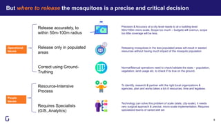

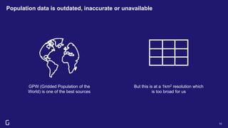
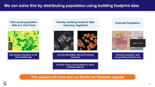
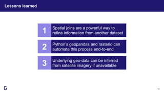
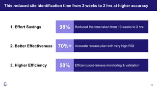
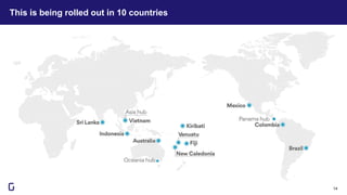


This document discusses how geospatial AI can help save lives by more precisely identifying locations to release Wolbachia-infected mosquitoes. Wolbachia bacteria can suppress mosquito-borne diseases like dengue and chikungunya by infecting mosquitoes. However, identifying exact release locations at a micro-scale (50-100m radius) is challenging. The author's company helped the World Mosquito Program address this by using building footprint data to more accurately distribute population data at a 100m grid level, reducing identification time from 3 weeks to 2 hours with higher accuracy. This approach is now being implemented in 10 countries to more efficiently roll out Wolbachia-infected mosquito releases.


![제 23회 보아즈(BOAZ) 빅데이터 컨퍼런스 - [MBOAX] : ABSA를 활용한 소비자 반응 분석 기반 운영 효율화 대시보드 설계](https://cdn.slidesharecdn.com/ss_thumbnails/3-1boaz23rdconferencemboax-260203102709-9d519923-thumbnail.jpg?width=640&height=640&fit=bounds)


