SlideShare a Scribd company logo
1 of 70
Download to read offline
M. Assumpció Termens, 2018-05-14, Enginyeria en Geoinformació i Geomàtica
AIRBORNE 

GRAVIMETRY

M. Assumpció Termens
M. Assumpció Termens, 2018-05-14, Enginyeria en Geoinformació i Geomàtica
agenda
• background

• problem statement

• NA approach

• INS/GNSS gravimetry: geodesy as usual

• future
2
M. Assumpció Termens, 2018-05-14, Enginyeria en Geoinformació i Geomàtica
background
3
M. Assumpció Termens, 2018-05-14, Enginyeria en Geoinformació i Geomàtica
gravimetry – what is it?
4
• geophysical method to measure the
gravity field of the Earth.
M. Assumpció Termens, 2018-05-14, Enginyeria en Geoinformació i Geomàtica
gravimetry – what is it?
5
• geophysical method to measure the
gravity field of the Earth.

• helps the understanding of mass transport
phenomena within our planet, in the
oceans and atmosphere
M. Assumpció Termens, 2018-05-14, Enginyeria en Geoinformació i Geomàtica
6
geodetic motivation
• sea-level rise

• river flooding

• coastal flooding from hurricane

• ...
M. Assumpció Termens, 2018-05-14, Enginyeria en Geoinformació i Geomàtica
gravimetry - applications
• precise terrestrial reference frame

• local geoid determination
7
M. Assumpció Termens, 2018-05-14, Enginyeria en Geoinformació i Geomàtica
gravimetry - applications
• precise terrestrial reference frame

• local geoid determination
8
• volcano monitoring

• glaciers melting monitoring

• plate boundaries

• deformation measurements

• eartquake tectonic studies
M. Assumpció Termens, 2018-05-14, Enginyeria en Geoinformació i Geomàtica
gravimetry - applications
• precise terrestrial reference frame

• local geoid determination
9
• volcano monitoring

• glaciers melting monitoring

• plate boundaries

• deformation measurements

• eartquake tectonic studies
• Natural resources (i.e. Mineral exploration)
M. Assumpció Termens, 2018-05-14, Enginyeria en Geoinformació i Geomàtica
gravimetry – measurement methods
10
GLOBAL
REGIONAL
LOCAL
CHAMP (> 600 km)
GRACE (> 270 km)
GOCE (> 70 km) terrestrial
10 km100 km1000 km 1 km
M. Assumpció Termens, 2018-05-14, Enginyeria en Geoinformació i Geomàtica
gravimetry – measurement methods
11
Kinematic gravimetry
(> 1 km)
GLOBAL
REGIONAL
LOCAL
CHAMP (> 600 km)
GRACE (> 270 km)
GOCE (> 70 km) terrestrial
10 km100 km1000 km 1 km
M. Assumpció Termens, 2018-05-14, Enginyeria en Geoinformació i Geomàtica
12
Airborne gravity is the only
technique that can
adequately connect existing
terrestrial data to existing
ship and altimetry data in
the oceans and fill coverage
gaps.

Airborne data will not
replace existing data, but
will be used as a baseline
for correcting that data to be
consistent across the
country.
M. Assumpció Termens, 2018-05-14, Enginyeria en Geoinformació i Geomàtica
13
airborne gravimetry
M. Assumpció Termens, 2018-05-14, Enginyeria en Geoinformació i Geomàtica
14
airborne gravimetry
M. Assumpció Termens, 2018-05-14, Enginyeria en Geoinformació i Geomàtica
problem
statement
15
M. Assumpció Termens, 2018-05-14, Enginyeria en Geoinformació i Geomàtica
kinematic gravimetry (KG) - concept
1950’s: placing gravimeters
onboard vehicles
16
rapid and high-resolution
surveys in oceans, polar
regions, high mountains,
tropical forests...
M. Assumpció Termens, 2018-05-14, Enginyeria en Geoinformació i Geomàtica
17
The first LaCoste-Romberg
Model “S” Air-Sea Gravimeter.
1958 - Air force Geophysics Lab
M. Assumpció Termens, 2018-05-14, Enginyeria en Geoinformació i Geomàtica
18
LaCoste-Romberg Model “S”
M. Assumpció Termens, 2018-05-14, Enginyeria en Geoinformació i Geomàtica
19
LaCoste-Romberg TAGS-6
M. Assumpció Termens, 2018-05-14, Enginyeria en Geoinformació i Geomàtica
20
BGM-3 Gravimeter - Bell Aerospace
M. Assumpció Termens, 2018-05-14, Enginyeria en Geoinformació i Geomàtica
21
Sea Gravimeter KSS31. Bodenseewerk Geosystem GmbH
M. Assumpció Termens, 2018-05-14, Enginyeria en Geoinformació i Geomàtica
22
Chekan-A Gravimeter
M. Assumpció Termens, 2018-05-14, Enginyeria en Geoinformació i Geomàtica
23
1965 - Carson Services, Inc.
M. Assumpció Termens, 2018-05-14, Enginyeria en Geoinformació i Geomàtica
kinematic gravimetry (KG) - concept
1950’s: placing gravimeters
onboard vehicles

1960’s: INS was introduced
as as surveying instrument
24
positioning limited by the
unknown anomalous
gravity field
M. Assumpció Termens, 2018-05-14, Enginyeria en Geoinformació i Geomàtica
kinematic gravimetry (KG) - concept
1950’s: placing gravimeters
onboard vehicles

1960’s: INS was introduced
as as surveying instrument
25
positioning limited by the
unknown anomalous
gravity field

gravity field will be recovered from INS
measurements if accurate kinematic
positions and velocities are known and
the system errors are kept small
M. Assumpció Termens, 2018-05-14, Enginyeria en Geoinformació i Geomàtica
26
INS used for airborne gravimetry
M. Assumpció Termens, 2018-05-14, Enginyeria en Geoinformació i Geomàtica
kinematic gravimetry (KG) - concept
1950’s: placing gravimeters
onboard vehicles

1960’s: INS was introduced
as as surveying instrument

1980’s: GPS represented the
opportunity to measure a
with adequate accuracy and
precision
27
M. Assumpció Termens, 2018-05-14, Enginyeria en Geoinformació i Geomàtica
28
Rampant Lion project
M. Assumpció Termens, 2018-05-14, Enginyeria en Geoinformació i Geomàtica
kinematic gravimetry (KG) - concept
1950’s: placing gravimeters
onboard vehicles

1960’s: INS was introduced
as as surveying instrument

1980’s: GPS represented the
opportunity to measure a
with adequate accuracy and
precision
29
gravity computation is easy,
in principle ...
M. Assumpció Termens, 2018-05-14, Enginyeria en Geoinformació i Geomàtica
... but, gravity computation is hard
30
• very dynamic environtment:

• noise-to-signal ratios > 1000

• largest contributions to noise:

• high frequency noise (vibration)
• noise amplification when computing accelerations
GNSS INS
meas. principle dist. from time delays inertial accel.
system operation reliance on space segment autonomous
output variables position, time position, orientation
long-wave. errors low high
short-wave. errors high low
data rate low (1Hz) high (≥ 25Hz)
instrument cost low high
INS/GNSS
limiting factors
M. Assumpció Termens, 2018-05-14, Enginyeria en Geoinformació i Geomàtica
airborne gravimetry - operational constraints
• navigation system used to position the aircraft

• aircraft speed: compromise between low vibrations (high
speed) and high spatial resolution (low speed)

• flight altitude: the signal to noise ratio improve with a lower
altitude

• use of an autopilot: to provide both smoother flight path and
the maintenance of a reference altitude

• weather condition: low turbulence is essential if high
frequency aircraft accelerations are to be avoided

• design of the aircraft
• design of the survey
31
M. Assumpció Termens, 2018-05-14, Enginyeria en Geoinformació i Geomàtica
32
airborne gravity survey
M. Assumpció Termens, 2018-05-14, Enginyeria en Geoinformació i Geomàtica
33
airborne gravity survey
M. Assumpció Termens, 2018-05-14, Enginyeria en Geoinformació i Geomàtica
KG - mathematical models
34
INS navigation equations
M. Assumpció Termens, 2018-05-14, Enginyeria en Geoinformació i Geomàtica
stochastic processes
INS/GNSS gravimetry – traditional approach
35
apriori stochastic info from manufacturer’s,
tricky calibrations and field testing modelling
M. Assumpció Termens, 2018-05-14, Enginyeria en Geoinformació i Geomàtica
INS/GNSS-g – traditional approach
36
process noises:
where
dynamical system
State Space Approach (SSA)
• prediction, Kalman filtering and
smoothing

• generates and optimal estimates, but not
the best

• cannot use all the observational info.

• disadvantage trying to deal with space
correlations (i.e. crossover points)
M. Assumpció Termens, 2018-05-14, Enginyeria en Geoinformació i Geomàtica
INS/GPS-g – SSA methodology
37
STATE SPACE APPROACH
prediction + KF + smoothing
STOCHASTIC TIME SERIES
• stochastic differential equations

• state vector

• observations
Sander Geophysics
US Naval Research Lab
Geomatics Canada
KMS
AGMASCO
ITC Moscow
Intermap
Univ. of Calgary (UofC
Univ. Porto
• scalar: L&R + platform + DGPS
• scalar/vector: INS/GNNS
M. Assumpció Termens, 2018-05-14, Enginyeria en Geoinformació i Geomàtica
INS/GPS-g – SSA methodology
38
STATE SPACE APPROACH
prediction + KF + smoothing
STOCHASTIC TIME SERIES
• stochastic differential equations

• state vector

• observations
• scalar: L&R + platform + DGPS

• scalar/vector: INS/GNNS
Kananaskis (UofC, 1995)

Skagerrak (AGMASCO, 1996)

Azores (AGMASCO, 1997)

Greenland (UofC-KMS, 1998)

Greenland, Baltic Sea, Great
Barrier Reef (KMS, 1999)

Alexandria (UofC, 2000)

Greenland (KMS, 2000)

Greenland, Crete, Corsica (KMS,
2001)

Geophysical surveys (Intermap,
Sander Geophysics)
M. Assumpció Termens, 2018-05-14, Enginyeria en Geoinformació i Geomàtica
INS/GPS-g – SSA methodology
39
Kananaskis (UofC, 1995)
Skagerrak (AGMASCO, 1996)

Azores (AGMASCO, 1997)

Greenland (UofC-KMS, 1998)

Greenland, Baltic Sea, Great
Barrier Reef (KMS, 1999)

Alexandria (UofC, 2000)

Greenland (KMS, 2000)

Greenland, Crete, Corsica (KMS,
2001)

Geophysical surveys (Intermap,
Sander Geophysics)
M. Assumpció Termens, 2018-05-14, Enginyeria en Geoinformació i Geomàtica
INS/GPS-g – SSA methodology
40
Kananaskis (UofC, 1995)

Skagerrak (AGMASCO, 1996)
Azores (AGMASCO, 1997)

Greenland (UofC-KMS, 1998)

Greenland, Baltic Sea, Great
Barrier Reef (KMS, 1999)
Alexandria (UofC, 2000)

Greenland (KMS, 2000)

Greenland, Crete, Corsica (KMS,
2001)

Geophysical surveys (Intermap,
Sander Geophysics)
M. Assumpció Termens, 2018-05-14, Enginyeria en Geoinformació i Geomàtica
INS/GPS-g – SSA methodology
41
Kananaskis (UofC, 1995)

Skagerrak (AGMASCO, 1996)

Azores (AGMASCO, 1997)

Greenland (UofC-KMS, 1998)
Greenland, Baltic Sea, Great
Barrier Reef (KMS, 1999)

Alexandria (UofC, 2000)

Greenland (KMS, 2000)

Greenland, Crete, Corsica (KMS,
2001)

Geophysical surveys (Intermap,
Sander Geophysics)
M. Assumpció Termens, 2018-05-14, Enginyeria en Geoinformació i Geomàtica
INS/GPS-g – SSA methodology
42
Kananaskis (UofC, 1995)

Skagerrak (AGMASCO, 1996)

Azores (AGMASCO, 1997)

Greenland (UofC-KMS, 1998)

Greenland, Baltic Sea, Great
Barrier Reef (KMS, 1999)
Alexandria (UofC, 2000)

Greenland (KMS, 2000)
Greenland, Crete, Corsica
(KMS, 2001)
Geophysical surveys (Intermap,
Sander Geophysics)
M. Assumpció Termens, 2018-05-14, Enginyeria en Geoinformació i Geomàtica
43
Greenland Aerogeophysical project 1991-92
• US Naval Research Lab

• NOAA

• Danish National Survey (now DTU-Space)

• NIMA (now NGA)
M. Assumpció Termens, 2018-05-14, Enginyeria en Geoinformació i Geomàtica
44
ArcGP
1992-2003
M. Assumpció Termens, 2018-05-14, Enginyeria en Geoinformació i Geomàtica
45
Arctic gravity project
M. Assumpció Termens, 2018-05-14, Enginyeria en Geoinformació i Geomàtica
46
Malaysia 2002-3
M. Assumpció Termens, 2018-05-14, Enginyeria en Geoinformació i Geomàtica
47
Rampant Lion project - Afghanistan 2006,2008
M. Assumpció Termens, 2018-05-14, Enginyeria en Geoinformació i Geomàtica
NA approach
48
M. Assumpció Termens, 2018-05-14, Enginyeria en Geoinformació i Geomàtica
INS/GNSS-g – Network Approach
49
Network Approach (NA)
• observation equations

• least-squares adjustment (LSA)
• the key to overcome SSA limitations is to look 

as stochastic differential equations (SDE)

• discretisation

leads to a geodetic network new
approach
Geodesy
as usual
M. Assumpció Termens, 2018-05-14, Enginyeria en Geoinformació i Geomàtica
NA – network approach
• general advantages:
• parameters related by observations regardless of time

• networks can be static and/or dynamic

• covariance information can be computed selectively

• variance component estimation can be performed 

• INS/GNSS gravimetry advantages:
• rigorous Earth gravity modelling

• better exploiting of external observational information

• more information for further geoid determination

• drawback:
• cannot be applied to real-time navigation
50
M. Assumpció Termens, 2018-05-14, Enginyeria en Geoinformació i Geomàtica
INS/GPS-g – approaches

PAST PRESENT FUTURE
51
NETWORK APPROACH
least-squares network adjustment
CLASSICAL NETWORKS
• static model, param. and obs.
NEW NETWORK APPROACH
• dynamic observation model

• static observation model

• time dependent parameters
(stochastic processes)

• time independent parameters
(random variable)

• independent observations

STATE SPACE APPROACH
prediction + KF + smoothing
STOCHASTIC TIME SERIES
• stochastic differential equations

• state vector

• observations
STOCHASTIC
TIME SERIES
STATIC
NETWORKS
TIME DEPENDENT NETWORKS
M. Assumpció Termens, 2018-05-14, Enginyeria en Geoinformació i Geomàtica
INS/GNSS-g – NA approaches
CLASSICAL NET TIME DEPENDENT NET
52
Termens,A., Colomina,I. Network
approach versus state-space
approach for strapdown inertial
kinematic gravimetry. GGSM2004,
IAG Symposia Vol. 129, pp.
107-112
Termens,A. A Network Approach
for Strapdown Inertial Kinematic
Gravimetry. Ph.D.
Colomina,I., Blázquez,M. A unified
approach to static and dynamic
modelling in photogrammetry and
remote sensing. International
Archives of the Photogrammetry,
Remote Sensing and Spatial
Information Sciences 35(B1). pp.
178-183
GAL FP7-287193 project “Galileo
for Gravity”
GAL final review. Castelldefels,
2014-02-10.
2004
2012
2014
...
M. Assumpció Termens, 2018-05-14, Enginyeria en Geoinformació i Geomàtica
INS/GNSS-g – NA approaches
CLASSICAL NET TIME DEPENDENT NET
53
Termens,A., Colomina,I. Network
approach versus state-space
approach for strapdown inertial
kinematic gravimetry. GGSM2004,
IAG Symposia Vol. 129, pp.
107-112
Termens,A. A Network Approach
for Strapdown Inertial Kinematic
Gravimetry. Ph.D.
Colomina,I., Blázquez,M. A unified
approach to static and dynamic
modelling in photogrammetry and
remote sensing. International
Archives of the Photogrammetry,
Remote Sensing and Spatial
Information Sciences 35(B1). pp.
178-183
GAL FP7-287193 project “Galileo
for Gravity”
2004
2012
2014
...
GeoTeX
GENA
M. Assumpció Termens, 2018-05-14, Enginyeria en Geoinformació i Geomàtica
INS/GNSS
gravimetry:
geodesy as usual
54
M. Assumpció Termens, 2018-05-14, Enginyeria en Geoinformació i Geomàtica
ICC GeoTeX package (1988 - )
• adopts a simple adjustment oriented point of view

• main data types: observations, parameters and sensors.

• Functional model

• FORTRAN-90 dynamic memory 32-bit implementation
55
M. Assumpció Termens, 2018-05-14, Enginyeria en Geoinformació i Geomàtica
GeoTeX functional model implementation
56
discretization
deriva1:
midpoint or
leap-frog
stochastic process Hz(INS)
Hz(cal)
Hz(g)
interpolation
intp: nearest point
RW process
M. Assumpció Termens, 2018-05-14, Enginyeria en Geoinformació i Geomàtica
INS/GNSS-g GeoTeX models
57
gravity
GNSS
INS
equations
M. Assumpció Termens, 2018-05-14, Enginyeria en Geoinformació i Geomàtica
GeoTeX WIB – INS angular rate vector model
58
Euler angles differential equations:
equivalent equations in terms of quaternions:
GeoTeX/ACX functional model
M. Assumpció Termens, 2018-05-14, Enginyeria en Geoinformació i Geomàtica
GeoTeX gravity parameters
59
DG-P
G-P
GRAVITY-P
G-P
DG-P
M. Assumpció Termens, 2018-05-14, Enginyeria en Geoinformació i Geomàtica
AB AB-O AB-P AOFF-O AOFF-P CUPT
CUPTX DG-O DG-OBS DG-OBS-GG DG-P
DGUPT-GG FB-DGE FB-DGN FB-GG G-O
G-OBS G-P GDT-DGE GDT1-DGE GDT-DGN
GDT1-DGN GDT-GG
GRAVITY GRAVITY-P
GUPT-DGE GUPT-DGN
GUPT-GG GUPTN-DGE GUPTN-DGN OB OB-O
OB-P Q-NORM Q-O Q-P RE-O RE-P VEL
VE-O VE-P VUPT VUPTX WIB XOVER-DGE
XOVER-DGN XOVER-GG
GeoTeX models – INS/GNSS gravimetry
60
38 observations 9 parameters
M. Assumpció Termens, 2018-05-14, Enginyeria en Geoinformació i Geomàtica
INS/GNSS-g – implementation issues
61
Cfg.1 Cfg.2 Cfg.3
IMU
Hz (IMU)
Hz (GPS)
T (s)
LN200
200
10
12 000
LTN101
50
1
12 000
LN200
200
5
14 400
N(imu)
N(gps)
N(aux)
45 599 982
360 003
720 000
11 399 982
36 003
180 000
54 719 982
216 003
N*(eq)
N(eq)
N(par)
45 959 985
46 679 985
45 600 000
11 435 985
11 615 985
11 400 000
54 935 985
54 935 985
54 720 000
Rb*
Rb
0.007 83
0.023 14
0.003 15
0.018 59
0.003 93
0.003 93
Rb =
N(eq) – N(par)
N(eq)
M. Assumpció Termens, 2018-05-14, Enginyeria en Geoinformació i Geomàtica
INS/GNSS-g – implementation issues
• large band-bordered matrix
• sparse matrix techniques

• fill-in reduction techniques

• memory-to-disk paging

• reducing parameters

• small redundancy
• increasing AUX obs.
62
ctra_LN200_v2a2x
M. Assumpció Termens, 2018-05-14, Enginyeria en Geoinformació i Geomàtica
INS/GNSS-g – implementation issues
• large band-bordered matrix
• sparse matrix techniques

• fill-in reduction techniques

• memory-to-disk paging

• reducing parameters

• small redundancy
• increasing AUX obs.
63
ctra_LN200_v2a2x
GDT GDT-p & XOVER
M. Assumpció Termens, 2018-05-14, Enginyeria en Geoinformació i Geomàtica
future
64
M. Assumpció Termens, 2018-05-14, Enginyeria en Geoinformació i Geomàtica
gravimetry – measurement methods
65
Kinematic gravimetry
(> 1 km)
GLOBAL
REGIONAL
LOCAL
CHAMP (> 600 km)
GRACE (> 270 km)
GOCE (> 70 km) terrestrial
10 km100 km1000 km 1 km
M. Assumpció Termens, 2018-05-14, Enginyeria en Geoinformació i Geomàtica
66
alternative survey platforms ?
M. Assumpció Termens, 2018-05-14, Enginyeria en Geoinformació i Geomàtica
67
airborne gravimetry
M. Assumpció Termens, 2018-05-14, Enginyeria en Geoinformació i Geomàtica
68
alternative survey platforms ?
M. Assumpció Termens, 2018-05-14, Enginyeria en Geoinformació i Geomàtica
69
global gravity … long-wavelength help aerogravity
M. Assumpció Termens, 2018-05-14, Enginyeria en Geoinformació i Geomàtica
70
satellite gravity: GOCE

More Related Content

Featured

2024 State of Marketing Report – by Hubspot
2024 State of Marketing Report – by Hubspot2024 State of Marketing Report – by Hubspot
2024 State of Marketing Report – by HubspotMarius Sescu
 
Everything You Need To Know About ChatGPT
Everything You Need To Know About ChatGPTEverything You Need To Know About ChatGPT
Everything You Need To Know About ChatGPTExpeed Software
 
Product Design Trends in 2024 | Teenage Engineerings
Product Design Trends in 2024 | Teenage EngineeringsProduct Design Trends in 2024 | Teenage Engineerings
Product Design Trends in 2024 | Teenage EngineeringsPixeldarts
 
How Race, Age and Gender Shape Attitudes Towards Mental Health
How Race, Age and Gender Shape Attitudes Towards Mental HealthHow Race, Age and Gender Shape Attitudes Towards Mental Health
How Race, Age and Gender Shape Attitudes Towards Mental HealthThinkNow
 
AI Trends in Creative Operations 2024 by Artwork Flow.pdf
AI Trends in Creative Operations 2024 by Artwork Flow.pdfAI Trends in Creative Operations 2024 by Artwork Flow.pdf
AI Trends in Creative Operations 2024 by Artwork Flow.pdfmarketingartwork
 
PEPSICO Presentation to CAGNY Conference Feb 2024
PEPSICO Presentation to CAGNY Conference Feb 2024PEPSICO Presentation to CAGNY Conference Feb 2024
PEPSICO Presentation to CAGNY Conference Feb 2024Neil Kimberley
 
Content Methodology: A Best Practices Report (Webinar)
Content Methodology: A Best Practices Report (Webinar)Content Methodology: A Best Practices Report (Webinar)
Content Methodology: A Best Practices Report (Webinar)contently
 
How to Prepare For a Successful Job Search for 2024
How to Prepare For a Successful Job Search for 2024How to Prepare For a Successful Job Search for 2024
How to Prepare For a Successful Job Search for 2024Albert Qian
 
Social Media Marketing Trends 2024 // The Global Indie Insights
Social Media Marketing Trends 2024 // The Global Indie InsightsSocial Media Marketing Trends 2024 // The Global Indie Insights
Social Media Marketing Trends 2024 // The Global Indie InsightsKurio // The Social Media Age(ncy)
 
Trends In Paid Search: Navigating The Digital Landscape In 2024
Trends In Paid Search: Navigating The Digital Landscape In 2024Trends In Paid Search: Navigating The Digital Landscape In 2024
Trends In Paid Search: Navigating The Digital Landscape In 2024Search Engine Journal
 
5 Public speaking tips from TED - Visualized summary
5 Public speaking tips from TED - Visualized summary5 Public speaking tips from TED - Visualized summary
5 Public speaking tips from TED - Visualized summarySpeakerHub
 
ChatGPT and the Future of Work - Clark Boyd
ChatGPT and the Future of Work - Clark Boyd ChatGPT and the Future of Work - Clark Boyd
ChatGPT and the Future of Work - Clark Boyd Clark Boyd
 
Getting into the tech field. what next
Getting into the tech field. what next Getting into the tech field. what next
Getting into the tech field. what next Tessa Mero
 
Google's Just Not That Into You: Understanding Core Updates & Search Intent
Google's Just Not That Into You: Understanding Core Updates & Search IntentGoogle's Just Not That Into You: Understanding Core Updates & Search Intent
Google's Just Not That Into You: Understanding Core Updates & Search IntentLily Ray
 
Time Management & Productivity - Best Practices
Time Management & Productivity -  Best PracticesTime Management & Productivity -  Best Practices
Time Management & Productivity - Best PracticesVit Horky
 
The six step guide to practical project management
The six step guide to practical project managementThe six step guide to practical project management
The six step guide to practical project managementMindGenius
 
Beginners Guide to TikTok for Search - Rachel Pearson - We are Tilt __ Bright...
Beginners Guide to TikTok for Search - Rachel Pearson - We are Tilt __ Bright...Beginners Guide to TikTok for Search - Rachel Pearson - We are Tilt __ Bright...
Beginners Guide to TikTok for Search - Rachel Pearson - We are Tilt __ Bright...RachelPearson36
 

Featured (20)

2024 State of Marketing Report – by Hubspot
2024 State of Marketing Report – by Hubspot2024 State of Marketing Report – by Hubspot
2024 State of Marketing Report – by Hubspot
 
Everything You Need To Know About ChatGPT
Everything You Need To Know About ChatGPTEverything You Need To Know About ChatGPT
Everything You Need To Know About ChatGPT
 
Product Design Trends in 2024 | Teenage Engineerings
Product Design Trends in 2024 | Teenage EngineeringsProduct Design Trends in 2024 | Teenage Engineerings
Product Design Trends in 2024 | Teenage Engineerings
 
How Race, Age and Gender Shape Attitudes Towards Mental Health
How Race, Age and Gender Shape Attitudes Towards Mental HealthHow Race, Age and Gender Shape Attitudes Towards Mental Health
How Race, Age and Gender Shape Attitudes Towards Mental Health
 
AI Trends in Creative Operations 2024 by Artwork Flow.pdf
AI Trends in Creative Operations 2024 by Artwork Flow.pdfAI Trends in Creative Operations 2024 by Artwork Flow.pdf
AI Trends in Creative Operations 2024 by Artwork Flow.pdf
 
Skeleton Culture Code
Skeleton Culture CodeSkeleton Culture Code
Skeleton Culture Code
 
PEPSICO Presentation to CAGNY Conference Feb 2024
PEPSICO Presentation to CAGNY Conference Feb 2024PEPSICO Presentation to CAGNY Conference Feb 2024
PEPSICO Presentation to CAGNY Conference Feb 2024
 
Content Methodology: A Best Practices Report (Webinar)
Content Methodology: A Best Practices Report (Webinar)Content Methodology: A Best Practices Report (Webinar)
Content Methodology: A Best Practices Report (Webinar)
 
How to Prepare For a Successful Job Search for 2024
How to Prepare For a Successful Job Search for 2024How to Prepare For a Successful Job Search for 2024
How to Prepare For a Successful Job Search for 2024
 
Social Media Marketing Trends 2024 // The Global Indie Insights
Social Media Marketing Trends 2024 // The Global Indie InsightsSocial Media Marketing Trends 2024 // The Global Indie Insights
Social Media Marketing Trends 2024 // The Global Indie Insights
 
Trends In Paid Search: Navigating The Digital Landscape In 2024
Trends In Paid Search: Navigating The Digital Landscape In 2024Trends In Paid Search: Navigating The Digital Landscape In 2024
Trends In Paid Search: Navigating The Digital Landscape In 2024
 
5 Public speaking tips from TED - Visualized summary
5 Public speaking tips from TED - Visualized summary5 Public speaking tips from TED - Visualized summary
5 Public speaking tips from TED - Visualized summary
 
ChatGPT and the Future of Work - Clark Boyd
ChatGPT and the Future of Work - Clark Boyd ChatGPT and the Future of Work - Clark Boyd
ChatGPT and the Future of Work - Clark Boyd
 
Getting into the tech field. what next
Getting into the tech field. what next Getting into the tech field. what next
Getting into the tech field. what next
 
Google's Just Not That Into You: Understanding Core Updates & Search Intent
Google's Just Not That Into You: Understanding Core Updates & Search IntentGoogle's Just Not That Into You: Understanding Core Updates & Search Intent
Google's Just Not That Into You: Understanding Core Updates & Search Intent
 
How to have difficult conversations
How to have difficult conversations How to have difficult conversations
How to have difficult conversations
 
Introduction to Data Science
Introduction to Data ScienceIntroduction to Data Science
Introduction to Data Science
 
Time Management & Productivity - Best Practices
Time Management & Productivity -  Best PracticesTime Management & Productivity -  Best Practices
Time Management & Productivity - Best Practices
 
The six step guide to practical project management
The six step guide to practical project managementThe six step guide to practical project management
The six step guide to practical project management
 
Beginners Guide to TikTok for Search - Rachel Pearson - We are Tilt __ Bright...
Beginners Guide to TikTok for Search - Rachel Pearson - We are Tilt __ Bright...Beginners Guide to TikTok for Search - Rachel Pearson - We are Tilt __ Bright...
Beginners Guide to TikTok for Search - Rachel Pearson - We are Tilt __ Bright...
 

20180514 upc airborne_gravimetry

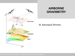
  • 1. M. Assumpció Termens, 2018-05-14, Enginyeria en Geoinformació i Geomàtica AIRBORNE 
 GRAVIMETRY
 M. Assumpció Termens
  • 2. M. Assumpció Termens, 2018-05-14, Enginyeria en Geoinformació i Geomàtica agenda • background • problem statement • NA approach • INS/GNSS gravimetry: geodesy as usual • future 2
  • 3. M. Assumpció Termens, 2018-05-14, Enginyeria en Geoinformació i Geomàtica background 3
  • 4. M. Assumpció Termens, 2018-05-14, Enginyeria en Geoinformació i Geomàtica gravimetry – what is it? 4 • geophysical method to measure the gravity field of the Earth.
  • 5. M. Assumpció Termens, 2018-05-14, Enginyeria en Geoinformació i Geomàtica gravimetry – what is it? 5 • geophysical method to measure the gravity field of the Earth. • helps the understanding of mass transport phenomena within our planet, in the oceans and atmosphere
  • 6. M. Assumpció Termens, 2018-05-14, Enginyeria en Geoinformació i Geomàtica 6 geodetic motivation • sea-level rise • river flooding • coastal flooding from hurricane • ...
  • 7. M. Assumpció Termens, 2018-05-14, Enginyeria en Geoinformació i Geomàtica gravimetry - applications • precise terrestrial reference frame • local geoid determination 7
  • 8. M. Assumpció Termens, 2018-05-14, Enginyeria en Geoinformació i Geomàtica gravimetry - applications • precise terrestrial reference frame • local geoid determination 8 • volcano monitoring • glaciers melting monitoring • plate boundaries • deformation measurements • eartquake tectonic studies
  • 9. M. Assumpció Termens, 2018-05-14, Enginyeria en Geoinformació i Geomàtica gravimetry - applications • precise terrestrial reference frame • local geoid determination 9 • volcano monitoring • glaciers melting monitoring • plate boundaries • deformation measurements • eartquake tectonic studies • Natural resources (i.e. Mineral exploration)
  • 10. M. Assumpció Termens, 2018-05-14, Enginyeria en Geoinformació i Geomàtica gravimetry – measurement methods 10 GLOBAL REGIONAL LOCAL CHAMP (> 600 km) GRACE (> 270 km) GOCE (> 70 km) terrestrial 10 km100 km1000 km 1 km
  • 11. M. Assumpció Termens, 2018-05-14, Enginyeria en Geoinformació i Geomàtica gravimetry – measurement methods 11 Kinematic gravimetry (> 1 km) GLOBAL REGIONAL LOCAL CHAMP (> 600 km) GRACE (> 270 km) GOCE (> 70 km) terrestrial 10 km100 km1000 km 1 km
  • 12. M. Assumpció Termens, 2018-05-14, Enginyeria en Geoinformació i Geomàtica 12 Airborne gravity is the only technique that can adequately connect existing terrestrial data to existing ship and altimetry data in the oceans and fill coverage gaps. Airborne data will not replace existing data, but will be used as a baseline for correcting that data to be consistent across the country.
  • 13. M. Assumpció Termens, 2018-05-14, Enginyeria en Geoinformació i Geomàtica 13 airborne gravimetry
  • 14. M. Assumpció Termens, 2018-05-14, Enginyeria en Geoinformació i Geomàtica 14 airborne gravimetry
  • 15. M. Assumpció Termens, 2018-05-14, Enginyeria en Geoinformació i Geomàtica problem statement 15
  • 16. M. Assumpció Termens, 2018-05-14, Enginyeria en Geoinformació i Geomàtica kinematic gravimetry (KG) - concept 1950’s: placing gravimeters onboard vehicles 16 rapid and high-resolution surveys in oceans, polar regions, high mountains, tropical forests...
  • 17. M. Assumpció Termens, 2018-05-14, Enginyeria en Geoinformació i Geomàtica 17 The first LaCoste-Romberg Model “S” Air-Sea Gravimeter. 1958 - Air force Geophysics Lab
  • 18. M. Assumpció Termens, 2018-05-14, Enginyeria en Geoinformació i Geomàtica 18 LaCoste-Romberg Model “S”
  • 19. M. Assumpció Termens, 2018-05-14, Enginyeria en Geoinformació i Geomàtica 19 LaCoste-Romberg TAGS-6
  • 20. M. Assumpció Termens, 2018-05-14, Enginyeria en Geoinformació i Geomàtica 20 BGM-3 Gravimeter - Bell Aerospace
  • 21. M. Assumpció Termens, 2018-05-14, Enginyeria en Geoinformació i Geomàtica 21 Sea Gravimeter KSS31. Bodenseewerk Geosystem GmbH
  • 22. M. Assumpció Termens, 2018-05-14, Enginyeria en Geoinformació i Geomàtica 22 Chekan-A Gravimeter
  • 23. M. Assumpció Termens, 2018-05-14, Enginyeria en Geoinformació i Geomàtica 23 1965 - Carson Services, Inc.
  • 24. M. Assumpció Termens, 2018-05-14, Enginyeria en Geoinformació i Geomàtica kinematic gravimetry (KG) - concept 1950’s: placing gravimeters onboard vehicles 1960’s: INS was introduced as as surveying instrument 24 positioning limited by the unknown anomalous gravity field
  • 25. M. Assumpció Termens, 2018-05-14, Enginyeria en Geoinformació i Geomàtica kinematic gravimetry (KG) - concept 1950’s: placing gravimeters onboard vehicles 1960’s: INS was introduced as as surveying instrument 25 positioning limited by the unknown anomalous gravity field gravity field will be recovered from INS measurements if accurate kinematic positions and velocities are known and the system errors are kept small
  • 26. M. Assumpció Termens, 2018-05-14, Enginyeria en Geoinformació i Geomàtica 26 INS used for airborne gravimetry
  • 27. M. Assumpció Termens, 2018-05-14, Enginyeria en Geoinformació i Geomàtica kinematic gravimetry (KG) - concept 1950’s: placing gravimeters onboard vehicles 1960’s: INS was introduced as as surveying instrument 1980’s: GPS represented the opportunity to measure a with adequate accuracy and precision 27
  • 28. M. Assumpció Termens, 2018-05-14, Enginyeria en Geoinformació i Geomàtica 28 Rampant Lion project
  • 29. M. Assumpció Termens, 2018-05-14, Enginyeria en Geoinformació i Geomàtica kinematic gravimetry (KG) - concept 1950’s: placing gravimeters onboard vehicles 1960’s: INS was introduced as as surveying instrument 1980’s: GPS represented the opportunity to measure a with adequate accuracy and precision 29 gravity computation is easy, in principle ...
  • 30. M. Assumpció Termens, 2018-05-14, Enginyeria en Geoinformació i Geomàtica ... but, gravity computation is hard 30 • very dynamic environtment: • noise-to-signal ratios > 1000 • largest contributions to noise: • high frequency noise (vibration) • noise amplification when computing accelerations GNSS INS meas. principle dist. from time delays inertial accel. system operation reliance on space segment autonomous output variables position, time position, orientation long-wave. errors low high short-wave. errors high low data rate low (1Hz) high (≥ 25Hz) instrument cost low high INS/GNSS limiting factors
  • 31. M. Assumpció Termens, 2018-05-14, Enginyeria en Geoinformació i Geomàtica airborne gravimetry - operational constraints • navigation system used to position the aircraft • aircraft speed: compromise between low vibrations (high speed) and high spatial resolution (low speed) • flight altitude: the signal to noise ratio improve with a lower altitude • use of an autopilot: to provide both smoother flight path and the maintenance of a reference altitude • weather condition: low turbulence is essential if high frequency aircraft accelerations are to be avoided • design of the aircraft • design of the survey 31
  • 32. M. Assumpció Termens, 2018-05-14, Enginyeria en Geoinformació i Geomàtica 32 airborne gravity survey
  • 33. M. Assumpció Termens, 2018-05-14, Enginyeria en Geoinformació i Geomàtica 33 airborne gravity survey
  • 34. M. Assumpció Termens, 2018-05-14, Enginyeria en Geoinformació i Geomàtica KG - mathematical models 34 INS navigation equations
  • 35. M. Assumpció Termens, 2018-05-14, Enginyeria en Geoinformació i Geomàtica stochastic processes INS/GNSS gravimetry – traditional approach 35 apriori stochastic info from manufacturer’s, tricky calibrations and field testing modelling
  • 36. M. Assumpció Termens, 2018-05-14, Enginyeria en Geoinformació i Geomàtica INS/GNSS-g – traditional approach 36 process noises: where dynamical system State Space Approach (SSA) • prediction, Kalman filtering and smoothing • generates and optimal estimates, but not the best • cannot use all the observational info. • disadvantage trying to deal with space correlations (i.e. crossover points)
  • 37. M. Assumpció Termens, 2018-05-14, Enginyeria en Geoinformació i Geomàtica INS/GPS-g – SSA methodology 37 STATE SPACE APPROACH prediction + KF + smoothing STOCHASTIC TIME SERIES • stochastic differential equations • state vector • observations Sander Geophysics US Naval Research Lab Geomatics Canada KMS AGMASCO ITC Moscow Intermap Univ. of Calgary (UofC Univ. Porto • scalar: L&R + platform + DGPS • scalar/vector: INS/GNNS
  • 38. M. Assumpció Termens, 2018-05-14, Enginyeria en Geoinformació i Geomàtica INS/GPS-g – SSA methodology 38 STATE SPACE APPROACH prediction + KF + smoothing STOCHASTIC TIME SERIES • stochastic differential equations • state vector • observations • scalar: L&R + platform + DGPS • scalar/vector: INS/GNNS Kananaskis (UofC, 1995) Skagerrak (AGMASCO, 1996) Azores (AGMASCO, 1997) Greenland (UofC-KMS, 1998) Greenland, Baltic Sea, Great Barrier Reef (KMS, 1999) Alexandria (UofC, 2000) Greenland (KMS, 2000) Greenland, Crete, Corsica (KMS, 2001) Geophysical surveys (Intermap, Sander Geophysics)
  • 39. M. Assumpció Termens, 2018-05-14, Enginyeria en Geoinformació i Geomàtica INS/GPS-g – SSA methodology 39 Kananaskis (UofC, 1995) Skagerrak (AGMASCO, 1996) Azores (AGMASCO, 1997) Greenland (UofC-KMS, 1998) Greenland, Baltic Sea, Great Barrier Reef (KMS, 1999) Alexandria (UofC, 2000) Greenland (KMS, 2000) Greenland, Crete, Corsica (KMS, 2001) Geophysical surveys (Intermap, Sander Geophysics)
  • 40. M. Assumpció Termens, 2018-05-14, Enginyeria en Geoinformació i Geomàtica INS/GPS-g – SSA methodology 40 Kananaskis (UofC, 1995) Skagerrak (AGMASCO, 1996) Azores (AGMASCO, 1997) Greenland (UofC-KMS, 1998) Greenland, Baltic Sea, Great Barrier Reef (KMS, 1999) Alexandria (UofC, 2000) Greenland (KMS, 2000) Greenland, Crete, Corsica (KMS, 2001) Geophysical surveys (Intermap, Sander Geophysics)
  • 41. M. Assumpció Termens, 2018-05-14, Enginyeria en Geoinformació i Geomàtica INS/GPS-g – SSA methodology 41 Kananaskis (UofC, 1995) Skagerrak (AGMASCO, 1996) Azores (AGMASCO, 1997) Greenland (UofC-KMS, 1998) Greenland, Baltic Sea, Great Barrier Reef (KMS, 1999) Alexandria (UofC, 2000) Greenland (KMS, 2000) Greenland, Crete, Corsica (KMS, 2001) Geophysical surveys (Intermap, Sander Geophysics)
  • 42. M. Assumpció Termens, 2018-05-14, Enginyeria en Geoinformació i Geomàtica INS/GPS-g – SSA methodology 42 Kananaskis (UofC, 1995) Skagerrak (AGMASCO, 1996) Azores (AGMASCO, 1997) Greenland (UofC-KMS, 1998) Greenland, Baltic Sea, Great Barrier Reef (KMS, 1999) Alexandria (UofC, 2000) Greenland (KMS, 2000) Greenland, Crete, Corsica (KMS, 2001) Geophysical surveys (Intermap, Sander Geophysics)
  • 43. M. Assumpció Termens, 2018-05-14, Enginyeria en Geoinformació i Geomàtica 43 Greenland Aerogeophysical project 1991-92 • US Naval Research Lab • NOAA • Danish National Survey (now DTU-Space) • NIMA (now NGA)
  • 44. M. Assumpció Termens, 2018-05-14, Enginyeria en Geoinformació i Geomàtica 44 ArcGP 1992-2003
  • 45. M. Assumpció Termens, 2018-05-14, Enginyeria en Geoinformació i Geomàtica 45 Arctic gravity project
  • 46. M. Assumpció Termens, 2018-05-14, Enginyeria en Geoinformació i Geomàtica 46 Malaysia 2002-3
  • 47. M. Assumpció Termens, 2018-05-14, Enginyeria en Geoinformació i Geomàtica 47 Rampant Lion project - Afghanistan 2006,2008
  • 48. M. Assumpció Termens, 2018-05-14, Enginyeria en Geoinformació i Geomàtica NA approach 48
  • 49. M. Assumpció Termens, 2018-05-14, Enginyeria en Geoinformació i Geomàtica INS/GNSS-g – Network Approach 49 Network Approach (NA) • observation equations • least-squares adjustment (LSA) • the key to overcome SSA limitations is to look as stochastic differential equations (SDE) • discretisation leads to a geodetic network new approach Geodesy as usual
  • 50. M. Assumpció Termens, 2018-05-14, Enginyeria en Geoinformació i Geomàtica NA – network approach • general advantages: • parameters related by observations regardless of time • networks can be static and/or dynamic • covariance information can be computed selectively • variance component estimation can be performed • INS/GNSS gravimetry advantages: • rigorous Earth gravity modelling • better exploiting of external observational information • more information for further geoid determination • drawback: • cannot be applied to real-time navigation 50
  • 51. M. Assumpció Termens, 2018-05-14, Enginyeria en Geoinformació i Geomàtica INS/GPS-g – approaches
 PAST PRESENT FUTURE 51 NETWORK APPROACH least-squares network adjustment CLASSICAL NETWORKS • static model, param. and obs. NEW NETWORK APPROACH • dynamic observation model • static observation model • time dependent parameters (stochastic processes) • time independent parameters (random variable) • independent observations STATE SPACE APPROACH prediction + KF + smoothing STOCHASTIC TIME SERIES • stochastic differential equations • state vector • observations STOCHASTIC TIME SERIES STATIC NETWORKS TIME DEPENDENT NETWORKS
  • 52. M. Assumpció Termens, 2018-05-14, Enginyeria en Geoinformació i Geomàtica INS/GNSS-g – NA approaches CLASSICAL NET TIME DEPENDENT NET 52 Termens,A., Colomina,I. Network approach versus state-space approach for strapdown inertial kinematic gravimetry. GGSM2004, IAG Symposia Vol. 129, pp. 107-112 Termens,A. A Network Approach for Strapdown Inertial Kinematic Gravimetry. Ph.D. Colomina,I., Blázquez,M. A unified approach to static and dynamic modelling in photogrammetry and remote sensing. International Archives of the Photogrammetry, Remote Sensing and Spatial Information Sciences 35(B1). pp. 178-183 GAL FP7-287193 project “Galileo for Gravity” GAL final review. Castelldefels, 2014-02-10. 2004 2012 2014 ...
  • 53. M. Assumpció Termens, 2018-05-14, Enginyeria en Geoinformació i Geomàtica INS/GNSS-g – NA approaches CLASSICAL NET TIME DEPENDENT NET 53 Termens,A., Colomina,I. Network approach versus state-space approach for strapdown inertial kinematic gravimetry. GGSM2004, IAG Symposia Vol. 129, pp. 107-112 Termens,A. A Network Approach for Strapdown Inertial Kinematic Gravimetry. Ph.D. Colomina,I., Blázquez,M. A unified approach to static and dynamic modelling in photogrammetry and remote sensing. International Archives of the Photogrammetry, Remote Sensing and Spatial Information Sciences 35(B1). pp. 178-183 GAL FP7-287193 project “Galileo for Gravity” 2004 2012 2014 ... GeoTeX GENA
  • 54. M. Assumpció Termens, 2018-05-14, Enginyeria en Geoinformació i Geomàtica INS/GNSS gravimetry: geodesy as usual 54
  • 55. M. Assumpció Termens, 2018-05-14, Enginyeria en Geoinformació i Geomàtica ICC GeoTeX package (1988 - ) • adopts a simple adjustment oriented point of view • main data types: observations, parameters and sensors. • Functional model • FORTRAN-90 dynamic memory 32-bit implementation 55
  • 56. M. Assumpció Termens, 2018-05-14, Enginyeria en Geoinformació i Geomàtica GeoTeX functional model implementation 56 discretization deriva1: midpoint or leap-frog stochastic process Hz(INS) Hz(cal) Hz(g) interpolation intp: nearest point RW process
  • 57. M. Assumpció Termens, 2018-05-14, Enginyeria en Geoinformació i Geomàtica INS/GNSS-g GeoTeX models 57 gravity GNSS INS equations
  • 58. M. Assumpció Termens, 2018-05-14, Enginyeria en Geoinformació i Geomàtica GeoTeX WIB – INS angular rate vector model 58 Euler angles differential equations: equivalent equations in terms of quaternions: GeoTeX/ACX functional model
  • 59. M. Assumpció Termens, 2018-05-14, Enginyeria en Geoinformació i Geomàtica GeoTeX gravity parameters 59 DG-P G-P GRAVITY-P G-P DG-P
  • 60. M. Assumpció Termens, 2018-05-14, Enginyeria en Geoinformació i Geomàtica AB AB-O AB-P AOFF-O AOFF-P CUPT CUPTX DG-O DG-OBS DG-OBS-GG DG-P DGUPT-GG FB-DGE FB-DGN FB-GG G-O G-OBS G-P GDT-DGE GDT1-DGE GDT-DGN GDT1-DGN GDT-GG GRAVITY GRAVITY-P GUPT-DGE GUPT-DGN GUPT-GG GUPTN-DGE GUPTN-DGN OB OB-O OB-P Q-NORM Q-O Q-P RE-O RE-P VEL VE-O VE-P VUPT VUPTX WIB XOVER-DGE XOVER-DGN XOVER-GG GeoTeX models – INS/GNSS gravimetry 60 38 observations 9 parameters
  • 61. M. Assumpció Termens, 2018-05-14, Enginyeria en Geoinformació i Geomàtica INS/GNSS-g – implementation issues 61 Cfg.1 Cfg.2 Cfg.3 IMU Hz (IMU) Hz (GPS) T (s) LN200 200 10 12 000 LTN101 50 1 12 000 LN200 200 5 14 400 N(imu) N(gps) N(aux) 45 599 982 360 003 720 000 11 399 982 36 003 180 000 54 719 982 216 003 N*(eq) N(eq) N(par) 45 959 985 46 679 985 45 600 000 11 435 985 11 615 985 11 400 000 54 935 985 54 935 985 54 720 000 Rb* Rb 0.007 83 0.023 14 0.003 15 0.018 59 0.003 93 0.003 93 Rb = N(eq) – N(par) N(eq)
  • 62. M. Assumpció Termens, 2018-05-14, Enginyeria en Geoinformació i Geomàtica INS/GNSS-g – implementation issues • large band-bordered matrix • sparse matrix techniques • fill-in reduction techniques • memory-to-disk paging • reducing parameters • small redundancy • increasing AUX obs. 62 ctra_LN200_v2a2x
  • 63. M. Assumpció Termens, 2018-05-14, Enginyeria en Geoinformació i Geomàtica INS/GNSS-g – implementation issues • large band-bordered matrix • sparse matrix techniques • fill-in reduction techniques • memory-to-disk paging • reducing parameters • small redundancy • increasing AUX obs. 63 ctra_LN200_v2a2x GDT GDT-p & XOVER
  • 64. M. Assumpció Termens, 2018-05-14, Enginyeria en Geoinformació i Geomàtica future 64
  • 65. M. Assumpció Termens, 2018-05-14, Enginyeria en Geoinformació i Geomàtica gravimetry – measurement methods 65 Kinematic gravimetry (> 1 km) GLOBAL REGIONAL LOCAL CHAMP (> 600 km) GRACE (> 270 km) GOCE (> 70 km) terrestrial 10 km100 km1000 km 1 km
  • 66. M. Assumpció Termens, 2018-05-14, Enginyeria en Geoinformació i Geomàtica 66 alternative survey platforms ?
  • 67. M. Assumpció Termens, 2018-05-14, Enginyeria en Geoinformació i Geomàtica 67 airborne gravimetry
  • 68. M. Assumpció Termens, 2018-05-14, Enginyeria en Geoinformació i Geomàtica 68 alternative survey platforms ?
  • 69. M. Assumpció Termens, 2018-05-14, Enginyeria en Geoinformació i Geomàtica 69 global gravity … long-wavelength help aerogravity
  • 70. M. Assumpció Termens, 2018-05-14, Enginyeria en Geoinformació i Geomàtica 70 satellite gravity: GOCE