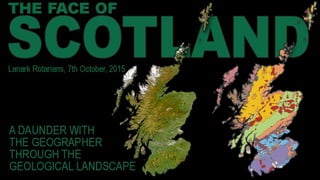
Face of Scotland
•Download as PPTX, PDF•
1 like•876 views

The document discusses the benefits of meditation for reducing stress and anxiety. Regular meditation practice can help calm the mind and body by lowering heart rate and blood pressure. Making meditation a part of a daily routine, even if just 10-15 minutes per day, can have mental and physical health benefits over time by reducing stress levels and promoting relaxation.

Recommended
More Related Content
Viewers also liked
Viewers also liked (20)
More from Alan Doherty
More from Alan Doherty (20)
Recently uploaded
Recently uploaded (20)
Editor's Notes
- When I delivered this presentation to my students, I used to use the analogy of reading a face – John Byrne’s face in particular. His self portraits are particularly honest. If you can read a face, you can read a landscape. Of course, it can be any face, or any group of faces….
- …such as this bunch of Scottish lads. Notice how worried the goalkeeper is – maybe he has played behind this defense before?... Or maybe it was the court case that was coming up. And every team needs it’s smiling assassin. Mind you this team seems to have 10 of them.
- How is this for a Scottish back four? These are slightly more important faces in terms of the geology of Scotland. Geology, as an academic pursuit, was more or less invented in our country. All four gentlemen had their curiosity aroused by their local surroundings. So James Hutton studied the igneous rocks around Edinburgh. Playfair and Lyell’s first love was the lithification of the Old Red Sandstone Rocks of Strathmore and Angus while Hugh Miller studied the fossils which he came across as a stonemason in the Black Isle.
- Between them they set up the foundations of geology. They identified the main rock types and began to wrestle with the concept of geological time – or the “abyss of time” as James Hutton called it. It was a struggle which eventually cost Hugh Miller his life.
- All four made contributions towards the Rock Cycle, recognizing that everything started with igneous rocks – a molten earth in space. These rocks are then weathered and eroded down into sediments which collect in basins and eventually harden into layers of sedimentary rocks. Tectonic processes then may heat or pressurize these layers into metamorphic rocks. The same material can therefore become three different types of rock during its development cycle.
- By the beginning of the 20th century, we had a very accurate geology map of Scotland. By the end of the 20th century this map hadn’t changed but our understanding of it had improved immeasurably.
- Alfred Wegener had introduced the theory of continental drift in the 1920s. It took a long time for his theories to be accepted but by the 1990s there was worldwide acceptance of the theory of Plate Tectonics. And for the first time, geology maps began to record tectonic terranes.
- The surface geology was the same as before but the nomenclature was very different. We have not only identified all the separate terranes which make up the British Isles but we can track their positions back through time.
- And so the landscapes of Scotland begin to make more sense.
- Dating techniques improved as well and so the geological timescale now looks like this. There are still problems especially with really old rocks. These three rocks are nominally the same….
- Iona
- Barra
- Harris So let’s look at Scotland’s Journey. We can go back about a 1000 million years with some degree of accuracy.
- A billion years ago, the Earth’s landmasses were fused in a supercontinent called Rodinia. Rodinia was unusual in that most of the landmass was mountainous. The main range was about 20,000kms long. No vegetation meant that the land surface was covered in rivers. Erosion, on a scale never seen before or since, held sway. Our planet is about 4.54 billion years old. This is about as far back as we can go in terms of the location of the landmasses.
- Snowball Earth! There is very little ice near our equator at present. This wasn’t the case 700 ma. Our planet was being repeatedly covered in ice, the glaciations coming and going over a period of about 55 million years. It seems that the eruption of a supervolcano brought vast volumes of basalt to the surface that quickly weathered under tropical rains, sucking huge amounts of CO2 out of the atmosphere. There might have been a biological trigger as well. Single celled zooplankton may have evolved that excreted fecal pellets, thus removing carbon from the system. Eventually CO2 seeping out of undersea volcanoes began to warm things and the glaciation was over almost as quicly as it began.
- The third great discovery of the last decade has been the accurate tracking of the origins and movements of different terranes. We will have a look at Scotland and England’s journeys. 600 mya – the start of life as we know it – multi-celled animals. The earliest evidence for this was provided by fossil poo on the Isle of Islay.
- During the final stages of the Caledonian orogeny, the erosion of the high mountains led to the deposition of the Old Red Sandstone in the Midland Valley.
- 420mya Scotland and northern Ireland finally dock with England and southern Ireland. The last remnants of the Iapetus Ocean disappear.
- 348 mya Britain was on the equator and the great Carboniferous limestone was being laid down in a sea which covered most of England and Wales. In Scotland an enigmatic island arc puntuated the landscape with volcanoes.
- Pangaea was C shaped, wrapped around the Tethys Sea. Biggest desert ever? Most geologists think that the continents repeatedly coalesce and split apart in a 500 million year cycle.
- 52-63 mya intense igneous activity formed the British Tertiary Volcanic Province.
- Good news Bad news?
- We are 9 degrees warmer than we should be for our latitude. Suppose the Gulf Stream switched off? Winds drive ocean currents in the upper 100 meters of the ocean’s surface. However, ocean currents also flow thousands of meters below the surface. These deep-ocean currents are driven by differences in the water’s density, which is controlled by temperature (thermo) and salinity (haline). This process is known as thermohaline circulation.
- An excellent example of the glacial diversion of drainage. The present route of the River Clyde occupies a bedrock gorge which was cut following the infilling of its former course by glacial deposits.
- The Falls of Clyde provide a particularly striking example of the effects of glacial disruption of drainage. The original channel of the Clyde was infilled with glacial deposits, forcing the river to adopt a new course. The latter takes the form of a bedrock gorge and is distinguished by the presence of two waterfalls. The site is important in illustrating some of the indirect, but nevertheless significant, effects of glaciation on the landscape.
- Carstairs Kames is a classic site, long renowned for its glacial landforms. These comprise a series of esker ridges, kames and kettle holes, one of the best such assemblages in Britain formed by the meltwater (rivers) of the last ice sheet as it decayed approximately 13,000 years ago.
- Tinto Hill is important for studies of periglacial processes, illustrating the best example of active stone stripes in Scotland.
- Felsite Tinto Hill is composed entirely of felsite, a fine grained but not glassy volcanic rock. It is high in silica or felsic, typically consisting of the minerals quartz, plagioclase feldspar and alkali feldspar. Felsite is usually called the extrusive equivalent of granite. It is very prone to frost shattering and felsite hills often produce active scree slopes. A maritime periglacial climate prevails in Scotland above about 600 metres resulting in sorted patterned ground on loose scree material.
- Although active stone stripes are known from a number of mountains in the Highlands and Islands, the examples on Tinto Hill are exceptional for their size, clarity and degree of development. Tinto Hill is also the first locality in Scotland at which such features were described in detail.
- Pagan ritual joke.