SlideShare a Scribd company logo
1 of 17
LINCOLN UNIVERSITY
Reefton
Recreation Opportunity Spectrum and Limits
of Acceptable Change
Tracy Mezger
6/4/2013
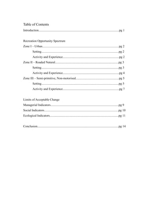
Table of Contents
Introduction........................................................................................................pg 1
Recreation Opportunity Spectrum
Zone I – Urban...................................................................................................pg 2
Setting....................................................................................................pg 2
Activity and Experience.........................................................................pg 2
Zone II – Roaded Natural..................................................................................pg 3
Setting....................................................................................................pg 3
Activity and Experience.........................................................................pg 4
Zone III – Semi-primitive, Non-motorised........................................................pg 5
Setting....................................................................................................pg 5
Activity and Experience.........................................................................pg 7
Limits of Acceptable Change
Managerial Indicators........................................................................................pg 9
Social Indicators................................................................................................pg 10
Ecological Indicators.........................................................................................pg 11
Conclusion.........................................................................................................pg 14
Introduction
Reefton is located on the West Coast of New Zealand's South island with a
population of approximately 950 people (NewZealand.com). The town is commonly
referred to as the “town of light” because it was the first town in the Southern
Hemisphere to light up an entire street with electricity, and is also known as an old
mining town. Reefton is commonly accessed through State Highway 69 as well as
Highway 7. It is a central hub of state highway access into the Coast, north from
Murchison, Nelson and Blenheim and east from Christchurch (Reefton Tourism, 2012).
The town was originally founded from a rush of people heading towards the west coast
because of the gold bearing quartz in the region (Reefton Tourism, 2012). The Victoria
Conservation Park surrounds the town, which is New Zealand’s largest park of its kind,
and the Inangahua River runs alongside the town as well (Reefton Tourism, 2012).
Mining has recently become dominant in the area again, beginning in 2008. The town has
many different options for tourists who wish to stay overnight, offering over 300 spaces
in hotels, backpackers and other types of accommodation (Reefton Tourism, 2012). While
Reefton is primarily known for mining, its history makes it a popular location for all
types of tourists. Because the Inangahua River and Victoria Conservation Park surround
the area, the diversity of activities can meet all tourist needs. Today, there are many tracks
that lead to mining sites for tourists, although most of them must be accessed during an
overnight trek. Overall, the area provides a broad range of recreational activities for
tourists.
Zone I – Urban
Setting
The urban zone, or the town of Reefton, is located approximately 80 kilometres
Northeast of Greymouth on the West Coast of New Zealand’s South Island. The zone is
marked by the Inanguahua River as its West boundary, Grey Road as its South boundary,
much of Burkes Road as the East boundary, and a combination of tracks and Highway 69
round the boundary off. Because it is the only inland town between Greymouth and
Nelson, it often catches overnight visitors on their West Coast road trip. This zone can be
accessed through State Highway 7 as well as State Highway 69 and several other smaller
roads. It is located among a native beech forest reserve between the Victoria and Paproa
ranges and in the valley of the Inanguahua River (Reefton Tourism, 2012). It is also
surrounded by Victoria Conservation Park, which is New Zealand’s largest park of its
kind (Reefton Tourism, 2012). The level of visitors is moderate to high, often depending
on the weather and time of year. There are generally more visitors in the summer months
(Reefton Tourism, 2012). There are many facilities in the area for visitors, including
toilets, vehicles, shops and supermarkets, allowing for many managerial activities
(Reefton Tourism, 2012). These opportunities include providing accommodation for
visitors. There are several hotels, backpackers and bed and breakfasts in order to satisfy
different budgets (Reefton Tourism, 2012). The urban area also has Department of
Conservation (DOC) sites and campgrounds for those staying outdoors (Reefton Tourism,
2012). Most visitors staying in the urban area of Reefton are looking for a low-risk
experience, and have no problem with coming into contact with many other tourists.
Activity and Experience
There are a range of activities—hunting, golf, mountain biking, kayaking, walks
and tramps, fishing, swimming and even a cinema for those interested in more of a
relaxing environment. Because Reefton is surrounded by conservation area, there are
many opportunities for hunting, although it does require a hunting licence. Luckily, a
visitor centre is present to aid in the process of acquiring a license. In addition, there are
many trails surrounding Reefton itself, allowing for tramping and multiple mountain
biking opportunities. There are four tracks that can be accessed, including the Big River,
Kirwans Track, Reefton Lookout and Waitahu Valley/Murray Creek. Most of the tracks
allow for one day, and they have a wide range of grades. There are a variety of distances
as well. In addition to mountain biking, Reefton offers a couple opportunities for golfing.
This is more prevalent in the summer months whenever the weather is cooperative. There
are three golf courses in the area: Reefton Golf Course, Ikamatua Golf Course and
Caledonian Creek Golf Course. While Caledonian Creek is a small drive from the town,
it is known as one of the most unique courses in New Zealand.
Kayaking is available in Reefton as well, on the Inangahua River and the Upper
Grey River. There are four different grades ranging from 2-5, depending on the level of
risk tourists are seeking. Most options allow for entering the water and finishing the
kayak trip in Reefton. Aside from outdoor activities, Reefton also has a cinema and a
museum. The cinema shows new arrivals once a week on Saturday nights. The museum,
known as Black’s Point Museum, is located two kilometres from Reefton and dates back
to 1876. It records the way of life in a mining town as well as featuring school records,
cemetery records, town directories, historical photos, artefacts, family tress, books and
mining memorabilia.
Zone II - Roaded Natural
Setting
Zone II is an area of approximately 130 km² located in the south western corner of
the Reefton map. As far as physical attributes go the area has been modified with several
roads including highway 7 to allow access to motorized vehicles and parking is available
in multiple locations. The area also boasts a vast array of hiking, walking, and biking
trails. The zone also supports several areas that have multiple mines. For the most part the
zone appears predominantly natural, with untouched landscape dominating the majority
of the area (West Coast, 2013). The area includes two major rivers, the Inangahua River
and the Waitahu River.
The social attributes of the area vary from isolated backpacking tracks to areas
along the highway that are frequented by tourists. The area’s that have the highest
numbers of visitors include the campgrounds and day visit areas, where during peak
season moderate contact with other tourists is expected. The parts of the zone that provide
backpacking and overnight trips can be very isolated and even during peak season do not
have an abundance of visiting tourists (Reefton Tourism, 2012).
The managerial attributes of the area include a wide range of roads providing
convince, comfort, and safety. These roads range from a major highway to small paved
roads such as Garvey’s creek road that leads through the mountains to a small mining
area (West Coast, 2013). The area also has an abundant amount of sign posting and
information areas for tourists to gain an understanding of an area as well as mark trails
and explain rules and regulations. These signs are put up and maintained most often by
the DOC (West Coast, 2013). The managerial duties of the area are very small due to the
areas non-existent campground and hut facilities.
The area faces potential threats mostly dealing with physical aspects such as fire
threats as well as pest and weed management. The DOC has very strict fire bans in place
throughout the zone and has posted signs explaining the serious danger of potential wild
fires. The area also faces pest’s problems such as possums which are having an effect on
the natural ecosystem of the area; this plays a role in making the area less ideal and
enjoyable for visitors (West Coast, 2013). The current positive status of the areas
landscape and wildlife means the DOC maintains the area and deals managerially with
potential problems and threats in a very effective way.
Activity and Experience
The area provides a range of activities to potential tourists and visitors. The area
contains multiple walking tracks which provide gentle walking that lasts from a few
minutes to a day; this type of activity is great for families and people that are not looking
for physically demanding activities (Reefton Tourism, 2012). The area also provides
tramping tracks for the most experienced and physically fit individuals who are looking
for a bit more of an isolated and risk taking adventure. There are also multiple mountain
bike trails that provide the chance to mountain bike on intermediate to advanced trails
that range in distance (West Coast, 2013). The area also has day spending areas such as
Stab Hut Creek, where visitors are provided with picnic tables and toilets. This type of
area is frequented during peak season (Reefton Tourism, 2012). The area does not
provide any huts or camping grounds for visitors.
Water activities are available on the areas Waitahu River and Inangahua River.
These activities include kayaking, river rafting, and fishing (Reefton Tourism, 2012).
There is also fishing opportunities in some of the areas smaller areas of water as well as
open hunting permit areas near the southern part of the Inangahua River. With the vast
array of activities available the area is popular to short stop travellers as well as day
visitors but due to lack of overnight tracks and camping areas is not frequented by
backcountry adventurers or overnighters. The experience that can be expected from the
area depends on the type of activity is engaged in and varies from visitor to visitor.
For the most part the area provides opportunities that would provide visitors with
the experiences of a beautiful landscape and day of sightseeing (Reefton Tourism, 2012).
Visitors can expect a very isolated and wilderness experience very short from the roaded
areas. Visitors who wish to have a more social experience can visit plotted picnic areas
where handfuls of other visitors can be expected to be during peak seasons. The type of
experience that a thrill seeking visitor would be after would not be found in this zone,
other than for small parts of the rapids where kayaking and river rafting can be dangerous
(West Coast, 2013). Visitors can also get a historic experience from visiting old mining
areas and getting a feel for the history of the area. Potential activities for the area would
include campsites to promote the overnight stay of visitors. The area could also attempt to
add a track or extend a current track to provide visitors with a multi-day tramping trail.
Zone III - Semi-primitive, Non-motorised
Setting
The land this zone encompasses a smaller stretch of the vast Victoria Forest Park.
It is most accessible by tracks from the east and west, many of which date from the
mining days of nearby town of Reefton (West Coast, 2013). The boundary of Zone 3
begins less than a kilometre from the rural part of Reefton and follows the Waitahu River
southeast for about 11 kilometres until it hits the Montgomerie Hut where the boundary
shifts east following the Montgomerie River. Following the river northwest, the boundary
continues along Wheel Creek until it collides with Maruia River. The boundary leads
north for about 6 kilometres and trails west back towards Reefton along Scotty Creek
which turns into Awarau River.
The area totals approximately 170 km^2. We have defined this area as a semi-
primitive non-motorised area, meaning all trails are primitive or cross-country and only
accessible by foot or bike. There is low probability of seeing other visitors in this zone
and the environment appears to be in its natural state. This zone is preferred by those
seeking solitude (Recreation Opportunity, n.d.). The only man-made change in this area
are the 3 huts included in this zone; Kirwans Hut and Montgomerie Hut, and Wheel
Creek Hut. Kirwans Hut is serviced by DOC and accommodates 12 people per night.
Montgomerie Hut and Wheel Creek Hut are also serviced by DOC and can accommodate
6 people per night.
Mt. Victoria is the highest point in the forest park reaching 1640 meters. Victoria
Forest Park includes the Victoria and Brunner Ranges made up of greywacke and argillite
rocks that have been folded from the nearby reverse fault line; the abundant amount of
minerals in these gold-bearing rocks is what fuelled past and present mining in the area
(West Coast, 2013). The fault has also contributed to the formation of steep topography,
making the park great for advanced tramping and biking. The forest is made up of both
native and exotic plant species. Native coniferous forest is made up mostly of a variety of
Beech trees. They are quick growing trees and have aggressively regenerated in areas that
had been cleared for mining in the 1970s (Adventure Activities, n.d.). The forest is also
home to many native bird species such as the tui, bellbird, tomtit and robin, and can be
seen and heard throughout the year (West Coast, 2013).
Potential threats may include possums who contribute to a large amount of
damage to native species by competing with native animals and birds for food and
damage trees. Land clearance is also a major threat, as it has contributed to major
reduction in the size of beech forests. Limits for beech trees to regenerate have further
been restricted due to introduced grazing animals such as sheep and deer. Forest fire is
always a concern, but is consistently monitored by DOC. (West Coast, 2013) The natural
features of the area are valuable to visitors and conservation management, and could be
threatened by potential overuse and recreational exploitation of the land. As this area is
managed for wildlife, these threats are very important when considering conservation and
visitor management strategies.
The walking trails range from day tramps requiring beginner skills and moderate
fitness levels to expert backcountry tramps, requiring previous experience and good
fitness as well as offering physical and mental challenges. Wilderness mountain biking
tracks are also accessible in this zone and cater to all skill levels. The tracks are single
tracks and are generally not maintained, meaning they can be muddy and rocky
depending on the changing environment and amount of visitor use. The more technical
backcountry tracks require some walking (West Coast, 2013). Tracks lead to huts, mines,
and rivers allowing a variety of recreational opportunities within the area.
Activity and Experience
There are a variety of tracks and tramps available to visitors in zone 3, many of
which lead to stunning landscapes, rivers, and unspoiled beech forest. It is the perfect
environment for recreational experiences and wildlife viewing. A popular tramp is the
Kirwans track, which leads to the Kirwans Reward mine (Reefton Tourism, 2013). In
addition, mountain biking is a common activity. Most mountain biking tracks are
accessed out of Reefton. They range from short days trips to overnight wilderness biking.
There is opportunities for beginners as well as expert level bikers. The tracks are mostly
single and rocky, but some are gravel and wider. A popular track out of Reefton is the
Kirwans Track. It is grade 5, meaning expert skills are required. It is 14 km one way and
starts at the Capleston car park at the end of Boatmans road. The track gains about 1000
meters and ends at the Kirwans Hut. The Kirwans track links up the Waitahu Valley track.
The Waitahu track is grade 2, and requires an intermediate level of skill. The track starts
at Gannons point and is 7 kilometres one way, ending at Montgomerie Hut (Reefton
Tourism, 2012).
There are two opportunities within the park for kayaking. The Maruia River has
Grade 1, 2 and 3 rapids. It can be a long day trip through the forest. Waitahu River has
Grade 2 runs during higher flows (Reefton Tourism, 2012). Although some guided kayak
trips and rafting trip are available in Victoria Forest Park, none are available in this zone.
Fishing opportunities are readily available within the zone as well. North of
Reefton, the Waitahu River is a low to medium flowing shallow river and is known for its
brown and rainbow trout (Reefton Tourism, 2012). The season for fishing is 1 October
through the 30 April. Visitors may only take 2 fish, but with no size limit (West Coast
Region, n.d.). In addition to fishing, hunting is permitted throughout the zone. Red deer,
fallon deer, pigs and chamois are species that can be hunted in the forest park. There is no
bag limit or specific season for hunting. (Reefton Tourism, 2012) Back country fishing
and hunting licenses can be purchased through NZ Fish and Game (New Zealand Fishing
Rules and Regulations, n.d.).
Mining is also a popular activity in zone III, but must be carried out in designated
sites. When gold-fossicking recreationally at designated sites, visitors are not required to
get permission from the Department of Conservation. Any non-minimum impact
activities on public land, including prospecting and mining, are required to apply for a
Crown Minerals Act permit as well as permission from the Department of Conservation
(West Coast, 2013). Mines accessible to visitors include Lone Star Mine, Just in Time
Mine, Welcome Mine, and Kirwans Reward Mine.
These types of activities are ideal for day visitors, overnighters, back country
comfort seekers, back country adventurers, remote seekers and thrill seekers. The semi-
primitive non-motorised zone offers natural landscapes and a great sense of freedom. As
there are many recreational opportunities, many are interrelated and can serve as
alternatives when some locations are closed.
People can find information about all of these activities through DOC online or
office in Reefton. Alerts about closed tracks and huts in the Greymouth area are updated
online and visitors can receive more information at the DOC office. Often reasons for
track closing are damage to track from slips and washouts. DOC strictly enforces that
visitors be responsible for their own safety while recreating in the park. It is best to plan
ahead by checking alerts, weather updates, and gathering permits and maps beforehand
(West Coast, 2013).
Limits of Acceptable Change
Zone III – Semi-primitive, Non-motorised
Managerial Indicators
We can use the Limits of Acceptable Change (LAC) model to help determine a
point that social, environmental, and managerial change is unacceptable. This is based on
the values of both community interest and stakeholders involved. Management and
planning also needs to reflect the range of values and experiences sought by the public
recreationists, which can be identified by indicators of change.
Managerial attributes consist of amount type and visibility of rules and personnel
apparent to visitors. Currently, Zone III – semi-primitive, non-motorised, is managed for
wildlife and a natural environmental setting. In order to maintain this objective,
management uses ecological and social indicators of change to adapt and mitigate
impacts on setting. The LAC framework is useful to management as it sets up measurable
standards of impact.
Although there are a variety of recreational activities available for all visitor skill
levels, there is no limit to the number of visitors in the park. The huts have a capacity, and
once they are full visitors must find alternatives such as camping. Hut usage and
popularity can be a managerial indicator of change.
Strategies ensuring the values of natural setting include development and
regulation. In Zone III, structures can be seen although they are rare and isolated. They
offer facilities such as beds and toilets. These facilities help protect natural resources and
the safety of visitors. There is also minimal on-site regulation and mostly enforced by
DOC staff. Most people will find regulations and alerts from the office in town, not in the
wilderness.
Evidence of a specific conservation management plan is minimal in this zone.
DOC provides a West Coast Conservation Management strategy (CMS), published in
2010. The CMS outlines the Department of Conservation's intentions “for the integrated
management of natural and physical resources located within the West Coast Tai Poutini
Conservancy over the next 10 years.” (West Coast, 2013) The management strategy is
broken up into 6 parts which include: an introduction of CMS and how to use it, the
context of current the current state of the area, management objectives and policies,
desired outcomes in both general and specific areas through implementing objectives and
policies, and lastly, monitoring the implementation of the next 10 years (West Coast,
2013). Outcomes for the Victoria Forest Park area include keeping it a remote back
country zone (Victoria Forest Park, n.d.). There is also a list of activity codes provided by
DOC that informs visitors how to minimise their impact on the environment when
participating in recreational and tourist activities (West Coast, 2013). Whether or not
visitors decide to brief themselves on the codes is up to them.
Managerial monitoring can be carried out on the trail and from visitor feedback.
Consistent research and monitoring is necessary to understand the managerial, ecological
and social impacts in the area and further create efficient management objectives and
strategies. Zoning areas with the ROS model helps LAC further manage areas for the
valued resources. Zoning also helps visitors properly choose their park activities. Zoning
an area as semi-primitive and non-motorised will sort people with similar values and
behaviours, decreasing the chance of conflict. This also helps visitors have the experience
they are seeking.
Social Indicators
A social indicator for Zone III in Reefton is the number of people others see while
on walking and biking tramps. Because this zone is semi-primitive, non-motorised,
tourists and backpackers are going here to slip away from people. They do not want to be
bothered by seeing lots of people every day. They want to get more in touch with nature
in peace and quiet while enjoying the beauty of Victoria Conservation Park. Seeing many
people throughout the day would degrade the experience these visitors are looking for.
A good standard for the indicator would be greater than five people per day,
unless they are staying at one of the Huts offered on the trail. If there were more people
than this on the trail, it would limit the ability of the tourists to enjoy nature and the
beauty of Victoria Conservation Park. This would be very reasonable because most of
these tracks are longer and take multiple days, and they cannot be accessed by vehicle.
In order to evaluate the standards, the visitors taking advantage of the huts on the
trails could take a survey indicating their satisfaction of the amount of people they
encountered. Guide companies that lead people on the trails could also contribute to the
research by answering questions regarding the number of people they encounter. The
surveying and research would need to be analysed on a regular basis to ensure numbers
are down in order to accommodate the need for isolation. This would be a never-ending
process.
If this standard is breached, the Department of Conservation could develop ways
in order to keep the amount of people entering this zone at a minimum. They could begin
to monitor how many people per day go on the trail. They could also begin charging a
fee, which would keep the amount of people at a minimum because most do not wish to
pay to go hiking.
Ecological Indicators
There are multiple ecological indicators of change that can be used to decide the
degree to which recreation is affecting the area. The major indicators for this particular
zone are: wear on tracks and trails, litter, and effects on wildlife activity. Each of these are
indicators that should be kept track of in accordance to the overall amount of visiting
tourists to determine whether the amount of recreationists to the area are having a
negative effect on the ecological well-being.
The wear on tracks and huts is an indicator that can be easily seen and is a result
of over use of the area. If the total number of people visiting and using the area’s tracks
(both biking and tramping) and huts becomes too overwhelming the area as a hole may
suffer. The effects that over use of the tracks and trails have on the area are vast. A key
indicator that the visitation of the area has reached a dangerous level is when the
increased foot or bike traffic has begun to cause damage to local vegetation. This
destruction of vegetation and wearing out of trails and hut facilities has a directly
negative impact on the overall recreation experience as well. People who come to this
particular area are seeking the novel feeling of untouched wilderness and the sense of
isolation, which is threatened by extreme amounts of visitors.
The over use of an area by recreationists also has the very evident problem of an
increase of litter and waste. This is an issue that increases directly in proportion to an
increase in human traffic. The more visitors there are, the more potential risk there is for
litter and waste issues. This has detrimental effects on the local area’s delicate ecological
balance, as the litter and waste are clearly not part of the natural environment. This of
course also has a negative effect on the areas overall experience for visitors as the
presence of litter and waste takes greatly away from the outdoors experience that visitors
are seeking. When garbage and waste become an issue in the area it is a strong indicator
that the area itself is being over used, or that proper measures of enforcement and
education have not been taken.
For this particular zone due to its primitive nature and remoteness, the overall use
of recreationists should be relatively limited. For this reason the effect that visitors due
have on local wildlife should be very minimal. If the area does experience an over uses
by recreationists the wildlife activity would be a key ecological indicator that change
needs to be made. If the habits and activities of local animals has to change to adjust to
the over use of the area, the use of recreationists has more than likely reached a negative
level.
In order to properly keep track of these indicators, standards must be set and kept
track of. Each of the three specific ecological indicators should have a set specific
threshold of acceptance and if that standard is broken the DOC must adjust its
management efforts. First off, the wear on tracks should be carefully evaluated
periodically to ensure that the vegetation around the tracks is not suffering in monumental
ways. The area should be evaluated to determine a standard for the amount of acceptable
litter and waste. And finally, the wildlife’s activities should be loosely monitored to make
sure that an excessive amount of use by recreationists is not deterring the animals from
areas that are there natural habitats.
The DOC should determine the specific standards for tracking the above
indicators and adjust management efforts accordingly. They should determine the specific
acceptable standards by surveying visitors to the area. They should also go to the area and
make observations of the overall ecological well-being. If the ecological indicators do
breech the standard the DOC should increase its efforts to enforce the responsible use of
the area as well as raise awareness as to detrimental effects that the misuse of the area
may have. To deal with overall demand of the area being simply to high the DOC could
adjust by adding more tracks in different areas of the zone in an attempt to disperse the
recreationists and visitors to the area.
Conclusion
After social, ecological, and managerial analysis of the zones of Reefton we are
able to discuss current conditions and recreational aspects of the area under the
Recreation Opportunity Spectrum. Taking into account the values of the community and
the environment, more rational decisions can be made, maximising the benefits of the
Reefton setting. Rather than prescribing carrying capacity numbers, we can approach
management with the Limits of Acceptable Change framework. It is essential to identify
the opportunities and issues concerning tourists, locals, and stakeholders as well as the
capacity of the land to supply these opportunities. Further monitoring and allocation of
alternatives is efficient and effective, and this framework allows for modification. We can
conclude that the Reefton setting is ideal for many types of tourists, recreationists, and
experiences.
References
Adventure Activities ~ Reefton, New Zealand. (n.d.). Quartzopolis Birds Trees
Comments. Retrieved from http://quartzopolis.co.nz/birds-and-bush/
Reefton Tourism. (2012). Reefton Visitors Center. Retrieved May 25, 2013, from
http://www.reefton.co.nz/
West coast. (2013). Department of Conservation. Retrieved May 20, 2013, from
http://www.doc.govt.nz/
Recreation Opportunity. (n.d.). Appendix C. Retrieved from
http://www.fs.fed.us/recreation/programs/beig/beig6c.htm
Victoria Forest Park - New Zealands Great Outdoors. (n.d.). Victoria Forest Park - New
Zealands Great Outdoors. Retrieved from http://www.newzealandnz.co.nz/forest-
parks/victoria.html
New Zealand Fishing Rules and Regulations. (n.d.). New Zealand Trout Fishing
Regulations-salmon Regulations-nzfishing. Retrieved from
http://www.nzfishing.com/Regulations/Regulations.htm
West Coast Region. (n.d.). West Coast Region NZ Fish and Game. Retrieved from
http://westcoast.fishandgame.org.nz/

More Related Content

What's hot

Tour Reort On Saint Martins Island 2016
Tour Reort On Saint Martins Island 2016Tour Reort On Saint Martins Island 2016
Tour Reort On Saint Martins Island 2016Rabby Rahman
 
Kayli St. Lucia
Kayli St. LuciaKayli St. Lucia
Kayli St. Luciachglat
 
Mauritius - Geographical aspects of Tourism
Mauritius - Geographical aspects of TourismMauritius - Geographical aspects of Tourism
Mauritius - Geographical aspects of TourismSaras Agrawal
 
Marine Zoning Works For Me Zoning Presentation
Marine Zoning Works For Me Zoning PresentationMarine Zoning Works For Me Zoning Presentation
Marine Zoning Works For Me Zoning PresentationMZWM
 
Entertainment infrastructure yanbu
Entertainment infrastructure   yanbuEntertainment infrastructure   yanbu
Entertainment infrastructure yanbuIbrahim Al-Hudhaif
 
Presentation of Kuchchaweli
Presentation of Kuchchaweli Presentation of Kuchchaweli
Presentation of Kuchchaweli BOISriLanka
 
Beach Chalet Soccer Fields - the threat to Golden Gate Park & Ocean Beach
Beach Chalet Soccer Fields - the threat to Golden Gate Park & Ocean BeachBeach Chalet Soccer Fields - the threat to Golden Gate Park & Ocean Beach
Beach Chalet Soccer Fields - the threat to Golden Gate Park & Ocean BeachSFOceanEdge
 
Tourist attractions on the gold coast[1][1]
Tourist attractions on the gold coast[1][1]Tourist attractions on the gold coast[1][1]
Tourist attractions on the gold coast[1][1]Babo Yaoo
 
David St. Lucia Options
David St. Lucia OptionsDavid St. Lucia Options
David St. Lucia Optionschglat
 

What's hot (13)

Vision Report: The Bay Way (2004)
Vision Report:  The Bay Way (2004)Vision Report:  The Bay Way (2004)
Vision Report: The Bay Way (2004)
 
Tour Reort On Saint Martins Island 2016
Tour Reort On Saint Martins Island 2016Tour Reort On Saint Martins Island 2016
Tour Reort On Saint Martins Island 2016
 
Kayli St. Lucia
Kayli St. LuciaKayli St. Lucia
Kayli St. Lucia
 
Mauritius - Geographical aspects of Tourism
Mauritius - Geographical aspects of TourismMauritius - Geographical aspects of Tourism
Mauritius - Geographical aspects of Tourism
 
Marine Zoning Works For Me Zoning Presentation
Marine Zoning Works For Me Zoning PresentationMarine Zoning Works For Me Zoning Presentation
Marine Zoning Works For Me Zoning Presentation
 
Entertainment infrastructure yanbu
Entertainment infrastructure   yanbuEntertainment infrastructure   yanbu
Entertainment infrastructure yanbu
 
The Bay Way Plan 2009
The Bay Way Plan 2009The Bay Way Plan 2009
The Bay Way Plan 2009
 
Presentation of Kuchchaweli
Presentation of Kuchchaweli Presentation of Kuchchaweli
Presentation of Kuchchaweli
 
Beach Chalet Soccer Fields - the threat to Golden Gate Park & Ocean Beach
Beach Chalet Soccer Fields - the threat to Golden Gate Park & Ocean BeachBeach Chalet Soccer Fields - the threat to Golden Gate Park & Ocean Beach
Beach Chalet Soccer Fields - the threat to Golden Gate Park & Ocean Beach
 
Notes for Radio Interview 26
Notes for Radio Interview 26Notes for Radio Interview 26
Notes for Radio Interview 26
 
Pigeon Island
Pigeon IslandPigeon Island
Pigeon Island
 
Tourist attractions on the gold coast[1][1]
Tourist attractions on the gold coast[1][1]Tourist attractions on the gold coast[1][1]
Tourist attractions on the gold coast[1][1]
 
David St. Lucia Options
David St. Lucia OptionsDavid St. Lucia Options
David St. Lucia Options
 

Similar to Reefton Final Project

GEOGRAPHY IGCSE: TOURISM - CASE STUDY TOURISM IN UNITED KINGDOM.
GEOGRAPHY IGCSE: TOURISM - CASE STUDY TOURISM IN UNITED KINGDOM.GEOGRAPHY IGCSE: TOURISM - CASE STUDY TOURISM IN UNITED KINGDOM.
GEOGRAPHY IGCSE: TOURISM - CASE STUDY TOURISM IN UNITED KINGDOM.George Dumitrache
 
The adverse impact of tourism on coral reefs an analysis based on hikkaduwa m...
The adverse impact of tourism on coral reefs an analysis based on hikkaduwa m...The adverse impact of tourism on coral reefs an analysis based on hikkaduwa m...
The adverse impact of tourism on coral reefs an analysis based on hikkaduwa m...ImeshRamanayake
 
Tourism in the UK
Tourism in the UK Tourism in the UK
Tourism in the UK em1307
 
Tourism in Dorset
Tourism in DorsetTourism in Dorset
Tourism in Dorsetjdmcd
 
Presentation kuchchaweli
Presentation kuchchaweli Presentation kuchchaweli
Presentation kuchchaweli BOISriLanka
 
10 Best Eco tourism place of Canada.pdf
10 Best Eco tourism place of Canada.pdf10 Best Eco tourism place of Canada.pdf
10 Best Eco tourism place of Canada.pdfBabitaChouhan4
 
Alevel Geography Global Interdependence Case Study- The management of a touri...
Alevel Geography Global Interdependence Case Study- The management of a touri...Alevel Geography Global Interdependence Case Study- The management of a touri...
Alevel Geography Global Interdependence Case Study- The management of a touri...JamieHill67
 
GA NORTHEASTERN MOUNTAINS PROJECT
GA NORTHEASTERN MOUNTAINS PROJECTGA NORTHEASTERN MOUNTAINS PROJECT
GA NORTHEASTERN MOUNTAINS PROJECTHelen Le
 
Layout, Western Toad Mgmt in the SLA May 23km
Layout, Western Toad Mgmt in the SLA May 23kmLayout, Western Toad Mgmt in the SLA May 23km
Layout, Western Toad Mgmt in the SLA May 23kmKaren Marshall
 
Beach resorts features and environmental impacts
Beach resorts features and environmental impactsBeach resorts features and environmental impacts
Beach resorts features and environmental impactsAMALDASKH
 
Coastal tourism impact and the management
Coastal tourism impact and the managementCoastal tourism impact and the management
Coastal tourism impact and the managementKosala Handapangoda
 
Assignment 2A - Tourism
Assignment 2A - TourismAssignment 2A - Tourism
Assignment 2A - Tourismsarahcjames
 
Managing The Physical Environment 2 1200425132497774 3
Managing The Physical Environment 2 1200425132497774 3Managing The Physical Environment 2 1200425132497774 3
Managing The Physical Environment 2 1200425132497774 3whiskeyhj
 
NostalgicOutdoors™- Crater Lake- Visitor Guide
NostalgicOutdoors™- Crater Lake- Visitor GuideNostalgicOutdoors™- Crater Lake- Visitor Guide
NostalgicOutdoors™- Crater Lake- Visitor GuideNostalgicOutdoors™
 
Eco-tourism: Antidote To Tourism-induced Pollution? | Future Education Magazine
Eco-tourism: Antidote To Tourism-induced Pollution? | Future Education MagazineEco-tourism: Antidote To Tourism-induced Pollution? | Future Education Magazine
Eco-tourism: Antidote To Tourism-induced Pollution? | Future Education MagazineFuture Education Magazine
 
24.-TOURISM-AND-ENVIRONMENT.ppt
24.-TOURISM-AND-ENVIRONMENT.ppt24.-TOURISM-AND-ENVIRONMENT.ppt
24.-TOURISM-AND-ENVIRONMENT.pptJumbaWycllife
 
Environmental impact of tourism
Environmental impact of tourismEnvironmental impact of tourism
Environmental impact of tourismVineet Negi
 

Similar to Reefton Final Project (20)

Dorset coast
Dorset coastDorset coast
Dorset coast
 
GEOGRAPHY IGCSE: TOURISM - CASE STUDY TOURISM IN UNITED KINGDOM.
GEOGRAPHY IGCSE: TOURISM - CASE STUDY TOURISM IN UNITED KINGDOM.GEOGRAPHY IGCSE: TOURISM - CASE STUDY TOURISM IN UNITED KINGDOM.
GEOGRAPHY IGCSE: TOURISM - CASE STUDY TOURISM IN UNITED KINGDOM.
 
The adverse impact of tourism on coral reefs an analysis based on hikkaduwa m...
The adverse impact of tourism on coral reefs an analysis based on hikkaduwa m...The adverse impact of tourism on coral reefs an analysis based on hikkaduwa m...
The adverse impact of tourism on coral reefs an analysis based on hikkaduwa m...
 
Tourism in the UK
Tourism in the UK Tourism in the UK
Tourism in the UK
 
Tourism in Dorset
Tourism in DorsetTourism in Dorset
Tourism in Dorset
 
Presentation kuchchaweli
Presentation kuchchaweli Presentation kuchchaweli
Presentation kuchchaweli
 
10 Best Eco tourism place of Canada.pdf
10 Best Eco tourism place of Canada.pdf10 Best Eco tourism place of Canada.pdf
10 Best Eco tourism place of Canada.pdf
 
Alevel Geography Global Interdependence Case Study- The management of a touri...
Alevel Geography Global Interdependence Case Study- The management of a touri...Alevel Geography Global Interdependence Case Study- The management of a touri...
Alevel Geography Global Interdependence Case Study- The management of a touri...
 
GA NORTHEASTERN MOUNTAINS PROJECT
GA NORTHEASTERN MOUNTAINS PROJECTGA NORTHEASTERN MOUNTAINS PROJECT
GA NORTHEASTERN MOUNTAINS PROJECT
 
Layout, Western Toad Mgmt in the SLA May 23km
Layout, Western Toad Mgmt in the SLA May 23kmLayout, Western Toad Mgmt in the SLA May 23km
Layout, Western Toad Mgmt in the SLA May 23km
 
Beach resorts features and environmental impacts
Beach resorts features and environmental impactsBeach resorts features and environmental impacts
Beach resorts features and environmental impacts
 
Coastal tourism impact and the management
Coastal tourism impact and the managementCoastal tourism impact and the management
Coastal tourism impact and the management
 
Assignment 2A - Tourism
Assignment 2A - TourismAssignment 2A - Tourism
Assignment 2A - Tourism
 
Akashdeepsinghjandu14
Akashdeepsinghjandu14Akashdeepsinghjandu14
Akashdeepsinghjandu14
 
Coastal and Small Island Tourism brochure
Coastal and Small Island Tourism brochureCoastal and Small Island Tourism brochure
Coastal and Small Island Tourism brochure
 
Managing The Physical Environment 2 1200425132497774 3
Managing The Physical Environment 2 1200425132497774 3Managing The Physical Environment 2 1200425132497774 3
Managing The Physical Environment 2 1200425132497774 3
 
NostalgicOutdoors™- Crater Lake- Visitor Guide
NostalgicOutdoors™- Crater Lake- Visitor GuideNostalgicOutdoors™- Crater Lake- Visitor Guide
NostalgicOutdoors™- Crater Lake- Visitor Guide
 
Eco-tourism: Antidote To Tourism-induced Pollution? | Future Education Magazine
Eco-tourism: Antidote To Tourism-induced Pollution? | Future Education MagazineEco-tourism: Antidote To Tourism-induced Pollution? | Future Education Magazine
Eco-tourism: Antidote To Tourism-induced Pollution? | Future Education Magazine
 
24.-TOURISM-AND-ENVIRONMENT.ppt
24.-TOURISM-AND-ENVIRONMENT.ppt24.-TOURISM-AND-ENVIRONMENT.ppt
24.-TOURISM-AND-ENVIRONMENT.ppt
 
Environmental impact of tourism
Environmental impact of tourismEnvironmental impact of tourism
Environmental impact of tourism
 

Reefton Final Project

  • 1. LINCOLN UNIVERSITY Reefton Recreation Opportunity Spectrum and Limits of Acceptable Change Tracy Mezger 6/4/2013
  • 2. Table of Contents Introduction........................................................................................................pg 1 Recreation Opportunity Spectrum Zone I – Urban...................................................................................................pg 2 Setting....................................................................................................pg 2 Activity and Experience.........................................................................pg 2 Zone II – Roaded Natural..................................................................................pg 3 Setting....................................................................................................pg 3 Activity and Experience.........................................................................pg 4 Zone III – Semi-primitive, Non-motorised........................................................pg 5 Setting....................................................................................................pg 5 Activity and Experience.........................................................................pg 7 Limits of Acceptable Change Managerial Indicators........................................................................................pg 9 Social Indicators................................................................................................pg 10 Ecological Indicators.........................................................................................pg 11 Conclusion.........................................................................................................pg 14
  • 3. Introduction Reefton is located on the West Coast of New Zealand's South island with a population of approximately 950 people (NewZealand.com). The town is commonly referred to as the “town of light” because it was the first town in the Southern Hemisphere to light up an entire street with electricity, and is also known as an old mining town. Reefton is commonly accessed through State Highway 69 as well as Highway 7. It is a central hub of state highway access into the Coast, north from Murchison, Nelson and Blenheim and east from Christchurch (Reefton Tourism, 2012). The town was originally founded from a rush of people heading towards the west coast because of the gold bearing quartz in the region (Reefton Tourism, 2012). The Victoria Conservation Park surrounds the town, which is New Zealand’s largest park of its kind, and the Inangahua River runs alongside the town as well (Reefton Tourism, 2012). Mining has recently become dominant in the area again, beginning in 2008. The town has many different options for tourists who wish to stay overnight, offering over 300 spaces in hotels, backpackers and other types of accommodation (Reefton Tourism, 2012). While Reefton is primarily known for mining, its history makes it a popular location for all types of tourists. Because the Inangahua River and Victoria Conservation Park surround the area, the diversity of activities can meet all tourist needs. Today, there are many tracks that lead to mining sites for tourists, although most of them must be accessed during an overnight trek. Overall, the area provides a broad range of recreational activities for tourists.
  • 4. Zone I – Urban Setting The urban zone, or the town of Reefton, is located approximately 80 kilometres Northeast of Greymouth on the West Coast of New Zealand’s South Island. The zone is marked by the Inanguahua River as its West boundary, Grey Road as its South boundary, much of Burkes Road as the East boundary, and a combination of tracks and Highway 69 round the boundary off. Because it is the only inland town between Greymouth and Nelson, it often catches overnight visitors on their West Coast road trip. This zone can be accessed through State Highway 7 as well as State Highway 69 and several other smaller roads. It is located among a native beech forest reserve between the Victoria and Paproa ranges and in the valley of the Inanguahua River (Reefton Tourism, 2012). It is also surrounded by Victoria Conservation Park, which is New Zealand’s largest park of its kind (Reefton Tourism, 2012). The level of visitors is moderate to high, often depending on the weather and time of year. There are generally more visitors in the summer months (Reefton Tourism, 2012). There are many facilities in the area for visitors, including toilets, vehicles, shops and supermarkets, allowing for many managerial activities (Reefton Tourism, 2012). These opportunities include providing accommodation for visitors. There are several hotels, backpackers and bed and breakfasts in order to satisfy different budgets (Reefton Tourism, 2012). The urban area also has Department of Conservation (DOC) sites and campgrounds for those staying outdoors (Reefton Tourism, 2012). Most visitors staying in the urban area of Reefton are looking for a low-risk experience, and have no problem with coming into contact with many other tourists. Activity and Experience
  • 5. There are a range of activities—hunting, golf, mountain biking, kayaking, walks and tramps, fishing, swimming and even a cinema for those interested in more of a relaxing environment. Because Reefton is surrounded by conservation area, there are many opportunities for hunting, although it does require a hunting licence. Luckily, a visitor centre is present to aid in the process of acquiring a license. In addition, there are many trails surrounding Reefton itself, allowing for tramping and multiple mountain biking opportunities. There are four tracks that can be accessed, including the Big River, Kirwans Track, Reefton Lookout and Waitahu Valley/Murray Creek. Most of the tracks allow for one day, and they have a wide range of grades. There are a variety of distances as well. In addition to mountain biking, Reefton offers a couple opportunities for golfing. This is more prevalent in the summer months whenever the weather is cooperative. There are three golf courses in the area: Reefton Golf Course, Ikamatua Golf Course and Caledonian Creek Golf Course. While Caledonian Creek is a small drive from the town, it is known as one of the most unique courses in New Zealand. Kayaking is available in Reefton as well, on the Inangahua River and the Upper Grey River. There are four different grades ranging from 2-5, depending on the level of risk tourists are seeking. Most options allow for entering the water and finishing the kayak trip in Reefton. Aside from outdoor activities, Reefton also has a cinema and a museum. The cinema shows new arrivals once a week on Saturday nights. The museum, known as Black’s Point Museum, is located two kilometres from Reefton and dates back to 1876. It records the way of life in a mining town as well as featuring school records, cemetery records, town directories, historical photos, artefacts, family tress, books and mining memorabilia. Zone II - Roaded Natural Setting
  • 6. Zone II is an area of approximately 130 km² located in the south western corner of the Reefton map. As far as physical attributes go the area has been modified with several roads including highway 7 to allow access to motorized vehicles and parking is available in multiple locations. The area also boasts a vast array of hiking, walking, and biking trails. The zone also supports several areas that have multiple mines. For the most part the zone appears predominantly natural, with untouched landscape dominating the majority of the area (West Coast, 2013). The area includes two major rivers, the Inangahua River and the Waitahu River. The social attributes of the area vary from isolated backpacking tracks to areas along the highway that are frequented by tourists. The area’s that have the highest numbers of visitors include the campgrounds and day visit areas, where during peak season moderate contact with other tourists is expected. The parts of the zone that provide backpacking and overnight trips can be very isolated and even during peak season do not have an abundance of visiting tourists (Reefton Tourism, 2012). The managerial attributes of the area include a wide range of roads providing convince, comfort, and safety. These roads range from a major highway to small paved roads such as Garvey’s creek road that leads through the mountains to a small mining area (West Coast, 2013). The area also has an abundant amount of sign posting and information areas for tourists to gain an understanding of an area as well as mark trails and explain rules and regulations. These signs are put up and maintained most often by the DOC (West Coast, 2013). The managerial duties of the area are very small due to the areas non-existent campground and hut facilities. The area faces potential threats mostly dealing with physical aspects such as fire threats as well as pest and weed management. The DOC has very strict fire bans in place throughout the zone and has posted signs explaining the serious danger of potential wild fires. The area also faces pest’s problems such as possums which are having an effect on the natural ecosystem of the area; this plays a role in making the area less ideal and enjoyable for visitors (West Coast, 2013). The current positive status of the areas landscape and wildlife means the DOC maintains the area and deals managerially with potential problems and threats in a very effective way.
  • 7. Activity and Experience The area provides a range of activities to potential tourists and visitors. The area contains multiple walking tracks which provide gentle walking that lasts from a few minutes to a day; this type of activity is great for families and people that are not looking for physically demanding activities (Reefton Tourism, 2012). The area also provides tramping tracks for the most experienced and physically fit individuals who are looking for a bit more of an isolated and risk taking adventure. There are also multiple mountain bike trails that provide the chance to mountain bike on intermediate to advanced trails that range in distance (West Coast, 2013). The area also has day spending areas such as Stab Hut Creek, where visitors are provided with picnic tables and toilets. This type of area is frequented during peak season (Reefton Tourism, 2012). The area does not provide any huts or camping grounds for visitors. Water activities are available on the areas Waitahu River and Inangahua River. These activities include kayaking, river rafting, and fishing (Reefton Tourism, 2012). There is also fishing opportunities in some of the areas smaller areas of water as well as open hunting permit areas near the southern part of the Inangahua River. With the vast array of activities available the area is popular to short stop travellers as well as day visitors but due to lack of overnight tracks and camping areas is not frequented by backcountry adventurers or overnighters. The experience that can be expected from the area depends on the type of activity is engaged in and varies from visitor to visitor. For the most part the area provides opportunities that would provide visitors with the experiences of a beautiful landscape and day of sightseeing (Reefton Tourism, 2012). Visitors can expect a very isolated and wilderness experience very short from the roaded areas. Visitors who wish to have a more social experience can visit plotted picnic areas where handfuls of other visitors can be expected to be during peak seasons. The type of experience that a thrill seeking visitor would be after would not be found in this zone, other than for small parts of the rapids where kayaking and river rafting can be dangerous (West Coast, 2013). Visitors can also get a historic experience from visiting old mining
  • 8. areas and getting a feel for the history of the area. Potential activities for the area would include campsites to promote the overnight stay of visitors. The area could also attempt to add a track or extend a current track to provide visitors with a multi-day tramping trail. Zone III - Semi-primitive, Non-motorised Setting The land this zone encompasses a smaller stretch of the vast Victoria Forest Park. It is most accessible by tracks from the east and west, many of which date from the mining days of nearby town of Reefton (West Coast, 2013). The boundary of Zone 3 begins less than a kilometre from the rural part of Reefton and follows the Waitahu River southeast for about 11 kilometres until it hits the Montgomerie Hut where the boundary shifts east following the Montgomerie River. Following the river northwest, the boundary continues along Wheel Creek until it collides with Maruia River. The boundary leads north for about 6 kilometres and trails west back towards Reefton along Scotty Creek which turns into Awarau River. The area totals approximately 170 km^2. We have defined this area as a semi- primitive non-motorised area, meaning all trails are primitive or cross-country and only accessible by foot or bike. There is low probability of seeing other visitors in this zone and the environment appears to be in its natural state. This zone is preferred by those seeking solitude (Recreation Opportunity, n.d.). The only man-made change in this area are the 3 huts included in this zone; Kirwans Hut and Montgomerie Hut, and Wheel Creek Hut. Kirwans Hut is serviced by DOC and accommodates 12 people per night. Montgomerie Hut and Wheel Creek Hut are also serviced by DOC and can accommodate 6 people per night. Mt. Victoria is the highest point in the forest park reaching 1640 meters. Victoria Forest Park includes the Victoria and Brunner Ranges made up of greywacke and argillite rocks that have been folded from the nearby reverse fault line; the abundant amount of minerals in these gold-bearing rocks is what fuelled past and present mining in the area
  • 9. (West Coast, 2013). The fault has also contributed to the formation of steep topography, making the park great for advanced tramping and biking. The forest is made up of both native and exotic plant species. Native coniferous forest is made up mostly of a variety of Beech trees. They are quick growing trees and have aggressively regenerated in areas that had been cleared for mining in the 1970s (Adventure Activities, n.d.). The forest is also home to many native bird species such as the tui, bellbird, tomtit and robin, and can be seen and heard throughout the year (West Coast, 2013). Potential threats may include possums who contribute to a large amount of damage to native species by competing with native animals and birds for food and damage trees. Land clearance is also a major threat, as it has contributed to major reduction in the size of beech forests. Limits for beech trees to regenerate have further been restricted due to introduced grazing animals such as sheep and deer. Forest fire is always a concern, but is consistently monitored by DOC. (West Coast, 2013) The natural features of the area are valuable to visitors and conservation management, and could be threatened by potential overuse and recreational exploitation of the land. As this area is managed for wildlife, these threats are very important when considering conservation and visitor management strategies. The walking trails range from day tramps requiring beginner skills and moderate fitness levels to expert backcountry tramps, requiring previous experience and good fitness as well as offering physical and mental challenges. Wilderness mountain biking tracks are also accessible in this zone and cater to all skill levels. The tracks are single tracks and are generally not maintained, meaning they can be muddy and rocky depending on the changing environment and amount of visitor use. The more technical backcountry tracks require some walking (West Coast, 2013). Tracks lead to huts, mines, and rivers allowing a variety of recreational opportunities within the area. Activity and Experience There are a variety of tracks and tramps available to visitors in zone 3, many of which lead to stunning landscapes, rivers, and unspoiled beech forest. It is the perfect
  • 10. environment for recreational experiences and wildlife viewing. A popular tramp is the Kirwans track, which leads to the Kirwans Reward mine (Reefton Tourism, 2013). In addition, mountain biking is a common activity. Most mountain biking tracks are accessed out of Reefton. They range from short days trips to overnight wilderness biking. There is opportunities for beginners as well as expert level bikers. The tracks are mostly single and rocky, but some are gravel and wider. A popular track out of Reefton is the Kirwans Track. It is grade 5, meaning expert skills are required. It is 14 km one way and starts at the Capleston car park at the end of Boatmans road. The track gains about 1000 meters and ends at the Kirwans Hut. The Kirwans track links up the Waitahu Valley track. The Waitahu track is grade 2, and requires an intermediate level of skill. The track starts at Gannons point and is 7 kilometres one way, ending at Montgomerie Hut (Reefton Tourism, 2012). There are two opportunities within the park for kayaking. The Maruia River has Grade 1, 2 and 3 rapids. It can be a long day trip through the forest. Waitahu River has Grade 2 runs during higher flows (Reefton Tourism, 2012). Although some guided kayak trips and rafting trip are available in Victoria Forest Park, none are available in this zone. Fishing opportunities are readily available within the zone as well. North of Reefton, the Waitahu River is a low to medium flowing shallow river and is known for its brown and rainbow trout (Reefton Tourism, 2012). The season for fishing is 1 October through the 30 April. Visitors may only take 2 fish, but with no size limit (West Coast Region, n.d.). In addition to fishing, hunting is permitted throughout the zone. Red deer, fallon deer, pigs and chamois are species that can be hunted in the forest park. There is no bag limit or specific season for hunting. (Reefton Tourism, 2012) Back country fishing and hunting licenses can be purchased through NZ Fish and Game (New Zealand Fishing Rules and Regulations, n.d.). Mining is also a popular activity in zone III, but must be carried out in designated sites. When gold-fossicking recreationally at designated sites, visitors are not required to get permission from the Department of Conservation. Any non-minimum impact activities on public land, including prospecting and mining, are required to apply for a Crown Minerals Act permit as well as permission from the Department of Conservation
  • 11. (West Coast, 2013). Mines accessible to visitors include Lone Star Mine, Just in Time Mine, Welcome Mine, and Kirwans Reward Mine. These types of activities are ideal for day visitors, overnighters, back country comfort seekers, back country adventurers, remote seekers and thrill seekers. The semi- primitive non-motorised zone offers natural landscapes and a great sense of freedom. As there are many recreational opportunities, many are interrelated and can serve as alternatives when some locations are closed. People can find information about all of these activities through DOC online or office in Reefton. Alerts about closed tracks and huts in the Greymouth area are updated online and visitors can receive more information at the DOC office. Often reasons for track closing are damage to track from slips and washouts. DOC strictly enforces that visitors be responsible for their own safety while recreating in the park. It is best to plan ahead by checking alerts, weather updates, and gathering permits and maps beforehand (West Coast, 2013). Limits of Acceptable Change Zone III – Semi-primitive, Non-motorised Managerial Indicators We can use the Limits of Acceptable Change (LAC) model to help determine a point that social, environmental, and managerial change is unacceptable. This is based on the values of both community interest and stakeholders involved. Management and planning also needs to reflect the range of values and experiences sought by the public recreationists, which can be identified by indicators of change. Managerial attributes consist of amount type and visibility of rules and personnel apparent to visitors. Currently, Zone III – semi-primitive, non-motorised, is managed for wildlife and a natural environmental setting. In order to maintain this objective, management uses ecological and social indicators of change to adapt and mitigate impacts on setting. The LAC framework is useful to management as it sets up measurable standards of impact.
  • 12. Although there are a variety of recreational activities available for all visitor skill levels, there is no limit to the number of visitors in the park. The huts have a capacity, and once they are full visitors must find alternatives such as camping. Hut usage and popularity can be a managerial indicator of change. Strategies ensuring the values of natural setting include development and regulation. In Zone III, structures can be seen although they are rare and isolated. They offer facilities such as beds and toilets. These facilities help protect natural resources and the safety of visitors. There is also minimal on-site regulation and mostly enforced by DOC staff. Most people will find regulations and alerts from the office in town, not in the wilderness. Evidence of a specific conservation management plan is minimal in this zone. DOC provides a West Coast Conservation Management strategy (CMS), published in 2010. The CMS outlines the Department of Conservation's intentions “for the integrated management of natural and physical resources located within the West Coast Tai Poutini Conservancy over the next 10 years.” (West Coast, 2013) The management strategy is broken up into 6 parts which include: an introduction of CMS and how to use it, the context of current the current state of the area, management objectives and policies, desired outcomes in both general and specific areas through implementing objectives and policies, and lastly, monitoring the implementation of the next 10 years (West Coast, 2013). Outcomes for the Victoria Forest Park area include keeping it a remote back country zone (Victoria Forest Park, n.d.). There is also a list of activity codes provided by DOC that informs visitors how to minimise their impact on the environment when participating in recreational and tourist activities (West Coast, 2013). Whether or not visitors decide to brief themselves on the codes is up to them. Managerial monitoring can be carried out on the trail and from visitor feedback. Consistent research and monitoring is necessary to understand the managerial, ecological and social impacts in the area and further create efficient management objectives and strategies. Zoning areas with the ROS model helps LAC further manage areas for the valued resources. Zoning also helps visitors properly choose their park activities. Zoning an area as semi-primitive and non-motorised will sort people with similar values and
  • 13. behaviours, decreasing the chance of conflict. This also helps visitors have the experience they are seeking. Social Indicators A social indicator for Zone III in Reefton is the number of people others see while on walking and biking tramps. Because this zone is semi-primitive, non-motorised, tourists and backpackers are going here to slip away from people. They do not want to be bothered by seeing lots of people every day. They want to get more in touch with nature in peace and quiet while enjoying the beauty of Victoria Conservation Park. Seeing many people throughout the day would degrade the experience these visitors are looking for. A good standard for the indicator would be greater than five people per day, unless they are staying at one of the Huts offered on the trail. If there were more people than this on the trail, it would limit the ability of the tourists to enjoy nature and the beauty of Victoria Conservation Park. This would be very reasonable because most of these tracks are longer and take multiple days, and they cannot be accessed by vehicle. In order to evaluate the standards, the visitors taking advantage of the huts on the trails could take a survey indicating their satisfaction of the amount of people they encountered. Guide companies that lead people on the trails could also contribute to the research by answering questions regarding the number of people they encounter. The surveying and research would need to be analysed on a regular basis to ensure numbers are down in order to accommodate the need for isolation. This would be a never-ending process. If this standard is breached, the Department of Conservation could develop ways in order to keep the amount of people entering this zone at a minimum. They could begin to monitor how many people per day go on the trail. They could also begin charging a fee, which would keep the amount of people at a minimum because most do not wish to pay to go hiking. Ecological Indicators
  • 14. There are multiple ecological indicators of change that can be used to decide the degree to which recreation is affecting the area. The major indicators for this particular zone are: wear on tracks and trails, litter, and effects on wildlife activity. Each of these are indicators that should be kept track of in accordance to the overall amount of visiting tourists to determine whether the amount of recreationists to the area are having a negative effect on the ecological well-being. The wear on tracks and huts is an indicator that can be easily seen and is a result of over use of the area. If the total number of people visiting and using the area’s tracks (both biking and tramping) and huts becomes too overwhelming the area as a hole may suffer. The effects that over use of the tracks and trails have on the area are vast. A key indicator that the visitation of the area has reached a dangerous level is when the increased foot or bike traffic has begun to cause damage to local vegetation. This destruction of vegetation and wearing out of trails and hut facilities has a directly negative impact on the overall recreation experience as well. People who come to this particular area are seeking the novel feeling of untouched wilderness and the sense of isolation, which is threatened by extreme amounts of visitors. The over use of an area by recreationists also has the very evident problem of an increase of litter and waste. This is an issue that increases directly in proportion to an increase in human traffic. The more visitors there are, the more potential risk there is for litter and waste issues. This has detrimental effects on the local area’s delicate ecological balance, as the litter and waste are clearly not part of the natural environment. This of course also has a negative effect on the areas overall experience for visitors as the presence of litter and waste takes greatly away from the outdoors experience that visitors are seeking. When garbage and waste become an issue in the area it is a strong indicator that the area itself is being over used, or that proper measures of enforcement and education have not been taken. For this particular zone due to its primitive nature and remoteness, the overall use of recreationists should be relatively limited. For this reason the effect that visitors due have on local wildlife should be very minimal. If the area does experience an over uses
  • 15. by recreationists the wildlife activity would be a key ecological indicator that change needs to be made. If the habits and activities of local animals has to change to adjust to the over use of the area, the use of recreationists has more than likely reached a negative level. In order to properly keep track of these indicators, standards must be set and kept track of. Each of the three specific ecological indicators should have a set specific threshold of acceptance and if that standard is broken the DOC must adjust its management efforts. First off, the wear on tracks should be carefully evaluated periodically to ensure that the vegetation around the tracks is not suffering in monumental ways. The area should be evaluated to determine a standard for the amount of acceptable litter and waste. And finally, the wildlife’s activities should be loosely monitored to make sure that an excessive amount of use by recreationists is not deterring the animals from areas that are there natural habitats. The DOC should determine the specific standards for tracking the above indicators and adjust management efforts accordingly. They should determine the specific acceptable standards by surveying visitors to the area. They should also go to the area and make observations of the overall ecological well-being. If the ecological indicators do breech the standard the DOC should increase its efforts to enforce the responsible use of the area as well as raise awareness as to detrimental effects that the misuse of the area may have. To deal with overall demand of the area being simply to high the DOC could adjust by adding more tracks in different areas of the zone in an attempt to disperse the recreationists and visitors to the area.
  • 16. Conclusion After social, ecological, and managerial analysis of the zones of Reefton we are able to discuss current conditions and recreational aspects of the area under the Recreation Opportunity Spectrum. Taking into account the values of the community and the environment, more rational decisions can be made, maximising the benefits of the Reefton setting. Rather than prescribing carrying capacity numbers, we can approach management with the Limits of Acceptable Change framework. It is essential to identify the opportunities and issues concerning tourists, locals, and stakeholders as well as the capacity of the land to supply these opportunities. Further monitoring and allocation of alternatives is efficient and effective, and this framework allows for modification. We can conclude that the Reefton setting is ideal for many types of tourists, recreationists, and experiences.
  • 17. References Adventure Activities ~ Reefton, New Zealand. (n.d.). Quartzopolis Birds Trees Comments. Retrieved from http://quartzopolis.co.nz/birds-and-bush/ Reefton Tourism. (2012). Reefton Visitors Center. Retrieved May 25, 2013, from http://www.reefton.co.nz/ West coast. (2013). Department of Conservation. Retrieved May 20, 2013, from http://www.doc.govt.nz/ Recreation Opportunity. (n.d.). Appendix C. Retrieved from http://www.fs.fed.us/recreation/programs/beig/beig6c.htm Victoria Forest Park - New Zealands Great Outdoors. (n.d.). Victoria Forest Park - New Zealands Great Outdoors. Retrieved from http://www.newzealandnz.co.nz/forest- parks/victoria.html New Zealand Fishing Rules and Regulations. (n.d.). New Zealand Trout Fishing Regulations-salmon Regulations-nzfishing. Retrieved from http://www.nzfishing.com/Regulations/Regulations.htm West Coast Region. (n.d.). West Coast Region NZ Fish and Game. Retrieved from http://westcoast.fishandgame.org.nz/