1. Aftermath of Tropical Storm Ondoy
(Ketsana)
24-30 September, 2009
8/15/2014
AIM – Stephen Zuellig Graduate School of Development Management
Tashfeen Siddique – Research Fellow
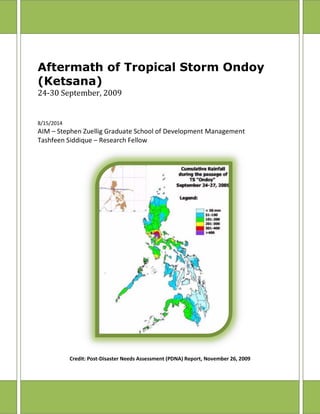
Credit: Post-Disaster Needs Assessment (PDNA) Report, November 26, 2009
2. Aftermath of Tropical Storm Ondoy
Tashfeen - Research Fellow i
Table of Contents
Acronyms and Abbreviations:...................................................................................................... iii
Overview..............................................................................................................................................1
Chronology of Typhoon Ondoy .....................................................................................................4
Public Advisories and Evacuation.................................................................................................9
Climatology / Science....................................................................................................................12
Effects and Damages.....................................................................................................................13
Affected Population.....................................................................................................................13
Casualties ......................................................................................................................................13
Damages........................................................................................................................................14
Metro Manila or National Capital Region..................................................................................14
Marikina City.................................................................................................................................15
Quezon City ..................................................................................................................................18
Caloocan City................................................................................................................................20
Pasig City.......................................................................................................................................21
Metropolitan Manila Development Authority (MMDA)......................................................23
Manila City.....................................................................................................................................25
Common Findings from the interviews ....................................................................................25
Disaster Management and Response........................................................................................26
Role of Media....................................................................................................................................28
Recommendations ..........................................................................................................................29
Conclusion.........................................................................................................................................31
Annexures..........................................................................................................................................I
Annex: I - Public Storm Warning Signals (PSWS)...............................................................I
Annex: II – Warnings issued by PAGASA..............................................................................II
Annex: III – PAGASA Services.................................................................................................III
Bibliography ...................................................................................................................................IV
Special Thanks ..............................................................................................................................VI
3. Aftermath of Tropical Storm Ondoy
Tashfeen - Research Fellow ii
List of Figures
Figure 1 : Image courtesy of BBC News, article written by Mr. Alastair Leithead, BBC News, Manila.........................2
Figure 2 : Image Courtesy of NASA, Hurricanes/ Tropical Cyclones, image showed the amount of rain dropped by
typhoon Ketsana ....................................................................................................................................................3
Figure 3: Credit to NASA, NASA's Aqua satellite AIRS instrument captured 17W just east of the northern Philippines,
poised for landfall. The purple areas indicate strong thunderstorms with cold cloud tops, colder than -63F..............5
Figure 4 : Credit: US Navy/Joint Typhoon Warning Center/NASA, Satellite image showed the center of circulation
just to the east of the northern Philippines..............................................................................................................5
Figure 5 : Track of Typhoon Ketsana/Ondoy, Japan Meteorological Agency, Annual Report on the Activities of the
RSMC Tokyo -Typhoon Center 2009 ........................................................................................................................7
Figure 6: Track of Typhoon Ondoy – Provided by PAGASA-DOST .............................................................................8
Figure 7 : Image taken from the final report of NDCC on typhoon Ondoy.................................................................8
Figure 8 : Metro Manila Map, Credit: Philippine ZIP Codes Directory..................................................................... 14
Figure 9: Graph showed the water level during Ondoy, Credit to Marikina City: Image taken from the Presentation
on Ondoy Vs. Habagat.......................................................................................................................................... 15
Figure 10: Red shows highest flood level areas, Credit to Marikina City: Image taken from the Presentation on
Ondoy vs. Habagat............................................................................................................................................... 16
Figure 11: Flood affected areas due to TS Ondoy; Image Credit to QC Hazards, Vulnerability and Risk Assessment
Report.................................................................................................................................................................. 19
Figure 12: Caloocan City location in MM, Map courtesy of Wikipedia .................................................................... 20
Figure 13: Pasig City Map, Credit: Pasig City DRRMO............................................................................................. 22
Figure 14: Four distinct thematic areas for sustainable development; Image credit to: MMDRRMC presentation by
Ms. Susana M. Cruz, Regional Director, OCD-NCR ................................................................................................. 24
List of Tables
Table 1 : Ketsana details from Japan Meteorological Agency, Annual Report on the Activities of the RSMC Tokyo -
Typhoon Center 2009..............................................................................................................................................6
Table 2 : Damages and Destruction details; the table is created on the basis of data provided by NDCC/ NDRRMC
and PAGASA......................................................................................................................................................... 13
Table 3: Humanitarian Assistance to Ondoy and Pepeng; Table from NDCC final report on TS Ondoy and TY Pepeng
............................................................................................................................................................................ 27
Table 4 : Damages or losses cost along with finance required for recovery and reconstruction, Table adapted from
Post disaster Needs Assessment (PDNA) report of Nov 26, 2009 ............................................................................ 27
4. Aftermath of Tropical Storm Ondoy
Tashfeen - Research Fellow iii
Acronyms and Abbreviations:
CAR Cordillera Administrative Region
DRRMO Disaster Risk Reduction and Management Office
Kph Kilometers per hour
LPA Low Pressure Area
LGU Local Government Unit
Mph Miles per hour
MM Metro Manila
MMDA Metropolitan Manila Development Authority
NASA National Aeronautics and Space Administration
NCR National Capital Region
NDCC National Disaster Coordinating Council
NDRRMC National Disaster Risk Reduction and Management Council
PAR Philippine Area of Responsibility
PSWS Public Storm Warning Signal
PDNA Post Disaster Needs Assessment
PAGASA Philippine Atmospheric, Geophysical and Astronomical Services Administration
QC Quezon City
STS Severe Tropical Storm
TD Tropical Depression
TS Tropical Storm
TY Typhoon
UTC Coordinated Universal Time
5. Aftermath of Tropical Storm Ondoy
Tashfeen - Research Fellow 1
Aftermath of Tropical Storm Ondoy (Ketsana)
24-30 September, 2009
Overview
About five year have been passed since the typhoon or tropical storm Ondoy hit the
entire areas of Philippines but still painful rainfall memories are still active in the
minds of common people and specifically affectees. The fears of this catastrophe
have griped their soul in such a way that they take every normal routine continuous
rain as an indication of another Typhoon ondoy which may bring irreparable loss to
their lives and property like the previous one. In the year 2009, twenty-two tropical
cyclones formed over the Western North Pacific and South China Sea. The tropical
cyclones (TC) season began in May with the formation of TC Kujira, which formed
east of the Philippines and moved northeastward to the southeast of Japan. Out of
these twenty-two TC, twelve formed in the month of August and September
including typhoon Ondoy1
.
Although typhoons are not new for the people of Philippines but every typhoon
which bang the various provinces of the country generally bring fresh challenges
and dimensions that have not been experienced before like Typhoon Frank brought
flash floods with unexpected amount of thick mud, typhoon Pablo surfaced with
both heavy rains and strong winds, typhoon Yolanda came up with six land falls and
powerful strong winds. Likewise, typhoon Ondoy (International name “Ketsana”)
poured rain equal to one month in a single day, resulting in substantial flooding and
it affected almost everyone. Some of the articles and news clips depicting the
devastation caused by this typhoon are elucidated below:
Philippines Daily Inquirer reported about rainfall and its effects in a news
clip titled “Too much rain too soon - Months’ worth of rain; storm Ondoy
kills 40” on 27th
September, 2009
“Nearly a month’s worth of rain fell in just six hours over Metro Manila Saturday,
triggering the worst floods in nearly 40 years, stranding people on rooftops, causing
wide-spread blackouts and killing at least 40 people, officials said.
In my experience, this is the worst that I have seen, Defense Secretary Gilbert
Teodoro said as he described how authorities grappled to deploy limited resources
amid a barrage of pleas for help after Storm ?Ondoy? Slammed ashore.
The government declared a state of calamity in Metro Manila and 25 provinces in
Luzon as the massive flooding paralyzed businesses and transportation. The
1
(Japan Meteorological Agency, 2009)
6. Aftermath of Tropical Storm Ondoy
Tashfeen - Research Fellow 2
calamity declaration allows officials to withdraw emergency money for relief and
rescue”2
.
According to BBC News published on 29th
September, 2009:
“BBC's Alastair Leithead in Manila says the rescue operation is now focusing on
getting supplies to those who have been displaced. Ketsana, with winds of up to
100km/h (62mph),
hit the Philippines
early on Saturday,
crossing the main
northern Luzon
island before
heading out toward
the South China
Sea.
Over the weekend,
the government
declared a "state of
calamity" in Manila
and the 25 storm-
hit provinces,
including many that
have not
experienced
widespread flooding
before, allowing
access to
emergency funds.
Officials say more
than 40cm (16in) of rain fell on Manila within 12 hours on Saturday, exceeding the
39cm average for the whole month of September”3
.
CNN highlighted the event in the following words on 27th
September, 2009:
“(CNN) -- Downpours subsided temporarily in the Philippines on Sunday, a day after
Tropical Storm Ketsana pummeled the capital Manila with its heaviest rainfall in
2
(Philippine Daily Inquirer, 2009)
3
(BBC News , 2009)
Figure 1 : Image courtesy of BBC News, article written by Mr. Alastair Leithead, BBC News,
Manila
7. Aftermath of Tropical Storm Ondoy
Tashfeen - Research Fellow 3
Figure 2 : Image Courtesy of NASA, Hurricanes/ Tropical Cyclones, image showed
the amount of rain dropped by typhoon Ketsana
more than 40 years. More than 80 percent of the capital was under water that
swallowed whole houses and buses.
Though the Philippines are no stranger to floods, Saturday's downpours approached
a record, with a month's worth of rain falling within six hours.
The average rainfall for the entire month of September is 391 mm (15.4 inches),
said Gilberto Teodoro, secretary of national defense and chairman of the National
Disaster Coordinating Council.
The capital experienced 341 mm (13.4 inches) between 8 a.m. and 2 p.m., he
said.”4
Relief Web International, a specialized digital service of the United Nations
Office for the Coordination of Humanitarian Affairs (OCHA) described the
situation in the following words on 29th
Sep, 2009:
“Tropical Storm "Ketsana," locally known as "Ondoy," swept across metro Manila
and parts of Central Luzon on Saturday, September 26, 2009, and brought a
month's worth of rain in just 12 hours. The waters rose so fast that people living in
low lying areas were caught unaware and had to stay on the roofs of their houses
to avoid being swept away by the floods. At least 140 died from the storm, and
more than 450,000 people have been displaced and have sought shelter in schools,
churches and other
evacuation shelters”5
.
The National Aeronautics
and Space Administration
(NASA), an agency of the
United States
government defined the
situation of flooding and
rain fall on 1st
October,
2009:
“According to the Philippine
Atmospheric Geophysical
Astronomical Services
Administration (PAGASA),
Ketsana dropped 17.9
inches (455 mm) of rain in
4
(CNN.com/asia , 2009)
5
(Presbyterian Disaster Assistance, 2009)
8. Aftermath of Tropical Storm Ondoy
Tashfeen - Research Fellow 4
Manila in just 24 hours on Saturday, September 26.
The TRMM(Tropical Rainfall Measuring Mission)-based, near-real time Multi-satellite
Precipitation Analysis (TMPA) at the NASA Goddard Space Flight Center, Greenbelt,
Md. is used to monitor rainfall over the global Tropics. TMPA rainfall totals for the 7-
day period 21 to 28 September 2009 for the northern Philippines and the
surrounding region showed that the highest rainfall totals occurred south of the
storm's track in an east-west band over central Luzon that includes Manila.
Amounts in this region are on the order of 375 mm (~15 inches) to over 475 mm
(~19 inches). The highest recorded amount from the TMPA near Manila was 585.5
mm (almost 24 inches)”6
.
World Bank report titled “Philippines - Typhoons Ondoy and Pepeng: post-
disaster needs assessment (Vol. 1 of 3)”, Report number: 64628, released
on 23rd
September, 2011 described the situation as follows:
“Tropical storm Ondoy (international name Ketsana) hit the Philippines on
September 26, 2009, causing widespread flooding. Ondoy, the equivalent of a
Category I storm, brought an unusually high volume of rain which inundated the
central part of Luzon. During the 12-hour period starting at 8:00 am on September
26, the rainfall was recorded as approximately 450 mm at the Manila Observatory,
an extremely rare occurrence. In turn, these intense rains generated high flooding
in the Marikina River that exceeded the river’s carrying capacity. Ondoy caused
extensive flooding in the Metro Manila area and the neighboring Rizal province,
including the cities of Antipolo, Makati, Malabon, Marikina, Muntinlupa, Pasig,
Quezon, San Juan, Taguig, and Valenzuela”7
.
There are several other reports and articles evidences about the extra ordinary
amount of rain brought by typhoon ondoy which results in massive flooding and
incurred heavy losses to infrastructure and agriculture.
Chronology of Typhoon Ondoy
Typhoon ondoy (International Name Ketsana) was identified as tropical depression
early in the afternoon of 24th
September, 2009. The chronology of the event was
reported by different Meteorological and weather agencies with the forecast of
heavy rains.
6
(National Aeronautics and Space Administration (NASA) , 2009)
7
(The World Bank, 2011)
9. Aftermath of Tropical Storm Ondoy
Tashfeen - Research Fellow 5
Figure 4 : Credit: US Navy/Joint Typhoon Warning Center/NASA, Satellite image
showed the center of circulation just to the east of the northern Philippines.
Figure 3: Credit to NASA, NASA's Aqua satellite AIRS instrument captured 17W just
east of the northern Philippines, poised for landfall. The purple areas indicate strong
thunderstorms with cold cloud tops, colder than -63F
According to National Aeronautics and Space Administration (NASA)
website:
“NASA's Aqua satellite
Atmospheric Infrared
Sounder (AIRS)
instrument captured
17W just east of the
northern Philippines on
September 24 at 1:29
p.m. as it was poised for
landfall. The purple
areas indicate strong
thunderstorms with cold
cloud tops, colder than
-63F.
The U.S. Navy's Joint
Typhoon Warning Center
forecast said "The
system will continue to
track generally
westward towards
Luzon, making landfall
shortly after [1 p.m.
EDT Sept. 26]. The [low
level center of
circulation] is expected
to weaken some, but
improved upper level
[atmospheric] conditions
and favorable sea
surface temperatures
will promote re-
intensification as the low
level center of
circulation emerges into
the South China Sea."
After that, 17W will
continue to track
westward towards
10. Aftermath of Tropical Storm Ondoy
Tashfeen - Research Fellow 6
Table 1 : Ketsana details from Japan
Meteorological Agency, Annual Report on the
Activities of the RSMC Tokyo -Typhoon Center
2009
Vietnam and strengthen in the warm waters in the Gulf of Tonkin.
At 15:00 UTC (1 p.m. EDT) on September 25, the center of 17W was located
approximately 330 nautical miles east of Manila, Philippines, near 14.6 north and
126.1 east. It had maximum sustained winds near 35 mph, and was moving west-
northwest near 10 mph. It was generating waves as high as 12 feet, so the east
facing shores of the northern Philippines can expect heavy surf and beach erosion,
accompanied by gusty winds and downpours.
Ketsana maintained minimal tropical storm intensity as it crossed central Luzon on
the afternoon of the 26th (local time). The main deluge in the Manila area, located
on the western side of Luzon, began around 8:00 a.m. local time (00 UTC
September 26) even though the center of Ketsana had yet to make landfall on the
eastern side of the island. A record 13.43 inches of rain fell in Manila in the 6 hours
between 8:00 a.m. and 2:00 p.m. local time, which is equivalent to about a
month's worth of rain for the area.
On September 28 at 1500 Zulu Time (11 a.m. EDT), Ketsana (Ondoy or 17W)
had moved into the South China Sea and strengthened into a typhoon. Ketsana had
maximum sustained winds near 90 knots (103 mph). It was located about 200
nautical miles east of Hue, Vietnam, near 16.2 norths and 110.6 easts. It was
moving west-northwest near 10 mph, and
generating waves 26 feet high.
By 10 p.m. local time on September 29, the
center of Ketsana had moved inland and was
located 70 miles south of Hue, Vietnam, near
the border of Vietnam and Cambodia. The storm
was weakening quickly. It was still moving
westward near 13 mph and is expected to
dissipate sometime late on Wednesday, 30th
September8
”.
Japan Metreological agency has shared the
track and movement of typhoon Ondoy
(Ketsana) in their Annual report on the
activities of the RSMC Tokyo- Typhoon
Center 2009 in the following words:
“Ketsana formed as a tropical depression (TD)
east of the Philippines at 00 UTC on 25
8
(National Aeronautics and Space Administration (NASA) , 2009)
11. Aftermath of Tropical Storm Ondoy
Tashfeen - Research Fellow 7
September 2009 and moved westward for the whole of its existence. It was
upgraded to tropical storm (TS) intensity at 00 UTC on 26 September just before
crossing Luzon Island. Moving westward over the South China Sea, it was
upgraded to typhoon (TY) intensity at 06 UTC on 28 September, reaching its peak
intensity with maximum sustained winds of 70 knots and a central pressure of 960
hectopascal (hPa). Ketsana hit Vietnam the next day with strength almost
equivalent to its peak intensity, then weakened rapidly and was downgraded to TD
intensity at 06 UTC on 30 September before dissipating 18 hours later”9
.
Figure 5 : Track of Typhoon Ketsana/Ondoy, Japan Meteorological Agency, Annual Report on the Activities of the RSMC
Tokyo -Typhoon Center 2009
The Weather forecasting Section of Philippine Atmospheric, Geophysical
and Astronomical Services Administration (PAGASA) summaries the
timeline of typhoon Ondoy as follows:
9
(Japan Meteorological Agency, 2009)
12. Aftermath of Tropical Storm Ondoy
Tashfeen - Research Fellow 8
Figure 6: Track of Typhoon Ondoy – Provided by PAGASA-DOST
Figure 7 : Image taken from the final report of NDCC on typhoon
Ondoy
“It developed inside the
Philippine Area of Responsibility
(PAR) from the active LPA east
of Luzon and gradually moved
westward towards Aurora-
Quezon Area. Prior from its
landfall, “ONDOY”, intensified
into a tropical Storm 130 km
Northeast of Virac,
Catanduanes. It continued
moving more to the west and
made landfall over the
boundary of Aurora and Quezon
at approximately 11 AM of
Sept. 26 then it crossed Central
Luzon for almost 10 hours
causing heavy downpour over
the Metropolis and some parts
of Central and southern Luzon
resulted to flashfloods and
landslides over these areas. After
crossing central Luzon, it continued moving farther away as it intensified further
over the South China Sea and exits the western border towards Vietnam”10
.
The Final report developed by National Disaster Coordinating Council
(NDCC) on Tropical
Storm“Ondoy” (Ketsana) and
Typoon “Pepeng” (Parma)
reported the timeline of the
track in the country as follows:
“24th
Sept, 2009 – a low pressure
area, east of Luzon developed into
a Tropical Depression (TD) and was
named “Ondoy”.
25th
Sept, 2009 – TS Ondoy
maintained its strength as it moved
closer to the west northwest in the
general direction of Central and
10
(PAGASA-DOST, 2009)
13. Aftermath of Tropical Storm Ondoy
Tashfeen - Research Fellow 9
Northern Luzon and intensified into a tropical storm as it moved towards Aurora-
Isabela area. PAGASA highlighted the occurrence of flashfloods and landslides.
26th
Sept, 2009 –accelerated further as it moved closer to Central Luzon, made its
landfall at 9:00 AM near the boundary or Aurora and Quezon, crossed Central Luzon
area for 12 hours and moved off the Coast of Zambales.
27th
Sept, 2009 – exited out of the country over the western border of PAR (South
China Sea). Its maximum center winds was 105 kph with gustiness of 135 kph
while its movement from 11 to 19 kph”11
.
Almost all the National and International agencies have reported the event more or
less in the same way. PAGASA have their own forecasting equipments installed and
as a member of World Metreological Organization they are linked with metrological
or weather agencies around the world and get updates or forecast about weather
disturbances. PAGASA is also responsible for giving timely advisories or alerts in
case of weather disturbances to safe the people from natural hazards.
Public Advisories and Evacuation
There are evidences available that PAGASA have issued warnings about rainfall and
flash floods at the time of typhoon Ondoy but they are not aware with the
magnitude of rainfall. The highest Public Storm Warning issued by PAGASA was
PSWS # 2 which means that disaster agencies /organizations concerned must act at
once to alert their communities12
(See: Annex-I). No one even PAGASA or
International Meteorological agencies have expected such large scale of rains,
therefore, they have given usual forecast of heavy rains.
National Aeronautics and Space Administration (NASA) have verified the
issuance of warnings by PAGASA on 25th
September, 2009 in their website
clip:
“Tropical depression 17W formed in the Philippine Sea very early today, September
25, and its forecast track takes it across the northern Philippines this weekend. The
Philippine government has designated the storm as Tropical Depression "Ondoy."
Warnings have already been posted in the Philippines today. Public storm warning
signal number 1 is already in effect in the Philippines provinces of: Albay, Burias
Island, Quezon, Marinduque, Rizal, Bulacan, Aurora, Nueva Ecija, Nueva Vizcaya,
Quirino, Isabela. Public storm Public storm warning signal number 2 is raised in the
11
(National Disaster Coordinating Council (NDCC), 2009)
12
(PAGASA-DOST, 2012)
14. Aftermath of Tropical Storm Ondoy
Tashfeen - Research Fellow 10
following Philippines provinces: Catanduanes, Camarines Norte & Sur, Polillo
Island”13
.
Philippine Daily Inquirer article titled “Floods submerge Metro Manila
areas” published on 26th
September, 2009 discussed about the warnings in
the following words:
“PAGASA raised storm signal warning number 2 over Aurora, Quirino, Nueva
Vizcaya, Nueva Ecija, Pangasinan, Tarlac, Zambales, Pampanga, Bulacan, Rizal,
Northern Quezon and Polillo Island.
Storm warning signal number 1 was hoisted over Isabela, Mountain province,
Ifugao, Benguet, La Union, Ilocos Sur, Laguna, Cavite, Batangas, Mindoro
Provinces, Lubang Island, Marinduque, Camarines Norte, Bataan, Metro Manila and
the rest of Quezon Province. Ondoy was expected to enhance the southwest
monsoon and bring rains over Central and Southern Luzon and parts of Visayas,
PAGASA said”14
.
The unexcepted amount of rain broke all the previous records.
On the release issued on 28th
September by NASA, they quoted the words
of PAGASA administration:
“Tropical Depression 17 W, now named Ketsana, and also named Ondoy in the
Philippines, dumped record-breaking rainfall there over the weekend. PAGASA, the
Philippine Atmospheric, Geophysical and Astronomical Services Administration
noted the total rainfall on Saturday from 8 a.m. to 2 p.m. surpassed the highest
24-hour rainfall that the weather bureau recorded back in June 1967 for Manila.
The rainfall generated from Ondoy (Ketsana) during its first six hours over land
measured 13.43 inches (341 millimeters). The old record from 42 years ago was
334 millimeters in 24 hours. NASA's Tropical Rainfall Measuring Mission (TRMM)
satellite data confirmed the rainfall from its orbit in space”15
.
Another news clip described that Ondoy dumped more rain then Katrina,
published by Philippine Daily Inquirer on 27th
September, 2009
“"Katrina" was no match to "Ondoy." The 15th weather disturbance that hit the
Philippines in 2009 dumped a total of 455 millimeters of rain in Quezon City alone
in 24 hours, compared to the 250 millimeters of rain that Hurricane Katrina brought
to New Orleans in Louisiana in the United States in 2005.
13
(National Aeronautics and Space Administration (NASA) , 2009)
14
(Philippine Daily Inquirer, 2009)
15
(National Aeronautics and Space Administration (NASA) , 2009)
15. Aftermath of Tropical Storm Ondoy
Tashfeen - Research Fellow 11
This was the report presented to President Gloria Macapagal-Arroyo by Dr. Prisco
Nilo, the chief of the Philippine Atmospheric, Geophysical, and Astronomical
Services Administration (PAGASA) at a briefing of the National Disaster
Coordinating Council (NDCC) in Camp Aguinaldo on Sunday”16
.
The warnings issued only to make them alert or” Be Ready” but no warning or alert
for the evacuation (see the warning details issued by PAGASA in Annex-II). The
evacuation took place only when the flood water start rising or enter into the
houses. Most of the people protected their lives by moving on the rooftops of their
houses.
BBC News reported about the situation on 29th
September, 2009:
“Public buildings including schools, universities and the presidential palace have
become relief centers.
"Evacuees will be given shelter in available areas among the Malacanang [palace]
buildings and in tents that will be put up in between the buildings," Philippines
President Arroyo said in a statement announcing the opening of the palace
compound.
She said that if required, palace employees would "yield their work stations to
provide more space for our displaced countrymen", and that she had temporarily
moved her office to another section of the compound along the Pasig river.
After word of the offer spread, hundreds of people converged on the palace and
received plastic bags filled with noodles and canned sardines”17
.
The situation reported by Philippine Daily Inquirer on 27th
September,
2009 as;
“By Sunday afternoon, the helicopters and boats had rescued more than 5,000
people, but many others were frantically waiting for help while battling thirst and
hunger.
"If you are on the roof, don't try to leave. Just remain there and we will do
everything to rescue you," Defense Secretary Gilberto Teodoro said in a radio
broadcast”18
.
The evacuation occurred only when flood reached to roof level and most of the
areas went under water. According to the final report of NDCC; 244 evacuation
16
(Philippine Daily Inquirer, 2009)
17
(BBC News , 2009)
18
(Philippine Daily Inquirer, 2009)
16. Aftermath of Tropical Storm Ondoy
Tashfeen - Research Fellow 12
centers established in the country with 15,798 families / 70,124 persons stayed
inside the evacuation centers19
. The unpredicted amount of rainfall affected the life
of all irrespective to rich and poor reported by Philippine daily Inquirer on 27th
September, 2009.
“The epic flood caused by Typhoon Ondoy in Metro Manila became the great
equalizer as rich and middle-class residents fled their homes for safety, turning into
"evacuees" themselves.
Joey Salgado, chief of Makati's public information office, said his family took only
their dogs and a few belongings with them as they left their three-story house in
Northview 2 in Quezon City at 3 p.m. Saturday.
"By the time we left, malapit na sa second floor yung baha (the flood was near the
second floor). This rarely happened in our area. All the neighbors were surprised
because this is a middle-class subdivision," he said, adding that their village was
usually spared despite being near the Marikina River”20
.
Climatology / Science
Nature cannot be predictable; everything unexpected can be happened without any
time. National Aeronautics and Space Administration (NASA) explained the science
behind remarkable rainfall in a day in their issue of 29th
September, 2009;
“The reason for the enhanced rainfall over on the Manila-side of the island as the
storm approached was the interaction between Ketsana's low-level circulation and
the seasonal southwest monsoon. The southwest monsoon comes about from the
summertime heating of the Asian landmass. As warm air rises over the continent it
induces low pressure as the surface, which draws air in from surrounding regions.
The southwest monsoon typically runs from June to September in the Philippines
and draws warm, humid air up from the southwest across the South China Sea and
into the islands where it can interact with the topography. Ketsana's
counterclockwise circulation enhanced the effect, which resulted in the torrential
rains”21
.
Typhoons or Tropical cyclones are dangerous due to the hazards attached with
them like Strom Surges, landfalls, strong winds, heavy rains / floods, Landslides,
mud flows and mud slides which results in destruction of lives and properties.
According to Mr. David Michael V. Padua, Sr. Typhoon Specialist of
Meteomedia Philippines Corporation;
19
(National Disaster Coordinating Council (NDCC), 2009)
20
(Philippine Daily Inquirer, 2009)
21
(National Aeronautics and Space Administration (NASA) , 2009)
17. Aftermath of Tropical Storm Ondoy
Tashfeen - Research Fellow 13
Table 2 : Damages and Destruction details; the
table is created on the basis of data provided by
NDCC/ NDRRMC and PAGASA
“The fantastic energy of a Tropical Cyclone is remarkable! Consider for example,
that an ordinary afternoon thunderstorm (which lasts for 1 to 2 hours) has the
energy equivalent of about 13, 20-kiloton atomic bombs. Now, a small typhoon
carrying winds of 120 kph has an energy equivalent of almost 500,000 atomic
bombs, or about 6 atomic bombs per second! A typhoon also releases about 20
billion tons of water.
So, if you have a tropical cyclone like Super Typhoon REMING (Durian) of
November 30, 2006 where its peak winds topped 250 kph, its equivalent energy
was estimated about 1 million atomic bombs! Just imagine!”22
Effects and Damages
The extra ordinary amount of rainfall caused record
flooded and initially almost all the media agencies
and other relevant authorities discussed about the
high number of displaced persons but eventually
the final number of internally displaced persons
reduced to only 37 reported by NDCC23
.
Affected Population
The National Disaster Coordinating Council (NDCC),
an agency of the Philippine government under the
Department of National Defense responsible for
ensuring the protection and welfare of people
during disasters or emergencies represented the
following information in their final report which is
considered as most esthetical;
According to their report a total of 993, 227
families / 4,901,234 persons were affected in 2,018
barangays, 172 municipalities, and 16 cities of 26
provinces in 12 regions24
. See Table 2
Casualties
There were 464 deaths, 529 injured and 37 missing
as the result of typhoon Ondoy25
.
22
(David Michael V. Padua, 2012)
23
(National Disaster Coordinating Council (NDCC), 2009)
24
(National Disaster Coordinating Council (NDCC), 2009)
25
(National Disaster Coordinating Council (NDCC), 2009)
Ondoy
(Ketsana)
464
529
37
Totally
Damaged
30,082
Partially 154,922
Total 185,004
Families 993,227
Persons 4,901,234
Barangays 2,018
Municipalitie
s
172
Cities 16
Provinces 26
Evacuation
Centers
244
Families 15,798
Persons 70,124
4,299,000,000
6,669,000,000
11,000,000,000
Agriculture
Total (Infra & Agri)
Missing Persons
(IDP’s)
HousesAffectedEvacuted
Infrastructure
Deaths
Injuries
Details
18. Aftermath of Tropical Storm Ondoy
Tashfeen - Research Fellow 14
Figure 8 : Metro Manila Map, Credit: Philippine ZIP Codes
Directory
Damages26
Typhoon Ondoy caused an estimated loss of Php11 Billion to both infrastructure and
Agriculture with a breakdown of Php4.299 Billion to infrastructure including schools
and health facilities and Php6.669 Billion to agriculture and livestock. A total of
1,382 school buildings were damaged. The total number of damaged houses were
185,004 (30, 082 totally and 154,922 partially damaged). Agriculture and livestock
was also badly affected by Ondoy and a total number of 203,477 hectares incurred
losses of about 329.230 MT of crops (rice, corn, high value commercial crops).
NDCC also reported that at the peak time of storm, there were 57 road sections
rendered impassable either to light vehicles and or all types of vehicles in Regions
II, III, IV, CAR and NCR due to eroded shoulders, floodwaters and landslides. Thirty
Seven (37) road sections in Metro
Manila were not secure for light
vehicles due to flooding. Isabela –
Cabagan –Sta Maria Overflow Bridge in
Sta Maria was not drivable due to
swollen Cagayan River. Nueva Viscaya
– Daang Maharlika 255+500 km Abian
Section bambang – one lane was not
safe for journey due to landslide and
eroded shoulders.
Metro Manila or National
Capital Region
The enhanced southwest monsoon
brought about by TS Ondoy caused
widespread floodings in almost all parts
of Metro Manila. Almost 80% of metro
Manila was affected due to severe
floods.
According to NDCC final report on
typhoon Ondoy; a total of 239
barangays in Metro Manila were flooded
with a break down; Pasig City (28,836),
Quezon City (22,966), Manila City
(21,118), Caloocan City (18,110),
Muntinlupa City (16,560) and Marikina
26
(National Disaster Coordinating Council (NDCC), 2009)
19. Aftermath of Tropical Storm Ondoy
Tashfeen - Research Fellow 15
City (15,631 houses or families affected). The most heavily affected by flood waters
ranging from knee / neck to roof top deep27
.
In one of the presentations provided by Mr. Robert Z. Quinto, Senior Weather
Specialist, PAGASA identified the causes of flooding and destruction in Metro Manila
as; Insufficient carrying capacities of Marikina, Pasig rivers, Manggahan floodway &
Napindan Channel, Uncontrolled development, deforestation, Informal settlers, and
Insufficient response28
.
The glimpse of interviews of the relevant stakeholders conducted in Metro Manila to
gather the details about level of preparedness and response observed by various
agencies during and after the crisis of typhoon ondoy is given as under:-
Marikina City
Ms. Kristin M. Roxas
Officer –In charge
Marikina City Disaster Risk Reduction
&Management Office (MCDRRMO),
Office of Civil Defense, Marikina City
Ph. # (632) 646 -0427
Mr. Rameses E. Mendoza
Operations & Warnings Supervisor
Marikina City Disaster Risk Reduction &
Management Office (MCDRRMO),
Office of Civil Defense, Marikina City
Ph # (632) 646-0427
Email: mcdrrmo@marikina.gov.ph
Mr. Mendoza employee of call center during the time of typhoon ondoy September,
2009, while recalling his
memories told that there
was continuous rain and
in the afternoon of
September 26, 2009 he
found that water level in
his street start rising.
Then, he visited the river
which start swallowing
the nearby houses. He
usually went to office in
the afternoon but due to
heavy rain he did not
able to attend his office.
Till evening the water
level reached above chest
in his street which is not normally flooded due to heavy rains. The water color was
dark black at the beginning which looked like overflow from drainage lines but when
the water from Marikina river entered into his street turned the water color to
brown. His house was also flooded; he and his family safe their lives by moving to
the second floor.
27
(National Disaster Coordinating Council (NDCC), 2009)
28
(PAGASA- DOST, 2009)
Figure 9: Graph showed the water level during Ondoy, Credit to Marikina City:
Image taken from the Presentation on Ondoy Vs. Habagat
20. Aftermath of Tropical Storm Ondoy
Tashfeen - Research Fellow 16
No one was aware about the
flood and there was no
preparation at that time told
by Mr. Mendoza. People start
shifting to nearby schools by
their own but later the schools
were also got flooded. On 27
September at around 3 AM,
the water start subsiding and
there was one inch mud left in
all over the city. Marikina city
consists of 16 barangays and
out of these 14 are flooded.
80% of the population of
Marikina got affected and 90%
of the Govt. employees are
the victims of typhoon Ondoy.
18,642 houses damaged and
1500 people relocated outside
of the city. 68 deaths were
recorded and 14,724 persons
shifted to evacuation centers.
After typhoon Ondoy, the
residents of provident village
(most vulnerable village of
Marikina city) decided to
relocate and most of them sold their properties and shifted to safer areas. He
described that Marikina city was popular in the past due to its agricultural land and
now the agricultural land is only exist near the surroundings of river. There was no
pre-evacuation and the evacuation only took place during the flood. The office of
DRRMO was established in 2012 under the Philippine Disaster Risk Reduction and
Management Act of 2010. Earlier there was office of Rescue 161 but not active and
now Rescue 161 is working under DRRMO.
Mr. Mendoza also pronounced that there were reported looting incidences during
typhoon ondoy. It’s a usual practice here told by Mr. Mendoza that during
evacuation, every family left one house member in house (usually father) for the
security of their valuables. Now by law it’s allowed to do forced evacuation and
police is patrolling for protecting the valuables and properties of the evacuees of
the area.
He discussed the activities of DRRMO by stating that now they are well prepared to
deal with natural hazards as compared with the past. The rain, wind and flood
gauges are already installed in different locations of the city. They have a Siren
system which they usually test in dry weather on regular intervals as if they test
Figure 10: Red shows highest flood level areas, Credit to Marikina City: Image
taken from the Presentation on Ondoy vs. Habagat
21. Aftermath of Tropical Storm Ondoy
Tashfeen - Research Fellow 17
the siren in rainy weather then people get scared and they consider as an alert.
When the water level reach to 15 meters in Marikina river they used 1st
Alarm that
will continuous airing for 1 Minute; 2nd
Alarm is used on 16 meters of water level
with 2 minutes intermittent airing which means prepare to evacuate, 3rd
Alarm is
used to evacuate people to designated centers and used at 17 meters of water level
by 5 minutes of continuous airing and the fourth alarm is for 18 meters or above
water level with 5 minutes of continuous airing and for forced evacuation. During
evacuation they used Flood Emergency Evacuation Tag (FEET), one tag for a family
which usually helped them to make record of evacuates in evacuation centers.
Schools, gyms and some other buildings are identified as an evacuation centers but
the good thing is that unlike the other parts of the country they are doing the
inspection of the buildings before considering them as an evacuation center and
Infrastructure Audit team is responsible for that. Marikina city as part of “Alliance
7”- (Alliance of seven cities for proactive response to disasters) is now well
prepared to deal with natural hazards. Although, it is located over the fault line and
may move any time due to earthquake.
Marikina City Disaster Risk Reduction and Management office is continuous focusing
on four areas:
1) Prevention and Mitigation
2) Preparedness
3) Response
4) Recovery and Rehabilitation
MDRRMO is doing several activities under each focus area like in preparedness they
are doing trainings and capacity building for awareness raising on all levels of the
society i.e. Media, Schools, public and private sector and local community. Some of
the trainings includes; Basic Fire Fighting, First Aid, water safety & Rescue, incident
command system, Rescue and response trainings and many more. They also have
organized citywide earthquake drills.
Regarding response they have Central Communications and Control Center which is
fully equipped with latest technology. 100 High definition cameras are installed all
over the city, with one additional camera under the main Marikina river bridge to
monitor the water level. Further Mr. Mendoza discussed that they have Response
vehicles, heavy machinery, rescue equipment’s, Text Messaging Alert System
(TMAS) and Five Minutes Quick Response team which provide guaranteed response
(medical, fire, police and other assistance) within 5 minutes.
Marikina city won several awards and prizes like Healthy cities good practice award
2006, Best highly urbanized city Disaster Risk Reduction and Management Council
2013 and many more. At the end of discussion, Mr. Mendoza argued that although
they did so many things regarding disaster preparedness but they are unable to
promise that Marikina will be safe in case of natural hazards as there is Marikina
river and the whole city is located on fault line. He said our focus area is
preparedness with continuous trainings. Marikina Settlement office is guiding local
22. Aftermath of Tropical Storm Ondoy
Tashfeen - Research Fellow 18
community for construction of safe houses. They conduct seminars and meetings
with local community for safer or resilience designs of construction.
Interview: 12th
May, 2014, 9:45 to 11:00 AM
Quezon City
Mr. Pssupt Jesse J STO Domingo (Ret.)
Special Assistant to the QCDRRMC Action
officer
Department of Public order and Safety
Quezon City Disaster Risk Reduction and
Management Council (QCDRRMC)
Quezon City Hall Compound, Kalayaan
Avenue, Quezon City
Ph. #. (632) 927-5914, 988-4242 Loc 8038
Cell # (+63) 917-8250-656 (Globe)
(+63) 922-8750-027 (Sun)
Email: jessedomingo@yahoo.com
Mr. Karl Michael E. Marasigan
Special Assistant for Operation, QCDRRMC
Department of Public order and Safety
Quezon City Disaster Risk Reduction and
Management Council (QCDRRMC)
Quezon City Hall Compound, Kalayaan
Avenue, Quezon City
Ph. #. (632) 927-5914, 988-4242 Loc 8038
Cell # (+63) 917-5219-382 (Globe)
Email: marasigan.karl@yahoo.com
Mr. Domingo stated that although he was not working in DRRMC at the time of
typhoon ondoy but as a resident of Quezon City, he still remembered that there
was no preparation at that time. There were heavy rains but no one excepted such
a big amount of flooding in Metro Manila. Almost 80% of the Metro Manila was
under severe flooding and billions of Pesos loss caused by that typhoon.
The other reason he argued is that under the previous law the calamity funds can
only be used in case of natural calamity or disaster. Typhoon ondoy made it
possible to make changes in the law and the offices of Disaster Risk Reduction and
Management council are established under the law. Previously there was Disaster
Control division in Quezon City which was replaced by DRRMO.
According to Mr. Domingo; Quezon City has more than 3 Million populations with
highest number of informal settlers in Metro Manila. The LGU have given three
options to informal settlers for relocation. These include: off-site, on-site and near
site. LGU is constructing off-site houses for informal settlers which they get by
paying cost in small installments for 20-30 years. The LGU also bound informal
settlers to shift their house at-least ten meters away from the bank of the river. He
further argued that some LGU’s are compromising if someone moves to 3 meters
far from the river bank but there are so many ongoing programs to protect informal
settlers from natural disasters.
Quezon City consists of 142 Barangays and there are three rivers passing from the
city i.e. Tullahan, Marikina and San Juan river. Quezon City also has a largest
water reservoir “La Mesa Reservoir” which is the source of drinking water for 80%
of the Metro Manila said by Mr. Domingo. Out of 142 barangays, 15 are located
near the bank of the rivers with a break down i.e. 9 barangay with Tullahan river, 2
Marikina and 4 barangays with San Juan river. 40% of the flood prone barangays
have retaining or flood control wall and there are some on-going projects also.
23. Aftermath of Tropical Storm Ondoy
Tashfeen - Research Fellow 19
Almost all the barangays have Barangay Disaster Risk Reduction and Management
Committees with a group of trained volunteers.
Mr. Domingo further discussed that as compared to 2009 now the Quezon City is
better prepared and we are continuously focusing on preparedness trainings. Early
warning systems are installed, Evacuation protocols are in place and evacuation
centers are identified. A state of art multi-purpose evacuation center with a
Figure 11: Flood affected areas due to TS Ondoy; Image Credit to QC Hazards, Vulnerability and Risk Assessment
Report
24. Aftermath of Tropical Storm Ondoy
Tashfeen - Research Fellow 20
capacity of more than 1000 evacuees is under construction in Barangay Bagong
Silangan.
According to him; Department of Public Order and Safety (DPOS) have main
responsibility to control the traffic but they can be used as relief and rescue
workers as they are well trained. Further Quezon City has developed a Disaster Risk
Reduction and Management Plan 2014-2020 which is now in implementation phase.
The main objective of the plan is to make the Disaster Resilient City.
Finally, he discussed the future plans which include the installation of 500 High
definition CCTV cameras in strategic locations for criminology and traffic control,
Inspection of structural integrity of almost all the public and private buildings and
continuous trainings for preparedness and awareness rising.
Interview: 12th
May, 2014, 12: 45 to 2:15 PM
Caloocan City
Mr. Alex P. Nadurata
Local Disaster Risk Reduction &
Management officer
Caloocan City Disaster Risk Reduction &
Management Office (CCDRRMO)
Caloocan City
Ph. # (632) 310-7563 / 668-7142
Mr. Kareem Mohammad Sali RN
Emergency Medical Technician /
Consultant,North Caloocan Rescue
Caloocan City Disaster Risk Reduction &
Management Office (CCDRRMO)
Cell # (+63) 999-3574-332
Email: kreemylicious@yahoo.com
Mr. Kareem discoursed that the Caloocan City has two parts i.e. North and South.
North Caloocan is located on high laying
areas or up streams and considered as
more safe while the south is over
populated and located at low lying area.
According to him due to its geographical
location it is hardly affected by disasters.
Caloocan city consists of 188 barangays
and main city is located in south Caloocan.
He mentioned that Caloocan city have
more trees and less buildings as compared
to Manila and that is another reason of
less affected by disasters.
Mr. Kareem by profession is a Registered
Nurse and used to work with a private
ambulance company in Manila during the
time of typhoon ondoy. He described that
the north part of Caloocan city was not
affected due to Ondoy, it’s only the south
which got flooded due to poor sewerage
and garbage problem at that time but now
they have a proper drainage and regular
Figure 12: Caloocan City location in MM, Map courtesy of
Wikipedia
25. Aftermath of Tropical Storm Ondoy
Tashfeen - Research Fellow 21
garbage collection programs. The highest possible disaster for the city is the
earthquake, he discussed as they are far from the river.
Caloocan city Disaster Risk Reduction and Management office (CCDRRMO) has
recently been established in January, 2014, both in north and south. Earlier there
was Department of Public Safety and Traffic Management (DPSTM) and now the
rescue group from DPSTM became part of CDRRMO. CDRRM office in the north is
now in construction phase and they have a single small room office and according
to him they are mostly sitting outside of office as there is no space inside but in the
north they have a well-equipped office. Only one barangay in Caloocan city have
their own Barangay Disaster Risk Reduction & Management Committee (BDRRMC)
and the rest ones are in the planning phase.
According to Mr. Kareem now they are focusing mostly on preparedness and rescue
trainings and they have continuous training program at all levels. They have trained
volunteers group for relief and rescue operations. Mr. Kareem joined the CCDRRMO
as an Emergency Medical Technician, he has a passion to do work for his own area
and contribute his part for making the Caloocan city a resilient one.
Interview : 12th
May, 2014, 3:30 to 4:15 PM
Pasig City
Mr. Ritche Van C. Angeles
Local Disaster Risk Reduction &
Management Officer
Pasig City Disaster Risk Reduction
and Management Office (PCDRRMO)
Pasig City Hall, 8th
Floor, Caruncho
Avenue, Barangay San Nicolas, Pasig
City
Ph. # (632) 643-0000
Ms. Maricel M. Evangelista
DRRMO/C3 Admin
Pasig City Disaster Risk Reduction and Management
Office (PCDRRMO)
Pasig City Hall, 8th Floor, Caruncho Avenue,
Barangay San Nicolas,
Pasig City, Ph. # (632) 643-0000
Che-evangelista3010@yahoo.com.ph
Mr. Noel C. Perez
OIC- Pasig City Fire Brigade, Red Training Center, C. Raymundo Avenue caniogan,
Pasig City DRRMO-C3, Ph. # (632) 643-0000, Cell # (+63) 917- 501-2808
Email: No_el_gimiketo@yahoo.com, Redtrainingcenter@yahoo.com
Ms. Evangelista still remembered the devastations caused by typhoon Ondoy as she
was also one of the victims of that typhoon. She still remembered the date and
according to her it was the morning of 26th
September, 2009 when she looked
outside from a window of her house and got surprised that there was 3 ft. water in
the street and slowly it reach to above chest level. The water entered to her house
also with a level of above 3 feet. At that time she was living with her two small
children (having the age of 5 and 3) and her husband was working abroad. She
received call from her office to report immediately, so she shifted her children to
her Mother in law’s house which was flooded very little. Then she went to office by
walking in 4 to 5 ft. water. There was no preparation at that time and it happened
without any notice. They have seen heavy rains but not so much flood due to rain
26. Aftermath of Tropical Storm Ondoy
Tashfeen - Research Fellow 22
in the past so they are not prepared for that.
They tried to contact volunteers during flood but most of the volunteers are also the
victims of the typhoon ondoy. She said, at that time there were so many incidence
of looting and some people get benefit of the situation and charged high money for
shifting the people
from flood water
to safe areas.
Although, they
delivered flood
response trainings
even before the
typhoon Ondoy
but unable to
respond properly
due to its
devastation and
intensity. Luckily
there were very
few causalities
and injuries.
Ms. Evangelista
described the
current situation
of DDRRM office
which is fully
equipped with
latest technology
and trained
workers. They
have installed 165
High definition
CCTV cameras in
the strategic
locations of Pasig
city and
continuous
monitoring the
city, 90 additional
cameras are
installed in public elementary and high schools to provide more security to students
from harassment and other related crimes. All the CCTV cameras are linked with
fiber optic cable. Earthquake monitoring devices, Early warning systems, rain fall
gauges and flood monitors are also installed. PCDRRMO office is working 24/7 and
fully prepared to deal with hazards.
Figure 13: Pasig City Map, Credit: Pasig City DRRMO
27. Aftermath of Tropical Storm Ondoy
Tashfeen - Research Fellow 23
Further, Pasig city have implemented color coding alert system and alerts are
represented by four colors i.e. white alert used for normal situation, yellow means
standby or listen radio , blue- 50 % of the staff will stay ready and check all the
equipment, and red color alert is used for deployment of 100% man power and
resources means full force alert.
Ms. Evangelista also debated that the city started green initiatives and their city hall
is smoke free building. They are giving advices regarding green technologies.
Moreover they have the Green police who give violations receipts to smokers with
first warning then plenty. The activities of green police are supported by city
ordinance. City has a proper garbage collection office with a proper disposal or
dumping of garbage facility.
Pasig City consists of 30 barangays and western side of the city is located on fault
line. She discussed that they have big buildings that can be used as evacuation
centers and there sports complex have a capacity of more than 10,000 evacuees.
Some schools are also identified as an evacuation centers but schools are only used
as a last resort. Every Evacuation center has assigned team’s i.e. Health team,
rescuers group, volunteers group and monitoring & communications team. The
DRRM office has volunteers from all levels including the corporate or business
sector. They have a stock of V-Bags with all the necessary things in it i.e. soap,
shampoo, towel, toothpaste, brush etc... For the evacuees.
Ms. Evangelista also discussed that the city have no debts and they are relaying on
their own resources. The DRRM office has their own well equipped training center
called Red training center (Rescue Emergency Disaster Training Center). The
Training center offered ten different short courses on search and Rescue, Fire
Fighting, First Responder course, Technical Rope Rescue, first aid etc… It’s a first
quality training center in Metro Manila and delivering training to all neighboring
LGU’s.
There future plans includes; continuous trainings, adding state of the art
equipment’s, continuous and regular inspection of buildings and make Pasig a
resilient city. The city also helped other LGU’s during typhoon Yolanda and adapted
five cities affected by typhoon Yolanda.
Interview : 13th
May, 2014, 8:45 to 11:00 AM
Metropolitan Manila Development Authority (MMDA)
Mr. Pablo R. Bautista Jr.
Assistant Head, Flood Control Information Center
Metro Manila Disaster Risk Reduction and Management Council (MMDRRMC)
Metro Manila Development Authority, MMDA Building, EDSA Corner, Orense St. Guadalupe,
Makati City; Ph. # (632) 882 – 0925; Email: jhua_bautistajr@yahoo.com
According to Mr. Bautista, Flood control Information center and Metro Manila
Disaster Risk Reduction and Management office was established in 2011. The main
28. Aftermath of Tropical Storm Ondoy
Tashfeen - Research Fellow 24
task of flood control information center is to monitor the flooding of Metro Manila
(MM) and timely issue
the warnings to cities
and municipalities in
MM or National capital
region.
MM consists of 17 cities
with above 1700
barangays. Manila bay
is located in the west
corner of MM. During
typhoon ondoy, the
incident commander
was from MMDA and
they established the
incident command post
in Marikina city, as it
was the most affected
city of MM. MMDA
played the major role
in relief, rescue and
rehabilitation.
MM has upgraded the drainage system told by Mr. Bautista and they have installed
50 plus censors all over MM for monitoring the flood and water level with the help
of Department of science and Technology (DOST). For controlling the flooding,
total of 52 pumping stations present in MM. Out of these total, 25 are large
pumping stations. These pumping stations pumped the water from inland and
retained it in pond and then transferred it to Pasig River. Some pumping stations
throw water directly to Manila bay from the pond. Although the ponds exist during
typhoon ondoy but the amount of water was so much high that almost all the
pumps got flooded and unable to perform operations. 10 small Pumping stations
added after typhoon ondoy.
Additionally MMDA have installed 35 automated weather stations all over MM for
issuing timely weather updates. Mr. Bautista also discussed that MMDRRMC has
developed IEC materials for the guidance of LGU’s and they issue advises to LGUs
to avoid dumping of garbage near the river banks and keep the river or lakes clean.
MM have their own training center located at Napindan and they are continuously
providing trainings on preparedness, rescue and response. The mandate of MMDA is
to make MM more livable, free from flooding’s and disasters.
Interview : 13th
May, 2014, 11:30 to 12:30 PM
Figure 14: Four distinct thematic areas for sustainable development; Image credit to:
MMDRRMC presentation by Ms. Susana M. Cruz, Regional Director, OCD-NCR
29. Aftermath of Tropical Storm Ondoy
Tashfeen - Research Fellow 25
Manila City
Mr. Johnny G.YU
Local Disaster Risk Reduction &
Management Officer
Disaster Risk Reduction & Management
office (DRRMO)
102 Ground floor, Delpan Evacuation Center,
Delpan Street., Binordo, Manila city
Ph. # (632) 527 – 0984 / 527- 4939
Cell # (+63) 917-8589-337
Mr. Nigel S. Tabliago
Staff- DRRMO
Disaster Risk Reduction & Management
office (DRRMO)
102 Ground floor, Delpan Evacuation Center,
Delpan Street., Binordo, Manila City
Ph. # (632) 527 – 0984 / 527- 4939
Cell # (+63) 917-7834-323
Manila city Disaster Risk Reduction and Management office is located very far and
almost at the corner of the city in Delpan Evacuation center. Mr. Tabliago said that
this office is temporary and soon they will shift in the Manila city hall. DRRMO is
established on 27th
September, 2013 under the city ordinance 82 &23.
He further discussed that the former mayor of Manila have established two
evacuation centers one is in Delpan in which there office is currently located and
the other is in Baseco. DRRM office is equipped with latest technology and
equipment’s but due to its location they also faced problems in coordination. He
said his office is doing continuous trainings and already did Multi hazard study of
the city with the help of several donors. Now days they are planning to conduct city
wide multi hazard drill which possibly be organize in the month of July.
Manila city consist of 896 barangays and all have trained volunteers for relief and
rescue work. According to him they have identified all the possible disasters of the
city and now preparing the city to safe from all possible future hazards.
Interview : 13
th
May, 2014, 3:00 to 4:00 PM
Common Findings from the interviews
There were heavy rains but no one was prepared for the floods. The flood
level was mostly above chest to roof tops. It’s the first time that they
experienced massive floods. Most of the people safe their lives by climbing
over the rooftops.
Evacuation took place during or after flood. Even most of the evacuation
centers were flooded.
Rescuers and Govt. Servants were also become the victims of typhoon Ondoy
and unable to perform their functions well.
Inefficient or no timely warnings for the flood.
DRRM offices were established after typhoon Ondoy. The law restricted the
use of available calamity funds until and unless natural disaster actually
occurs which is amended after typhoon Ondoy. In most of the visited areas
or cities the DRRM offices were established in 2012 and 2013. Some of them
have recently been established like Manila and Caloocan city offices.
30. Aftermath of Tropical Storm Ondoy
Tashfeen - Research Fellow 26
DRRM offices claimed that now they are fully prepared and continuously
focusing on preparedness trainings.
All the DRRM offices have trained volunteers and rescuers even barangays
have their own DRRM committees with trained volunteers.
Most of offices are equipped with rescue equipment’s and necessary vehicles.
Improved warning systems like color alerts in Pasig city, and alarms airing in
Marikina city.
Rain Gauges, Flood monitors, CCTV cameras are already installed in most of
the cities.
Only Quezon and Manila City have their own evacuation centers others still
treating schools, Gyms, sports complex and other big buildings as an
evacuation centers. Only few are focusing on inspection of buildings before
considering them as an evacuation center.
Pasig City and MMDA have their own well equipped training center.
Informal settlers are still in danger.
In the opinion of few individuals their area is located at disaster free zone
and hardly hit by any disaster like Caloocan city especially the North
Caloocan.
Disaster Management and Response
According to United Nations office for Disaster Risk Reduction (UNISDR);
“There is no such thing as a 'natural' disaster, only natural hazards.
Disaster Risk Reduction (DRR) aims to reduce the damage caused by natural
hazards like earthquakes, floods, droughts and cyclones, through an ethic of
prevention”29
.
During Ondoy no one was prepared for the destructive floods as it happened
instantly, resulting in massive destruction to lives and properties. Normally the first
responders were the local people or volunteers who started the relief and rescue
work with the help of LGU and other local organizations. The second responders like
relief agencies, NGO’s usually came after the incident passed or incurred.
The same happened in case of typhoon Ondoy but the response was not so much
efficient because most of the volunteers and Governments officials also became the
victim of the typhoon. So firstly they prefer to safe their own families and after that
they reported for their assigned relief and rescue work.
29
(United Nations office for Disaster Risk Reduction (UNISDR))
31. Aftermath of Tropical Storm Ondoy
Tashfeen - Research Fellow 27
Agency TS Ondoy TY Pepeng Total
OCD-NDCC 22,493,125 21,170,000 43,663,125
(Rice) (24,750 sacks) (23,200 sacks) (47,950 sacks)
DSWD 95,862,360 59,218,045 155,080,405
LGUs 25,169,867 71,370,735 96,540,602
NGOs / INGOs 17,740,150 57,809,036 75,549,186
Grand Total 161,265,502 209,567,816 370,833,318
Table 3: Humanitarian Assistance to Ondoy and Pepeng; Table from NDCC final
report on TS Ondoy and TY Pepeng
The Final report of NDCC presented the following information regarding
humanitarian assistance in response to TS Ondoy and TY Pepeng. The Typhoon
Pepeng came at the same
time as early the TS ondoy
passed.
Table 3 showed the volume
of assistance provided by
the National Government,
LGUs, NGOs and
Government organizations
for food, non-food items, early recovery and shelter was amounting to Php 371
million. Out of total Php 161million to TS ondoy and Php 209 million to TY Pepeng’
response30
.
While on the other hand this response seems to very little as compared to the
required amount identified by Post Disaster Need Assessment (PDNA) for recovery
and reconstruction in their assessment report of 26th
November, 2009;
Table 4 : Damages or losses cost along with finance required for recovery and reconstruction, Table adapted from Post
disaster Needs Assessment (PDNA) report of Nov 26, 2009
According to PDNA assessment and as shown in Table 4
30
(National Disaster Coordinating Council (NDCC), 2009)
32. Aftermath of Tropical Storm Ondoy
Tashfeen - Research Fellow 28
“The estimated damage and losses from Ondoy and Pepeng amount to a total of
US$4.38 billion. The PDNA found that damage to physical assets in the affected
areas amounts to an estimated Php 68.2 billion, equivalent to US$1.45 billion.
Associated losses in production and other flows of the economy were estimated at
nearly Php 137.8 billion or US$2.93 billion, equivalent to two-thirds of the total
disaster effects. While the destruction or damage to assets occurred at the time of
the storms, the associated changes in economic flows will last beyond the present
calendar year. In some sectors and cases, the effects will be felt in 2010 and 2011
depending on the speed and efficiency of the post disaster recovery and
reconstruction activities”31
.
The above table and cost mentioned for recovery and reconstruction is for short
and medium terms and for long term plans it needs an extra amount of Php 17
Billion (USD 362.6 Million-not included in above table) estimated by PDNA.
PDNA presented the estimated amount required for recovery and rehabilitation but
there is no single report available which showed the actual amount spent for that.
It is common practice that organizations both public and private mostly focus on
short and medium term plans and if another disaster happens they forget the
previous and focused on the new or latest. So might be the same case happened
with TS ondoy. Humanitarian assistance reports of few organizations are available
which they developed for showing their work and attract more donors and funding
agencies.
Role of Media
This case study truly showed the role and importance of media as many points or
information gathered from online newspapers. Role of media is very essential both
in updating the public about the incidents and hazards attached with it and
recording the event for future preparations.
The print, electronic and social media can also be helpful in issuing well in time
warnings to public to protect them from disasters or future hazards. Some of the
DRRM offices have developed their pages on Face book (FB) which they are
regularly updating by posting weather updates. Additionally they also attract
volunteers through FB for trainings. Updates are also issued regarding
preparedness. There are so many pages developed on FB regarding typhoon ondoy
but with the new typhoons or disasters the old pages became inactive. During big
or super typhoons the internet technology and other relevant backup equipment’s
also get destroyed and it is hard to use social media during disasters especially for
31
(Post-Disaster Needs Assessment (PDNA), 2009)
33. Aftermath of Tropical Storm Ondoy
Tashfeen - Research Fellow 29
victims but others can use it for attracting funds, finding their relatives, appeal for
help, giving good advises and for many other ways.
Recommendations
Although Philippines are always vulnerable to natural hazards especially typhoons
but the lessons learnt are the same as they are in few years ago. Only few changes
have been made in terms of improvements but a lot need to be done to make the
cities more live-able or resilience from future hazards. Some of the
recommendations are the following:
Although PAGASA have improved their forecasting system by installing more
radars and newly developed rainfall measurement system but it need more
technological improvements for better forecasting and issuance of well
advance warnings or advisories.
The Warning or advisory system should need to be more efficient by making
it more easy or understandable. Innovative warnings or alert systems should
need to be introduced for common public like color alert, alarm airing, flag
raising etc.
DRR System is also much improved as compared to the past but it need to
be more effective and efficient. The focus of all DRRM offices is on trainings
and drills which is an essential component of preparedness but along with
that the offices should need to be equipped with state of the art equipment’s
and technology.
Only trainings will not protect the people from future hazards in the absence
of resilient evacuation centers. It’s a usual practice in almost all over the
Philippines that school, gyms, sports complex and municipal halls are
considered as evacuation centers due to their big capacity to absorb the
evacuees without inspecting the buildings. During the field interviews in
different parts of the country there are several examples in which the LGU
did forced evacuation and shifted the people to evacuation centers but in the
course of typhoon, the evacuation centers start collapsing or shaking and
then they shifted the evacuees to other buildings. Luckily they got safe but if
something happened to that evacuation centers then it will be a more big
disaster with thousands of causalities.
There is hardly any LGU which is giving advises or guiding people regarding
resilient or safe construction of houses. After every typhoon or disaster the
people construct the same kind of houses and they again got affected in next
34. Aftermath of Tropical Storm Ondoy
Tashfeen - Research Fellow 30
disaster. The continuous re-building of houses without observing proper
construction code would bring more poverty to common people. The resilient
designs instead of old local construction should need to be introduced for
adapting the common public in this approach which may protect them from
hazards and natural disasters.
The informal Settlers or the people living near the river banks become
victims of typhoon or disasters resulting in more vulnerability. There is a
severe need to provide them permanent shelters with some livelihood
interventions.
Flood control measures should need to be updated or upgraded to meet the
future needs. Metro Manila is surrounding by sky rise buildings and hundreds
of new buildings are adding every year which results in more sanitation and
drainage needs. It should be mandatory for the contractors to get approval
from the Government by submitting drainage along with actual construction
plan before starting work.
Many of the DRRM offices staff discussed about the little compensation for
the hard and risky work they are doing. The salary of the staff should need to
be competitive or market based. This would help in retaining experienced
and qualified staff along with attracting more talented workers.
Only few DRRM offices have their own permanent buildings and the rest are
still planning due to unavailability of sufficient budgets. For efficient work it is
recommended that the DRRM office should have their well-furnished and well
equipped buildings as they have a duty of 24/7.
The good examples of other countries can also put in practice for more
efficient disaster preparedness, mitigation and management. DRR should also
need to be part of sustainable development.
The coordination of all stakeholders at all levels is necessary for better
planning, implementation and mitigation. The community based approaches
should need to be adopted for efficient and effective development plans.
Deforestation, illegal logging, pollution, inefficient mining etc. should need to
be controlled.
Green technologies, environment friendly approaches and more plantations
should also need to be part of DRR preparedness.
35. Aftermath of Tropical Storm Ondoy
Tashfeen - Research Fellow 31
Advanced backup system for electricity and communications should need to
be installed for stay active in case of emergencies.
The mock earthquake and flood drills should be conducted on regular basis to
prepare the general public for all type of disasters.
Conclusion
Tropical Storm Ondoy is one of the most destructive disasters in Philippines’
history. The remarkable amount of rainfall in a single day broke all the previous
records and results in massive flooding. The inappropriate warnings and poor
forecasting resulted into more destruction. Hundreds of people died due to Ondoy
and many safe their lives by staying on the rooftops. The rescuers, volunteers and
other Govt. servants were also become the victims of the typhoon.
Many things changed after TS Ondoy but still lot of improvement required to be
done in different areas to deal with future hazards. Better planning, proactive,
efficient and coherent Disaster Risk Reduction and Management system should
need to be placed. The focus will need to be shifted to resilient housing instead of
traditional ways of construction. There should be at-least one permanent
evacuation center with all the necessary facilities in each and every municipality.
The nature friendly plans, climate change issues, less pollution, more plantations
etc. are some of the ways to safe the country from more destructive future
hazards. The coordination amongst the stakeholders at all levels would result in
more appropriate planning which may lead towards sustainable development. The
better preparation at public/private sectors would cause less destruction and leave
positive/healthy impact on country’s economy to attract the investors.
36. Aftermath of Tropical Storm Ondoy
Tashfeen - Research Fellow I
Annexures
Annex: I - Public Storm Warning Signals (PSWS)32
PSWS No. Meanings What to Do
1
A Tropical Cyclone will affect the locality.
Winds of not more than 60 kph may be
expected in at least 36 hours*.
Disaster preparedness plan must now be
activated to alert status.
Listen to your radio for more
information about the weather
disturbance.
Check the ability of the house to
withstand strong winds and strengthen
it if necessary.
The people are advised to monitor the
latest severe weather Bulletin issued by
PAGASA every six hours. In the
meantime, business may be carried out
as usual except when flood occurs.
2
A moderate Tropical Cyclone will affect
the locality. Winds of 61 to 100 kph may
be expected in at least 24 hours*.
Disaster Agencies / organizations
concerned must act now to alert their
communities
Special attention should be given to the
latest position, the direction and speed
of movement as the cyclone may
intensify and move towards the locality.
The general public, especially people
travelling by sea and air are cautioned to
avoid unnecessary risks.
Protect properties before the signals are
upgraded.
Board up windows or put storm shutters
in place and securely fasten it.
Stay at home.
3
A strong Tropical cyclone will affect the
locality. Winds of 101 to 185 kph may be
expected in at least 18 hours*.
Disaster agencies / organizations
concerned must now be ready to act in
response to actual emergency.
Keep your radio on and listen to the
latest news about typhoon.
Everybody is advised to stay in safe and
strong houses.
Evacuate from low-lying areas to higher
grounds.
Stay away from coasts and riverbanks.
Watch out for the passage of the “Eye”
of the typhoon.
4
A very intense typhoon will affect the
locality. Winds of more than 185 kph may
be expected in at least 12 hours*.
Disaster Agencies / Organizations
concerned are now fully responding to
emergencies and in full readiness to
immediately respond to possible calamity.
*Times are valid only the first time the signal numbers is raised.
Stay in safe houses or evacuation
centers.
All travels and outdoor activities should
be cancelled.
32
(PAGASA-DOST, 2012)
37. Aftermath of Tropical Storm Ondoy
Tashfeen - Research Fellow II
Annex: II – Warnings issued by PAGASA33
Public Storm
Warning Signal
(PSWS) # 2:
was raised over Camarines Provinces, Burias Island, Catanduanes, Quezon
including Polillio islands, Aurora, Rizal, Bulacan, Nueva Ecija, Quirino, Aurora,
Nueva Vizcaya, Pampanga, Tarlac, Zambales, Pangasinan and La Union.
Public Storm
Warning Signal
(PSWS) # 1:
was raised over Albay, Laguna, Cavite, Batangas, Isabela, Mt. Province, Ifugao,
Ilocos sur, Mindoro Provinces, including Lubang island, Marinduque, Bataan
and Metro Manila.
33
(PAGASA-DOST, 2009)
38. Aftermath of Tropical Storm Ondoy
Tashfeen - Research Fellow III
Annex: III – PAGASA Services34
Services Products
Weather Forecast & Tropical
Cyclone Warning Services
24 –Hr. Public Weather Forecasts and Severe Weather Bulletins
Hourly Tropical Cyclone Warning Update
Shipping Forecasts & Tropical Cyclone Warning for Shipping
Gale Warning
Meteorological Aviation Services for Aeronautical Users through Access to
the World Area Forecasts Systems (WAFS)
Rainfall Warning System
Flood Forecasting & Warning
System
Basin Flood Bulletins for Telemetered Basins and General Flood Advisories
for the Non-Telemetered Basins
Dam Discharge Warning Information during Spilling Operation of Monitored
Dams
Community-Based Flood Early Warning System
Daily Hydrological Forecasts during Non-Flood Watch
Climatoligical & Farm Weather
Services
Daily Farm Weather Forecasts & Advisories
10-day Regional Agroclimatic Weather Advisories
10-day Philippine Agroclimatic Advisories
El Niño/La Niña Watch and Information
Monitoring and Prediction of Seasonal Rainfall Forecasting
Research and Development Dispatch of the Special Tropical Cyclone Reconnaissance, Information and
Data Evaluation (STRIDE) Quick Response Team to threatened and affected
by typhoons
Conduct Calibration, Repairs & Testing (for private and government sectors)
of Barometers and other related Equipment
Assist Researchers from Different Schools, Colleges, Universities and other
Agencies
Astronomical Services Philippine Standard Time (PST)
Promotion of Astronomy through Stargazing/Telescoping Sessions and
Planetarium Show
Planetarium Tour in selected Areas in Luzon
Information, Education and
Public Outreach
Public Awareness Campaign on Natural Hazards specifically Weather,
Climate, Typhoons, Floods, Storm Surges and other related hazards
Conduct of Information, Education and Dissemination Activities
Conduct of Seminars/Workshops on Meteorological and Hydro
meteorological Hazards
Conduct of Seminar for Science Teachers on Basic Astronomy
Public Information Drives for the target areas of monitored Dams
Conduct of Flood Drills
Conduct of Annual Media Seminar-Workshops on PAGASA Services
Conduct of Annual Typhoon and Flood Awareness Week
Participation in Special Events like Exhibitions, School Celebration and other
government and non-government organizations
Development of PAGASA print materials and non-print materials (flyers,
brochures, posters and exhibit display materials
34
(PAGASA- DOST)
39. Aftermath of Tropical Storm Ondoy
Tashfeen - Research Fellow IV
Bibliography
BBC News . (2009, Sep 29). Philippine flood death toll rises. Retrieved May 1, 2014, from BBC News:
http://news.bbc.co.uk/2/hi/asia-pacific/8279801.stm
CNN.com/asia . (2009, Sep 27). Dozens dead as flooding engulfs Manila. Retrieved Feb 18, 2014, from
CNN.com/asia :
http://edition.cnn.com/2009/WORLD/asiapcf/09/27/philippines.floods/index.html?eref=edition
David Michael V. Padua, S. T. (2012, April 16). Typhoon Climatology. Retrieved Mar 13, 2014, from The
Weather Philippines Foundation: http://weather.com.ph/typhoon/climatology
Japan Meteorological Agency. (2009). Annual Report on the Activities of the RSMC Tokyo - Typhoon
Center 2009. Tokyo, Japan.
National Aeronautics and Space Administration (NASA) . (2009, Oct 1). Hurricanes / Tropical cyclones.
Retrieved March 20, 2014, from National Aeronautics and Space Administration (NASA) :
http://www.nasa.gov/mission_pages/hurricanes/archives/2009/h2009_Ketsana.html
National Disaster Coordinating Council (NDCC). (2009). Final Report on Tropical Storm "Ondoy" {Ketsana}
and Typhoon "Pepeng" {Parma}. Quezon City, Philippines: National Disaster Coordinating
Council (NDCC).
PAGASA- DOST. (2009). Tropical Storm Ketsana Flood Disaster: Causes, Impacts and Lessons Learned.
Tropical Storm Ketsana Flood Disaster: Causes, Impacts and Lessons Learned. Quezon City,
National Capital Region, Philippines: PAGASA-DOST.
PAGASA- DOST. (n.d.). About us . Retrieved Jan 23, 2014, from PAGASA- DOST:
http://www.pagasa.dost.gov.ph/about-us
PAGASA-DOST. (2009). Tropical cyclone summary 2009. Tropical cyclone summary 2009. Quezon City,
National Capital Region, Philippines: PAGASA-DOST.
PAGASA-DOST. (2012). A Prmier on Tropical Cyclone "Bagyo". A Prmier on Tropical Cyclone "Bagyo".
Quezon City, National Capital Region, Philippines: PAGASA-DOST.
Philippine Daily Inquirer. (2009, Sep 27). 73 dead, more than 300,000 displaced by Ondoy . Retrieved
May 5, 2014, from Philippine Daily Inquirer:
http://newsinfo.inquirer.net/breakingnews/nation/view/20090927-227130/73-dead-more-
than-300000-displaced-by-Ondoy
Philippine Daily Inquirer. (2009, Sep 26). Floods submerge Metro Manila areas . Retrieved May 6, 2014,
from Philippine Daily Inquirer:
http://newsinfo.inquirer.net/breakingnews/nation/view/20090926-227047/Floods-submerge-
Metro-Manila-areas
40. Aftermath of Tropical Storm Ondoy
Tashfeen - Research Fellow V
Philippine Daily Inquirer. (2009, Sep 27). No rich, no poor for Ondoy’s onslaught. Retrieved May 2, 2014,
from Philippine Daily Inquirer:
http://newsinfo.inquirer.net/breakingnews/metro/view/20090927-227193/No-rich-no-poor-
for-Ondoys-onslaught
Philippine Daily Inquirer. (2009, Sep 27). Ondoy dumped more rains than Katrina . Retrieved May 7,
2014, from Philippine Daily Inquirer:
http://newsinfo.inquirer.net/breakingnews/metro/view/20090927-227186/Ondoy-dumped-
more-rains-than-Katrina
Philippine Daily Inquirer. (2009, Sep 27). Too much rain too soon . Retrieved May 2, 2014, from
Philippine Daily Inquirer:
http://newsinfo.inquirer.net/inquirerheadlines/nation/view/20090927-227074/Too-much-rain-
too-soon
Post-Disaster Needs Assessment (PDNA). (2009). Philippines, Typhoons Ondoy and Pepeng:Post-Disaster
Needs Assessment (PDNA). Post-Disaster Needs Assessment (PDNA).
Presbyterian Disaster Assistance. (2009, Sep 29). Situation report Philippines - Typhoon Ondoy. Retrieved
May 3, 2014, from Reliefweb International: Tropical Storm "Ketsana," locally known as "Ondoy,"
swept across metro Manila and parts of Central Luzon on Saturday, September 26, 2009, and
brought a month's worth of rain in just 12 hours. The waters rose so fast that people living in
low lying areas w
The World Bank. (2011, Sep 23). Documents and Reports - Philippines - Typhoons Ondoy and Pepeng :
post-disaster needs assessment (Vol. 1 of 3) : Executive summary (English). Retrieved Feb 23,
2014, from The World Bank:
http://documents.worldbank.org/curated/en/2011/01/15115760/philippines-typhoons-ondoy-
pepeng-post-disaster-needs-assessment-vol-1-3-executive-summary
United Nations office for Disaster Risk Reduction (UNISDR). (n.d.). What is Disaster Risk Reduction?
Retrieved Jan 21, 2014, from United Nations office for Disaster Risk Reduction (UNISDR):
http://www.unisdr.org/who-we-are/what-is-drr
41. Aftermath of Tropical Storm Ondoy
Tashfeen - Research Fellow VI
Special Thanks
Dr. Vicente B. Malano, Acting Administrator, Office of the Administrator
PAGASA Central Office, Science Garden, Agham road, Diliman, Quezon City 1100, Philippines
Ph. # 632-434-9040 / 632-434-2698/ 632-434-5886; Email: vmalano@hotmail.com
DR. Flaviana D. Hilario, Acting Deputy Administrator, Research and Development
PAGASA Central Office, Science Garden, Agham road, Diliman, Quezon City 1100, Philippines
Ph. # 632-929-1953
Ms. Rose S. Barba, Senior weather Specialist, Climate and Agromet Data Section (CADS),
PAGASA Central Office, Science Garden, Agham road, Diliman, Quezon City 1100, Philippines
Ph #.632- 434-2698 Cell # +63-919-6177-890; Email: rosebarba28@gmail.com
Ms. MA. Cecilia A. Monteverde, Assistant Weather Services Chief, Hydrometeorology,
Tropical Meteorology & Instrument, Research and Development Section (HTMIRDS), PAGASA
Central Office, Science Garden, Agham road, Diliman, Quezon City 1100, Philippines
Ph. # 632-434-2715; Cell # +63-917-9377-244; Email: charmiem@yahoo.com
Mr. Roberto S. Sawi, Officer-in-Charge, Weather Division
PAGASA, WFFC Building, Agham Road, Diliman, Quezon City 1100, Philippines
Ph. # 632-922-1996 /632-929-4570 Email: rssawi@pagasa.dost.gov.ph
Mr. Dante D. Balao, OIC, Plans & Program Division
National Disaster Risk Reduction and Management Council (NDRRMC),
Office of Civil Defence (OCD), Camp Gen. Emilio Aguinaldo, Quezon City 1110, Philippines
Ph. # 632-912-6675 / 632-912-2424; Cell # +63-905-4871-376 Email: ocda.ocd@gmail.com
Ms. Susan Quiambao, Trainings Division
NDRRMC, Office of Civil Defence, Camp Gen. Emilio Aguinaldo, Quezon City 1110, Philippines
Ph. # 632-912-4832; Cell # +63-917-8431-765 Email: ocdndrrmctraining@gmail.com,
quiambao2003@yahoo.com
Maj. Reynaldo B. Balido Jr. PA, Officer-in-Charge, NDRRMC Operations Center,
National Disaster Risk Reduction and Management Council (NDRRMC),
Office of Civil Defence (OCD), Camp Gen. Emilio Aguinaldo, Quezon City 1110, Philippines
Ph. # 632-912-6675 / 632-911-5061 to 64 Loc. 101; Cell # +63-917-5658-681/ +63-920-9748-918
Email: balido99@yahoo.com, balido.jr@gmail.com
Engr. Floventino Sison, Civil Defense Officer-II, NDRRMC Operations Center,
National Disaster Risk Reduction and Management Council (NDRRMC),
Office of Civil Defence (OCD), Camp Gen. Emilio Aguinaldo, Quezon City 1110, Philippines
Ph. # 632-912-6675 / 632-911-5061 to 64 Loc. 101; Cell # +63-905-4836-962
Email: tinosison@yahoo.com
Ms. Kathreen Ong, NDRRMC Operations Center,
National Disaster Risk Reduction and Management Council (NDRRMC),
42. Aftermath of Tropical Storm Ondoy
Tashfeen - Research Fellow VII
Office of Civil Defence (OCD), Camp Gen. Emilio Aguinaldo, Quezon City 1110, Philippines
Ph. # 632-912-6675/632-911-5061 to 64 Loc. 101; Cell # +63-943-3970-554
Ms. Rownie Aura Abella, NDRRMC Operations Center
National Disaster Risk Reduction and Management Council (NDRRMC),
Office of Civil Defence (OCD), Camp Gen. Emilio Aguinaldo, Quezon City 1110, Philippines
Ph. # 632-912-6675 / 632-911-5061 to 64 Loc. 101; Cell # +63-932-7960-213
Mr. Robert Z. Quinto, Senior weather Specialist,
Hydrometeorology, Tropical Meteorology & Instrument, Research and Development Section
(HTMIRDS),PAGASA Central Office, Science Garden, Agham road, Diliman, Quezon City 1100,
Philippines, Ph. # 632-434-2715; Cell:+63-947-3946-749 Email: bertzq@yahoo.com
Ms. Susana M. Cruz, Regional Director, OCD-NCR and Senior Vice-Chairperson MMDRRMC
2 F/3F RBA Building No.81, 15th Avenue, Murphy, Cubao, Quezon City
Ph. # (02) 9132786 / 4211918 Email: ordncr@yahoo.com , officeofcivildefensencr@yahoo.com
Ms. Kristin M. Roxas, Officer –In charge
Marikina City Disaster Risk Reduction & Management Office (MCDRRMO),Office of Civil Defense,
Marikina City, Ph. # (632) 646 -0427
Mr. Rameses E. Mendoza, Operations & Warnings Supervisor,
Marikina City Disaster Risk Reduction & Management Office (MCDRRMO), Office of Civil
Defense, Marikina City; Ph # (632) 646-0427; Email: mcdrrmo@marikina.gov.ph
Mr. Pssupt Jesse J STO Domingo (Ret.), Special Assistant to the QCDRRMC Action officer
Department of Public order and Safety, Quezon City Disaster Risk Reduction and Management
Council (QCDRRMC), Quezon City Hall Compound, Kalayaan Avenue, Quezon City
Ph.# (632) 927-5914, 988-4242 Loc 8038; Cell # (+63) 917-8250-656 (Globe); (+63) 922-8750-027
Email: jessedomingo@yahoo.com
Mr. Karl Michael E. Marasigan, Special Assistant for Operation, QCDRRMC, Department of Public
order and Safety, Quezon City Disaster Risk Reduction and Management Council (QCDRRMC)
Quezon City Hall Compound, Kalayaan Avenue, Quezon City, Ph. # (632) 927-5914, 988-4242 Loc
8038; Cell # (+63) 917-5219-382 (Globe); Email: marasigan.karl@yahoo.com
Mr. Alex P. Nadurata, Local Disaster Risk Reduction & Management officer
Caloocan City Disaster Risk Reduction & Management Office (CCDRRMO)
Caloocan City; Ph. # (632) 310-7563 / 668-7142
Mr. Kareem Mohammad Sali RN, Emergency Medical Technician / Consultant
North Caloocan Rescue, Caloocan City Disaster Risk Reduction & Management Office(CCDRRMO)
Cell # (+63) 999-3574-332; Email: kreemylicious@yahoo.com
Mr. Ritche Van C. Angeles, Local Disaster Risk Reduction & Management Officer
Pasig City Disaster Risk Reduction and Management Office (PCDRRMO)
Pasig City Hall, 8th Floor, Caruncho Avenue, Barangay San Nicolas, Ph. # (632) 643-0000
43. Aftermath of Tropical Storm Ondoy
Tashfeen - Research Fellow VIII
Ms. Maricel M. Evangelista, DRRMO/C3 Admin
Pasig City Disaster Risk Reduction and Management Office (PCDRRMO)
Pasig City Hall, 8th Floor, Caruncho Avenue, Barangay San Nicolas, Pasig City
Ph. # (632) 643-0000; Email: Che-evangelista3010@yahoo.com.ph
Mr. Noel C. Perez, OIC- Pasig City Fire Brigade
Red Training Center, C. Raymundo Avenue caniogan,, Pasig City DRRMO-C3
Ph. # (632) 643-0000, Cell # (+63) 917- 501-2808
Email: No_el_gimiketo@yahoo.com, Redtrainingcenter@yahoo.com
Mr. Pablo R. Bautista Jr., Assistant Head, Flood Control Information Center
Metro Manila Disaster Risk Reduction and Management Council (MMDRRMC)
Metro Manila Development Authority, MMDA Building, EDSA Corner, Orense St. Guadalupe,
Makati City, Ph. # (632) 882 – 0925, Email: jhua_bautistajr@yahoo.com
Mr. Johnny G.YU, Local Disaster Risk Reduction & Management Officer
Disaster Risk Reduction & Management office (DRRMO)
102 Ground floor, Delpan Evacuation Center, Delpan Street., Binordo, Manila
Ph. # (632) 527 – 0984 / 527- 4939; Cell # (+63) 917-8589-337
Mr. Nigel S. Tabliago, Staff- DRRMO, Disaster Risk Reduction & Management office (DRRMO)
102 Ground floor, Delpan Evacuation Center, Delpan Street., Binordo, Manila
Ph. # (632) 527 – 0984 / 527- 4939; Cell # (+63) 917-7834-323