Observed Impacts of Marcellus Shale Drilling on Agricultural Lands
NATCL Biopile Management Plan Dec 2014 - IFU
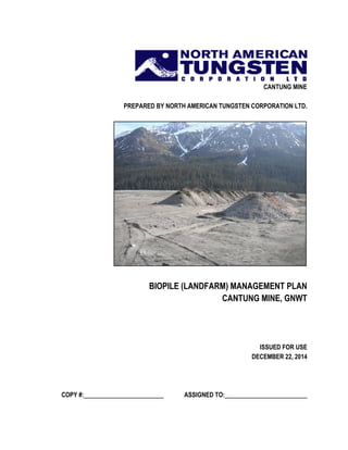
1. CANTUNG MINE
PREPARED BY NORTH AMERICAN TUNGSTEN CORPORATION LTD.
BIOPILE (LANDFARM) MANAGEMENT PLAN
CANTUNG MINE, GNWT
ISSUED FOR USE
DECEMBER 22, 2014
COPY #: ASSIGNED TO:
2. RECORD OF REVISIONS AND DISTRIBUTION LIST
Record of Revisions
REVISON NUMBER DATE SECTION REVISED, ADDED OR DELETED
0 30/09/2014 Initial Plan
1
2
3
Distribution List
COPY # DEPARTMENT/AGENCY CONTACT PHONE
1 Head Office Kurt Heikkila 604 684 5300
2 Mine Manager Jason McKenzie/Brian
Delaney
604 759 0913 ext. 363
3 Environmental Superintendent Deborah Flemming/David
Vokey
604 759 0913 ext. 275
4 Maintenance Superintendent Brian Harvey/Jon
MacCurdy
604 759 0913 ext. 227
5 - 7 MVLWB Julian Morse 867 766 7453
8 GNWT – Regulatory Officer Jarret Hardisty 867 695 2626
9 Wenck Associates, Inc Rodney Ambrosie, P.Eng 612 889 0764 cell
3. ISSUED FOR USE i
TABLE OF CONTENTS
Cantung Mine (Landfarm) Biopile Management Plan Sept 2014
PAGE
RECORD OF REVISIONS AND DISTRIBUTION LIST................................................................................. II
1.0 INTRODUCTION................................................................................................................................. 3
1.1 Regulatory Background ............................................................................................................ 3
2.0 GENERAL SITE INFORMATION........................................................................................................ 4
2.1 Location.................................................................................................................................... 4
2.2 Climate ..................................................................................................................................... 5
3.0 BIOPILE DESIGN............................................................................................................................... 6
3.1 Biopile Location ........................................................................................................................ 6
3.2 Biopile Cells.............................................................................................................................. 8
4.0 BIOPILE OPERATIONS................................................................................................................... 10
4.1 Soil Chemistry......................................................................................................................... 10
4.2 Acceptable Materials .............................................................................................................. 10
4.3 Time Requirements ................................................................................................................ 10
4.4 Remediation Standards .......................................................................................................... 11
4.4.1 Soil Standards ........................................................................................................... 11
4.4.2 Leachate Standards................................................................................................... 12
4.5 Remediation Methods............................................................................................................. 12
4.5.1 Cover......................................................................................................................... 13
4.5.2 Aeration ..................................................................................................................... 13
4.5.3 Nutrients .................................................................................................................... 13
4.5.4 Moisture..................................................................................................................... 13
4.6 Leachate Management........................................................................................................... 14
5.0 SAMPLING AND MONITORING ...................................................................................................... 14
5.1 Soil Sampling.......................................................................................................................... 14
5.2 Leachate Sampling................................................................................................................. 14
6.0 QUALITY ASSURANCE AND QUALITY CONTROL....................................................................... 15
7.0 CLOSURE AND RECLAMATION..................................................................................................... 15
8.0 SIGNATURE..................................................................................................................................... 17
9.0 REFERENCES.................................................................................................................................. 19
4. ISSUED FOR USE ii
TABLE OF CONTENTS
Cantung Mine (Landfarm) Biopile Management Plan Sept 2014
PAGE
APPENDICES
Appendix A Soil Sampling Results
5. 3
1.0 INTRODUCTION
The Biopile (Landfarm) Management Plan was developed to formalize the soil remediation
practices and procedures to be employed by North American Tungsten Corporation Ltd.
(NATCL) at the Cantung Mine. Phase I and II Environmental Site Assessments (Gartner
Lee Limited, 2002; EBA, 2009) revealed petroleum hydrocarbon (PHC) contamination as a
result of the extension of Tailings Pond 4 (TP4) into a historic waste disposal area. This soil
was excavated and stored on top of Tailings Pond 3 (TP3). NATCL has committed to
remediating or removing this, and any additional contaminated soil, as part of its Closure and
Reclamation Plan.
The purpose of this plan is to ensure the proper management, treatment, and monitoring of
contaminated soils during biopile operations and that all regulatory requirements pertaining
to biopile operations are followed. The Biopile (Landfarm) Management Plan should be read in
conjunction with the overall site Waste Management Plan.
1.1 REGULATORY BACKGROUND
This Biopile (Landfarm) Management Plan has been developed in accordance with the
requirements that are outlined in the Mackenzie Valley Land and Water Board Water
License MV2002L2-0019;
Part E.25. “The Licensee shall provide to the board for approval 60 (sixty) days prior
to the construction of any new landfarm an engineered design for the landfarm that
includes but is not limited to:
a. A description of the site characteristics, including surface and
subsurface characteristics, geotechnical characteristics and site Water
Management plans;
b. Construction and materials specifications including the Licensee’s
Quality Assurance and Quality Control program;
c. A geotechnical analysis, which may include, but is not limited to: settlement,
slope stability, groundwater seepage and contaminant transport, and
any liner performance;
d. The details of a volume balance and Landfarm sizing that considers
expected hydrocarbon contaminated soil and snow to be contained;
e. The details of leachate management that includes but is not limited to:
estimation of leachate generated; leachate collection and disposal; and
leachate sampling and monitoring;
f. An operational plan that details, but is not limited to: acceptable soil types to
be deposited in the Landfarm; remediation standards; and methods and
frequency of any soil conditioning to promote remediation;
6. 4
g. The spatial and temporal monitoring program for soil chemistry within
the Landfarm;
h. The location for the proposed Landfarm on a map to scale with GPS
coordinates; and
i. A detailed closure plan for the Landfarm.”
Annual reporting of treated soil is required in the Water License as per Section B.2 (g)
“…the monthly and annual quantity in cubic meters of soil treated in the Landfarm.”
2.0 GENERAL SITE INFORMATION
NATCL has operated the Cantung Tungsten Mine at Tungsten, NWT since 2001. Mining
operations at the Cantung Mine commenced in 1962 as an open pit mine, with suspensions
in 1962 and 1966. The discovery of the “E zone” ore body in 1971 resulted in the
development of an underground mine from 1973 onwards. The mine was in operation until
its temporary closure in 1986, and finally re-opened in 2001. The mine was then again
temporarily closed in 2009 and re-opened in 2010 with an extended mine life.
Prior to the 1986 closure, mine personnel lived in the town site of Tungsten with their
families. The mine is now operated on a fly-in/fly-out basis and parts of the former town
site are still used to house staff.
2.1 LOCATION
The Cantung Mine is located in the Mackenzie Mountains, approximately 5 km from the
NWT-Yukon Territory border and approximately 310 km northeast of Watson Lake
(Figure 1). The Cantung Mine is located near the headwaters of the Flat River in a narrow
valley surrounded by the mountains of the Mackenzie range. The elevations of the
mountain peaks in the immediate area of the property range from 1,981 to 2,750 m above
sea level. The main rivers are northwest-southeast trending at elevations of 914 to 1,067m
above sea level.
The Flat River Valley has been in-filled with unconsolidated sediments, largely deposited by
glacial meltwater associated with the last phase of the continental ice retreat. The deposits
are interbedded sand and gravels, with occasional silty sand layers, to a depth of roughly 30
m. These sediments are overlain by fluvial sands and gravels from the Flat River and
tributary streams emanating from the valley sides. There is no evidence of permafrost at the
Site.
7. 5
FIGURE 1 MINE SITE LOCATION MAP
2.2 CLIMATE
Climatic conditions in this area are typically sub-arctic. Average temperatures during the
winter period from November to March range from -6°C to -40°C. Blizzard conditions
during January and February are frequent but usually of short duration. Maximum snow
depth in the valleys during the winter averages about 127 cm. The snow-free season extends
from mid-May to early October. Total annual precipitation averages about 636mm, with
approximately half occurring as rain and half as snow.
8. 6
3.0 BIOPILE DESIGN
Landfarming has a demonstrated success record in treating petroleum hydrocarbon (PHC)
contaminated soil, even in cold climates with short summer seasons. A traditional landfarm
is typically an engineered berm where soil is aerated and fertilized to allow for
biodegradation and oxidation of PHC contaminants. A large surface area is typically
required, as well as lining and ditching to prevent infiltration of leachate to groundwater and
contamination of surface water features. This type of structure has high capital costs that
would be prohibitive to a small mining operation such as Cantung. Additionally, the
footprint of the Cantung Mine is relatively small and confined in a narrow mountainous
valley. As such, space for a traditional landfarm is limited.
The contaminated soil requiring remediation is currently stockpiled on top of Tailings Pond
3 (TP3). Locating a “landfarm” here is advantageous in that it does not require the
disturbance of any new land and eliminates the need to transfer the soil to a different
location. There are used fuel tanks on site that are no longer usable for their intended
purpose. These tanks will be used to house the “landfarm” or, more accurately, biopile. The
biopile cells will operate on the same principles as a traditional landfarm (i.e. requiring
aeration and fertilization) but will be contained within steel tanks. This eliminates the need
for a lined system with drainage ditching. This will significantly decrease construction time.
3.1 BIOPILE LOCATION
The proposed biopile operation on the top of TP3 is located at 541263 E and 6870035 N
(Figure 2). The design and location of the biopile have been selected to minimize
geotechnical issues relating to stability, seepage, contaminant transport and settlement.
Since the material will be stored in steel tanks, the effects of seepage and contaminant
transport have been mitigated. Therefore, since the tanks themselves will provide collection
of leachate, a liner system will not be needed. The proximity of the tanks to the tailings
slopes is such that the effects of the tanks on TP3 are negligible. In addition, the tanks will
provide support for the material, mitigating any possible failures of material as it will be
constrained by the tank walls. The tailings themselves consist of fine sand that can provide
adequate bearing capacity for the tanks to sit on. Settlement of the tanks will be negligible
and will not affect the integrity of the tanks.
10. 8
3.2 BIOPILE CELLS
The biopile cells will be contained within single-walled fuel tanks stored on site that are no
longer usable for their original purpose. Two tanks with a 45 m3
capacity will be halved
length-wise to create four cells, allowing approximately 90 m3
of soil to be treated at any
given time. Each of the four cells will be further divided in half with a welded section of
steel to provide a total of eight individual cells (Figure 3). Field trials will be conducted
during the first active working season of the biopile, with each individual cell receiving
differing treatments (Section 4.3). This will allow NATCL to determine the optimal
treatment regime, which will be applied to all eight cells in subsequent active working
seasons.
Each tank will be fitted with a 2-inch drain with shut-off valve, to allow for leachate
drainage and collection. One end of the fuel tanks will be propped to slope the cells slightly
and promote leachate drainage to the drainage valves (Figure 3). A 2” slotted PVC pipe will
be wrapped in geotextile cloth and fitted into the bottom of the steel divider, to allow
drainage from both halves of each biopile cell. Any excess moisture will be drained into
totes or 45 gallon drums, and sampled to determine leachate quality (Section 5.2)
Aeration and soil mixing will be achieved through the use of heavy equipment. To ensure
that the tanks are not damaged by heavy equipment during this process, the tanks will be
surrounded by a perimeter of cement blocks or other appropriate barriers.
11. 9
FIGURE 3 BIOPILE CONCEPTUAL DRAWING
Protective
Barrier
Steel Divider
2” Leachate Drain
Single Walled Tank
45 Gallon Drum
Prop for Drainage
Sloping
12. 10
4.0 BIOPILE OPERATIONS
4.1 SOIL CHEMISTRY
Sampling of the PHC contaminated soil was conducted in 2009 as part of a Phase II
Environmental Site Assessment (EBA, 2009). Discrete and composite samples were taken
from the three stockpiles of contaminated soil that existed at that time (an approximate
volume of 415 m3
). The results of the investigation revealed that contaminants of concern
included petroleum hydrocarbon fractions F2 and F3 and select metals (arsenic, copper,
nickel, selenium, and zinc). F2 fractions are hydrocarbons with 10 to 16 carbon atoms (i.e.,
C10-C16) and F3 fractions are hydrocarbons with 16 to 34 carbon atoms (i.e., C16-C34).
An estimated 600 m3
of PHC contaminated soil currently exists on site. The three
preexisting stockpiles were re-sampled in May 2014 to determine their current contaminant
levels. This revealed that contaminants of concern are very similar to those identified in
2009 (Appendix A – Tables 1 and 3). Hydrocarbon fractions F2 and F3, as well as arsenic,
copper, selenium and zinc are present in concentrations exceeding industrial remediation
objectives (see Section 4.2).
Background samples of undisturbed soil were also obtained and analyzed for metals, BTEX,
and F1-F4 fractions. The sampling results (Appenidx A – Tables 2 and 4) indicate elevated
levels of select metals (arsenic, copper, and zinc), although these are limited. There are no
hydrocarbon exceedances in the background samples.
4.2 ACCEPTABLE MATERIALS
In light of the May 2014 sampling results, the focus of the treatment at the biopiles will be
light hydrocarbon fractions such as gasoline, diesel, and jet fuel. Heavier petroleum
hydrocarbon fractions (i.e. F4) such as waste oils are not as readily degradable and may
remain in contaminated soils for extended periods of time (Sanscartier et al., 2009; DeBeers,
2013). The results of the 2009 and 2014 investigations did not however, reveal F4 fractions
as a contaminant of concern. Should soil become contaminated with heavy fraction PHC
products, they will not be accepted at the biopile for treatment, and will be shipped off-site
as hazardous waste.
As metals are not biodegradable, the soil will not be treated for metals removal in the
biopiles. When a batch of soil has been successfully remediated for PHC’s, the soil will be
resampled for metals. A strategy for disposal of any metals contaminated soil will be
developed at that time, with disposal to tailings being a possible consideration.
4.3 TIME REQUIREMENTS
An estimated 600 m3
of PHC contaminated soil currently exists on site. Given that the total
soil volume that can be treated at any one time is approximately 90 m3
, the contaminated
soil will be treated in about six batches. Landfarming studies conducted in the Canadian
13. 11
Arctic (McCarthy et al., 2004; Sanscartier et al., 2009) have successfully remediated
contaminated soils in minimal timeframes (i.e. one to three working seasons). The actual
time required to fully remediate a batch will, however, be highly variable and dependent on
the contaminant levels and treatment regime chosen. The results of the field trials will serve
to identify the most efficient remediation strategy and its approximate time requirements.
4.4 REMEDIATION STANDARDS
The results of the soil and leachate sampling programs (Section 5.1 and 5.2) will be
compared to remediation objectives based on GNWT and CCME guidelines, as well as
criteria defined in NATCL’s Closure and Reclamation Plan as it is developing.
4.4.1 Soil Standards
Laboratory analysis will be conducted for both petroleum hydrocarbon (PHC) fractions F1-
F4 and BTEX compounds in order to capture all possible petroleum contaminants. The
results for PHC fractions F1-F4 will be compared to the Canada Wide Standard (CWS) for
petroleum hydrocarbons in soil established by the Canadian Council of Ministers of the
Environment (CCME, 2001).
BTEX compounds are specific aromatic compounds falling within the F1 fraction (i.e.
benzene, toluene, ethyl benzene and xylene) that are normally managed separately (GNWT,
2003). Remediation objectives for BTEX compounds are not included in the CWS;
therefore sampling results will be compared to the criteria established by the GNWT for
coarse grained surface soil (GNWT, 2003).
Results will be compared to both Industrial and Residential/Parkland land use criteria. Soil
will be remediated to the most stringent set of criteria for both sets of parameters, namely
the Residential/Parkland standards (Table 1). Sampling results will be compared to the
Industrial land use criteria internally, as a measure of progress and to allow for a better
understanding of the time requirements for remediation.
TABLE 1 SOIL REMEDIATION OBJECTIVES
Parameter
Tier 1 CCME Canada Wide Standards for
Petroleum Hydrocarbons in Soil (mg/kg) Parameter
GNWT Environmental Guideline for
Contaminated Site Remediation (mg/kg)
Residential/Parkland Industrial Residential/Parkland Industrial
PHC F1 30 320 Benzene 0.5 5
PHC F2 150 260 Ethyl
Benzene
1.2 20
PHC F3 300 1700 Toluene 0.8 0.8
PHC F4 2800 3300 Xylene 1 20
14. 12
Once the contaminated soil has been treated to the Residential/Parkland remediation
objectives in Table 1, it will be considered clean and appropriate for closure/reclamation
activities.
4.4.2 Leachate Standards
The compliance parameter limits set for Station S4-43 in Table E2 of the Type A Water
License (Table 2) will be used as a guideline for acceptable biopile leachate quality. Leachate
that complies with parameter limits set out in Table 2 will be discharged to TP5 and treated
at the wastewater treatment facility. Leachate that exceeds these limits will be appropriately
labelled and shipped off site as hazardous waste (Section 4.4).
TABLE 2 LEACHATE PARAMETER LIMITS
Parameter
Type A Water License MV2002L2-0019, Section E.21.
Maximum Average Concentration Maximum Concentration of any Grab Sample
EPH 4.00 mg/L 5.00 mg/L
Benzene 4.00 ppm
Ethyl Benzene 2.00 ppm
Toluene 0.39 ppm
4.5 REMEDIATION METHODS
The three pre-existing stockpiles characterized in 2009 by EBA and again in 2014 by
NATCL will be remediated first, as more is known about their origins and contamination
level. It is anticipated that this volume of soil (approximately 415 m3
) will take a number of
years to remediate. At that time, the remaining stockpiled soil will be sampled and
characterized. The appropriate method of remediation, whether it is biopile treatment or
off-site disposal, will be determined at that time. If any new contaminated soil is generated,
it will be stored separately on TP3 with its origins, type of contamination, and location in
the stockpile storage area documented. All soil will be sampled prior to treatment in the
biopile cells to determine initial contaminant levels and appropriate treatment methods.
To determine the optimal treatment regime, NATCL will conduct field trials on eight
individual biopile cells during the first working season. The different treatment regimen will
vary the aeration levels, nutrient levels, and the application of a cover during the summer
months.
15. 13
4.5.1 Cover
Four biopile cells will receive a cover during the summer months in the form of a dark
coloured tarp to trap heat and warm the biopile. Tires will be placed on top of the pile to
create airspace and allow for air circulation under the tarp. Providing a warm environment
for soil microorganisms can not only extend the length of the working season, but can
possibly aid in enhanced bioremediation (Paudyn et al., 2008).
The other four biopile cells will remain uncovered and exposed to the elements. This may
negate the need for watering of the piles as they will be exposed to precipitation, and can
enhance volatilization of lighter hydrocarbon fractions (Sanscartier et al., 2009). The
benefits of warming the pile via use of a cover are also not proven, and this trial will help
determine its necessity.
4.5.2 Aeration
In each set of four biopiles (covered and uncovered), two cells will receive biweekly aeration
and two cells will receive monthly aeration. Mixing the soil provides oxygen to
microorganisms, enhances volatilization of lighter hydrocarbons, and evenly distributes
fertilizer amendments. Aeration will be achieved through the use of heavy equipment, and
should also be conducted when adding amendments to ensure uniform mixing. Some
studies have shown that an aggressive aeration schedule can significantly decrease the time
required for remediation (McCarthy, 2004), although low maintenance landfarms are
typically aerated once per month (Sanscartier et al., 2009; De Beers, 2013). Access to heavy
equipment during the busy summer months may be limited, thus it will beneficial to
determine whether additional aeration has any impact on remediation time.
4.5.3 Nutrients
It is well documented that the addition of nutrients stimulates the biodegradation of
hydrocarbon contaminants. Nitrogen and phosphorous will be added to the biopile cells in
the form of fertilizer. Studies have shown that low level nutrient addition is most beneficial,
as high levels can actually inhibit microbial activity (Braddock et al., 1997). The
recommended nitrogen to phosphorous ratio varies from anywhere between 2:1 and 15:1.
Within each set of four biopiles, two cells will receive fertilization with an N:P nutrient
concentration ratio of 10:1, while the other two will receive fertilization with an N:P
nutrient concentration of 2:1. While nitrogen is typically the limiting nutrient in landfarm
systems (Braddock et al., 1997), it will be useful to determine whether increasing the
amount of nitrogen will have any significant benefit.
4.5.4 Moisture
The contaminated soil will be monitored regularly by visual inspection for moisture content
during the working season. Dry soils can promote volatilization of hydrocarbons, but
moisture is essential for biodegradation (Sanscartier, 2009). The soil in all biopile cells,
regardless of treatment regime, should remain moist but not fully saturated. It is likely that
the uncovered cells will not require the addition of moisture as they will be exposed to
16. 14
precipitation. Should either covered or uncovered cells require moisture addition, the water
will be sourced from the waste water treatment facility, transferred in totes to TP3, and
sprayed onto the biopiles.
4.6 LEACHATE MANAGEMENT
Excess moisture within the biopile cells will be collected in totes or 45 gallon drums via the
2” drainage valves installed on the fuel tanks. The leachate will be sampled as it is produced
to determine water quality (see Section 5.2). Should the sampling results meet the criteria as
defined in Part E, Table E2 of the water license, the leachate will be discharged to TP5 and
treated at the wastewater treatment facility. Should the sampling results exceed these
criteria, the totes or drums will be appropriately labelled and shipped off site as hazardous
waste.
All biopile cells, regardless of treatment regime, will be covered with tarps during the winter
months. The tarps will be erected so as to ensure snow and rain run off the cells, and the
soil does not absorb this excess precipitation.
5.0 SAMPLING AND MONITORING
5.1 SOIL SAMPLING
Soil characterization and tracking of remediation progress will be achieved through a soil
sampling program. Initial sampling of the three pre-existing stockpiles has been conducted
in May 2014 to confirm the results of the 2009 Phase II ESA and to further characterize the
contaminated soils. At the beginning of the first working season, soil from these stockpiles
will be homogenized using heavy equipment and placed into the eight individual biopile
cells. The soil in each cell will then be re-sampled to determine initial contaminant levels.
The soil will be sampled twice per working season – once at the beginning and once at the
end. Samples will be analyzed for both PHC fractions F1-F4 and BTEX compounds by
AGAT Laboratories in Burnaby, BC. The results of these sampling events will be compared
to the remediation objectives outlined Section 4.2.1. Once the soil has been remediated to
the Residential/Parkland guidelines, it will be considered clean. The cell will be emptied and
re-filled with contaminated soil and the process will begin again.
5.2 LEACHATE SAMPLING
Sampling of leachate will occur as needed throughout the working season as totes/drums
become full. At the end of the active working season, all remaining leachate will be sampled
to determine its disposal method prior to the winter months. Leachate samples will be
analyzed for extractable petroleum hydrocarbons (EPH) and BTEX compounds by AGAT
Laboratories in Burnaby, BC. The results of sampling events will be compared to the
parameter limits set out in Section 4.2.2. If leachate does not exceed these limits it will be
17. 15
disposed of in TP5, otherwise it will be appropriately labelled and shipped off site as
hazardous waste.
6.0 QUALITY ASSURANCE AND QUALITY CONTROL
Soil and leachate samples will be collected, preserved, stored, and shipped as per the Water
Quality Sampling Quality Assurance and Quality Control Manual issued under separate cover. All
samples will be analyzed by AGAT Laboratories, an accredited lab by the Canadian
Association for Laboratory Accreditation Inc.
Once per working season, duplicate soil and leachate samples will be collected in order to
monitor the precision and accuracy of the laboratory conducting the analyses, and to
identify any deficiencies in sampling techniques.
To ensure that each biopile cell is clearly delineated and receives its appropriate treatment
regime during the field trials, durable signage will be erected at each cell indicating the
treatment regime. The steel sections dividing each tank in half will be taller than the height
of the tank to ensure that cells are clearly divided and that no mixing across cells occurs
during field trials.
Prior to loading soil, the fuel tanks will be partially filled with water and checked for leaks.
Any leaks found will be patched and rechecked prior to loading soil into the cells. Locating
the biopile cells on TP3 also minimizes risks to human and ecological receptors in the event
of a leak or spill of leachate. The contaminated stockpiles are also already located here, so
transporting the contaminated soil over large distances will not be necessary.
7.0 CLOSURE AND RECLAMATION
The creation and use of biopiles will contribute to the Closure and Reclamation Plan by
addressing site wide (SW) closure and reclamation plan objectives as approved by the
Mackenzie Valley Land and Water Board, specifically:
SW 3 “Surface soil quality on-site is safe for future land uses,” and
SW 4 “Contaminated soils are removed and remediated.”
To achieve these objectives NATCL has committed to the closure options of in-situ
treatment or removal of contaminated soils. In order to fulfill these commitments, in-situ
treatment will be conducted as outlined in this plan. To ensure that soil quality is safe for
future land uses, NATCL has chosen to adhere to the Residential/Parkland criteria for PHC
contaminated soils as established by the CCME and GNWT.
Any persistently contaminated soil that cannot be remediated on site as per these guidelines
will be shipped off site as hazardous waste. Any leachate that exceeds the criteria outlined in
18. 16
section 4.2.2 will also be appropriately labelled and shipped off site as hazardous waste. The
successfully remediated soil may be used for cover or fill applications for progressive
reclamation activities or at mine closure.
The construction of the biopile cells is not resource intensive, and will actually extend the
life of fuel tanks that are no longer usable for their original purpose. At the end of the soil
remediation program, minimal material will require disposal. The tarps used for cover will
be landfilled on site and the tires and steel fuel tanks will be shipped off site for recycling.
On site remediation of contaminated soils through the use of low maintenance biopiles will
help to resolve a contamination issue in a cost effective manner, provide clean fill for mine
site activities, and achieve closure and reclamation objectives as set out in the Closure and
Reclamation Plan.
21. 19
9.0 REFERENCES
Braddock, J., Ruth, M., Catterall, P., Walworth, J., and McCarthy, K.A. (1997). Enhancement and
inhibition of microbial activity in hydrocarbon contaminated Arctic soils: Implications for
nutrient-amended bioremediation. Environmental Science and Technology, 31 (7): 2078-2084.
CCME Canada-Wide Standards for Petroleum Hydrocarbons (PHC) in Soil. Canadian
Council of Ministers of the Environment. 2001
Gaucho Kue Project, Landfarm Management Plan. DeBeers Canada. May 2013
GNWT Environmental Guideline for Contaminated Site Remediation. GNWT. November
2003
Mackenzie Valley Land and Water Board Water License No. MV2002L2-0019. Mackenzie
Valley Land and Water Board. January 30, 2009.
McCarthy, K., Walker, L., Vigoren, L., and Bartel, J. (2004). Remediation of spilled petroleum
hydrocarbons by in situ landfarming at an arctic site. Cold Regions Science and Technology, 40:
31-39.
Phase I Environmental Site Assessment Update and Phase II Environmental Site
Assessment, Cantung Mine, NT. EBA Engineering Consultants Ltd. February 2009
Paudyn, K., Rutter, A., Kerry Rowe, R., and Poland, J. (2008). Remediation of hydrocarbon
contaminated soils in the Canadian Arctic by landfarming. Cold Regions Science and Technology,
53: 102-114.
Sanscartier, D., Laing, T., Reimer, K., and Zeeb, B. (2009). Bioremediation of weathered petroleum
hydrocarbon soil contamination in the Canadian High Arctic: Laboratory and field studies.
Chemosphere, 77: 1121-1126.