

Recommended
More Related Content
Featured
Featured (20)
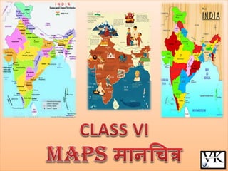
(VI) MAPS.pdf
- 2. GLOBE VS MAP LIMITATIONS OF THE GLOBE BIG IN A SIZE A globe can be useful when we want to study the earth as a whole MAPS ARE USEFUL FOR THE VARIOUS PURPOSE Maps shows a small area and a few facts. Maps may contain as many facts as a big book Many maps are put together we get an atlas Maps provide more information than a globe A Map is a representation or a drawing of the earth’s surface or a part of it drawn on a flat surface according to a scale. भानचित्र ऩृथ्वी की सतह मा इसक े एक बाग का ऩैभाने क े भाध्मभ से िऩटी सतह ऩय खीॊिा गमा चित्र है।
- 4. Political Maps:- Maps showing cities, towns and villages, and different countries and states of the world with their boundaries are called political maps. राजनीतिक मानचित्र याज्मों, नगयों, शहयों तथा गाॉवों औय ववश्व क े ववभबन्न देशों व याज्मों तथा उनकी सीभाओॊ को दशााने वारे भानचित्र को राजनीतिक मानचित्र कहा जाता है।
- 5. Physical Maps भौतिक मानचित्र Maps showing natural features of the earth such as mountains, plateaus, plains, rivers, oceans etc. are called physical or relief maps. ऩृथ्वी की प्राकृ ततक आकृ ततमों; जैसे- ऩवातों, ऩठायों, भैदानों, नददमों, भहासागयों इत्मादद को दशााने वारे भानचित्रों को बौततक मा उच्िावि भानचित्र कहा जाता है।
- 6. Thematic Maps Some maps focus on specific information; such as road maps, rainfall maps, maps showing distribution of forests, industries etc. are known as thematic maps. चिमैटिक मानचित्र क ु छ भानचित्र ववशेष जानकारयमाॉ प्रदान कयते हैं; जैसे- सड़क मानचित्र, वर्ाा मानचित्र, वन ििा उद्योगों आदद क े ववतयण दशााने वारे भानचित्र इत्मादद। इस प्रकाय क े भानचित्र को चथभैदटक भानचित्र कहा जाता है।
- 8. Distance दूरी Maps are drawings, which reduce the entire world or a part of it to fit on a sheet of paper. Or we can say maps are drawn to reduced scales. But this reduction is done very carefully so that the distance between the places is real. It can only be possible when a small distance on paper represents a large distance on the ground. Therefore, a scale is chosen for this purpose. Scale is the ratio between the actual distance on the ground and the distance shown on the map. मानचित्र एक आरेखण होिा है जो कक ऩूरे ववश्व या उसक े एक भाग को छोिा कर कागज क े एक ऩन्ने ऩर दर्ाािा है या यह कह सकिे हैं कक मानचित्र छोिे ऩैमाने ऩर खीॊिे जािे हैं। ऱेककन इसे इिनी सावधानी से छोिा ककया जािा है िाकक स्िानों क े बीि की दूरी वास्िववक रहे। मह तबी सॊबव हो सकता है जफ कागज ऩय एक छोटी दूयी, स्थर की फड़ी दूयी को व्मक्त कयती हो। इसभरए इस उद्देश्म क े भरए एक ऩैभाना िुना जाता है। ऩैमाना, स्िऱ ऩर वास्िववक दूरी ििा मानचित्र ऩर टदखाई गई दूरी क े बीि का अनुऩाि होिा है।
- 9. Distance For example, the distance between your school and your home is 10 km. If you show this 10 km. distance by 2 cm on a map, it means, 1 cm on the map will show 5 km. on the ground. The scale of your drawing will be 1cm = 5 km. Thus, scale is very important in any map. उदाहयण क े भरए, आऩक े ववद्याऱय एवॊ आऩक े घर क े बीि की दूरी 10 ककमी. है जजसे मानचित्र ऩर 2 सेमी. की दूरी से व्यक्ि ककया गया है, इसका अभभप्राय है कक मानचित्र का 1 सेमी. स्िऱ क े 5 ककमी. को दर्ााएगा। आऩक े रेखाचित्र का ऩैमाना होगा, 1 सेमी. = 5 ककमी.। इस प्रकाय ऩैभाना ककसी बी भानचित्र क े भरए फहुत भहत्त्वऩूणा होता है।
- 10. small scale map:- Scale used to show large areas like continents or countries . large scale map:- Scale used to show small area like your village or town . जफ फड़े ऺेत्रपर वारे बागों जैसे भहाद्वीऩों मा देशों को कागज ऩय ददखाना होता है, तफ हभ रोग छोटे ऩैभाने का उऩमोग कयते हैं। उदाहयण क े भरए, भानचित्र ऩय 5 सेभी., स्थर क े 500 ककभी. को दशााता है। इसको छोिे ऩैमाने वाऱा मानचित्र कहते हैं। जफ एक छोटे ऺेत्रपर वारे बाग जैसे आऩक े गाॉव मा शहय को कागज ऩय ददखाना होता है तफ हभ फड़े ऩैभाने का उऩमोग कयते हैं जैसे स्थर ऩय 500 भीटय की दूयी को भानचित्र ऩय 5 सेभी. से दशाामा जाता है। इस प्रकाय क े भानचित्र को फड़े ऩैभाने वारा भानचित्र कहते हैं। फड़े ऩैभाने वारे भानचित्र छोटे ऩैभाने वारे भानचित्र की अऩेऺा अचधक जानकायी प्रदान कयते हैं।
- 11. Direction You might have seen “N” IN MANY MAPS= NORTH DIRECTION When you know the north, you can find out other directions, for example east, west and south. CARDINAL DIRECTIONS:- North, South, East and West INTERMEDIATE DIRECTIONS:- north- east (NE), south-east(SE), south-west (SW) and north-west (NW).
- 12. We can find out the direction of a place with the help of a compass. It is an instrument used to find out main directions. Its magnetic needle always points towards north- south direction हभ ददक्सूिक की सहामता से ककसी स्थान की ददशा का ऩता रगा सकते हैं। मह एक मॊत्र है जजसकी सहामता से भुख्म ददशाओॊ का ऩता रगामा जाता है। इसकी िुॊफकीम सुई की ददशा हभेशा उत्तय-दक्षऺण ददशा भें होती है।
- 13. Symbols रूढ़ प्रिीक It is the third important component of a map. मह ककसी बी भानचित्र का तीसया प्रभुख घटक है। It is not possible to draw on a map the actual shape and size of different features such as buildings, roads, bridges, trees, railway lines or a well. So, they are shown by using certain letters, shades, colours, pictures and lines These symbols give a lot of information in a limited space. ककसी बी भानचित्र ऩय वास्तववक आकाय एवॊ प्रकाय भें ववभबन्न आकृ ततमों; जैसे- बवनों, सड़कों, ऩुरों, वृऺों, येर की ऩटरयमों मा क ु एॉ को ददखाना सॊबव नहीॊ होता है। इसभरए, वे तनजश्ित अऺयों, छामाओॊ, यॊगों, चित्रों तथा येखाओॊ का उऩमोग कयक े दशााए जाते हैं। मे प्रतीक कभ स्थान भें अचधक जानकायी प्रदान कयते हैं। Maps have a universal language that can be understood by all. There is an international agreement regarding the use of these symbols. These are called conventional symbols. भानचित्रों की एक ववश्वव्माऩी बाषा होती है जजसे सबी आसानी से सभझ सकते हैं। इन प्रतीकों क े उऩमोग क े सॊफॊध भें एक अॊतयााष्ट्रीम सहभतत है। मे रूढ़ प्रतीक कहे जाते हैं।
- 16. Various colours are used for the same purpose. For example, generally i. blue is used for showing water bodies ii. brown for mountain iii. yellow for plateau iv. green is used for plains ववभबन्न यॊगों का उऩमोग बी इसी उद्देश्म से ककमा जाता है। उदाहयण क े भरए साभान्मत् नीऱे रॊग का इस्िेमाऱ जऱार्यों, भूरा रॊग ऩवािों, ऩीऱा रॊग ऩठारों और हरा रॊग मैदानों को दर्ााने क े भऱए ककया जािा है।
- 17. Sketch रेखाचित्र A sketch is a drawing mainly based on memory and spot observation and not to scale. Sometimes a rough drawing is required of an area to tell where a particular place is located with respect to other places. Suppose, you want to go to your friend’s house, but you don’t know the way. Your friend may make a rough drawing to show the way to his house. Such a rough drawing is drawn without scale, and is called a sketch map. रेखाचित्र एक आरेखण है, जो ऩैमाने ऩर आधाररि न होकर याद्दाश्ि और स्िानीय प्रेऺण ऩर आधाररि होिा है। कबी-कबी ककसी ऺेत्र क े एक कच्िे आयेखण की आवश्मकता वहाॉ क े एक स्थान को दूसये स्थान क े साऩेऺ ददखाने क े भरए होती है। भान रीजजए कक आऩ अऩने भभत्र क े घय जाना िाहते हैं, रेककन आऩको यास्ते की जानकायी नहीॊ है। आऩका भभत्र अऩने घय क े यास्ते को फताने क े भरए एक कच्िा आयेखण फना सकता है। इस प्रकार कच्िे आरेख को बबना ऩैमाने की सहायिा से खीॊिा जािा है ििा इसे रेखाचित्र मानचित्र कहिे हैं।
- 19. Plan खाका A plan is a drawing of a small area on a large scale. A large- scale map gives lot of information, but there are certain things which we may sometimes want to know for example the length and breadth of a room, which can’t be shown in a map. At that time, we can refer drawings drawn to scale called a plan. एक छोिे ऺेत्र का बड़े ऩैमाने ऩर खीॊिा गया रेखाचित्र खाका कहा जािा है। एक बड़े ऩैमाने वाऱे मानचित्र से हमें बहुि सी जानकाररयाॉ प्राप्ि होिी हैं रेककन क ु छ एेेसी िीज़ें होती हैं जजन्हें हभ कबी-कबी जानना िाहते हैं जैसे ककसी कभये की रॊफाई एवॊ िौड़ाई, जजसे भानचित्र भें नहीॊ ददखामा जा सकता है। उस सभम, हभ रोग फड़े ऩैमाने वाऱा एक रेखाचित्र खीॊि सकिे हैं जजसे खाका कहा जािा है।