SlideShare a Scribd company logo
1 of 13
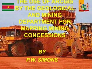
THE USE OF ARCGIS
BY THE GEOLOGICAL
AND MINING
DEPARTMENT FOR
MAPPING MINING
CONCESSIONS
BY
P.W. SIMONS
Content
Some facts of suriname
Geological map of suriname
Importance of mining sector
Use of ArcGis for mapping
2
3Location
4
Geological Map
The Main Sources of National
Income
 Alumina, Gold and Oil account for 94% of
export receipts and 40% of GDP.
5
The use of ArcGis
 ArcGIS provides contextual tools
for mapping and spatial reasoning
so you can explore data and share
location-based insights.
ArcGIS creates deeper
understanding, allowing you to
quickly see where things are
happening and how information is
connected.
6
Use of ArcGis with Suriname’s
Mining Concessions
 Creating Database management system of
required information in Microsoft Access or
Microsoft Excel
 Acquiring the Arcgis software from NV Gissat
 Previously mapping was offline visible on a Lcd
screen or printed at the Geological and Mining
Department (GMD)
 August 2017: Ministry of Natural Resources
launced the GMD website of the mining
concessions online at
 https://geologymining-
sr.maps.arcgis.com/home/index.html
7
Home page 8
Concession map of gold
and building materials
9
Example of the relational
joint table in ArcGis
10
Story Map
Everyone has a story to tell. Harness the
power of maps to do it
 Esri Story Maps let
you combine
authoritative maps
with narrative text,
images, and
multimedia
content. They
make it easy to
harness the power
of maps and
geography to tell
your story.
11
Benificiaries of the GMD
Website
 Students for research
 Investors
 Entrepenuers
 Other ministries in Suriname
responsible for issuing other types
of concessions e.g. forestry,
agriculture, building permits,
archeology
12
Suriname “Land of ICT
in uprising”
THANK YOU!!

More Related Content

What's hot

Geographic Information Systems in the Oil & Gas Industry
Geographic Information Systems in the Oil & Gas IndustryGeographic Information Systems in the Oil & Gas Industry
Geographic Information Systems in the Oil & Gas IndustryFrancois Viljoen
 
Urbanization of mancherial town
Urbanization of mancherial town Urbanization of mancherial town
Urbanization of mancherial town avinash111d
 
Lect 1 & 2 introduction to gis & rs
Lect 1 & 2  introduction to gis & rsLect 1 & 2  introduction to gis & rs
Lect 1 & 2 introduction to gis & rsRehana Jamal
 
Paul Zhao-resume
Paul Zhao-resumePaul Zhao-resume
Paul Zhao-resumePaul Zhao
 
BIM - Esri UK Annual Conference 2016
BIM - Esri UK Annual Conference 2016BIM - Esri UK Annual Conference 2016
BIM - Esri UK Annual Conference 2016Esri UK
 
GIS Application in Water Resource Management by Engr. Ehtisham Habib
GIS Application in Water Resource Management by Engr. Ehtisham HabibGIS Application in Water Resource Management by Engr. Ehtisham Habib
GIS Application in Water Resource Management by Engr. Ehtisham HabibEhtisham Habib
 
Incorporating Google Street View Imagery with the LLPG
Incorporating Google Street View Imagery with the LLPGIncorporating Google Street View Imagery with the LLPG
Incorporating Google Street View Imagery with the LLPGSterling Geo
 
Gis applications in tourism a tool for sustainable tourism
Gis applications in tourism  a tool for sustainable tourismGis applications in tourism  a tool for sustainable tourism
Gis applications in tourism a tool for sustainable tourismpankaj kumar
 
Prospecting for Profits with GIS
Prospecting for Profits with GIS Prospecting for Profits with GIS
Prospecting for Profits with GIS Greg Babinski
 
Gis application in toursim
Gis application in toursimGis application in toursim
Gis application in toursimLydia Sitharthan
 
Swiss Territorial Data Lab - Spacial Data Science Conference
Swiss Territorial Data Lab - Spacial Data Science ConferenceSwiss Territorial Data Lab - Spacial Data Science Conference
Swiss Territorial Data Lab - Spacial Data Science ConferenceRaphael Rollier
 
Management information system
Management information systemManagement information system
Management information systemSajid Jadoon
 
Subsurface 3D GIS 05nov2011
Subsurface 3D GIS 05nov2011Subsurface 3D GIS 05nov2011
Subsurface 3D GIS 05nov2011Andrew Zolnai
 
Lect 9 lab-1 intro to interface
Lect 9 lab-1 intro to interfaceLect 9 lab-1 intro to interface
Lect 9 lab-1 intro to interfaceRehana Jamal
 

What's hot (20)

Urban planing & gis
Urban planing & gisUrban planing & gis
Urban planing & gis
 
Gis technology
Gis technologyGis technology
Gis technology
 
Geographic Information Systems in the Oil & Gas Industry
Geographic Information Systems in the Oil & Gas IndustryGeographic Information Systems in the Oil & Gas Industry
Geographic Information Systems in the Oil & Gas Industry
 
Urbanization of mancherial town
Urbanization of mancherial town Urbanization of mancherial town
Urbanization of mancherial town
 
Lect 1 & 2 introduction to gis & rs
Lect 1 & 2  introduction to gis & rsLect 1 & 2  introduction to gis & rs
Lect 1 & 2 introduction to gis & rs
 
Paul Zhao-resume
Paul Zhao-resumePaul Zhao-resume
Paul Zhao-resume
 
BIM - Esri UK Annual Conference 2016
BIM - Esri UK Annual Conference 2016BIM - Esri UK Annual Conference 2016
BIM - Esri UK Annual Conference 2016
 
GIS Application in Water Resource Management by Engr. Ehtisham Habib
GIS Application in Water Resource Management by Engr. Ehtisham HabibGIS Application in Water Resource Management by Engr. Ehtisham Habib
GIS Application in Water Resource Management by Engr. Ehtisham Habib
 
Incorporating Google Street View Imagery with the LLPG
Incorporating Google Street View Imagery with the LLPGIncorporating Google Street View Imagery with the LLPG
Incorporating Google Street View Imagery with the LLPG
 
Gis applications in tourism a tool for sustainable tourism
Gis applications in tourism  a tool for sustainable tourismGis applications in tourism  a tool for sustainable tourism
Gis applications in tourism a tool for sustainable tourism
 
Resume_Basheer_2017
Resume_Basheer_2017Resume_Basheer_2017
Resume_Basheer_2017
 
Resume
ResumeResume
Resume
 
Gis in transportation
Gis in transportationGis in transportation
Gis in transportation
 
Gis Application
Gis ApplicationGis Application
Gis Application
 
Prospecting for Profits with GIS
Prospecting for Profits with GIS Prospecting for Profits with GIS
Prospecting for Profits with GIS
 
Gis application in toursim
Gis application in toursimGis application in toursim
Gis application in toursim
 
Swiss Territorial Data Lab - Spacial Data Science Conference
Swiss Territorial Data Lab - Spacial Data Science ConferenceSwiss Territorial Data Lab - Spacial Data Science Conference
Swiss Territorial Data Lab - Spacial Data Science Conference
 
Management information system
Management information systemManagement information system
Management information system
 
Subsurface 3D GIS 05nov2011
Subsurface 3D GIS 05nov2011Subsurface 3D GIS 05nov2011
Subsurface 3D GIS 05nov2011
 
Lect 9 lab-1 intro to interface
Lect 9 lab-1 intro to interfaceLect 9 lab-1 intro to interface
Lect 9 lab-1 intro to interface
 

Recently uploaded

Repurposing LNG terminals for Hydrogen Ammonia: Feasibility and Cost Saving
Repurposing LNG terminals for Hydrogen Ammonia: Feasibility and Cost SavingRepurposing LNG terminals for Hydrogen Ammonia: Feasibility and Cost Saving
Repurposing LNG terminals for Hydrogen Ammonia: Feasibility and Cost SavingEdi Saputra
 
Navigating Identity and Access Management in the Modern Enterprise
Navigating Identity and Access Management in the Modern EnterpriseNavigating Identity and Access Management in the Modern Enterprise
Navigating Identity and Access Management in the Modern EnterpriseWSO2
 
Modular Monolith - a Practical Alternative to Microservices @ Devoxx UK 2024
Modular Monolith - a Practical Alternative to Microservices @ Devoxx UK 2024Modular Monolith - a Practical Alternative to Microservices @ Devoxx UK 2024
Modular Monolith - a Practical Alternative to Microservices @ Devoxx UK 2024Victor Rentea
 
Navigating the Deluge_ Dubai Floods and the Resilience of Dubai International...
Navigating the Deluge_ Dubai Floods and the Resilience of Dubai International...Navigating the Deluge_ Dubai Floods and the Resilience of Dubai International...
Navigating the Deluge_ Dubai Floods and the Resilience of Dubai International...Orbitshub
 
Vector Search -An Introduction in Oracle Database 23ai.pptx
Vector Search -An Introduction in Oracle Database 23ai.pptxVector Search -An Introduction in Oracle Database 23ai.pptx
Vector Search -An Introduction in Oracle Database 23ai.pptxRemote DBA Services
 
Strategize a Smooth Tenant-to-tenant Migration and Copilot Takeoff
Strategize a Smooth Tenant-to-tenant Migration and Copilot TakeoffStrategize a Smooth Tenant-to-tenant Migration and Copilot Takeoff
Strategize a Smooth Tenant-to-tenant Migration and Copilot Takeoffsammart93
 
Exploring Multimodal Embeddings with Milvus
Exploring Multimodal Embeddings with MilvusExploring Multimodal Embeddings with Milvus
Exploring Multimodal Embeddings with MilvusZilliz
 
Stronger Together: Developing an Organizational Strategy for Accessible Desig...
Stronger Together: Developing an Organizational Strategy for Accessible Desig...Stronger Together: Developing an Organizational Strategy for Accessible Desig...
Stronger Together: Developing an Organizational Strategy for Accessible Desig...caitlingebhard1
 
WSO2 Micro Integrator for Enterprise Integration in a Decentralized, Microser...
WSO2 Micro Integrator for Enterprise Integration in a Decentralized, Microser...WSO2 Micro Integrator for Enterprise Integration in a Decentralized, Microser...
WSO2 Micro Integrator for Enterprise Integration in a Decentralized, Microser...WSO2
 
Decarbonising Commercial Real Estate: The Role of Operational Performance
Decarbonising Commercial Real Estate: The Role of Operational PerformanceDecarbonising Commercial Real Estate: The Role of Operational Performance
Decarbonising Commercial Real Estate: The Role of Operational PerformanceIES VE
 
[BuildWithAI] Introduction to Gemini.pdf
[BuildWithAI] Introduction to Gemini.pdf[BuildWithAI] Introduction to Gemini.pdf
[BuildWithAI] Introduction to Gemini.pdfSandro Moreira
 
Cloud Frontiers: A Deep Dive into Serverless Spatial Data and FME
Cloud Frontiers:  A Deep Dive into Serverless Spatial Data and FMECloud Frontiers:  A Deep Dive into Serverless Spatial Data and FME
Cloud Frontiers: A Deep Dive into Serverless Spatial Data and FMESafe Software
 
API Governance and Monetization - The evolution of API governance
API Governance and Monetization -  The evolution of API governanceAPI Governance and Monetization -  The evolution of API governance
API Governance and Monetization - The evolution of API governanceWSO2
 
Connector Corner: Accelerate revenue generation using UiPath API-centric busi...
Connector Corner: Accelerate revenue generation using UiPath API-centric busi...Connector Corner: Accelerate revenue generation using UiPath API-centric busi...
Connector Corner: Accelerate revenue generation using UiPath API-centric busi...DianaGray10
 
AI+A11Y 11MAY2024 HYDERBAD GAAD 2024 - HelloA11Y (11 May 2024)
AI+A11Y 11MAY2024 HYDERBAD GAAD 2024 - HelloA11Y (11 May 2024)AI+A11Y 11MAY2024 HYDERBAD GAAD 2024 - HelloA11Y (11 May 2024)
AI+A11Y 11MAY2024 HYDERBAD GAAD 2024 - HelloA11Y (11 May 2024)Samir Dash
 
Polkadot JAM Slides - Token2049 - By Dr. Gavin Wood
Polkadot JAM Slides - Token2049 - By Dr. Gavin WoodPolkadot JAM Slides - Token2049 - By Dr. Gavin Wood
Polkadot JAM Slides - Token2049 - By Dr. Gavin WoodJuan lago vázquez
 
Why Teams call analytics are critical to your entire business
Why Teams call analytics are critical to your entire businessWhy Teams call analytics are critical to your entire business
Why Teams call analytics are critical to your entire businesspanagenda
 
Choreo: Empowering the Future of Enterprise Software Engineering
Choreo: Empowering the Future of Enterprise Software EngineeringChoreo: Empowering the Future of Enterprise Software Engineering
Choreo: Empowering the Future of Enterprise Software EngineeringWSO2
 
JohnPollard-hybrid-app-RailsConf2024.pptx
JohnPollard-hybrid-app-RailsConf2024.pptxJohnPollard-hybrid-app-RailsConf2024.pptx
JohnPollard-hybrid-app-RailsConf2024.pptxJohnPollard37
 

Recently uploaded (20)

Repurposing LNG terminals for Hydrogen Ammonia: Feasibility and Cost Saving
Repurposing LNG terminals for Hydrogen Ammonia: Feasibility and Cost SavingRepurposing LNG terminals for Hydrogen Ammonia: Feasibility and Cost Saving
Repurposing LNG terminals for Hydrogen Ammonia: Feasibility and Cost Saving
 
Navigating Identity and Access Management in the Modern Enterprise
Navigating Identity and Access Management in the Modern EnterpriseNavigating Identity and Access Management in the Modern Enterprise
Navigating Identity and Access Management in the Modern Enterprise
 
Modular Monolith - a Practical Alternative to Microservices @ Devoxx UK 2024
Modular Monolith - a Practical Alternative to Microservices @ Devoxx UK 2024Modular Monolith - a Practical Alternative to Microservices @ Devoxx UK 2024
Modular Monolith - a Practical Alternative to Microservices @ Devoxx UK 2024
 
Navigating the Deluge_ Dubai Floods and the Resilience of Dubai International...
Navigating the Deluge_ Dubai Floods and the Resilience of Dubai International...Navigating the Deluge_ Dubai Floods and the Resilience of Dubai International...
Navigating the Deluge_ Dubai Floods and the Resilience of Dubai International...
 
Vector Search -An Introduction in Oracle Database 23ai.pptx
Vector Search -An Introduction in Oracle Database 23ai.pptxVector Search -An Introduction in Oracle Database 23ai.pptx
Vector Search -An Introduction in Oracle Database 23ai.pptx
 
Strategize a Smooth Tenant-to-tenant Migration and Copilot Takeoff
Strategize a Smooth Tenant-to-tenant Migration and Copilot TakeoffStrategize a Smooth Tenant-to-tenant Migration and Copilot Takeoff
Strategize a Smooth Tenant-to-tenant Migration and Copilot Takeoff
 
Exploring Multimodal Embeddings with Milvus
Exploring Multimodal Embeddings with MilvusExploring Multimodal Embeddings with Milvus
Exploring Multimodal Embeddings with Milvus
 
Stronger Together: Developing an Organizational Strategy for Accessible Desig...
Stronger Together: Developing an Organizational Strategy for Accessible Desig...Stronger Together: Developing an Organizational Strategy for Accessible Desig...
Stronger Together: Developing an Organizational Strategy for Accessible Desig...
 
+971581248768>> SAFE AND ORIGINAL ABORTION PILLS FOR SALE IN DUBAI AND ABUDHA...
+971581248768>> SAFE AND ORIGINAL ABORTION PILLS FOR SALE IN DUBAI AND ABUDHA...+971581248768>> SAFE AND ORIGINAL ABORTION PILLS FOR SALE IN DUBAI AND ABUDHA...
+971581248768>> SAFE AND ORIGINAL ABORTION PILLS FOR SALE IN DUBAI AND ABUDHA...
 
WSO2 Micro Integrator for Enterprise Integration in a Decentralized, Microser...
WSO2 Micro Integrator for Enterprise Integration in a Decentralized, Microser...WSO2 Micro Integrator for Enterprise Integration in a Decentralized, Microser...
WSO2 Micro Integrator for Enterprise Integration in a Decentralized, Microser...
 
Decarbonising Commercial Real Estate: The Role of Operational Performance
Decarbonising Commercial Real Estate: The Role of Operational PerformanceDecarbonising Commercial Real Estate: The Role of Operational Performance
Decarbonising Commercial Real Estate: The Role of Operational Performance
 
[BuildWithAI] Introduction to Gemini.pdf
[BuildWithAI] Introduction to Gemini.pdf[BuildWithAI] Introduction to Gemini.pdf
[BuildWithAI] Introduction to Gemini.pdf
 
Cloud Frontiers: A Deep Dive into Serverless Spatial Data and FME
Cloud Frontiers:  A Deep Dive into Serverless Spatial Data and FMECloud Frontiers:  A Deep Dive into Serverless Spatial Data and FME
Cloud Frontiers: A Deep Dive into Serverless Spatial Data and FME
 
API Governance and Monetization - The evolution of API governance
API Governance and Monetization -  The evolution of API governanceAPI Governance and Monetization -  The evolution of API governance
API Governance and Monetization - The evolution of API governance
 
Connector Corner: Accelerate revenue generation using UiPath API-centric busi...
Connector Corner: Accelerate revenue generation using UiPath API-centric busi...Connector Corner: Accelerate revenue generation using UiPath API-centric busi...
Connector Corner: Accelerate revenue generation using UiPath API-centric busi...
 
AI+A11Y 11MAY2024 HYDERBAD GAAD 2024 - HelloA11Y (11 May 2024)
AI+A11Y 11MAY2024 HYDERBAD GAAD 2024 - HelloA11Y (11 May 2024)AI+A11Y 11MAY2024 HYDERBAD GAAD 2024 - HelloA11Y (11 May 2024)
AI+A11Y 11MAY2024 HYDERBAD GAAD 2024 - HelloA11Y (11 May 2024)
 
Polkadot JAM Slides - Token2049 - By Dr. Gavin Wood
Polkadot JAM Slides - Token2049 - By Dr. Gavin WoodPolkadot JAM Slides - Token2049 - By Dr. Gavin Wood
Polkadot JAM Slides - Token2049 - By Dr. Gavin Wood
 
Why Teams call analytics are critical to your entire business
Why Teams call analytics are critical to your entire businessWhy Teams call analytics are critical to your entire business
Why Teams call analytics are critical to your entire business
 
Choreo: Empowering the Future of Enterprise Software Engineering
Choreo: Empowering the Future of Enterprise Software EngineeringChoreo: Empowering the Future of Enterprise Software Engineering
Choreo: Empowering the Future of Enterprise Software Engineering
 
JohnPollard-hybrid-app-RailsConf2024.pptx
JohnPollard-hybrid-app-RailsConf2024.pptxJohnPollard-hybrid-app-RailsConf2024.pptx
JohnPollard-hybrid-app-RailsConf2024.pptx
 

Assignment 2

  • 1. THE USE OF ARCGIS BY THE GEOLOGICAL AND MINING DEPARTMENT FOR MAPPING MINING CONCESSIONS BY P.W. SIMONS
  • 2. Content Some facts of suriname Geological map of suriname Importance of mining sector Use of ArcGis for mapping 2
  • 5. The Main Sources of National Income  Alumina, Gold and Oil account for 94% of export receipts and 40% of GDP. 5
  • 6. The use of ArcGis  ArcGIS provides contextual tools for mapping and spatial reasoning so you can explore data and share location-based insights. ArcGIS creates deeper understanding, allowing you to quickly see where things are happening and how information is connected. 6
  • 7. Use of ArcGis with Suriname’s Mining Concessions  Creating Database management system of required information in Microsoft Access or Microsoft Excel  Acquiring the Arcgis software from NV Gissat  Previously mapping was offline visible on a Lcd screen or printed at the Geological and Mining Department (GMD)  August 2017: Ministry of Natural Resources launced the GMD website of the mining concessions online at  https://geologymining- sr.maps.arcgis.com/home/index.html 7
  • 9. Concession map of gold and building materials 9
  • 10. Example of the relational joint table in ArcGis 10
  • 11. Story Map Everyone has a story to tell. Harness the power of maps to do it  Esri Story Maps let you combine authoritative maps with narrative text, images, and multimedia content. They make it easy to harness the power of maps and geography to tell your story. 11
  • 12. Benificiaries of the GMD Website  Students for research  Investors  Entrepenuers  Other ministries in Suriname responsible for issuing other types of concessions e.g. forestry, agriculture, building permits, archeology 12
  • 13. Suriname “Land of ICT in uprising” THANK YOU!!