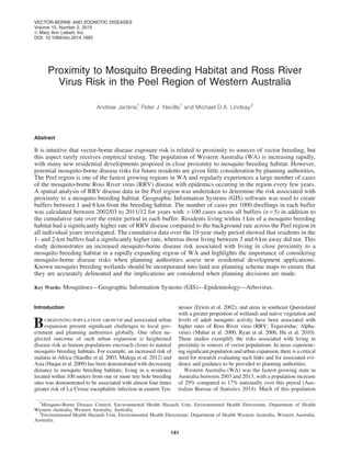
Jardine at al RRV in Peel region_proximity to wetlands_VBZD Feb 2015_Vol 15 p 141-146
1. Proximity to Mosquito Breeding Habitat and Ross River
Virus Risk in the Peel Region of Western Australia
Andrew Jardine,1
Peter J. Neville,1
and Michael D.A. Lindsay2
Abstract
It is intuitive that vector-borne disease exposure risk is related to proximity to sources of vector breeding, but
this aspect rarely receives empirical testing. The population of Western Australia (WA) is increasing rapidly,
with many new residential developments proposed in close proximity to mosquito breeding habitat. However,
potential mosquito-borne disease risks for future residents are given little consideration by planning authorities.
The Peel region is one of the fastest growing regions in WA and regularly experiences a large number of cases
of the mosquito-borne Ross River virus (RRV) disease with epidemics occuring in the region every few years.
A spatial analysis of RRV disease data in the Peel region was undertaken to determine the risk associated with
proximity to a mosquito breeding habitat. Geographic Information Systems (GIS) software was used to create
buffers between 1 and 6 km from the breeding habitat. The number of cases per 1000 dwellings in each buffer
was calculated between 2002/03 to 2011/12 for years with > 100 cases across all buffers (n = 5) in addition to
the cumulative rate over the entire period in each buffer. Residents living within 1 km of a mosquito breeding
habitat had a significantly higher rate of RRV disease compared to the background rate across the Peel region in
all individual years investigated. The cumulative data over the 10-year study period showed that residents in the
1- and 2-km buffers had a significantly higher rate, whereas those living between 3 and 6 km away did not. This
study demonstrates an increased mosquito-borne disease risk associated with living in close proximity to a
mosquito breeding habitat in a rapidly expanding region of WA and highlights the importance of considering
mosquito-borne disease risks when planning authorities assess new residential development applications.
Known mosquito breeding wetlands should be incorporated into land use planning scheme maps to ensure that
they are accurately delineated and the implications are considered when planning decisions are made.
Key Words: Mosquitoes—Geographic Information Systems (GIS)—Epidemiology—Arbovirus.
Introduction
Burgeoning population growth and associated urban
expansion present significant challenges to local gov-
ernment and planning authorities globally. One often ne-
glected outcome of such urban expansion is heightened
disease risk as human populations encroach closer to natural
mosquito breeding habitats. For example, an increased risk of
malaria in Africa (Staedke et al. 2003, Midega et al. 2012) and
Asia (Haque et al. 2009) has been demonstrated with decreasing
distance to mosquito breeding habitats; living in a residence
located within 100 meters from one or more tree hole breeding
sites was demonstrated to be associated with almost four times
greater risk of La Crosse encephalitis infection in eastern Ten-
nessee (Erwin et al. 2002); and areas in southeast Queensland
with a greater proportion of wetlands and native vegetation and
levels of adult mosquito activity have been associated with
higher rates of Ross River virus (RRV; Togaviridae: Alpha-
virus) (Muhar et al. 2000, Ryan et al. 2006, Hu et al. 2010).
These studies exemplify the risks associated with living in
proximity to sources of vector populations. In areas experienc-
ing significant population and urban expansion, there is a critical
need for research evaluating such links and for associated evi-
dence and guidance to be provided to planning authorities.
Western Australia (WA) was the fastest growing state in
Australia between 2003 and 2013, with a population increase
of 29% compared to 17% nationally over this period (Aus-
tralian Bureau of Statistics 2014). Much of this population
1
Mosquito-Borne Disease Control, Environmental Health Hazards Unit, Environmental Health Directorate, Department of Health
Western Australia, Western Australia, Australia.
2
Environmental Health Hazards Unit, Environmental Health Directorate, Department of Health Western Australia, Western Australia,
Australia.
VECTOR-BORNE AND ZOONOTIC DISEASES
Volume 15, Number 2, 2015
ª Mary Ann Liebert, Inc.
DOI: 10.1089/vbz.2014.1693
141
2. growth occurred in the outer suburbs of Perth, most notably in
the Peel region (defined here as the Local Government Areas
of Rockingham, Mandurah, Murray, and Waroona; Fig. 1),
and it increased by 53% between 2003 and 2013 (Australian
Bureau of Statistics 2014). Population forecasts by the
Western Australian Planning Commission indicate that this
rapid growth rate is expected to continue in the region over
coming decades (Western Australian Planning Commission
2012), placing further pressure to develop surrounding land
into new residential areas that are often proposed close to
water due to intrinsic aesthetic values. Residents who live in
close proximity to breeding sites may be subjected to intense
nuisance problems and, more importantly, increased risk of
infection with a mosquito-borne virus.
A substantial number of cases of RRV (Togaviridae: Al-
phavirus) disease, a nonfatal but potentially debilitating
polyarthritic disease (Russell 2002), are reported annually
from the Peel region, and large outbreaks are experienced
every few years despite significant mosquito control efforts
(Lindsay et al. 1996). Extensive areas of salt marsh mosquito
breeding habitat are located in the lower reaches of the Ser-
pentine River, the Peel Inlet, and the Harvey Estuary (Fig. 1)
(Wright 1988), many of which are protected under the
Ramsar Convention listed Peel-Yalgorup system (Depart-
ment of the Environment 2011). Mosquito surveillance in the
Peel region over the last 20 years has shown that Aedes (Ae.)
camptorhynchus is the predominant species between April
and December, whereas Ae. vigilax is the major species
present from January to March each year (Lindsay et al.
1996). Both species are important vectors of RRV in coastal
regions of WA (Lindsay et al. 1996, Russell 2002). Fur-
thermore, substantial areas of native bushland remain in close
proximity to many mosquito breeding sites in the Peel region
that support western grey kangaroo populations (Macropus
fuliginosus), an important vertebrate host of RRV in southern
WA (Russell 2002, Potter et al. 2014).
Significant residential development has occurred and
continues to expand in close proximity to mosquito breeding
habitats in the Peel region due to the aesthetic values of living
near water. Unfortunately, the potential for residents who
move into these areas to be exposed to mosquito-borne dis-
eases and intense nuisance problems is given little consid-
eration by planning authorities because limited evidence
presently exists to quantify this risk. In WA, RRV incidence
was found to decrease with distance from a tidal estuary with
extensive mosquito breeding habitats in rural and semirural
areas (Vally et al. 2012). However, no relationship was found
in urban areas with higher population density (Vally et al.
2012). We also recently demonstrated a significant increase
in RRV risk within 2 km of a known highly productive
breeding habitat located 200 km south of the current study
region that resulted from dispersal of Ae. camptorhynchus
into surrounding residential areas (Jardine et al. 2014).
The aim of the current study is to build on these previous
findings and quantify the risk associated with proximity to
mosquito breeding habitats in the Peel region, a key focus of
RRV activity and population growth. The larger spatial scale
and more detailed temporal analysis in this study add to the
evidence basis to inform planning decisions and target
mosquito control activities.
FIG. 1. Location of the study site within the Peel Region with 1- to 6-km buffer zones indicated by the solid black lines
surrounding known mosquito breeding wetlands of the Peel and Harvey Estuaries.
142 JARDINE ET AL.
3. Materials and Methods
RRV is a notifiable disease in Australia, meaning that all cases
of RRV diagnosed by a doctor or detected in laboratory tests in
WA are required to be notified to the Department of Health under
the Health Act (1911). WA also undertakes an ‘‘enhanced sur-
veillance’’ program through which RRV cases are followed up
via patient interviews to determine the most likely location and
timing of exposure. Residential address is assumed to be the
location of exposure if the case cannot be contacted.
The dataset created for spatial analyses consisted of all cases
for which the most likely place of exposure could be precisely
geocoded to a specific cadastral lot (a legally defined property
boundary). In addition, if place of exposure data or residential
data are not given as an exact location but can be pinpointed
with reasonable confidence (e.g., a street corner within 250
meters), then these cases are also geocoded. All other cases
were excluded from the dataset for spatial analyses.
Mosquito breeding habitats identified from field surveys in
the Peel Inlet, Harvey Estuary, and the lower reaches of the
Serpentine River (Wright 1988) were mapped, and six 1-km
buffers were created around them using Quantum Geo-
graphic Information System (GIS) 1.7.4 (Quantum GIS De-
velopment Team 2012) (Fig. 1). The intersection of the
buffers with the RRV case data was used to determine the
number of cases within each buffer.
A property street address cadastral lot data layer main-
tained by Landgate was overlaid by the Peel Regional Plan-
ning Scheme data layer maintained by the Western
Australian Planning Commission. Addresses in areas zoned
as urban or rural were retained and all other lots were ex-
cluded. Any other addresses not defined as a house were also
excluded. Finally, the remaining property street address lots
were intersected with the buffers to determine the number of
dwellings within each buffer.
The case and cadastral data were then summed for each
buffer, the rate of RRV notifications per 1000 dwellings was
determined, and 95% confidence intervals (CIs) were calculated.
Poisson regression was then undertaken to determine if a sta-
tistically significant trend in the rate of RRV notifications with
buffer distance was present. The number of cases was assigned
as the dependent variable, the buffer distance as the independent
variable, and the number of dwellings as the exposure variable.
Finally, to determine the expected background rate for the
Peel region, the number of RRV cases and dwellings for the
whole region was calculated using the same methods described
above. The rate for each buffer was determined to be signifi-
cantly elevated if the 95% CI did not span the background rate.
Rates were calculated for cases recorded between July 1,
2002, and June 30, 2012, to establish the cumulative risk for
each buffer over the 10-year period. The same analysis was also
undertaken for individual financial years in which more than
100 cases were notified across all buffers, which included 2005/
06, 2007/08, 2008/09, 2010/11, and 2011/12 mosquito seasons,
to determine if the pattern repeated in all outbreak years.
Ethics approval was not required because our study eval-
uated data collected during the routine public health response
to RRV as a notifiable disease.
Results
The background rate of RRV per 1000 dwellings across the
Peel region from July, 2002, to June, 2012, was 0.93 cases per
year, and average annual rates for each buffer are shown in
Table 1. A clear decreasing trend with increasing buffer
distance was evident (Fig. 2), and Poisson regression indi-
cated this trend to be significant ( p < 0.001). The number of
RRV cases per 1000 dwellings was significantly higher than
the rate across the Peel region for buffer distances up to 2 km
during the 10-year period.
Figure 3 shows the number of RRV cases per 1000
dwelling for each buffer distance for the years in which more
than 100 cases were notified across all buffers, which in-
cluded 2005/06, 2007/08, 2008/09, 2010/11, and 2011/12
mosquito seasons. It was consistently demonstrated across all
years investigated that residents living within 1 km of a
mosquito breeding habitat had a significantly higher rate of
RRV disease compared to the background rate across the Peel
region. Poisson regression also indicated that a statistically
significant reduction ( p < 0.05) in RRV rate with increasing
buffer distance was evident in all years except 2011/12.
Discussion
This study sought to quantify disease risk associated with
proximity to sources of vector breeding and a significantly
increased risk of contracting RRV associated with living in
close proximity to a mosquito breeding salt marsh habitat in
the Peel region of WA was demonstrated. Between July,
2002, and June, 2012, the rate of RRV cases per 1000
dwellings within 1 km of a breeding habitat was double the
rate compared to the Peel region as a whole, and 26% higher
between 1 and 2 km from a mosquito breeding habitat. A
significant decreasing trend with increasing buffer distance
was evident over the 10-year period and in most individual
years with high case numbers ( > 100).
Only one year, 2011/12, was divergent from this trend. In
this year, a cluster of cases occurred in the 5- to 6-km buffer,
which was thought to be associated with a separate breeding
site, not related to those in the Peel Inlet or Harvey Estuary
that were mapped as part of this study. Given that this year
was otherwise comparable with the other high case number
years (i.e., case numbers in the 1-km buffer were still sig-
nificantly higher than the background rate and the other
buffers were not different from the background rate), we
consider this an atypical event for this region. Overall, the
data show that those living within 2 km of a mosquito
breeding habitat were at increased risk of RRV disease,
Table 1. Number of Dwellings, Ross River
Virus Cases, and Rate per 1000 Dwellings
by Buffer Distance from Mosquito Breeding
Habitat, Peel Region, July, 2002, to June, 2012
July, 2002, to June, 2012
Buffer
distance Dwellings Cases
Average annual
cases/1000 dwellings
< 1 km 20,128 381 1.89
1–2 km 17,724 209 1.18
2–3 km 8,555 94 1.10
3–4 km 4,605 38 0.83
4–5 km 6,874 45 0.65
5–6 km 4,178 25 0.60
Background 0.93
PROXIMITY TO MOSQUITO BREEDING HABITATS AND RRV RISK 143
4. which is further evidence to support the results of previous
spatial analyses of RRV case data in close proximity to Ae.
camptorhynchus breeding habitats in other locations in
southwestern WA (Vally et al. 2012, Jardine el al. 2014).
With increasing pressure to release land for residential
development in the Peel region, these findings provide evi-
dence to planning authorities for consideration when asses-
sing applications for new residential developments in close
proximity of recognized permanent or semipermanent natural
mosquito breeding sites, such as wetlands, salt marshes, or
estuarine environments. It is recommended that planning
authorities incorporate known mosquito breeding wetlands
into land use planning scheme maps to ensure that they are
accurately delineated and the implications are considered
when planning decisions are made. Notifications should be
placed on the land titles within 2 km of known mosquito
breeding habitats to advise prospective buyers of the in-
creased health risk. Built form design measures such as insect
screening on doors and windows and screened outdoor en-
closures, public education packages, and public signage
should also be included as part of the conditions of approval.
Physical changes to topography should prevent runoff from
creating surface retention and constructed water bodies
should be located, designed, and maintained so they do not
create or contribute to additional mosquito breeding. It may
also be appropriate for developers of land in close proximity
to breeding habitats to contribute to the cost of mosquito
control by the local authority.
FIG. 2. Number of Ross River virus (RRV) cases per 1000 dwellings versus buffer distance from a mosquito breeding
habitat, Peel region, July, 2002, to June, 2012.
FIG. 3. Number of Ross River virus cases per 1000 dwellings versus buffer distance during years in which more than 100
cases were notified across all buffers.
144 JARDINE ET AL.
5. It is also recommended that environmental managers of
natural wetlands that support mosquito breeding should be
made aware that mosquito management actions that may
impact on the wetlands could be required if developments in
close proximity are approved to proceed. Where possible,
public open space with limited vegetation should be located
between a mosquito breeding habitat and residential areas to
create an area that is refractory to mosquito dispersal, thereby
reducing the number of mosquitoes impacting residents. Fi-
nally, similar to the proposal for bushfire management plans
to be required for planning development in high fire danger
areas in WA (Department of Planning 2014), a mosquito
management plan should be developed in high-risk mosqui-
to-borne disease areas or for developments in close proximity
to mosquito breeding sites to ensure that viable measures
have been considered and can be applied to reduce the risk of
exposure to disease carrying mosquitoes.
Although we are confident in the robustness of the find-
ings of this study, there are also limitations that should be
acknowledged. Limitations include the accuracy of expo-
sure location for the RRV data and the need to use dwelling
counts to approximate the population at risk. Follow-up data
was not available for about half the cases, therefore resi-
dential address was assumed to be the location of exposure.
An analysis of RRV case data since 2002 showed that
where enhanced surveillance information was available,
location of exposure was at the place for residence for
66.2% of cases (unpublished data). Therefore, whereas the
exposure location of some of the RRV cases included in this
study will not be accurate, the overall proportion will be
relatively small. Furthermore, there is no reason to suspect
the proportion of cases with inaccurate exposure informa-
tion would have varied across the buffers and therefore
the potential for differential bias to be introduced is low.
Finally, PSA data were only available for 2012; therefore,
rates over 10 years are likely to be an underestimate be-
cause fewer dwellings would have been present in previous
years. Nevertheless, again there is no evidence that these
limitations in the dwelling counts were different between
the buffers and is therefore unlikely to significantly bias the
outcomes of the study.
Conclusions
This study highlights the importance for planning au-
thorities to consider mosquito-borne disease risk when
considering residential development applications. This is
particularly important in WA where rapid population
growth has resulted in acute pressure to develop land for
residential purposes, with many new developments pro-
posed in close proximity to mosquito breeding habitats due
to the aesthetic value of living near water. However, as
discussed previously, similar results have also been dem-
onstrated for other diseases, so the potential health impact
from mosquitoes on future residents should be considered
wherever new developments are proposed across Australia
and globally.
Acknowledgment
This study was funded by the Western Australia Depart-
ment of Health.
Author Disclosure Statement
No competing financial interests exist.
References
Australian Bureau of Statistics. Regional Population Growth,
Australia, 2012–13. Cat. no. 3218.0 Canberra: ABS; 2014.
Available at www.abs.gov.au/ausstats/abs@.nsf/mf/3218.0/
Accessed April 10, 2014.
Department of the Environment. Peel-Yalgorup System. Last
updated 24 January, 2011. Available at www.environment
.gov.au/cgi-bin/wetlands/ramsardetails.pl?refcode=36 Accessed
May 12, 2014.
Department of Planning. Planning for bushfire risk management.
Last updated 29 August, 2014. Available at www.planning
.wa.gov.au/publications/7183.asp Accessed October 8, 2014.
Erwin PC, Jones TF, Gerhardt RR, Halford SK, et al. La Crosse
encephalitis in eastern Tennessee: Clinical, environmental,
and entomological characteristics from a blinded cohort
study. Am J Epidemiol 2002; 155:1060–1065.
Haque U, Huda M, Hossain A, Ahmed SM, et al. Spatial ma-
laria epidemiology in Bangladeshi highlands. Malar J 2009;
8:185.
Hu W, Mengersen K, Dale P, Tong S. Difference in mosquito
species (Diptera: Culicidae) and the transmission of Ross
River virus between coastline and inland areas in Brisbane,
Australia. Environ Entomol 2010; 39:88–97.
Jardine A, Neville PJ, Dent C, Webster C, et al. Ross River
virus risk associated with dispersal of Aedes (Ochlerotatus)
camptorhynchus (Thomson) from breeding habitat into sur-
rounding residential areas: Muddy Lakes, Western Australia.
Am J Trop Med Hyg 2014; 91:101–108.
Lindsay M, Oliveira N, Jasinska E, Johansen C, et al. An out-
break of Ross River virus disease in Southwestern Australia.
Emerg Infect Dis 1996; 2:117–120.
Midega JT, Smith DL, Olotu A, Mwangangi JM, et al.
Wind direction and proximity to larval sites determines
malaria risk in Kilifi District in Kenya. Nat Commun 2012;
3:674.
Muhar A, Dale PE, Thalib L, Arito E. The spatial distribution of
Ross River virus infections in Brisbane: Significance of res-
idential location and relationships with vegetation types.
Environ Health Prev Med 2000; 4:184–189.
Potter A, Johansen CA, Fenwick S, Reid SA, et al. The ser-
oprevalence and factors associated with Ross River virus
infection in western grey kangaroos (Macropus fuliginosus)
in Western Australia. Vector Borne Zoonotic Dis 2014; 14:
740–745.
Quantum GIS Development Team. Quantum GIS Geographic
Information System. Open Source Geospatial Foundation
Project, 2012.
Russell RC. Ross River virus: Ecology and distribution. Annu
Rev Entomol 2002; 47:1–31.
Ryan PA, Alsemgeest D, Gatton ML, Kay BH. Ross River virus
disease clusters and spatial relationship with mosquito biting
exposure in Redland Shire, southern Queensland, Australia. J
Med Entomol 2006; 43:1042–1059.
Staedke SG, Nottingham EW, Cox J, Kamya MR, et al. Short
report: Proximity to mosquito breeding sites as a risk factor
for clinical malaria episodes in an urban cohort of Ugandan
children. Am J Trop Med Hyg 2003; 69:244–246.
Western Australian Planning Commission. Western Australia
Tomorrow: Forecast Profile, Peel Planning Region. Popula-
tion Report No. 7, 2006 to 2026; 2012. Available at
PROXIMITY TO MOSQUITO BREEDING HABITATS AND RRV RISK 145
6. www.planning.wa.gov.au/dop_pub_pdf/Peel(1).pdf Accessed
April 10, 2014.
Wright AE. Report on the mosquito eradication campaign:
survey of mosquitoes in the Manduarah region, Western
Australia. Perth: Department of Health Western Australia,
1988.
Vally H, Peel M, Dowse GK, Cameron S, et al. Geographic
Information Systems used to describe the link between the
risk of Ross River virus infection and proximity to the Le-
schenault estuary, WA. Aust NZ J Public Health 2012;
36:229–235.
Address correspondence to:
Andrew Jardine
Mosquito-Borne Disease Control
Environmental Health Hazards Unit
Environmental Health Directorate
Department of Health Western Australia
Western Australia
Australia
E-mail: Andrew.Jardine@health.wa.gov.au
146 JARDINE ET AL.